 Via Jasper to Astoria CampgroundAugust 27

My second backpacking trip of the year takes me to Jasper National Park: to Verdant Pass and Tonquin Valley. I am supposed to leave on August 20th, but the weather is not cooperating. It just snowed in the mountains and frost is in the forecast followed by heavy rain all week. Under these conditions, I prefer to cancel my hike. Tonquin Valley is notorious for its muddy trails anyway.
Over the next few days, I keep checking Parks Canada's online booking system and actually find enough campsite cancellations from other hikers to put together a decent new tour for the following week. Instead of the planned seven nights, I only have five. Most hikers do the Tonquin hike as a one-way trip from the Astoria trailhead to Portal or vice versa. Since I have already done the Portal to Tonquin Valley route in 2012, I want to hike there and back from Astoria this time.
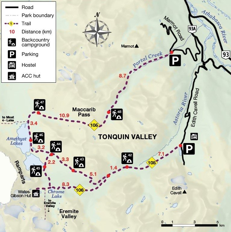
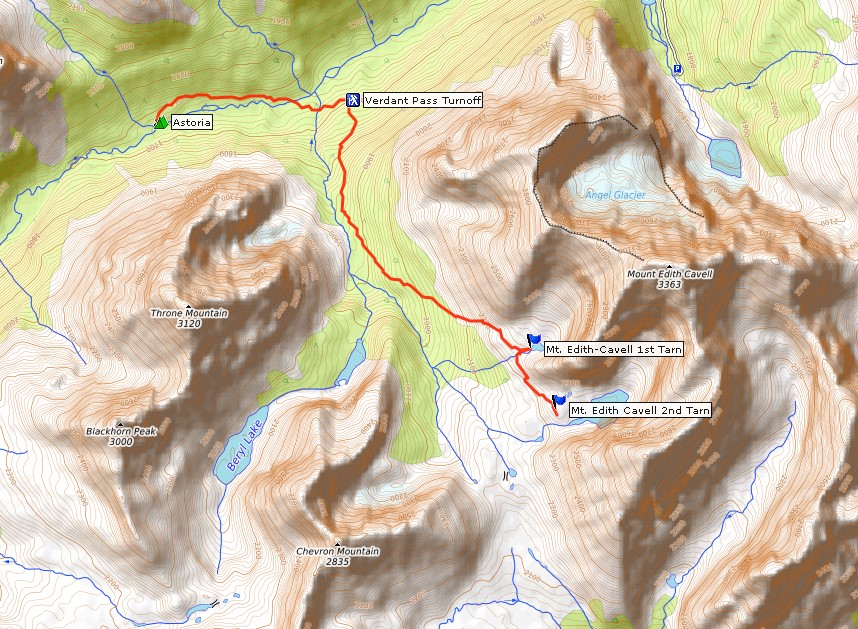
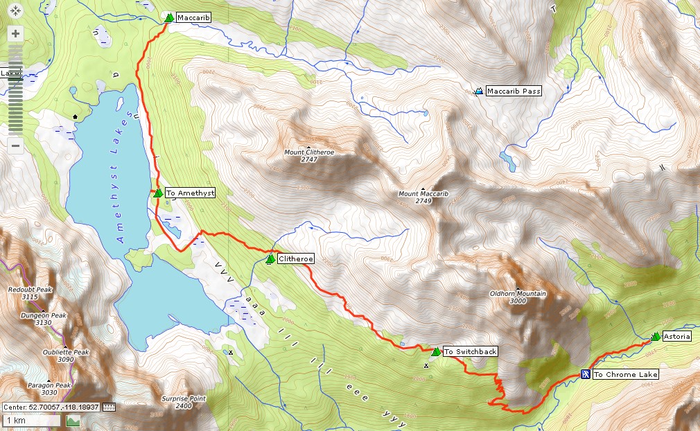
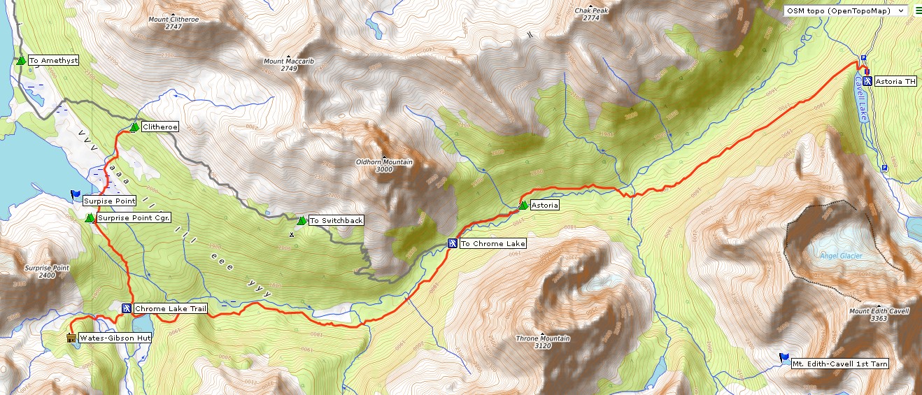
Tonquin Valley trail map
For the first two nights I am booked into Astoria campground (#42) and want to do a side trip to Verdant Pass from there. Unfortunately, the popular campgrounds Amethyst (#46) and Surprise Point (#45) are fully booked, so I have to hike from Astoria straight to Maccarib campground (#47), more than 16 kilometers away at the other end of Tonquin Valley. Then it's back to Clitheroe campground (#44), and for the last night I have to make do with Switchback campground (#43), even though the final walk out is still 13.6 kilometers from there. However, it should be possible to drive back home on the same day.
Even though I won't be able to include excursions to Eremite Valley, Tonquin Hill or Mount Clitheroe in the new and shorter version of the tour, I'm glad that it's happening at all. I leave on a sunny Sunday morning with just a bit of a haze in the air. It's supposed to stay dry at first and rain again on Wednesday. But who knows. On Sundays they don’t work at the many construction sites on the Yellowhead Highway, so I make good time and arrive in Jasper before noon.
The Astoria trailhead is located on the road to Mount Edith Cavell. This road is narrow and winds up the mountain in steep switchbacks. There is a fair amount of oncoming traffic. All the marked parking spaces on the side of the road are full, so I have to park in a bend a little further on. Even there, I'm not the first to stop. I pack a few last things into my backpack and then I'm ready to go. My destination for today is Astoria campground, 7.1 kilometers away.
| Distance | 7.5 km |
| Time | 2 hrs |
| Min. Elevation | 1671 m |
| Max. Elevation | 1751 m |
| Ascent | 80 m |
| Cum. Ascent | 342 m |
| Cum. Descent | 383 m |
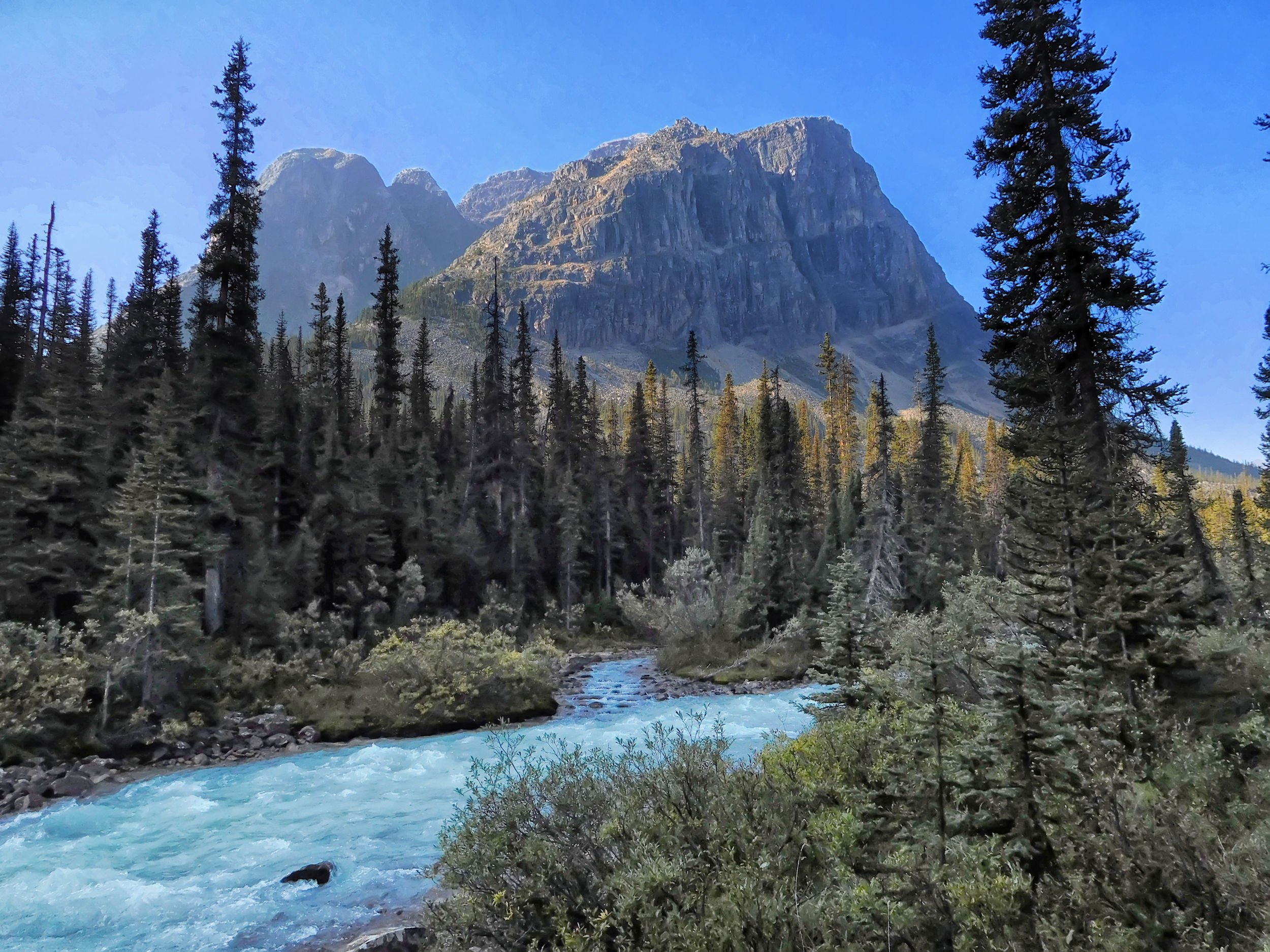
I walk downhill a bit and immediately reach a beautiful viewpoint of Mount Edith Cavell and Cavell Lake. Too bad that the top of the mountain is currently shrouded in fog.
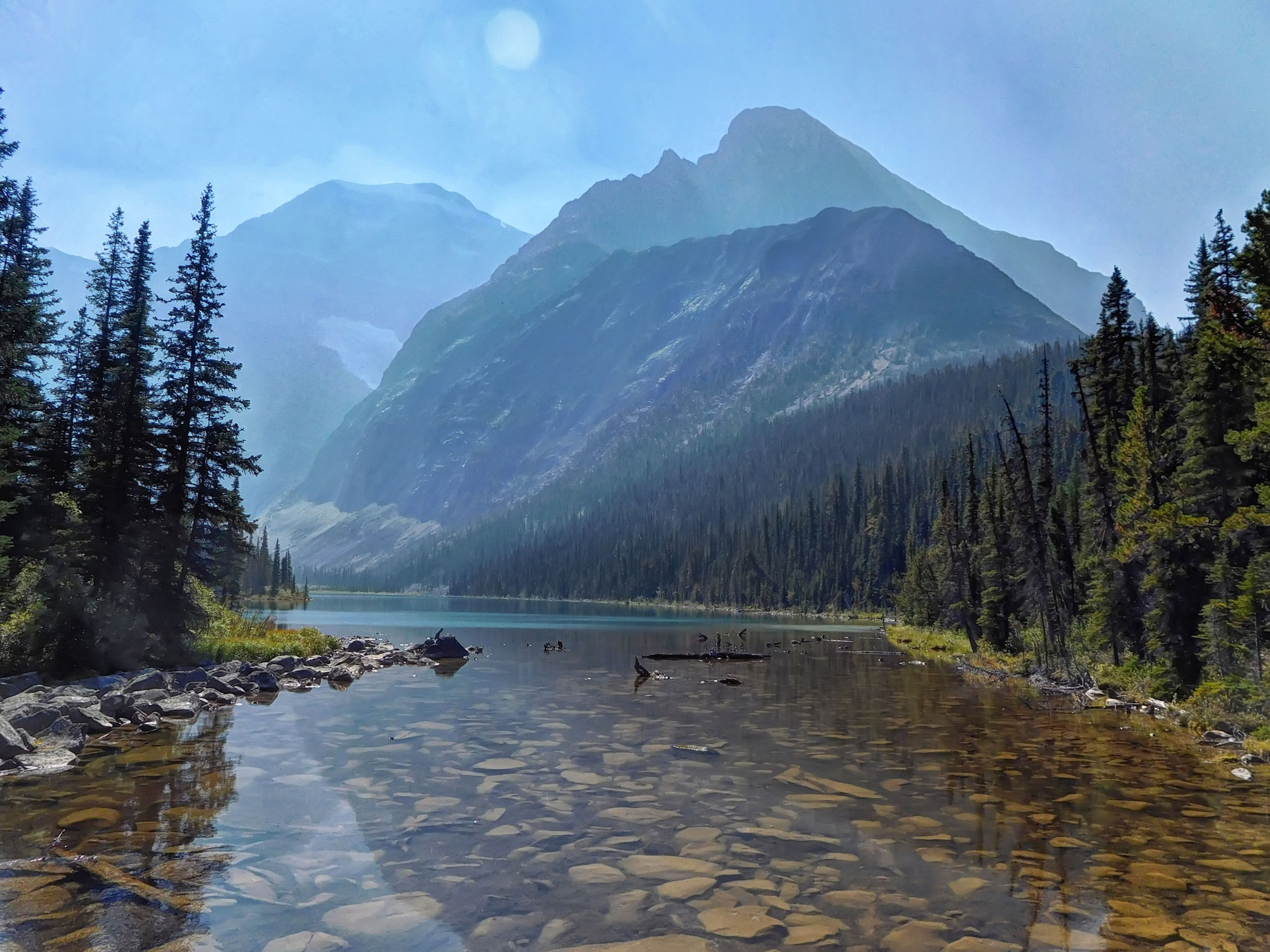
Mount Edith Cavell and Cavell Lake
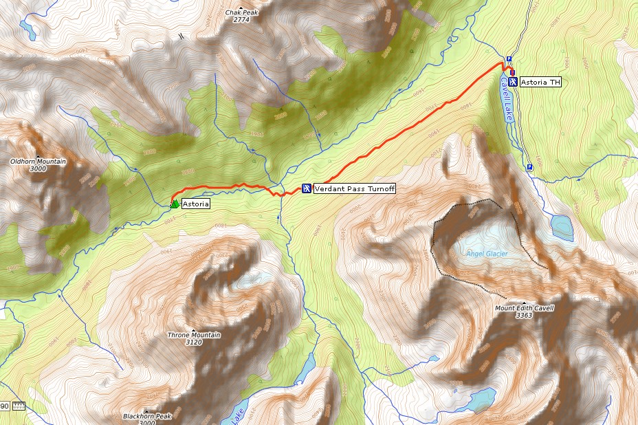
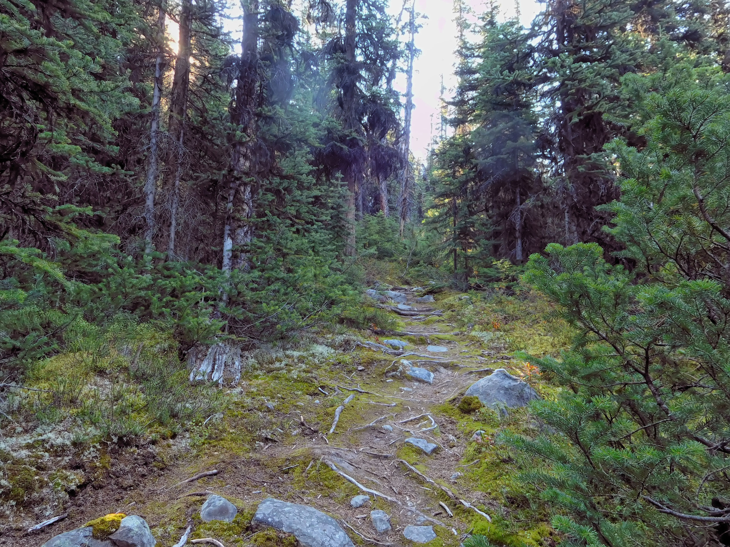
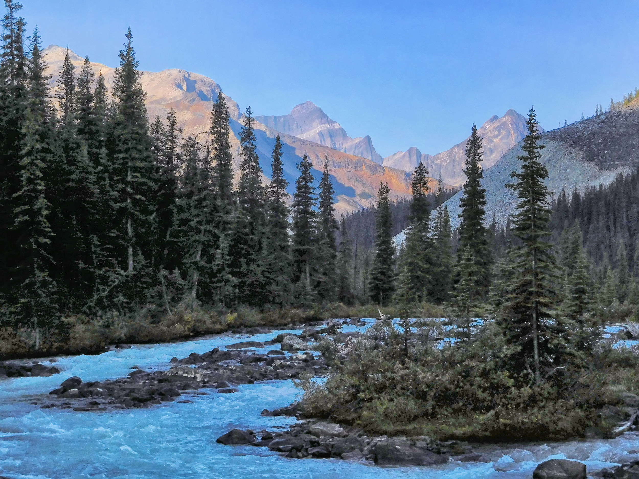
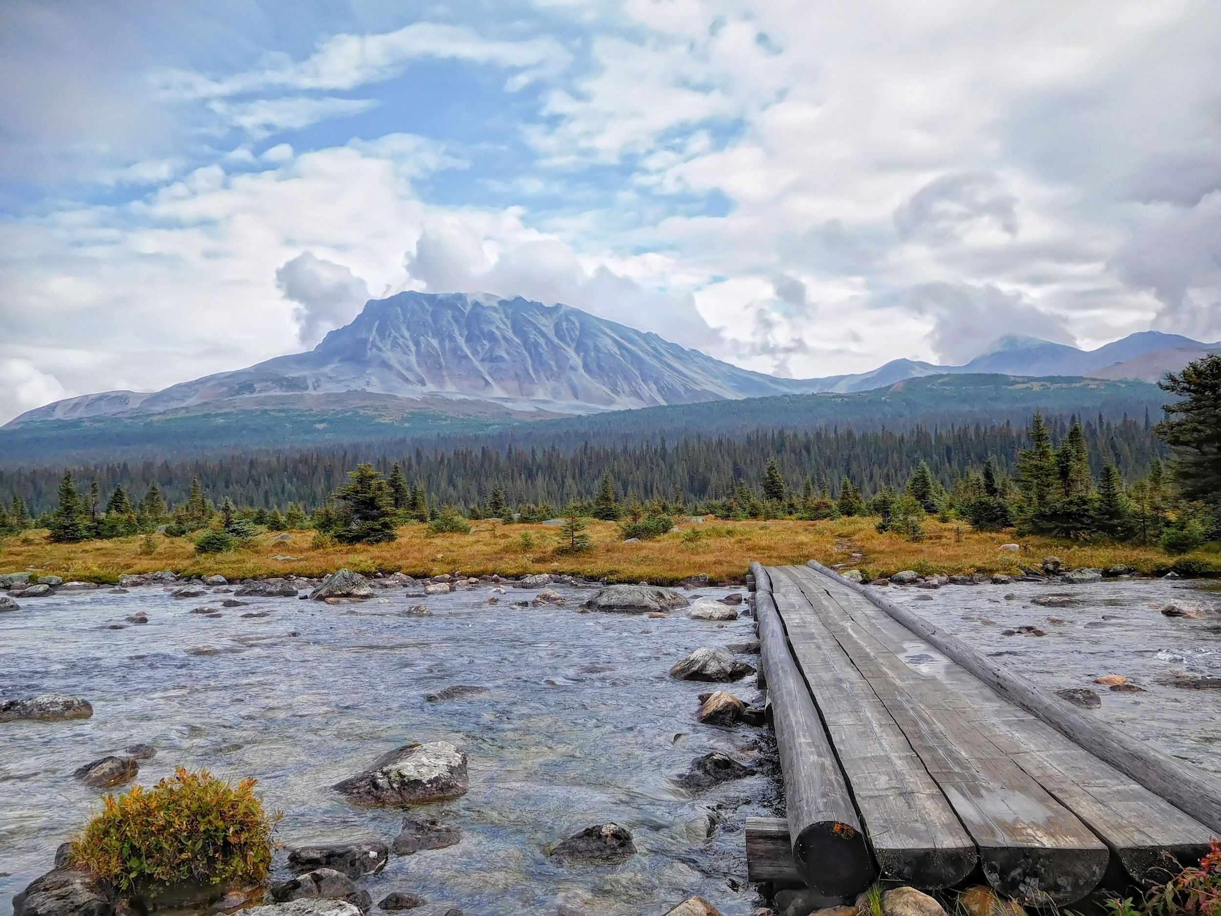
The trail runs along the Astoria River without any significant inclines. After a good 4.5 kilometers, I reach the turnoff to Verdant Pass, which I want to hike tomorrow. It's just another 3 kilometers to Astoria campground. On a bridge crossing Verdant Creek, I catch the first good view of the surrounding mountains.
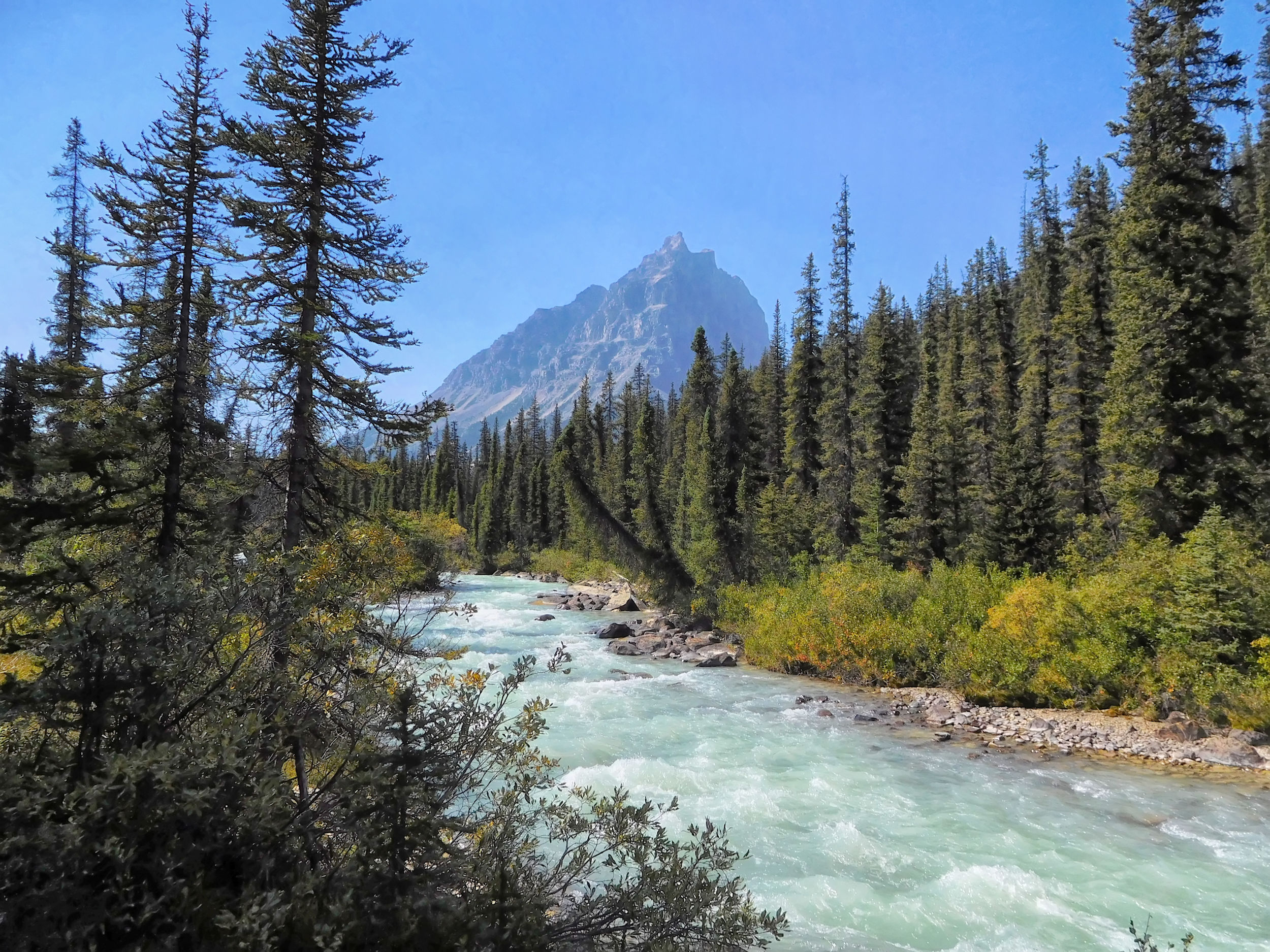
Hiking along
the Astoria River trail
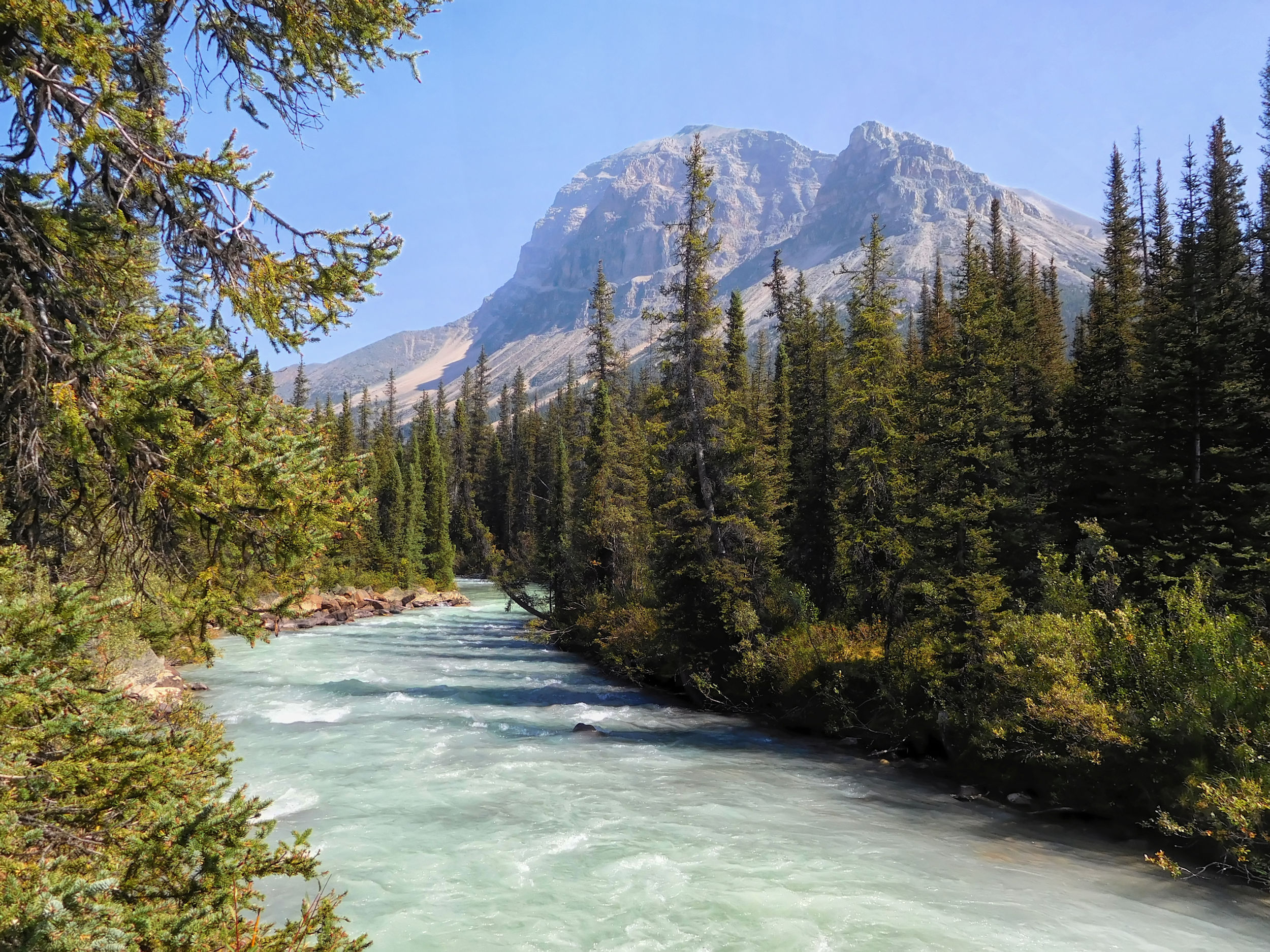
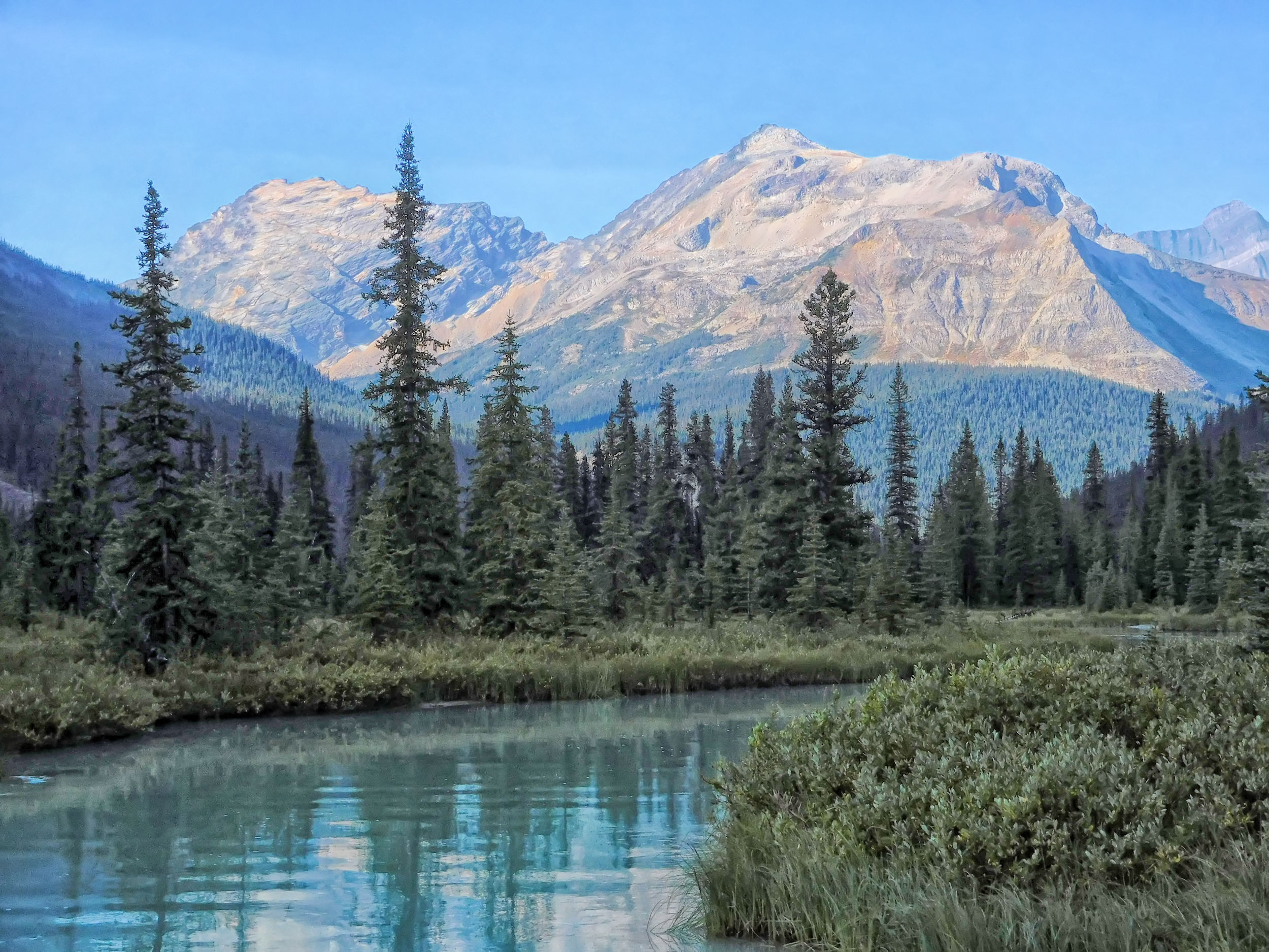
A second bridge leads over the Astoria River and shortly thereafter, I reach the campground. I'm the first one here today and choose site #1, which I think is the nicest of the four sites available. The campsites and the picnic area are located on a small hill, behind which there is a steep drop-off down to the river. From the picnic area you have a wonderful view of Throne Mountain and Mount Edith Cavell.
Astoria River and Mount Edith Cavell 3363 m

Throne Mountain 3120 m
While I stow my food in the bear-proof lockers down by the trail, a family with two children arrives and takes a short break. They plan to hike all the way to the Wates-Gibson Hut today, even though the 10-year-old boy isn't feeling well and has a tummy ache.
I prepare an early dinner. Later, a group of two men, a woman and two young girls occupy one of the other sites with a 5-person tent. Finally, two young women arrive and I make friends with them in the evening. Monica and Tamara have come all the way from Maccarib campground today, a long walk that I will have to make the day after next. Monica is of German descent and shares with me numerous stories about her German grandmother, who also lives in Canada and is probably not much older than I am. We have an interesting exchange and stay up until sunset. After the setting sun has turned the mountain peaks red, it quickly gets cold and we disappear into our tents.
Sunset at Astoria campground
| Distance | 17.6 km |
| Time | 6 hrs |
| Incl. Pausen | 8 hrs |
| Min. Elevation | 1657 m |
| Max. Elevation | 2269 m |
| Ascent | 612 m |
In the morning I say goodbye to Monica and Tamara, who are hiking out today and drive home. I take full advantage of the sunny day and hike to Verdant Pass. On the way to the turnoff I meet a couple from Colorado and we chat about our plans. They are on a day hike and want to get a glimpse of the famous Ramparts mountain range - a long way to go.
Backtracking along the river to the Verdant Pass turnoff
At the turnoff to my destination, a narrow path leads steeply up the mountain. Fortunately it is not too overgrown and very easy to walk on. Along the way I find huckleberries, later mixed with blueberries which taste even better.
Steep and root-covered trail to Verdant Pass
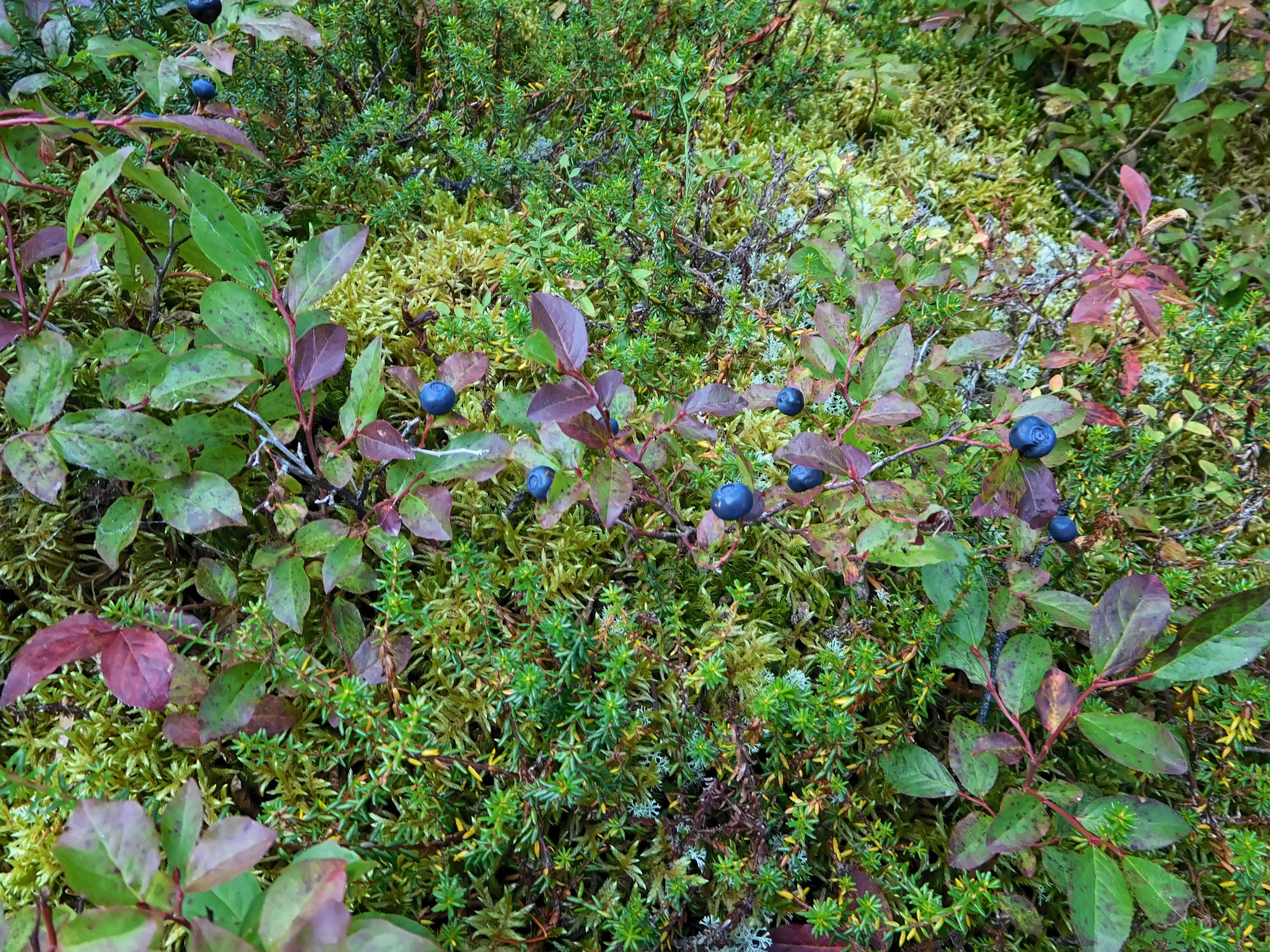
Snacking on blueberries on the way up
Shortly before the tree line the path becomes extremely narrow and steep. I scrape my wrist on a protruding branch and it turns blue, even bleeds a little. I’m more careful now before pushing through the dense undergrowth. About two hours after the turnoff, I emerge from the dense forest and enjoy the first beautiful vistas.
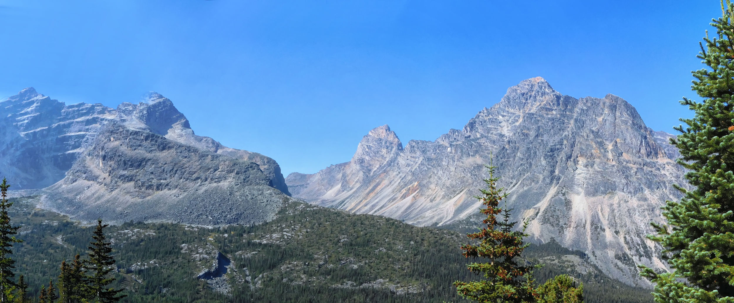
Above treeline: view of Chevron (l), Blackhorn (m) and Throne (r) mountains
Looking back to the valley: Throne and Oldhorn mountains, Chak Peak in the background
Throne Mountain 3120 m, Oldhorn Mountain 3000 m behind it
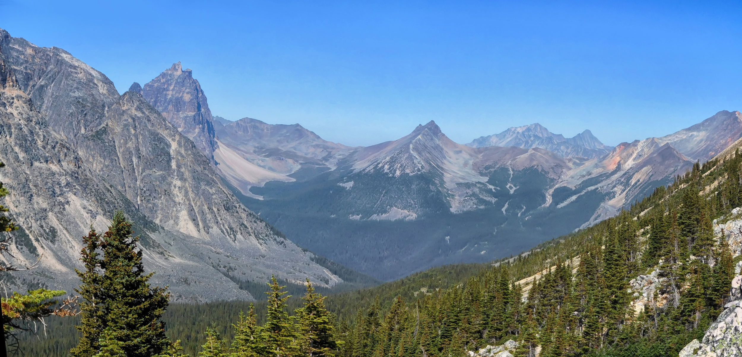
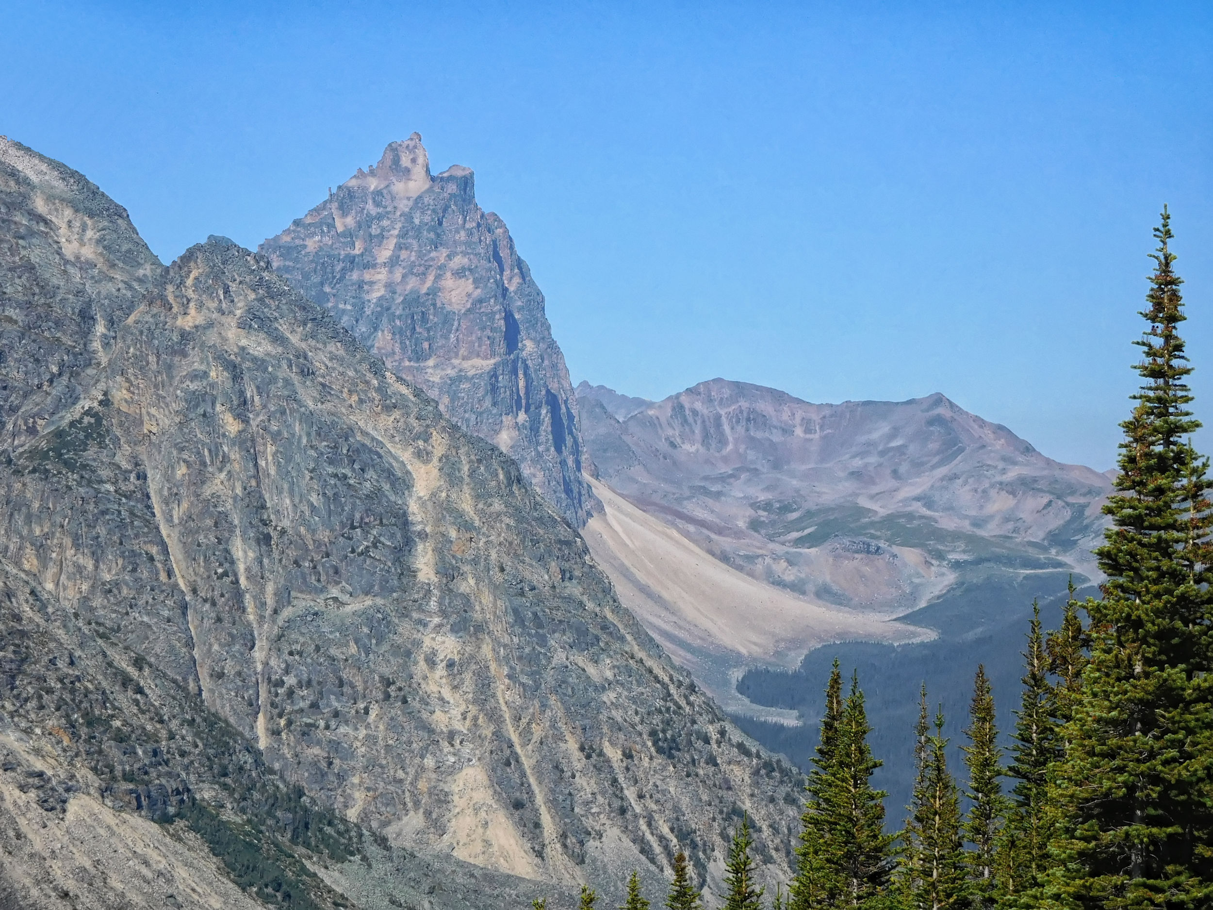
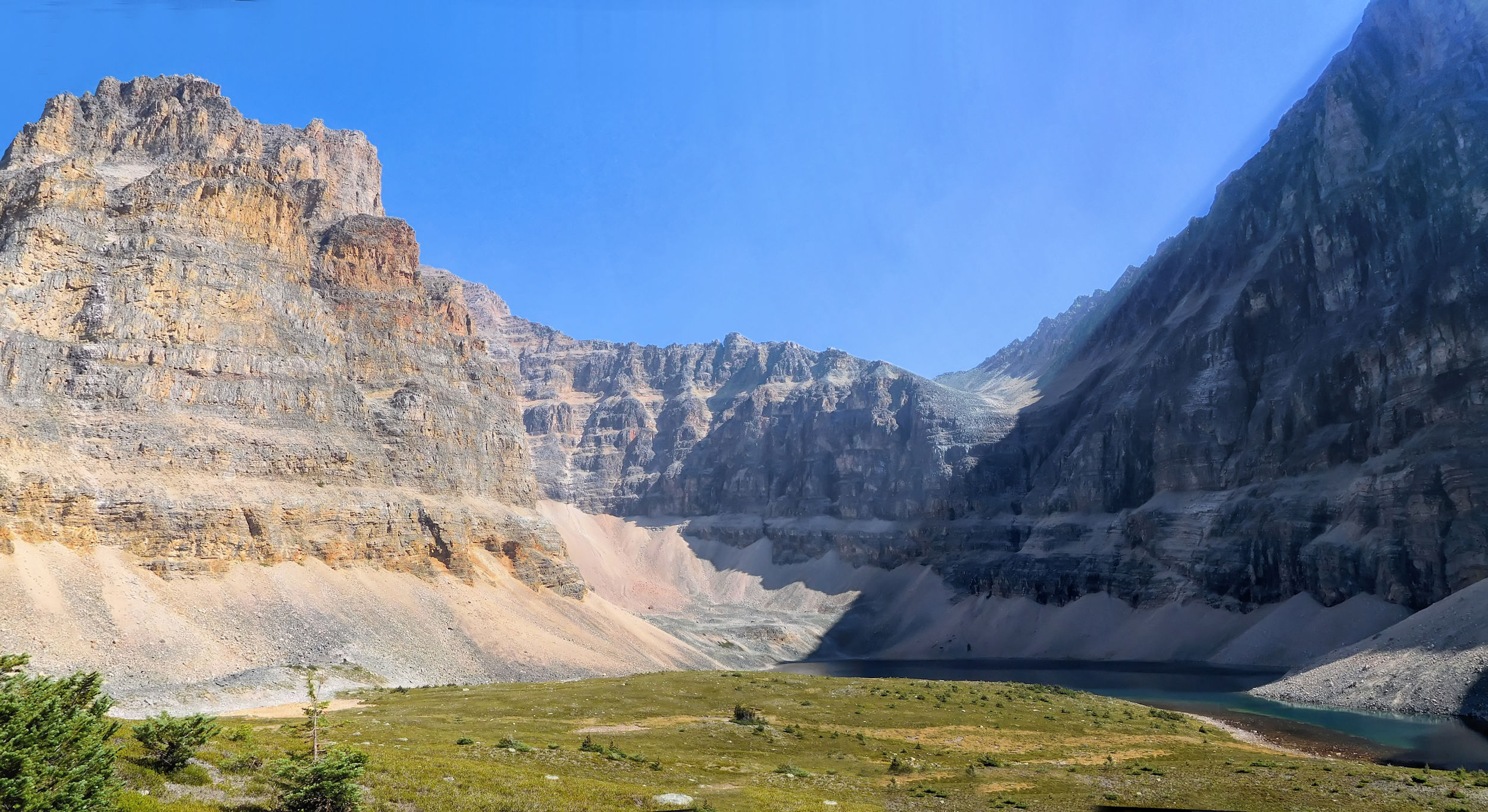
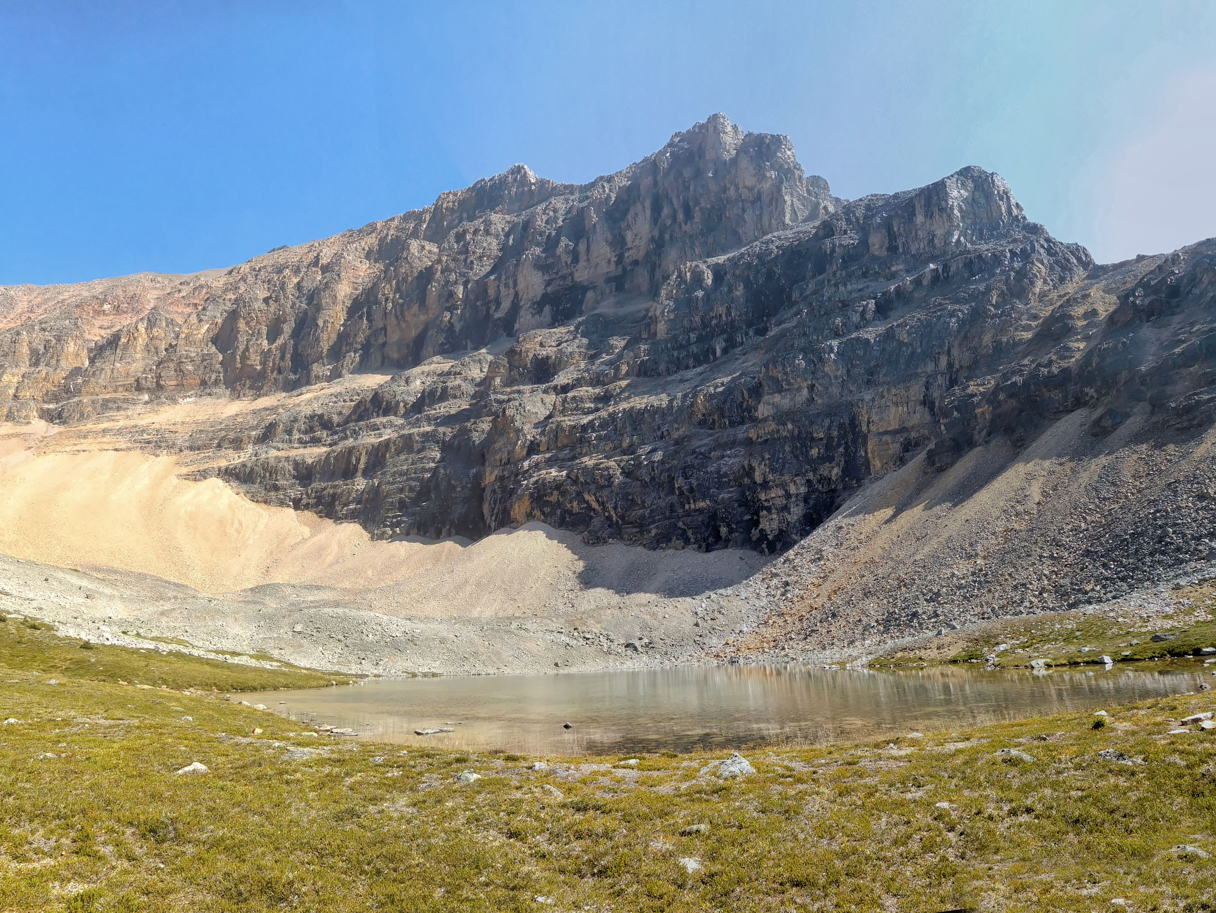
The panorama becomes more and more fascinating. I hike to the first tarn at the back of the Edith Cavell massif and have lunch. On the left side of the tarn, a small track leads to the beginning of a climbing route to the summit.
Backside of Mount Edith Cavell and 1st tarn

Verdant Pass and Chevron Mountain 2835 m
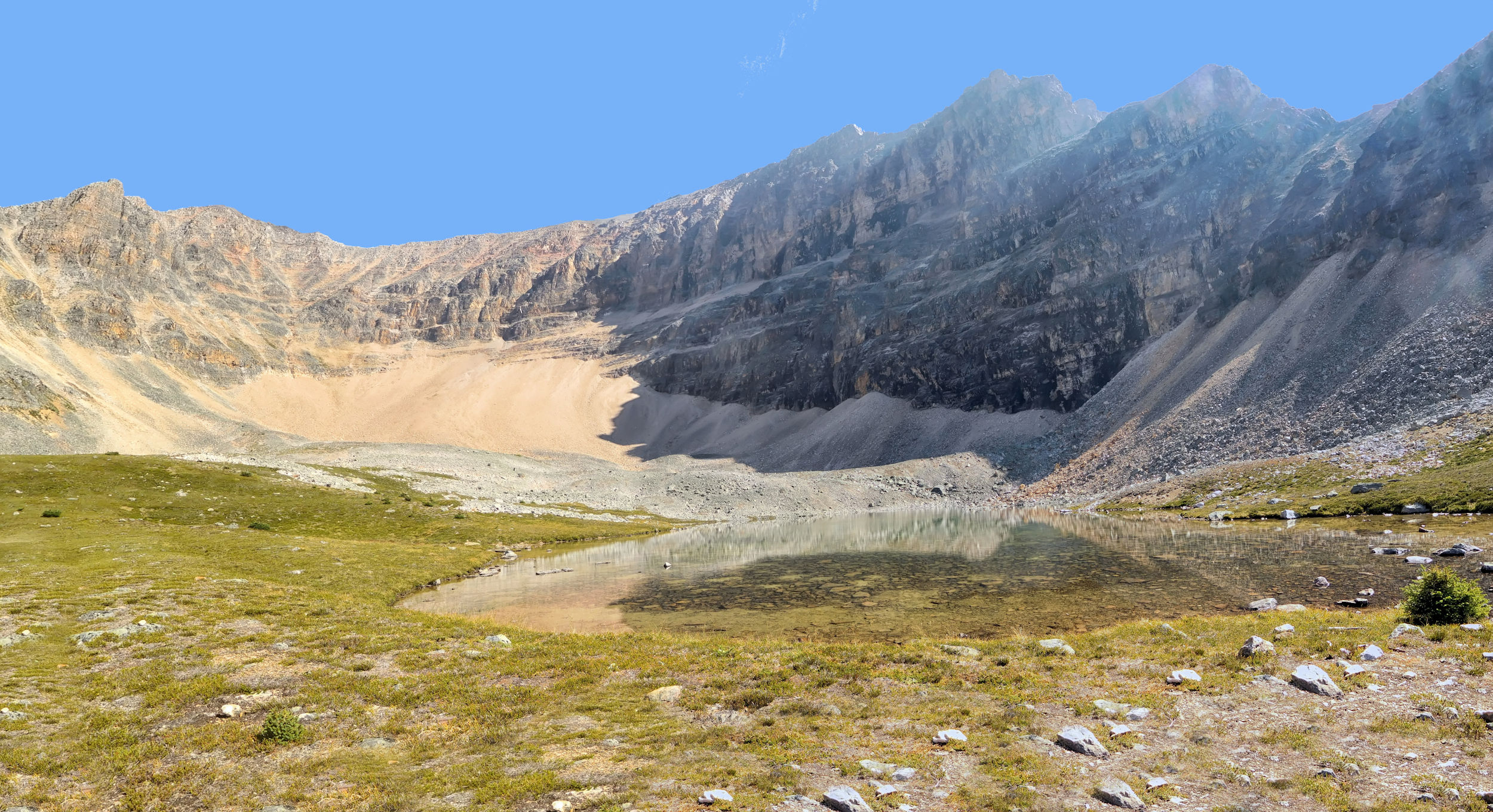
To get to Edith's 2nd tarn, I have to climb down a steep scree field and then walk uphill on a good path. Currently, the back of Edith Cavell lies in the shade and the intense teal color of the tarns doesn't show all that much. To the south you can make out the Hooker Ice Field in the distant haze. The mountains all around are magnificent and make for magical scenery.
Mount Edith Cavell’s 2nd tarn
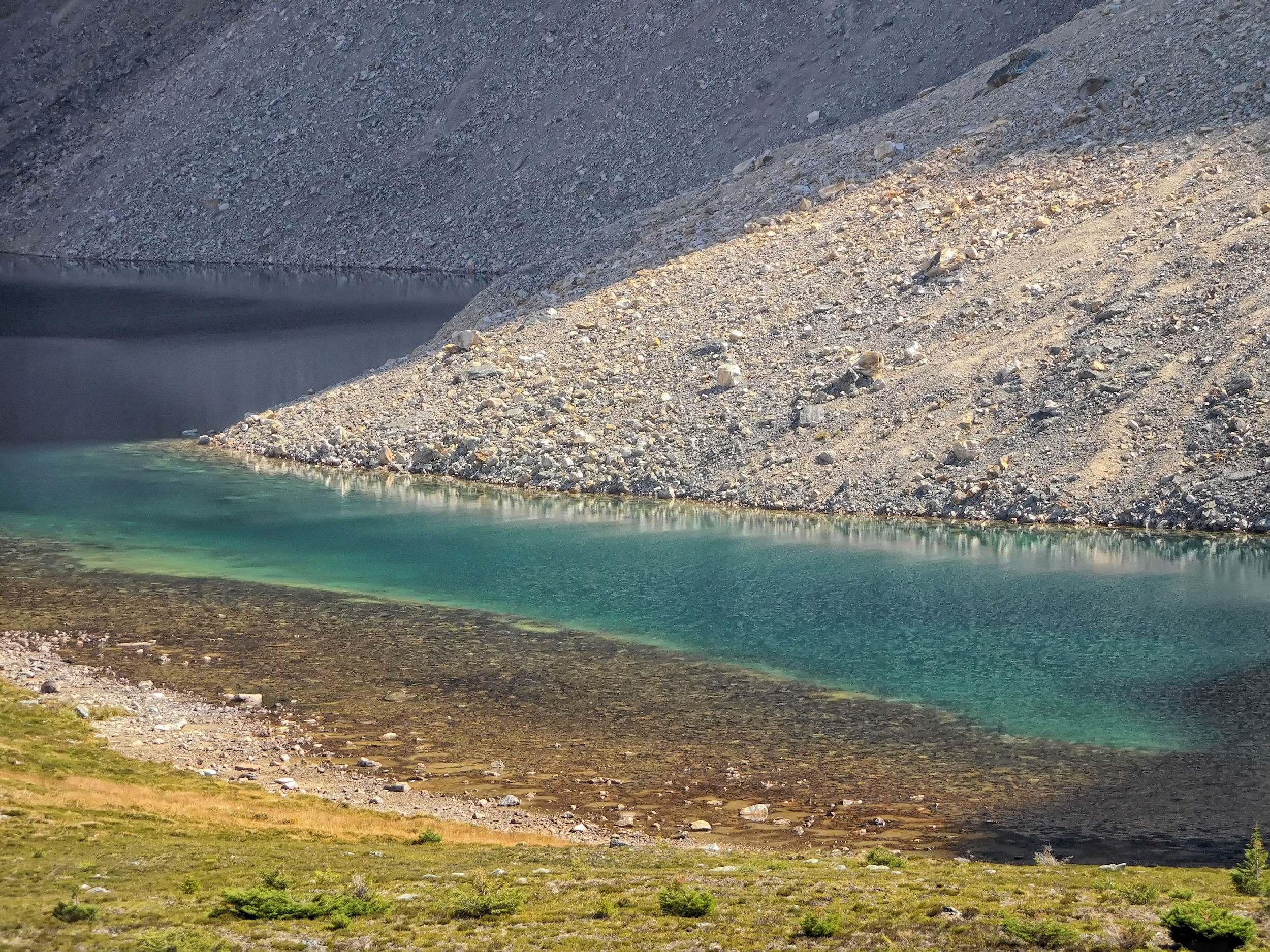
Teal blue water of the tarn
All too soon I have to head back. As the shadows lessen in the early afternoon, I stop again at the 1st tarn and take another photo.
Returning to Edith’s 1st tarn
The steep section of the trail down to where the forest begins is very slippery and I walk carefully. I admire a red coloured mountain slope far back in the valley.
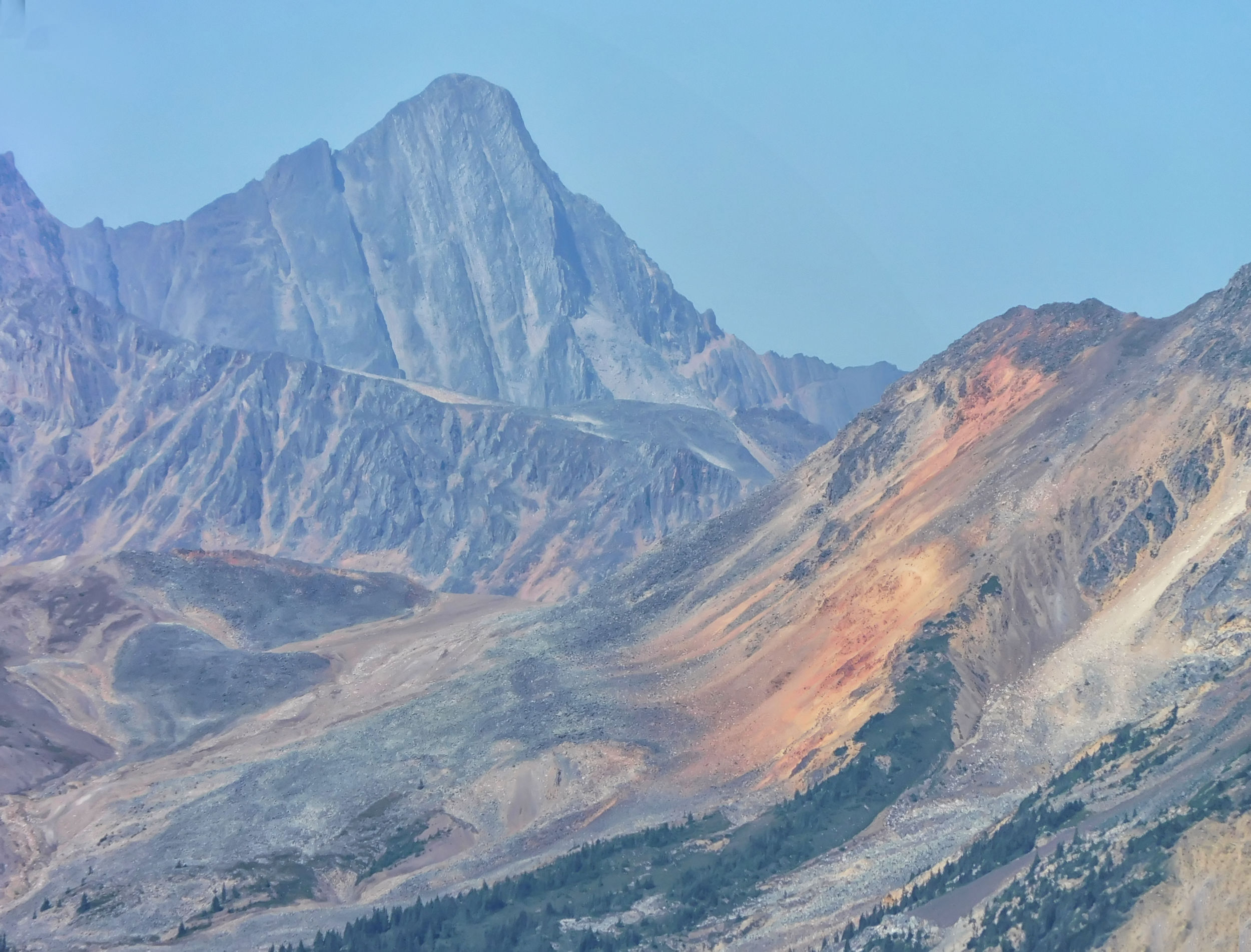
Red coloured mountain slope in the distance
On the main path I run into the couple from Colorado again, who are also on their way back. We talk for quite a while. They have actually managed to catch a glimpse of the Ramparts, so they must have made it past the so-called Switchbacks, where the trail climbs through a rock avalanche. Like me, they have come a long way and we all need the rest.
The campground is full today. A group of three men and two women have taken the other three sites. They stay up until dark, while I'm pretty tired and go to bed early. Tomorrow I have a long day ahead of me as I am continuing to Maccarib campground, 16.3 kilometers away
| Distance | 17.7 km |
| Time | > 6 hrs |
| Incl. Pausen | 7 hrs |
| Min. Elevation | 1697 m |
| Max. Elevation | 2120 m |
| Ascent | 423 m |
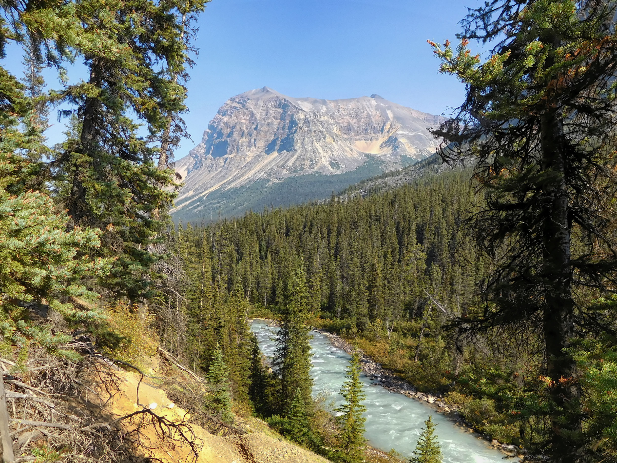
The weather is still nice, so I take my time for the long hike to Maccarib campground. I will pass through the entire northern third of Tonquin Valley.
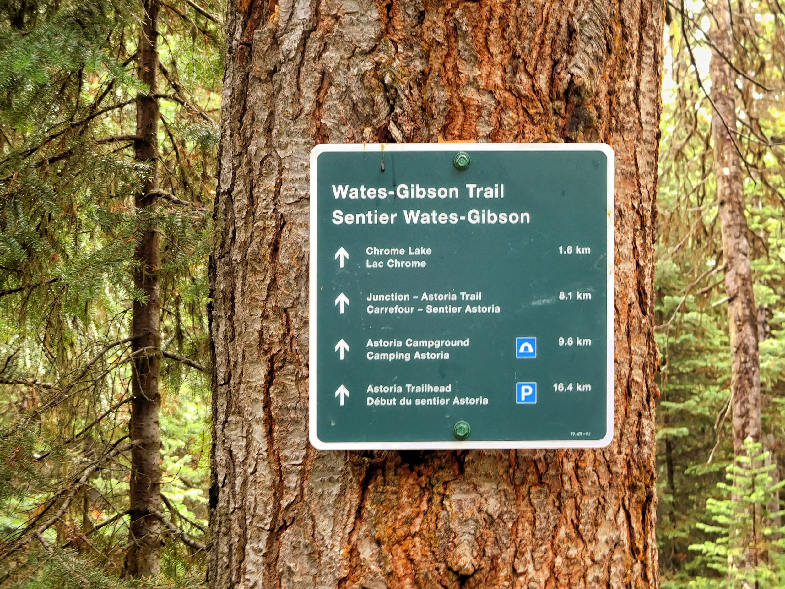
I reach another bridge over the Astoria River. On the other side the Chrome Lake trail leads to the Wates-Gibson Hut. It is said to be much rougher and wetter than the main trail on this side of the river. Until last year, it was regularly used by horse treks that are unable to negotiate the hoof-unfriendly Switchbacks on the main trail. However, Tonquin Valley has been closed to horseback riding for the past year. The two private lodges in the valley that depended on horses have also been shut down. The restrictions are intended to protect Tonquin Valley's mountain caribou, whose population has been on the brink of extinction for years.
Astoria Bridge
crossing over to the Chrome Lake trail
I continue on this side of the bridge and reach a former horse camp right next to the river. Too bad that it has not been turned into a campground.
Continuing on the main trail
this side of the river
The so-called Switchbacks are the steepest section of the trail. Here, the path winds through a rock avalanche that is still in constant motion and keeps blocking the path with large boulders. Stopping is strictly prohibited. The trail climbs higher and higher along the boulders of the landslide.
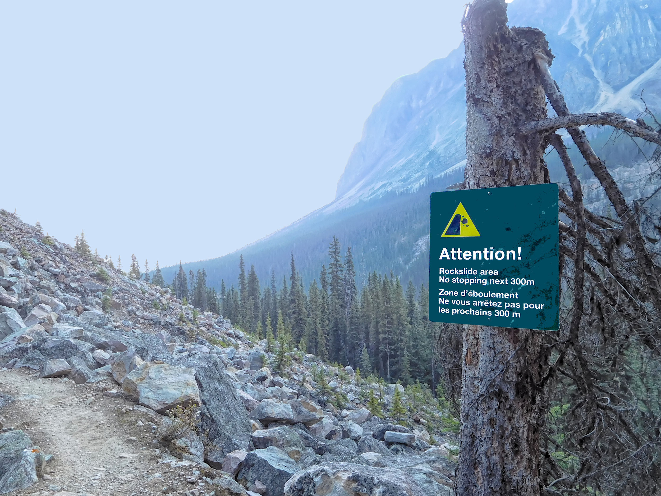
No stopping!
Slide area!
Out of breath I finally reach the end of the switchbacks and shortly thereafter the turnoff to Switchback campground, where I am booked for the last night. Then, on my final day I only need to go down the switchbacks and not up.
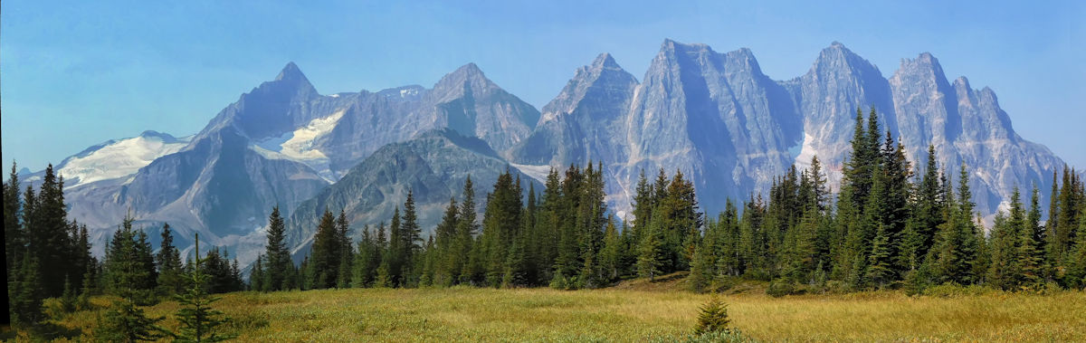
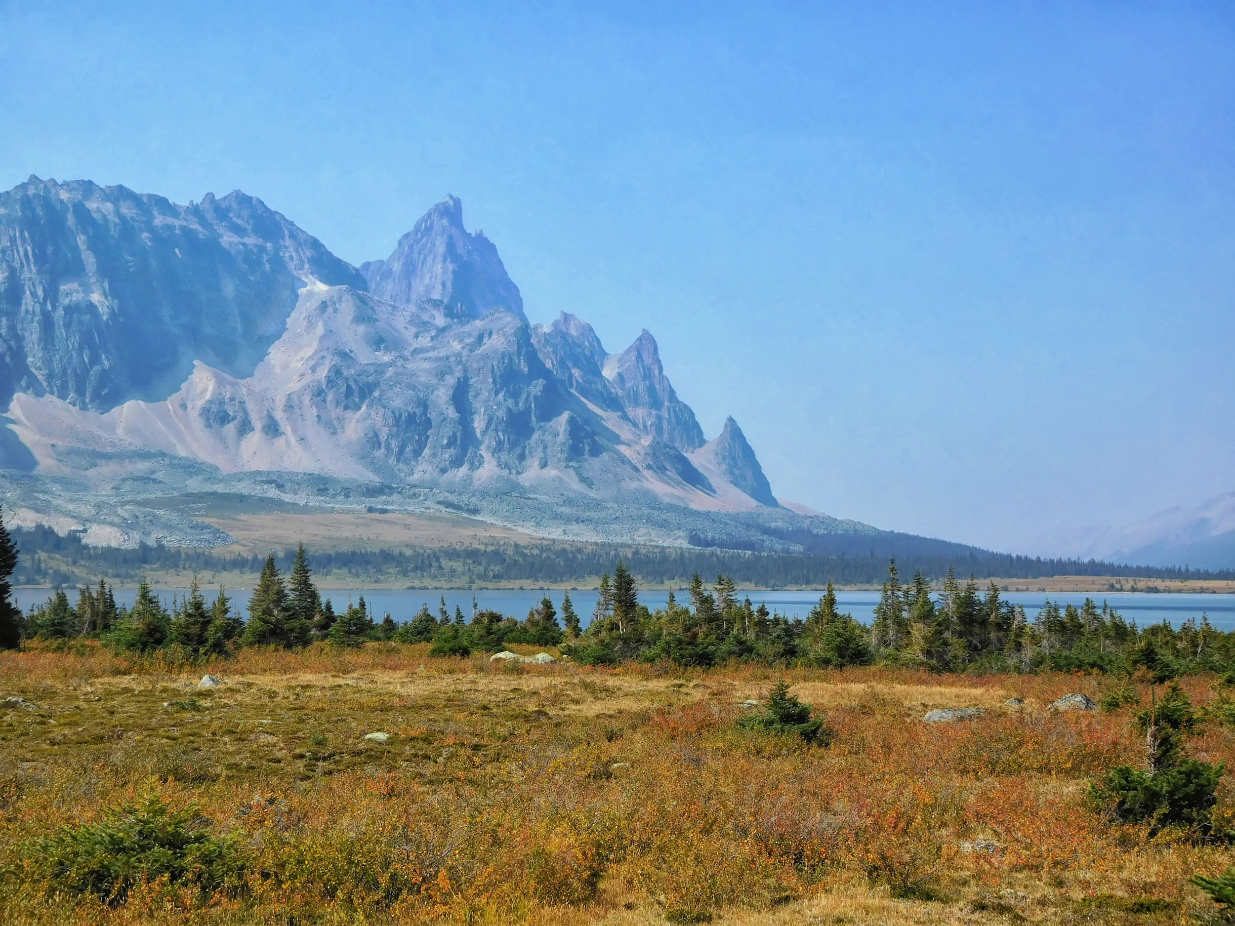
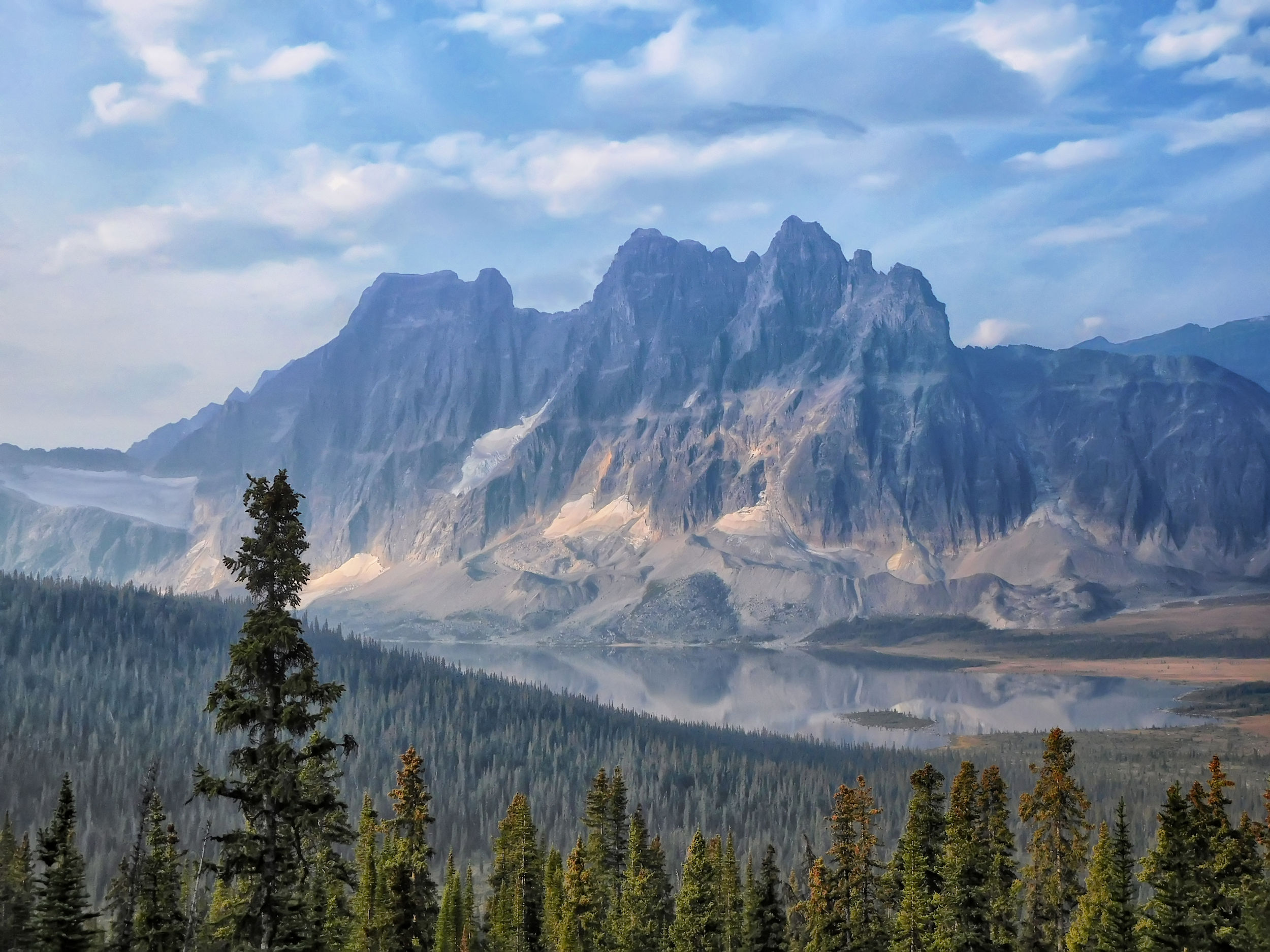
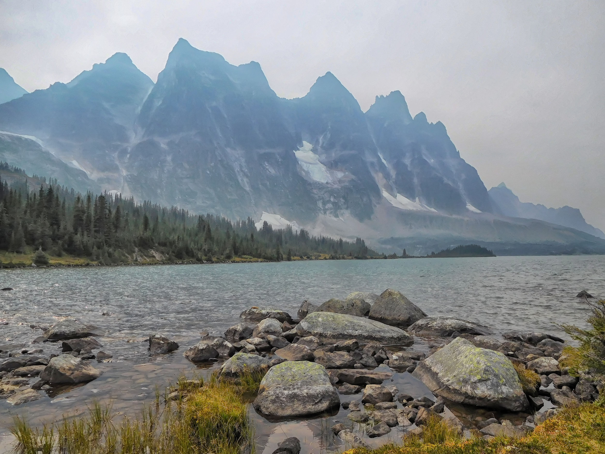
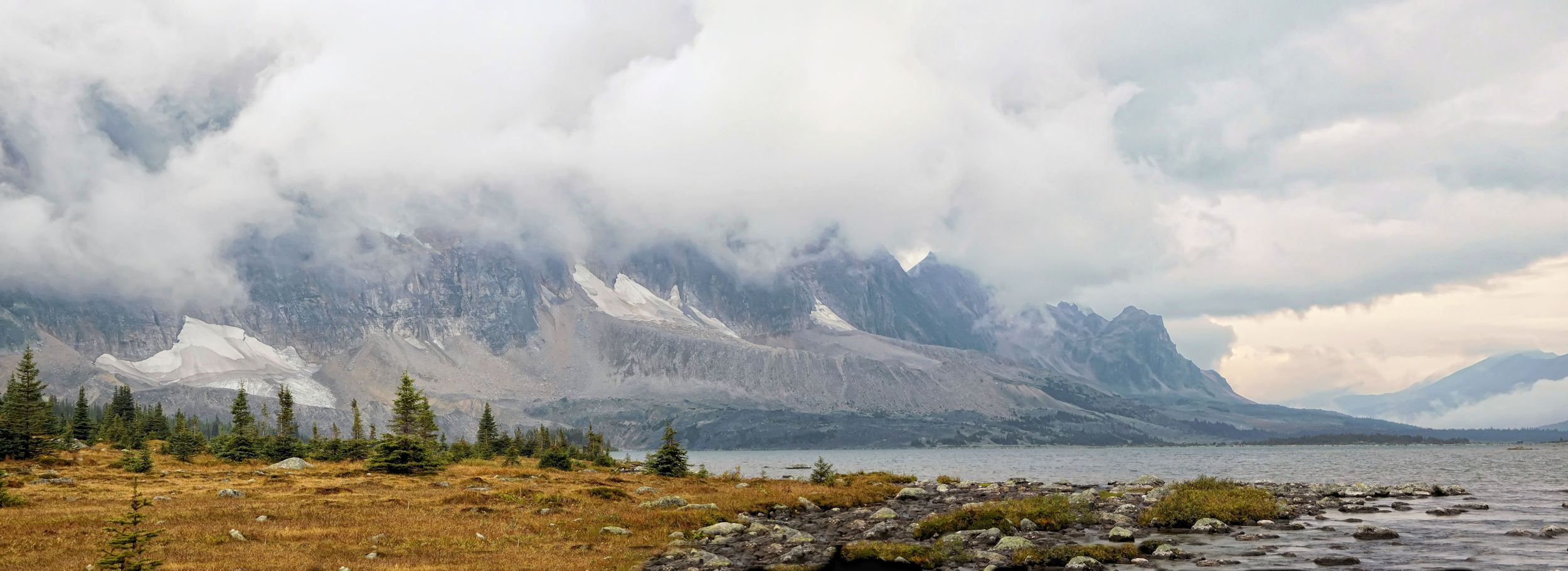
I get my first view of the Ramparts, an imposing mountain range on the Canadian Continental Divide. The Ramparts and the two Amethyst Lakes at their base are the main attraction in Tonquin Valley.
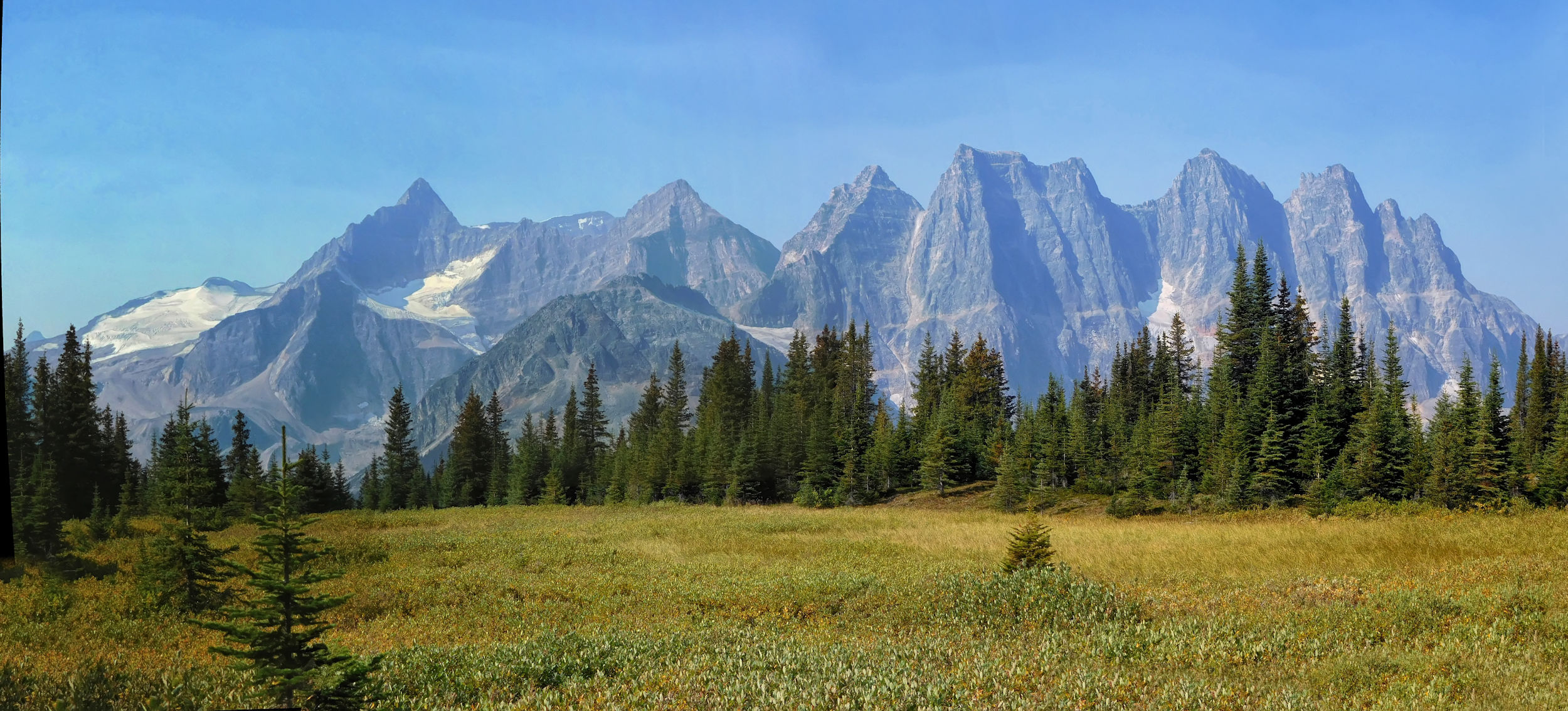
First view of the glorious Ramparts near Switchback campground
The last wildflowers of the season line the path, which disappears into the dense forest much too quickly. At Clitheroe campground I meet the family with the two girls again. They spent the night at Switchback campground and visited Amethyst Lakes this morning. They hike on to Surprise Point campground. A young woman arrives and stuffs her big backpack into one of the lockers to go on a day hike from Clitheroe to Surprise Point and the Wates-Gibson Hut. That's my plan for the day after tomorrow.
Clitheroe campground is not my favourite. It's in dense forest and has no view. There's no water nearby either, you have to walk almost a kilometer uphill to a small bridge over a rapid creek. I continue on my way to Amethyst Lakes. From the small bridge the trail drops steeply into the valley. I follow a boardwalk through the marshland that covers much of the valley. Straight ahead is former Tonquin Adventure Lodge, to the right the trail skirts the two Amethyst Lakes and reaches Amethyst campground.

Approaching Amethyst Lakes
The trail passes through scrubby vegetation interspersed with trees and ponds. At the turnoff to Amethyst campground, a footpath leads directly to the lakeshore. It's a bit boggy, but not too bad. I take a long break by the lake and enjoy the tranquility.
Amethyst Lakes
Two women, doctors from Burnaby and Edmonton respectively, join me. Like me, they will spend the night at Maccarib campground. A group of mountain caribou is grazing nearby, not bothered by us at all.
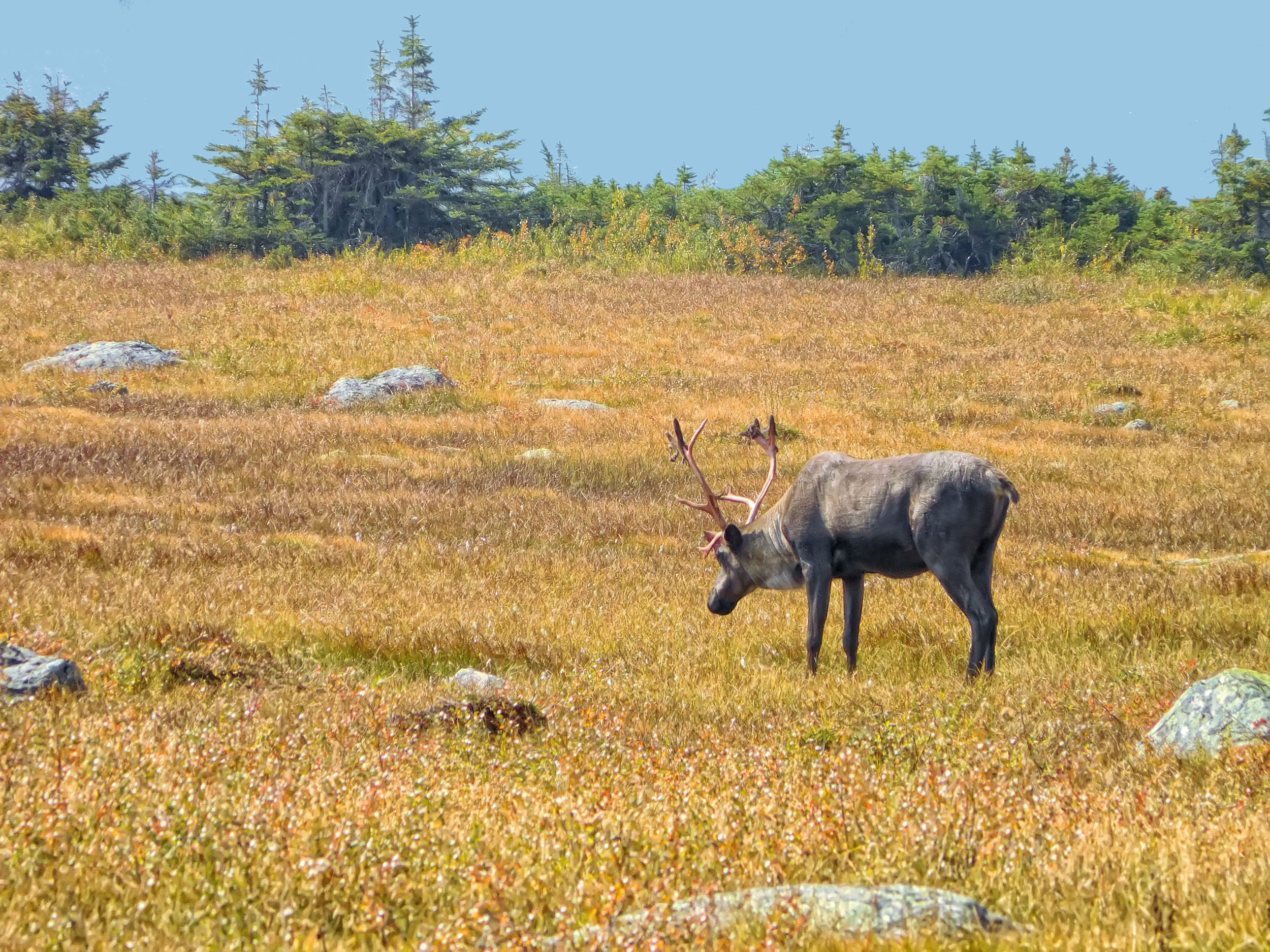
Mountain caribou on the shore of Amethyst Lakes
It is getting hazy, and the rising midday sun makes the haziness even worse. The mountains look almost ghostly; there must be smoke in the air, but I can't smell it.
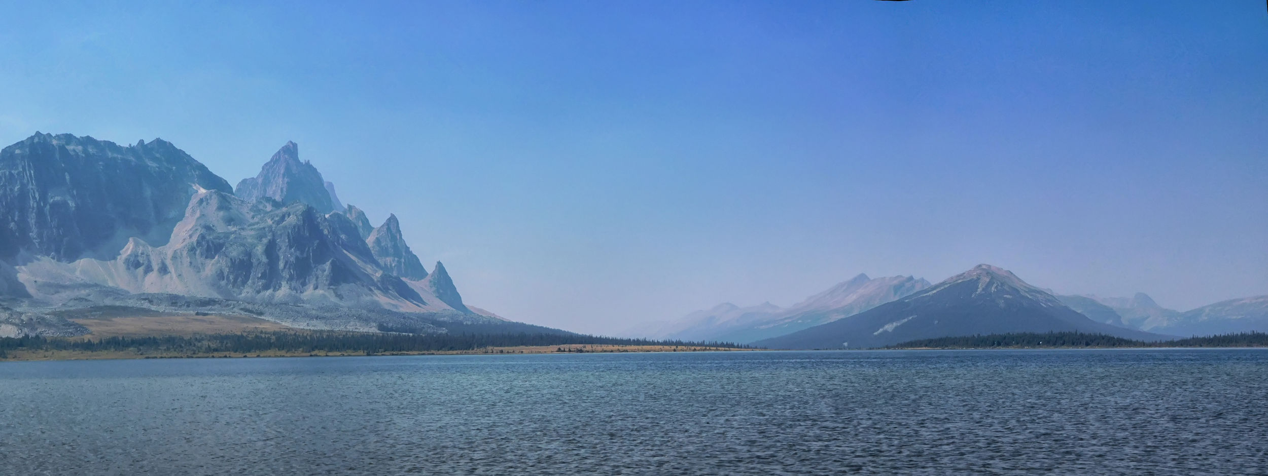
View towards Tonquin Hill (r), quickly getting hazier from smoke
Only in the direction of Mount Clitheroe is the sky still bright blue. Originally I wanted to climb this mountain or at least the ridge below the summit. I would have had a hard time bushwhacking through the trees between the trail and the ridge. I had expected it to be easier.
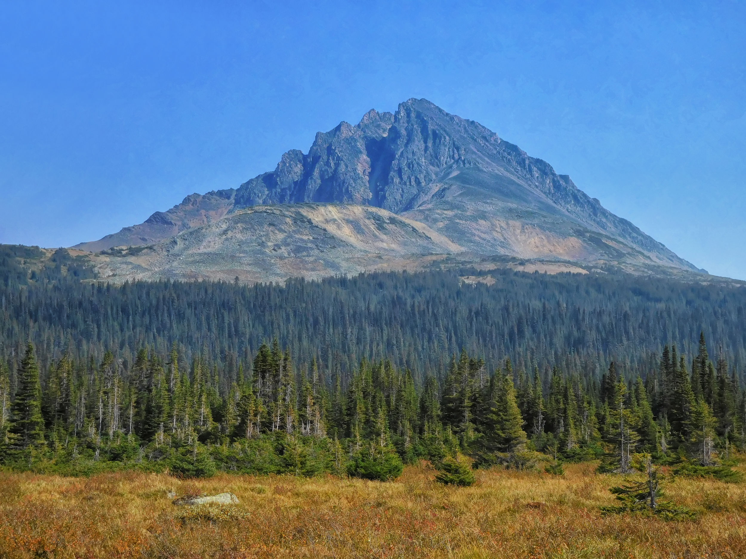
Mount Clitheroe
I set off because I am thirsty and have hardly any drinking water left. The lake smells very sulphurous and the water is probably not suitable for drinking. I find a stream that flows along another boardwalk and carries enough water to fill up.
After another hour I reach Maccarib campground. Upstream from the bridge, Maccarib Creek rushes through picturesque red rocks. A man (Welsh) is bathing in one of the frigid pools in the creek while his girlfriend watches from a safe distance.
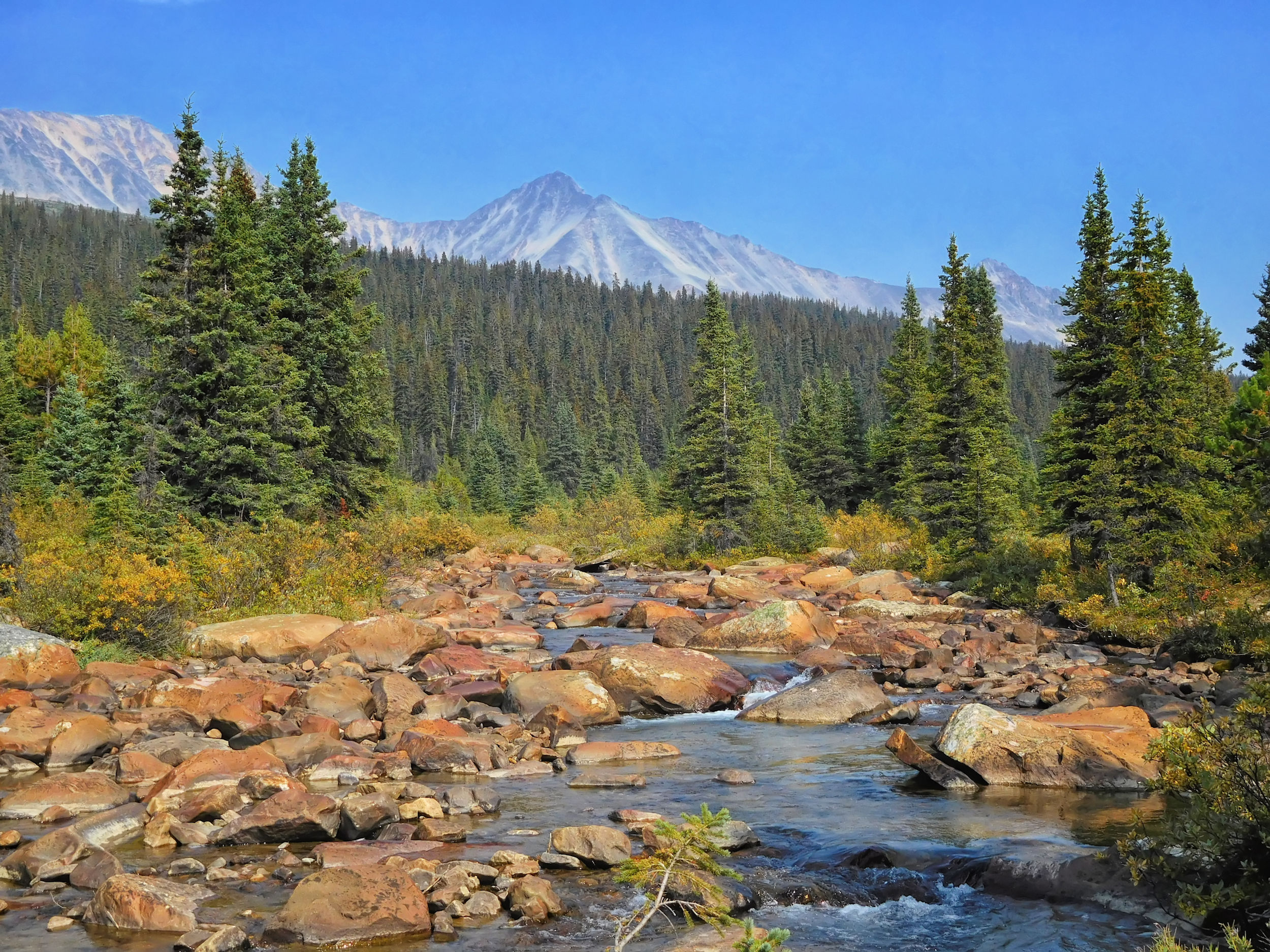
Maccarib Creek from the bridge near Maccarib campground
A very friendly fellow hiker greets me at the lockers where I store my food. He came from the Portal trailhead earlier today and is pretty exhausted. Although he arrived some time before me, he needs more rest and finishes setting up his tent an hour after me. Another couple arrives from the Portal trailhead and then the two women I already met at Amethyst Lakes.
We all gather around the only large picnic table for dinner. The other table is rotten and seats only one person. A lively discussion begins about tomorrow's weather. Some of us have Inreach devices (a kind of satellite phone) and can call up the latest weather forecast. Others have the latest forecast from the morning or the day before. Everything from heavy storms with up to 37mm of rain, frost or 30% showers is in the mix. The only thing they all agree on is that the bad weather will start tomorrow night.
So I'll get to the Maccarib meadows and back to Clitheroe campground dry, and the two doctors can enjoy their hike to Tonquin Hill without rain. One of them dislocated her shoulder just before the hike and shows us how she exercises using an elastic band. She usually likes to scramble all kinds of peaks, but this time she has to scale back her ambitions a bit.
| Distance | 17.7 km |
| Time | 6 ½ hrs |
| Min. Elevation | 1967 m |
| Max. Elevation | 2214 m |
| Ascent | 247 m |
The next morning I leave my tent up and hike out the other end of the campsite towards the Maccarib meadows. The trail is narrow and climbs steadily. Early in the morning, the Ramparts still have contours, but they quickly disappear in the haze. I look up into the valley of Portal Creek leading to Maccarib Pass and out to the Portal trailhead.
Looking back from the Maccarib meadows trail
At a lookout I have a short break and turn around. After yesterday's long hike and with the smoky skys today, I don’t feel like carrying on further up into the meadows.
On my return, I find the campsite deserted and pack up my tent. I wonder if the two women found their way to Tonquin Hill, since it's a cross-country hike and wasn't well marked when I visited in 2012. The people who ran Tonquin Valley Backcountry Lodge may have even removed the few trail markers before the lodge closed.
At the turnoff to Moat Lake and Tonquin Hill, I walk a ways towards the lodge, because there are supposed to be some pretty ponds on the way. The trail is littered with large rocks, more suitable for horses and extremely difficult for two legged walkers. I can hardly take my eyes off the ground. So I turn around and walk the main trail back to Amethyst Lakes.
At some places along the way I have to trudge through the infamous Tonquin mud. So far it has been relatively benign, as the weather has been dry. The other curse of the valley, the many mosquitoes and horseflies that usually swarm the wetlands, have been killed off by the recent frost.
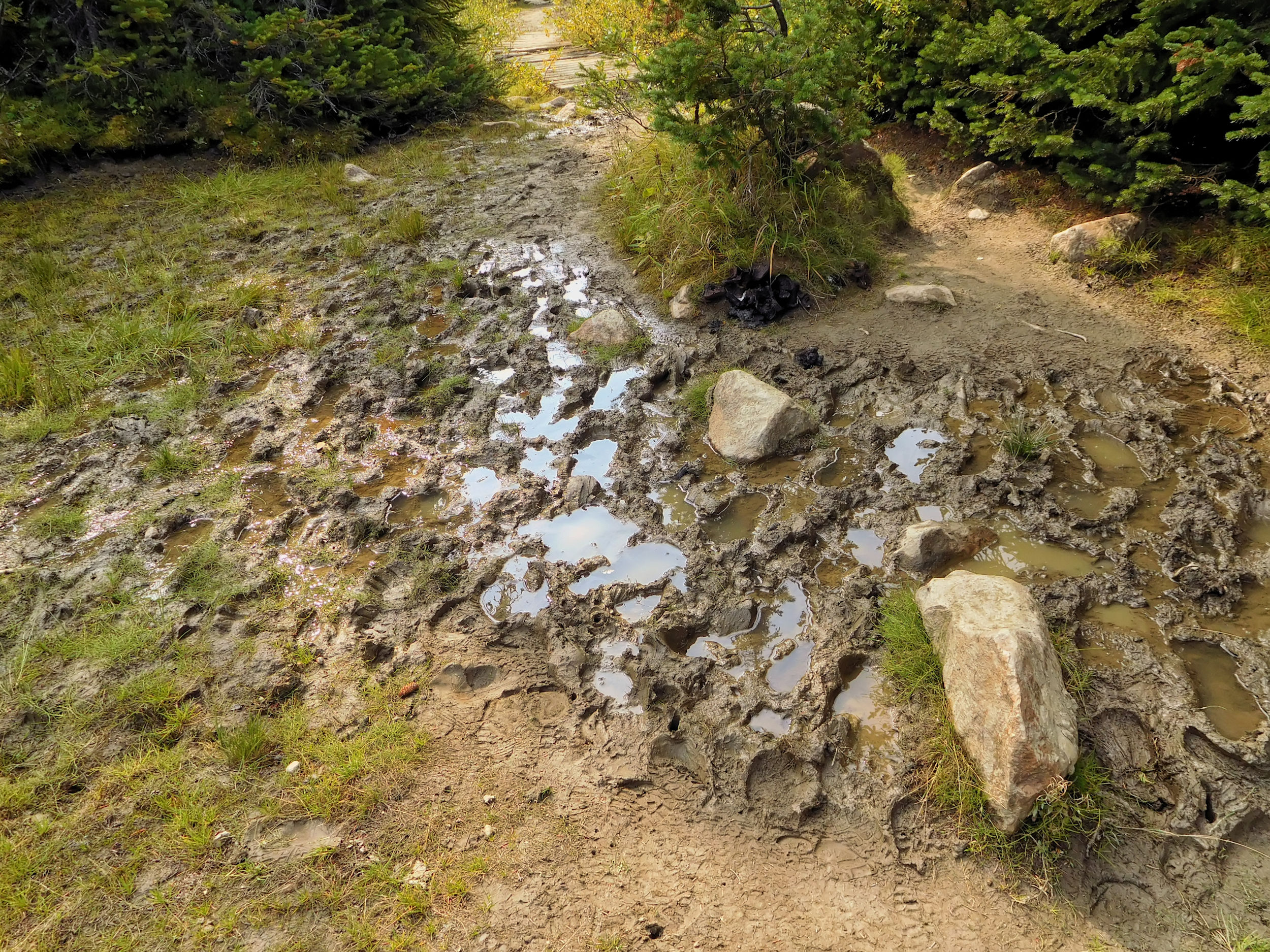
A faint reminder of the infamous Tonquin mud
There is no sign of caribou today. The view of the mountains is even hazier than yesterday, only Mount Clitheroe stands out against the cloudy sky. Just before Clitheroe campground I meet the young woman from the day before. She raves about her day trip to the Wates-Gibson Hut, but also warns of the bad weather to come.
Helicopters have been flying back and forth over Tonquin Valley for a while now, bringing back unpleasant memories of past forest fires. Then I see one of them hovering directly over Clitheroe campground with three blue barrels hanging from long ropes. I take cover, because it’s the toilet bins, which are being replaced. Fortunately, they are the new empty barrels, the three workers on the ground assure me.
At second glance, Clitheroe campground is not so bad. I move into site #3, which seems level and sloping enough not to be flooded by the anticipated rain. Since it's still early and the weather is uncertain, I have something to eat before making a trip to Surprise Point. I really want to see it before it gets too wet and cloudy.
It takes me 40 minutes to cover the 2.3 kilometers. The trail leads downhill and then through a large wetland. I pass a ranger's cabin on the way. The outlet of Amethyst Lakes is particularly scenic. A bridge leads across and you are very close to the glaciers. Too bad it's so hazy in this direction; the better sky is back over Mount Clitheroe.
Bridge over the outflow of Amethyst Lakes
At Surprise campground I meet the family with the two girls again. They are the only ones here at the moment and try to persuade me to move over here as there was a free spot the day before, too. Very tempting, but it's still early and who knows who else will show up. Besides, my tent is already set up and moving it would take a lot of time. The next day, the family plans to hike out the Chrome Lake trail to the Astoria trailhead. They rely on what the toilet crew has told them, that the missing bridges on this trail have recently been replaced and that the weather forecast promises only 30% rain showers during the night and drier conditions afterwards.
I relax at a pond surrounded by golden grass right next to the campground. Then I walk to the rocky point at the shore of Amethyst Lakes. It is really beautiful here. I'm looking forward to tomorrow's day trip to the Wates-Gibson Hut, where the family went today and is very enthusiastic about.
A hazy view from Surprise Point
It takes me a whole hour to get back to Clitheroe campground because it's uphill. Meanwhile more hikers have arrived at the campground. One group goes on to Surprise Point campground, which won't be empty after all. Another couple catches our eye with a red, professional looking tunnel tent. It turns out that they often camp in the Arctic.
In the evening - fortunately everyone is already in their tents - and during the night there are two thunderstorms. They don't hit us directly, but they do bring extremely heavy rain.
| Distance | 23.0 km |
| Time | 7 ½ hrs |
| Min. Elevation | 1671 m |
| Max. Elevation | 2079 m |
| Descent | 405 m |
With short interruptions, it rains all night and into the morning. During a short break in the rain, I put on my thin plastic coat, visit the outhouse, which is quite far away, and get my food from the lockers. I have breakfast in the tent, cold of course, but I stay dry. I pack my things as best I can inside the tent and wait for better weather.
Eventually the rain ends and I drop by the picnic tables to see what the others are up to. A young man is thinking about packing up today instead of staying another day, because the weather forecast doesn't promise any improvement. He gives me the idea to walk out to the trailhead today, too, because I don't want to set up the wet and muddy tent only to have to hike another 13.6 kilometers from Switchback campground the next day.
Side trip to the Wates-Gibson Hut
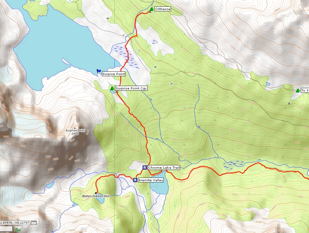
Under the circumstances, the best way to end my Tonquin hike is to return via the Chrome Lake trail with a side trip to the Wates-Gibson Hut. The total distance is 23 kilometers, but at least I get to see another corner of Tonquin Valley. I can take all day to do this since I won't be going home today anyway.
It's not raining at the moment. I quickly pack up the wet tent, which now weighs much more than when it was dry. At least the air is no longer smoky after the heavy rain, even if the clouds are very low. Surprise Point is very beautiful in this light as well.
Surprise Point after the big rain
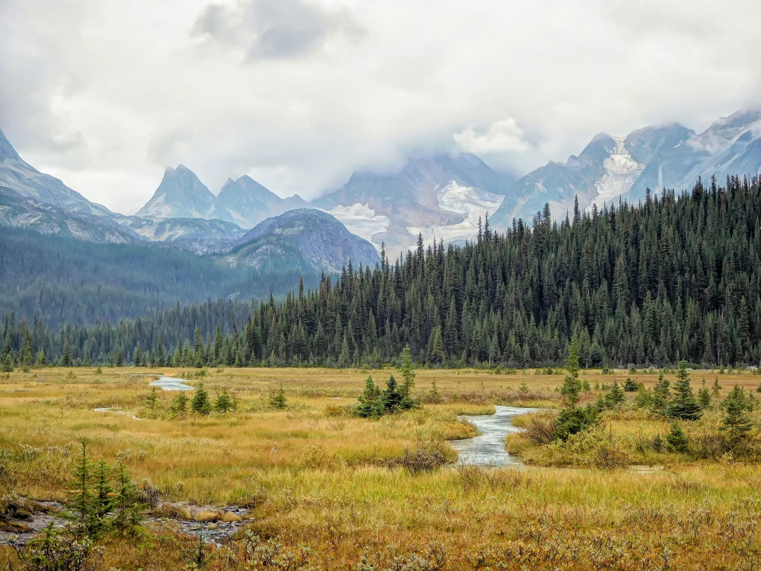
I descend into the valley through a dense mossy forest with blueberry bushes along the way. The landscape soon opens up and is beautiful even in this gloomy weather. Glaciers and golden grasses are shrouded in mist and clouds.
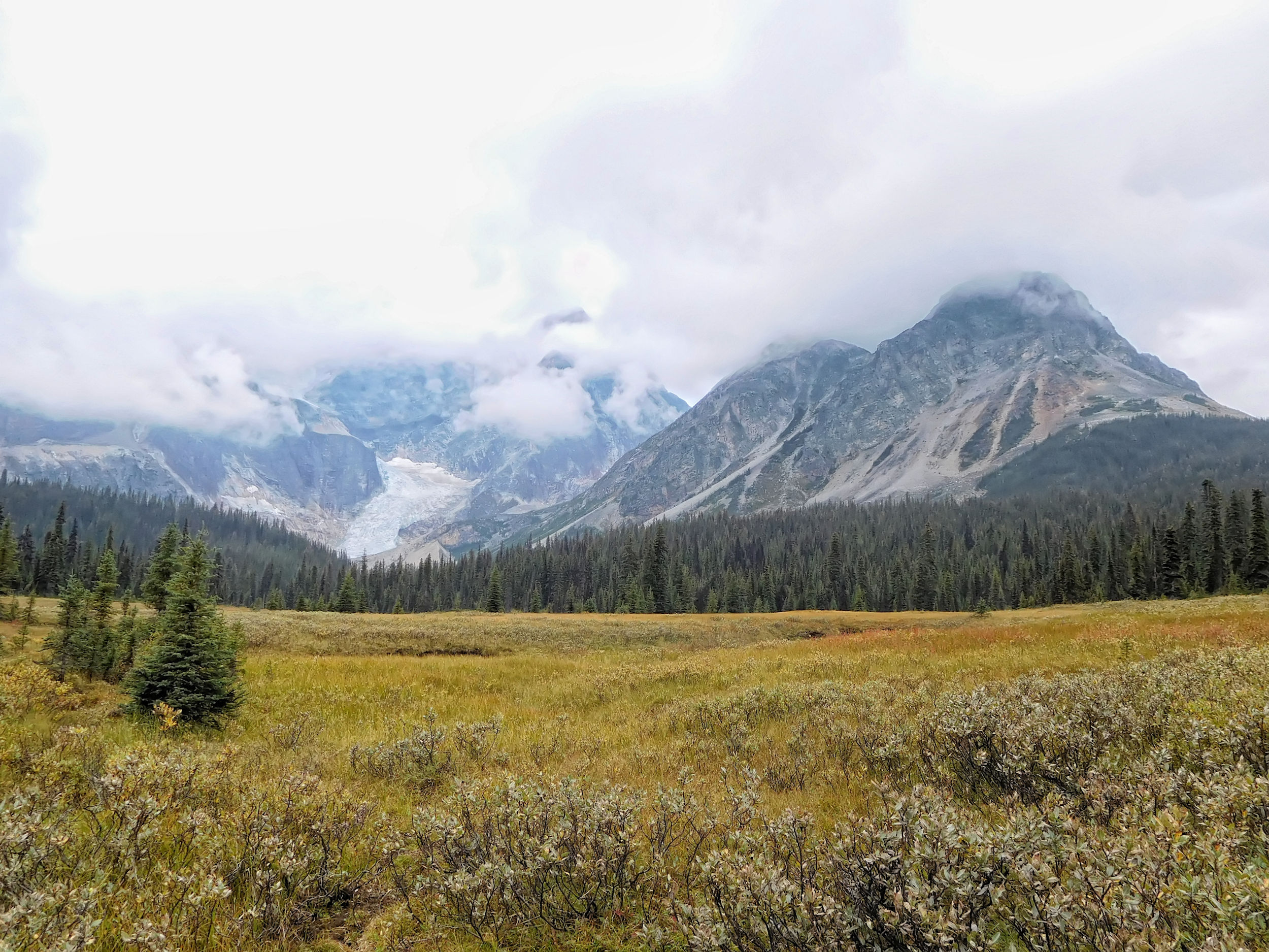
On the way to the Wates-Gibson Hut
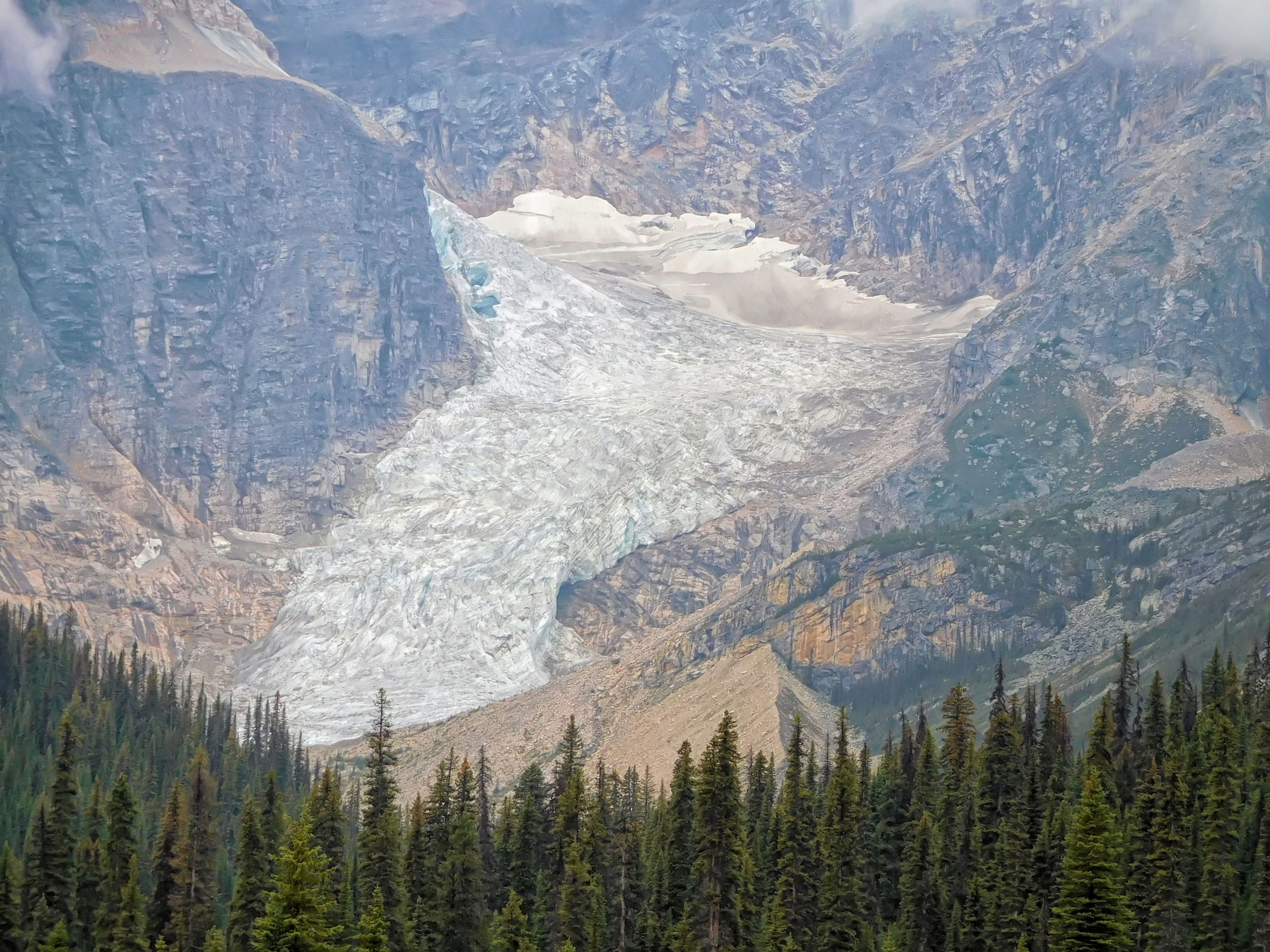
Closeup of the glacier
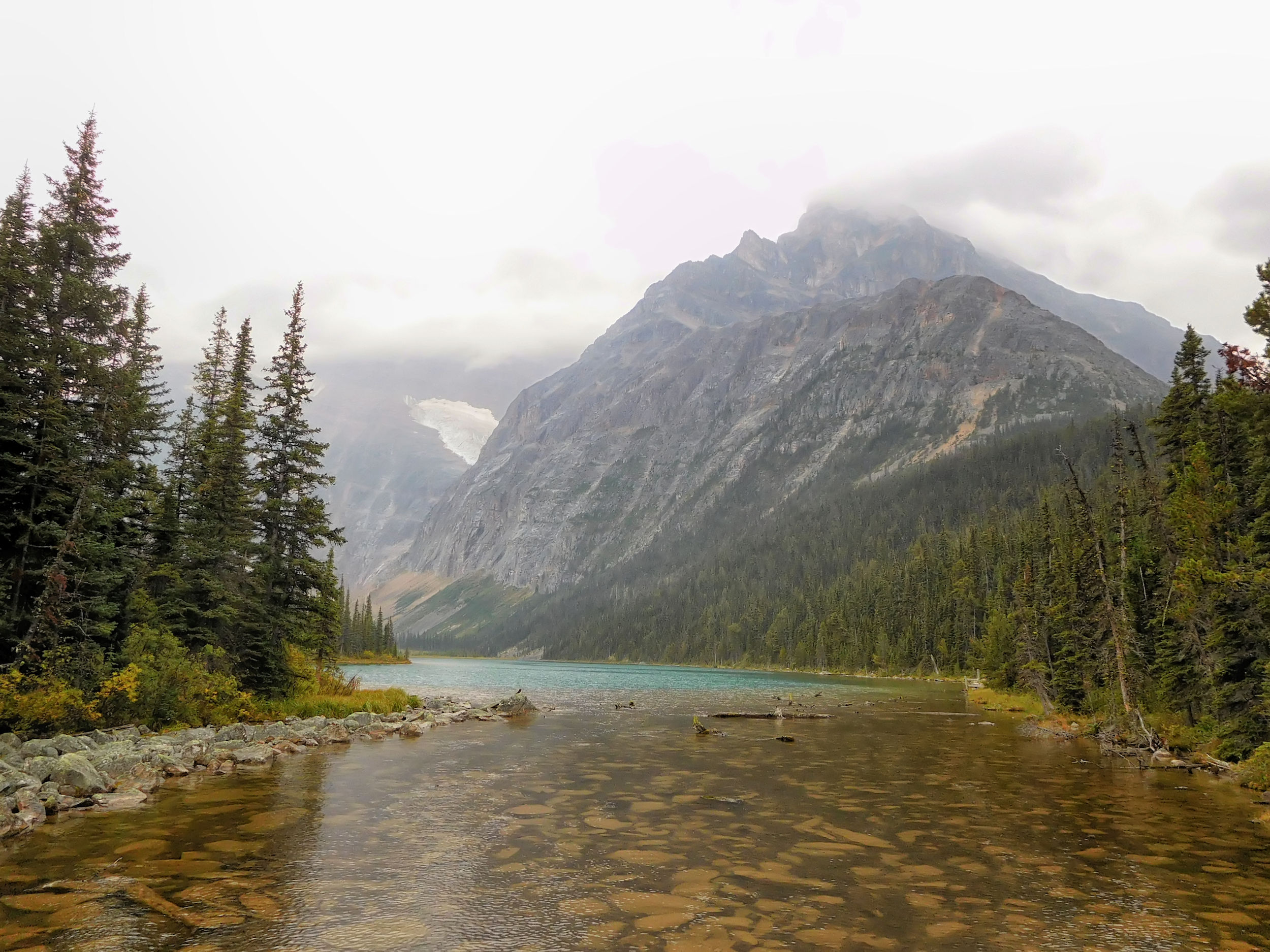
Brand new bridges cross a raging creek. The climb to the Wates-Gibson hut is steep. It's only 1.3 kilometers, but it's tough.
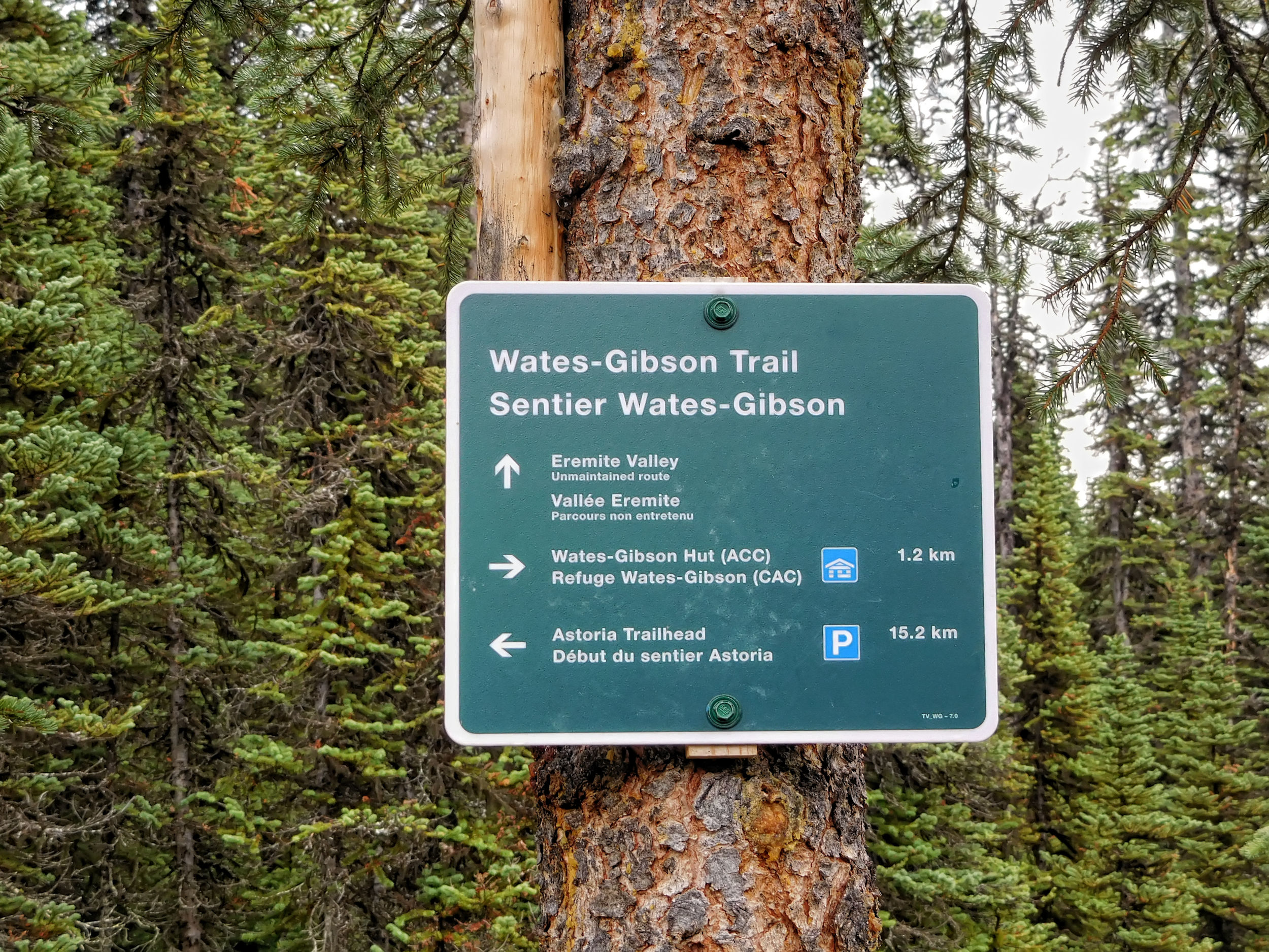
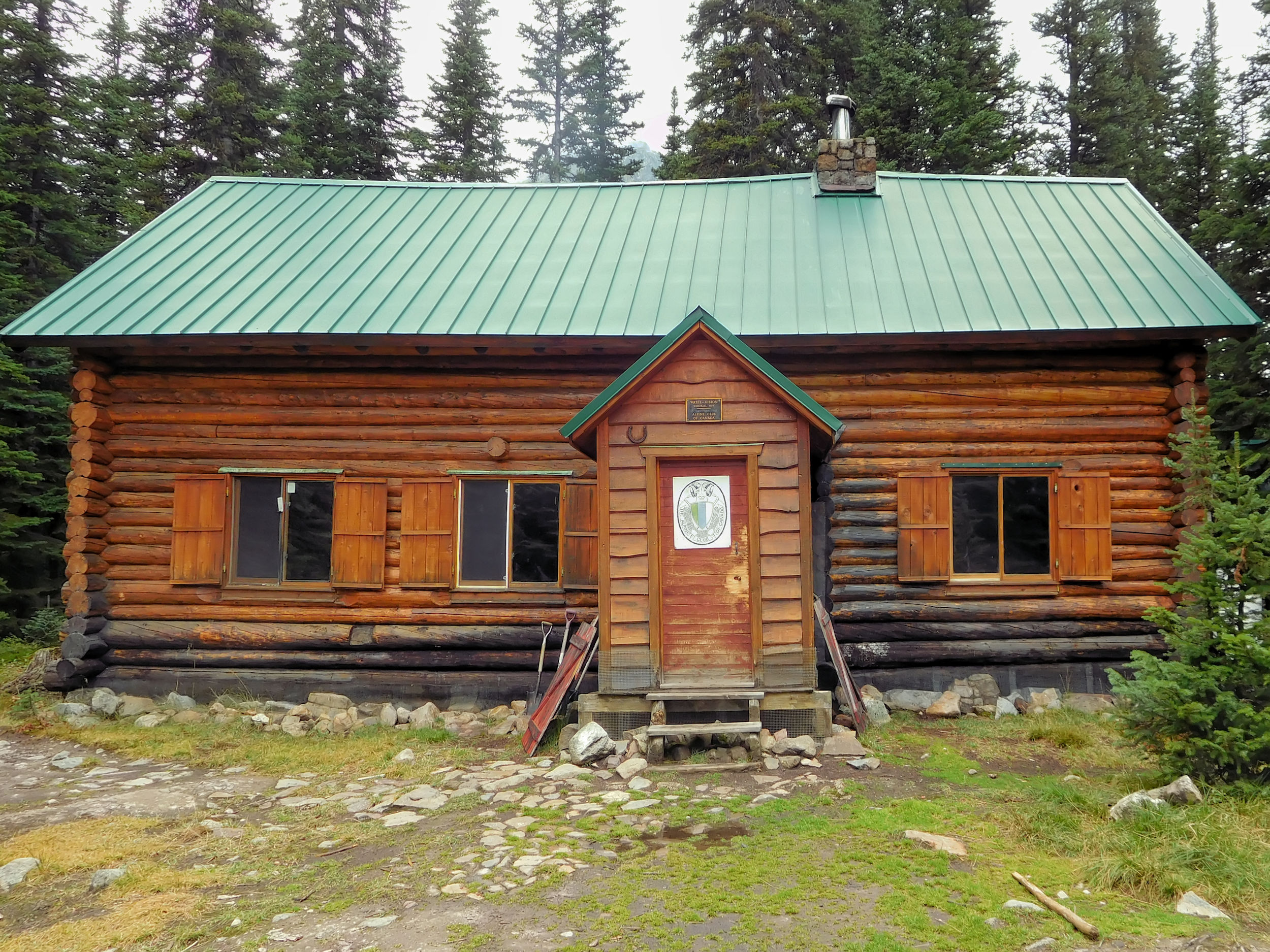
The hut sits on the shore of photogenic Outpost Lake.
Outpost Lake
There's another hike to a small lake above the hut, but that's too much for me today. It's still a long way to the parking lot and the trail is supposed to be very bad. Energized by a snack, I start my way back.
A different hike out via Chrome Lake
The little I can see of Eremite Valley looks promising. This time I won't have the chance to explore this remote valley. Also, the bridge that gives access to the valley has been missing for several years and the creek is difficult to ford. Another time...
Looking towards Eremite Valley
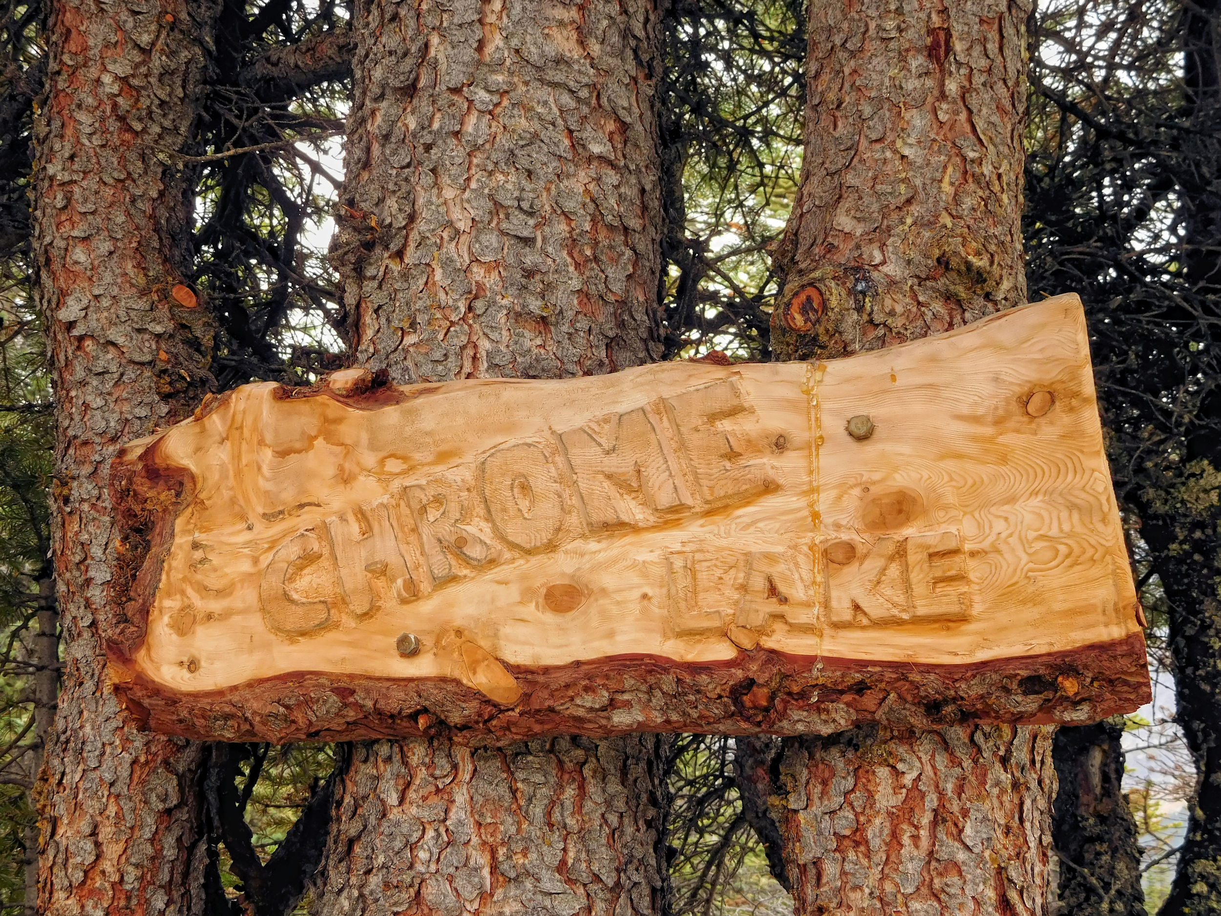
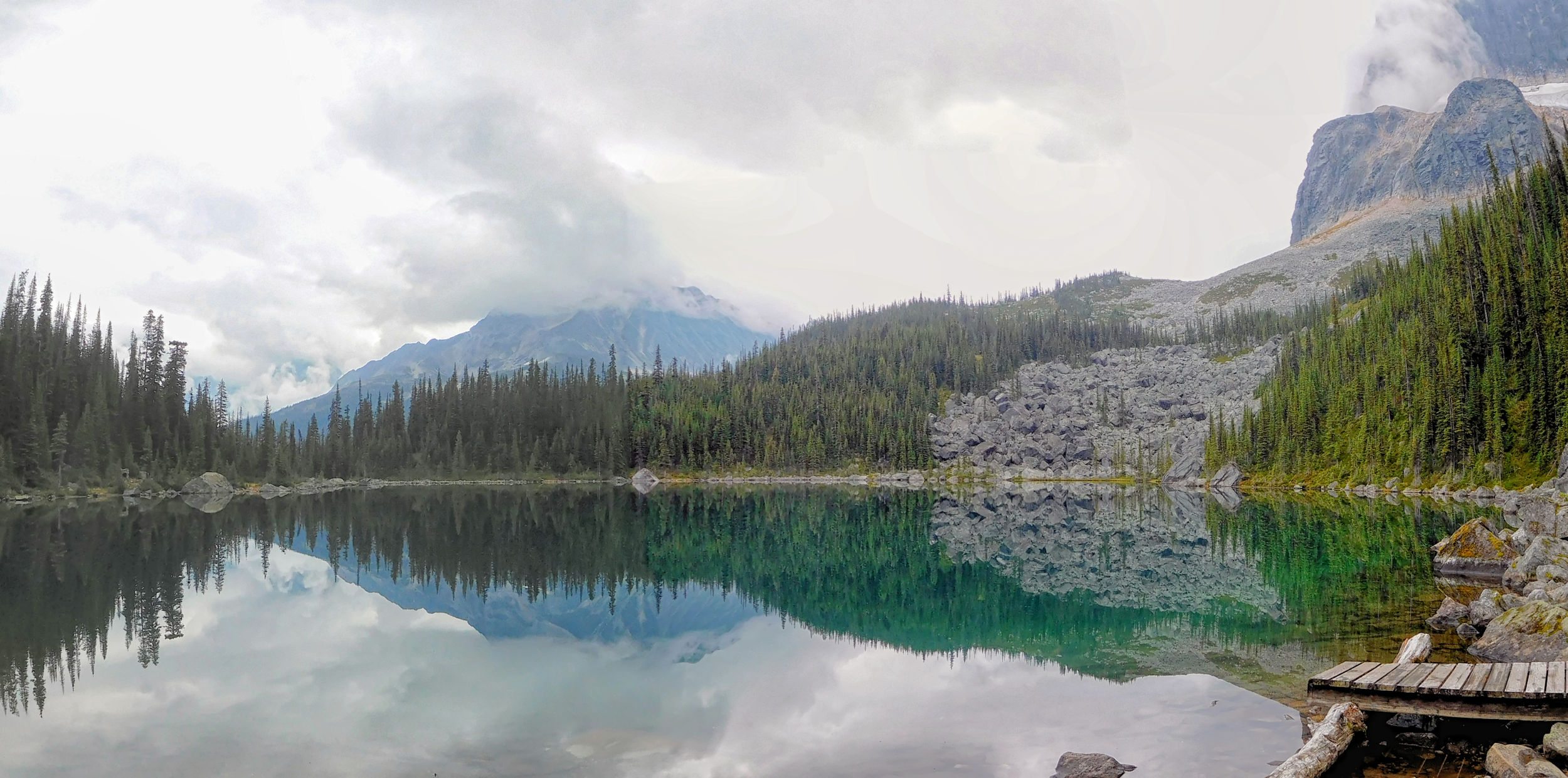
Soon, I reach scenic Chrome Lake.
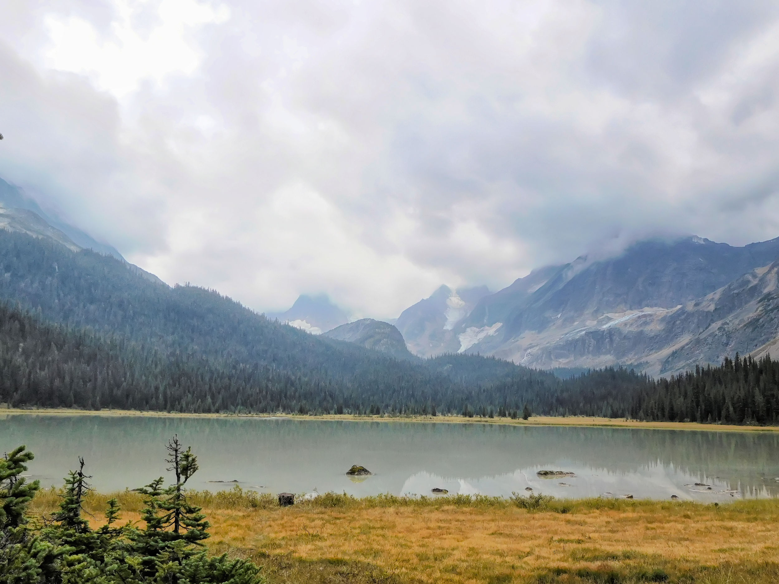
Chrome Lake
Chrome Lake Outflow
Beyond Chrome Lake, there are no views and the trail becomes rough. Roots, rocks, puddles and mud alternate with each other. I walk very cautiously yet at one point I literally fall on my face. Luckily without serious consequences except for some dirty knees and mud-spattered glasses.
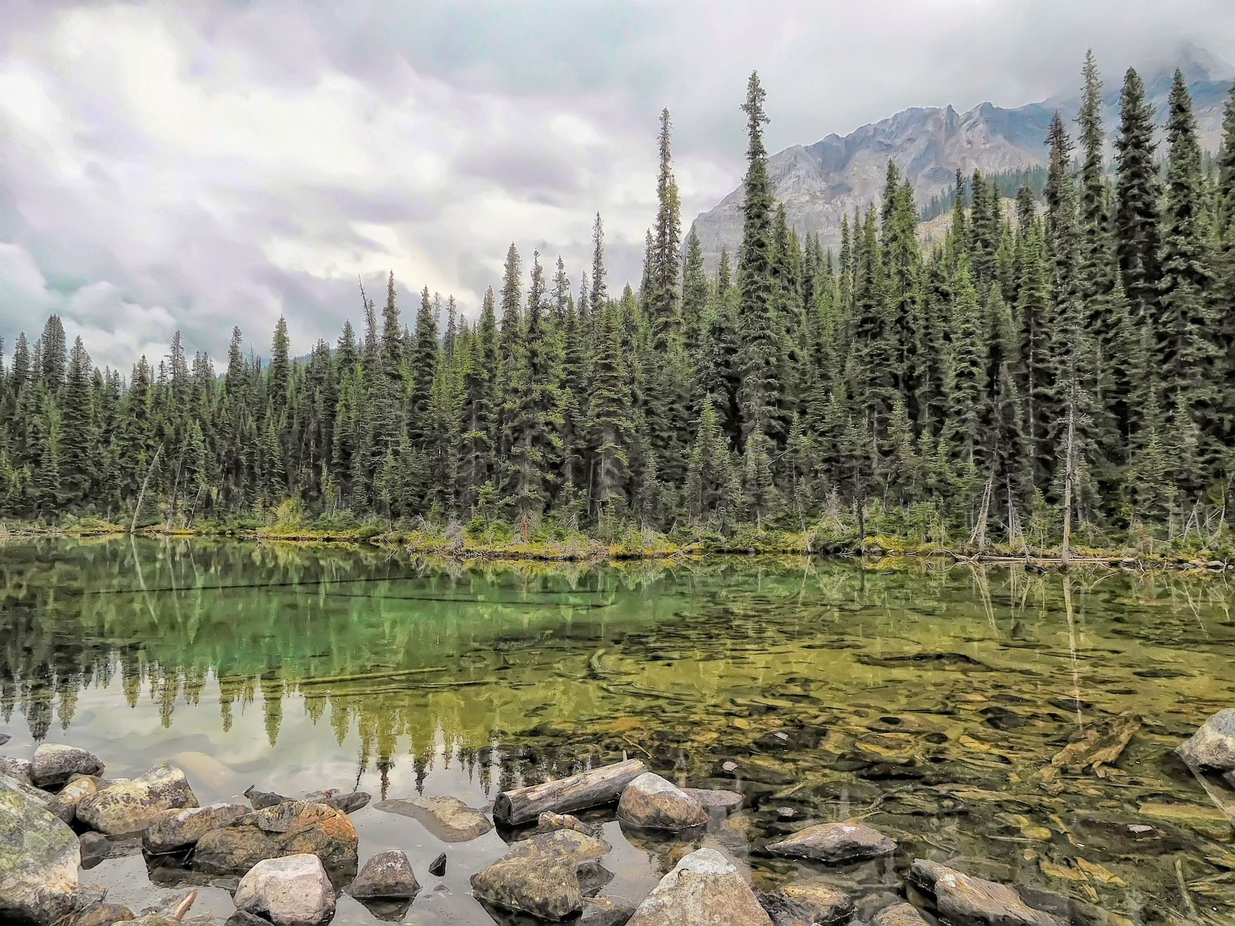
Pond along the rocky trail with lots of boulders, roots and bogs
Recently, a Parks Canada crew replaced the bridge over Campus Creek. Previously, you had to balance on a fallen log to cross the creek.
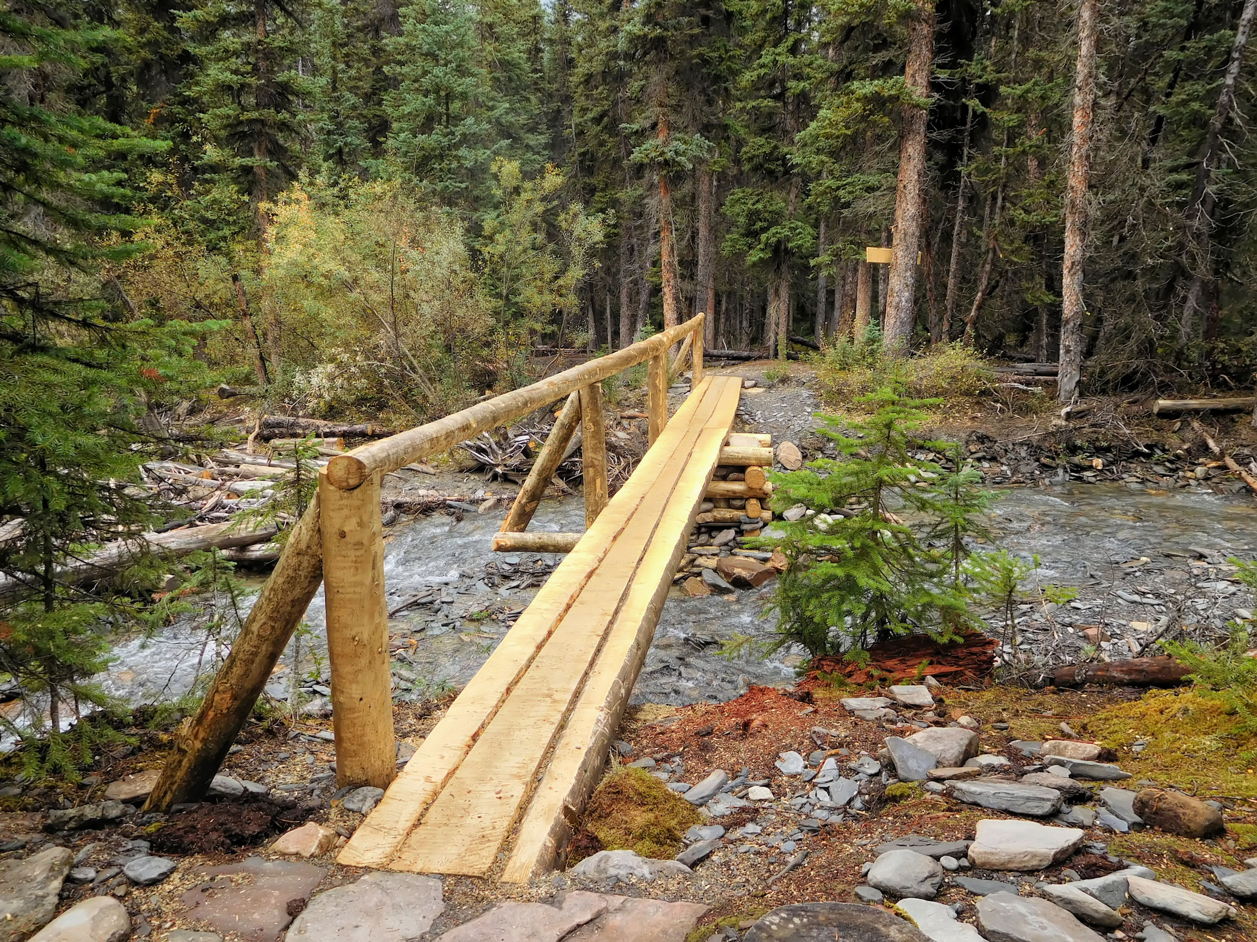
A brand new bridge
over Campus Creek
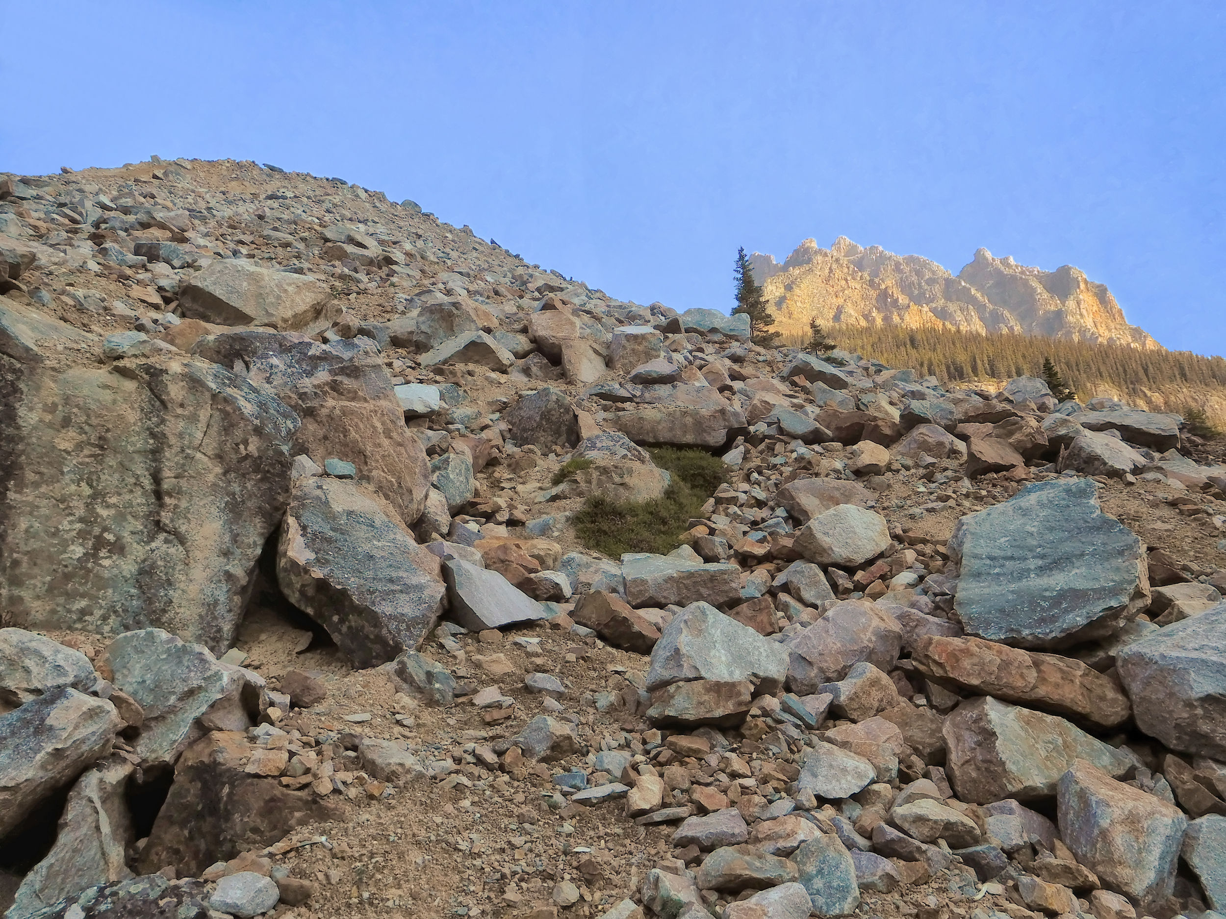
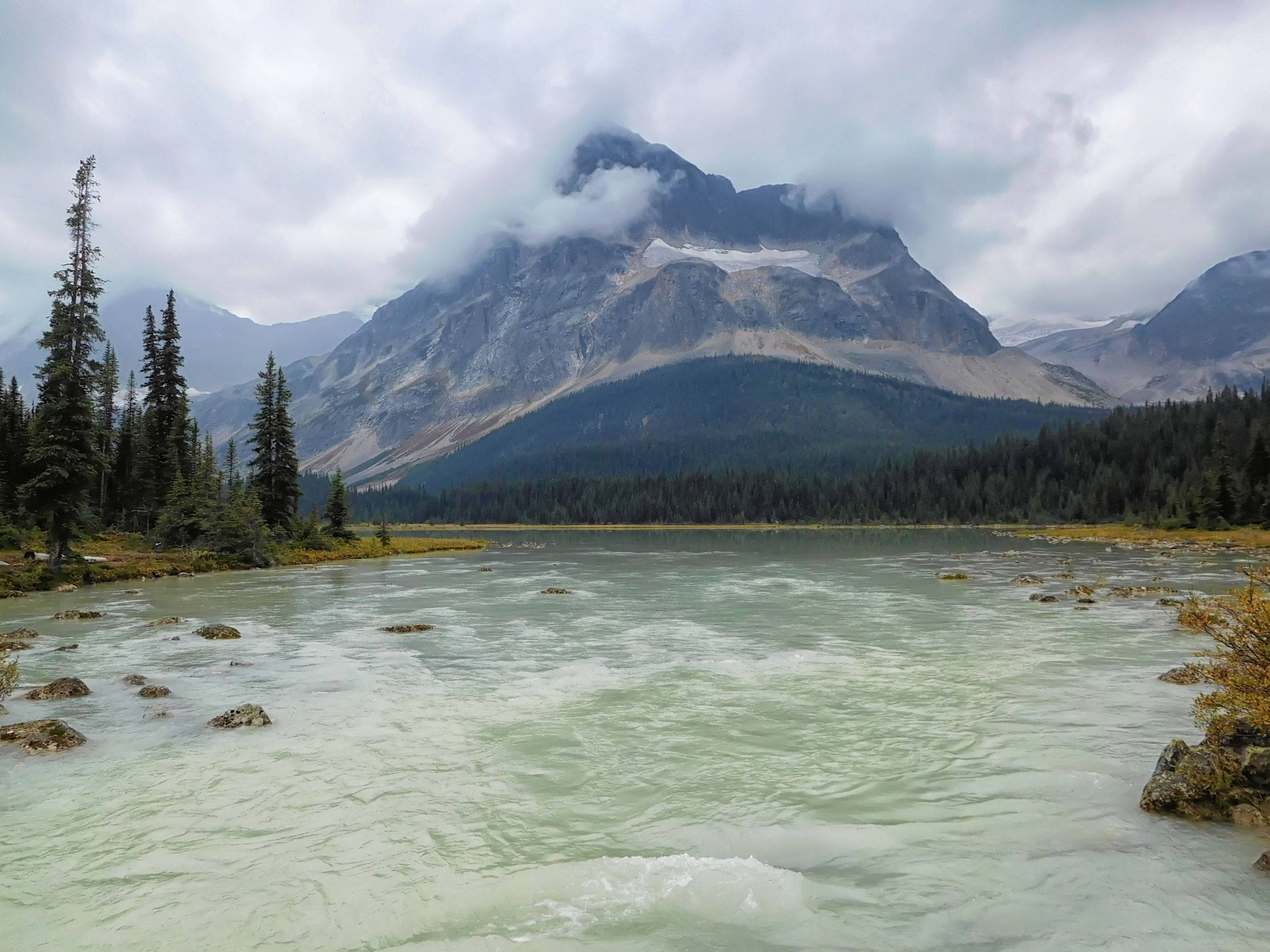
Apart from two young women on their way to Surprise Point campground, I don't meet a soul. I'm glad when I finally spot the big rock slide on the other side of the Astoria River. That means I'm not far from the bridge over the river and the main trail.
The slide area on the other side of the river
The rain has also made the main trail much muddier than it was on the way in. Still, I manage to walk a little faster here. When I reach Astoria campground it starts to drizzle, so I decide not to eat there. Besides, it is getting late, almost six o'clock. I just pack up my empty gas canister, which I had left in the locker on the way in, and walk on.
The last 7 kilometers seem endless. There is actually not much of an incline, but I feel like it is constantly going uphill. My legs are just tired. At the Cavell Lake viewpoint, the top of Mount Edith Cavell is covered in clouds this time.
Evening drizzle at Cavell Lake
I'm glad to reach the car and escape the drizzle. Of course it is too late to go home today, so I spend the night in Jasper.
I really enjoyed Tonquin Valley. I would love to go back to Surprise Point and venture into Eremite Valley - as soon as there is a way to get across Eremite Creek again.