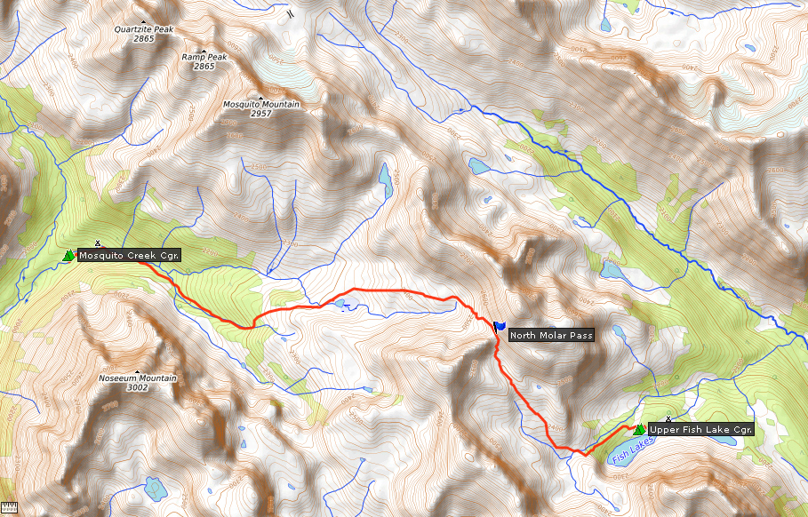
 Via Jasper to Mosquito Creek CampgroundAugust 1

On my first backpacking trip of the year, I will return to the Molar Mountain passes and the Fish Lakes in Banff National Park. I have visited this stunning mountain region twice before, most recently in 2021, but there is always something new to discover. This time I want to focus on the Pipestone Valley and the remote Devon Lakes.
The summer is once again characterized by countless forest fires and smoky air. This time the forest fire season started already in May and will last until mid-September. In the mountains the air is always on the move, so I'm still hoping for a reasonably smoke-free hiking week.
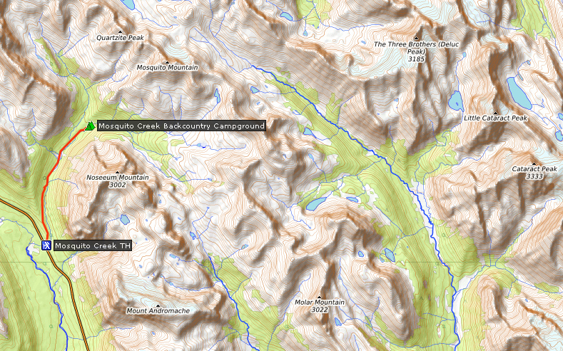
I drive through Jasper and in seven and a half hours I reach the Mosquito Creek trailhead on the Icefield Parkway in Banff National Park. I left home early because I want to hike to my first destination today, the Mosquito Creek campground at kilometer five on the Mosquito Creek trail.
| Distance | 5.0 km |
| Time | 1 ¼ hrs |
| Min. Elevation | 1868 m |
| Max. Elevation | 2014 m |
| Ascent | 146 m |
| Cum. Ascent | 290 m |
| Cum. Descent | 153 m |
The trailhead is at the Mosquito Creek Hostel and there are still plenty of parking spaces available. I pack some food from the cooler into my backpack and then I'm ready to go. I shoulder my pack and cross the bridge to Mosquito Creek campground. This campground, which is right on the road and is also suitable for RVs, is not to be confused with the campground of the same name in the backcountry where I am heading. I start my hike along Mosquito Creek on the other side of the highway.
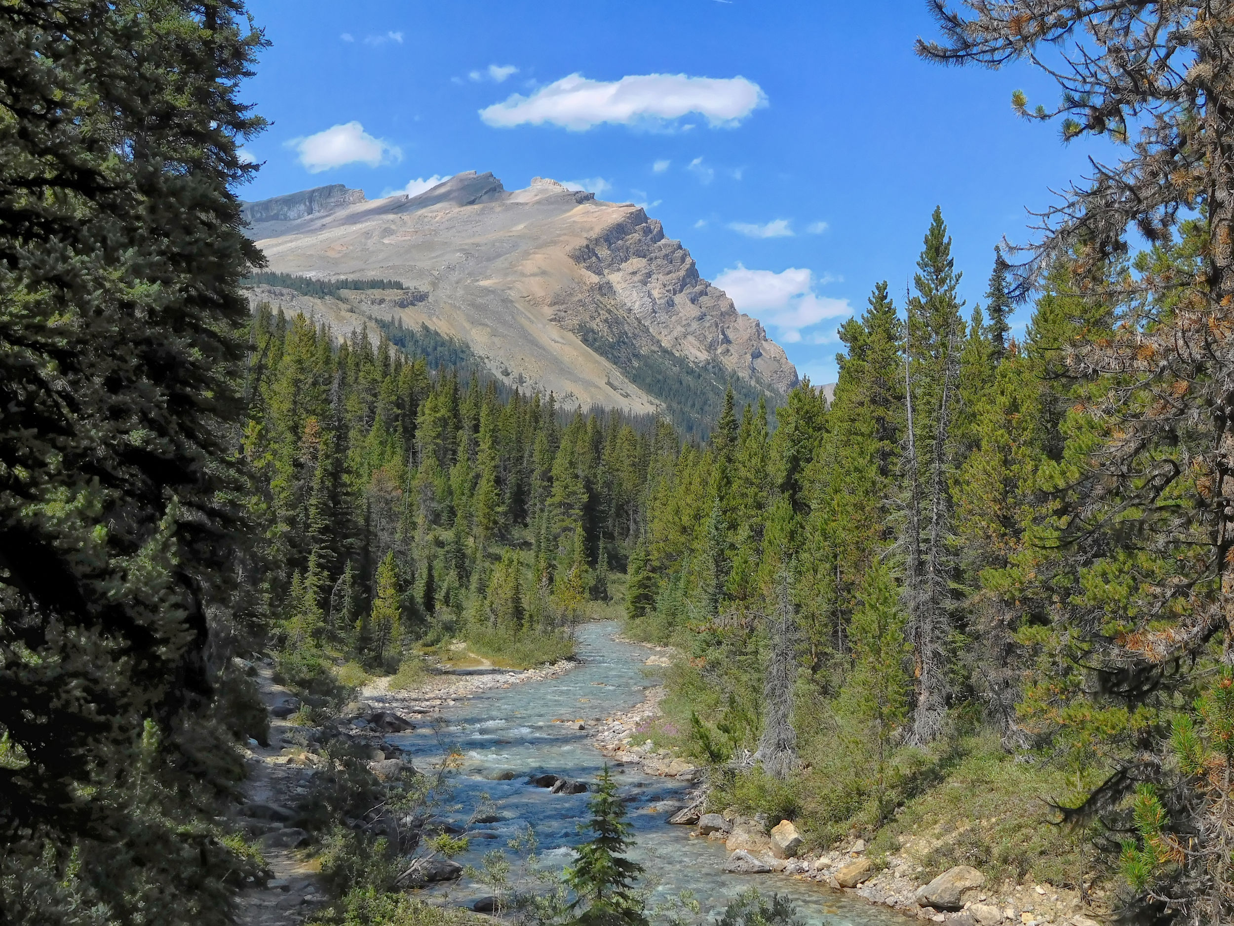
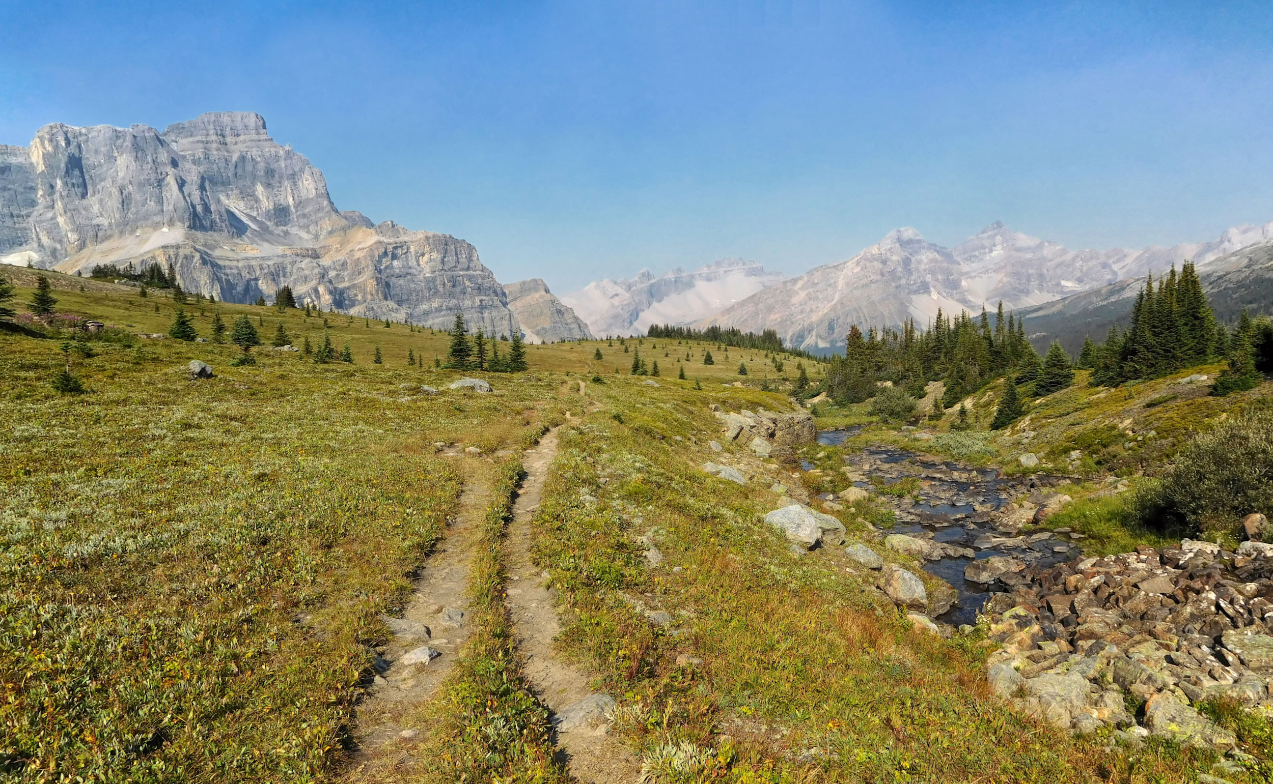
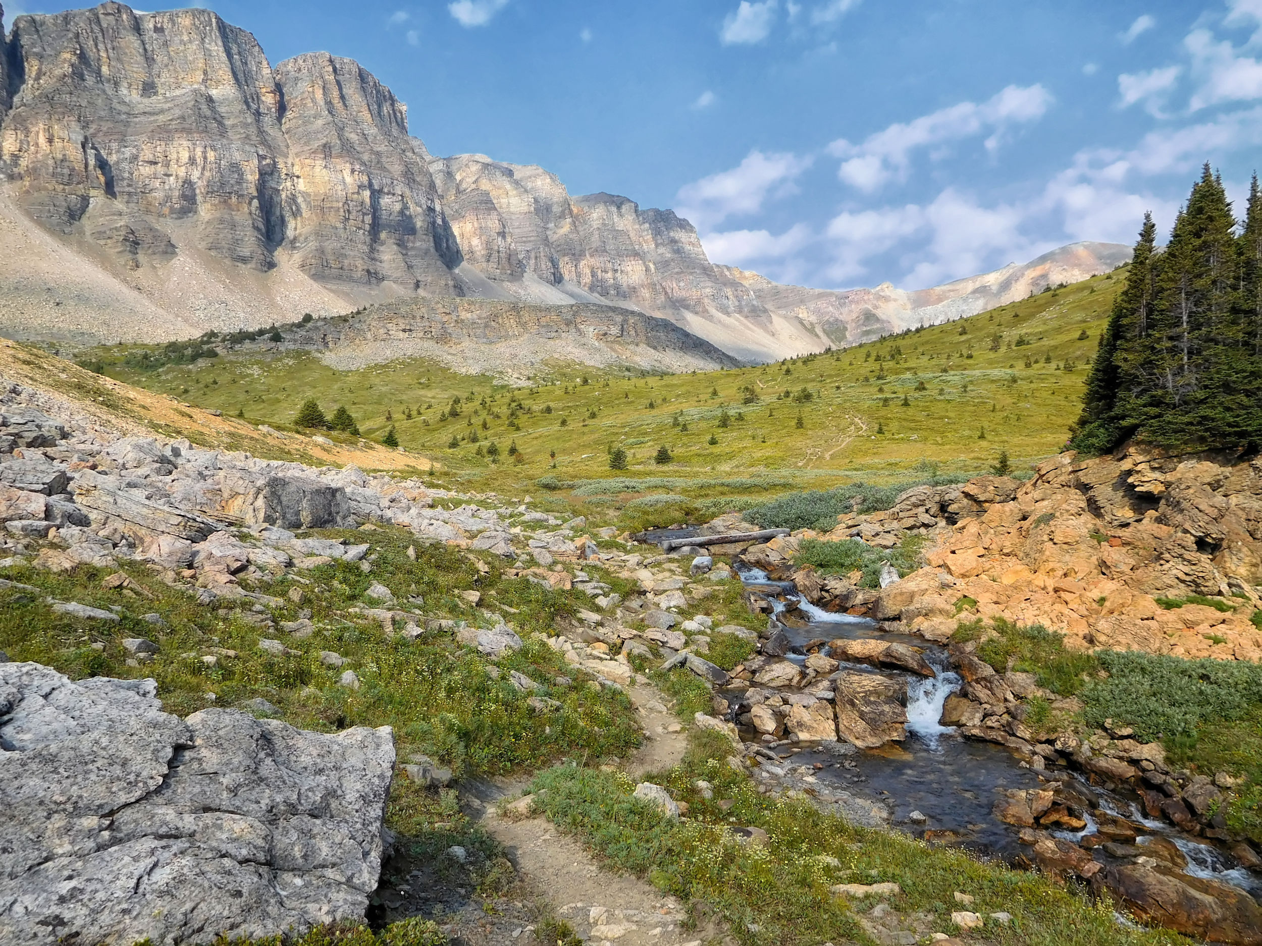
The trail is very scenic. It's a gentle climb along the banks of the turbulent creek.
Mosquito Creek trail
I soon have some nice mountain vistas. The view is much clearer than it was two years ago, but the wildflowers, even the late-summer fireweed, have already finished blooming.
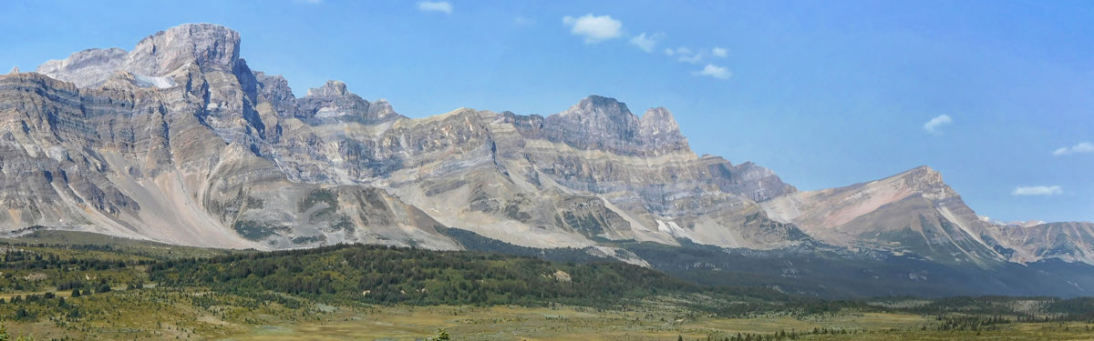
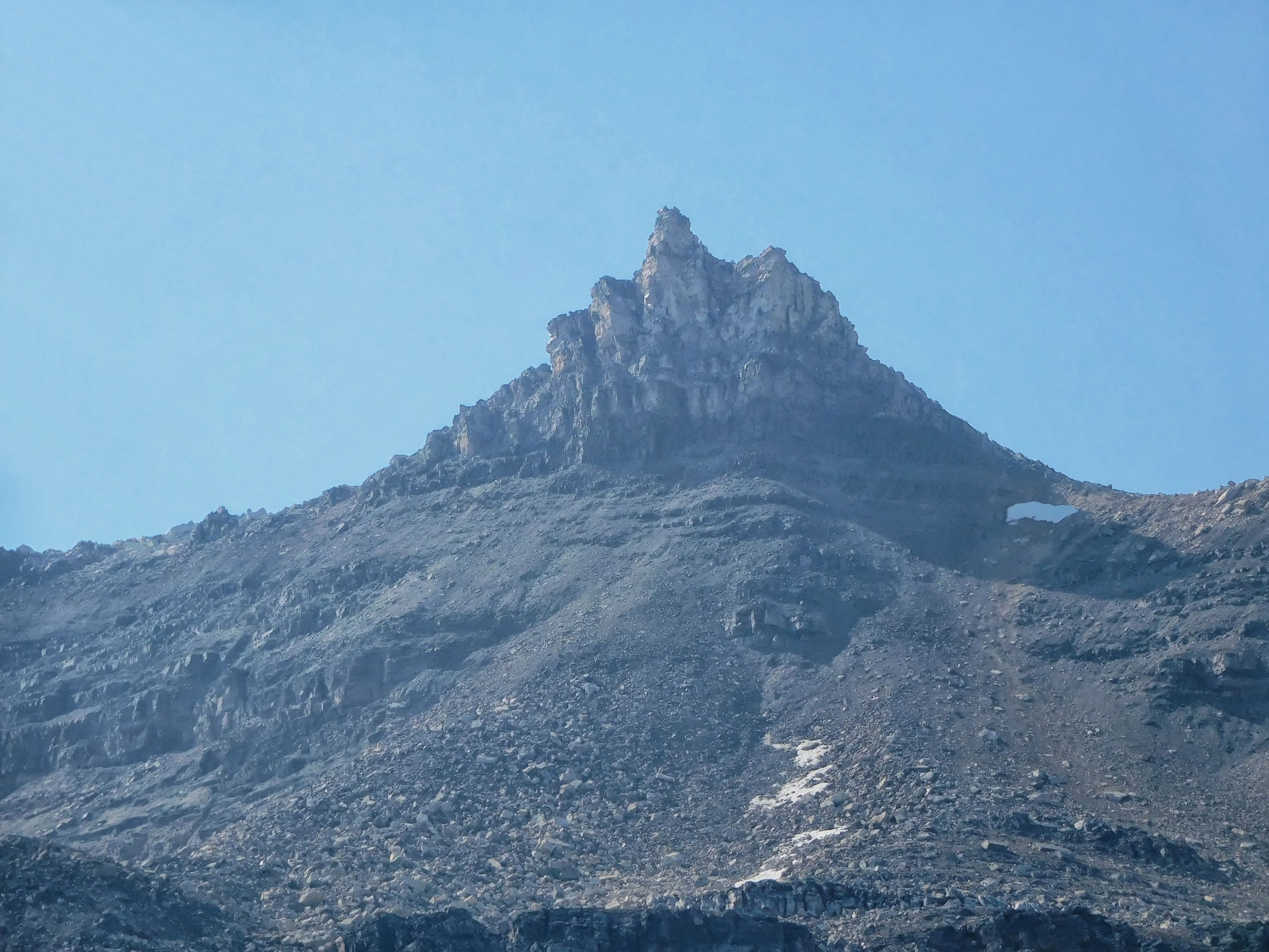
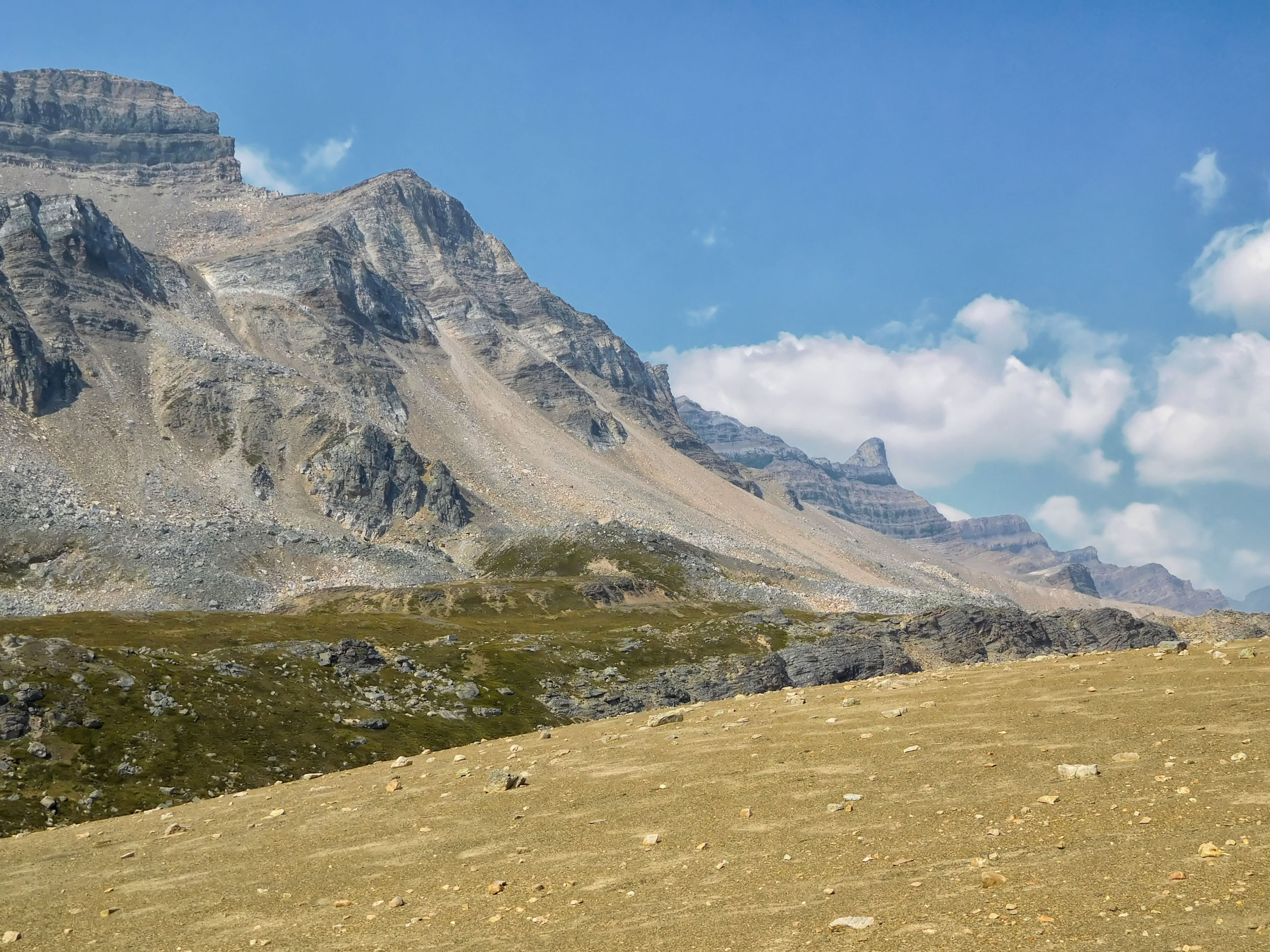
Mosquito Creek with Quartzite & Ramp Peaks and Mosquito Mountain in the background
After a little more than an hour, I reach Mosquito Creek campground. I have to pitch my tent near the fire pit, because the sites in the back are already taken. I brought a slice of pizza, so I don't have to unpack my stove tonight. From my less sheltered campsite, the creek is particularly noisy. Its constant roar wakes me up several times during the night.

| Distance | 19 km |
| Time | ca. 8 hrs |
| Min. Elevation | 1988 m |
| Max. Elevation | 2435 m |
| Ascent | 447 m |
| Descent | 447 m |
I'm pretty tired in the morning because I didn't sleep well due to the noisy creek next to my campsite. Luckily, today I only plan to do a day hike to warm up, the length of which I can decide on the way. I want to explore some lakes beyond South Molar Pass. The sun is shining, but the air is not as clear as the day before.
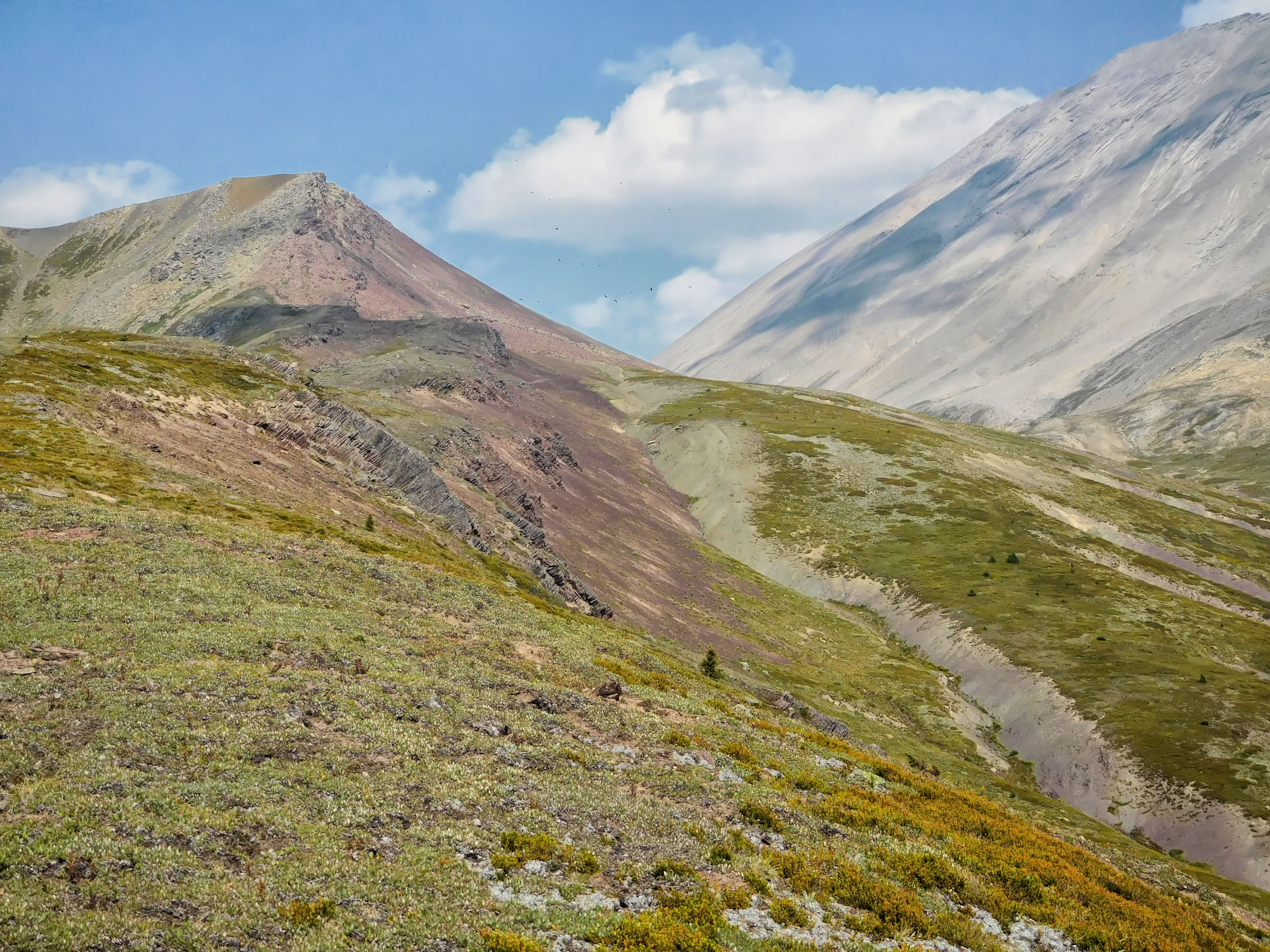
The trail initially winds along Mosquito Creek. The eastern flank of Noseeum Mountain rises to my right. After about an hour I come to a fork in the trail. To the left is North Molar Pass, but I keep to the right towards South Molar Pass.
The trees are dense and the ground vegetation is lush in the sheltered basin through which the trail leads to South Molar Pass. The trail winds through conifer forest and small wildflower meadows. It is so narrow that I can't see very far. Two years ago, I almost ran into a grizzly bear here, if another hiker half an hour ahead of me hadn't scared it off.
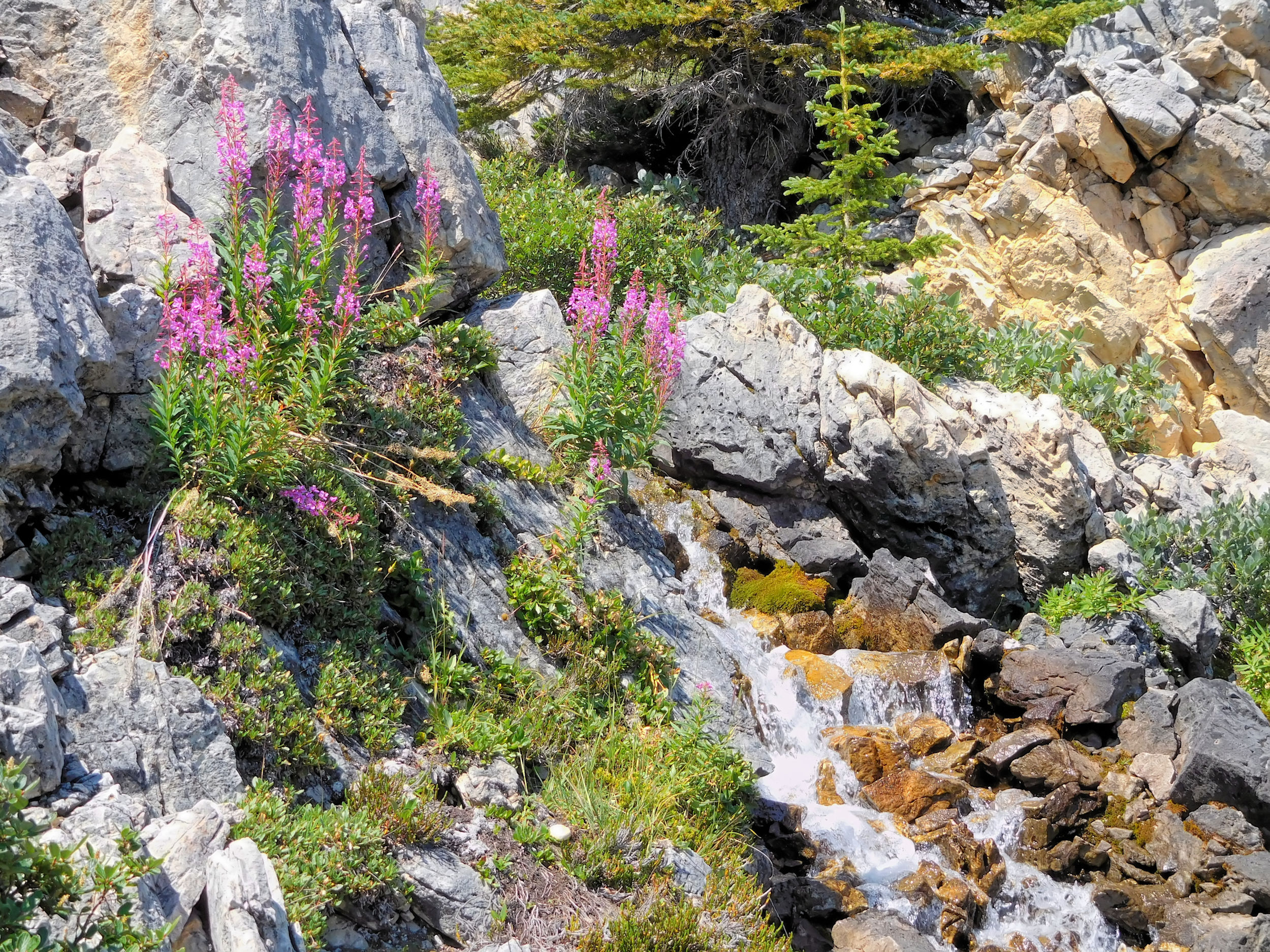
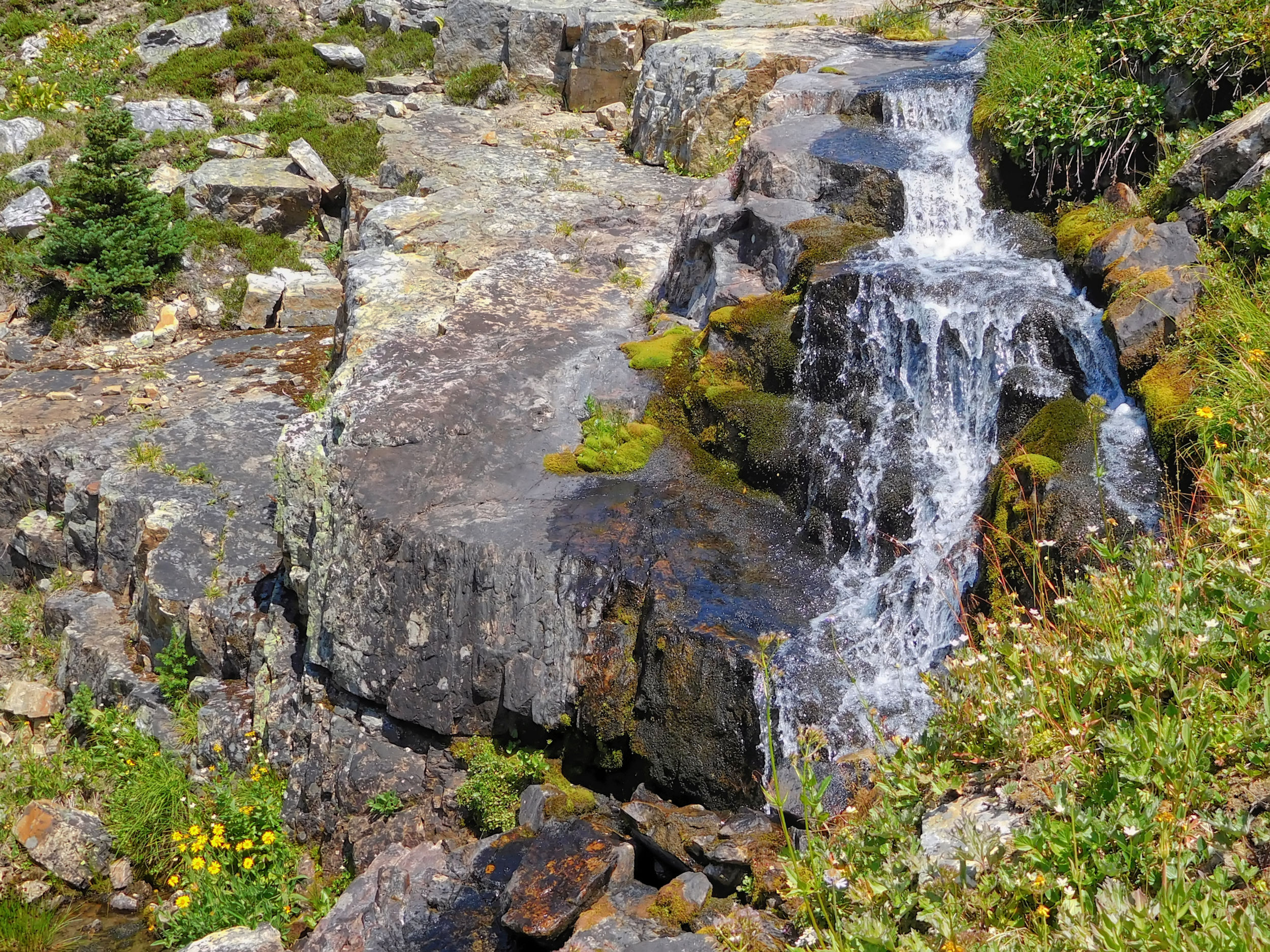
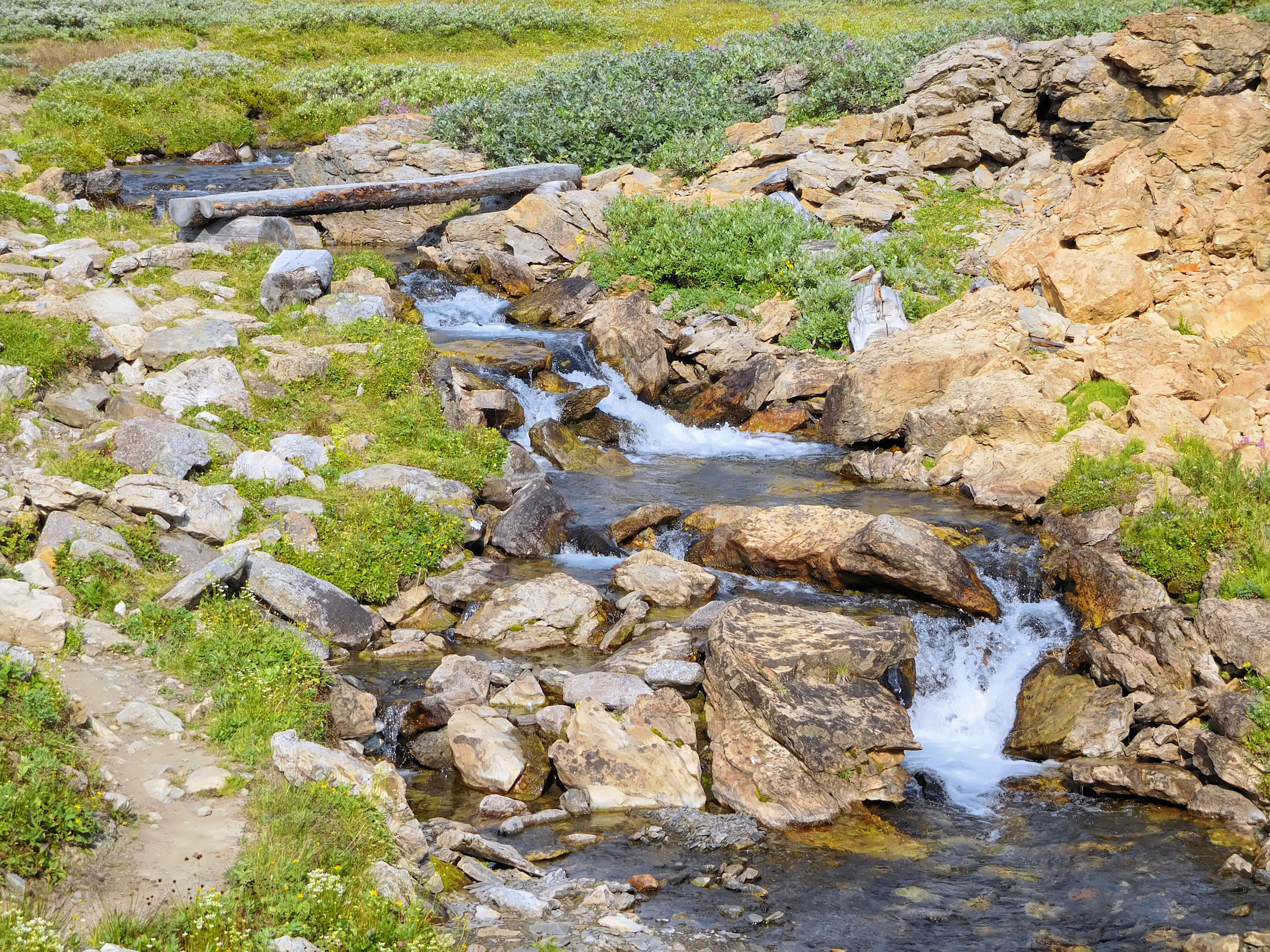
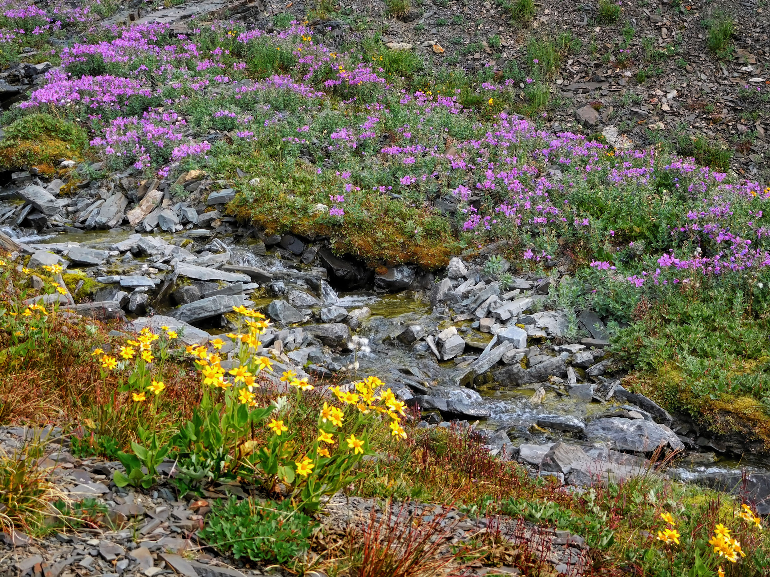
I hike just below the mighty Noseeum Mountain. There is hardly any fireweed in bloom. All the wildflowers have been very early this year and were rather sparse due to the prolonged heat and drought. The trail climbs steadily. Soon I reach a pretty waterfall that cascades over rock steps and through flower meadows, also known as the Japanese Garden. There is still enough humidity for the pink flowering fireweed here.
At the Japanese Garden
Beyond, the trail becomes steep and winds its way out of the valley. South Molar Pass is not far away.
View back over the valley
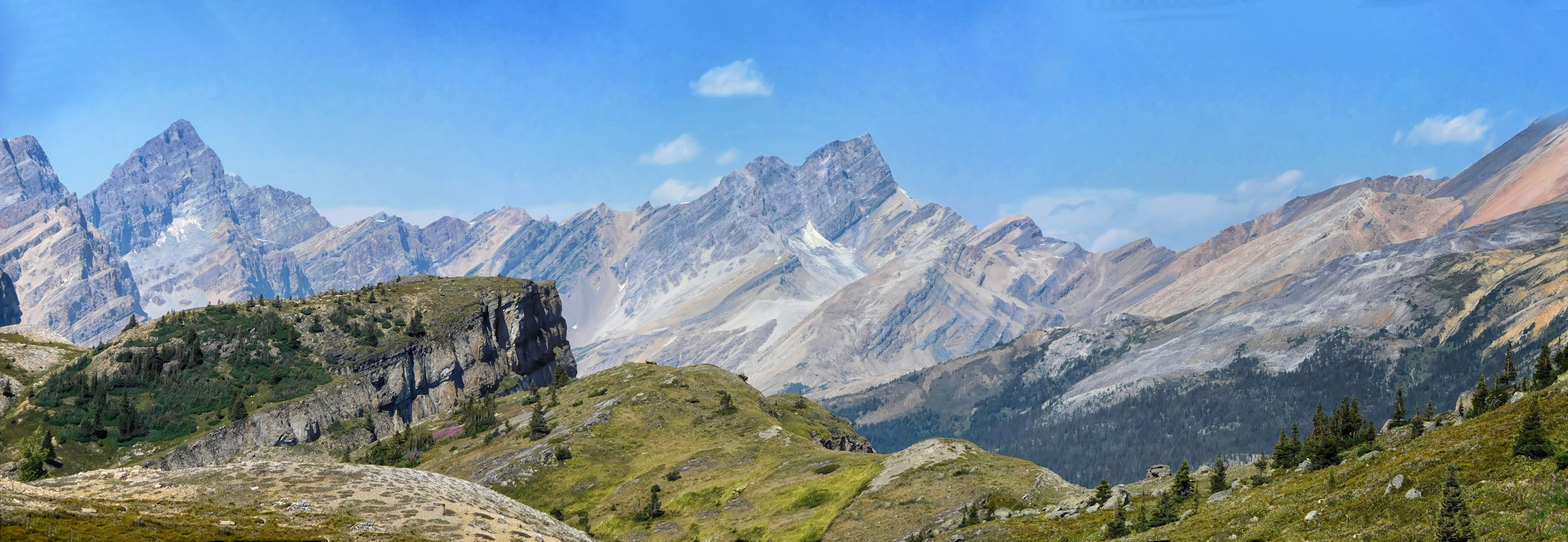
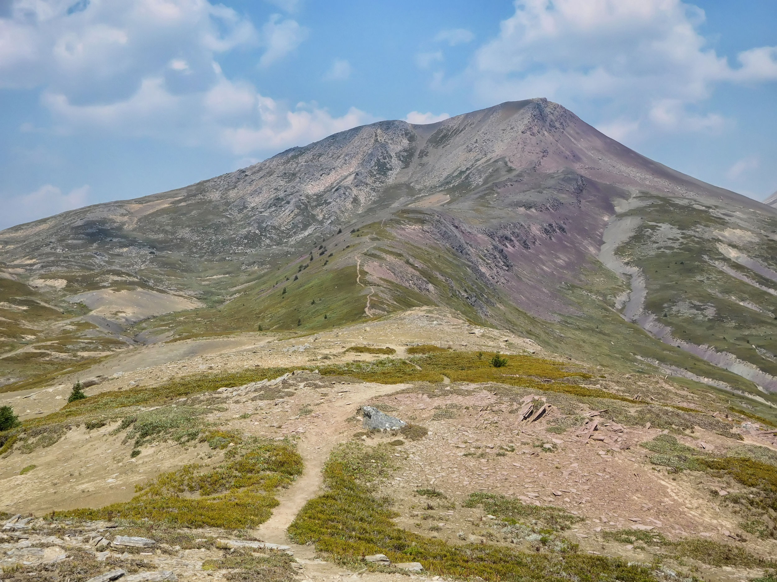
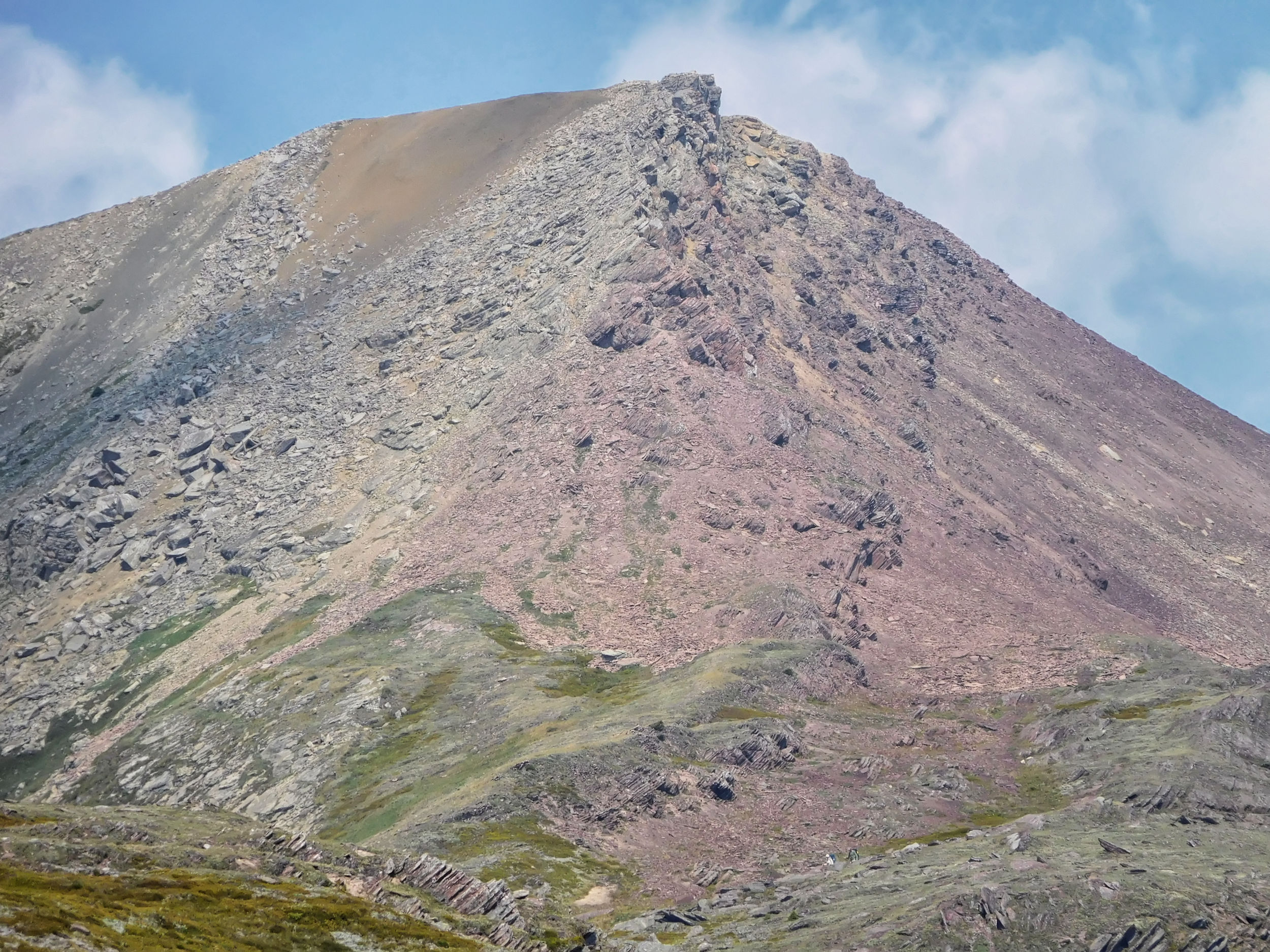
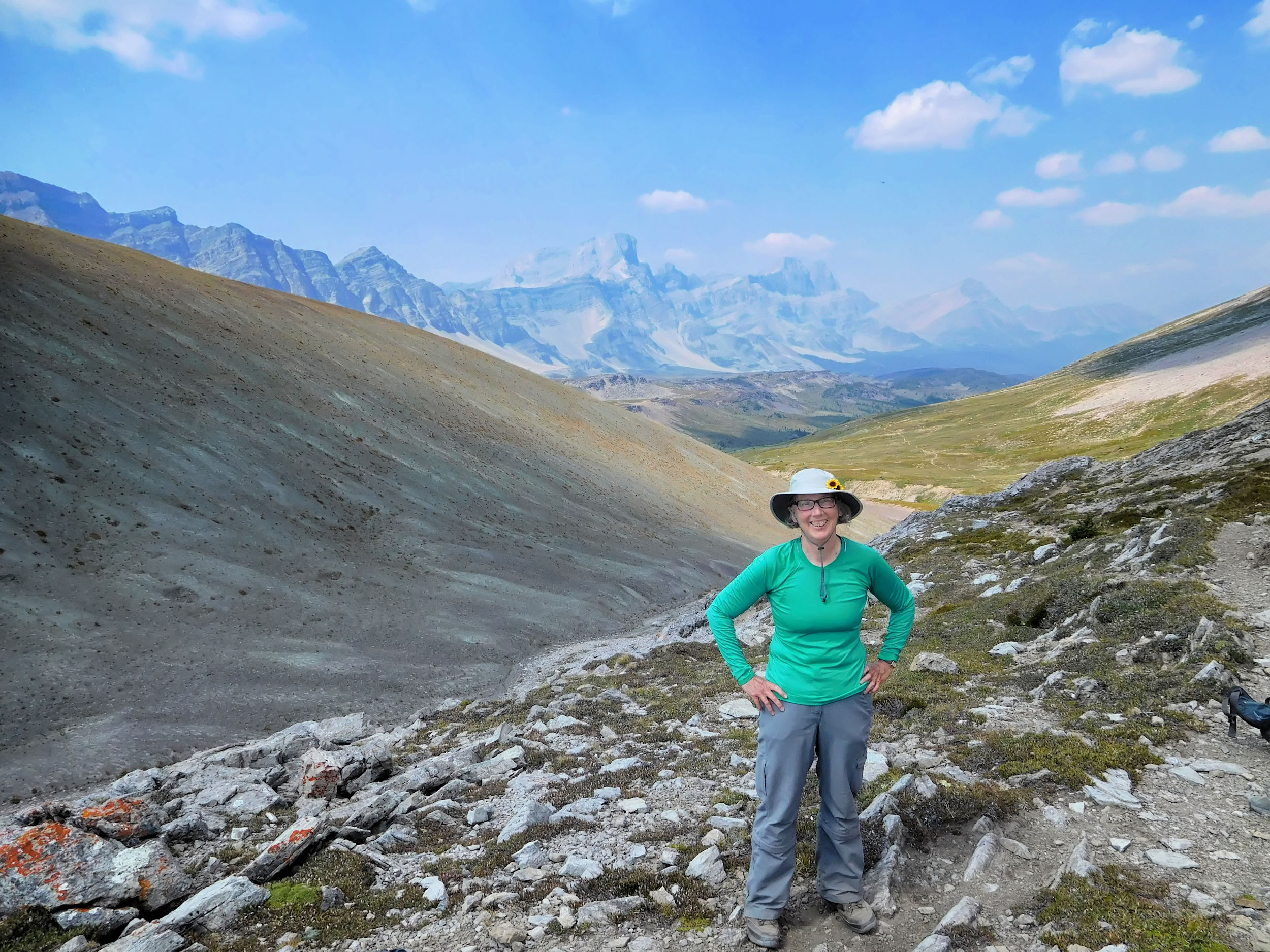
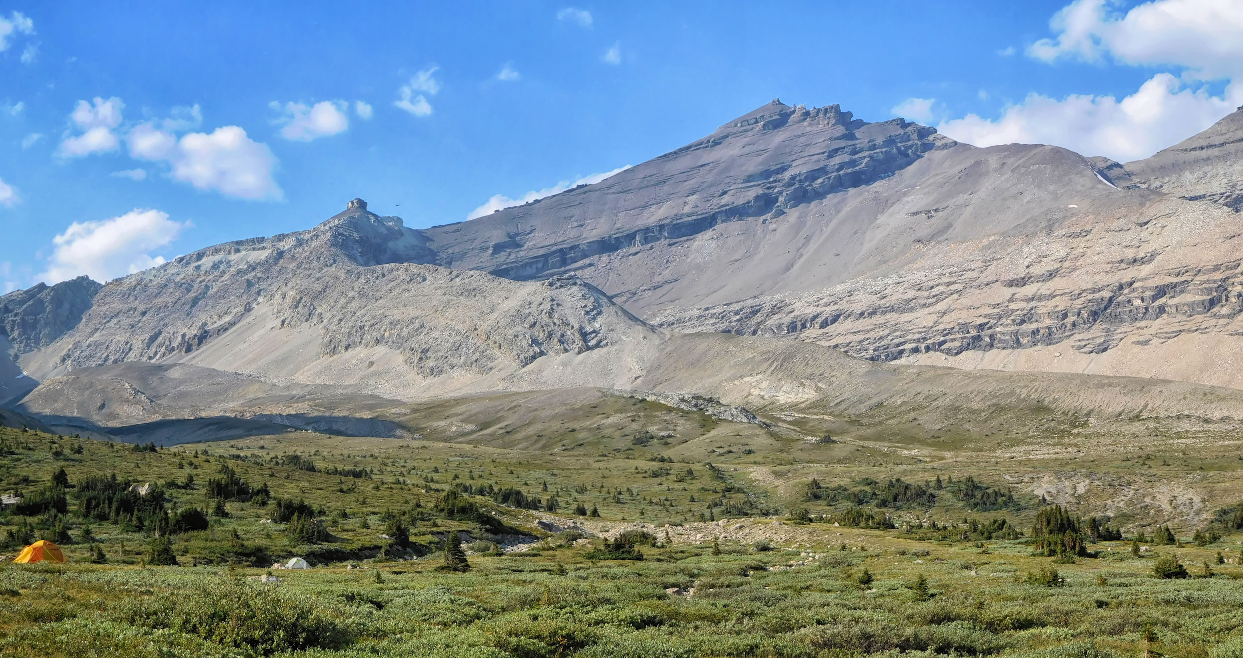
At South Molar Pass I take a break for a snack before continuing my way. It is a slow but steady descent. The views of Molar Mountain get better and better. The name of the mountain describes its shape very well.
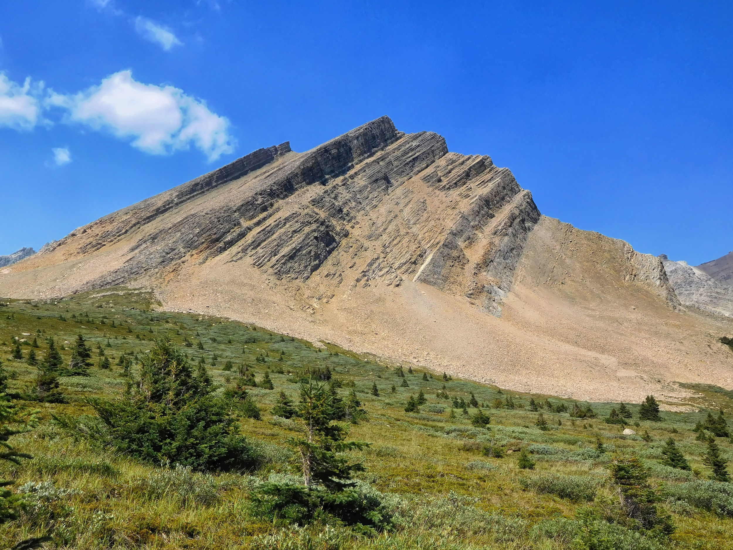
Molar Mountain 3022 m
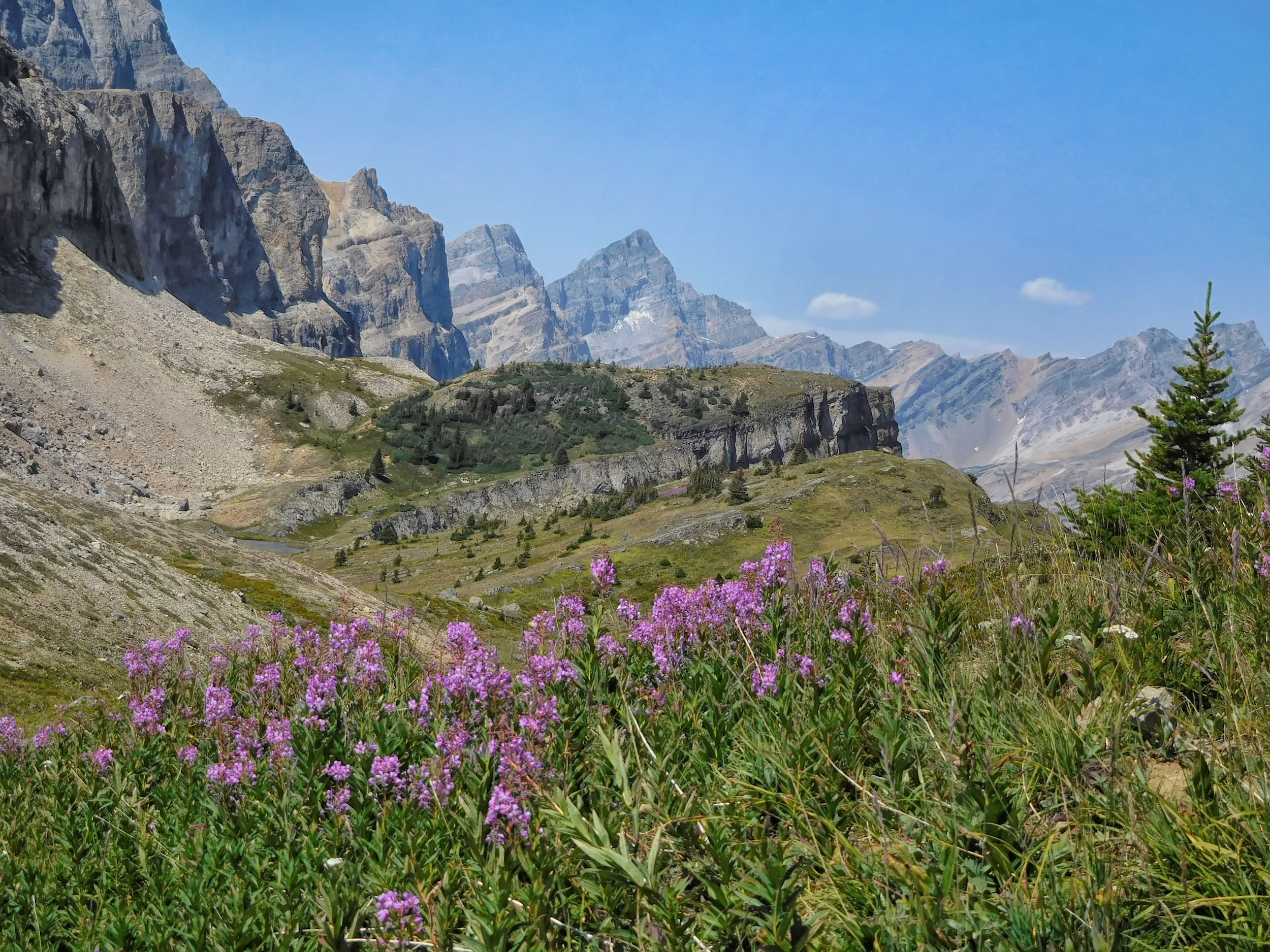
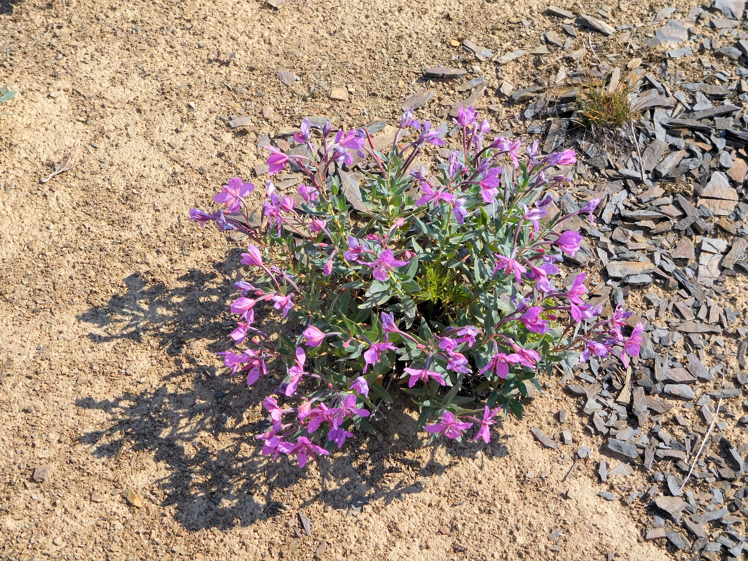
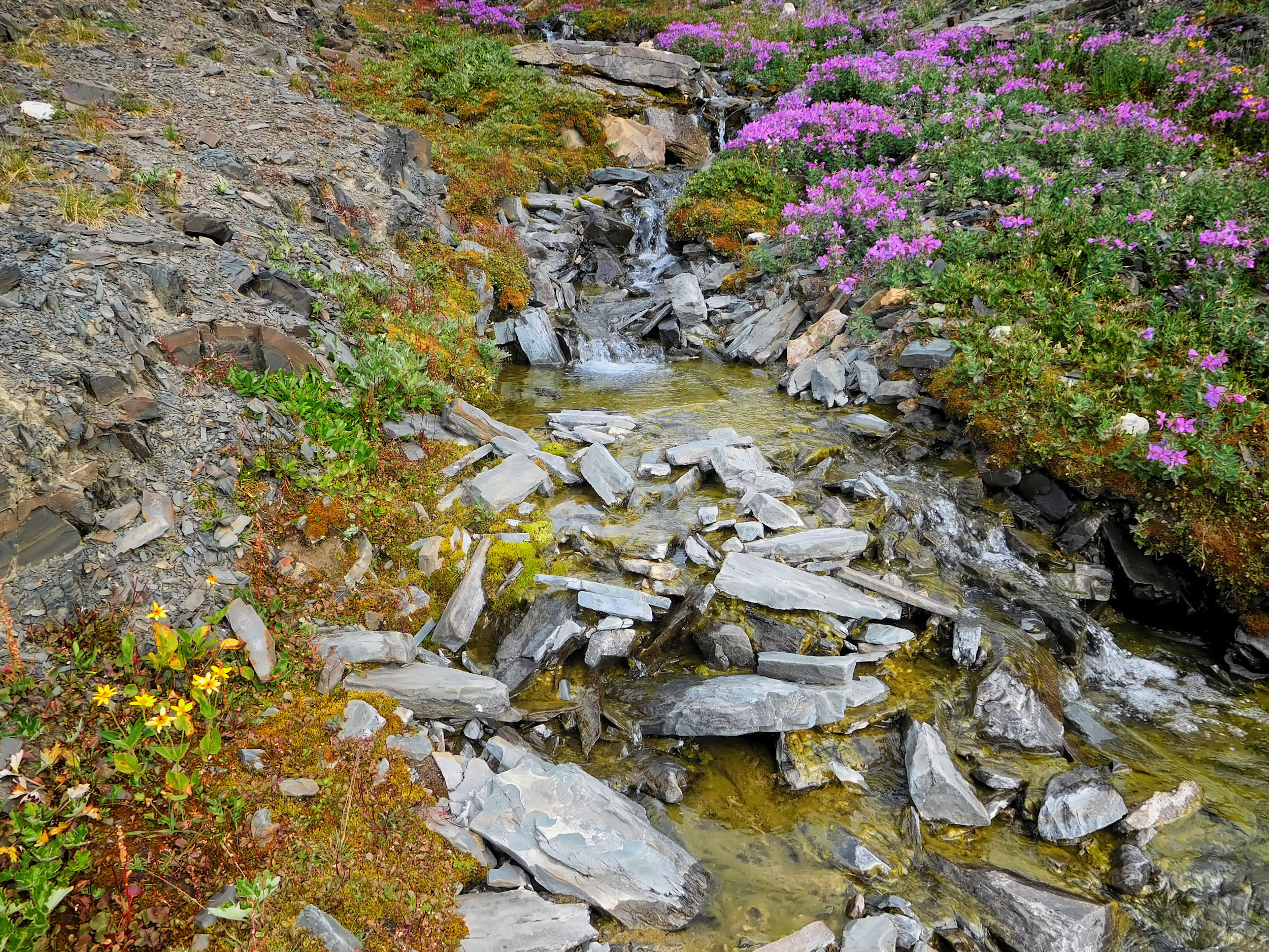
The trail forks and I take the lower right. But it soon takes me too deep into the Molar Creek valley. I return to the high point and hike cross-country towards South Molar Lake. It lies on the backside of the ridge between North and South Molar Pass and higher than the pass itself. Like many landmarks in the national parks, this lake has no official name. On the slopes, a few small stands of fireweed are still in bloom.
Fireweed
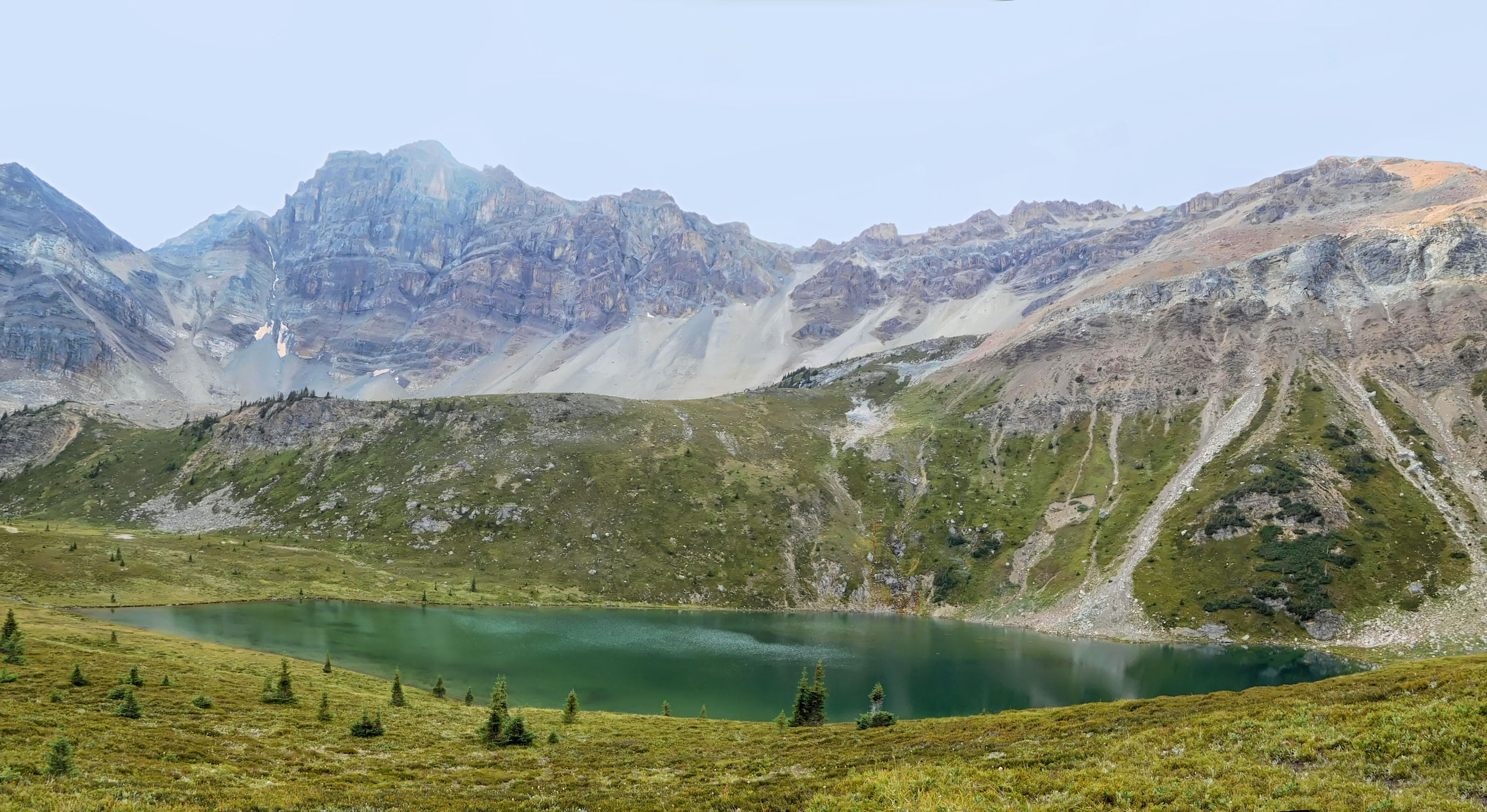
The pink patches serve as a first rough orientation for the ascent. Above them I follow a stream and then a currently dry drainage uphill. It is quite steep, but the ground is easy to walk on. After crossing several bumps, the turquoise surface of South Molar Lake suddenly appears in front of me.

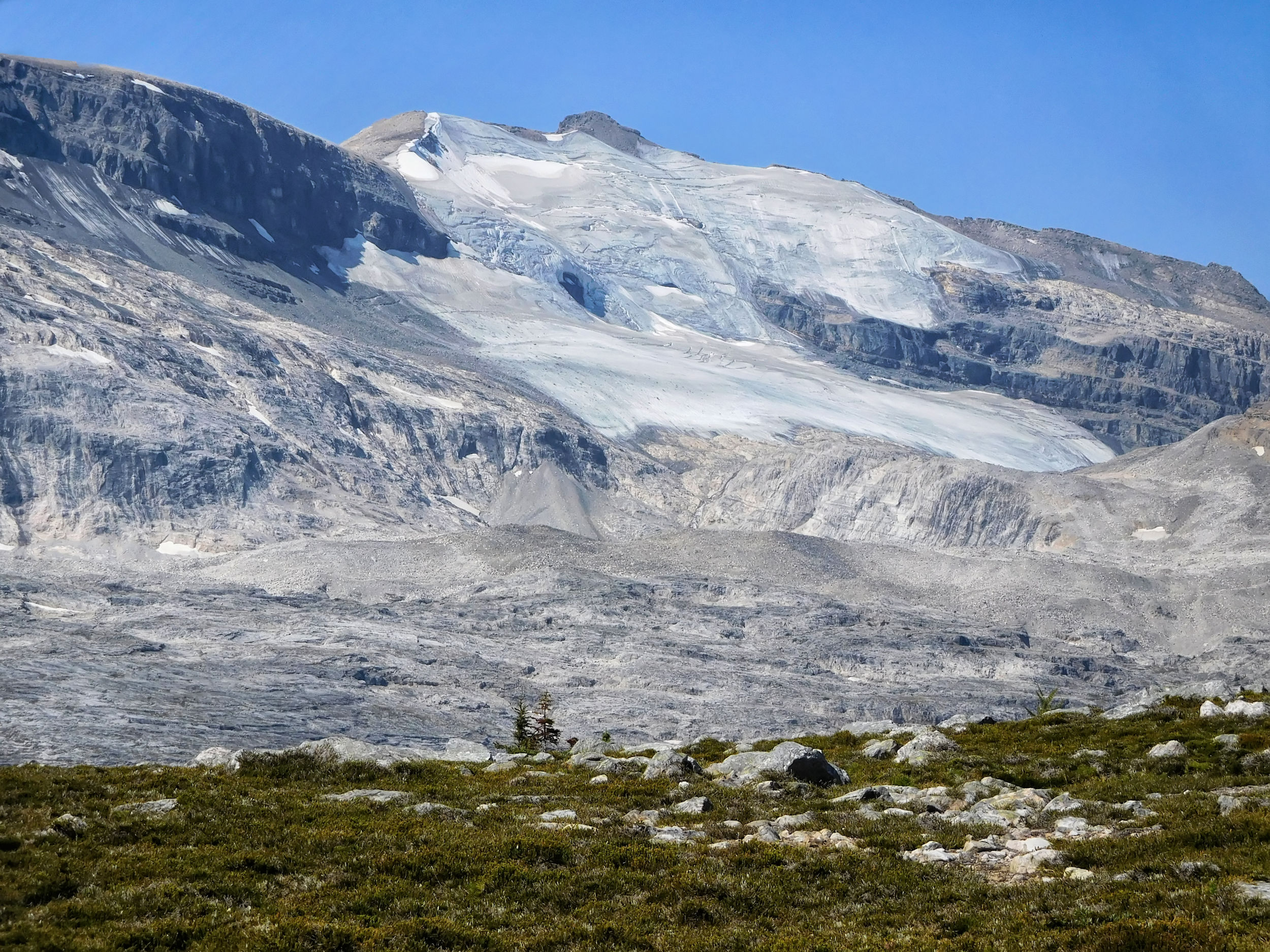
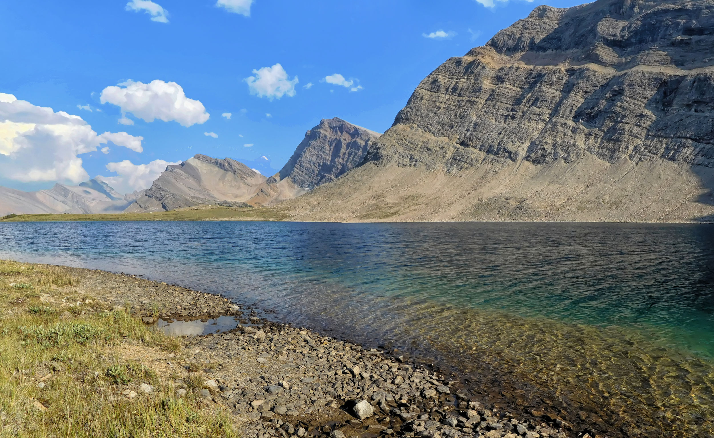
South Molar Lake 2404 m
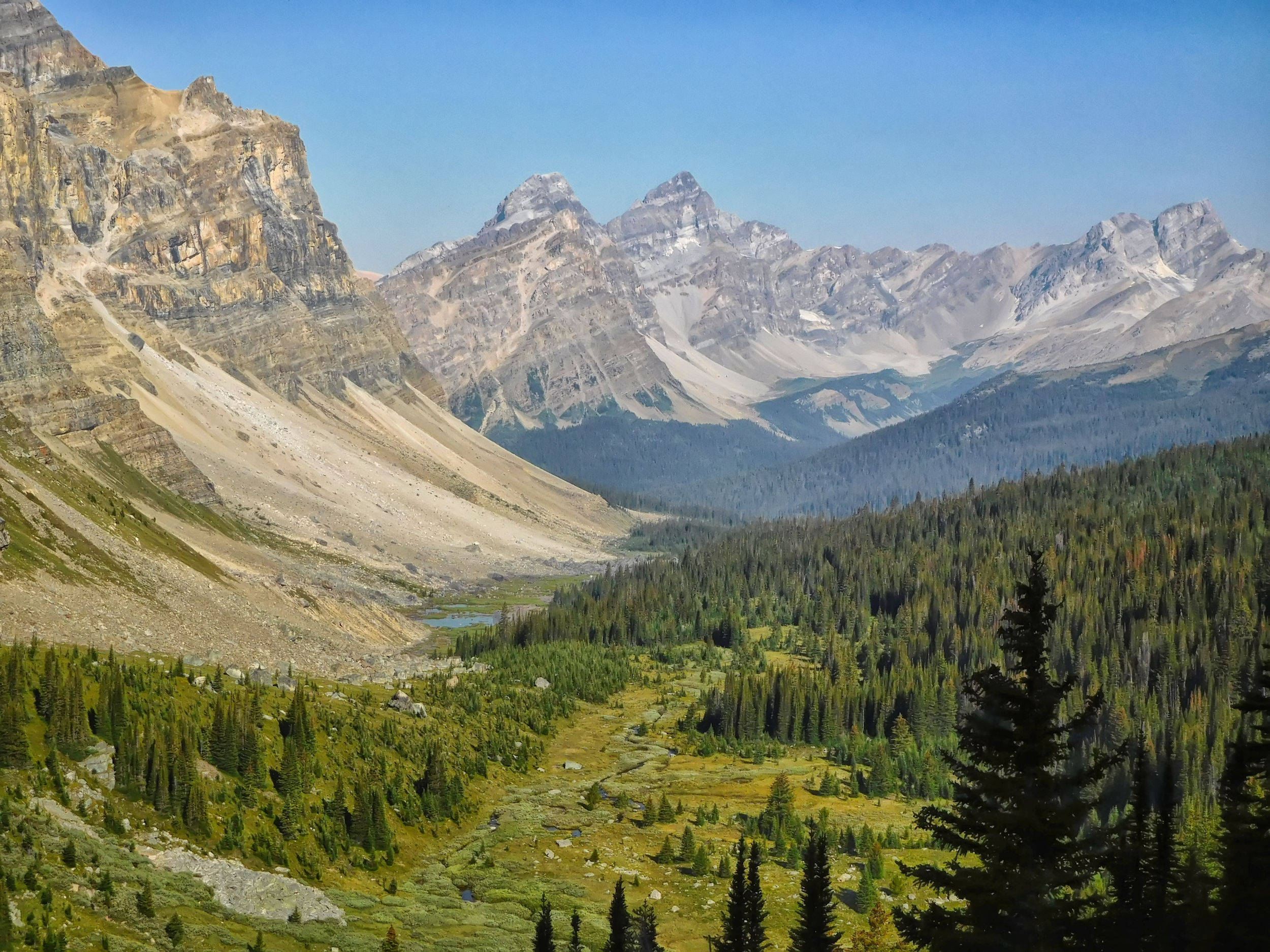
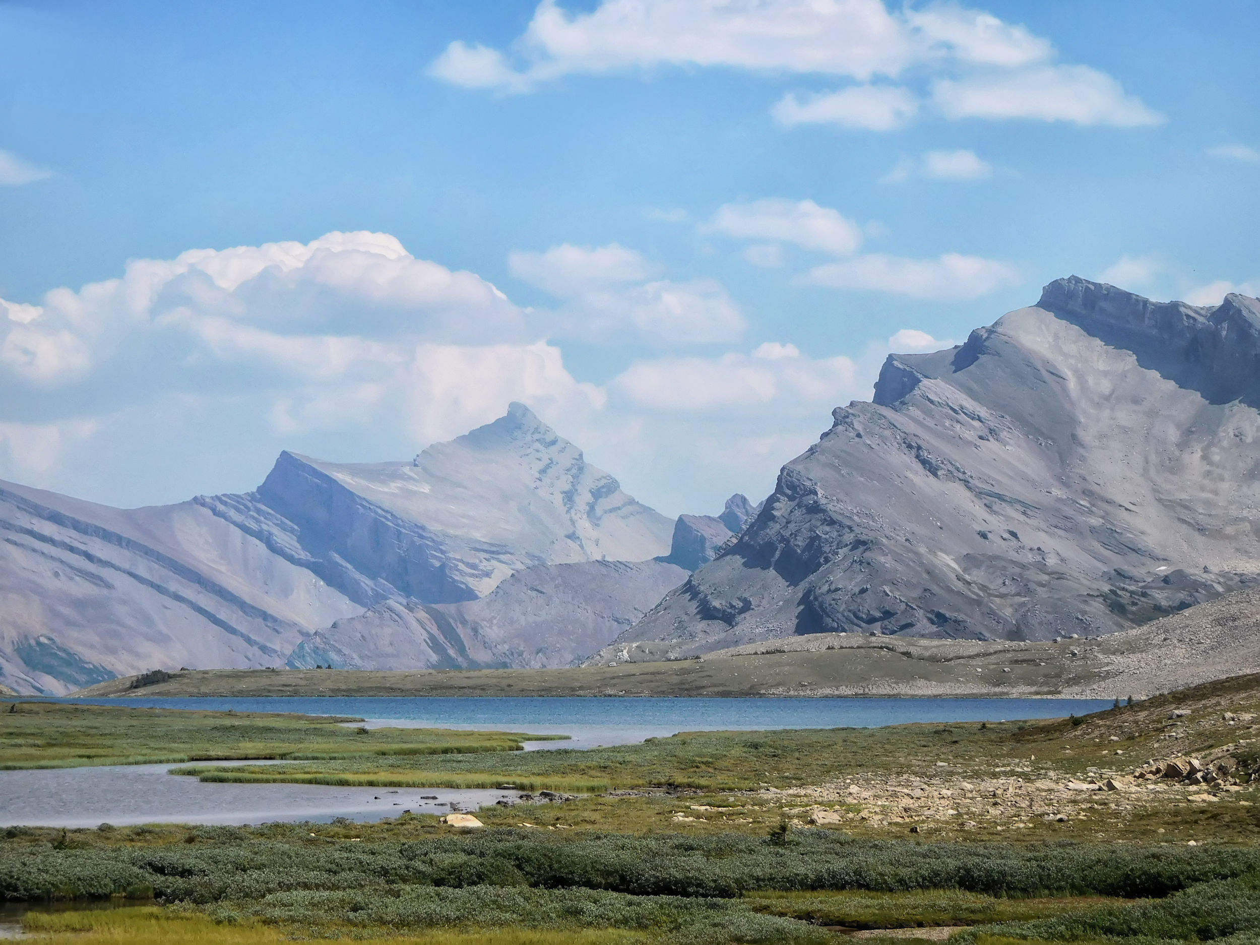
I take a lunch break and enjoy the impressive view of Mount Hector, Mount Andromache and Molar Glacier.
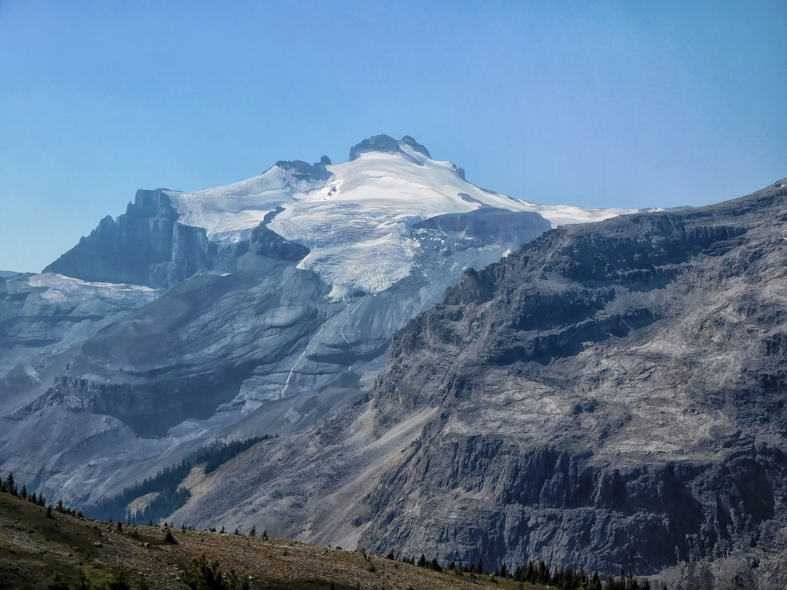
Mount Hector 3394 m
Mount Andromache 3033 m
Mount Hector and Mount Andromache with Molar Glacier
After my break I descend back to the trail and this time follow the upper spur back toward South Molar Pass. After checking the map and the GPS, I leave the trail again, but this time in the other direction to find Little Hector Lake (also an unofficial name). It lies in a basin and is barely visible from the trail. I cross a couple of small creeks and then climb up into the basin next to a waterfall.

Waterfall
on the way to Little Hector Lake
Little Hector Lake
I walk along the west shore of the lake and find a steep exit from the basin at the other end. From here it's easy to get back to the South Molar trail.
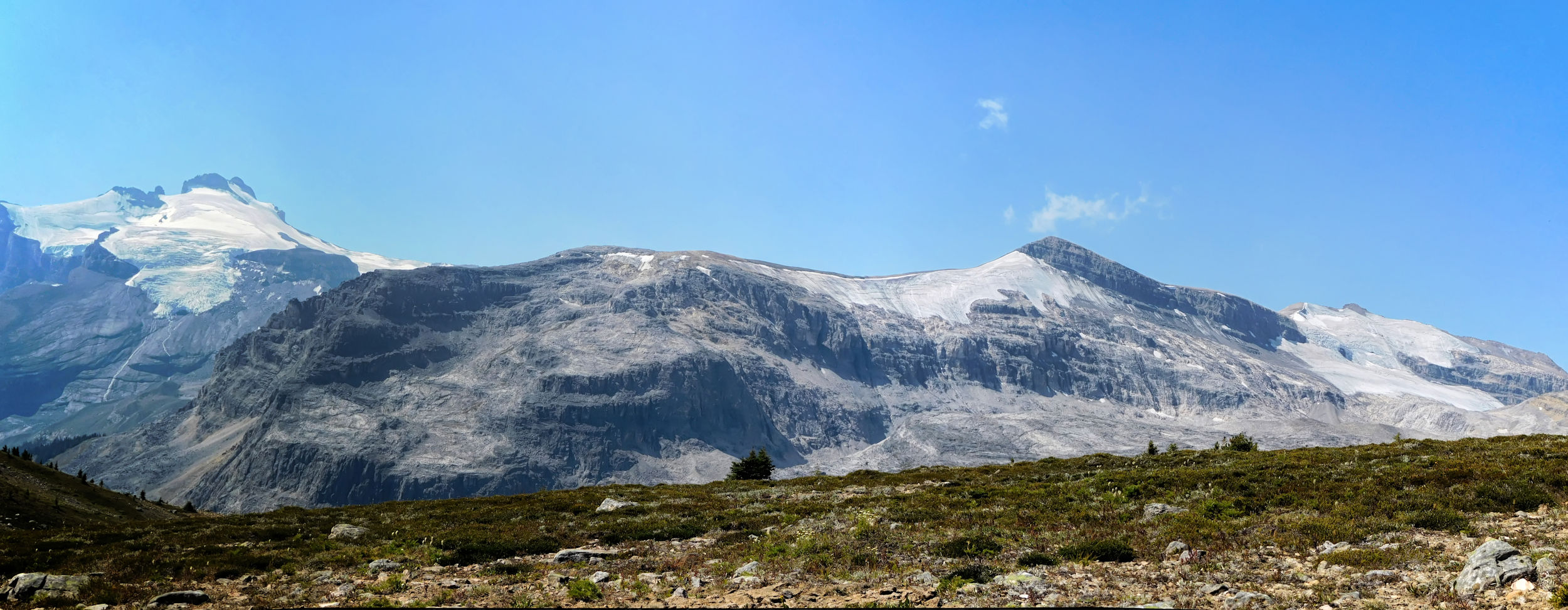
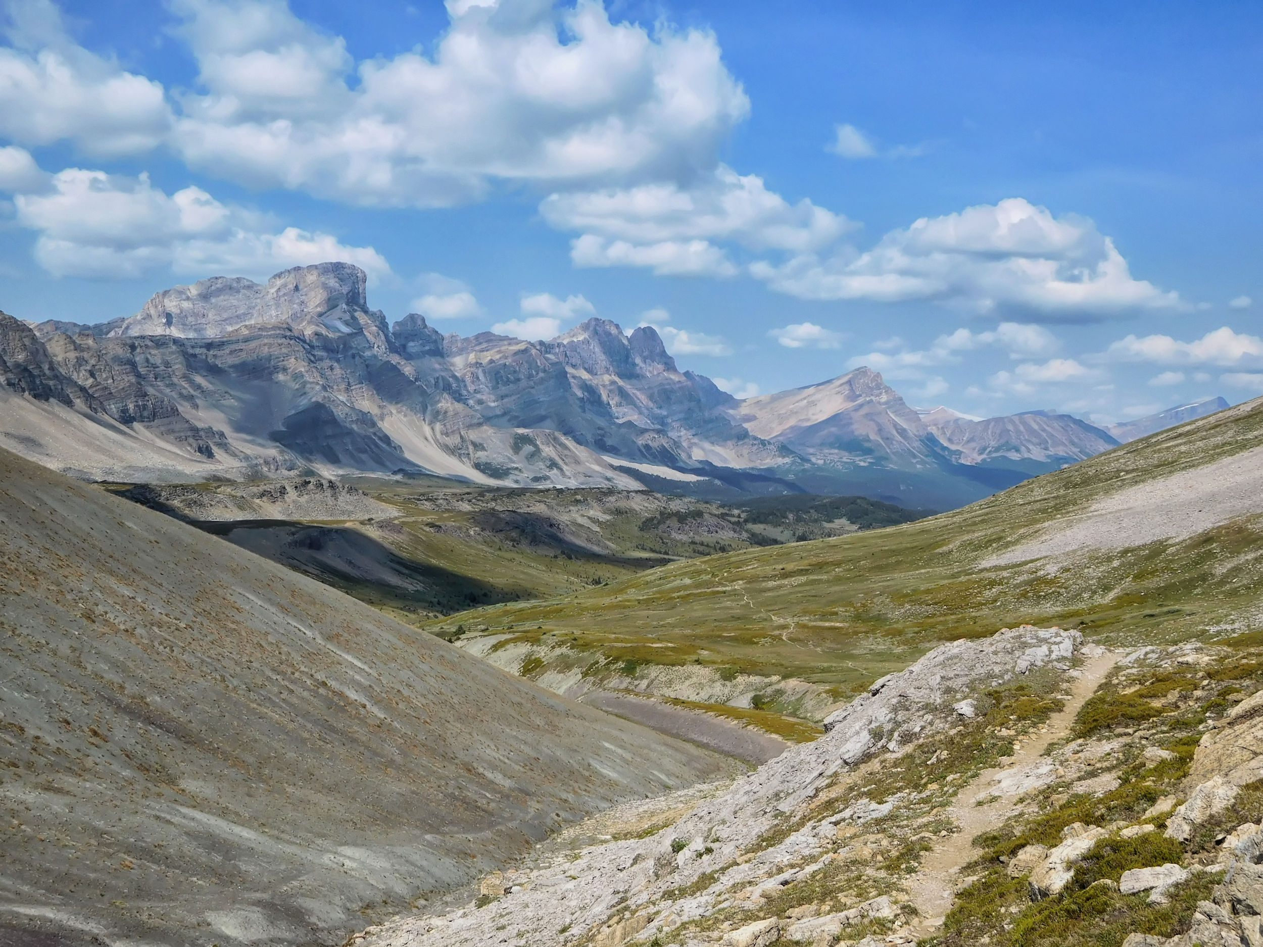
South Molar Pass panorama
Beyond South Molar Pass, I begin descending into the valley. It is still early enough to make a small detour. From the Japanese Garden I follow the cascade up the mountain. Wildflowers are still blooming along the many small tributaries.
Cascade at the Japanese Garden
The backside of The Fang, a prominent peak rising above the alpine meadows of North Molar Pass, is clearly visible from here.
Cascade with The Fang in the background
At the very top I discover a rather inconspicuous tarn (Dorothy Lake), the origin of the cascade. It should be possible to climb The Fang from here, but I don't see that option. Two years ago I found a better route from South Molar Pass.

Tarn and possible route up The Fang
After this little excursion I take a break at the foot of the cascade and filter some fresh drinking water to fill my bottle. It's still a long way back to the campsite. The many mushrooms along the way have an interesting texture and look like carved wood.
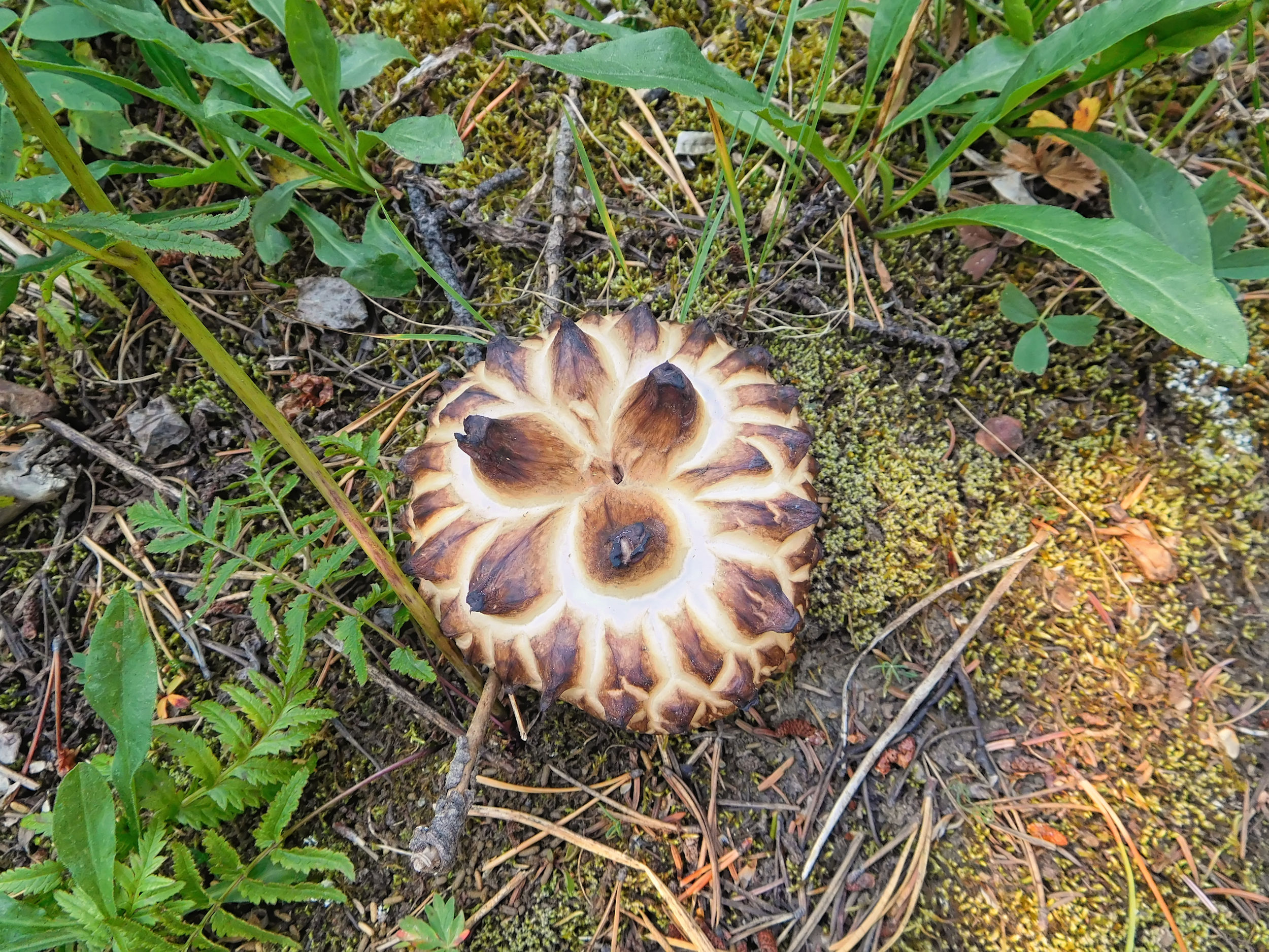
Mushrooms along
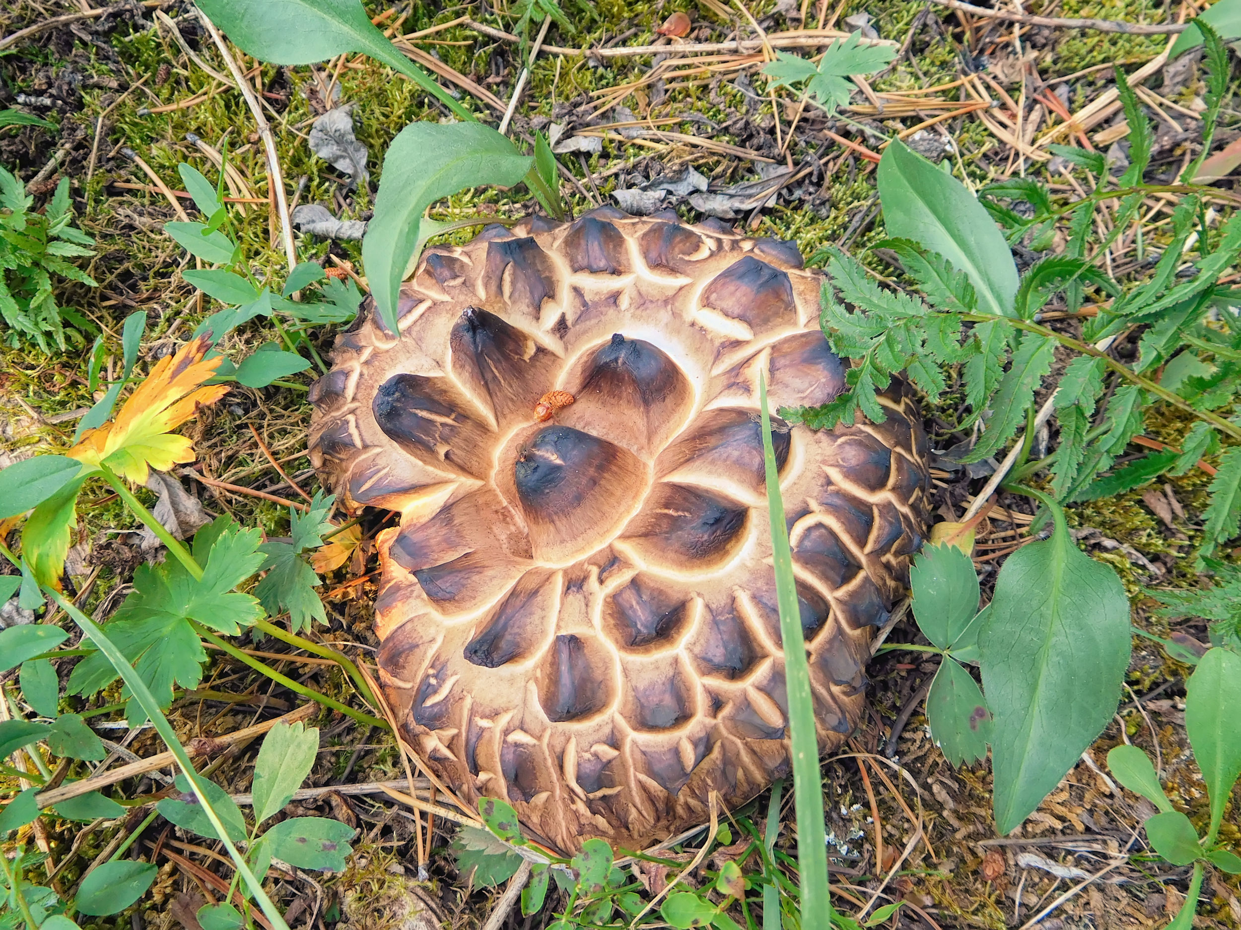
the trail
At the end of my day hike, I am pleased to find my tent waiting for me at the campsite. Especially since my warm-up hike has covered an impressive 19 kilometers.
In the early evening, a group of four men and a separate group of five teenagers arrive. The five don't seem to have reservations and pitch their tents next to the picnic tables. I'm already inside the tent when I suddenly smell smoke. I hope it's not smoke from another forest fire. I look outside and am relieved to see that only a campfire is responsible for the smell. Unlike British Columbia, Alberta apparently still allows campfires.
During the night, the sound of the stream keeps me awake again.
| Distance | 10.4 km |
| Time | 3 ½ hrs |
| Incl. breaks | 4 ½ hrs |
| Min. Elevation | 1991 m |
| Max. Elevation | 2603 m |
| Ascent | 612 m |
| Cum. Ascent | 811 m |
| Cum. Descent | 626 m |
This morning I have to pack up my tent because I'm moving on to the next campsite. I'm pretty slow and don't get going until after nine. But there's no hurry. The four men are still having breakfast when I leave. I will meet them later at Fish Lakes campground. The five young guys also want to go there.
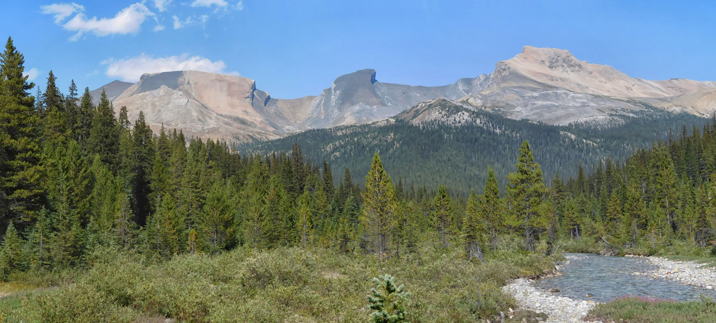
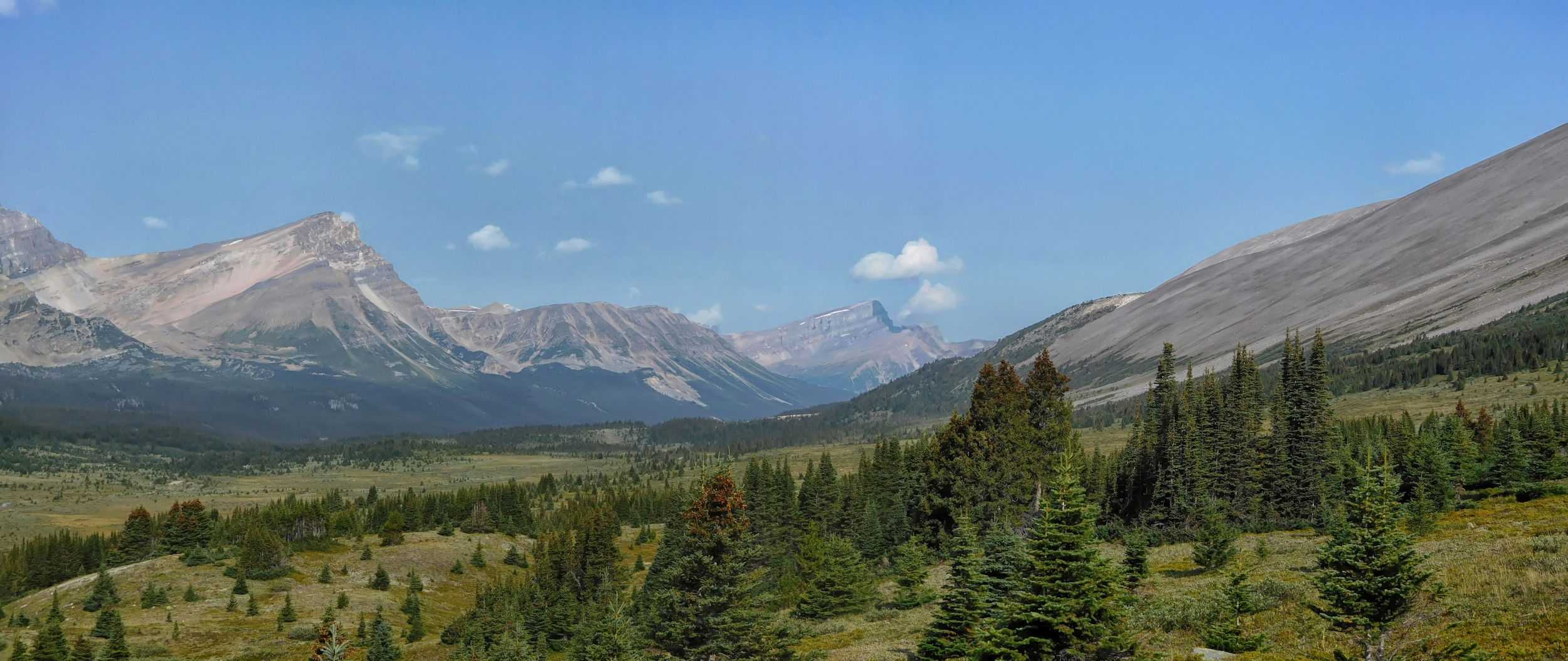
The sun is shining and it is pleasantly warm. Soon I reach the junction of the North and South Molar passes. The trees are sparser now and numerous rivulets run between them. The few remaining flowers along the trail are teeming with butterflies, but the mushrooms far outnumber the flowers.
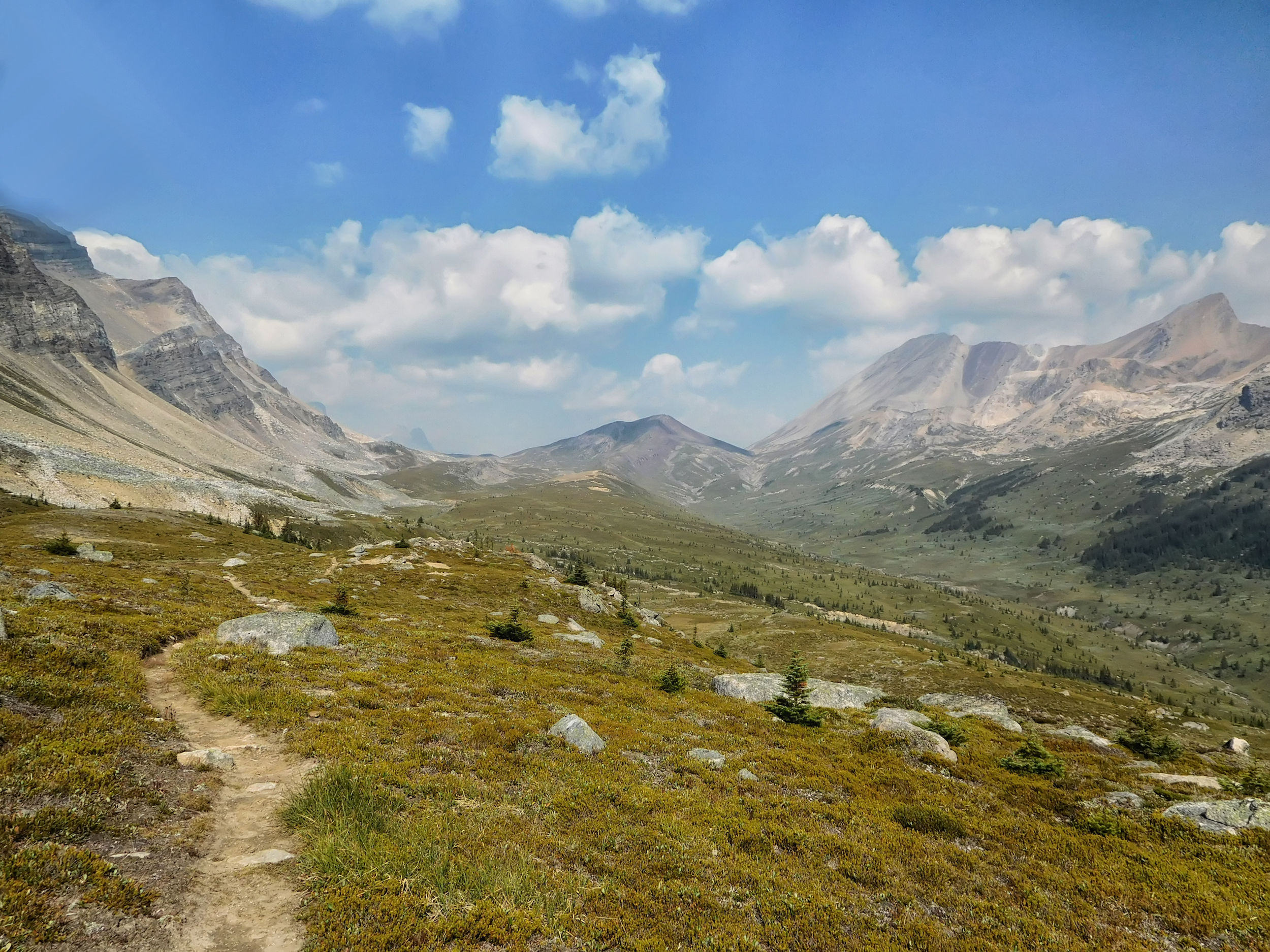
Finally, I reach the vast North Molar meadows. Here, too, it already looks a lot like fall. There is no trace of the huge carpet of bright yellow Mountain Arnica and pink Fireweed that I saw at this time two years ago.
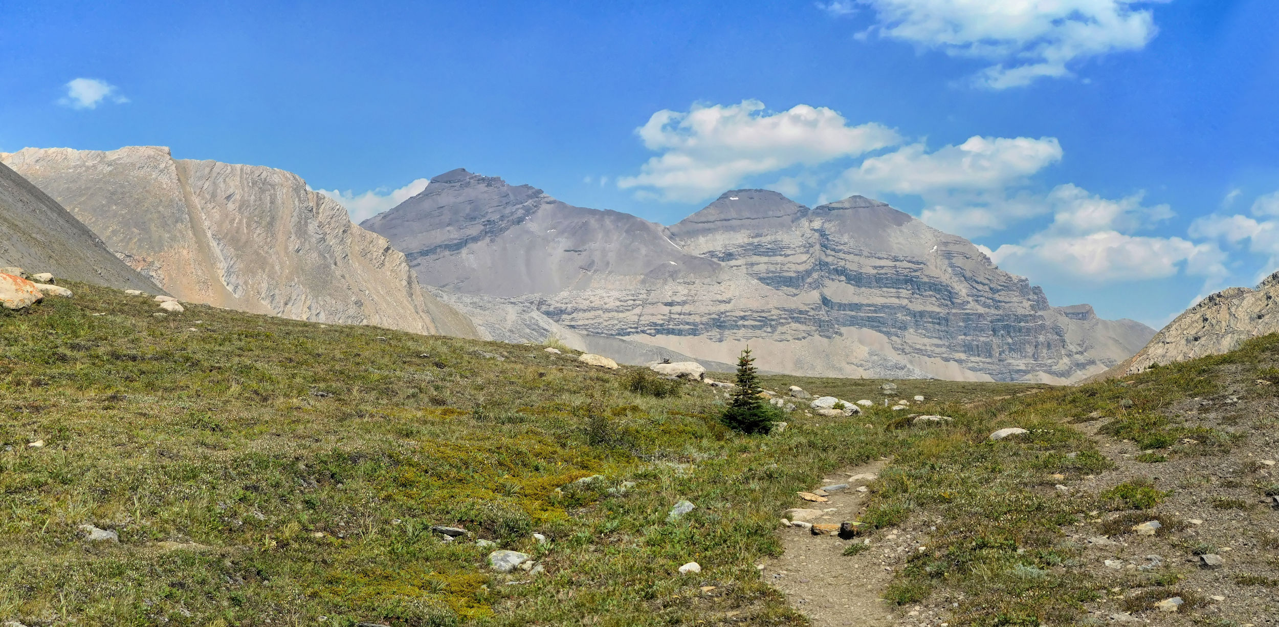
North Molar Pass meadows
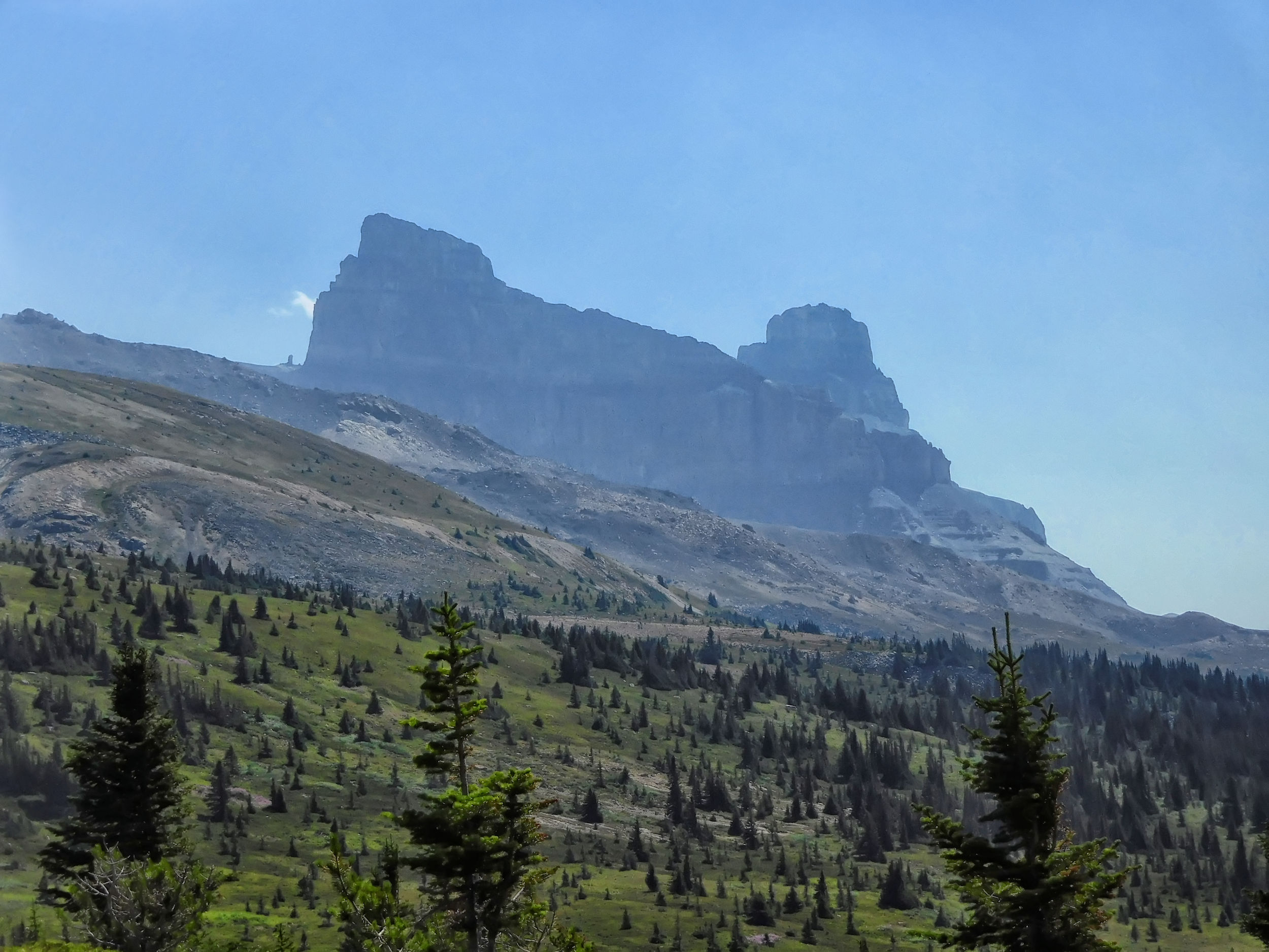
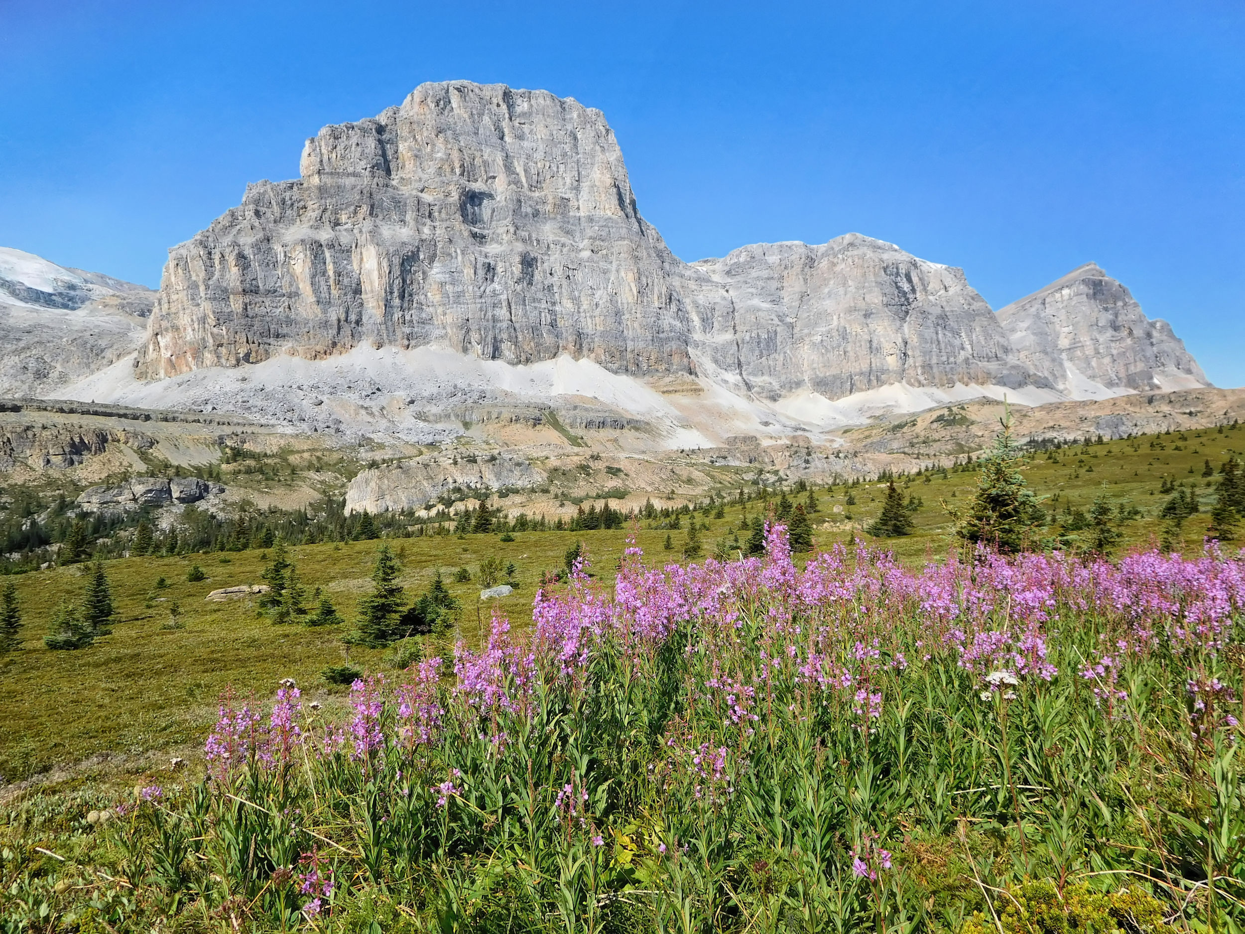
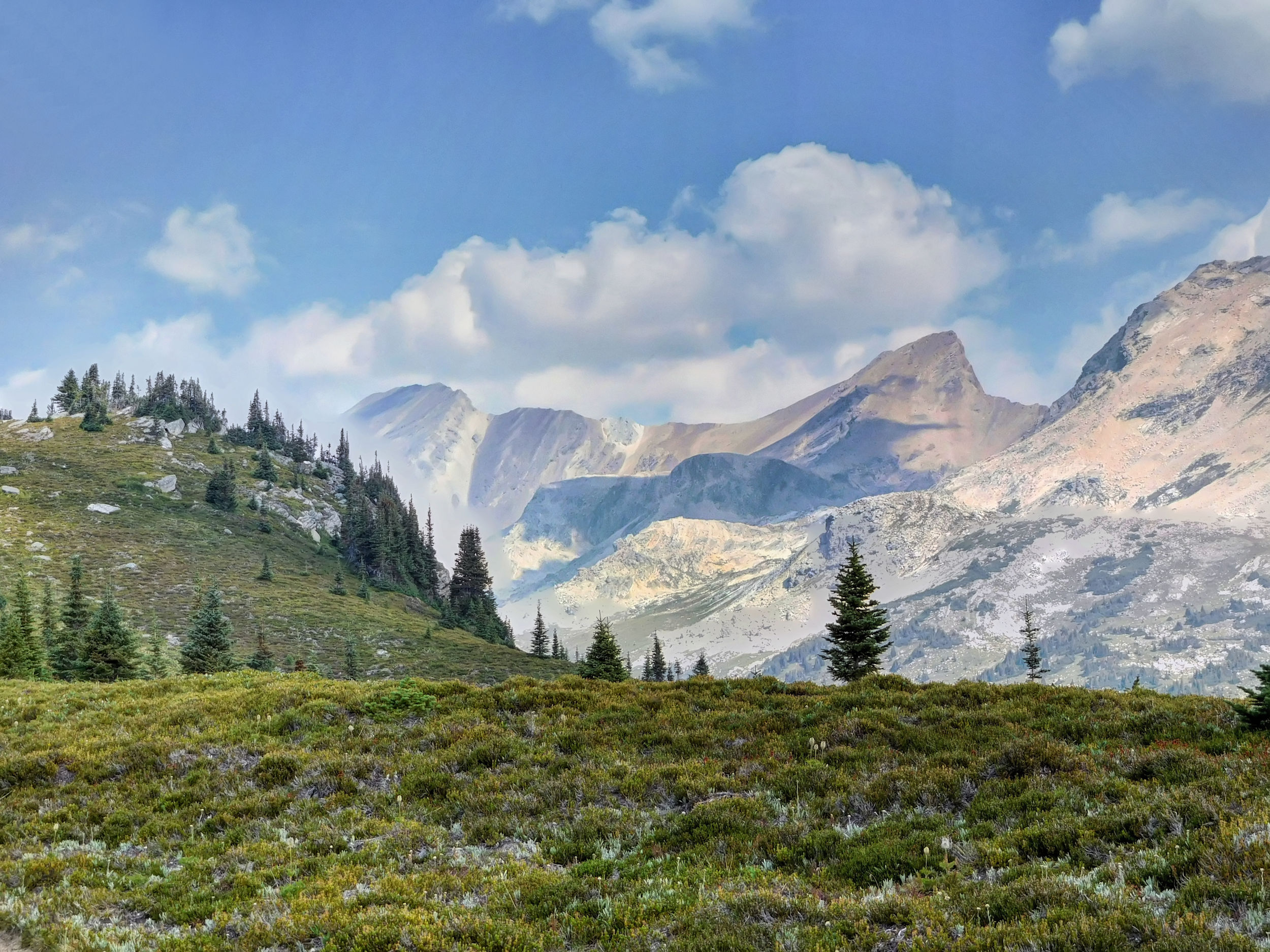
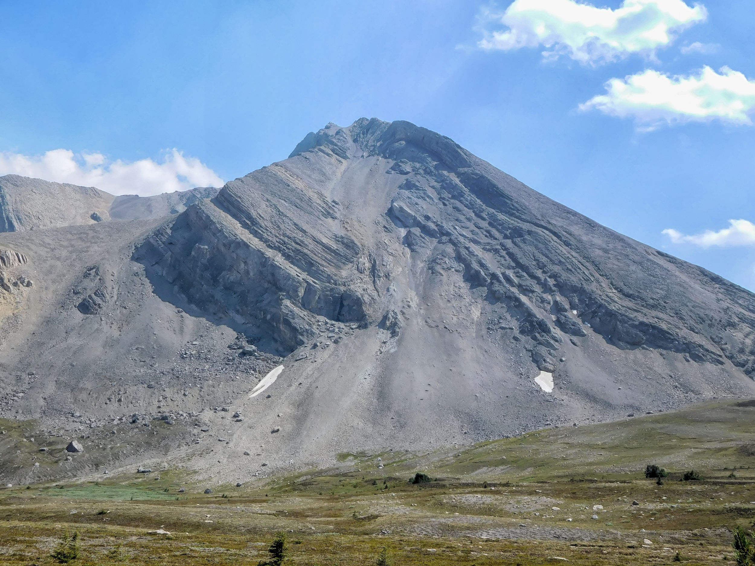
The Fang (also known as Houndstooth), on the backside of which I was standing yesterday, dominates the landscape. It is a striking peak of 2408 meters on the ridge between North and South Molar Pass.
The Fang (Houndstooth)
Last Flowers
I follow the left bank of Mosquito Tarn, a small lake in the middle of the meadows, and look for a possible route up to Pipestone Lookout, which I want to hike to on the last day.
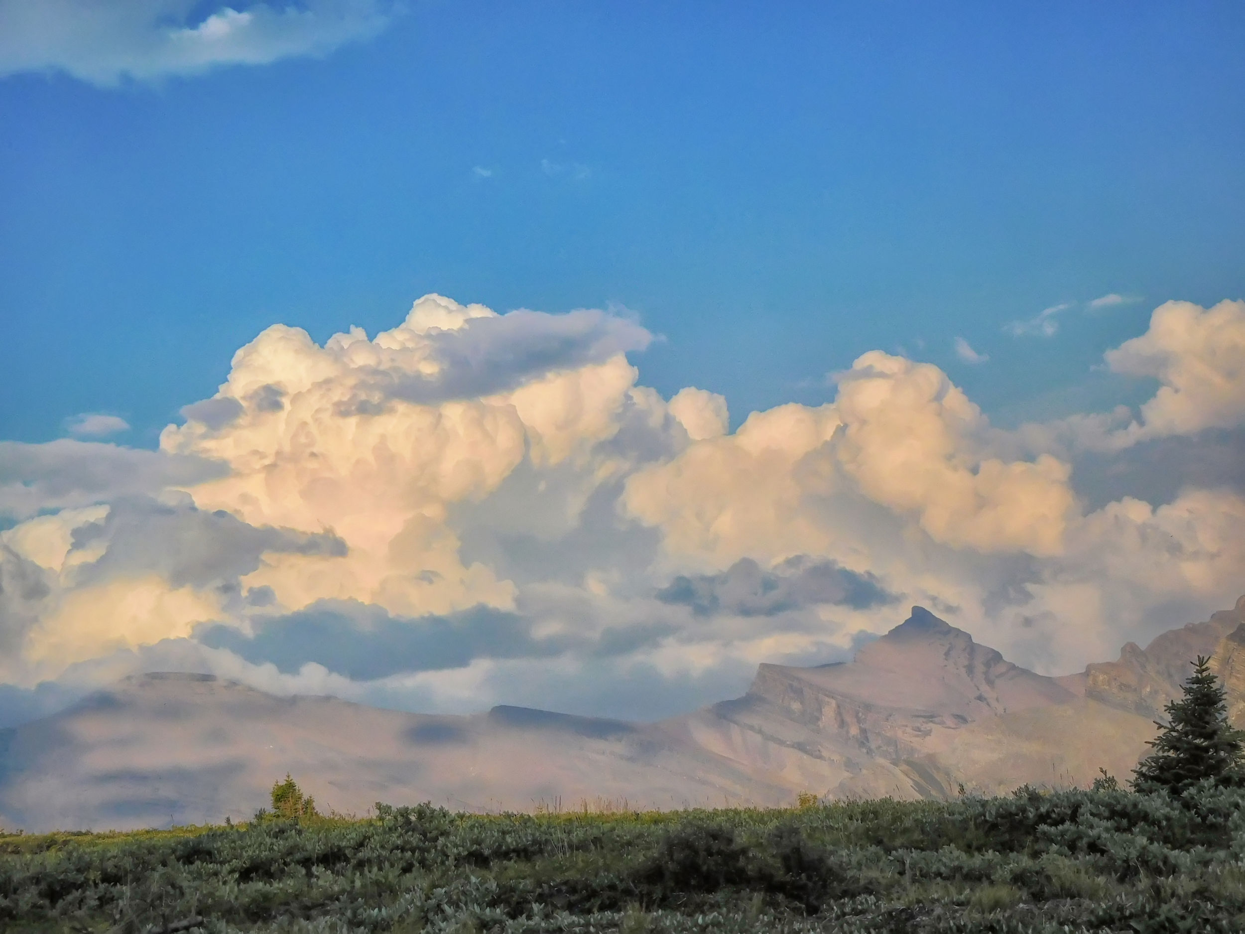
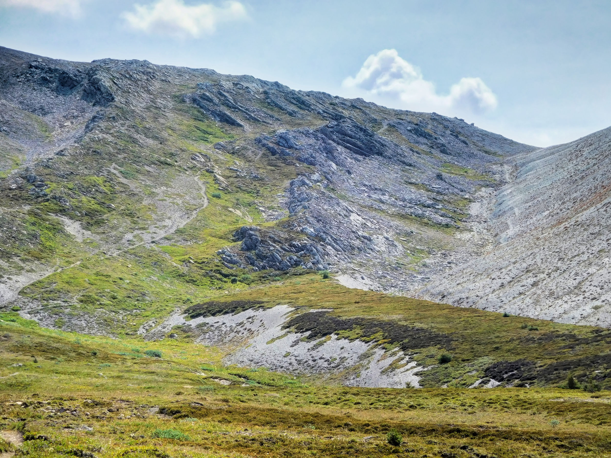
As I approach the pass through the alpine meadows, the valley fills with smoke, and I can smell it. The view back becomes hazy, while the sky on the other side of the pass remains quite clear. The final section to the pass is a narrow track that winds through the scree.
I take a lunch break at the top of the pass. The cornice up here - supposedly eternal snow - has mostly melted away and is much smaller than it was two years ago.
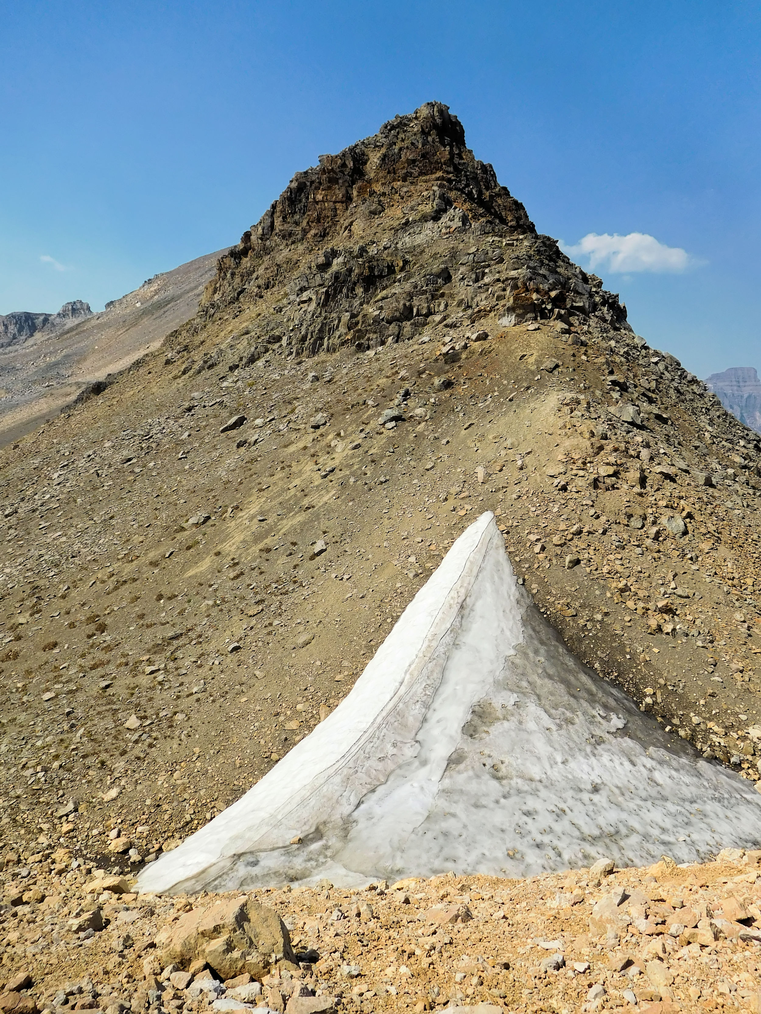
At North Molar Pass
Just before the end of my break, the four men from the campground catch up with me and we stop to rest together for a moment. John documents their hike on YouTube. I had already noticed at the campsite that he always has his video camera ready.
View back into the Mosquito Creek valley
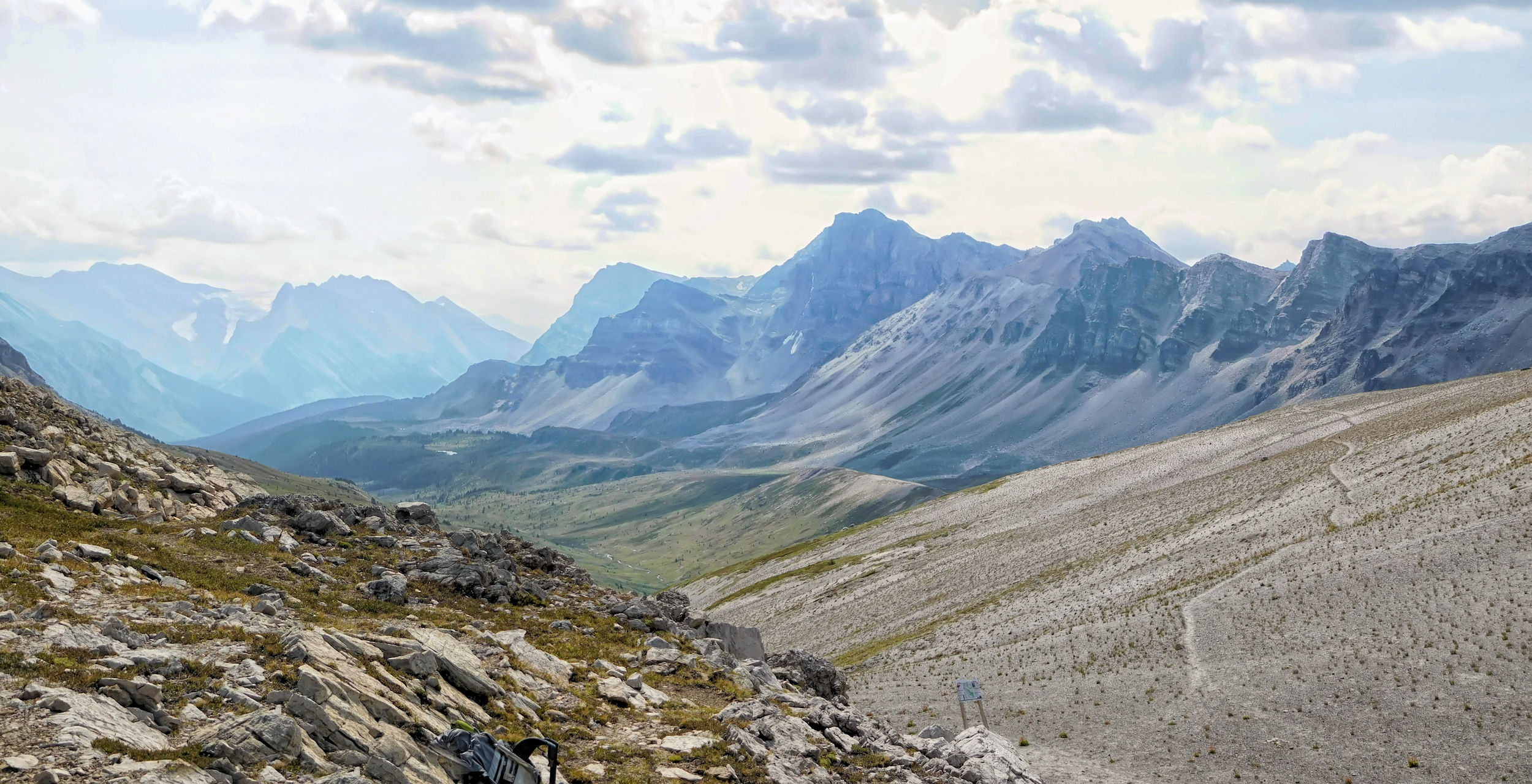
On the other side of the pass the visibility is indeed better. I hope the smoke doesn't drift up behind us.
View from North Molar Pass
I find my way down through the boulder fields. There are still some flowers blooming along the stream at the bottom of the valley.
Just before the last steep descent to Upper Fish Lake I have a nice view of Cataract Peak. I look at a possible route to Minnow Peak, which starts on the other side of the creek. This mountain, with Upper Fish Lake at its base, is too big for me, but I might be able to reach the tarn, which is hidden in a bowl far below the summit.
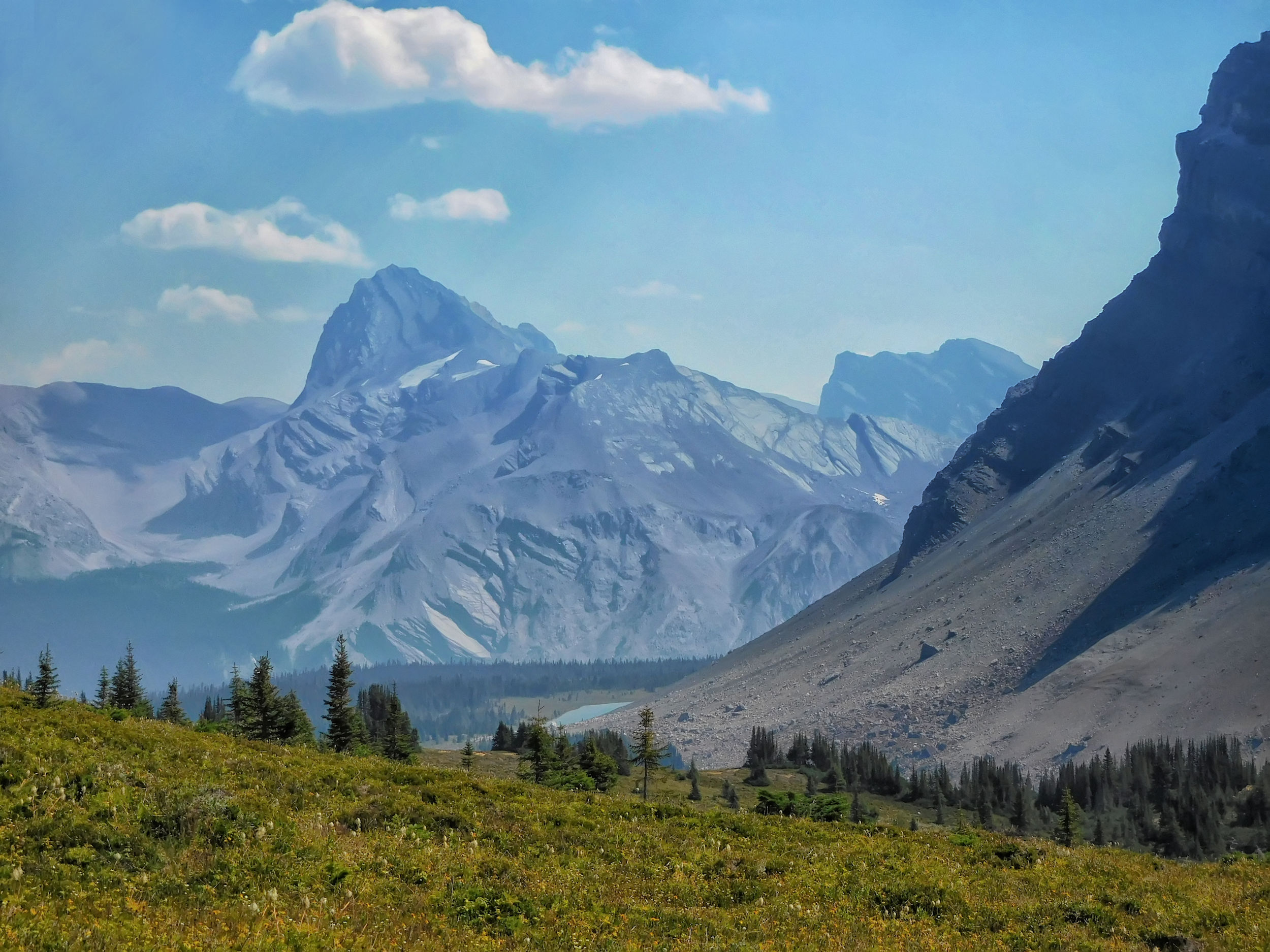
Cataract Peak (l) and Minnow Peak (r)
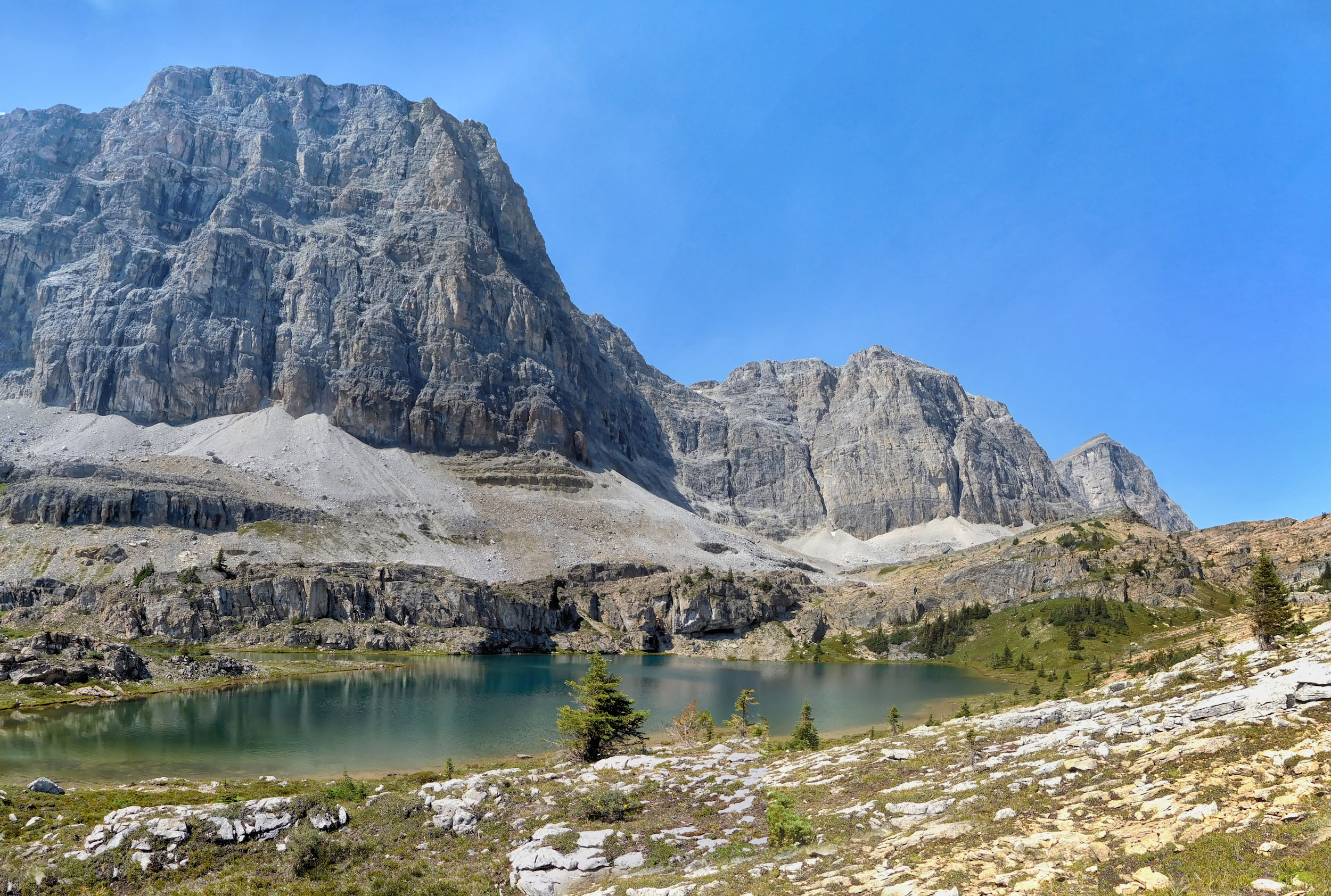
I spot two hikers in the underbrush next to the trail and follow them, as they have found the best viewpoint of Upper Fish Lake.
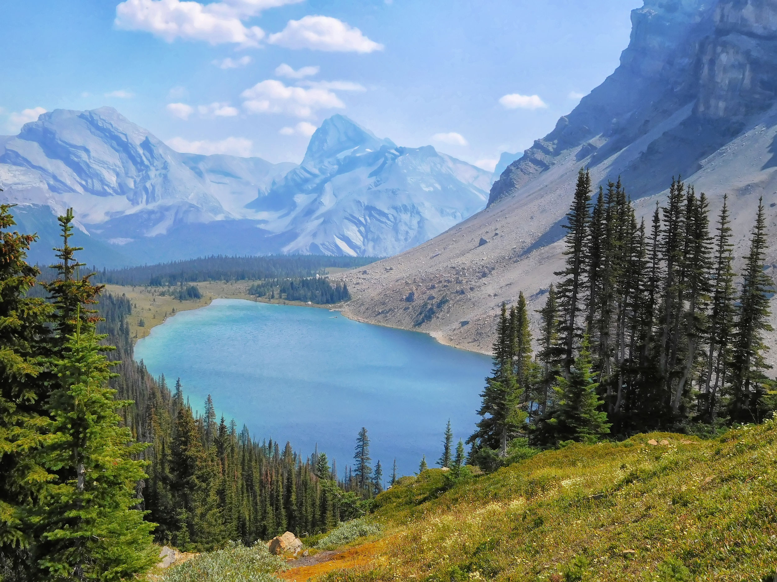
Upper Fish Lake
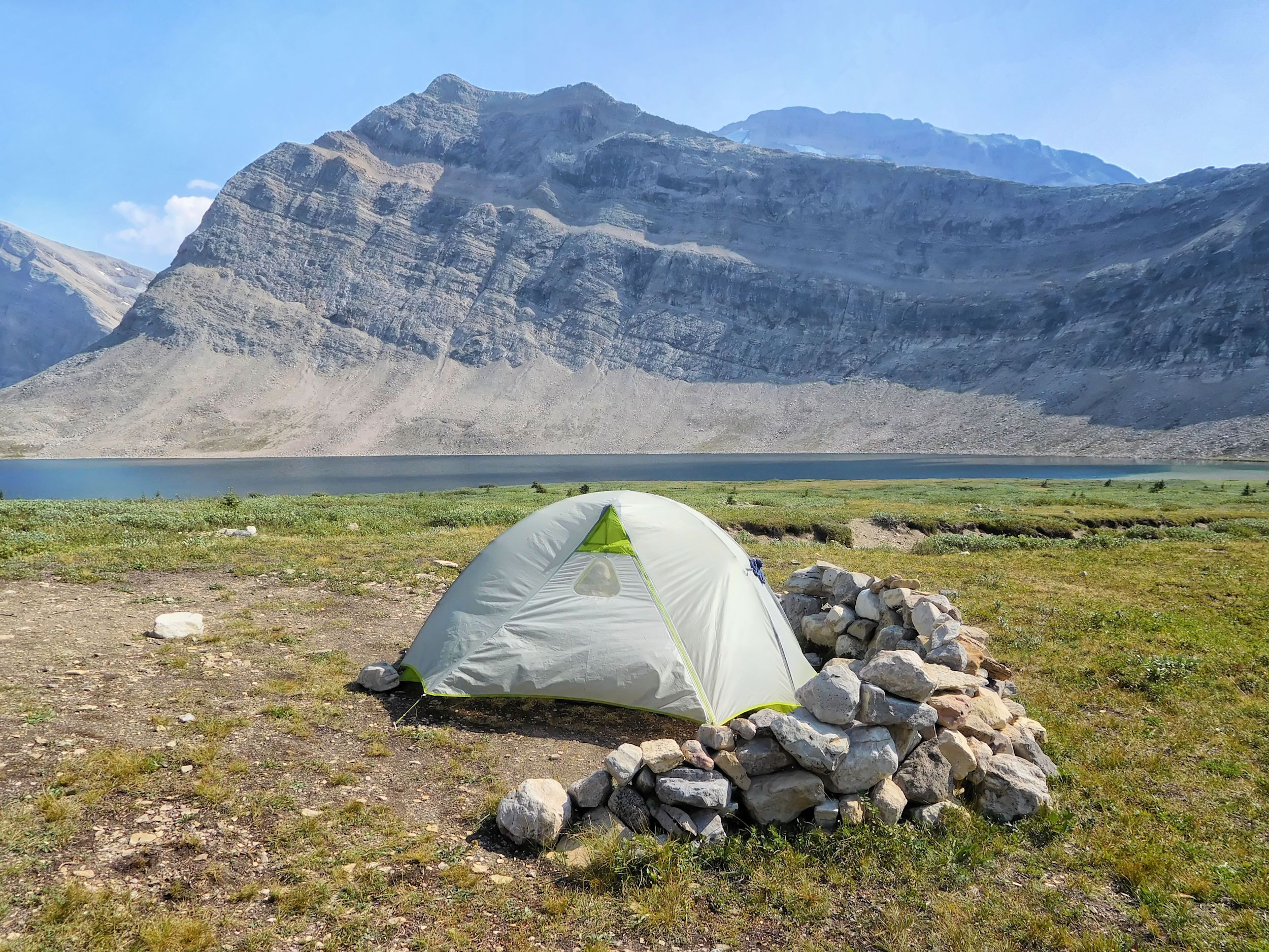
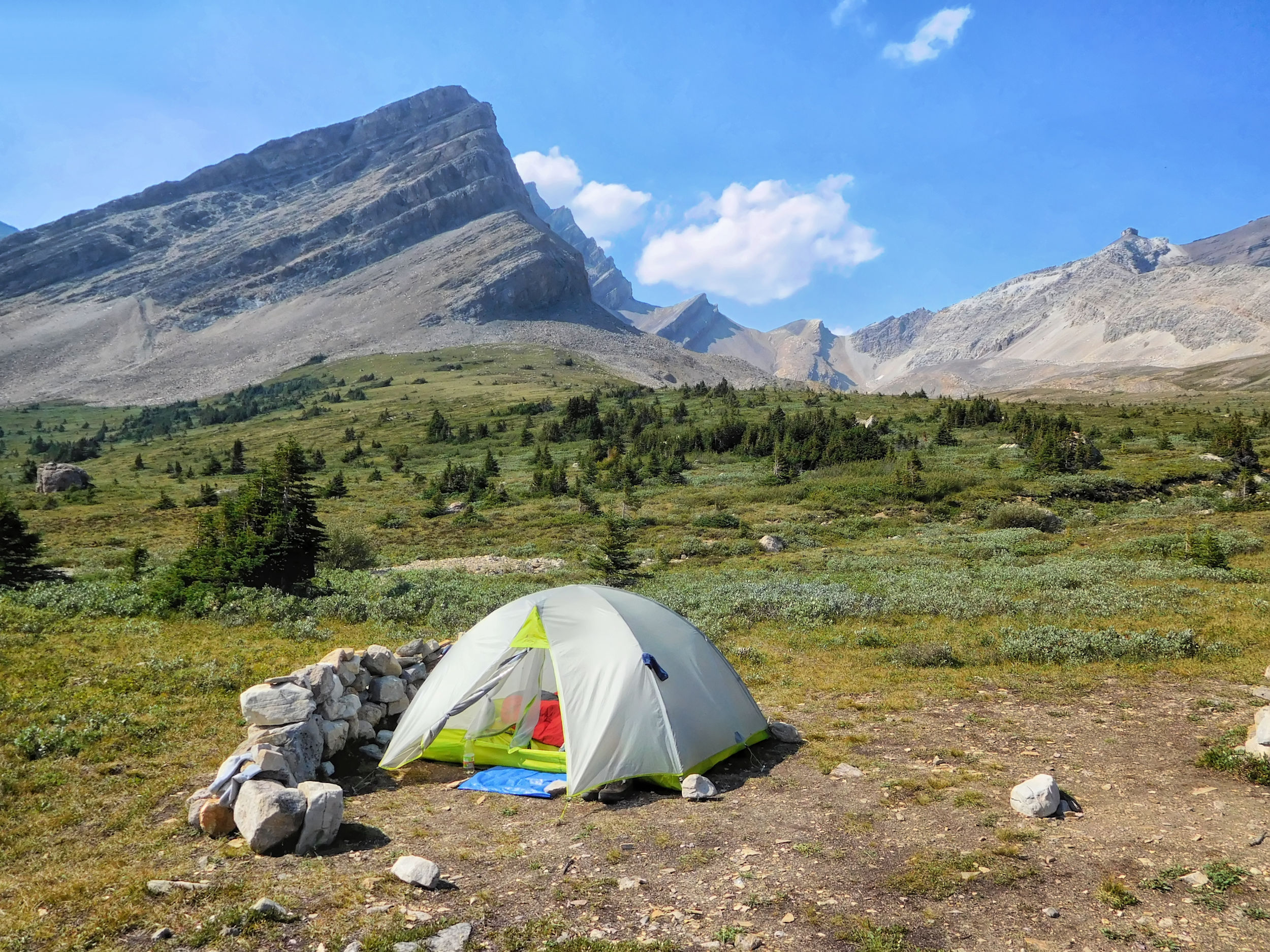
I'm the first to reach Fish Lakes campground today and can choose the best spot. The campground is located at the higher of the two Fish Lakes and has only five sites. No wonder it always books up very quickly. I pitch my tent in the only site with a small mound in the middle. Even though it looks a bit uncomfortable, I hope that in case of a heavy rain the water will run off better here than on the flat spot between the trees. Two years ago my tent was flooded there.
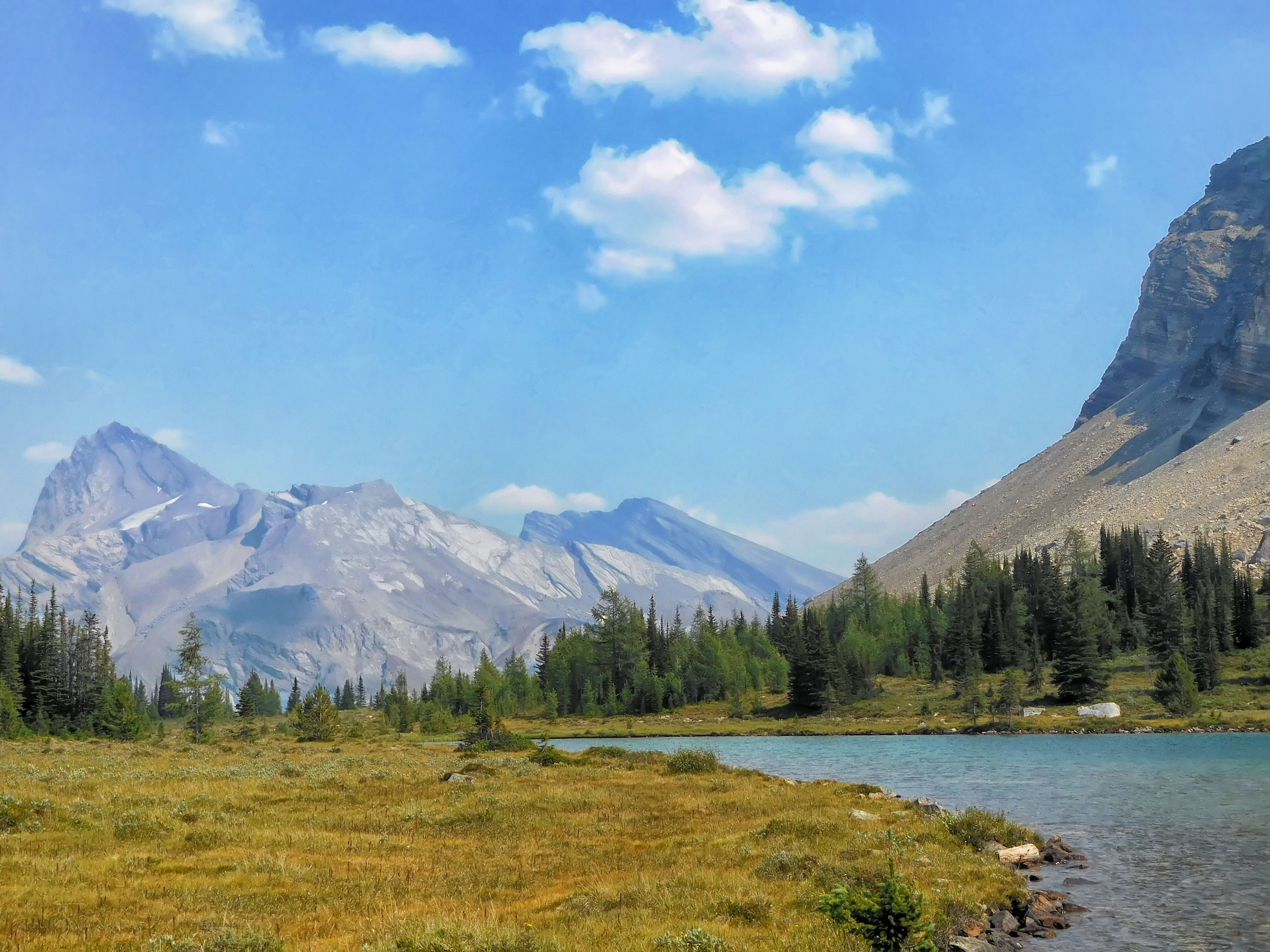
Fish Lakes campground
The lake and its surroundings are very scenic. The four men soon arrive and occupy three more campsites. They are hiking the Dolomite Loop. From the Fish Lakes they want to go to the horse camp in Siffleur Wilderness Area and then via Dolomite Pass and Helen Lake back to the highway. Although the Devon Lakes are supposed to be very beautiful, they don't plan a stop there due to time constraints. Too bad, I would have liked some company at the unofficial camp there.
The five youngsters arrive just in time for dinner. They are quite unprepared, relying solely on an app to guide them along the Molar Loop, which is very poorly marked in places. They don't seem to know how far everything is. After dinner, the ten of us discuss the possible routes from here, with me contributing my experience from two years ago. In the end, the five of them surprise us with the decision to continue on to Molar Creek campground today and spend the night there before heading back to the highway tomorrow. It's a good thing that the days are still long, because it's already after six.
Later in the evening a young couple arrives with two dogs. Yay! They want to go to the Devon Lakes tomorrow. So I won't be camping there all alone after all. They also have the latest weather forecast: no storms for the next two days. I spend a quiet night and finally get a few more hours of sleep.
| Distance | 15.3 km |
| Time | 6 ½ hrs |
| Min. Elevation | 2135 m |
| Max. Elevation | 2468 m |
| Ascent | 333 m |
| Cum. Ascent | 822 m |
| Cum. Descent | 716 m |
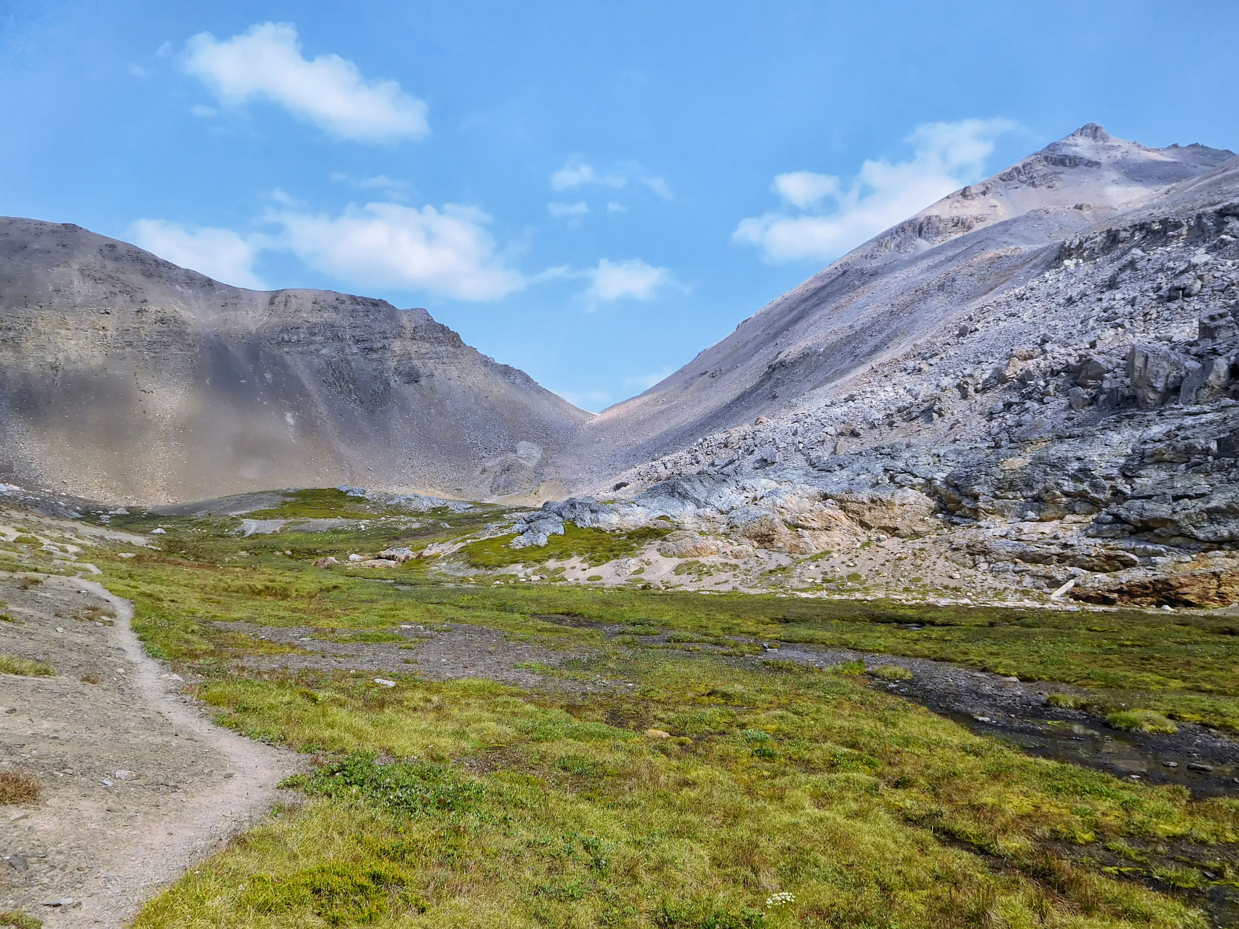
After a good night's sleep, I am full of anticipation and excitement. The weather is good, even though the sky looks overcast towards the Pipestone Valley. Now nothing shall stop me from reaching the Devon Lakes on my second attempt. They are only 16 kilometers away from here. I will have to spend the night there, because a day hike of 32 kilometers is too far for me.
Full Moon at Upper Fish Lake
The four men set off before me because it's 20 kilometers to their next campsite. The two young people with the dogs have a different routine: they leave late, travel slowly and get there late.
I only pack one dinner, one breakfast and two lunches in my backpack. I leave the rest of the food on the bear pole at Fish Lakes campground, since I'll be returning here for the night after next. There are no facilities like toilets or picnic tables at the Devon Lakes.
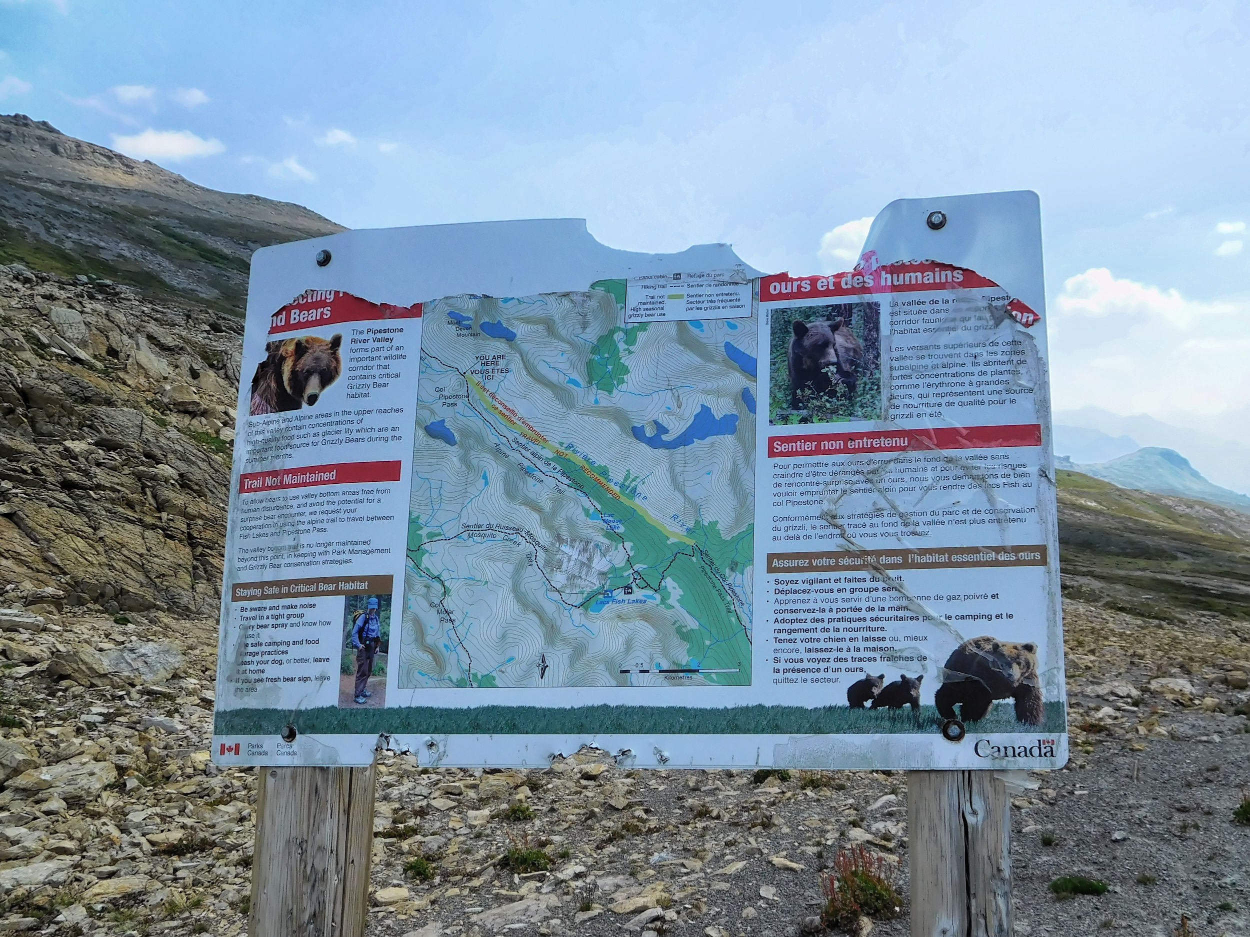
I head out to the Fish Lakes cabin, a cozy looking ranger cabin about ten minutes from Upper Fish Lake. This is where the highline trail to Pipestone Pass begins. Behind the cabin I have to cross a fast flowing tributary of the main creek, but I manage it without getting my feet wet.
There are some steep climbs and descents through the forest before the trail reaches the open slopes of the Pipestone Valley. A more level route is said to start at the campground by the outhouse and exit at Moose Lake. However, I have only met people who have read about it but nobody has actually done it. It is probably mostly cross-country, which is no fun in the dense forest.
My route runs high along the western edge of the valley to Pipestone Pass and from there over Clearwater Pass into the valley of the Devon Lakes. As the morning progresses it gets sunny and clear.
Highline trail in the Pipestone Valley
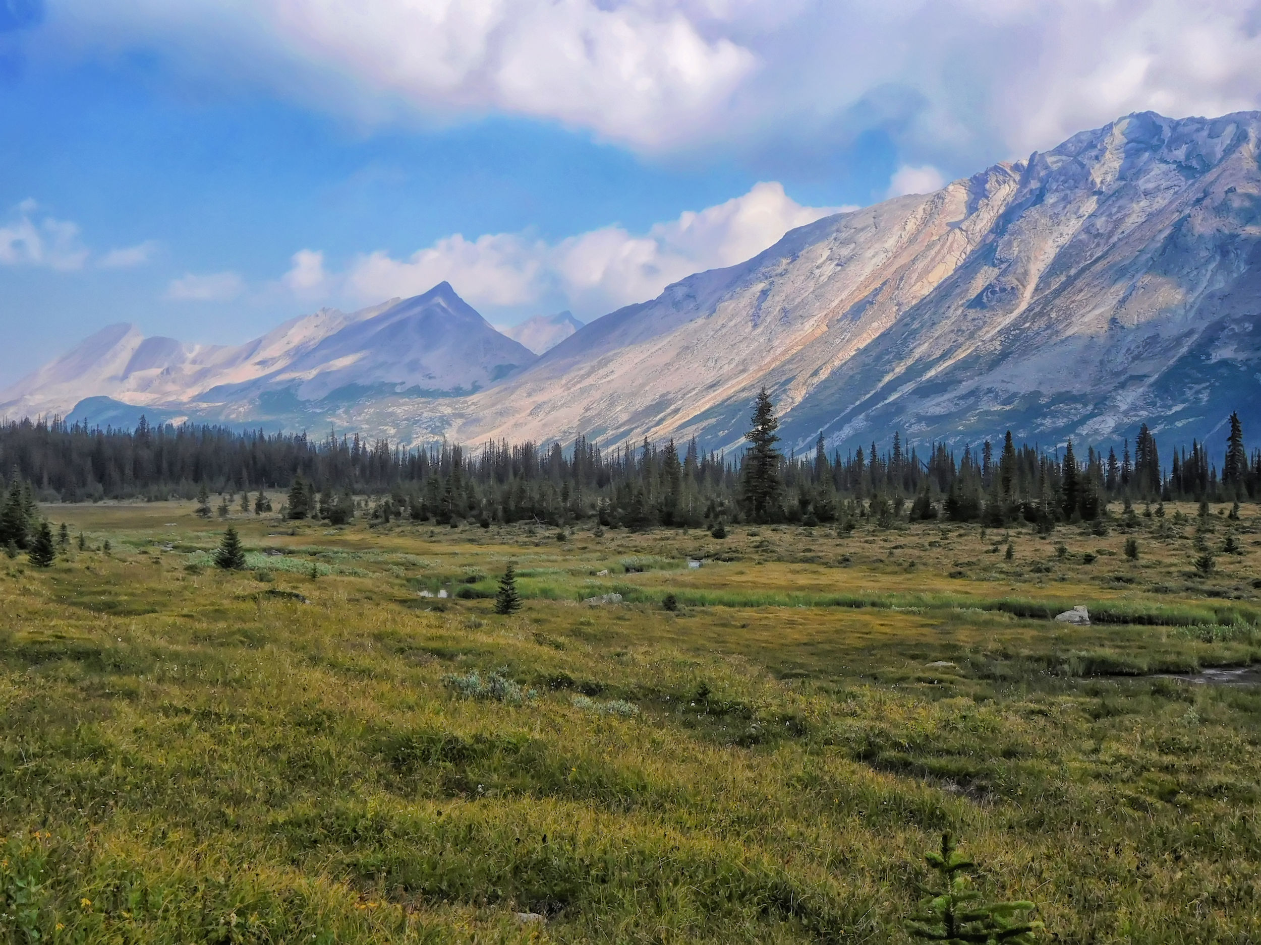
I soon reach Moose Lake, a beautiful lake surrounded by rugged mountains.
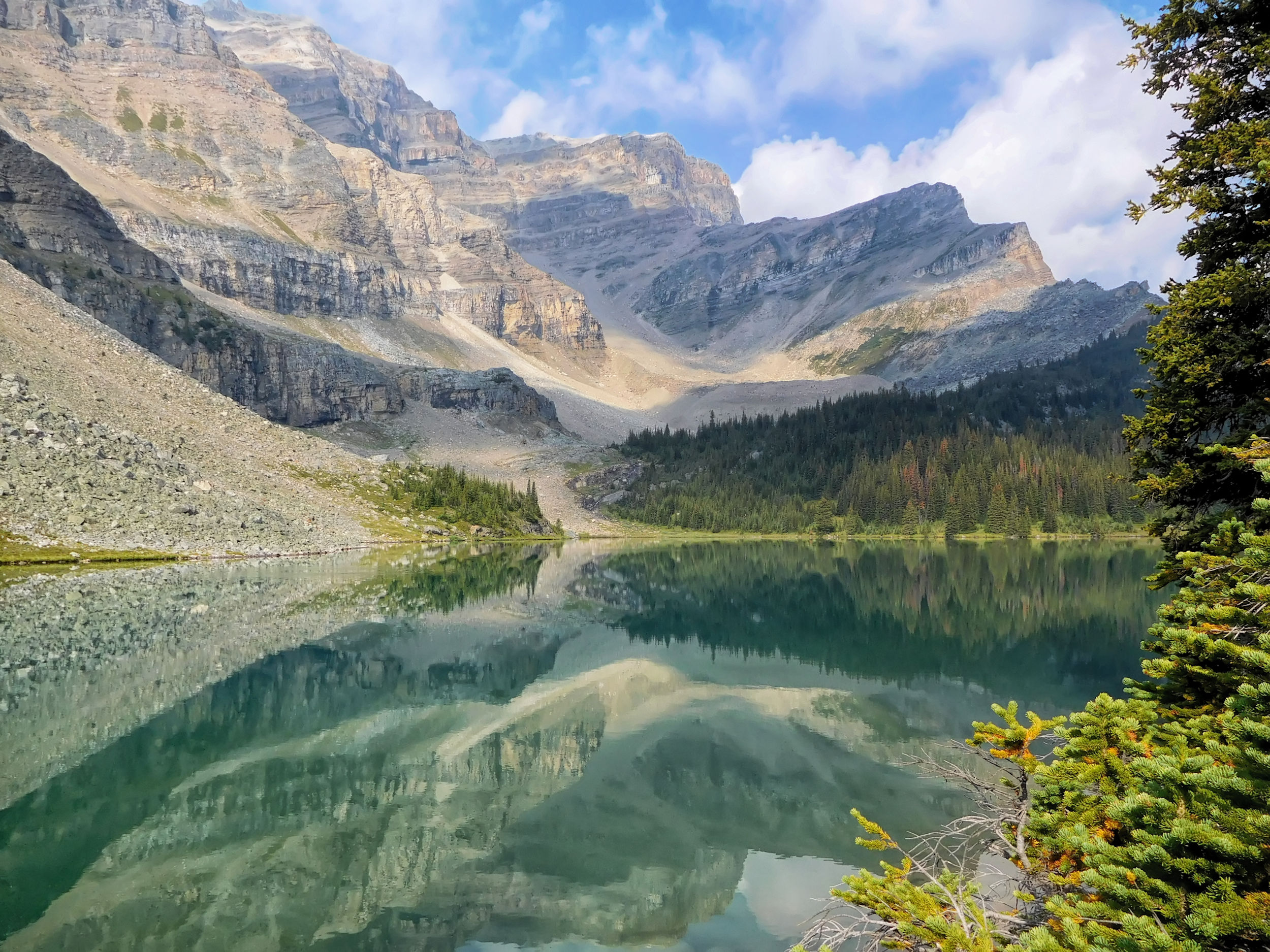
Moose Lake 2202 m
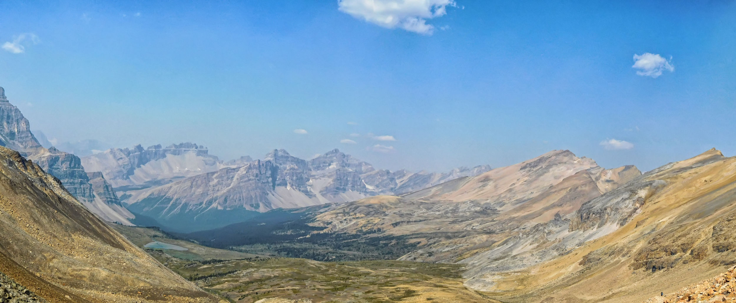
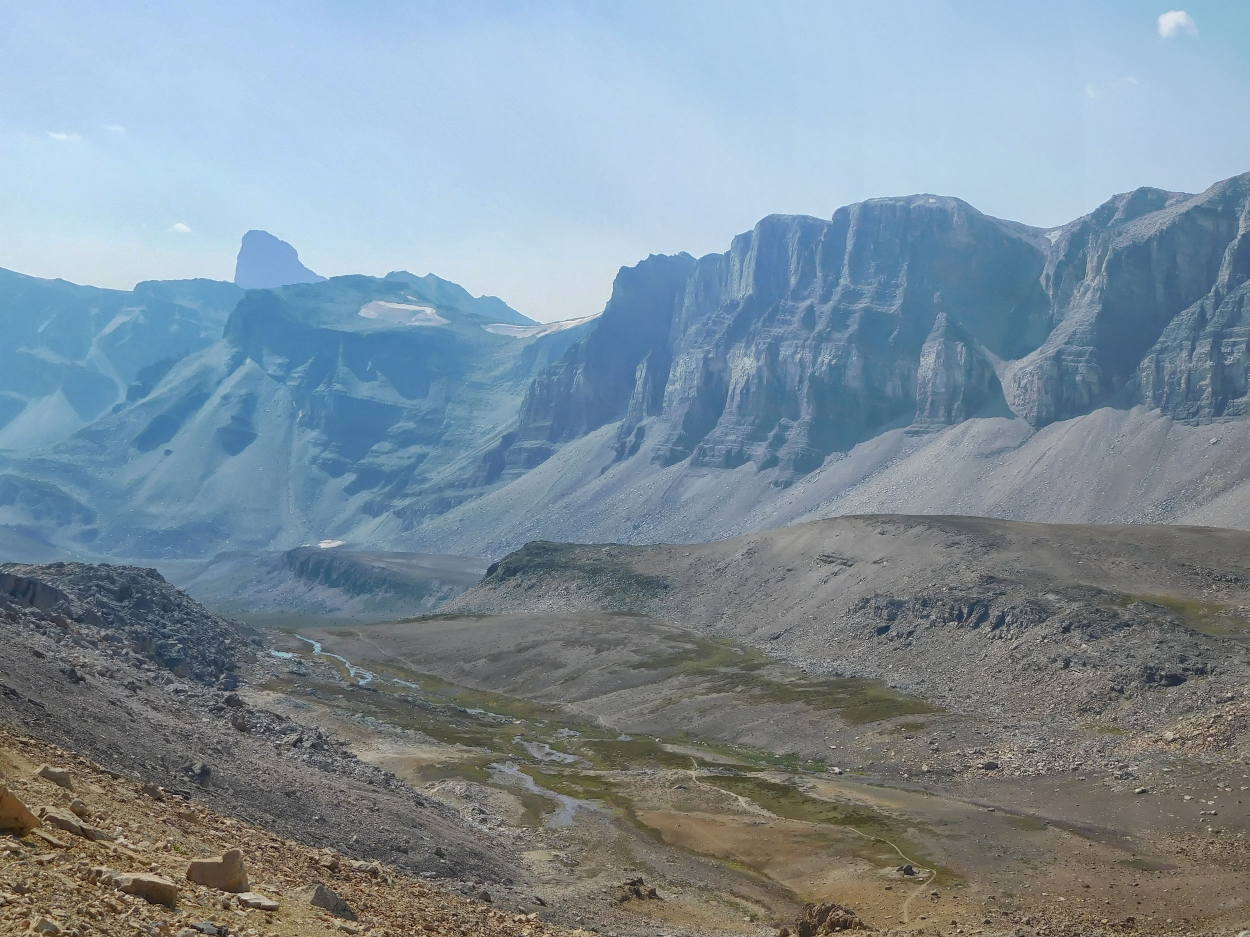
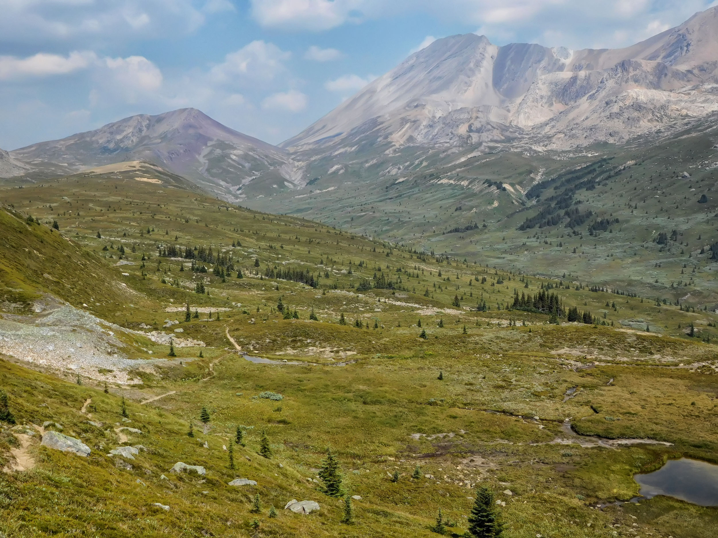
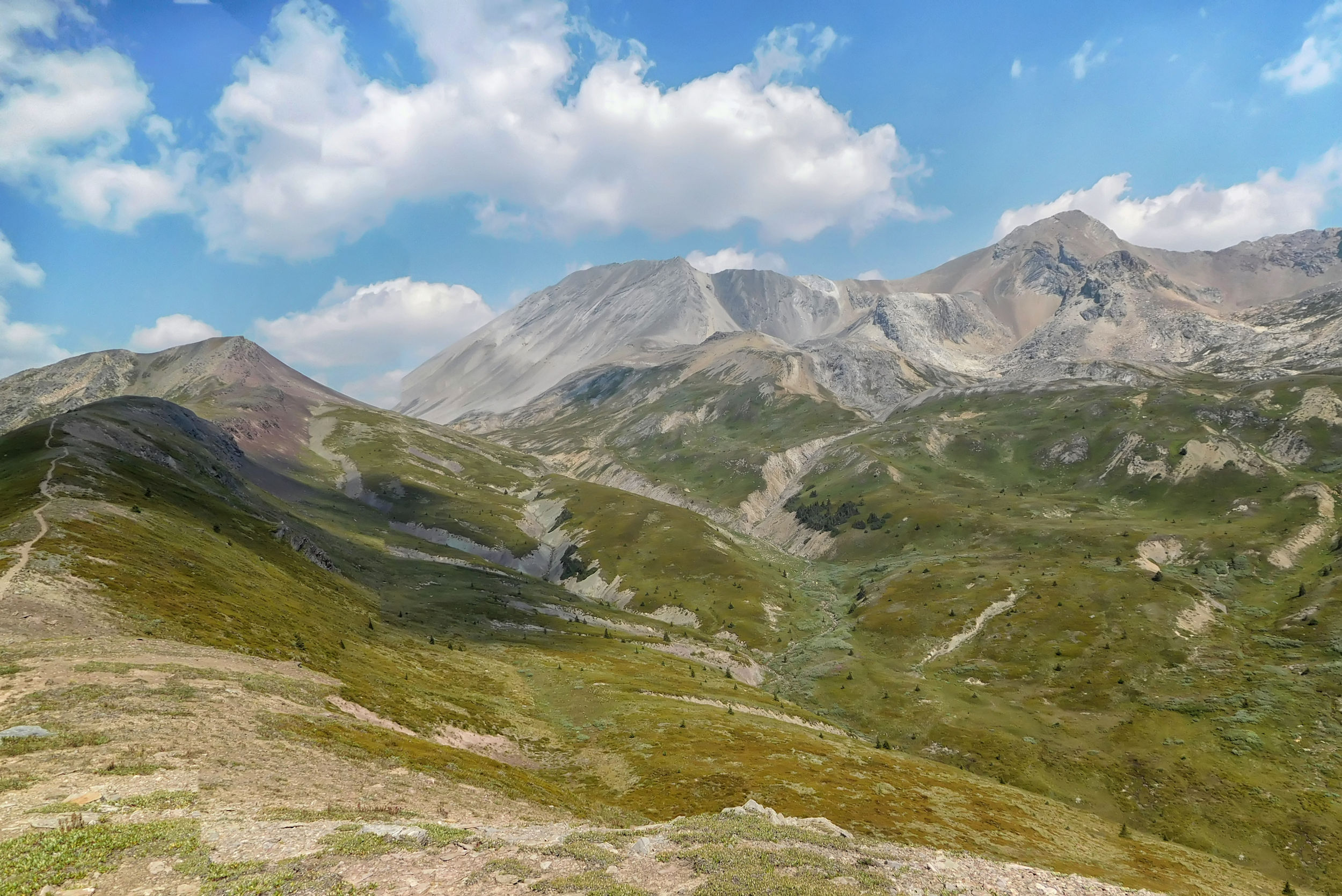
A little further on, I overlook the endless expanse of the Pipestone Valley. Only a few hikers find their way into this remote valley.
The vast Pipestone Valley
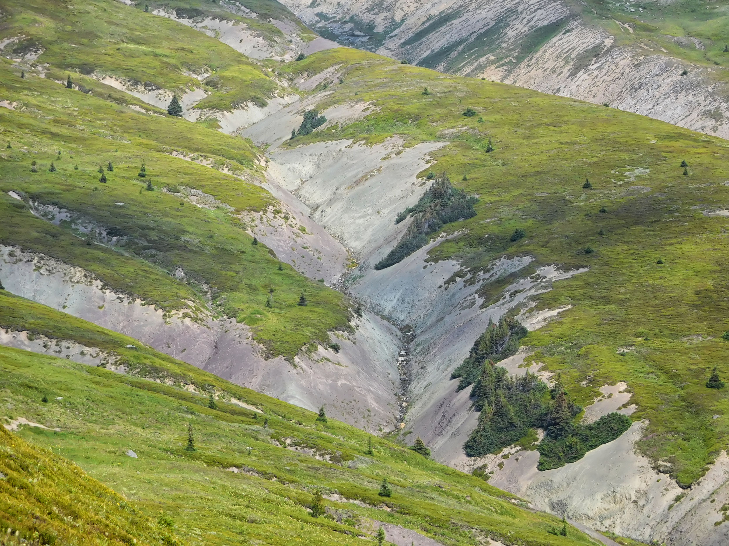
The trail crosses numerous streams that tumble down the slopes into the valley. Most of the time there are stable rocks in the water, so crossing is not difficult. At one of the crossings I climb a little upstream until I find a spot where I don't have to wade through deep water.
Tarn at the Pipestone highline trail
I reach the small hill where two years ago I stopped for lunch and then turned around. Today I don't stop here. Pipestone Pass seems to be more appropriate for a lunch break, since I will have covered more than half the distance there (10 kilometers).
Turnaround point 2021
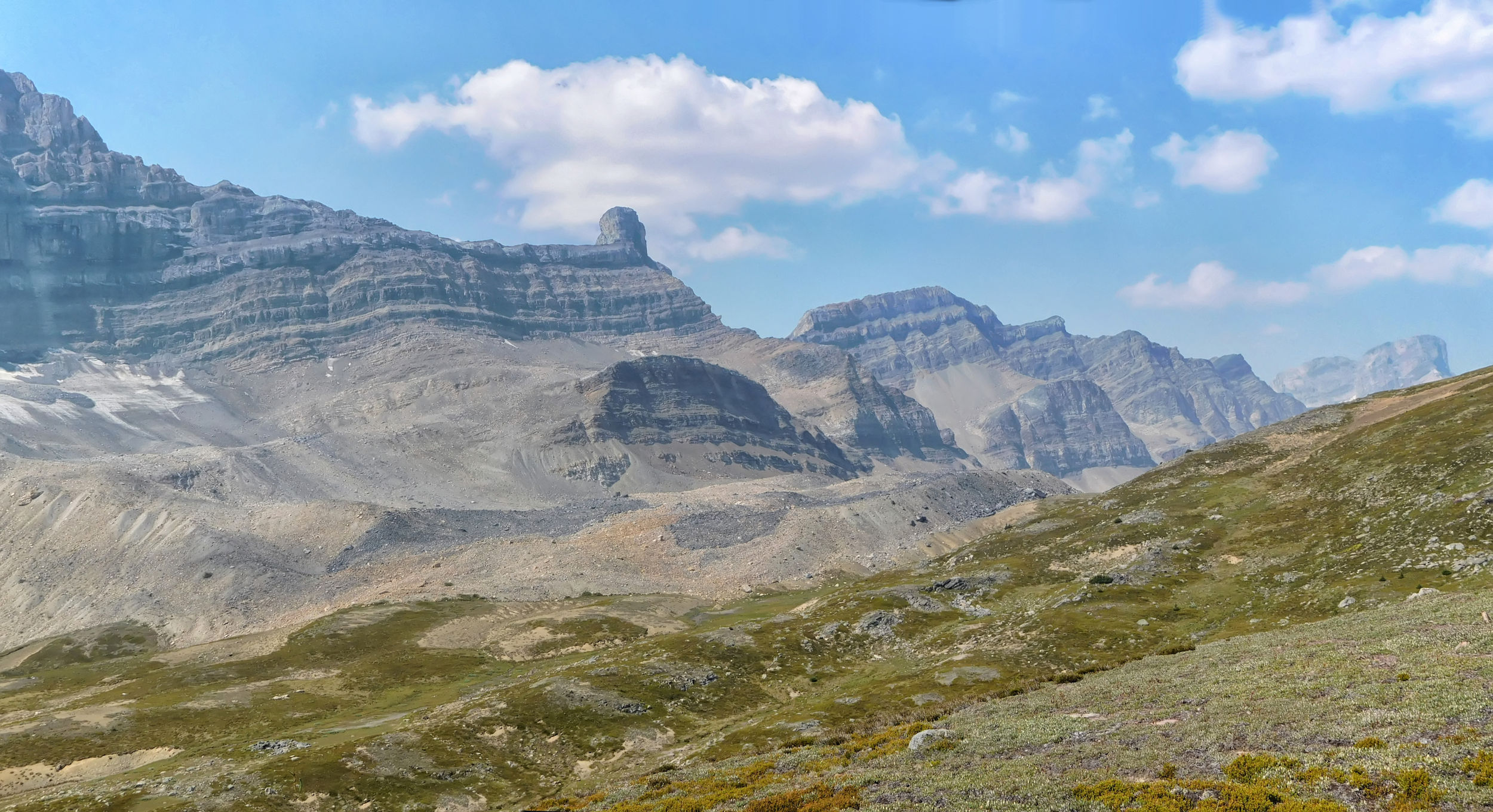
From here you have a fantastic view of Pipestone Pass. The Pipestone Valley is unique in its wild, vast emptiness.
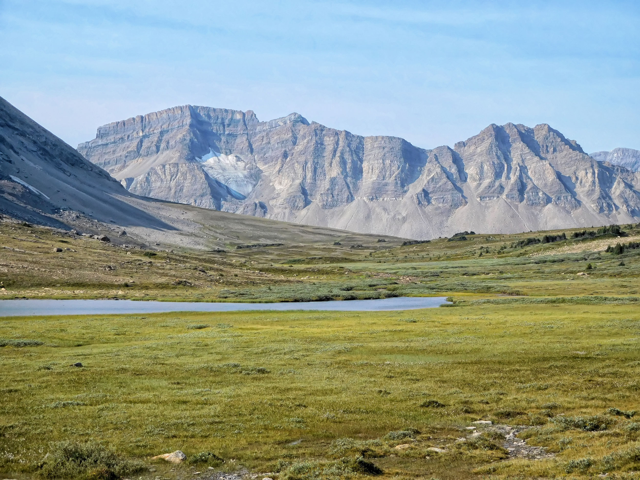
Pipestone Pass and Devon Mountain in the distance
A rugged mountain range with towering peaks borders the Pipestone Valley to the west.
Western slope of the Pipestone Valley
The trail to Pipestone Pass seems endless and I don't know whether it leads out of the valley on the right or left side of the mountain in front of me. Then in the distance I notice two hikers coming from the right, so the pass must be on that side. When we meet shortly afterwards I find out that they have spent two nights at Upper Devon Lake. They give me some good tips for the rest of the way.
Ascending Pipestone Pass
The red rock at Pipestone Pass contrasts sharply with the white-gray cliffs that descend into the valley. The upper reaches of the Pipestone River have cut deep into these cliffs.
View of Pipestone Pass
Headwaters of the Pipestone River
Red rocks at
Pipestone Pass
Looking west just before arriving at Pipestone Pass
I pass a sign marking the junction of the highline trail with the Pipestone River valley trail. The valley is protected as grizzly bear habitat and the trail along the river closed to hikers. One final climb separates me from the top of the pass.

Final steps to the pass
Junction with the Pipestone River valley trail
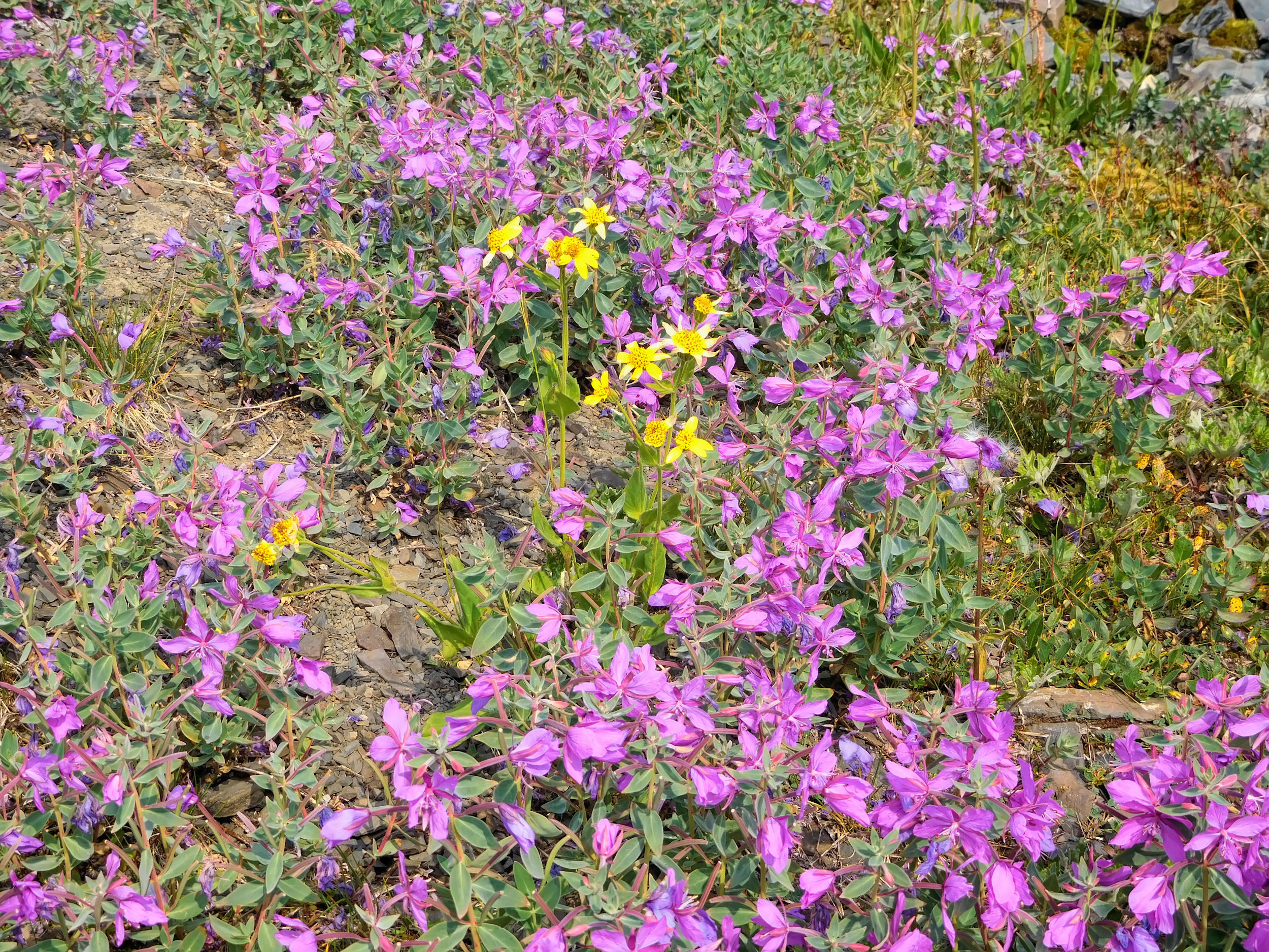
Pipestone Pass is spectacular: red rock, yellow arnica, and expansive views on both sides.
On top of Pipestone Pass
At the top of the pass I catch up with John, Kevin, Barry and Jim, who have just finished their lunch break. We chat for a while and take pictures of each other. I finally have a break and eat my lunch snack while the four of them descend into the valley.
Looking north from Pipestone Pass
Just before I follow the others down into the valley, I am about to take a picture when all of a sudden my camera stops working. Even turning it off and on doesn't help. This can't be happening. Now there will be no pictures of the Devon Lakes! On a hunch, I remove the battery for a moment and to my great relief, everything is working again.
Beyond the pass, the trail leads across a field of scree and then through an area of dense brush and low trees. Just as the couple on the other side of the pass had warned me, I see the fresh tracks of a grizzly bear that has churned up the ground on both sides of the trail in search for ground squirrels and marmots. Even though it's probably long gone, I make a lot of noise by shouting and singing.
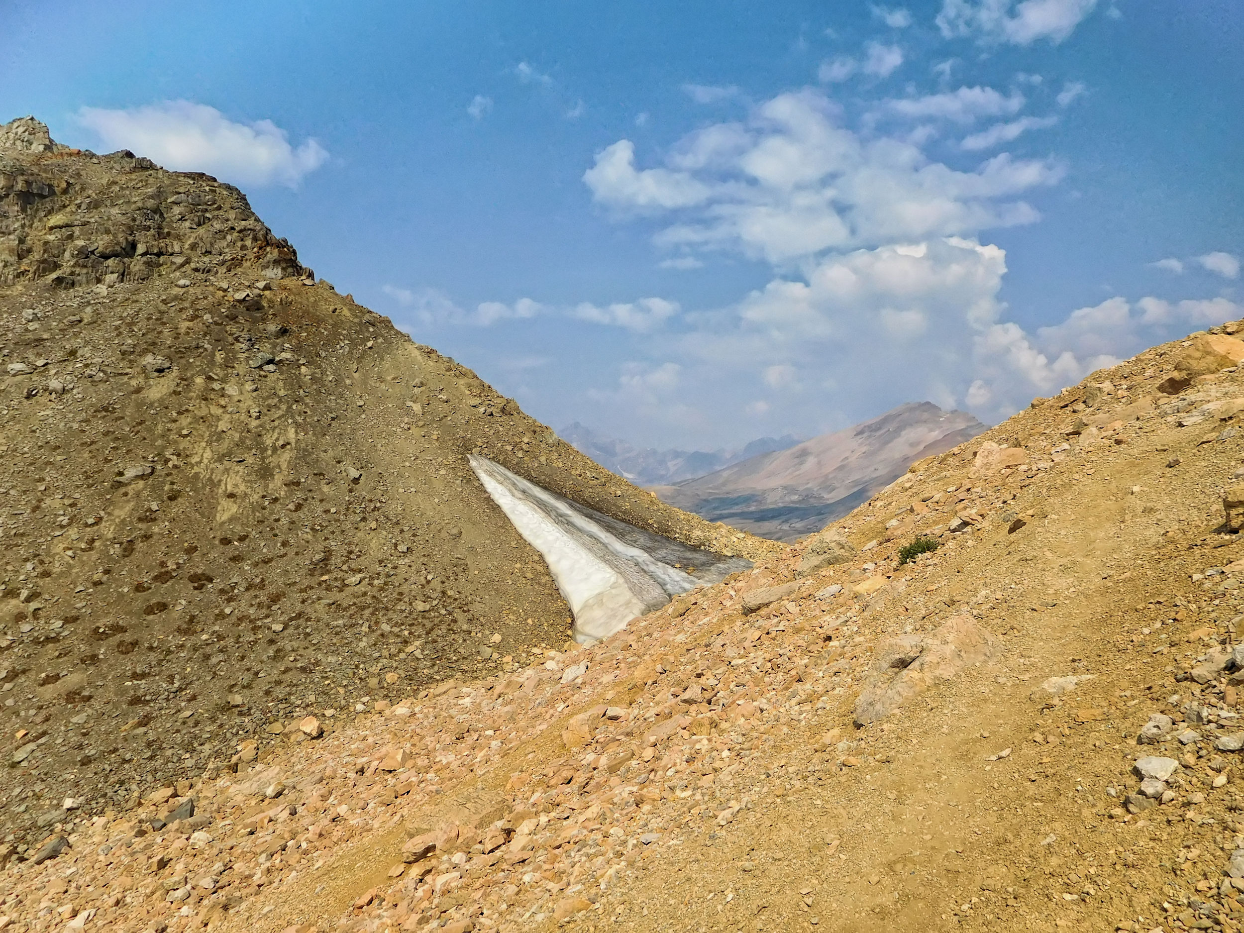
Soon it's uphill again as another pass separates me from my destination. Shortly before I reach Clearwater Pass, I follow a GPS track I found on the Internet, which is supposed to shorten the way into the Clearwater Valley. Unfortunately, the small trail on the flank of Devon Mountain vanishes quite quickly. So I return to the main trail, cross Clearwater Pass and reach the turnoff to the Siffleur Valley.
Clearwater Pass
At this fork in the path the four men, long out of sight, have turned left into the valley. I keep to the right, skirt the flank of Devon Mountain and finally reach the valley of the Devon Lakes, the Clearwater Valley.
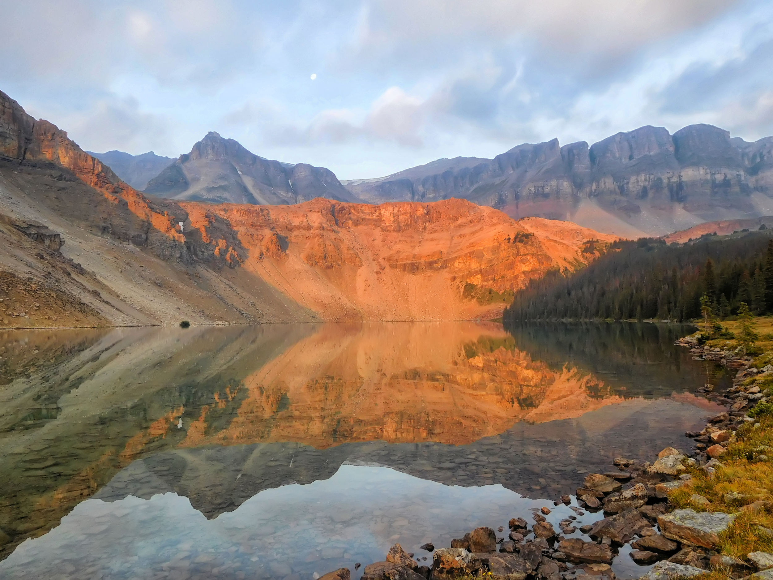
The light is fantastic, especially after I have come around Devon Mountain and look east. Rugged, jagged mountains everywhere you can see.
Rugged peaks in
the Clearwater Valley
First you walk above a large pond that is surrounded by a wetland area.
On the way to Upper Devon Lake
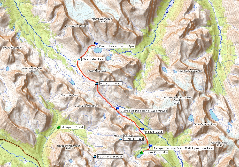
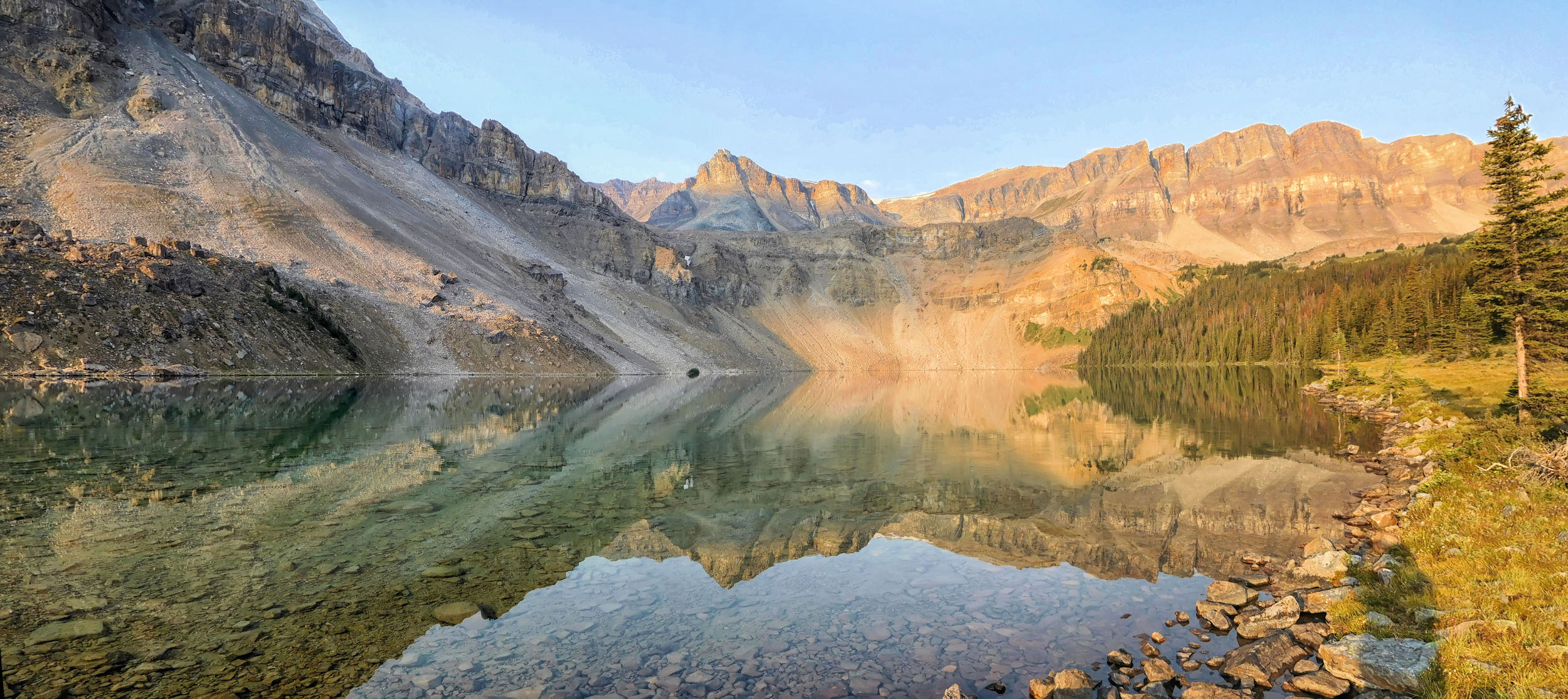
Then suddenly Upper Devon Lake appears. It is the first and larger of the two lakes, which are quite far apart and at different elevations.

Upper Devon Lake panorama
Most hikers spend the night at Upper Devon Lake. However, Lower Devon Lake is said to be even better for camping because it is at a lower altitude in a sparse forest and therefore more sheltered. As I've walked enough for today, I'm happy to see a large boulder with a long branch attached to it, announcing the informal camp at Upper Devon Lake. As I read on the Internet, the branch is supposed to serve as a safe place to hang food supplies.
A path leads to a small open area in the low scrub above the lake. There is a fire pit and two stone walls protect against the wind. The few trees growing nearby are very low and far apart. None of them are suitable for the safe storage of food supplies. Near the camp, five of these trees form a thicket and provide a good windbreak for cooking. Over time, the hikers have gathered many flat stones that serve as seats and small tables for this kitchen area.
I set up my tent in the shelter of one of the stone walls, but the constant wind makes the tarps flap anyway. Well, as long as there isn’t a real storm, I'll be fine.
Alpine camping spot
above the lake
While I'm eating, Helen and Dayton from Fish Lakes campground arrive with their two dogs, Nala and Nanu. They pitch their bright orange tent just below mine. Dayton piles up another stone wall to protect the tent from the wind.
Welcome neighbours in the wilderness
The two of them, together with their dogs, take over the cooking area that I have just cleared. I admire the perfect behavior of the dogs. Despite the confined space, not a single pot is knocked over or a plate stepped on. Nanu is an Akita and very wary of me at first. Nala, a slightly smaller mixed breed, is very friendly right from the start.
I walk along the lakeshore, enjoying the late afternoon light. But soon I return because it's too far to go to Lower Devon Lake today.
Late afternoon at Devon Lake
Since the boulder with the stick is quite far away and hanging my food would require an awkward scramble, I stow my food bag between the branches of the kitchen trees. It will be fine for one night and should at least be safe from mice and squirrels. Dayton and Helen have brought bear-proof containers for the dog food, which they hide under a pile of rocks away from camp. We don't really expect to see any grizzlies because of the dogs.
Later in the evening, a monster cloud rolls in. The wind picks up and the tent begins to flap wildly. Dayton and Helen also look up at the sky with some concern. None of our tents are suitable for alpine camping in such open terrain.
Storm clouds gathering
Fortunately, the storm passes us by. It doesn't rain and the cloud cover promises a warm night ahead. Eventually the wind dies down and it becomes quiet. I can sleep peacefully.
| Distance | 15.3 km |
| Time | 6 ½ hrs |
| Min. Elevation | 2135 m |
| Max. Elevation | 2468 m |
| Descent | 333 m |
| Cum. Ascent | 716 m |
| Cum. Descent | 822 m |
The next morning I get up early. The sky is clear again and the clouds from the night before have completely disappeared.
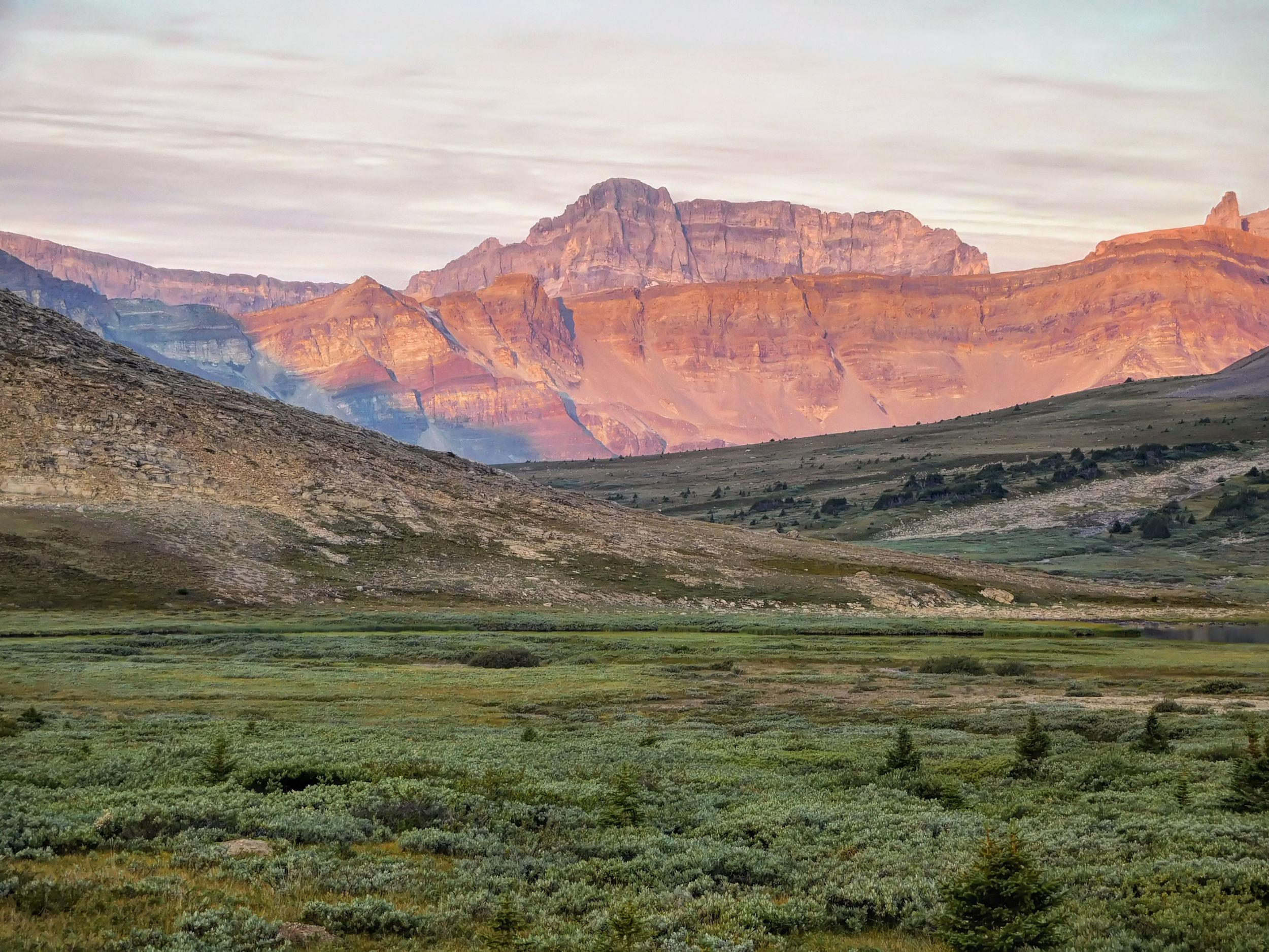
Dawn in the Clearwater Valley
A deer is straying very close to the tents. Surprisingly, the dogs in the neighboring tent don't make a sound. The deer is also interested in our kitchen corner. I chase it away because it could easily reach the food bags hanging in the trees. Luckily it hasn't already helped itself during the night.
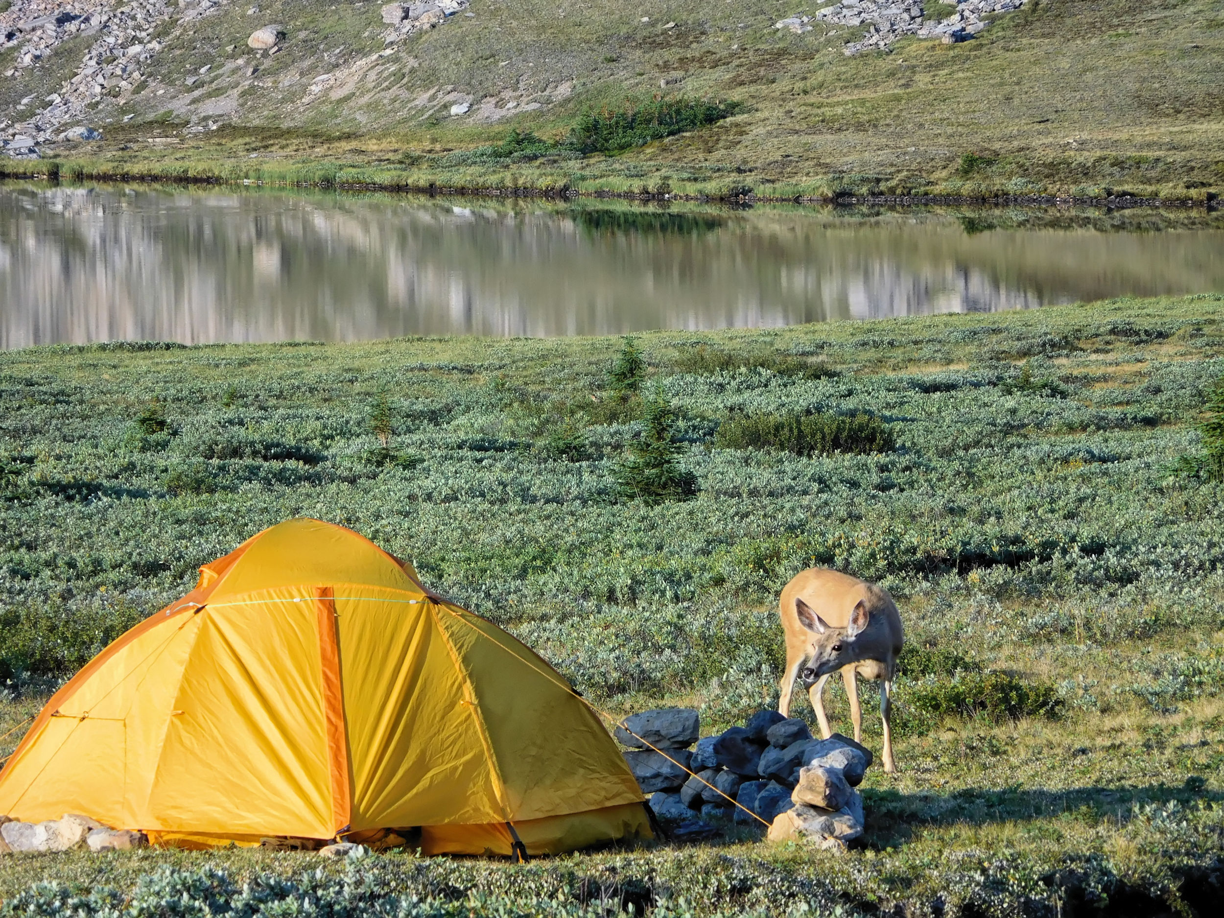
A deer is interested in the neighbours‘ tent
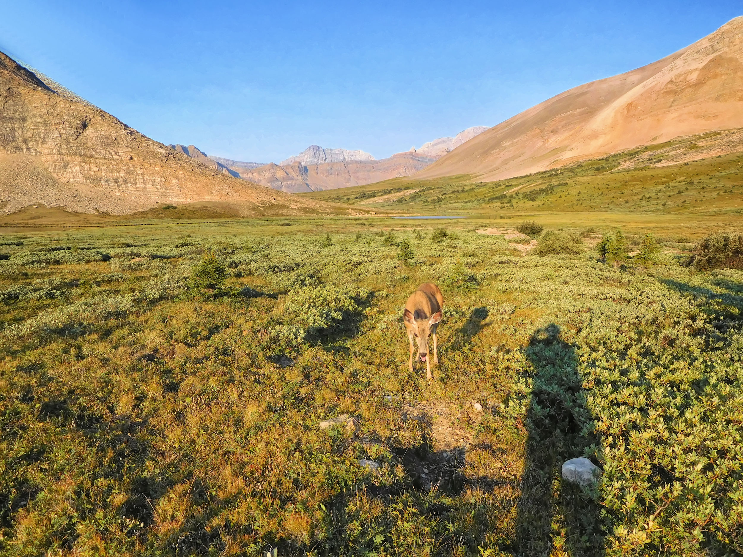
and the photographer
However, other uninvited overnight guests have nibbled the cork handles on my hiking poles. I always store the poles between the ground sheet and the tent floor so that the handles lie under my legs. The thought of mice getting there is not pleasant. At least the straps are intact and the poles still usable.
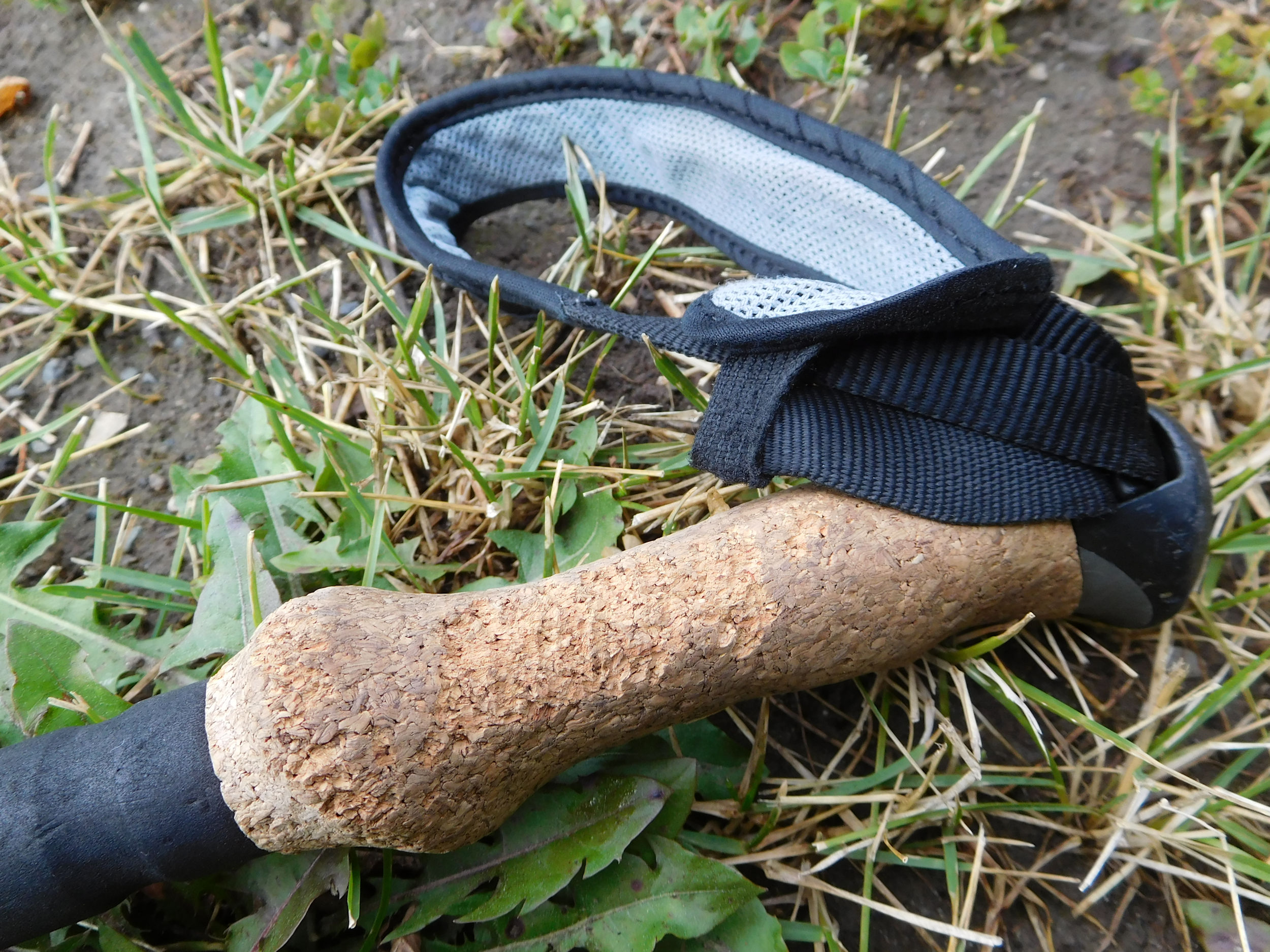
Mice at night…
Finally, Helen and Dayton let the two dogs out of the tent and the deer recedes to a safe distance. When they come out of the tent themselves, they put the dogs on leashes to be on the safe side. An interesting conversation ensues over breakfast. Helen is from the Alsace (in France) and we rave about the food and wine. The two will spend another night at the Devon Lakes.
It is already 10 o'clock when I finally leave. I would have liked to stay longer for a visit to Lower Devon Lake. On the other hand, I'm glad to have survived this alpine camping adventure in good weather.
The air is crystal clear today and I take countless more photos.
Returning to Clearwater Pass
Clearwater Pass
View into the Siffleur Valley
Climbing Pipestone Pass
Pipestone Pass
On top of Pipestone Pass
Red peak near the pass
Returning via the Pipestone highline trail
I don't see a soul until just before Moose Lake. There I meet a couple who, like the four men, are hiking the Dolomite Loop. The timing of the encounter is fortunate, as I have just lost the marked trail and the hikers show me the way.
When I finally arrive at the ranger cabin, I'm pretty tired. Since the sky has closed in and it is going to rain at some point, I didn't take any long breaks along the way. The many ups and downs through the forest at the end have exhausted me. Now I'm taking the time to filter water from the stream because my bottle is empty and I'm thirsty.
After a short final push I reach the campground. My old spot is free again and I quickly pitch my tent. The campsite is full: a 73 year old woman with her granddaughter from Salmon Arm, two very talkative young women who can be heard from everywhere, an ambitious young couple who want to do the 32 km to the Devon Lakes and back tomorrow in one day, and another couple I don't get to talk to.
When everyone has finished eating and some have already taken shelter in their tents, it actually starts to rain. In the middle of the night, a short thunderstorm is passing through with loud echoing thunder and a heavy strike nearby. Now I'm not sad anymore that I'm not spending the night at Upper Devon Lake...
| Distance | 10.4 km |
| Time | 3 ½ hrs |
| Incl. breaks | 4 ½ hrs |
| Min. Elevation | 1991 m |
| Max. Elevation | 2603 m |
| Descent | 612 m |
| Cum. Ascent | 626 m |
| Cum. Descent | 811 m |
I take my time this morning because it's only four hours to Mosquito Creek campground. I have a long conversation with the other senior about the joys of camping as one gets older.
Sunrise at Upper Fish Lake
Upper Fish Lake
From Fish Lake I climb up the steep trail and out of the forest. I rise higher and higher on my way to North Molar Pass.
On the way to North Molar Pass
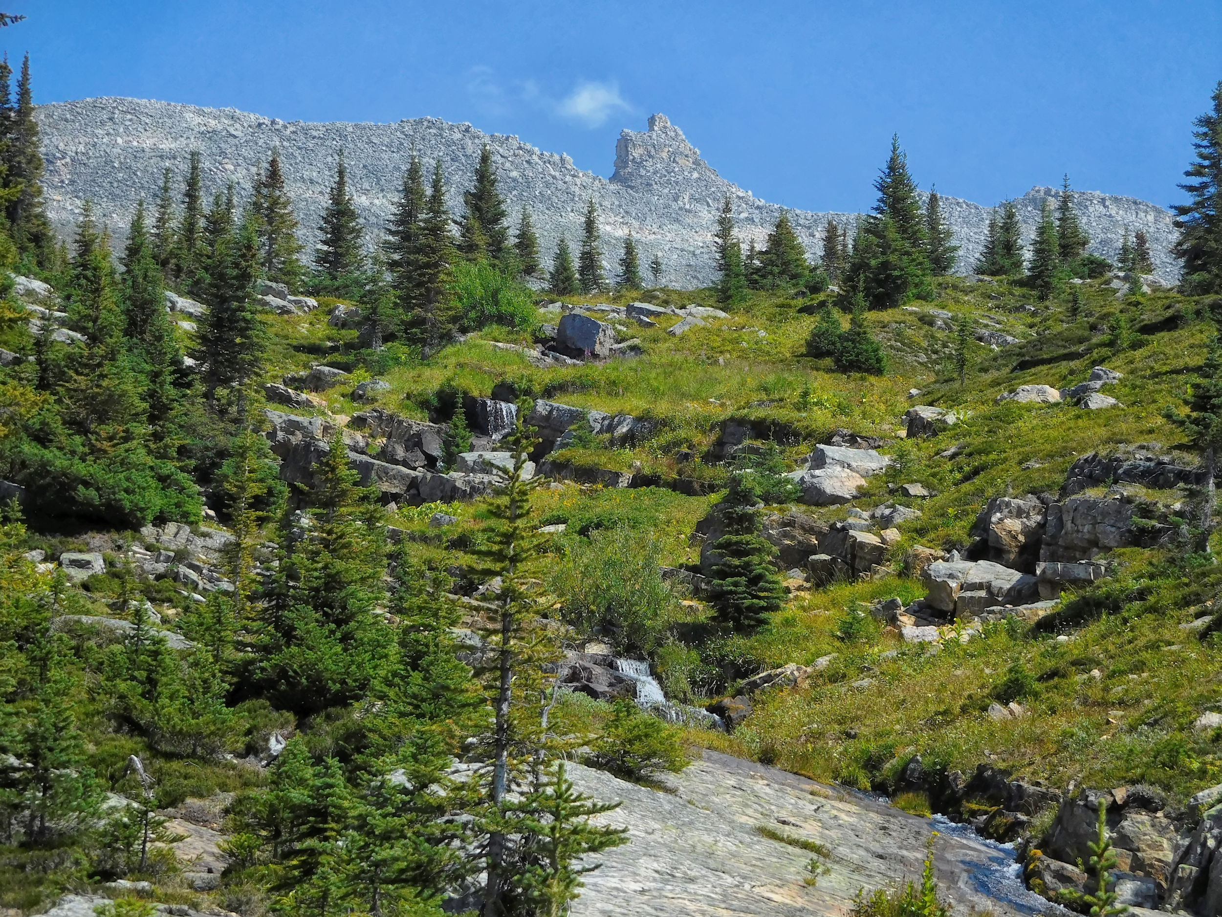
Soon I catch my first glimpse of the pass, which is just to the right of the cornice, though barely visible from a distance. Molarstone Mountain rises on the east side of the pass.
Looking up to North Molar Pass
Finally I reach North Molar Pass. A couple with a Husky comes up the mountain from the other side. We take a lunch break together at the top of the pass.
Back at North Molar Pass 2603 m
The Husky and its owner climb down onto the cornice, which seems very stable. The Husky enjoys cooling off in the snow.
The sky is getting really dark now; it looks like an early thunderstorm. Faint smoke is in the air again, too. We begin our descent into the valley in order to leave the exposed alpine area no later than 2 o'clock. On the North Molar meadows we run across a group that wants to climb The Fang in spite of the looming thunderstorm. The leader thinks he knows what he's doing, after all he has an app with directions. I wish them good luck.
At Mosquito Tarn I take another look at the possible route to Pipestone Lookout. But I have doubts if I really want to do another strenuous hike tomorrow. My feet are tired and I long for my soft bed at home. I'll decide tomorrow, depending on the weather and my mood.
On the last stretch to the campsite it starts to rain. I pull the rain cover over my backpack, but don't put on any rain gear. Instead I wait a few minutes between the trees until the rain lets up. This time I find a spot in the back of the campground. I set up the tent as quickly as possible, because the rain is certainly not finished for today. A young woman with a black Labrador and a couple with a small child are my neighbors.
I eat quickly before a brief thunderstorm rolls in. In the evening, it is dry again and I have a long chat with Michelle. Like me, she travels alone. The one-year-old Lab she is looking after is very calm for his age and part of a training program for guide dogs. Little Clara from next door cries a lot. Her parents have their hands full trying to keep her happy. Since my tent is further away from the noisy stream, I sleep better at night. Only Clara calls from time to time, but I am not bothered.
| Distance | 5.0 km |
| Time | 1 ¼ hrs |
| Min. Elevation | 1868 m |
| Max. Elevation | 2014 m |
| Descent | 146 m |
| Cum. Ascent | 153 m |
| Cum. Descent | 290 m |
More smoke has moved into the Mosquito Creek valley overnight. The weather forecast is similar to yesterday: sunny in the morning and rain or thunderstorms beginning in the early afternoon. I decide to head home today and say goodbye to Michelle and her dog. Just before the parking lot I catch up with the young family that left a few minutes before me. They have successfully completed their first camping experience with a small child and have gained important insights for future adventures of this kind.
For the return trip I take the southern route via Golden and Kamloops. The smoke gets thicker and thicker, the worst being in Glacier National Park and Sicamous. Despite the holiday, the traffic is bearable and without long traffic jams. The air clears near Kamloops and improves further for the rest of the drive.
With all the forest fires and smoke, I was very fortunate to have enjoyed another successful hike. I feel elated about having camped at the Devon Lakes and to have been rewarded with ideal conditions in this remote and unique wilderness.