 Via Jasper to Mosquito CreekAugust 1

In the end of June, a heat dome over the western part of Canada produces scorching, record breaking temperatures of up to 49.6 degrees and causes wildfires all over BC. Tragically, the town of Lytton burns down. Evacuation alerts and orders are issued everywhere. Dense smoke rolls in and out that makes it hard to breathe and drives air quality numbers to hazardous levels. Actually, by late July most of the country is shrouded in smoke as there are numerous wildfires burning in other provinces, too.
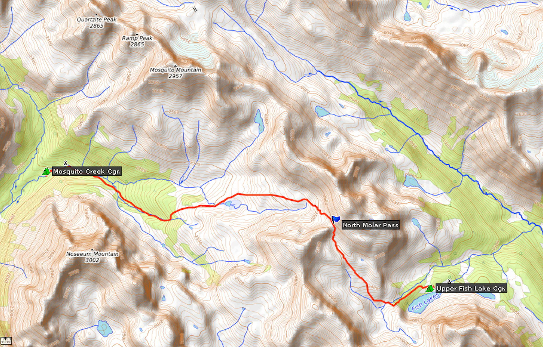
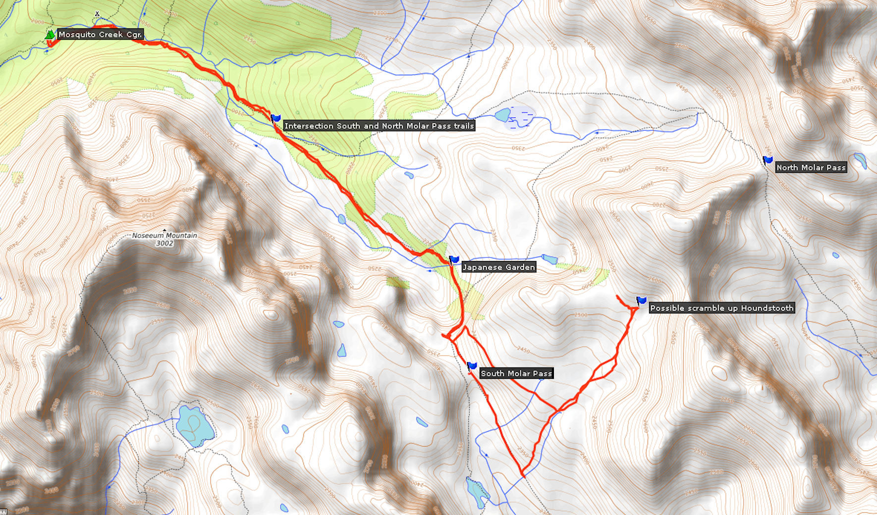
I take my chances with the conditions and go for the hiking trip that I managed to book earlier in April. It would be a shame to give up the reservations for the highly popular backcountry campgrounds that were so hard to come by. My trip will bring me to the North & South Molar passes and to Fish Lakes in Banff National Park. I have visited the area before, during a camp with the Skyline Hikers of the Rocky Mountains. Then, there was still a lot of snow on the trails and we did not reach North Molar Pass nor Fish Lakes. This time, I am confident to get there and even beyond into the Pipestone valley and possibly to Devon Lakes.
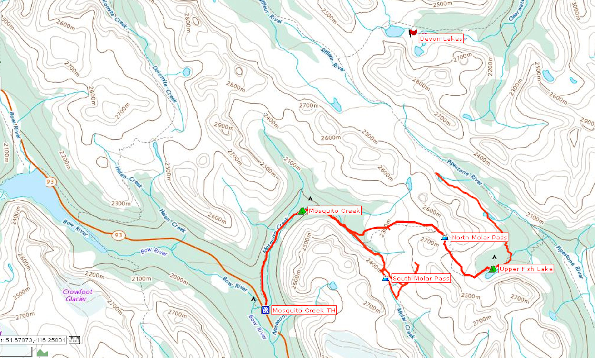
I chose the northern route via Jasper that takes me in seven and a half hours to the Mosquito Creek trailhead on the Icefield Parkway in Banff National Park. It is very smoky all through the North Thompson Valley. Mount Robson is invisible in spite of a cloudless sky. It is quite warm regardless of the smoke blocking out most of the sun’s heat. Towards Jasper the air gets lighter with a slight breeze. I can now see the mountains nearby but those in the distance remain veiled by the haze. The further south I come, the better the air gets.
I have left home early because I am staying at the Mosquito Creek backcountry campground tonight, a hike to kilometer five on the Molar Pass trail.
| Distance | 5.0 km |
| Time | 1 ¼ hrs |
| Min. Elevation | 1868 m |
| Max. Elevation | 2014 m |
| Ascent | 146 m |
| Cum. Ascent | 290 m |
| Cum. Descent | 153 m |
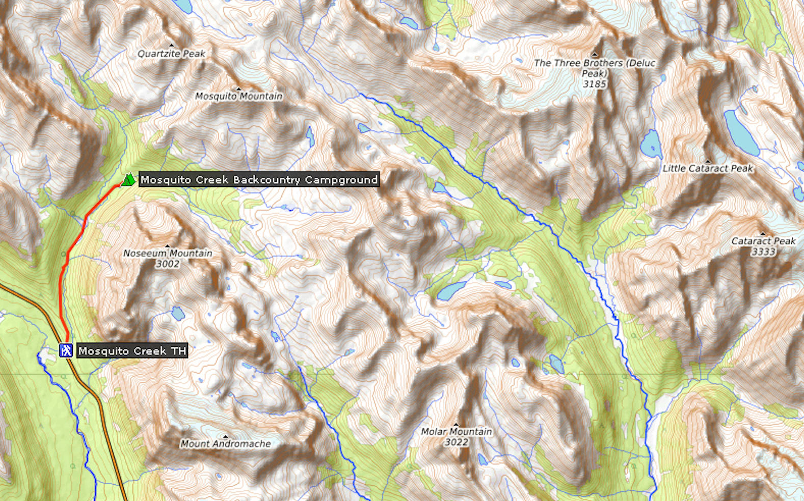
I park in the lot shared with the Mosquito Creek hostel. It is not very busy with ample parking available. I move some last food items from the cooler into my backpack and I am all set to go.
View from the parking lot
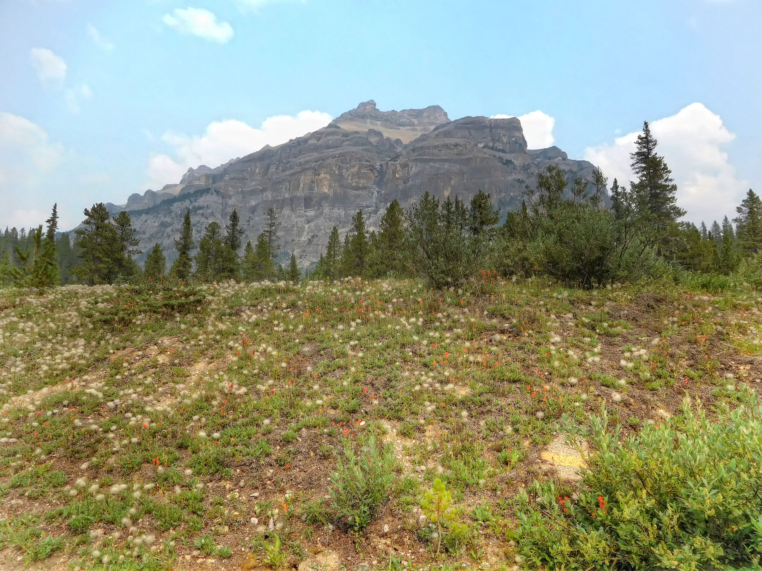
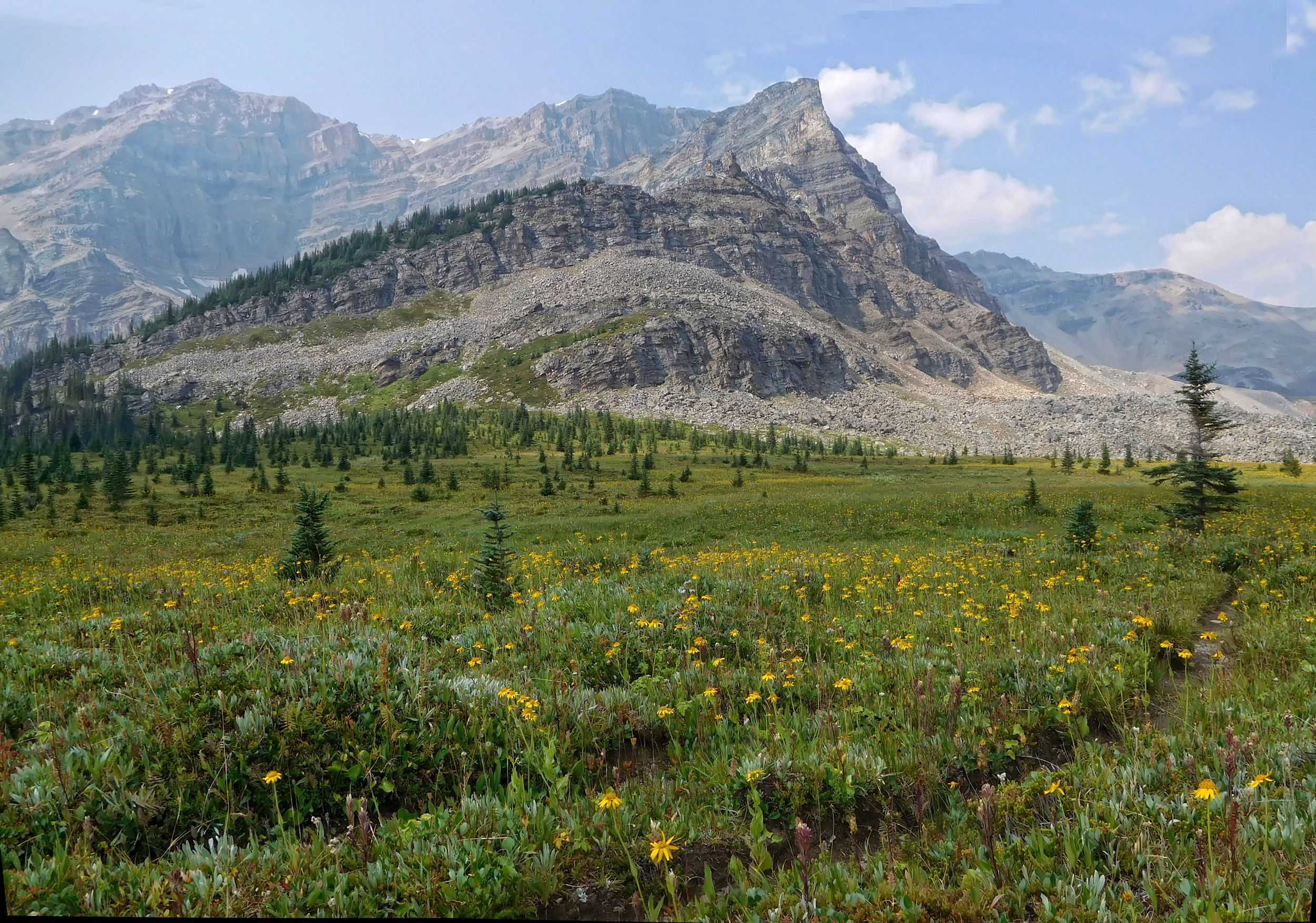
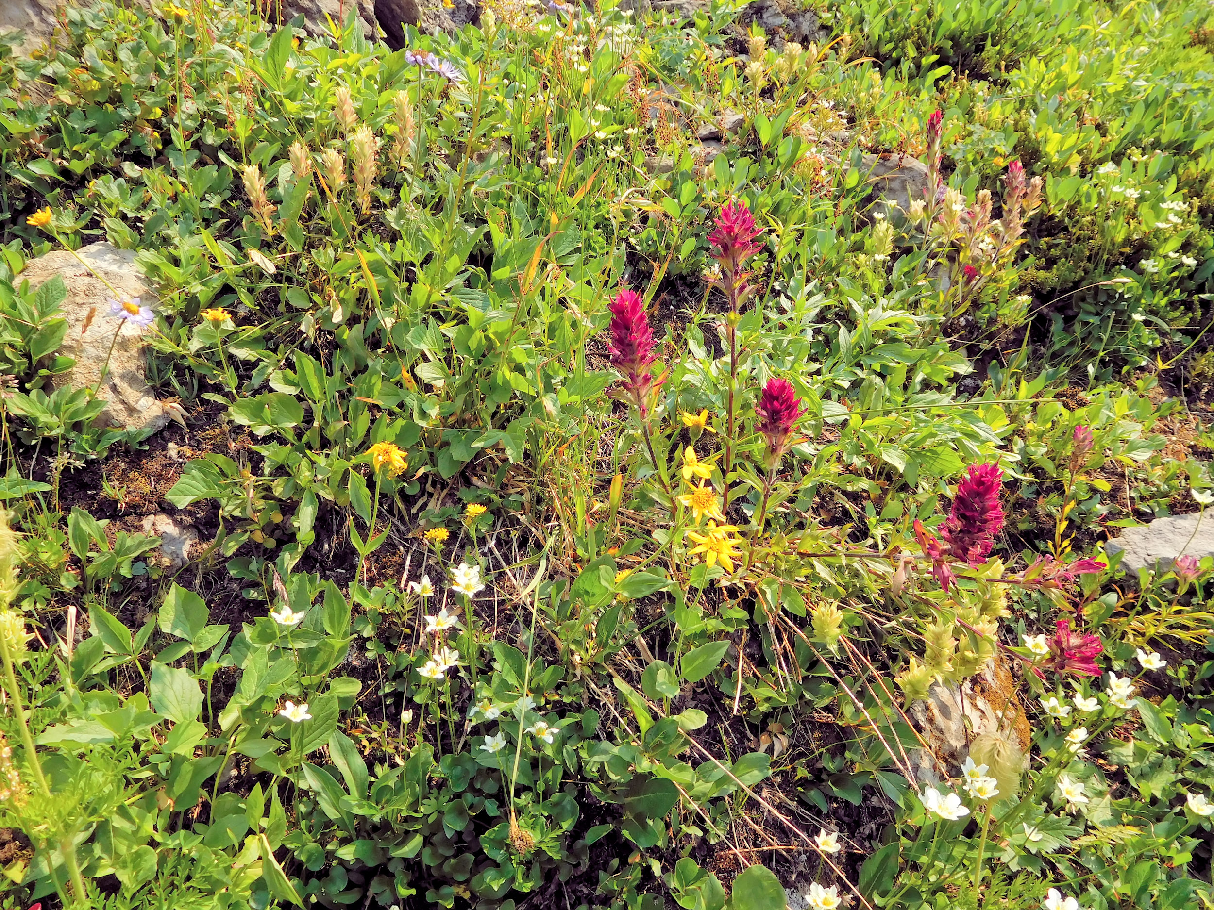
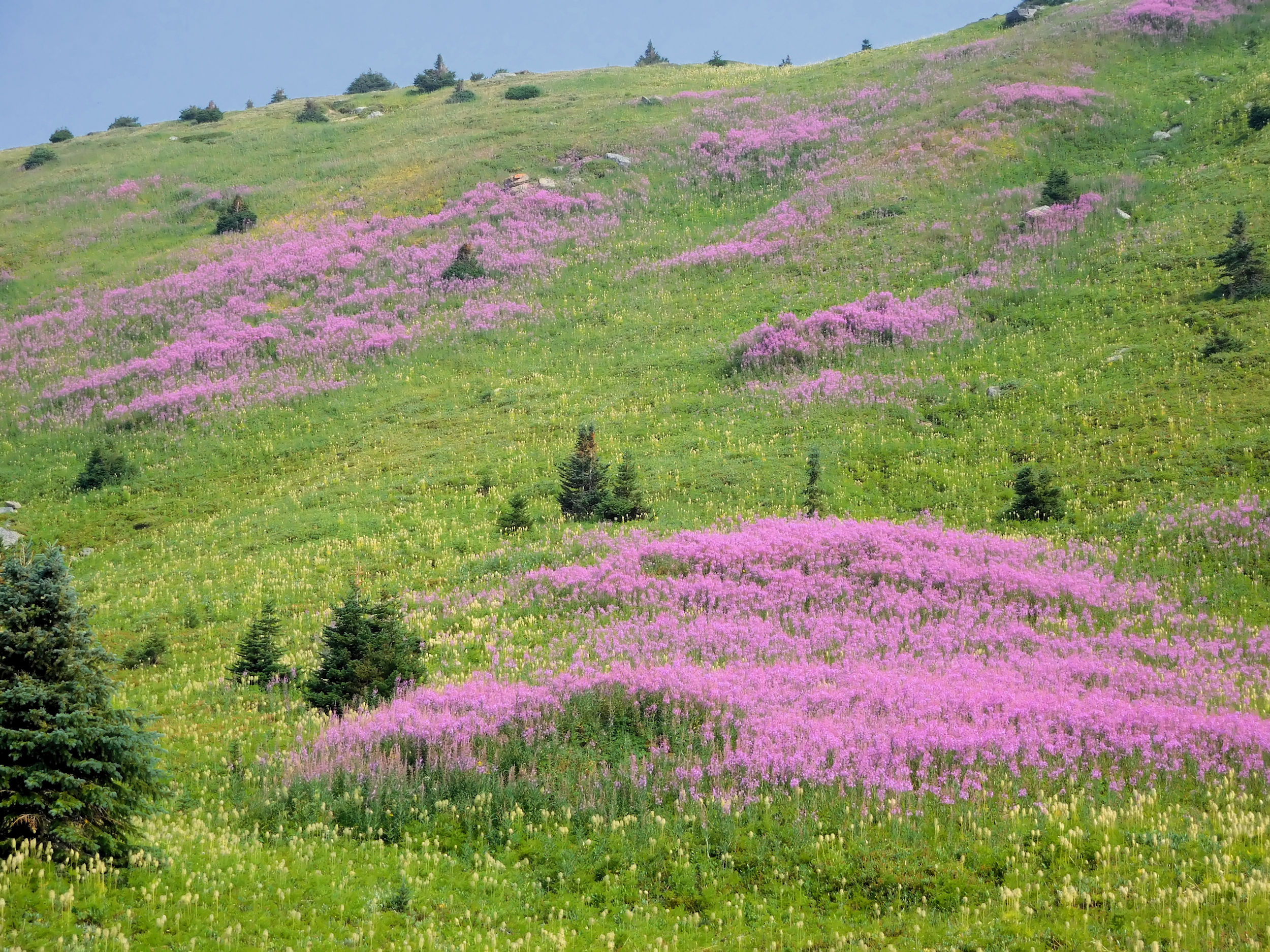
Right away I take a first picture: a mountain with flowers in the foreground and - most importantly - with a blue sky and some nice fluffy clouds in the background. I haven’t seen clear blue skies for a while.
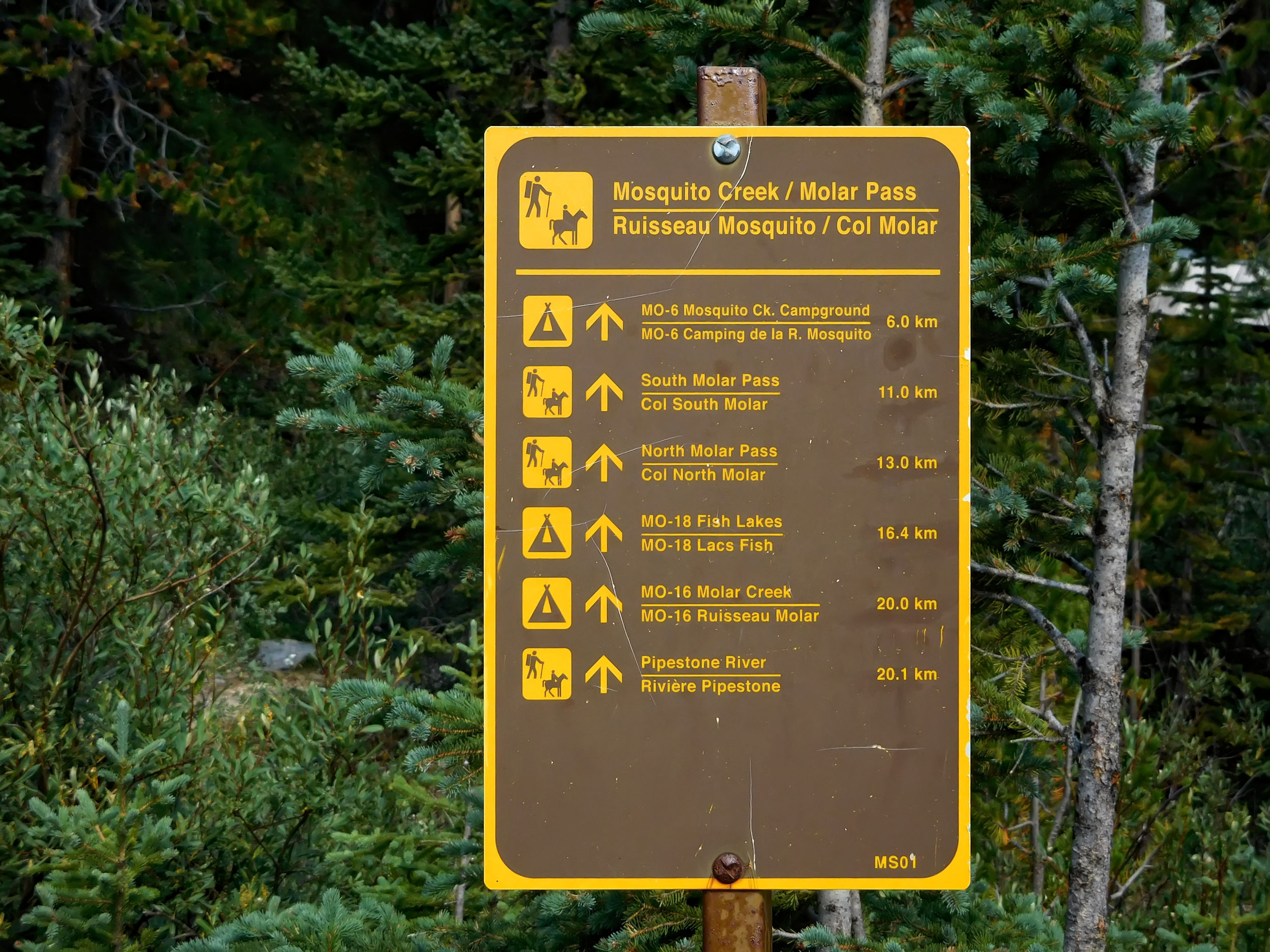
I shoulder my backpack and cross the bridge towards the Mosquito Creek frontcountry campground. This one is not to be confused with the backcountry campground of the same name which is my destination for today. I find my way across the busy highway and begin the hike along Mosquito Creek.
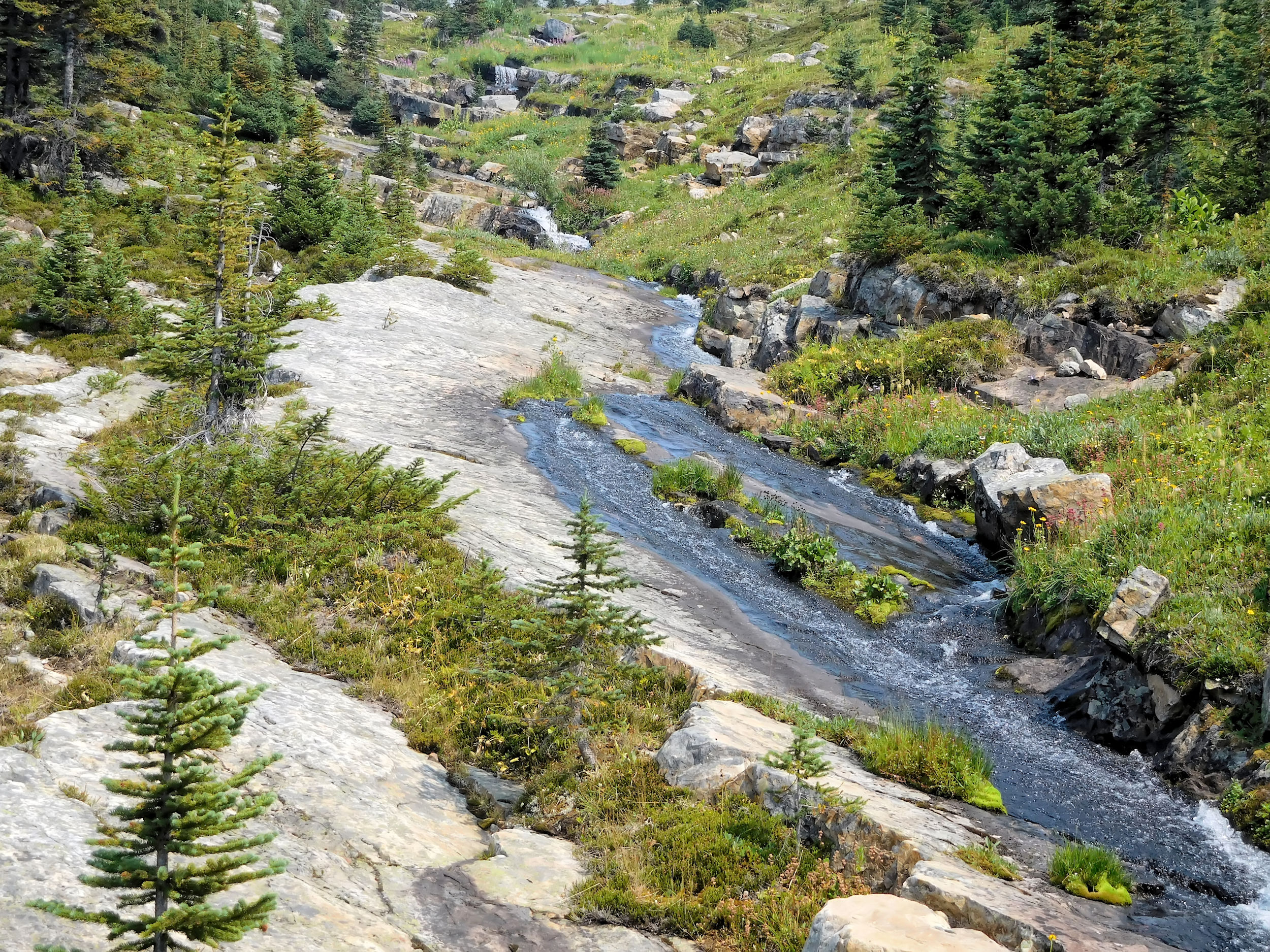
The trail is lovely and ascends gently along the turbulent creek.
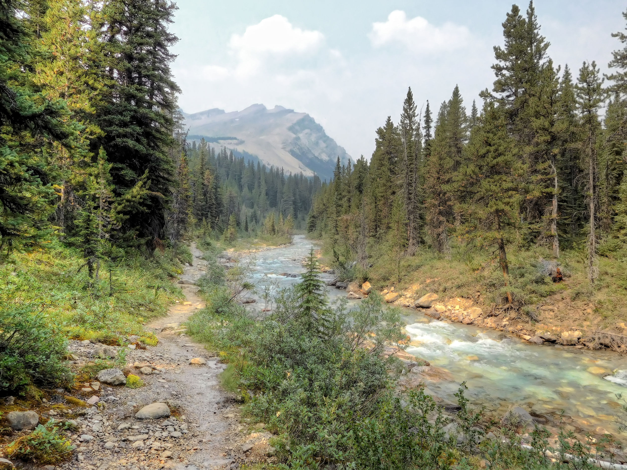
Mosquito Creek trail
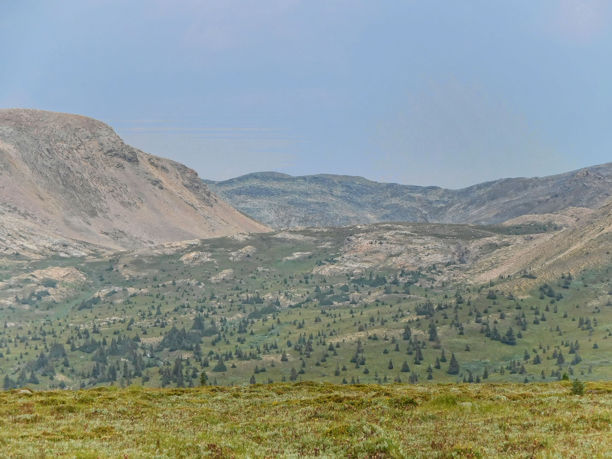
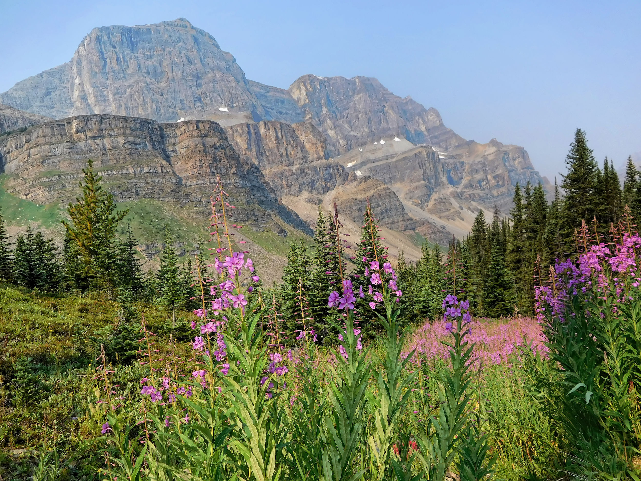
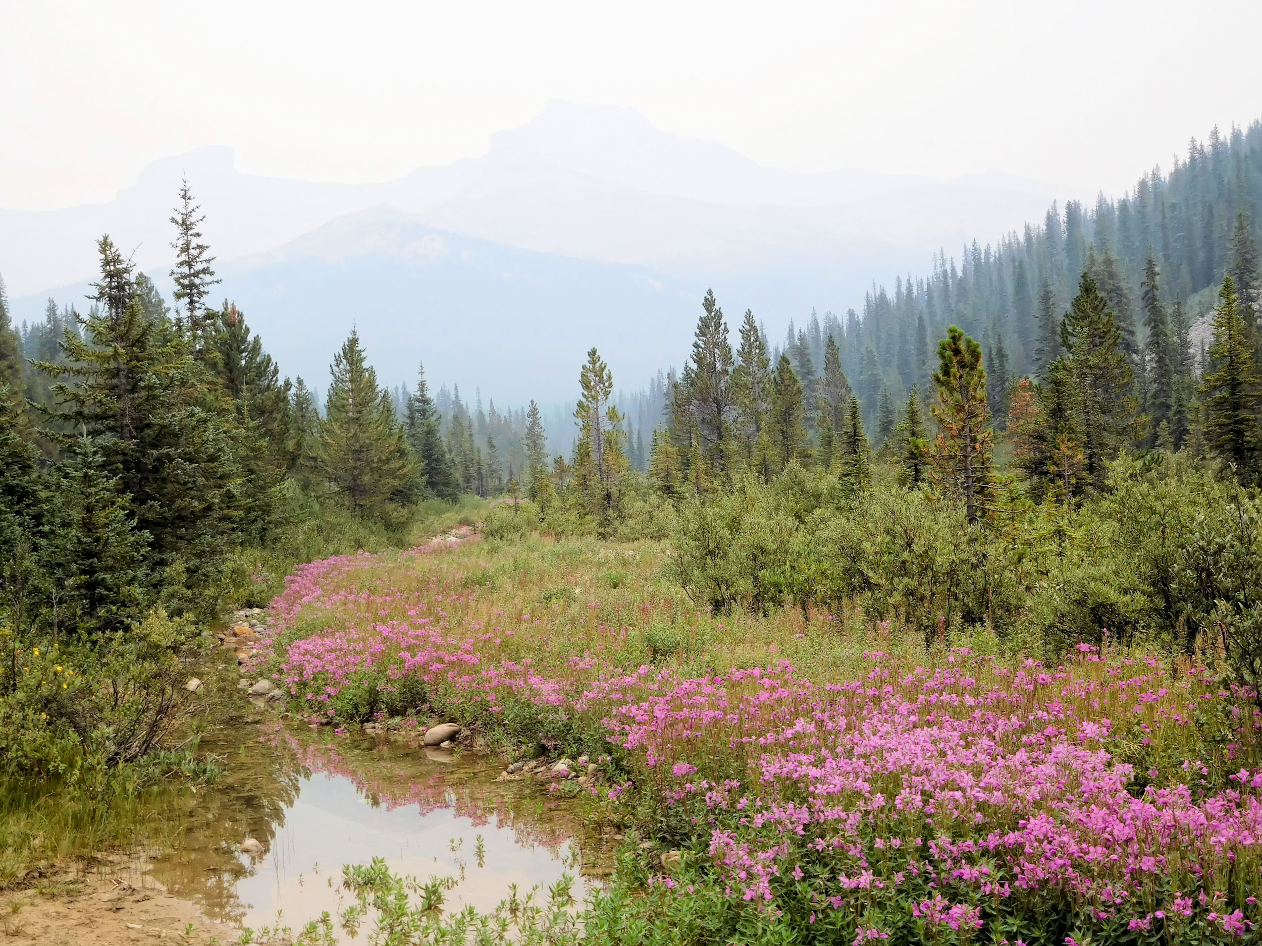
Soon I have some nice views of the mountains. The air is not perfectly clear, but much better than anticipated. The fireweed and other flowers are in full bloom.
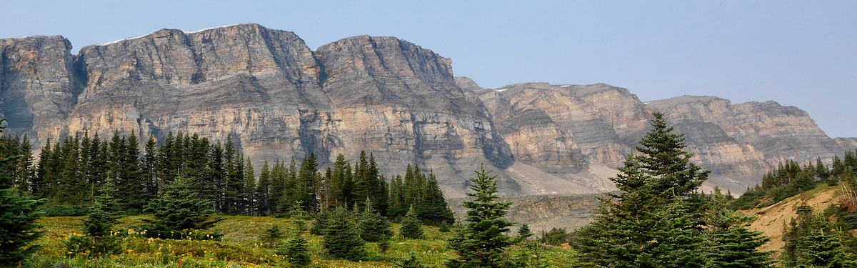
Mosquito Creek with Quartzite & Ramp peaks and Mosquito Mountain in the background
After a little over an hour I arrive at Mosquito Creek campground and find a spot for my tent under the trees. They will protect me from the bad weather that is forecasted for the night. These days, bad weather often enough means heavy thunderstorms. I brought a slice of home-made pizza, so I don’t even have to set up my cooking gear. I talk to a couple who stay at the campground for three days of day hiking. We exchange some information about the hiking possibilities around here. In the evening it starts drizzling.
Later during the night it rains on and off, but not too seriously. I have a decent night’s sleep, interrupted here and there by the roaring sound of Mosquito Creek.
| Distance | 10.4 km |
| Time | 3 ½ hrs |
| Incl. breaks | 4 ½ hrs |
| Min. Elevation | 1991 m |
| Max. Elevation | 2603 m |
| Ascent | 612 m |
| Cum. Ascent | 811 m |
| Cum. Descent | 626 m |
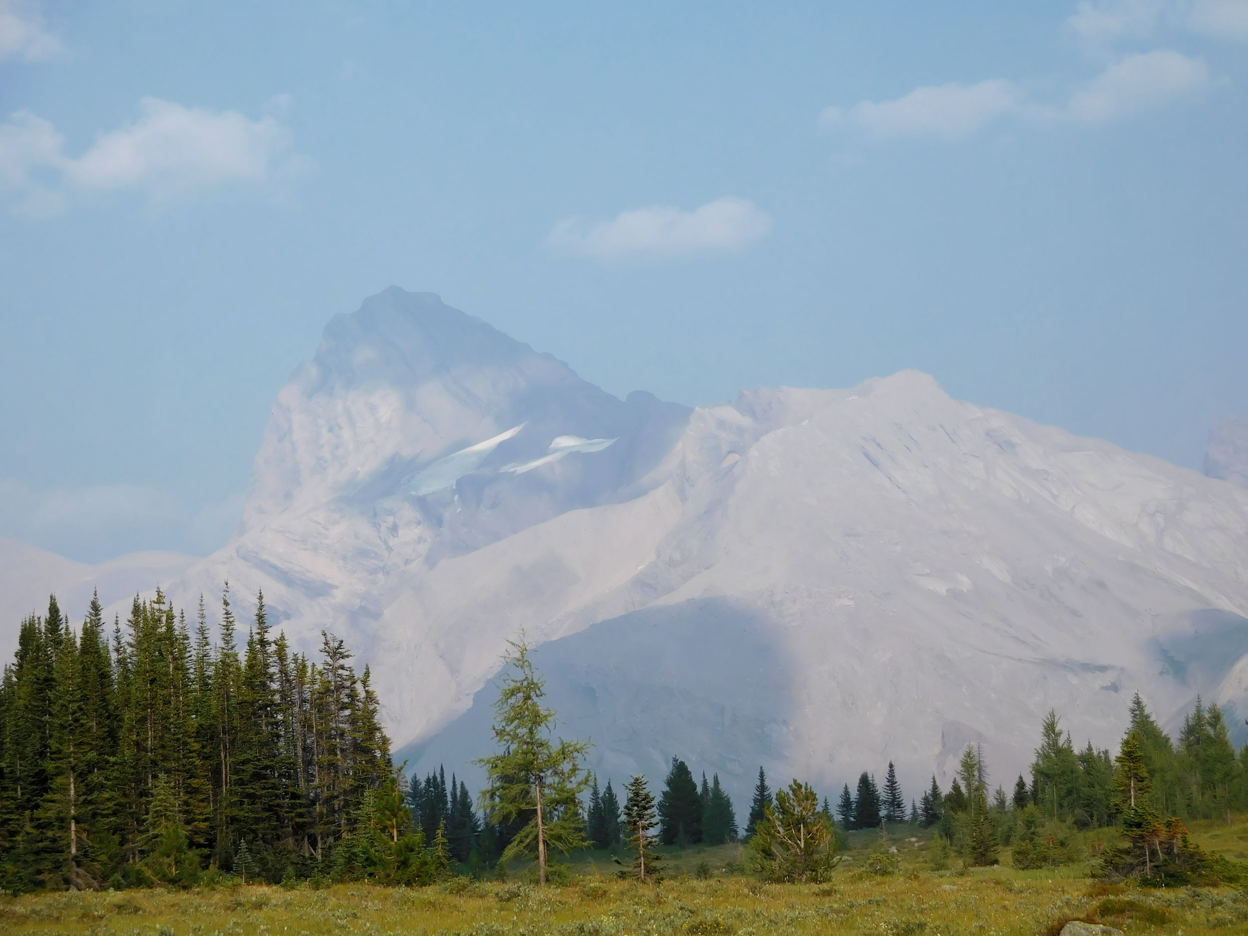
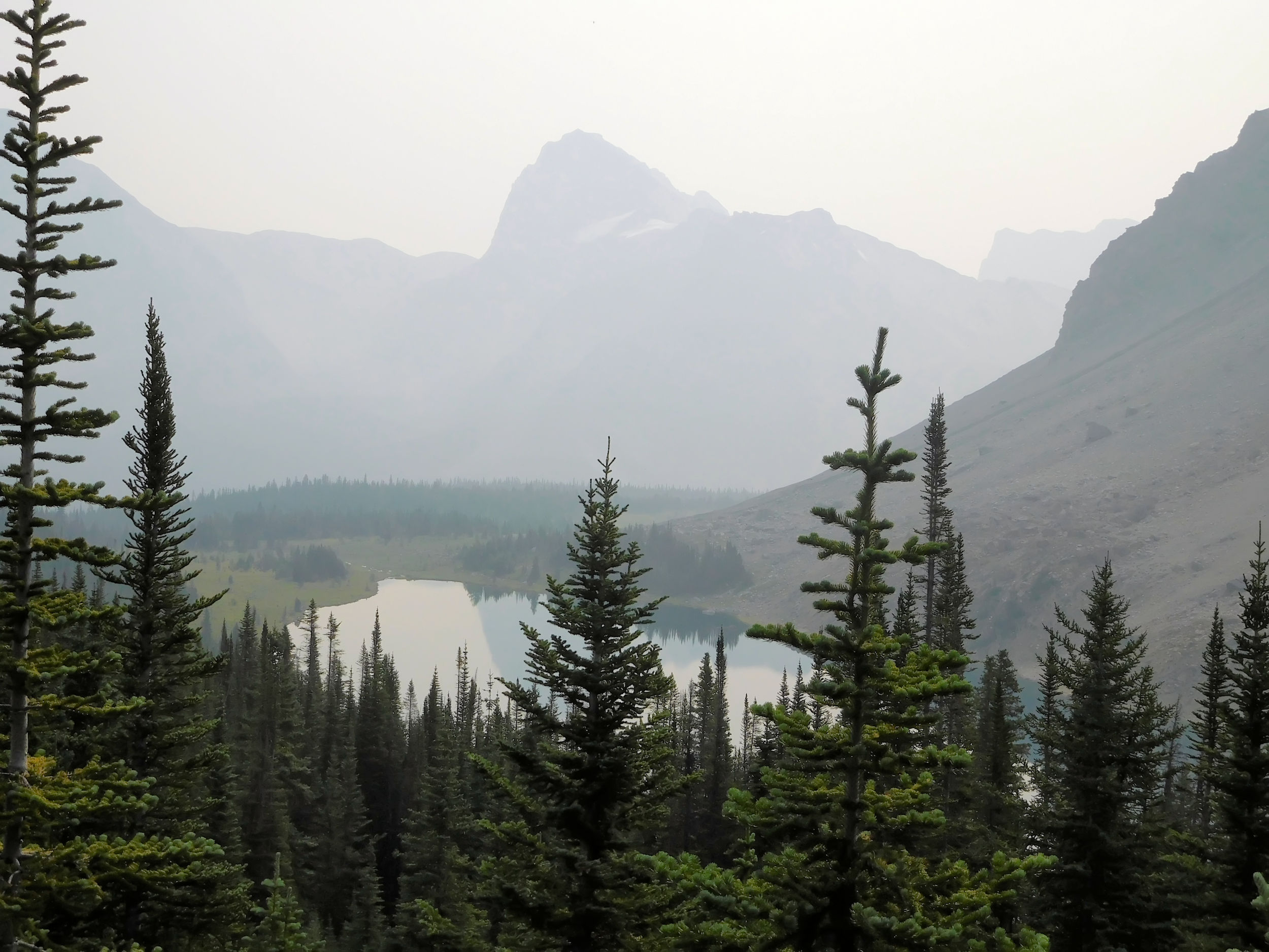
The night has been so balmy that I did not even need to close my tent flaps. At one point in the morning, the rain stops long enough for me to make a move for breakfast. I even manage to pack up while it stays dry. In spite of the gray skies, there is not much choice than to move along to the next campground. I hope for some views from North Molar Pass, with 2600 m one of the highest points in the Canadian Rockies that can be reached by a proper trail. The air is moist, almost free of smoke. I haven’t been breathing nice fresh air in a while.
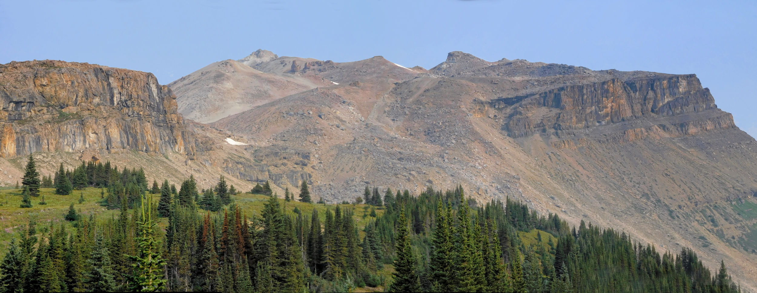
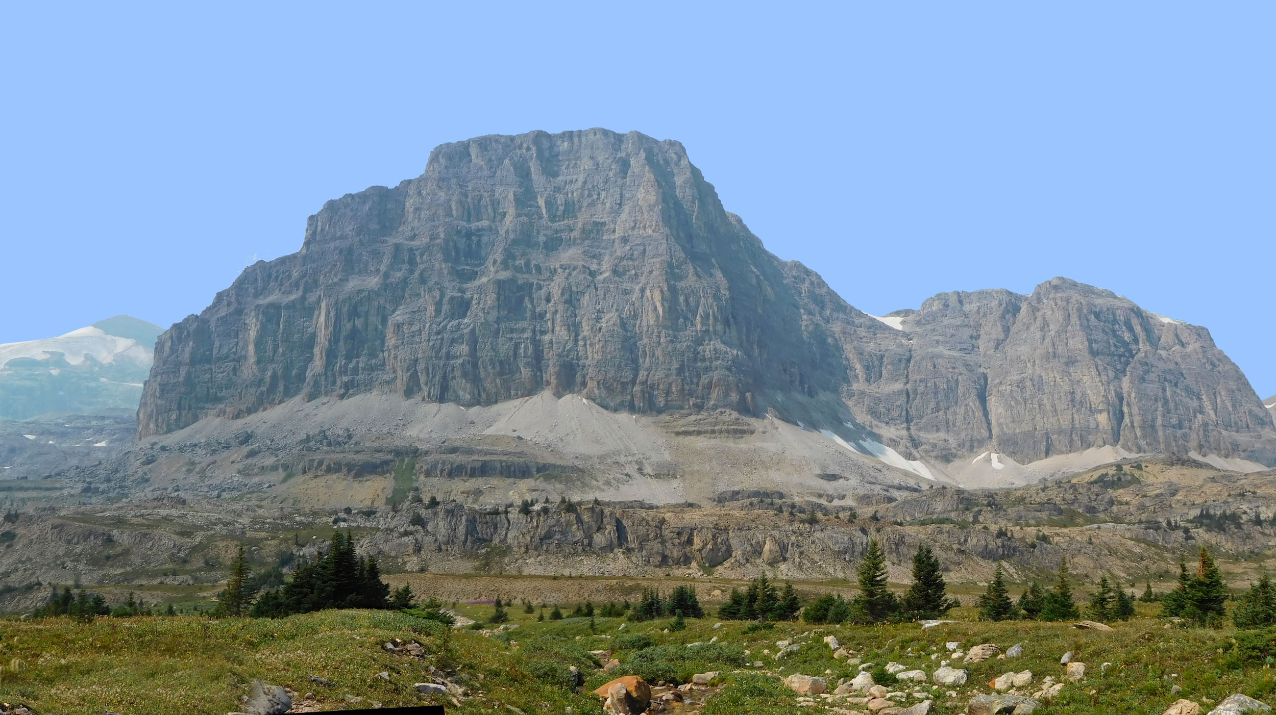
The trail continues along Mosquito Creek and I keep an eye out for the old camp of the Skyline Hikers. This is where in 2010 my passion for alpine hiking started. After about 20 minutes and about 1.2 kilometers down the trail, I discover a faint side trail towards the creek. This must be the old access, but no trace is left from the camp. The forest opens into a meadow. The eastern cliffs of the mighty Noseeum Mountain become visible to my right.
Noseeum Mountain 3002 m
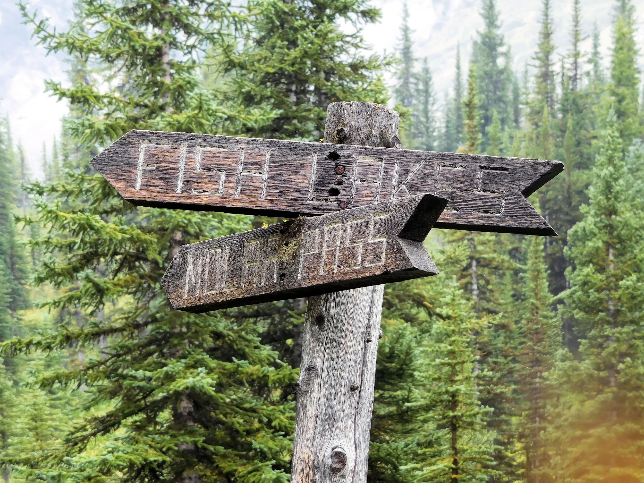
Soon I reach a fork in the trail. (South) Molar Pass is to the right. I keep left to Fish Lakes, which are on the other side of North Molar Pass and my destination for today.
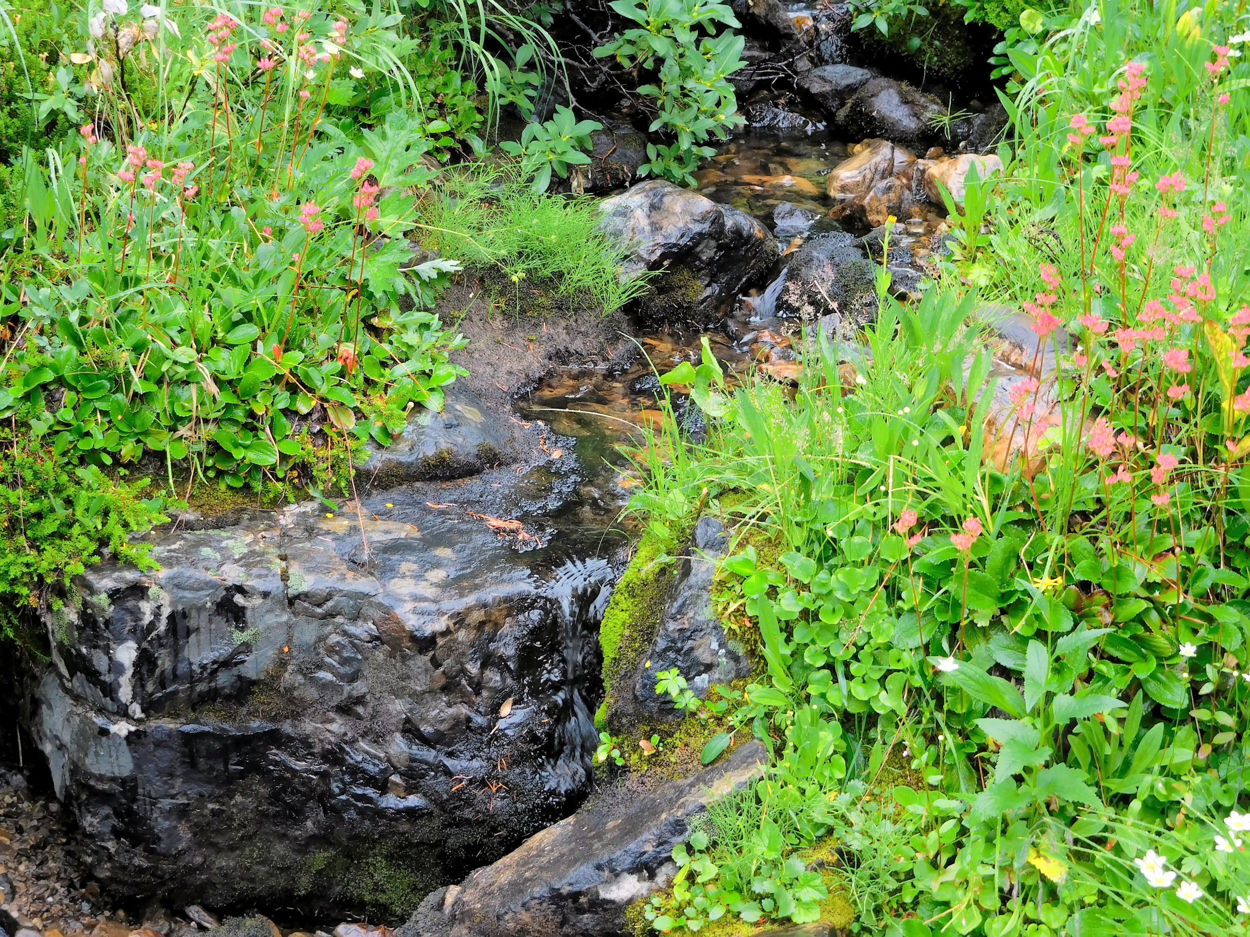
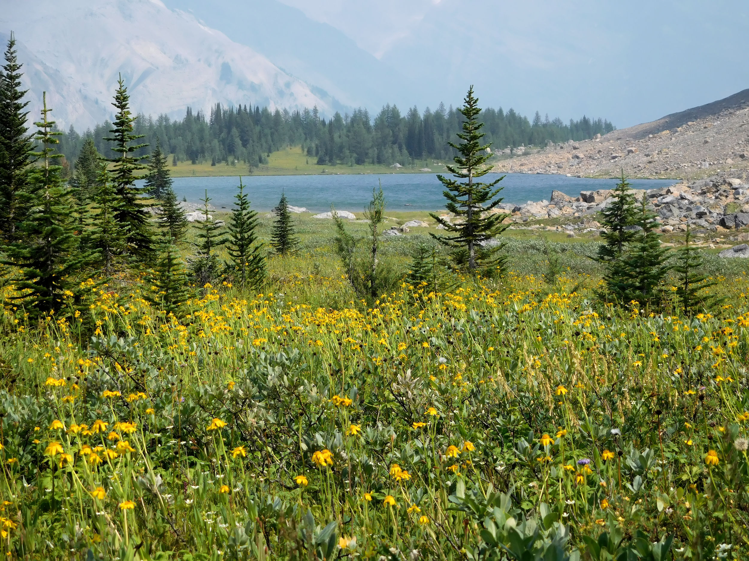
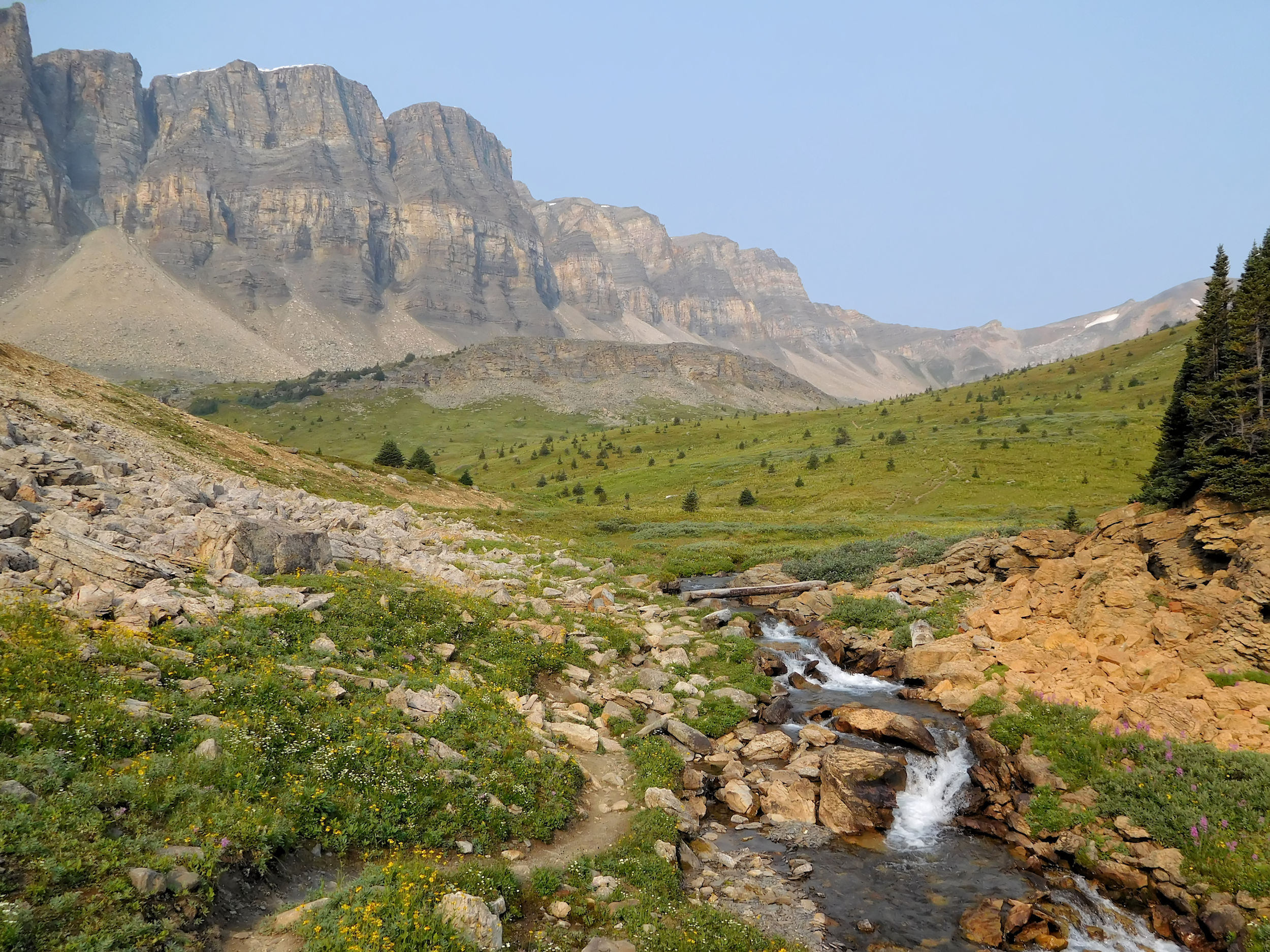
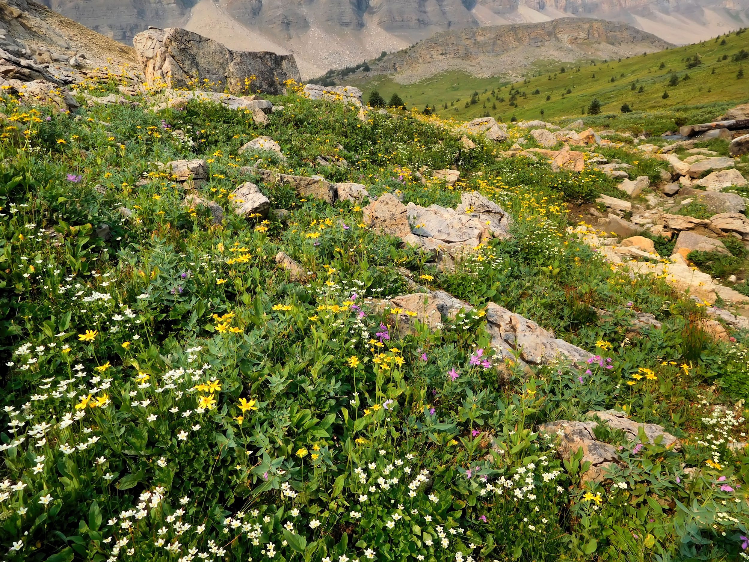
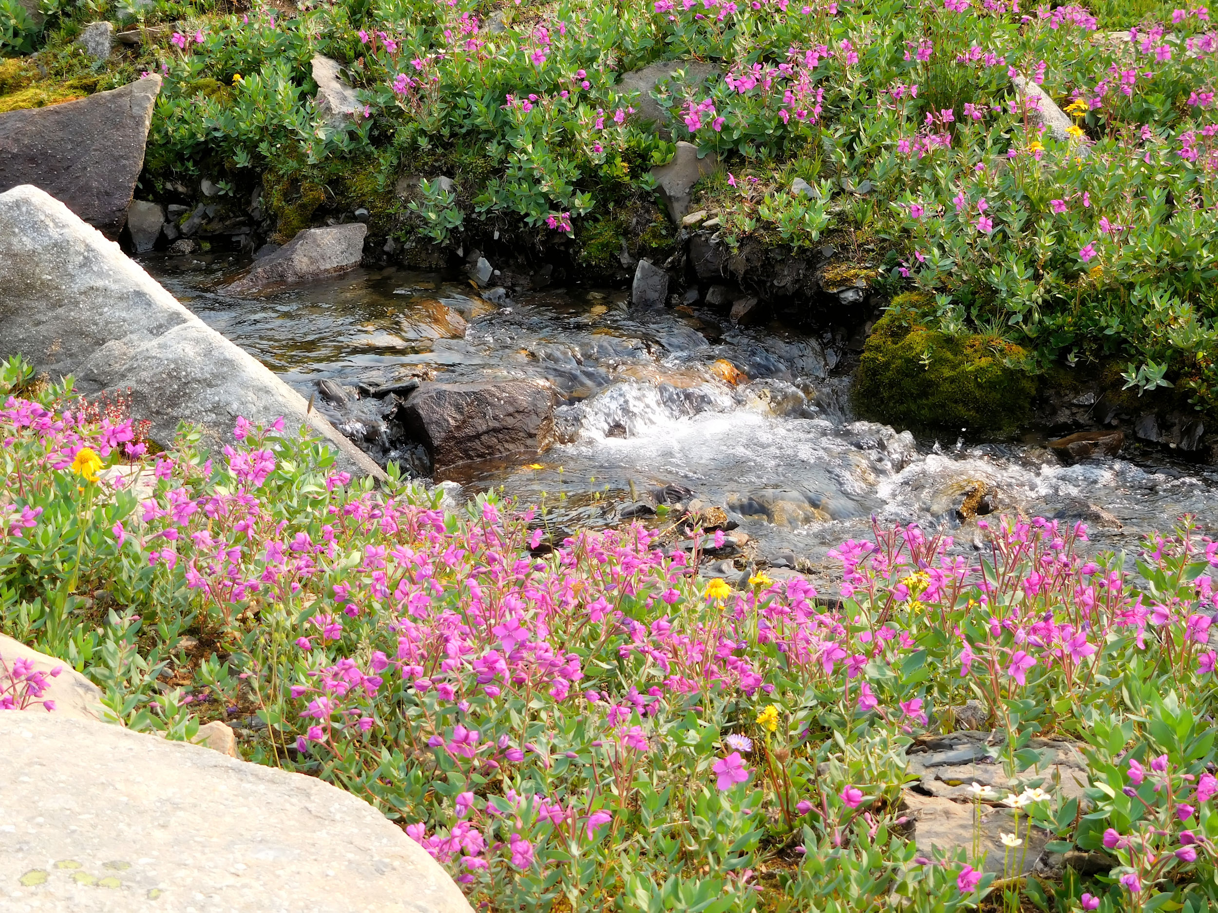
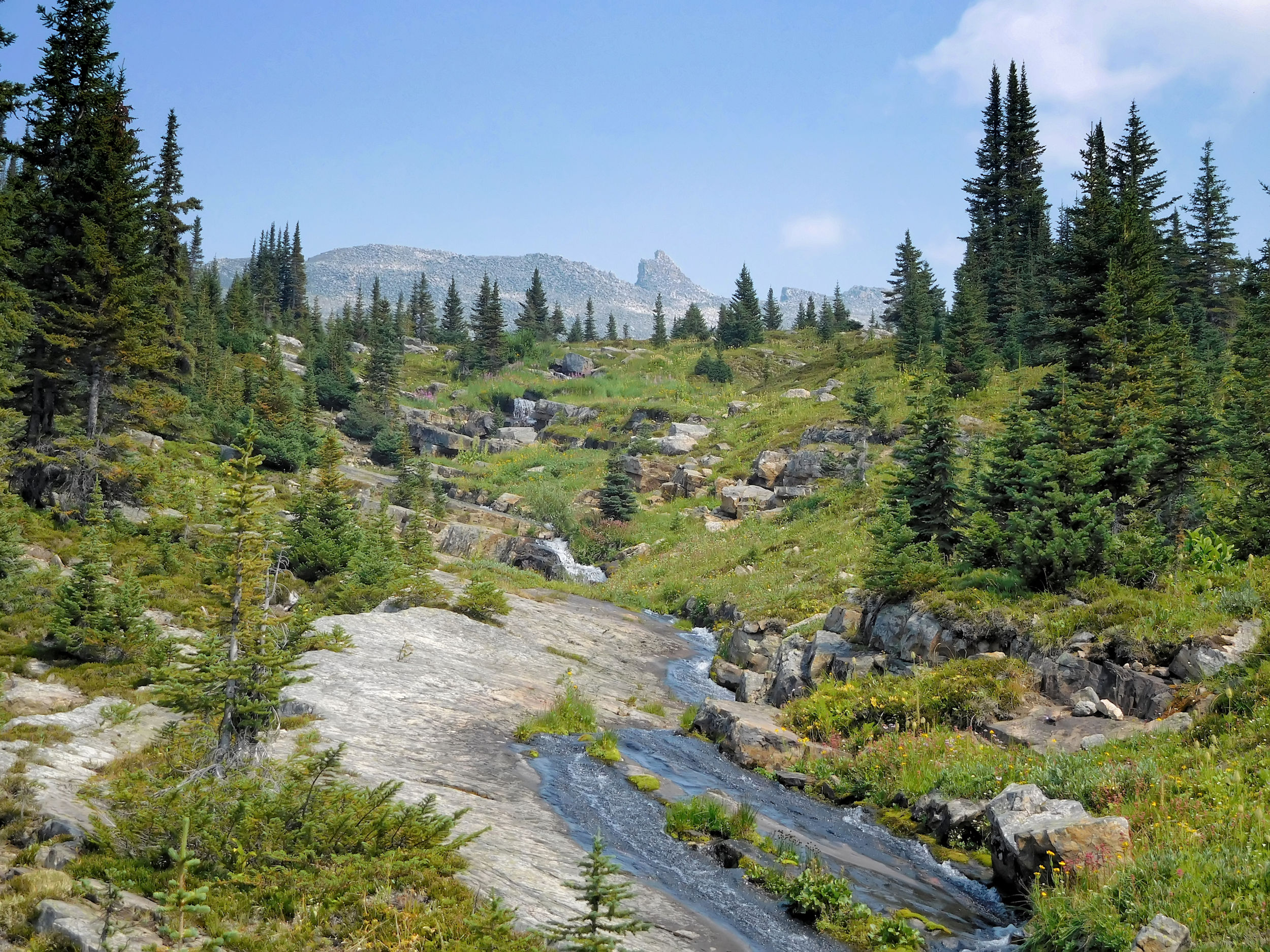
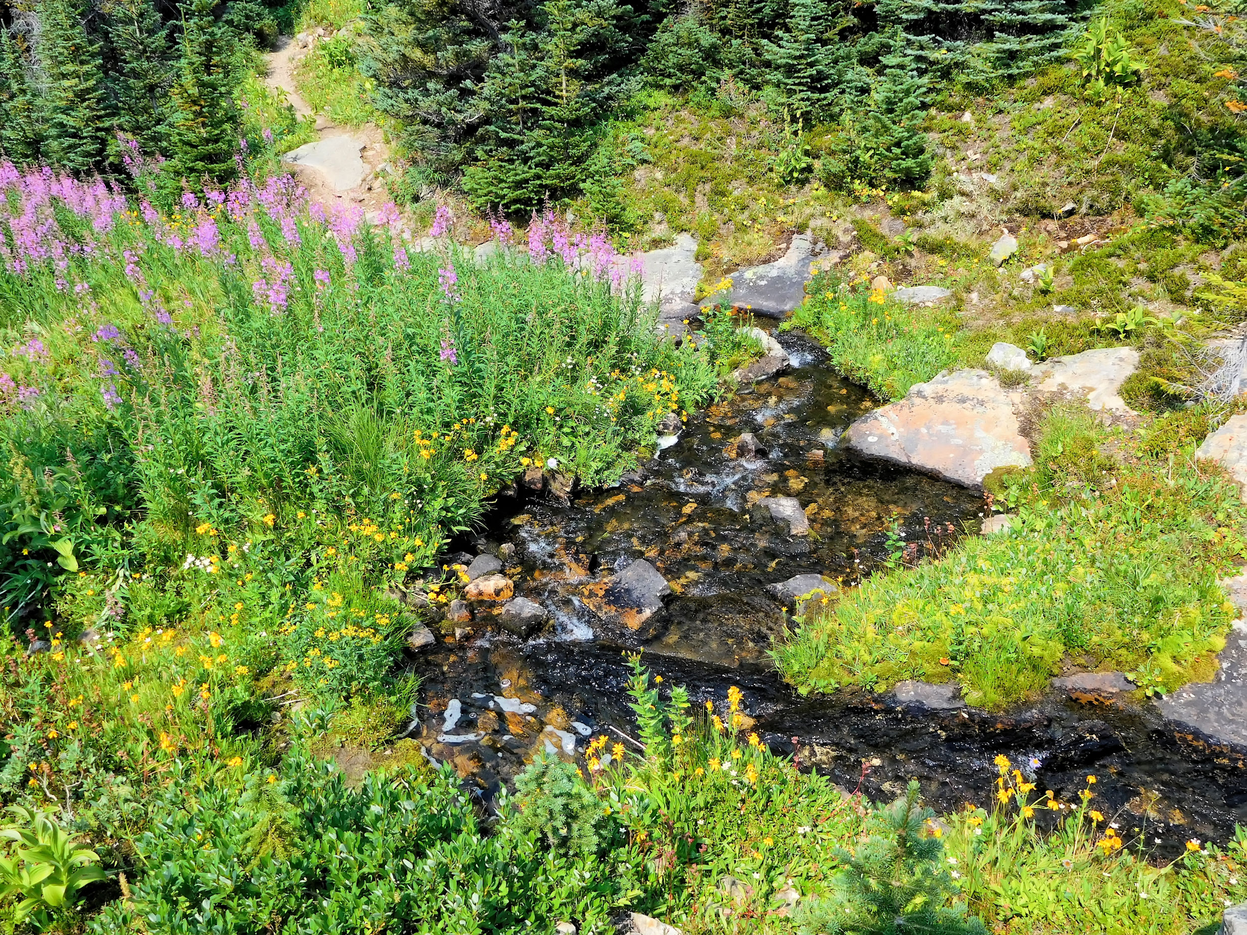
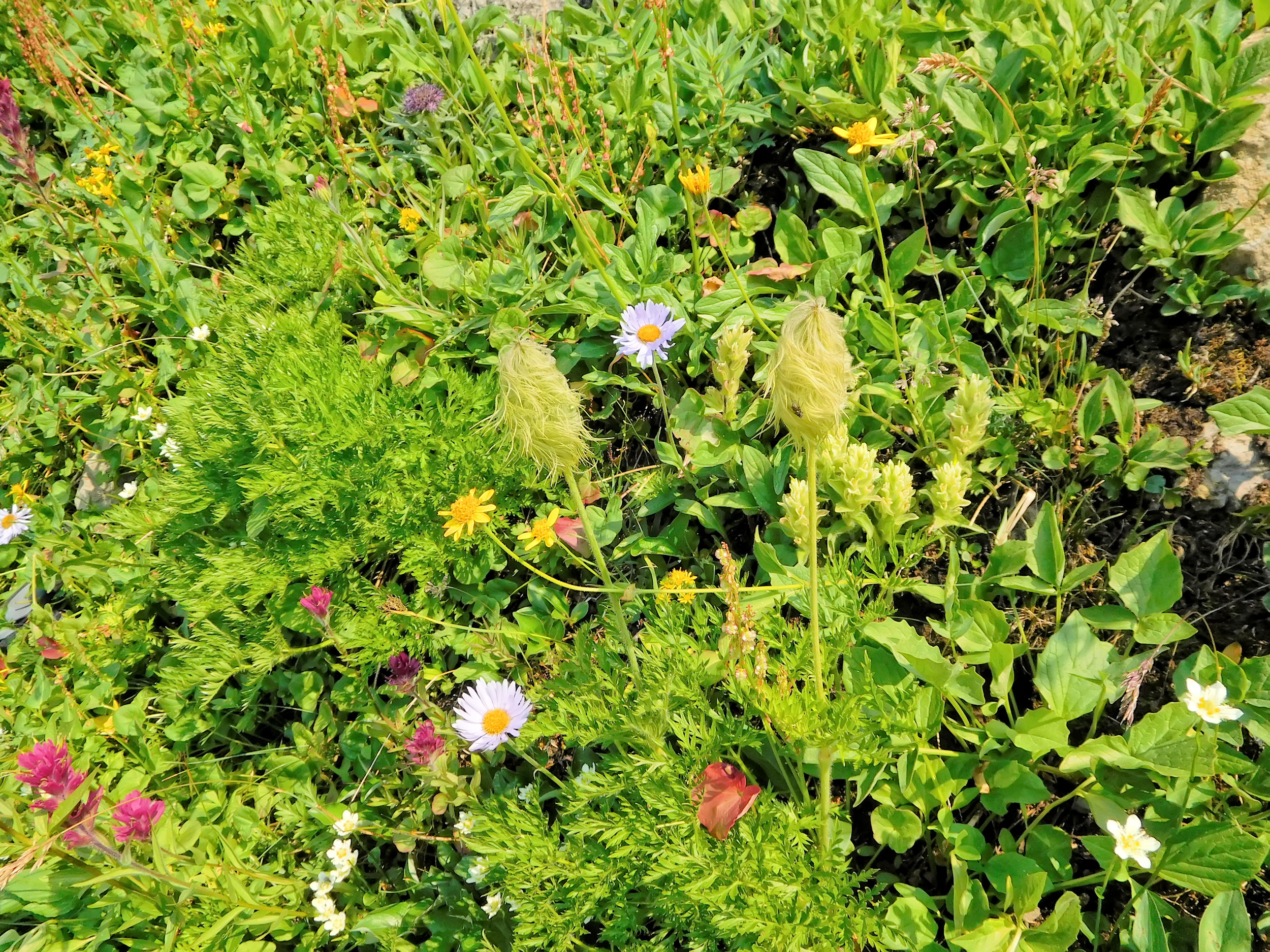
Numerous small creeks trickle through the open forest. Pretty flowers border them and make more than up for the dull skies.
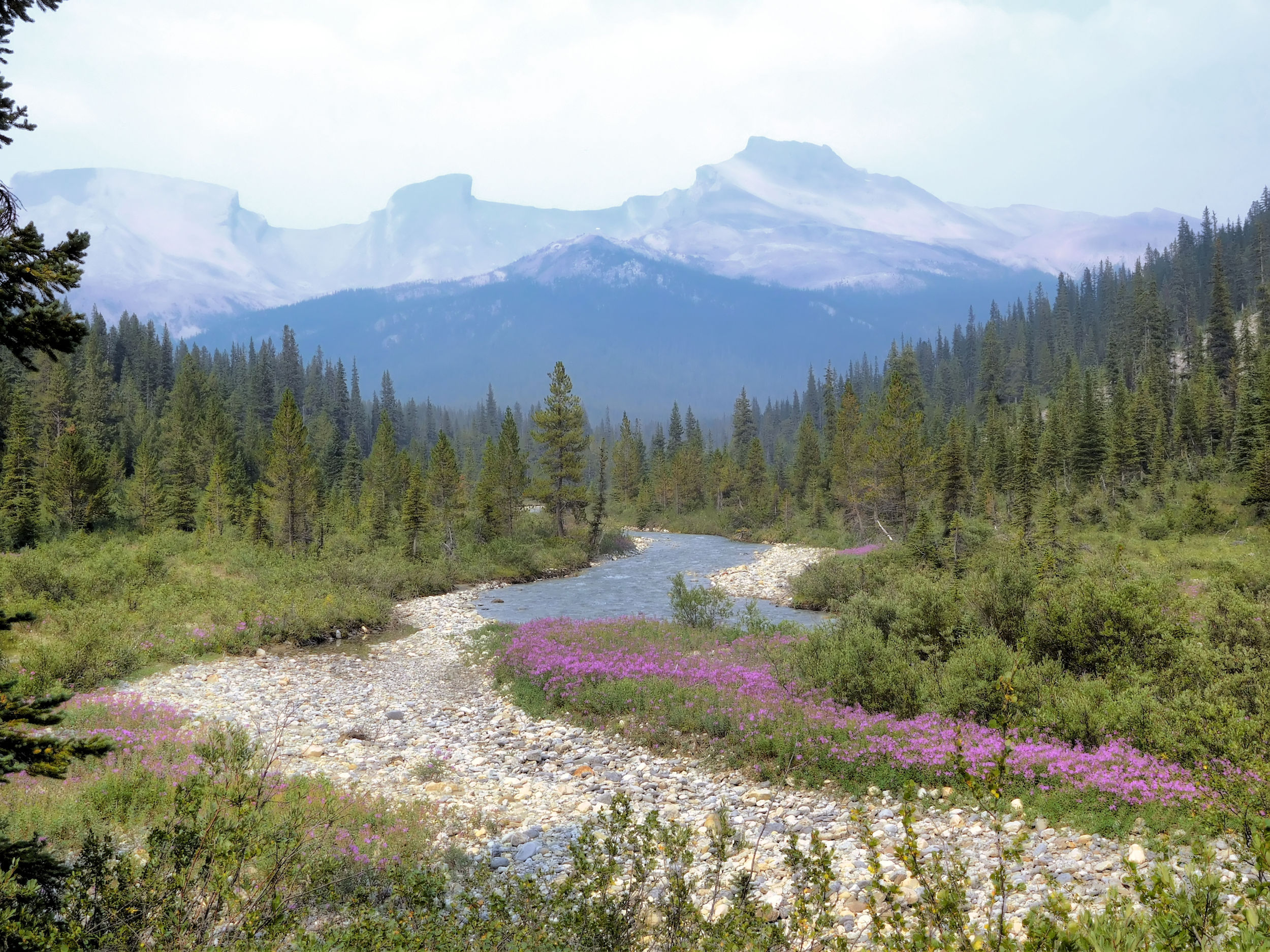
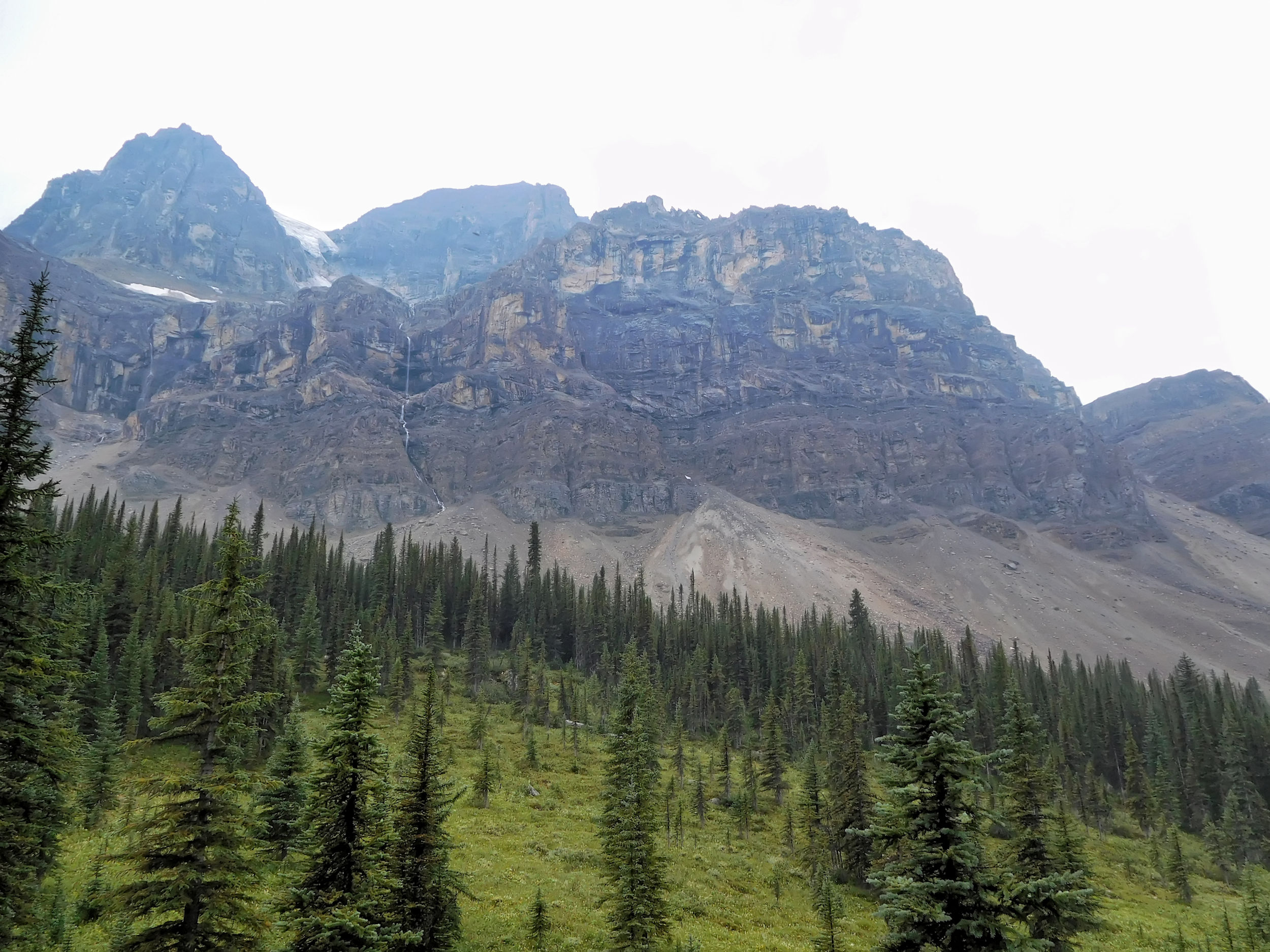
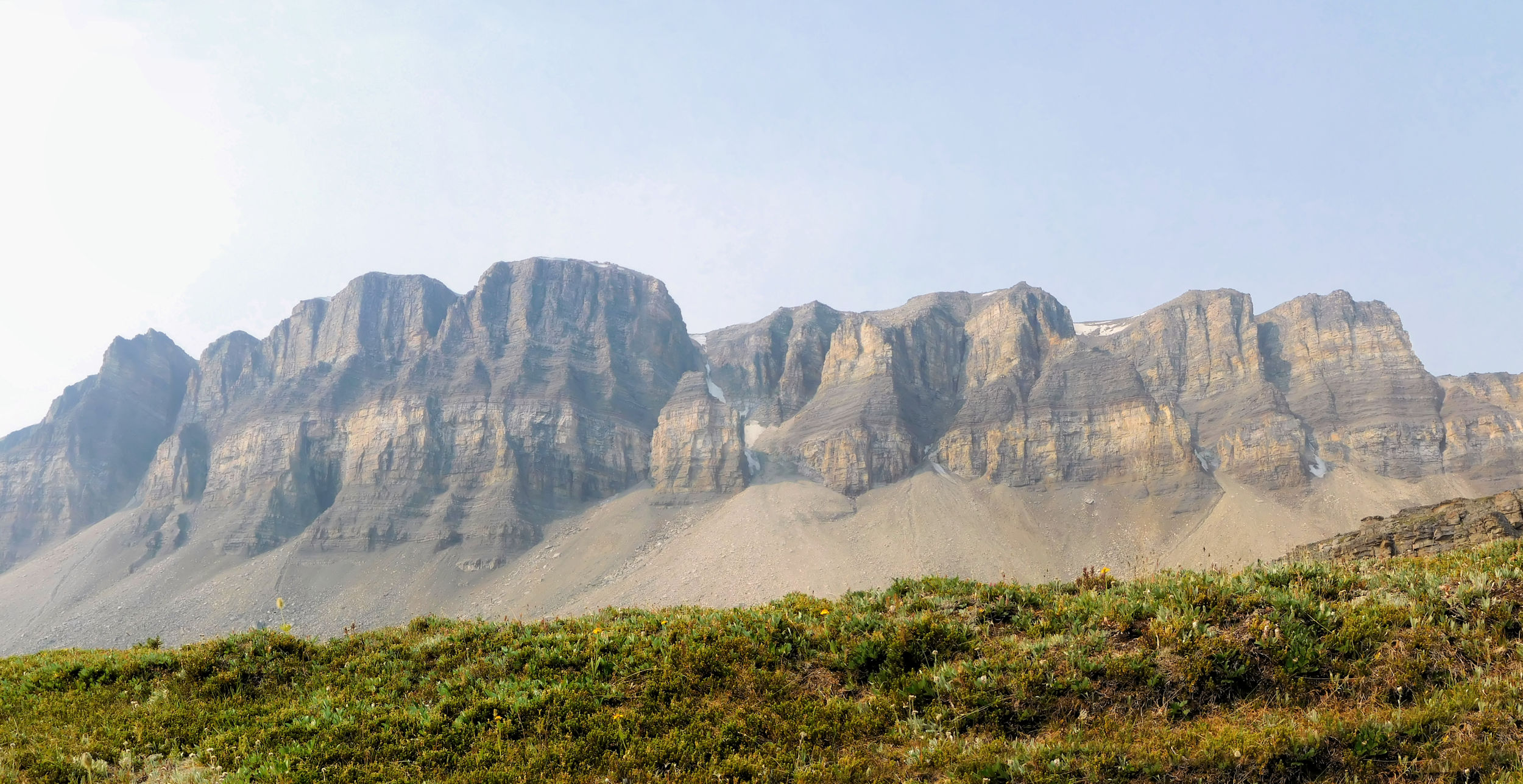
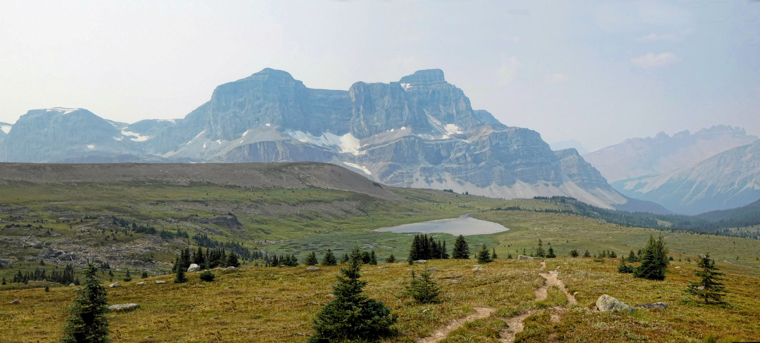
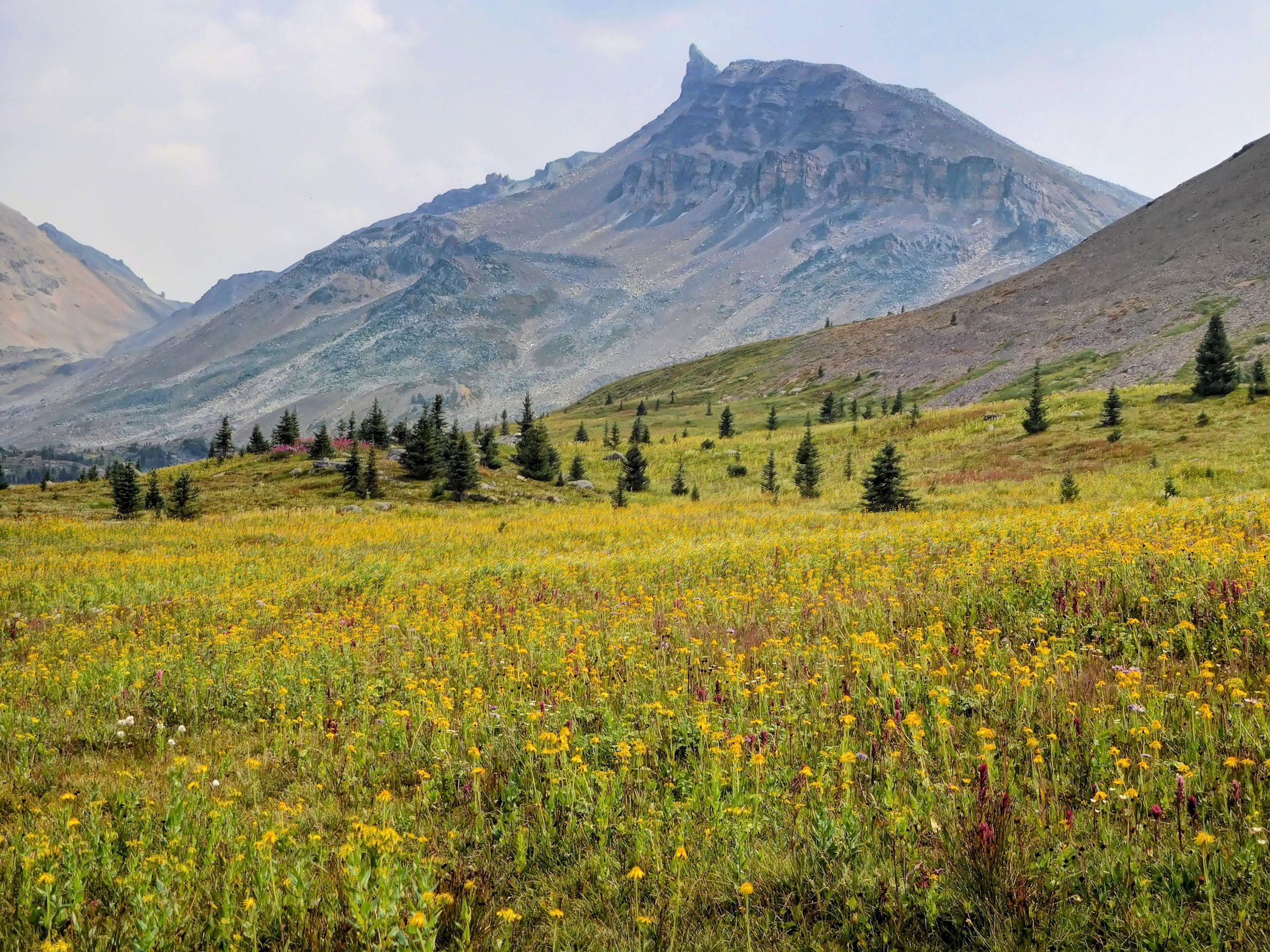
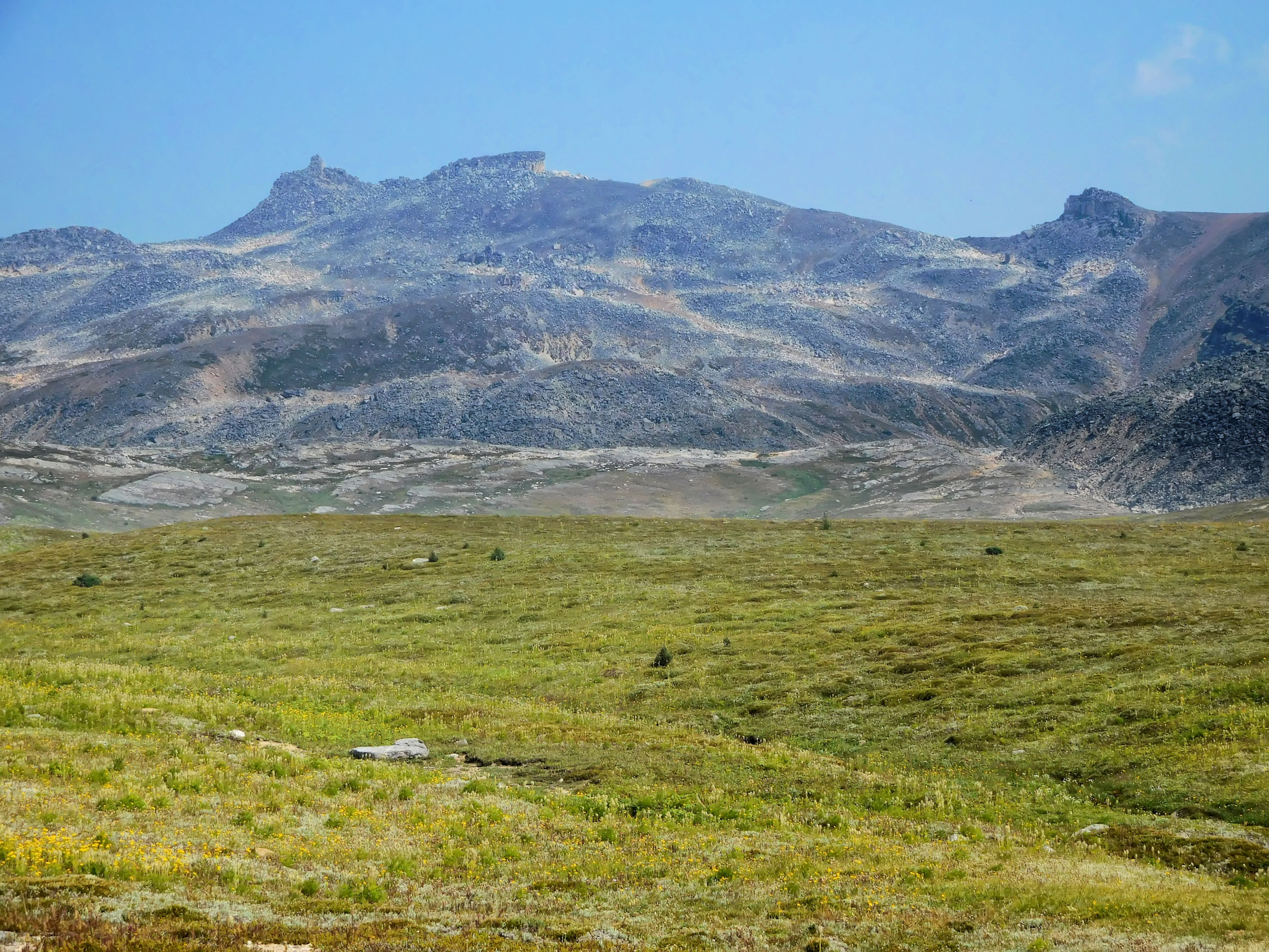
When I finally reach the wide open North Molar meadow, I am awed by its vast carpets of bright yellow Mountain Arnica. They are interspersed by large pockets of pink Fireweed. The unique shape of The Fang (or Houndstooth) dominates the scenery. It is a 2408-meter peak on the ridge between the North and South Molar passes.
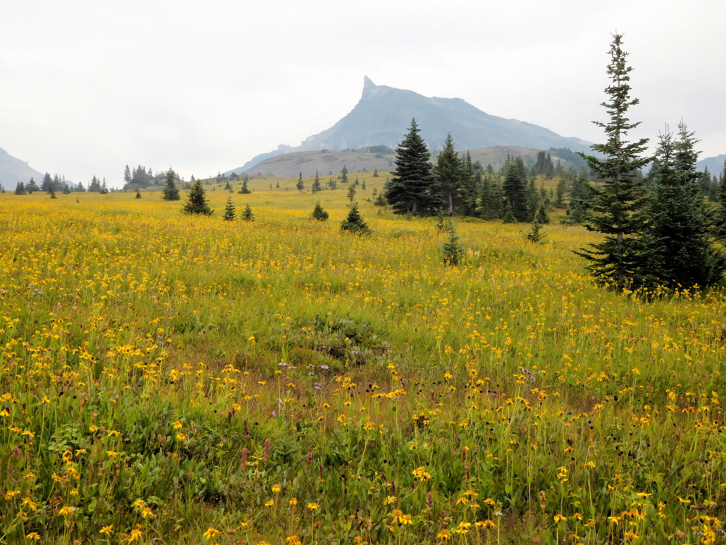
Carpets of Mountain Arnica
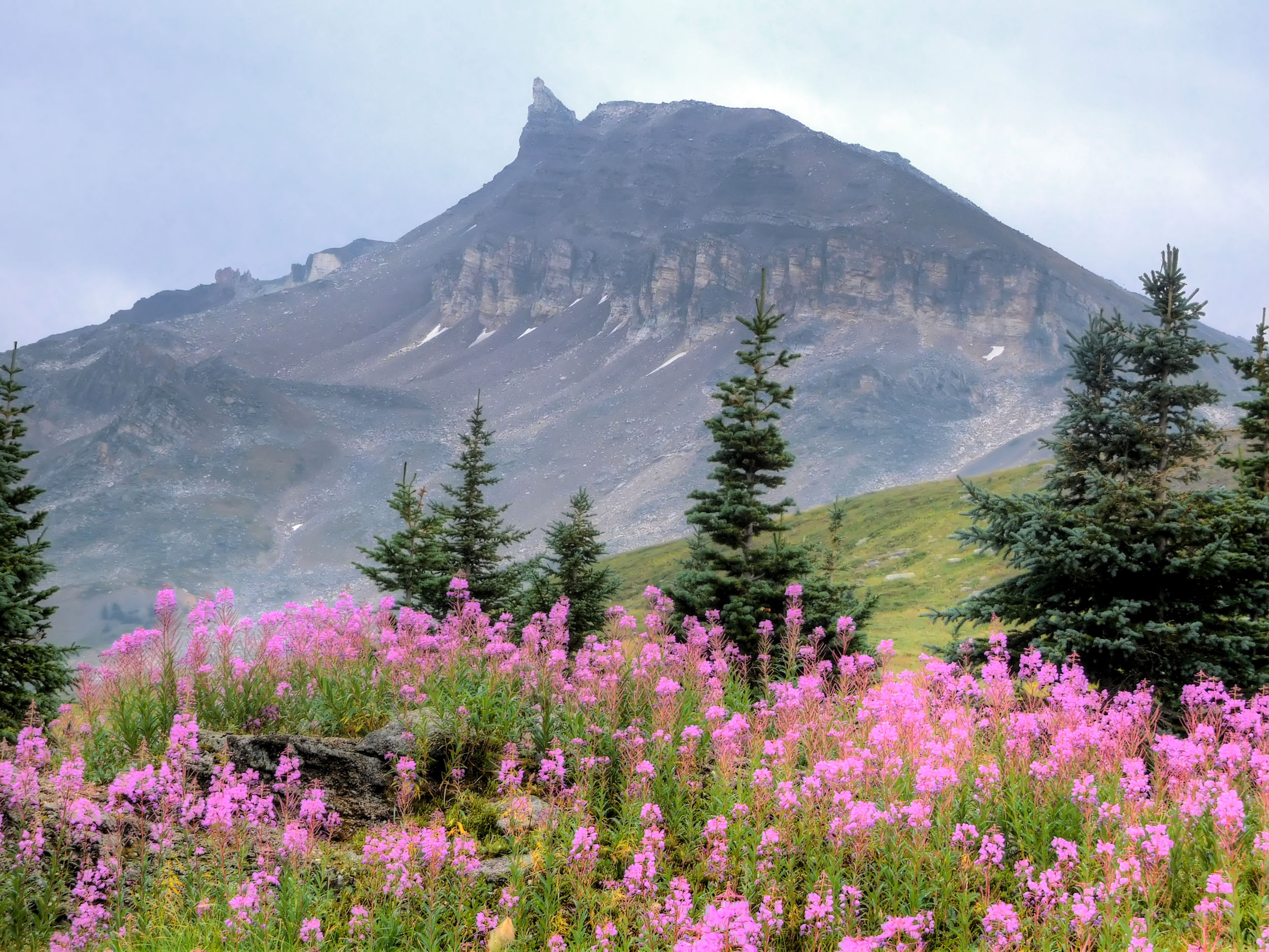
Fireweed with The Fang, 2408 m, in the background
View back towards the Mosquito Creek valley and the Dolomites
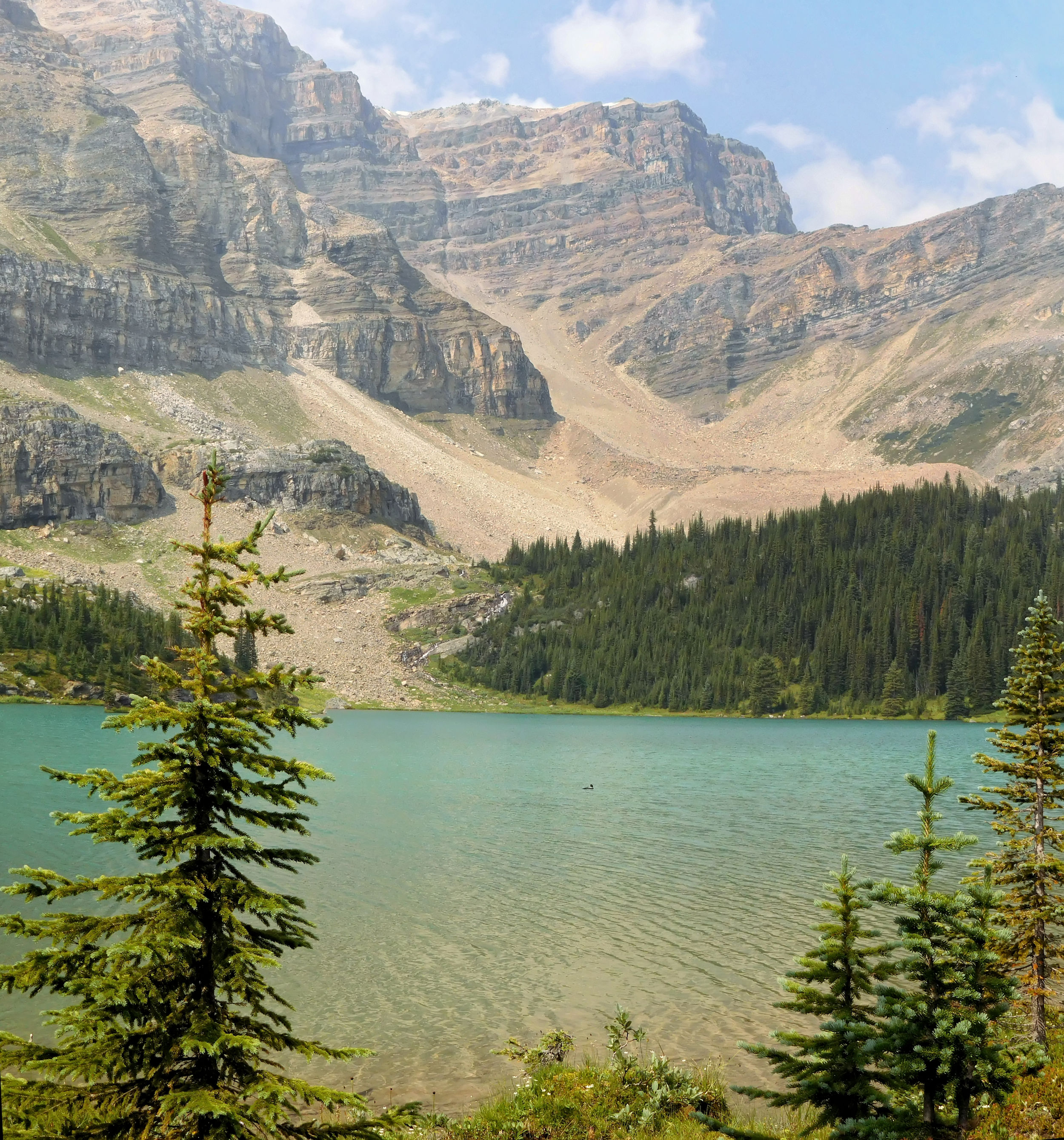
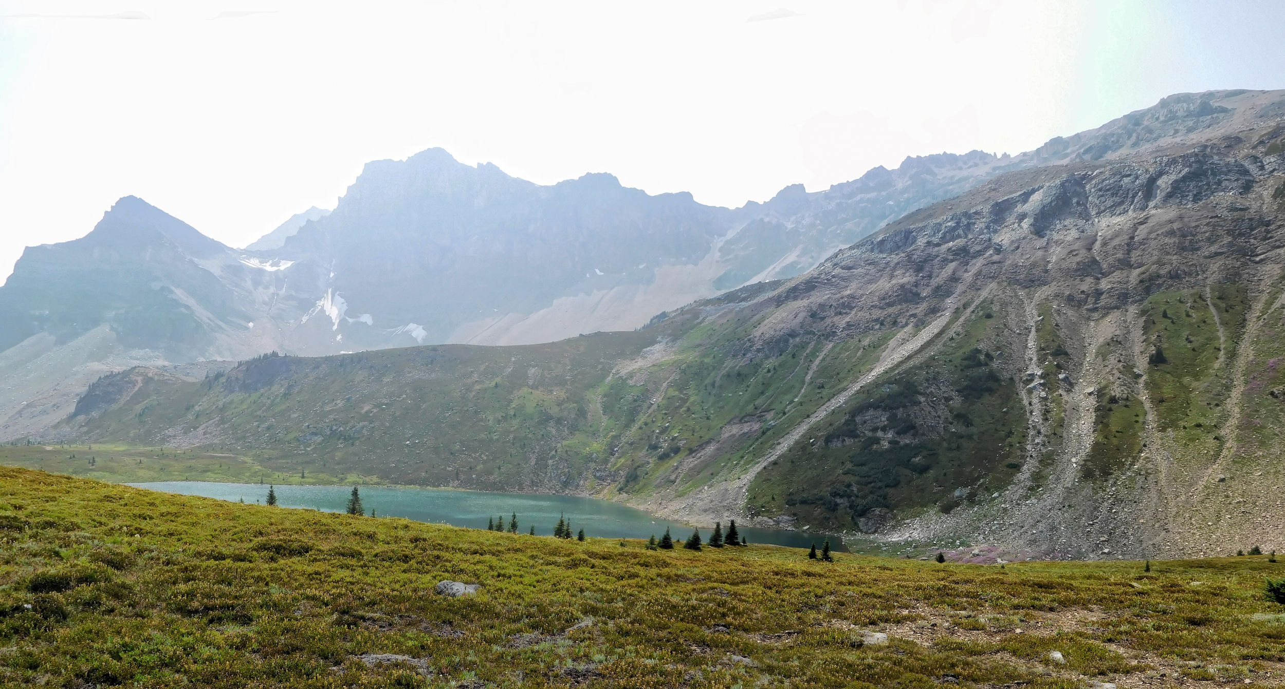
Mosquito Tarn seen from above
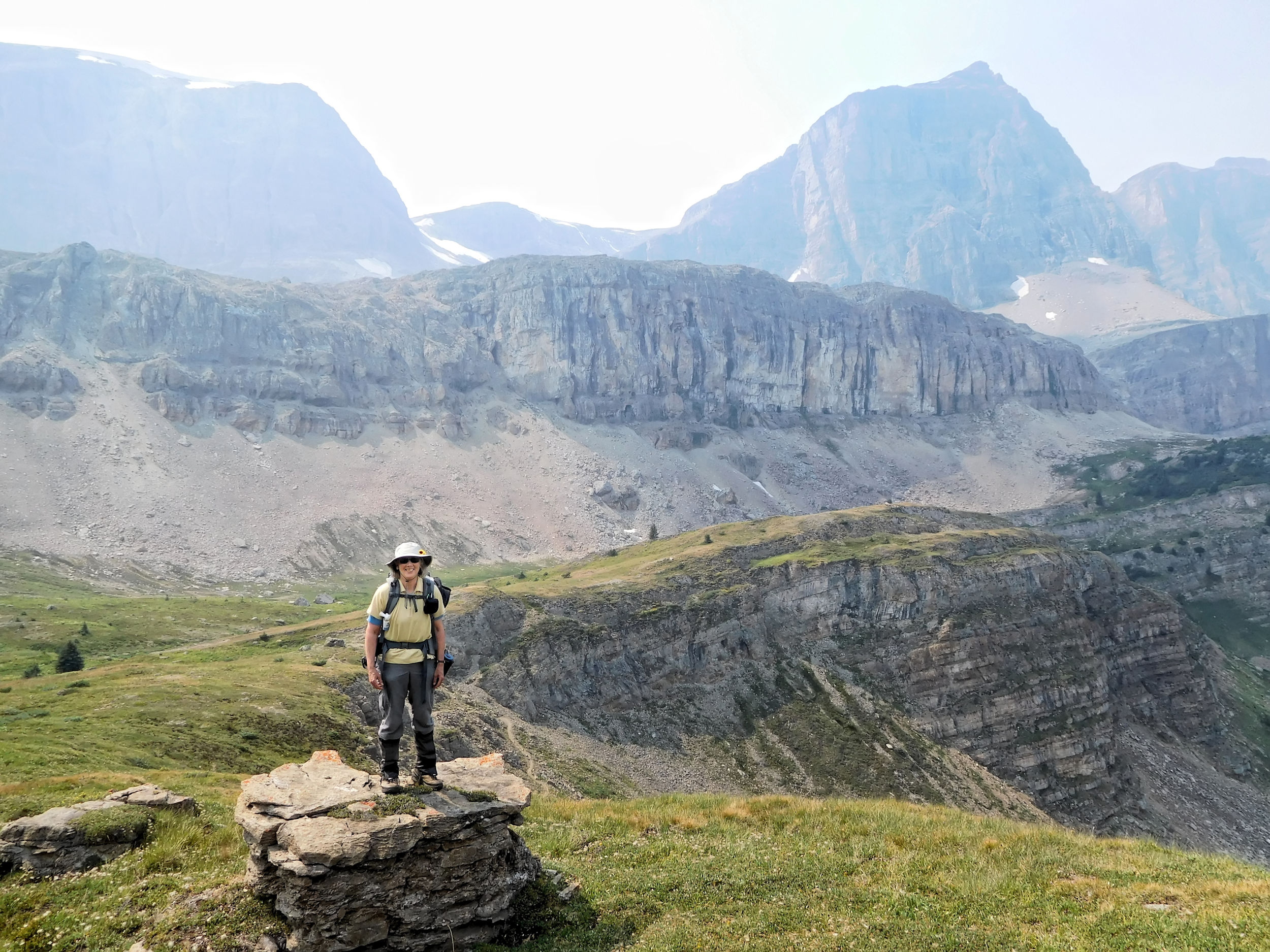
At Mosquito Tarn, a sizable pond in the middle of the meadow, I keep to its right shore when the trail suddenly ends. I check my map and realize that I have missed the crossing at the tarn’s outflow. I backtrack, hop over some rocks and re-discover the trail on the other side of the tarn. Two hikers approach. They are Parks Canada rangers and on the return from an investigative trip to find out about hikers in the Fish Lakes and Devon Lakes areas. They met plenty at the campground but none in the Pipestone valley and beyond. As I am going to day-hike that area, they are happy to include me into their studies. Who knows, maybe they will follow up on my suggestion to provide a bear pole near remote Devon Lakes. They have a lot of advice and show me some nice pictures on their cell phones.
When I continue on my way, bad weather moves in from the valley. At first it looks like it is just fog catching up with me, but further up towards North Molar Pass it starts to drizzle. A group of ten young hikers comes down the pass and they tell me that I will have the campground to myself. Not something I am keen on in grizzly bear country. It seems that many people have cancelled their hiking trips because of smoke and bad weather and just don’t show. It is a shame if they don’t cancel their highly sought-after reservations to return them into the booking system.
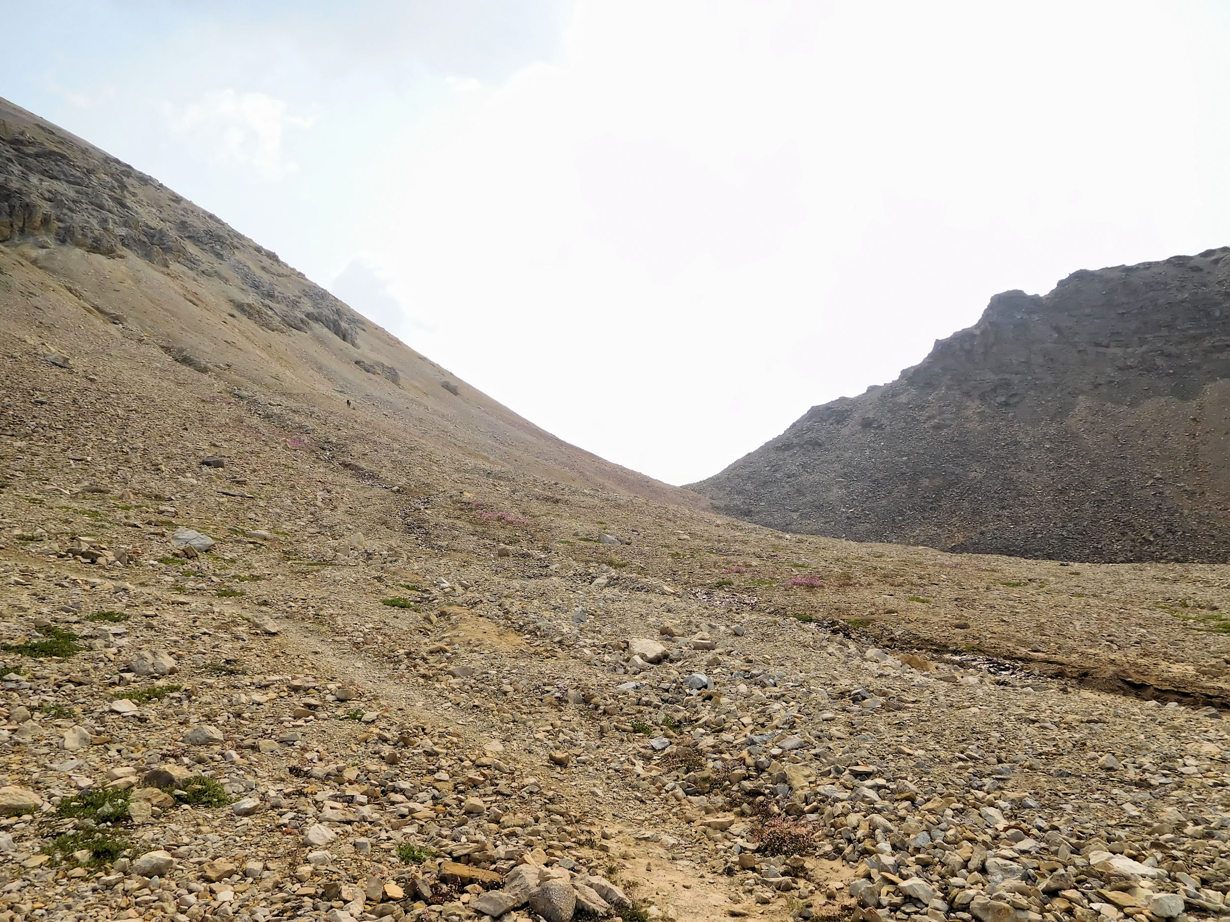
The final ascent to the pass is a bit of a slog through gravel. The trail is narrow and steep but well-trodden. It would be visible even in a whiteout, I think. Without taking any pictures of the somewhat gloomy sights, I cross over the pass and walk down the other side. Here it starts raining in earnest and the mountains have all but disappeared in low hanging clouds. I can always hope for sunny views on my return trip along this trail. Still, I don’t mind the rain all that much. The temperature is mild in spite of the altitude, and the air is clean. I worry about my hiking boots, though. They are soaking wet by now.
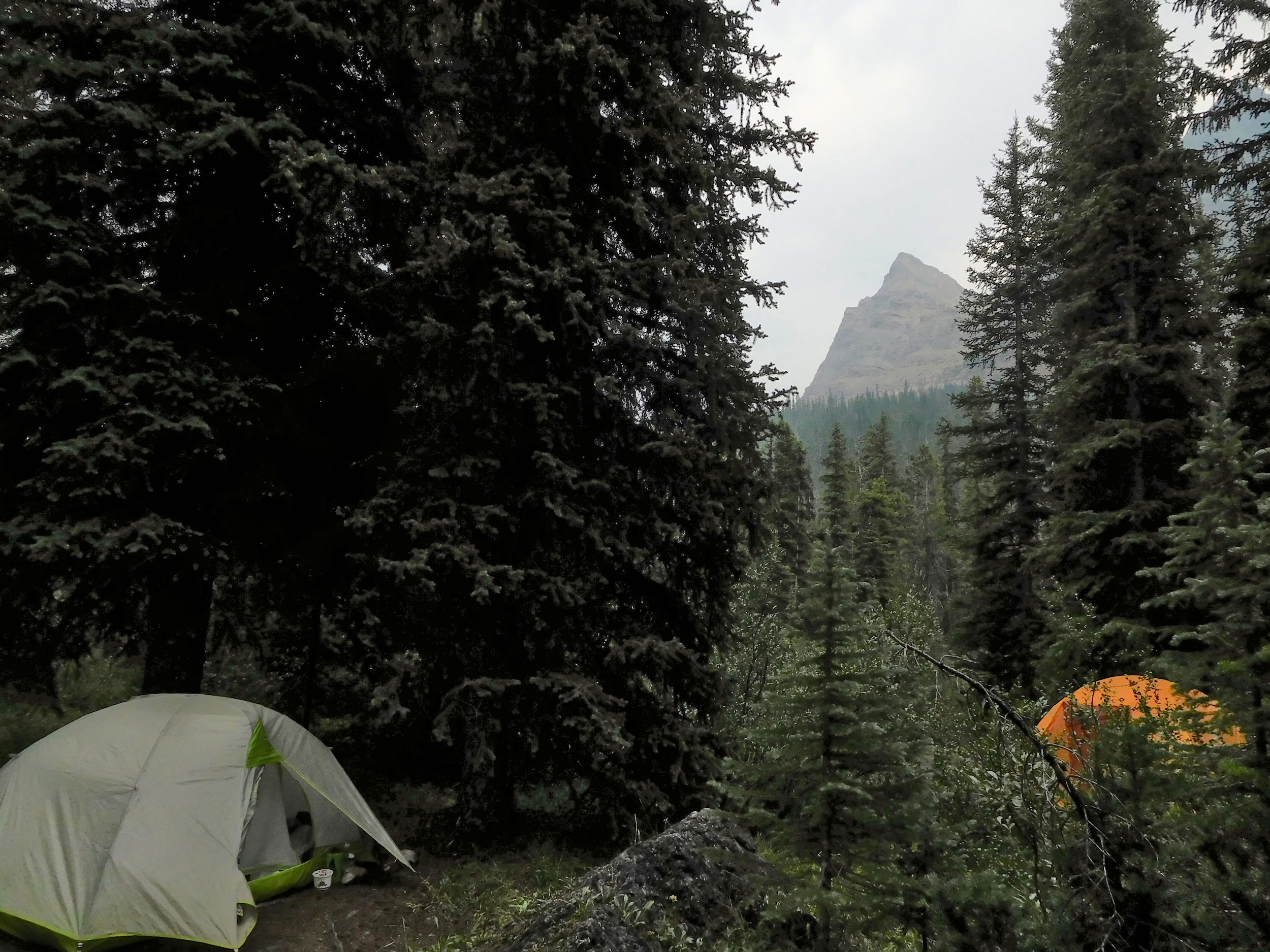
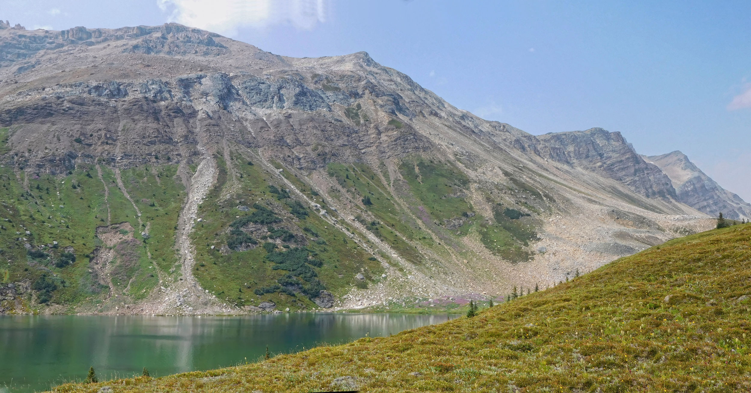
I reach a deserted Fish Lakes campground and immediately put up my tent under some trees. It is still wet from last night, so I don’t care about the light rain during setup. Covered in my poncho, I sit down by the lake and have a late lunch. Even in this weather, it is a serene and beautiful place.
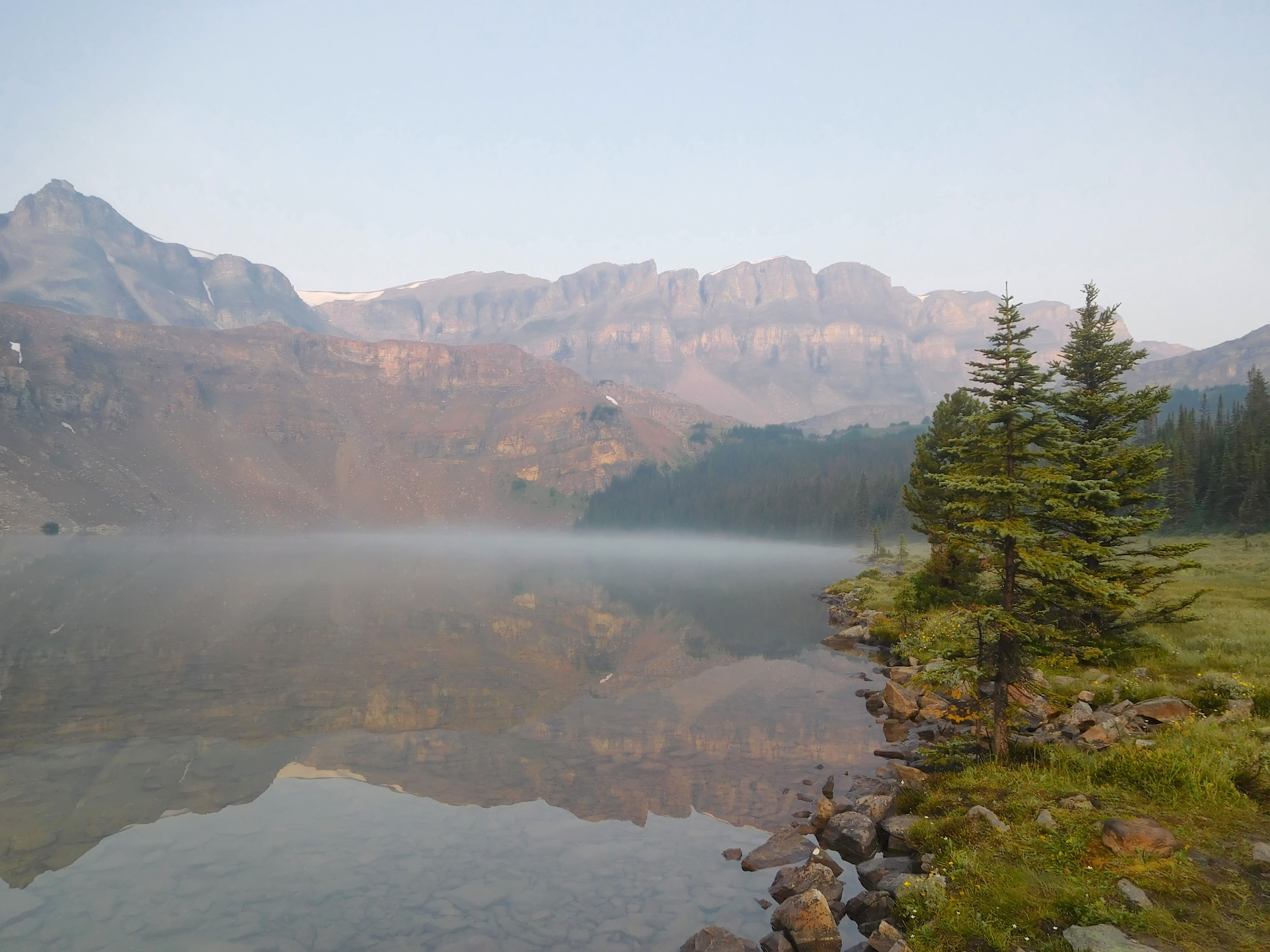
Upper Fish Lake
Being wet and sitting still, makes me feel cold after a while. I take shelter in the tent and change out of my wet clothes. The rain becomes heavy at times. I start worrying whether I brought enough changes of clothes, especially socks. It doesn’t look like I will be drying things on the clothesline any time soon. My boots are a mess. I keep them in the tent vestibule, but discover soon that a rivulet is running through there. None of the tent pads at Fish Lakes campground are level and they are prone to flooding. That would have been something to tell the park rangers this morning, had I known about it then. I find some rocks to put under the boots and keep them out of the pooling water. In the other vestibule, I leave the wet poncho, gaiters and rain pants to their fate. They will get even muddier there.
Cooking dinner in this rain is out of the question. I cannot get more of my clothing wet. So I eat a cold meal of beef crumbs with broccoli that I had started re-hydrating in the morning, with a nutrition bar on the side. Oh well, this is camping on its downside. Most of the time I am lucky enough, and it is only one rainy day out of four or five sunny ones. I leave the tent just one more time in order to hang my food at the bear pole.
Late in the evening I hear other campers setting up. At least I am not by myself out here any longer. During the night, a howl wakes me up. A wolf, that close? No, the neighbours brought a husky dog with them that is having a bad dream. At some point during the night, the rain stops and all is quiet.
| Distance | 15.2 km |
| Time | 4 ½ hrs |
| Min. Elevation | 2137 m |
| Max. Elevation | 2325 m |
| Ascent | 188 m |
| Cum. Ascent | 749 m |
| Cum. Descent | 749 m |
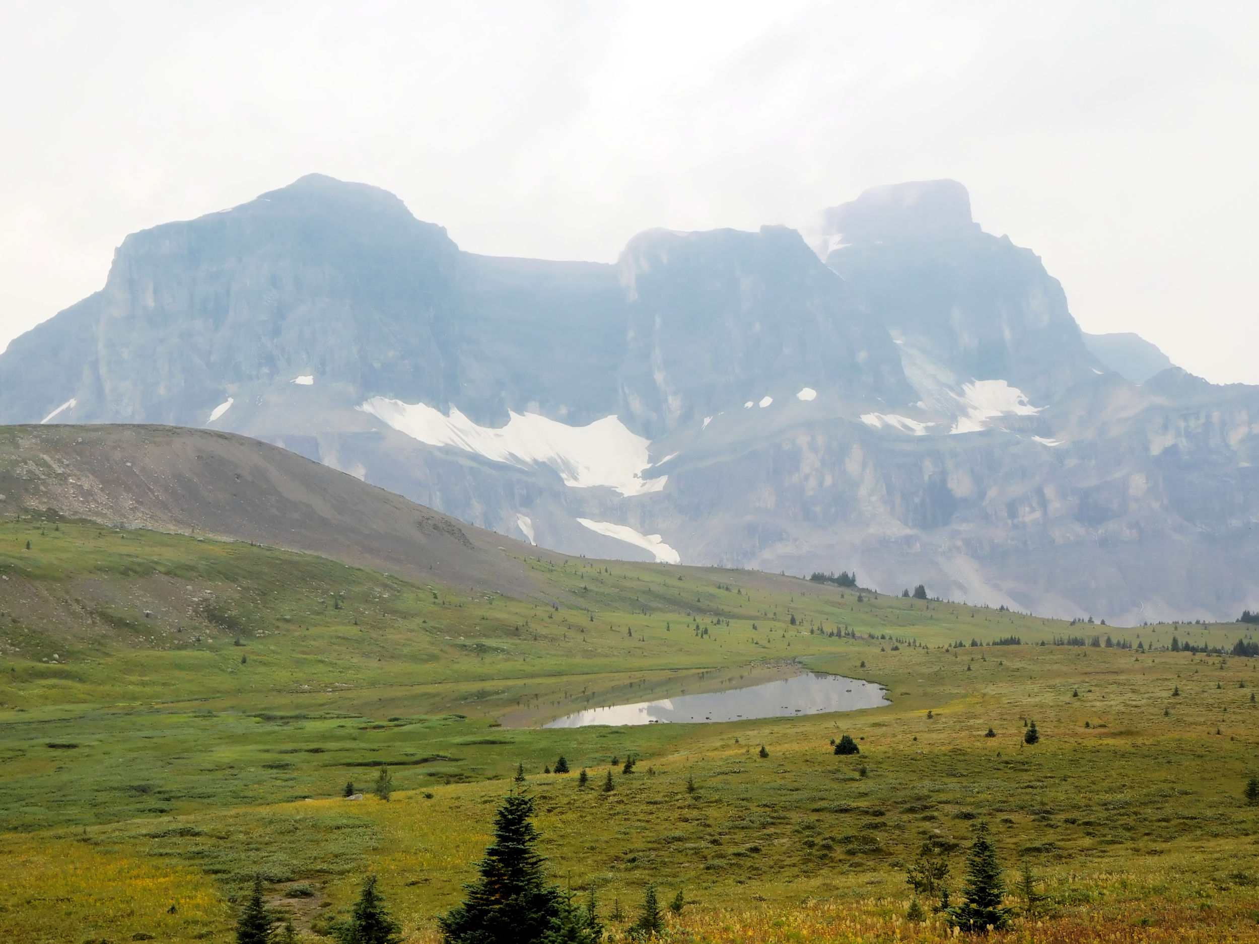
The next morning, the sky is of a pale blue and hazy. Hard to say how much is fog and how much is smoke. Yet, Upper Fish Lake shows all its beauty.
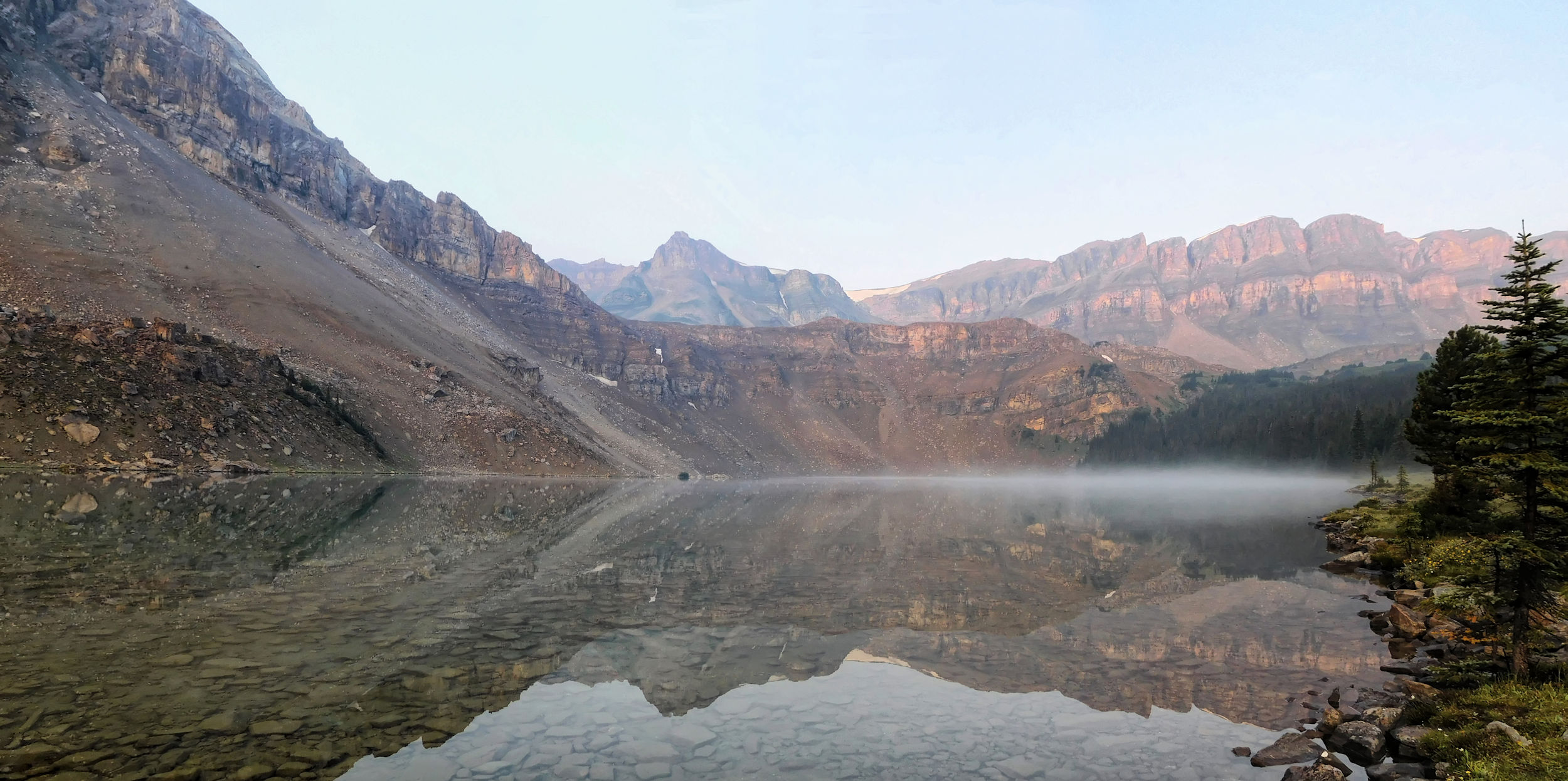
Upper Fish Lake
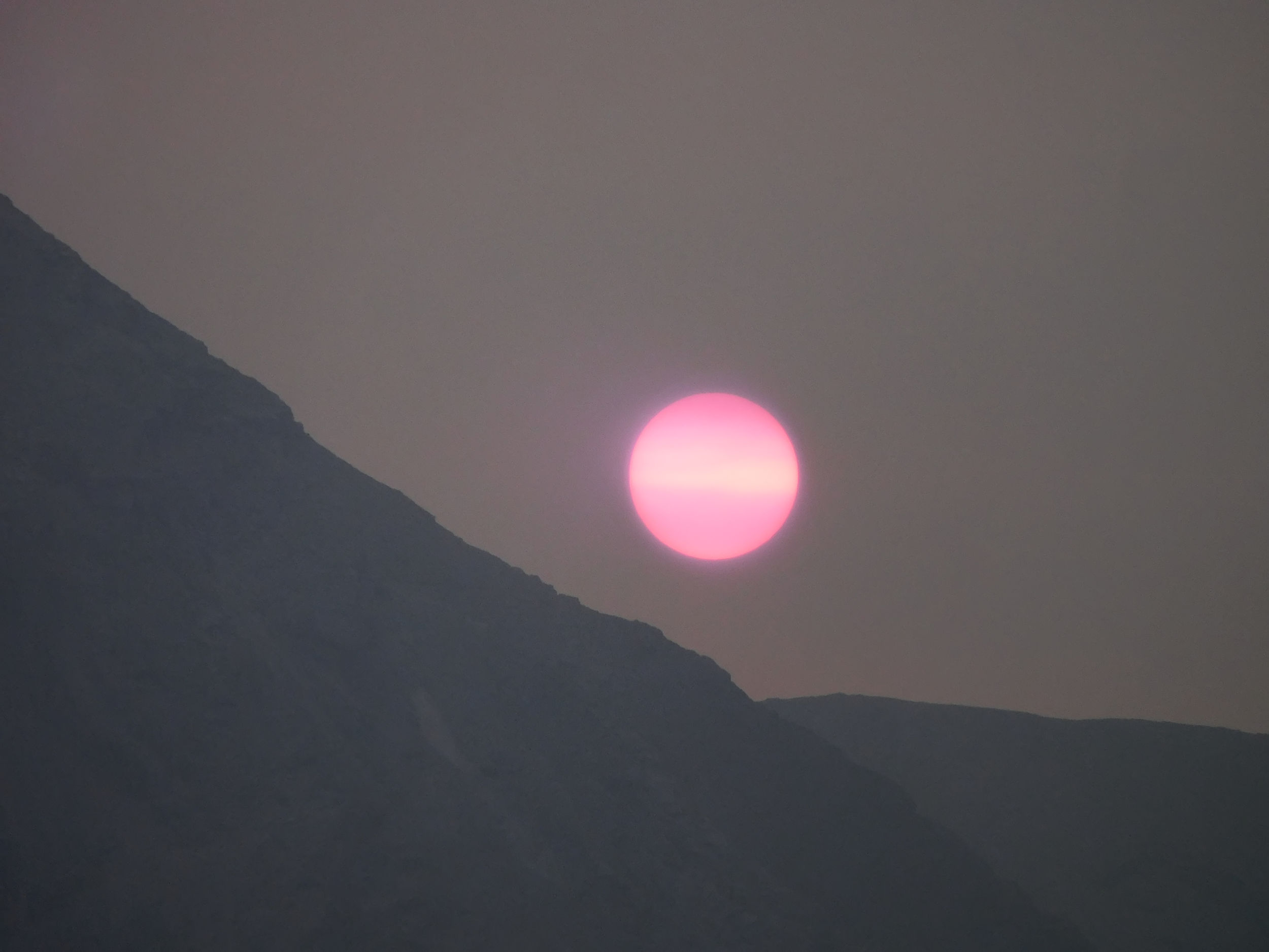
Everything around us is wet. My hiking clothes are as well, so I stay in my sleeping clothes for now. I wipe down one of the picnic tables by the lake. I feel exhausted from yesterday’s climb over the 2600 m pass and not having eaten properly. A hot cereal with lots of dried fruit and a strong coffee bring me back to life. The sunrise is amazing. The sun’s redness, however, is a sign of smoke in the air, even if I cannot smell any.
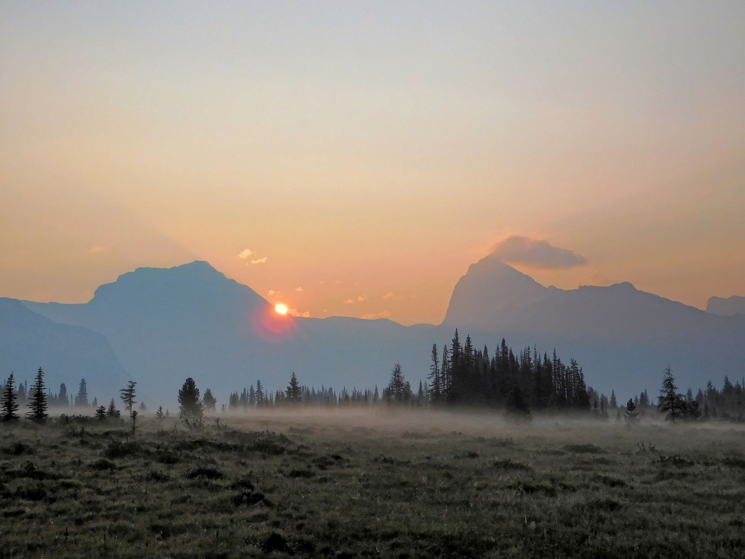
Sunrise over the Pipestone valley
The couple who arrived late yesterday got caught hiking in the rain and their stuff is also very wet. We bring some of our gear from the shaded campsites down to the open and sunny picnic area to dry. As the sun gets stronger, I change into my damp hiking clothes and wear a warm black fleece on top. This way the clothes can dry on my body, while my boots dry on my feet. I am a “walking drying rack” so to speak. The sun’s heat through the black jacket is quite intense, and a spare pair of socks helps against the unpleasant feel of wet feet, at least for the first little while.
While the couple debate which way they will head off for their next destination, I have a second breakfast. I am in no rush to get anywhere fast. I will only day-hike today and it is still very foggy in that direction. I cook couscous with Thai sauce which was supposed to be part of my dinner last night. After the second meal I feel up to shape again. I string up a clothesline for my wettest shirt. I don’t dare leave any essential clothes hanging outside while I am away, because a porcupine was spotted in the campground and they can be very destructive. As an extra precaution, I collect everything with the faintest smell of food, sweat or soap in a bag and hang it on the bear pole next to my food bag.
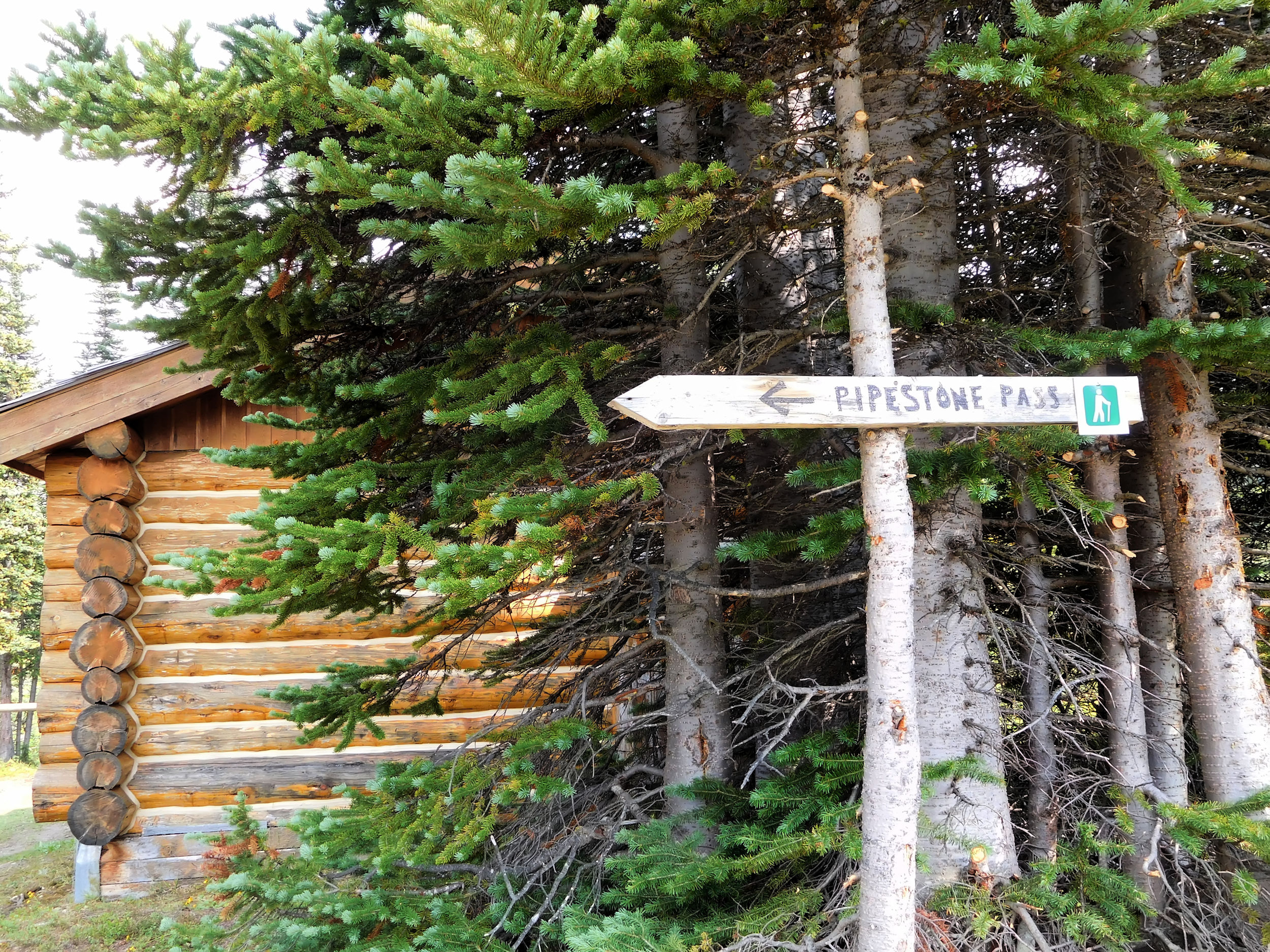
While the other two will backtrack over North Molar Pass and follow the South Molar Pass trail to reach their next camp at Molar Creek, I take my chances with the Pipestone valley. My trail does not actually follow the Pipestone River at the bottom of the valley but clings to its western highline. I won’t be able to make it to Devon Lakes today. For this 30 km out and back hike I should have started hours ago. Hopefully I get there another time and maybe can stay overnight.
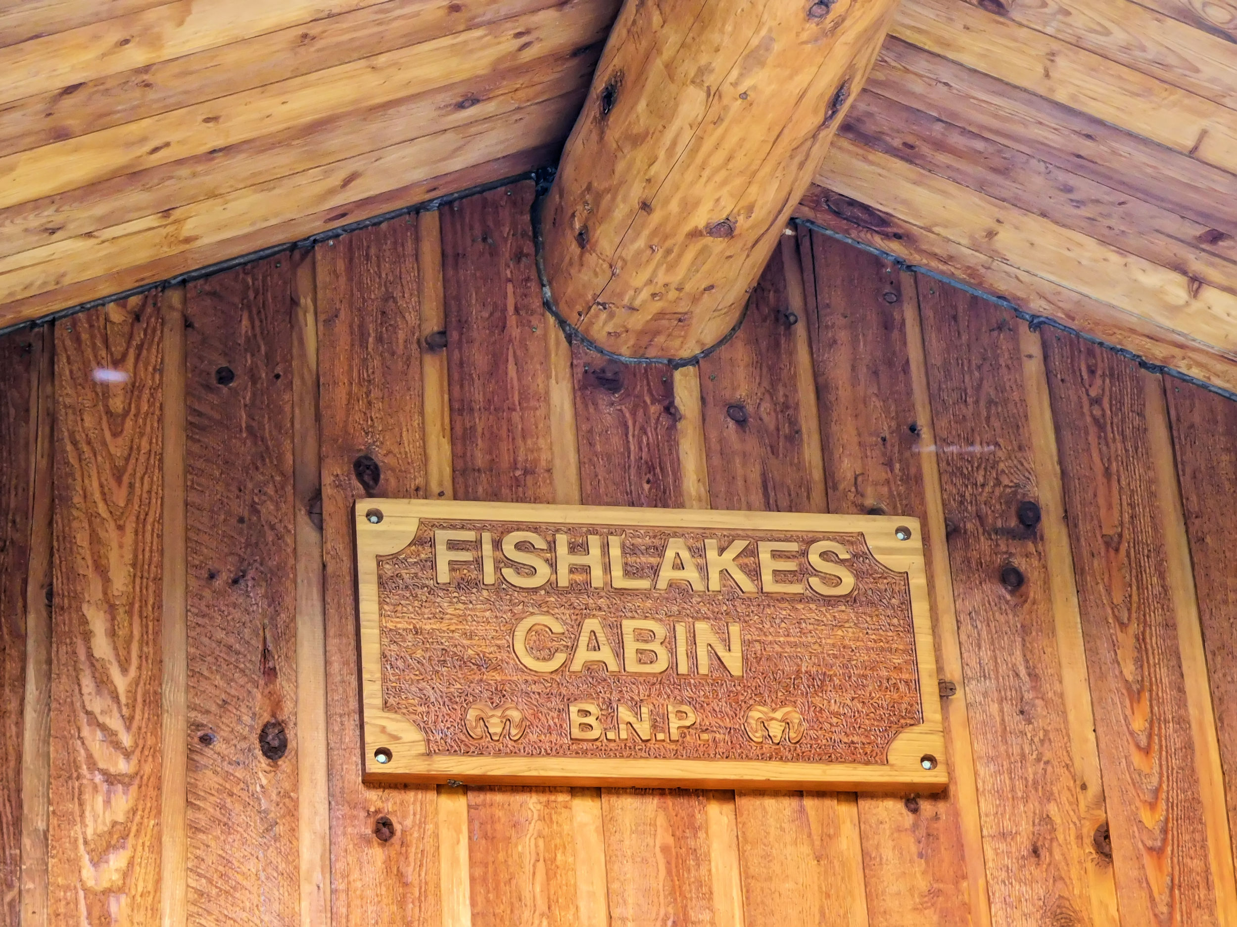
I set out to the Fish Lakes cabin, ten minutes away and a comfortable place to stay for the rangers when visiting the area. Here the Pipestone Pass trail begins.
I fill up my water bottles in the creek and continue my hike with a crossing that gets my boots even wetter. I am glad that I am carrying only a daypack. Fortunately this will be the only tricky creek crossing for today.
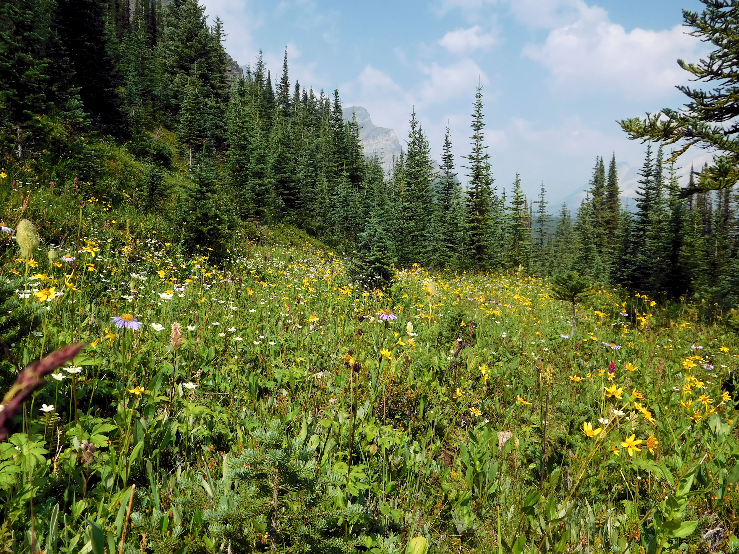
The trail climbs up the treed side of the valley. The flowers are delightful and the mist is lifting, too. It appears that there wasn’t much smoke in the air after all.
Soon I reach Moose Lake, a very pretty alpine lake.
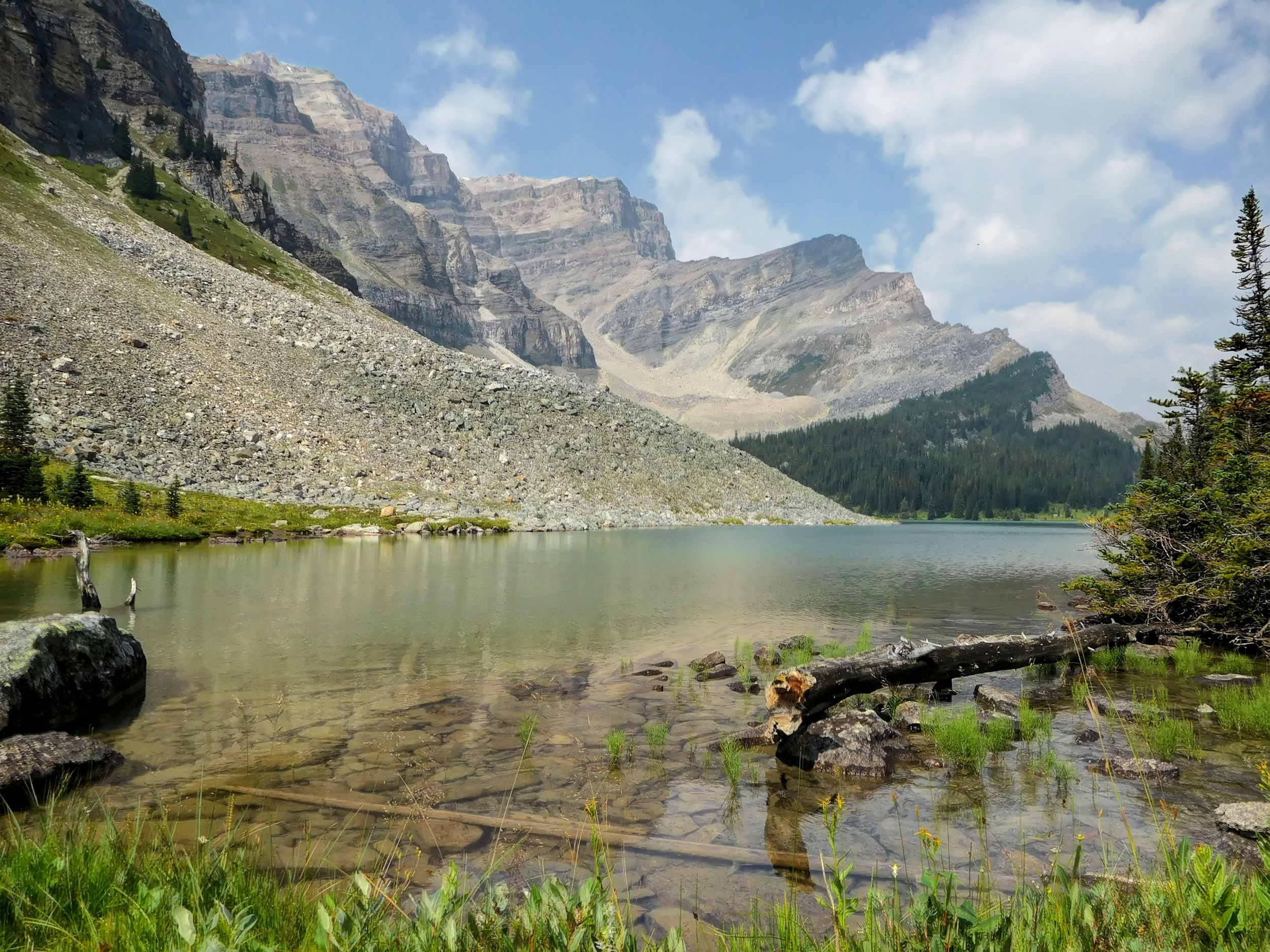
Moose Lake 2202 m
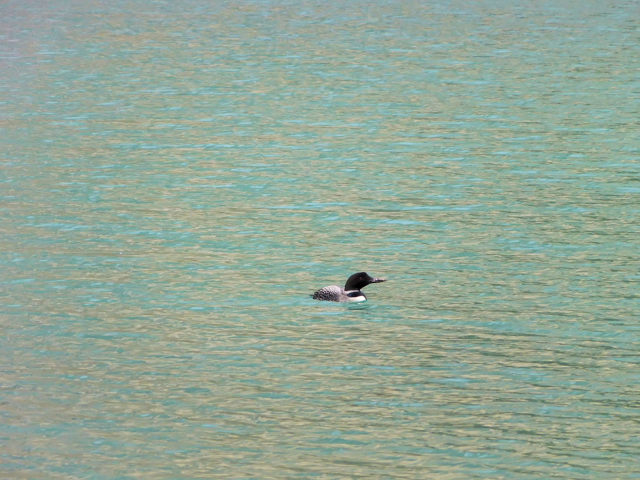
A loon calls the lake home. I am amazed to find them at this altitude; there must be fish in the lake.
Loon on Moose Lake
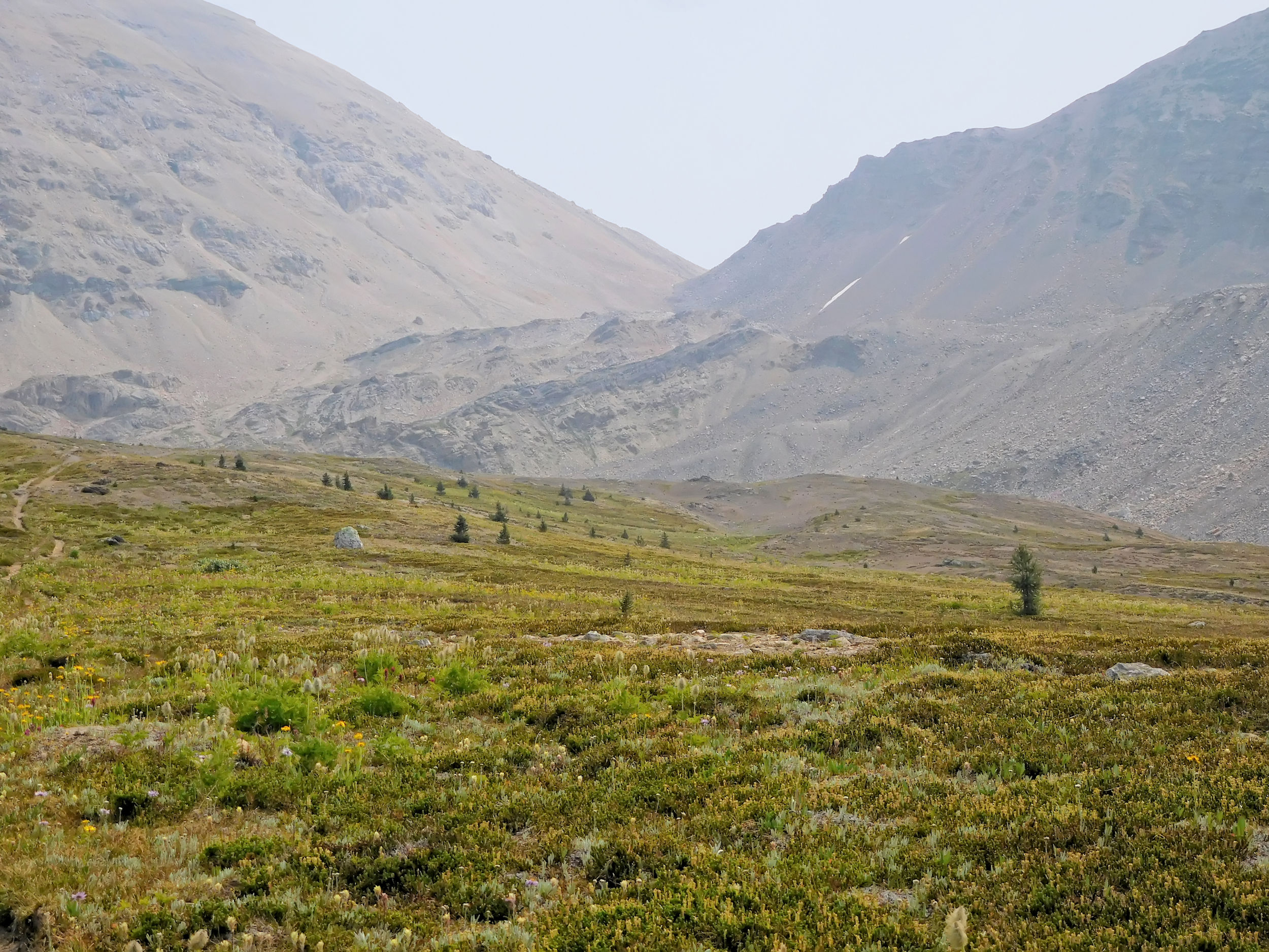
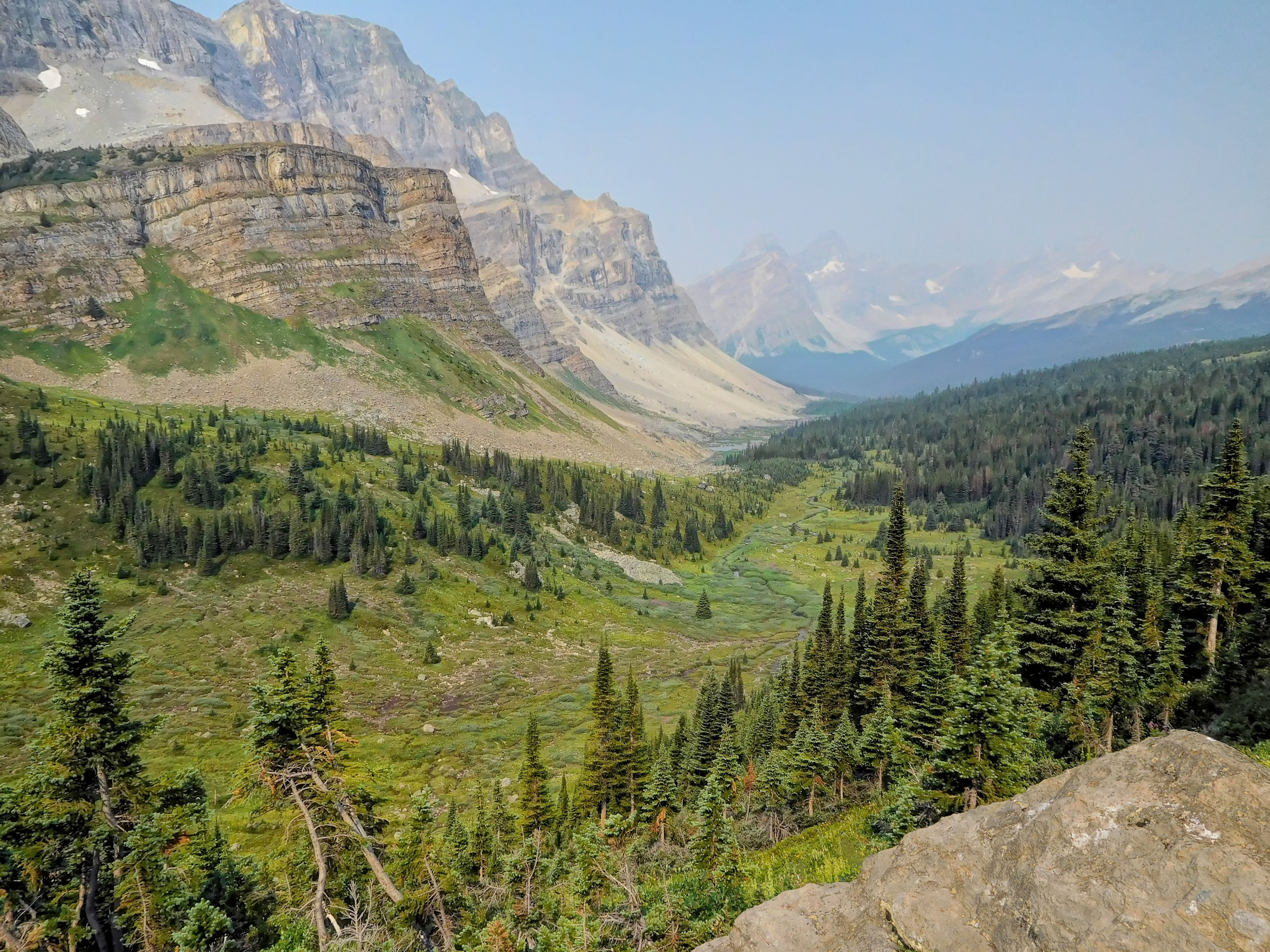
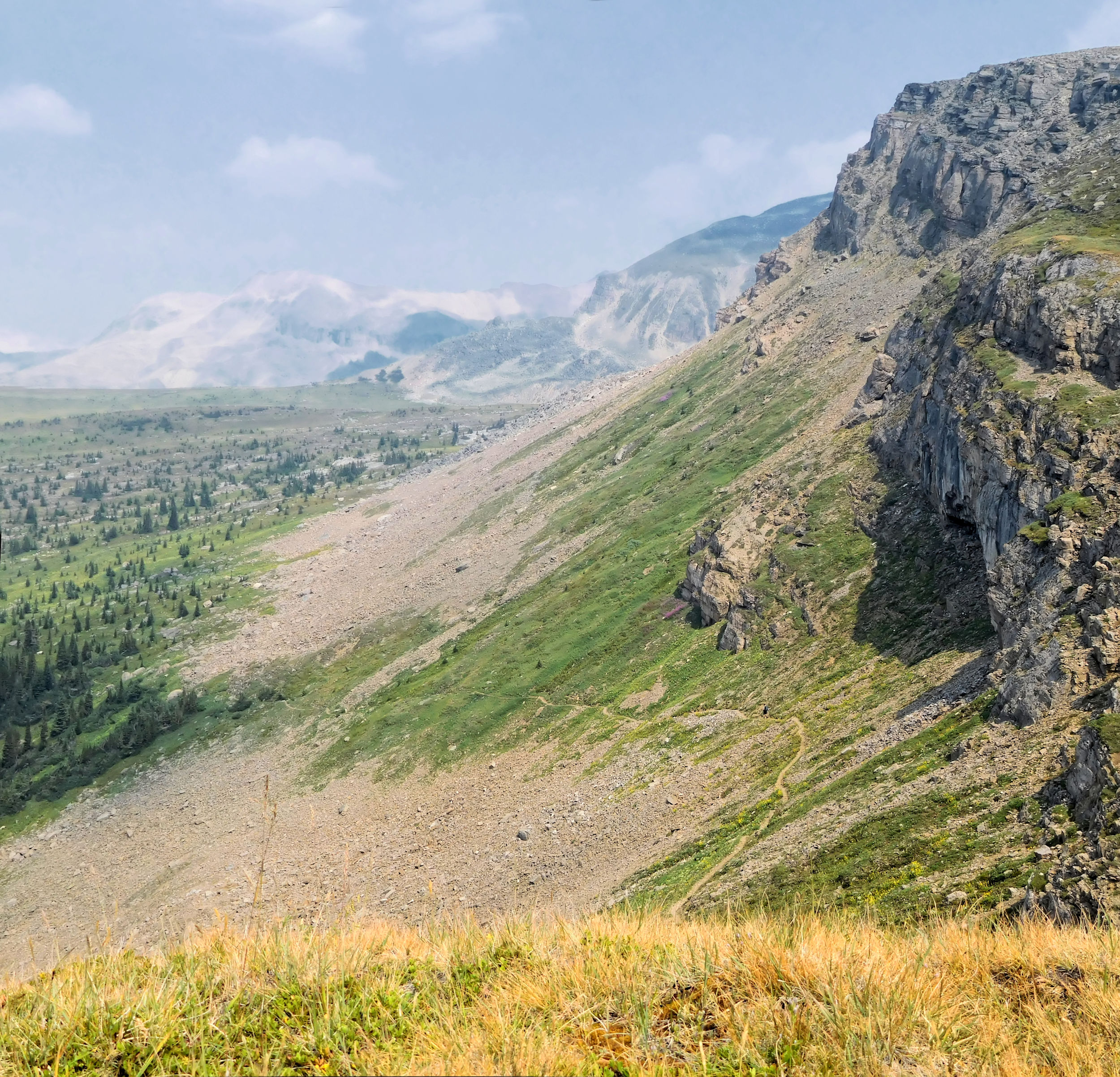
The view opens into the vast Pipestone valley. Not many hikers find their way into this remote area. I feel elated to be one of the lucky few.
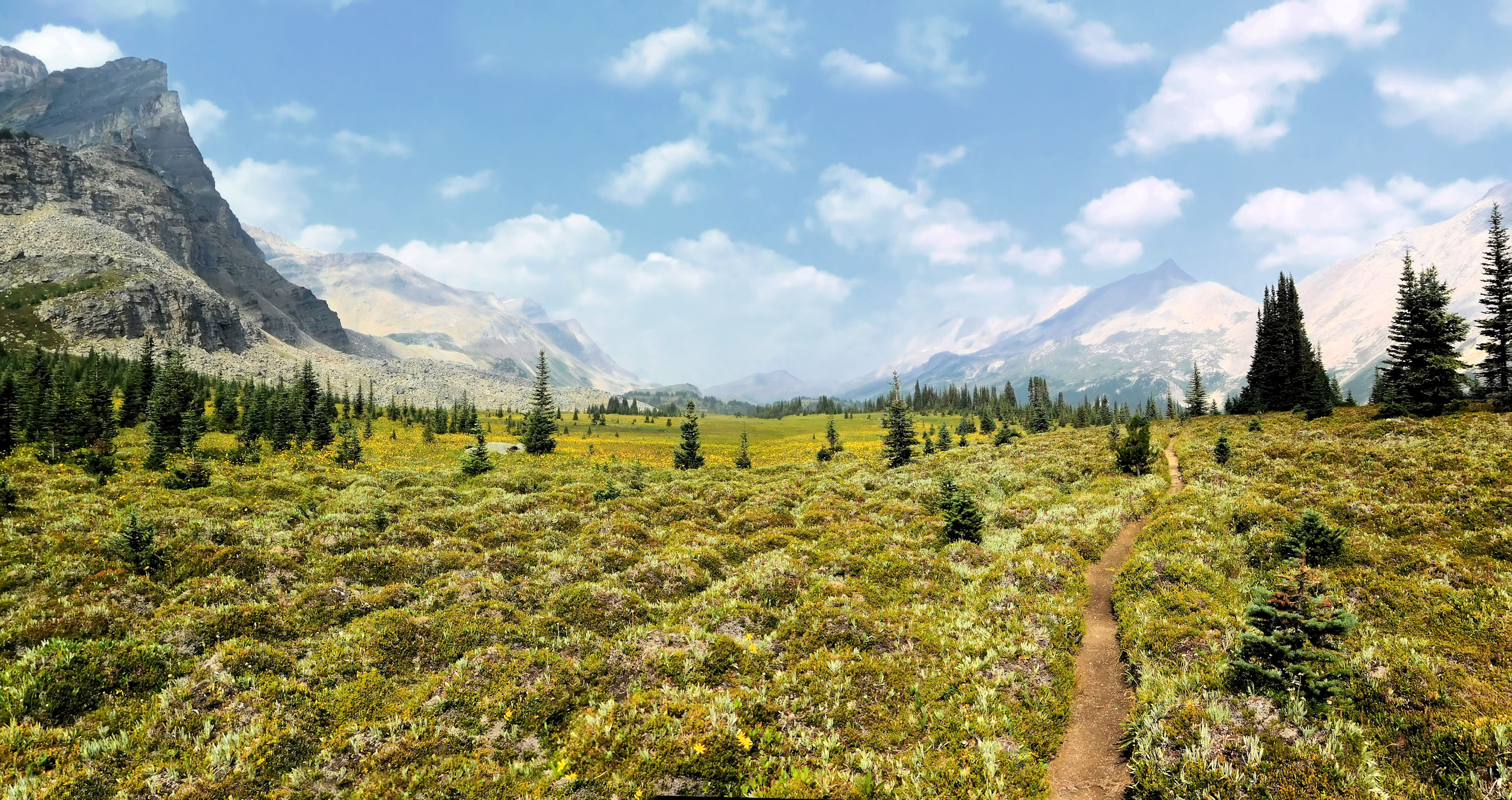
Pipestone valley highline
There are a few more creek crossings, but all of them have easy rocks to step on. Only one of them needs some route finding in order to cross without having to step into the water.
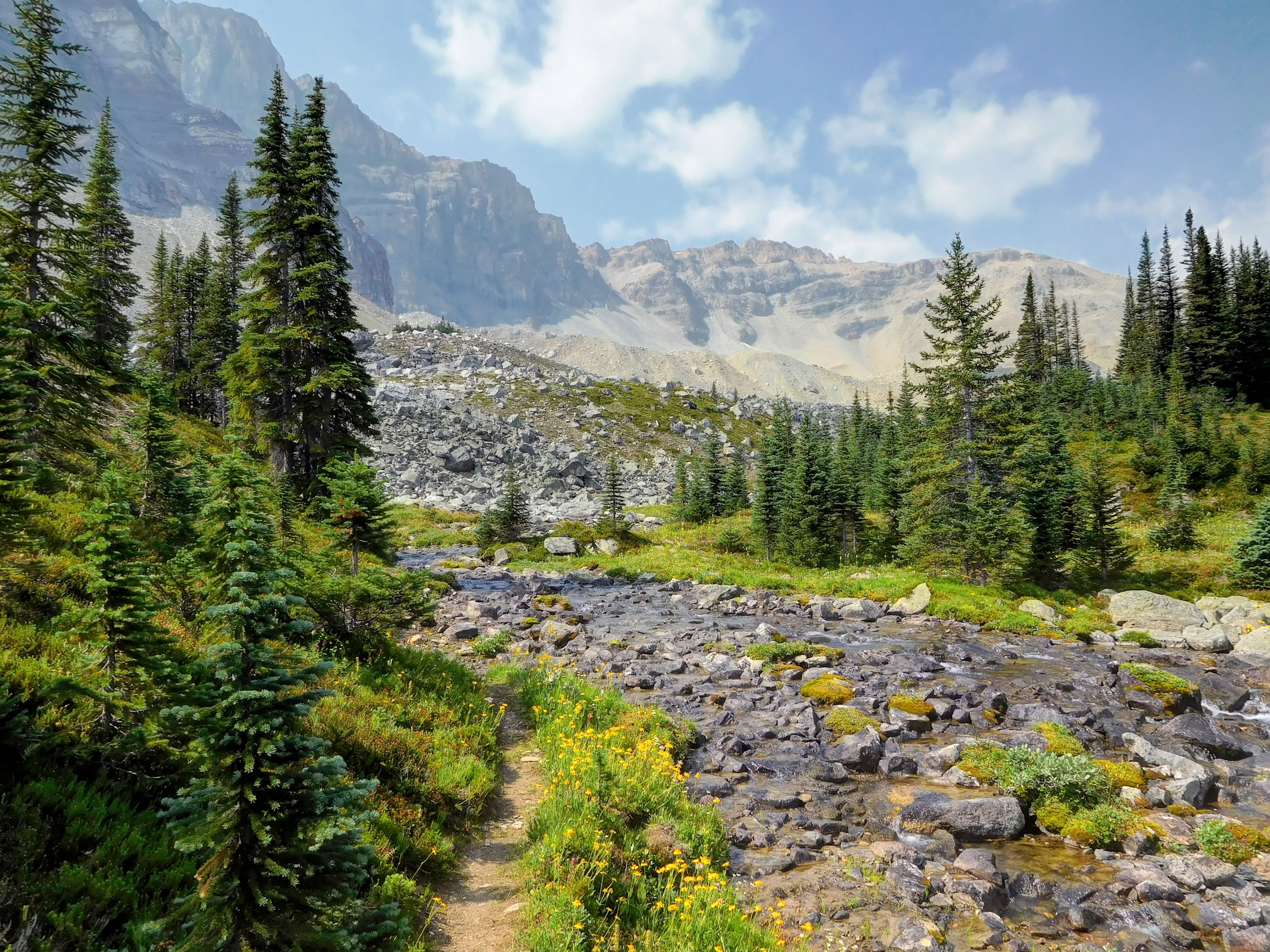
One of many creeks to cross
Behind the creek I meet the only other hiker for today. Ian is on his way to Devon Lakes. He is a very strong hiker and covers the 30 km distance from the highway over the North Molar, Pipestone and Clearwater passes in one day. Because of my late start, I won’t even make it to Pipestone Pass now. But I am fine with that; I’ll slow down and take it all in. This valley is just magnificent.
Flowers in front of Molarstone‘s west slopes
Tarn
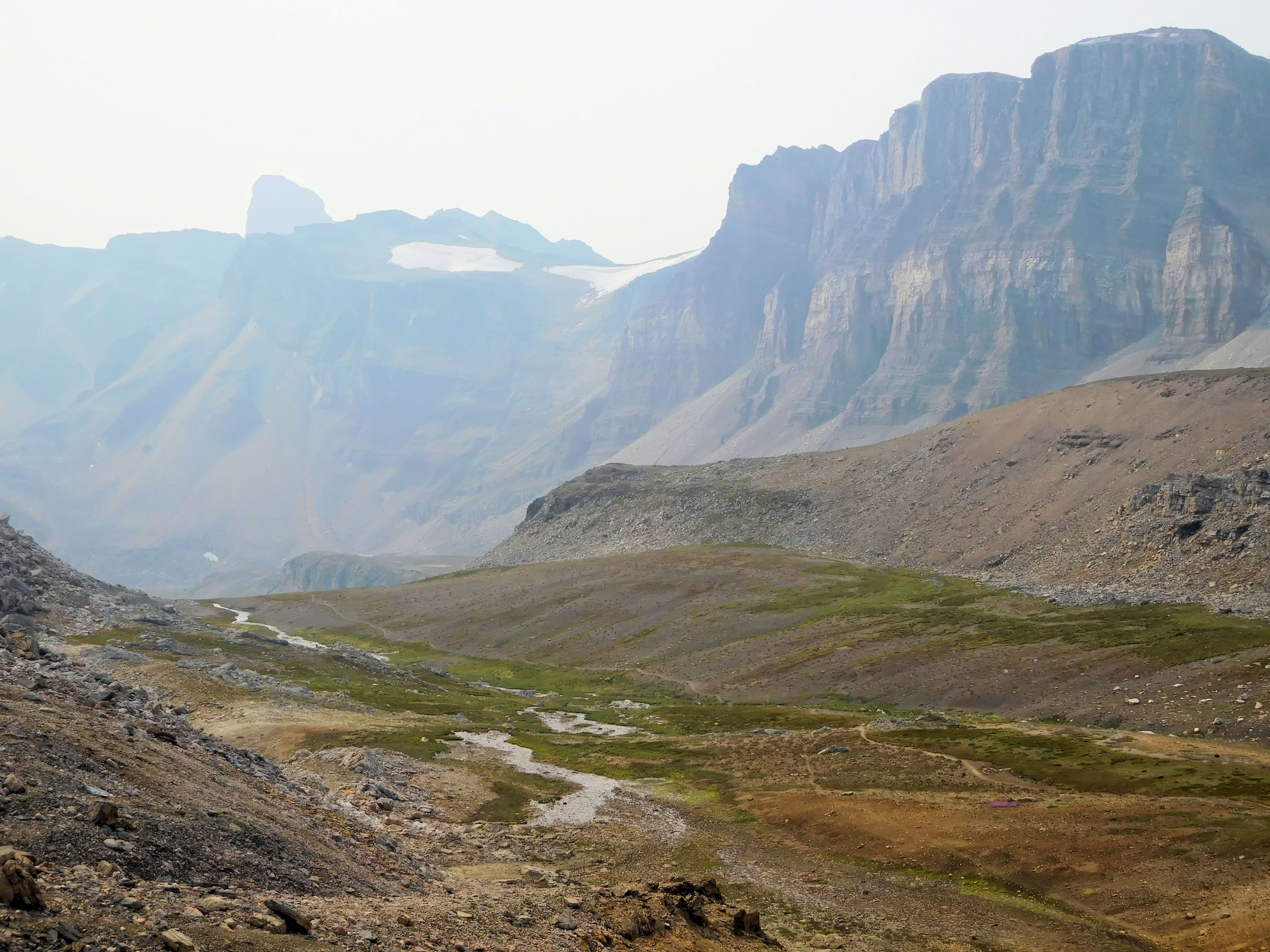
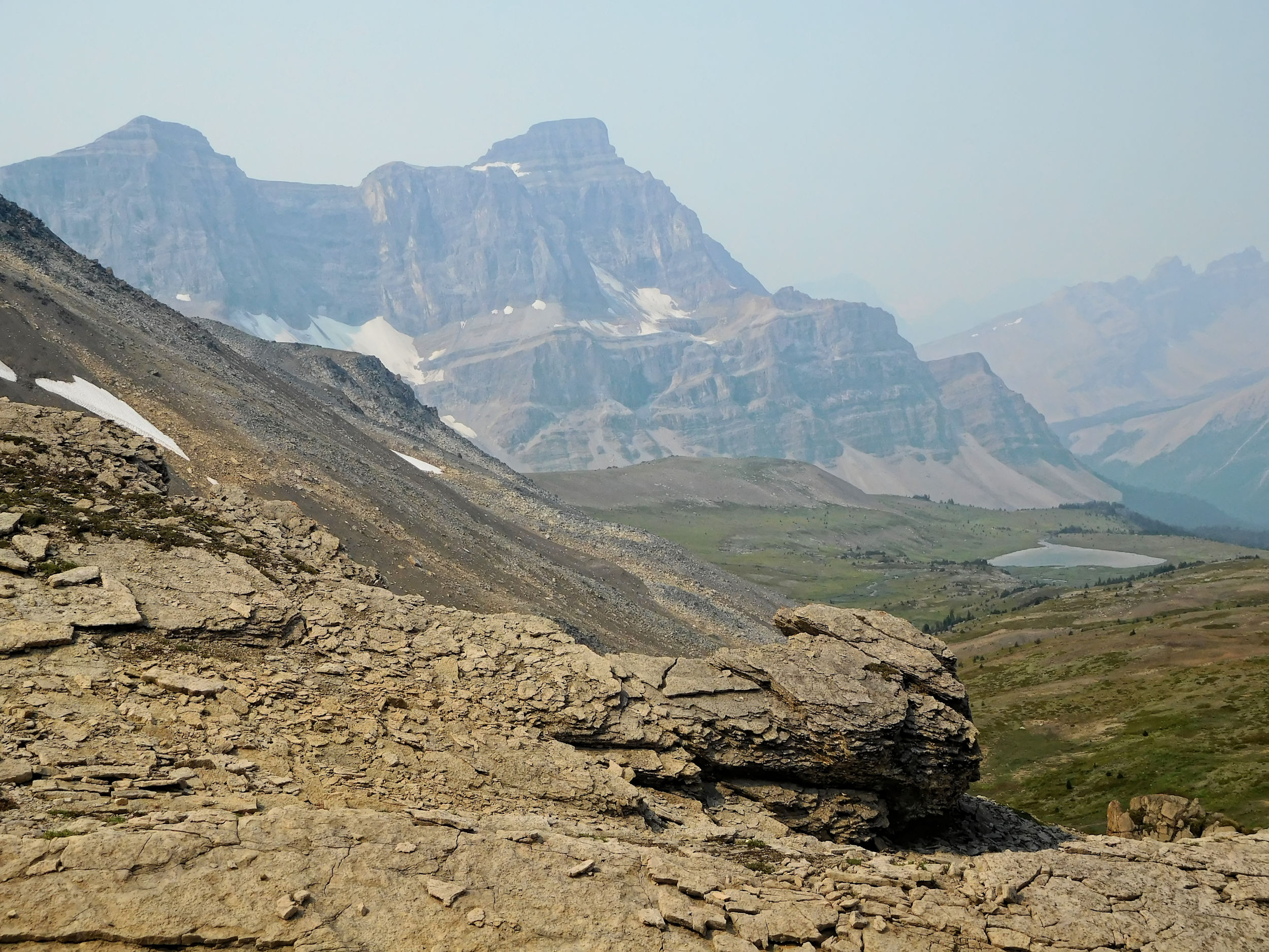
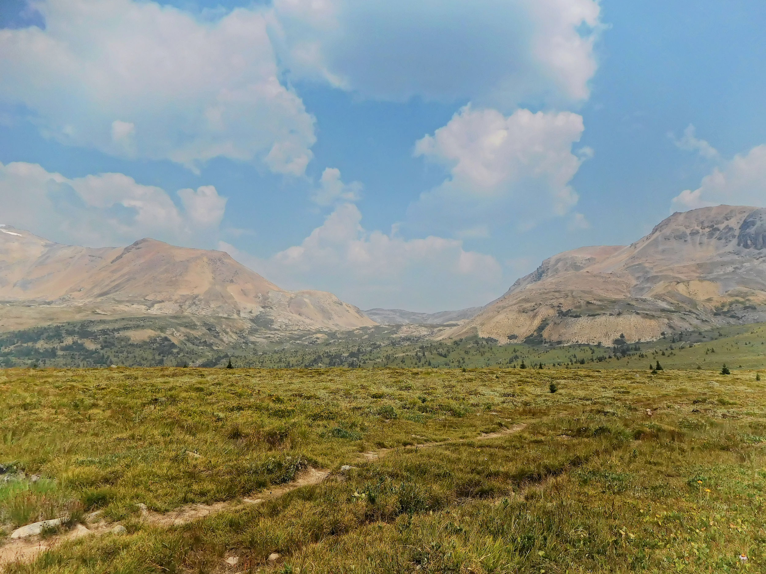
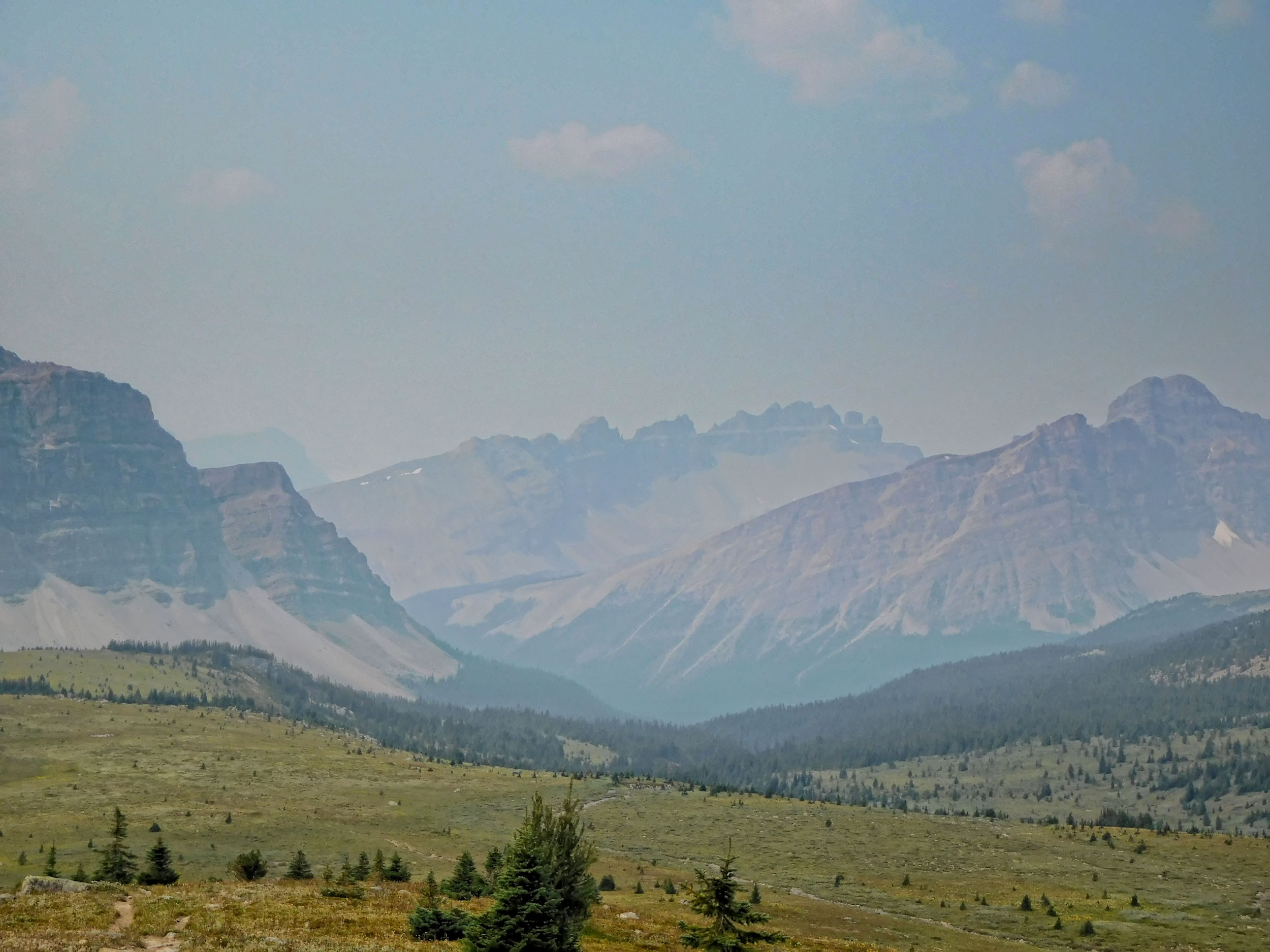
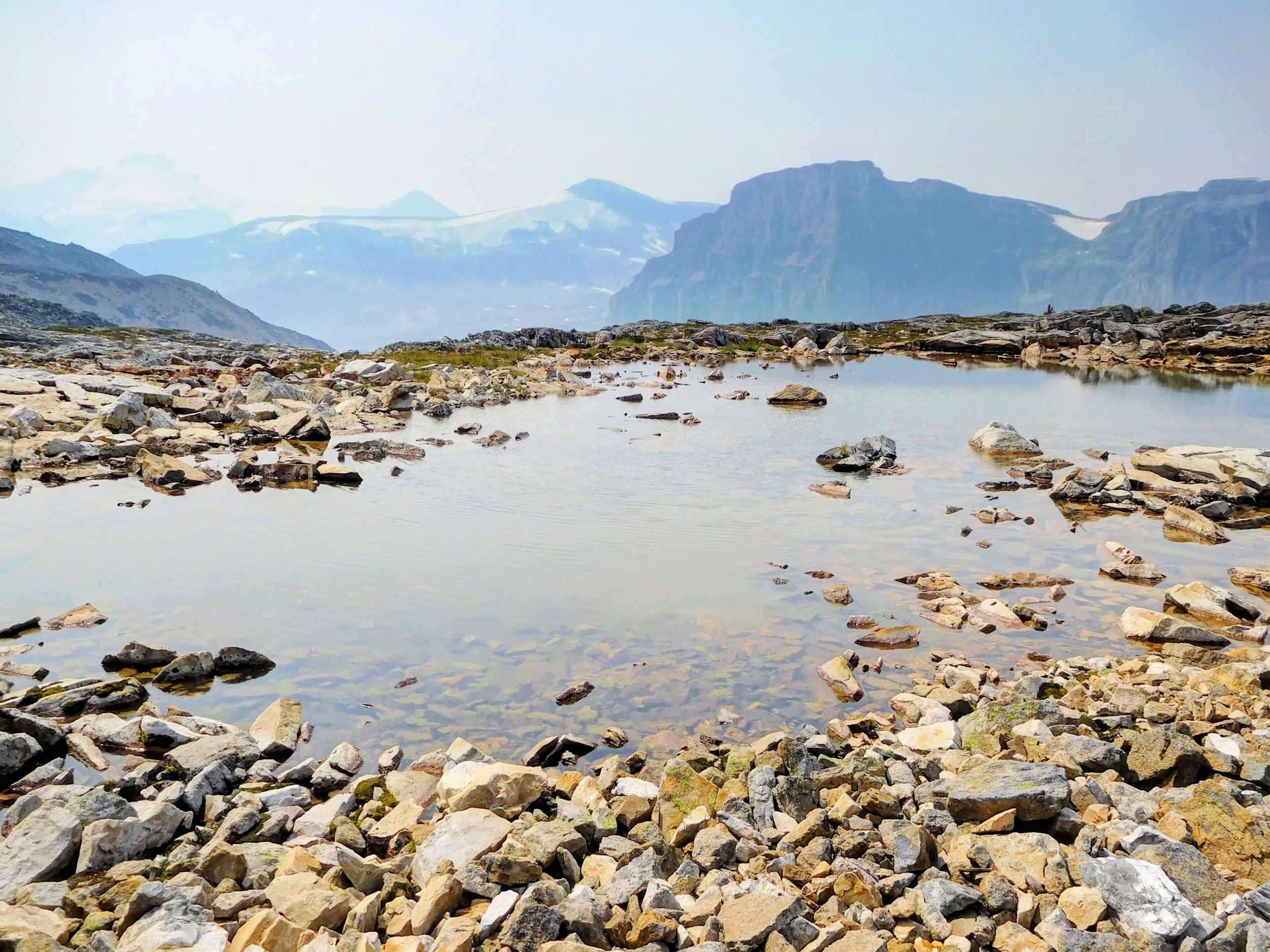
I crest a knoll that provides me with a spectacular view of the Pipestone and Clearwater passes ahead. The valley’s empty vastness feels exceptional. There is a slight haze in the distance, possibly caused by a fire that is burning on the far side of the Clearwater valley.
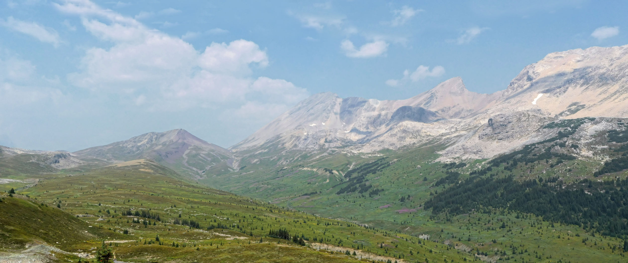
View towards Pipestone Pass, Clearwater Pass and Devon Mountain
In the east, the Pipestone valley is bordered by some rugged slopes.
Eastern slopes above the Pipestone valley
Declaring the knoll my turnaround point, I have a nice long lunch break here. I take off my boots to give them every chance to get dry. They are not in a bad shape right now. It feels so good to wriggle my toes freely for a change.
On my return trip, the skies seem hazier because now I look into the sun. The tarn captures my attention again, as it looks particularly pretty against the backdrop of the mountains.
Tarn seen from the north
Further down yet another tarn adorns the meadows. The top of Cataract Peak is faintly visible to the south.
Another tarn with Cataract Peak to the south
Lower Fish Lake
When returning to the Fish Lakes cabin, I fill up my water bottles again. A bit further down on the trail, I take the turnoff to Lower Fish Lake. After only half a kilometer the lake comes into view. The terrain around it is more open and rugged than Upper Fish Lake with the campground on its shore.
I catch a glimpse of Cataract Peak, the most distinctive peak around here, unfortunately somewhat obscured by the haze.
Cataract Peak 3333 m
Back at the campground, I am relieved to find my tent unharmed by the porcupine or any other creature for that matter. My shirt has dried on the clothesline and all my gear is dry again, too, even the boots. My spare clothing can go back into the pack.
The campground is filling up today and every site taken. We all enjoy a pleasant warm and dry evening at the picnic tables. The campsites here don’t have much privacy, so at bedtime it takes a while until the sounds of voices and squeaky mattresses change over to occasional snoring.
| Distance | 10.4 km |
| Time | 3 ½ hrs |
| Incl. breaks | 6 hrs |
| Min. Elevation | 1991 m |
| Max. Elevation | 2603 m |
| Descent | 612 m |
| Cum. Ascent | 631 m |
| Cum. Descent | 809 m |
I am first at the picnic tables and enjoy a quiet breakfast. It is another spectacular sun rise, the sun even redder this morning.
I am ready for the trail when most of the others start cooking breakfast. Some are staying for a day hike like I did yesterday. I hit the trail just ahead of two girls whom I will meet a few times on the way over North Molar Pass back to Mosquito Lake campground. I climb up above Upper Fish Lake and wave it a last good-bye. I will be back as soon as I can to explore this remarkable area some more.
Upper Fish Lake and Cataract Peak
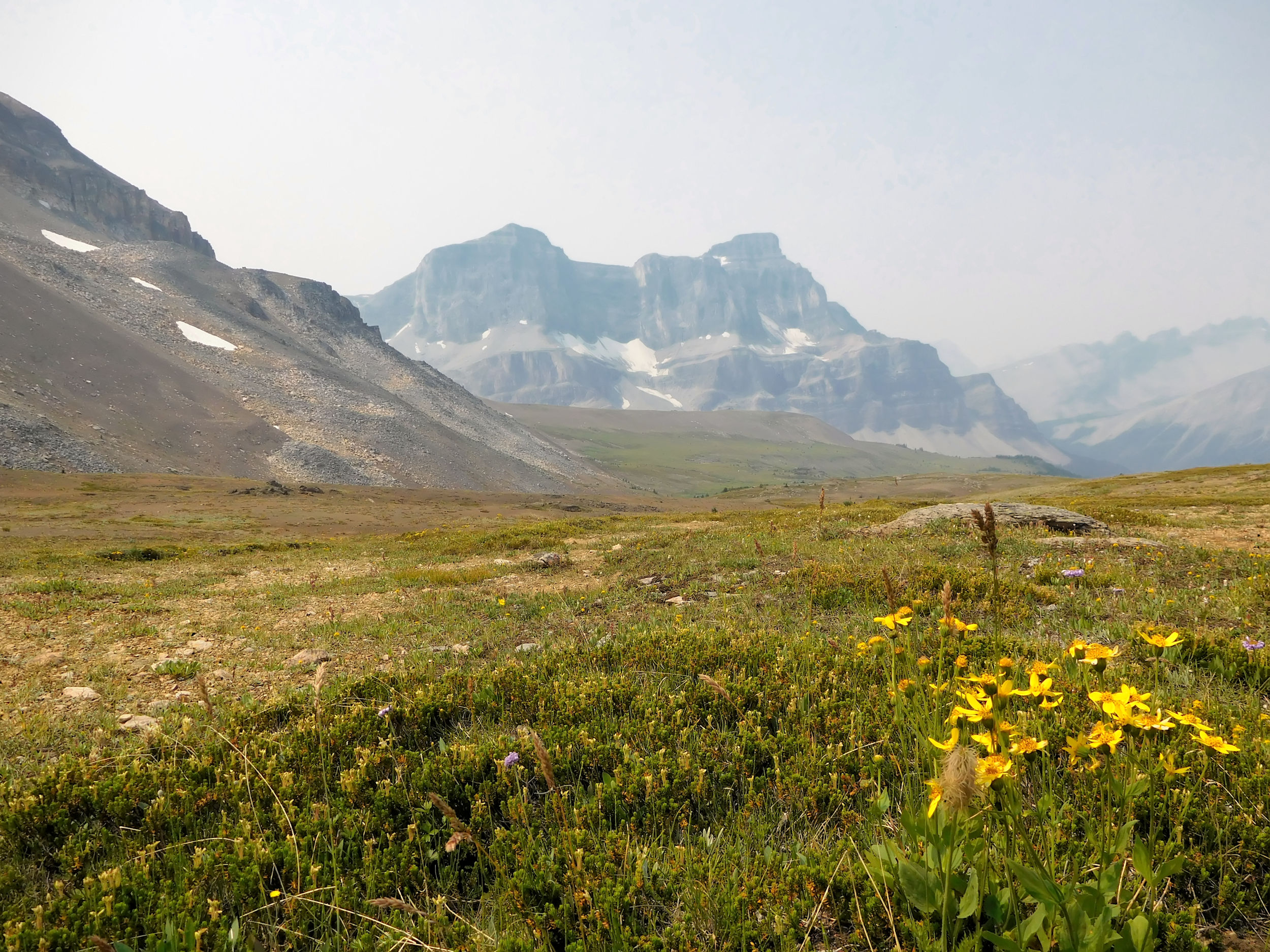
With the sunshine today, I delight in the surroundings of North Molar Pass. What a difference it makes to the rainy hike in.
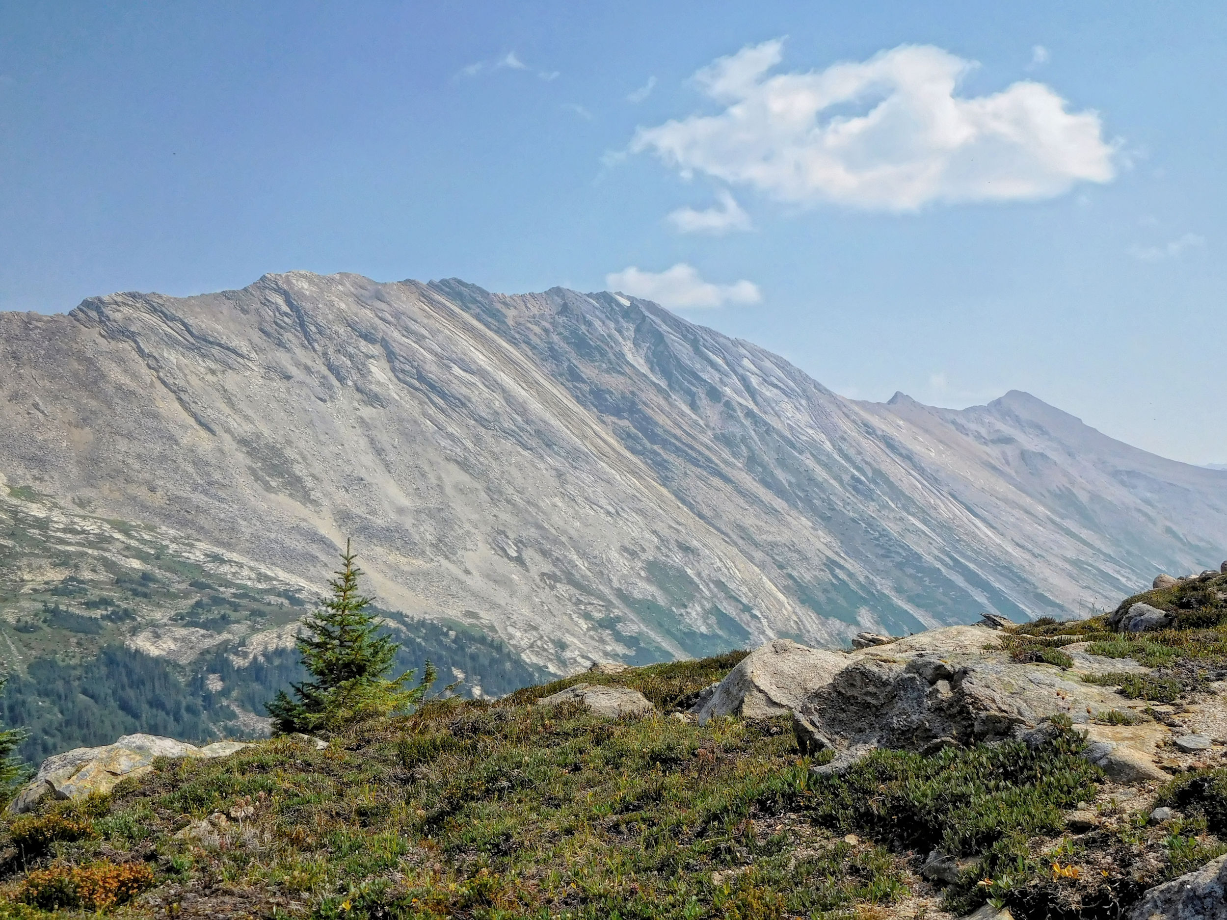
Outlier of Molar Mountain
Outlier of Molar Mountain, continuation to the north
Log bridge over a side creek of the Pipestone River
Beautiful meadows
Fireweed by the creek

Mountain Fireweed
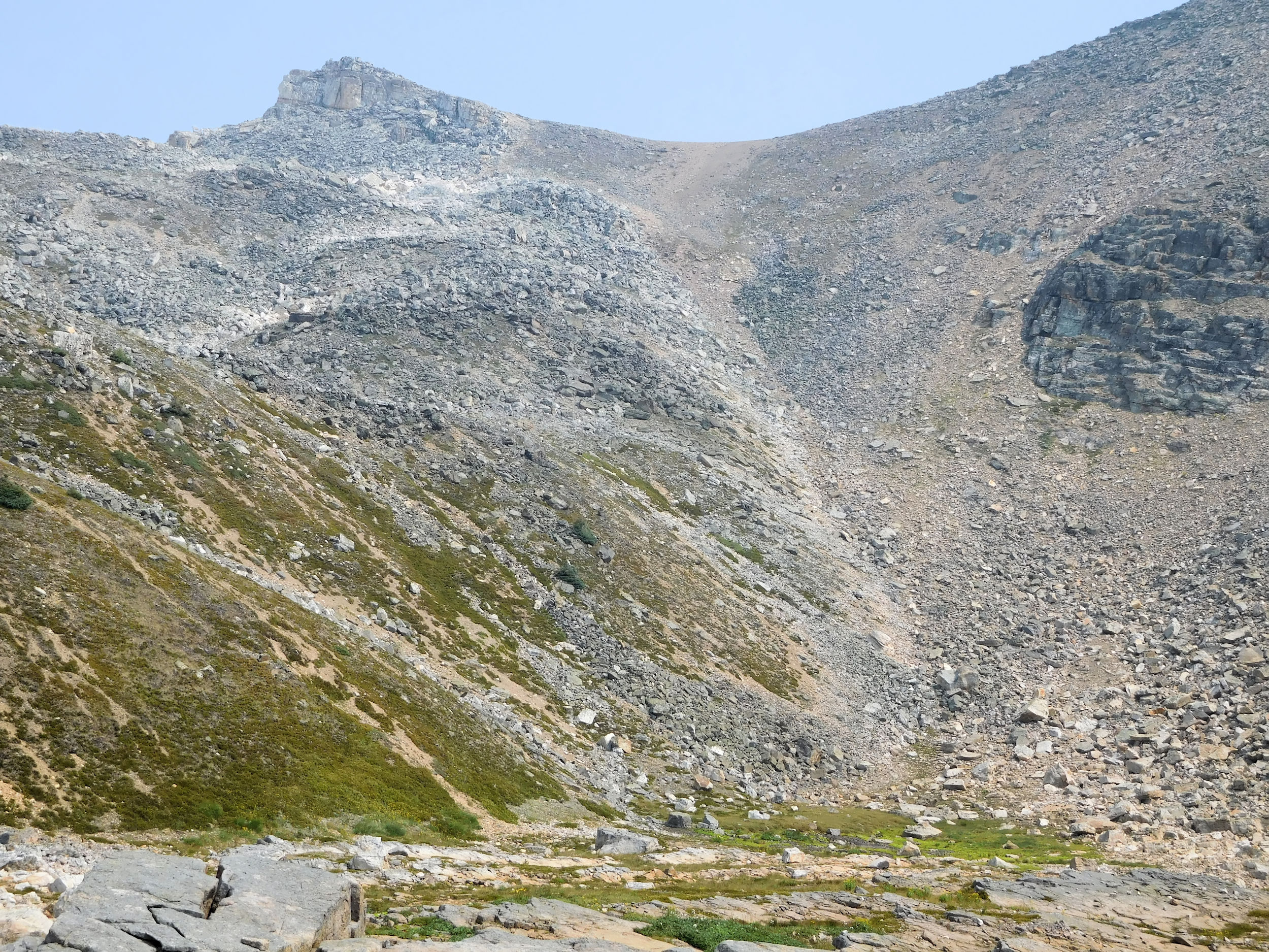
Slowly but steadily I approach North Molar Pass.
Outlier of Molar Mountain seen from higher up
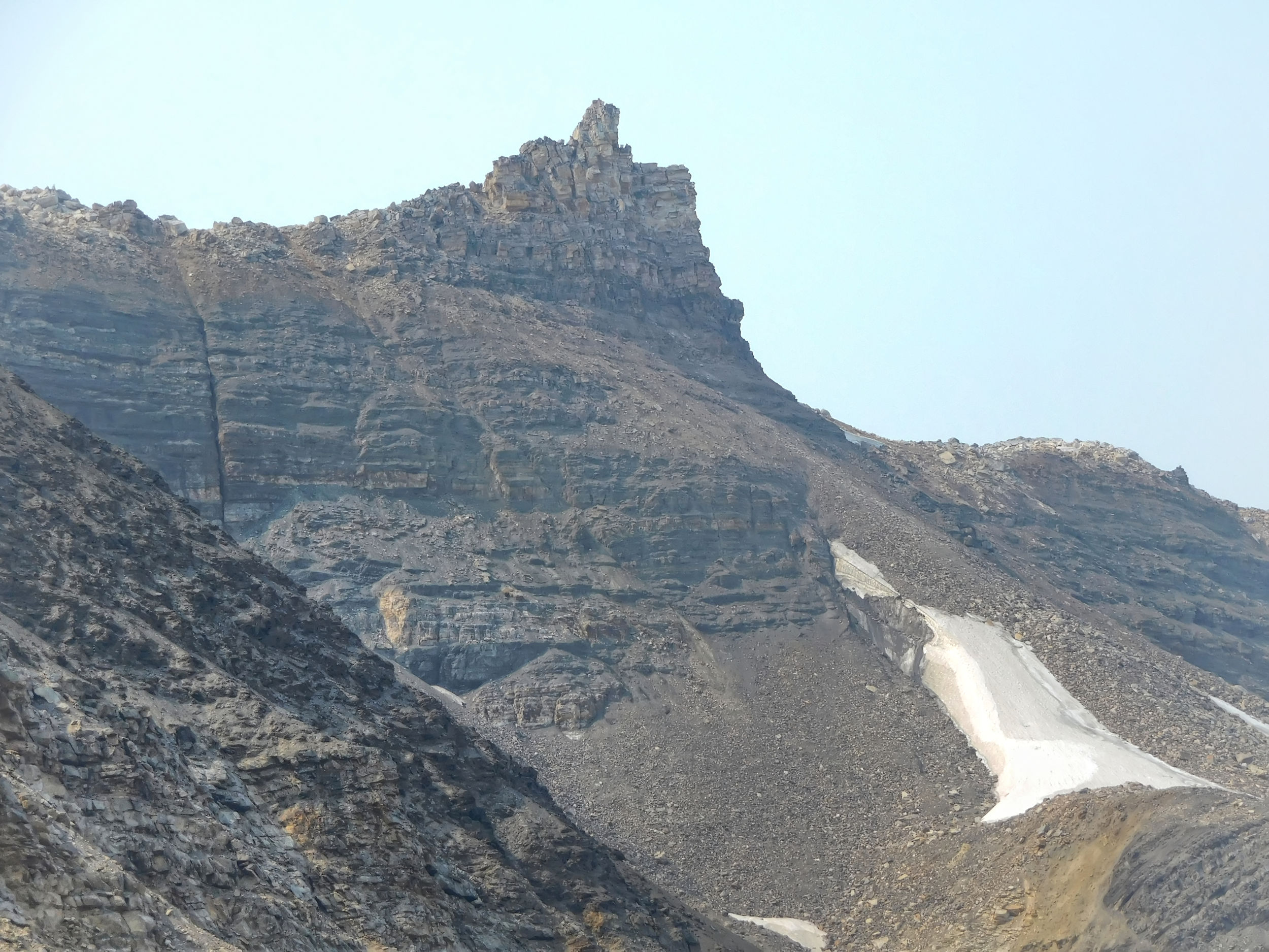
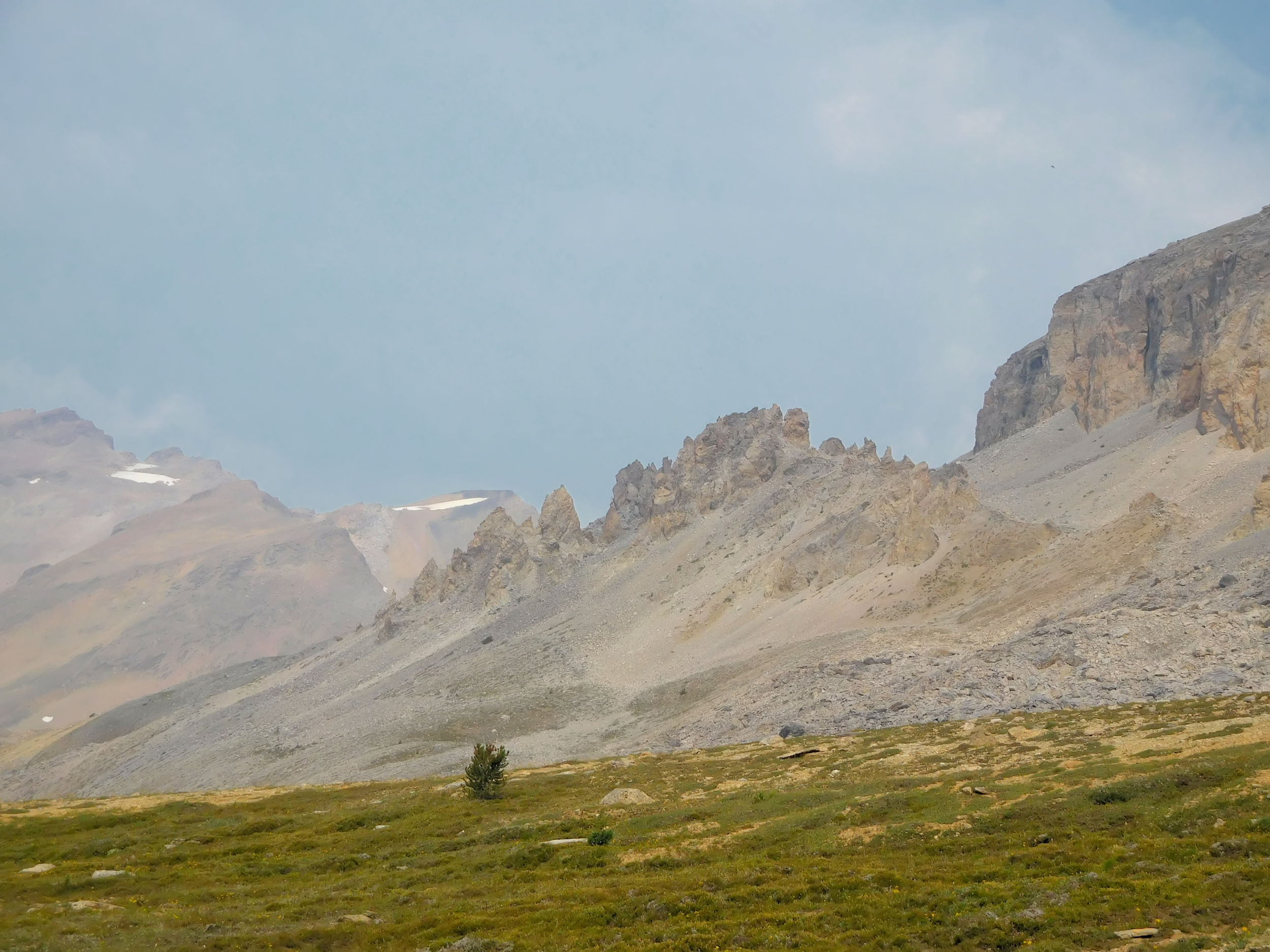
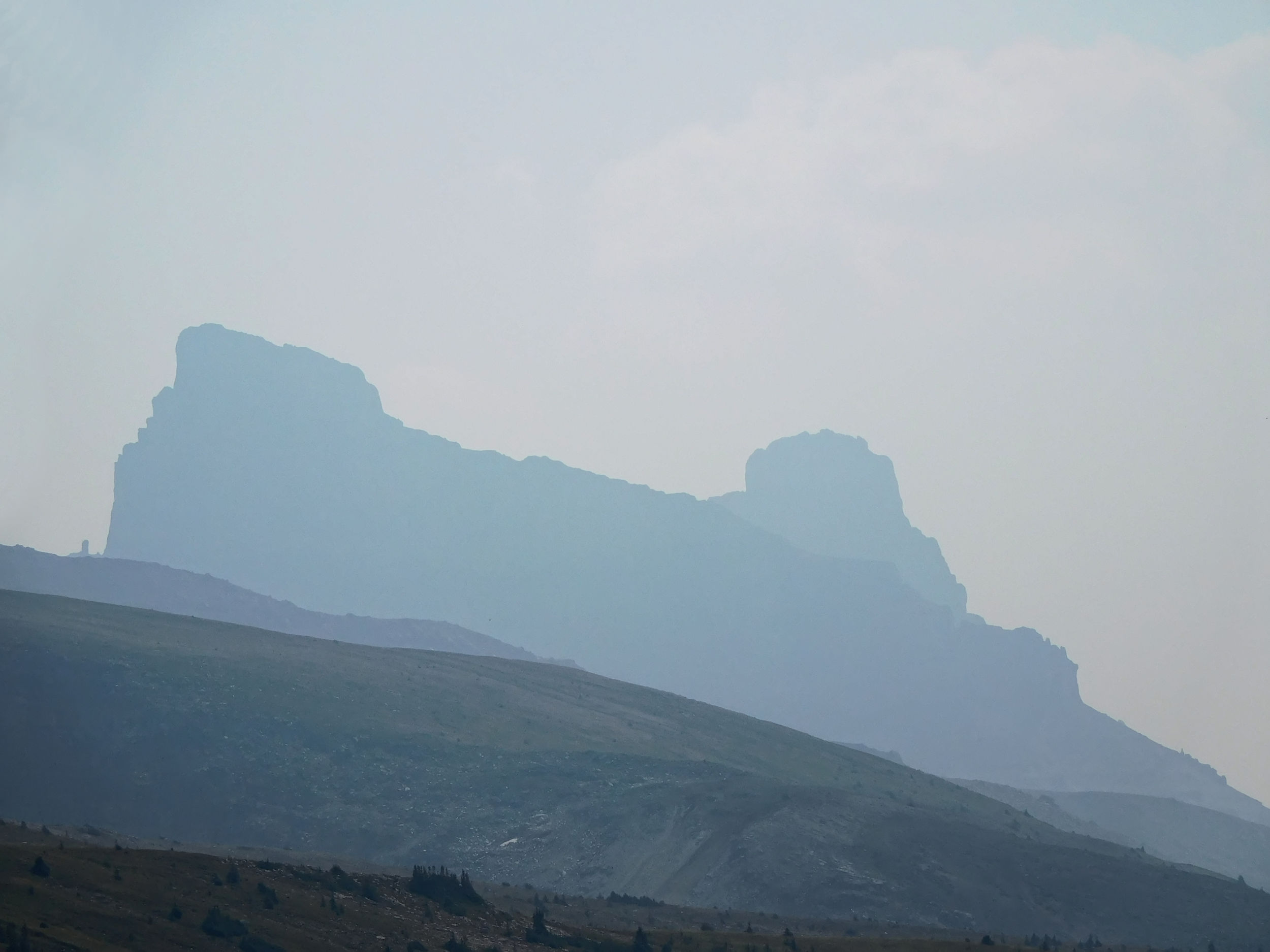
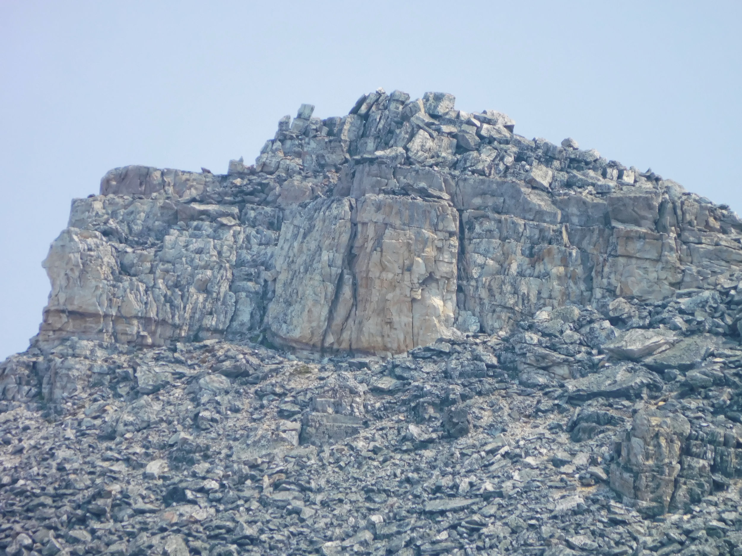
Here I get my first look at the pass, which is to the right of the cornice. The red coloured pinnacles further left on the ridge are fascinating.
North Molar Pass (R) and the ridge over to South Molar Pass
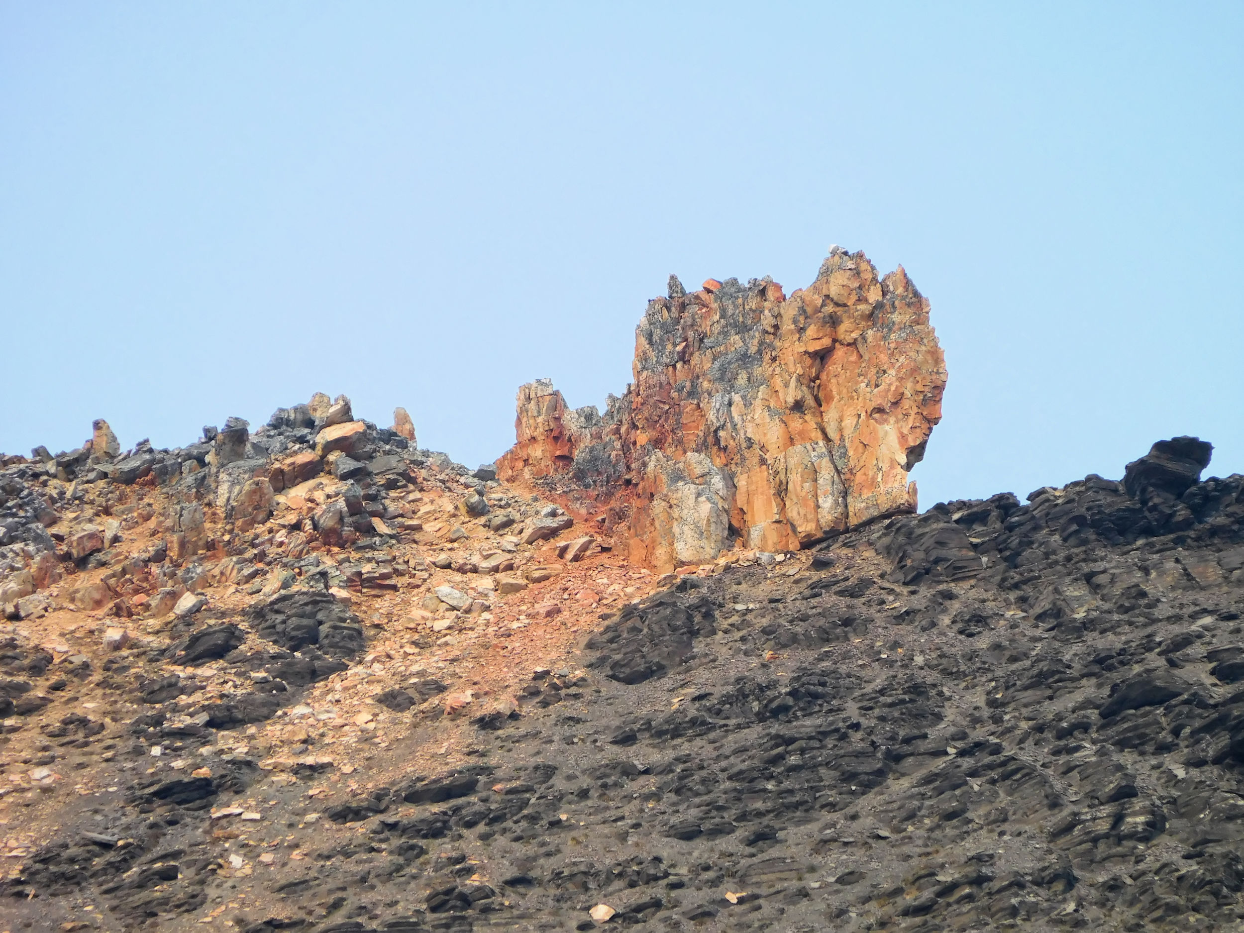
Closeup of the pinnacles
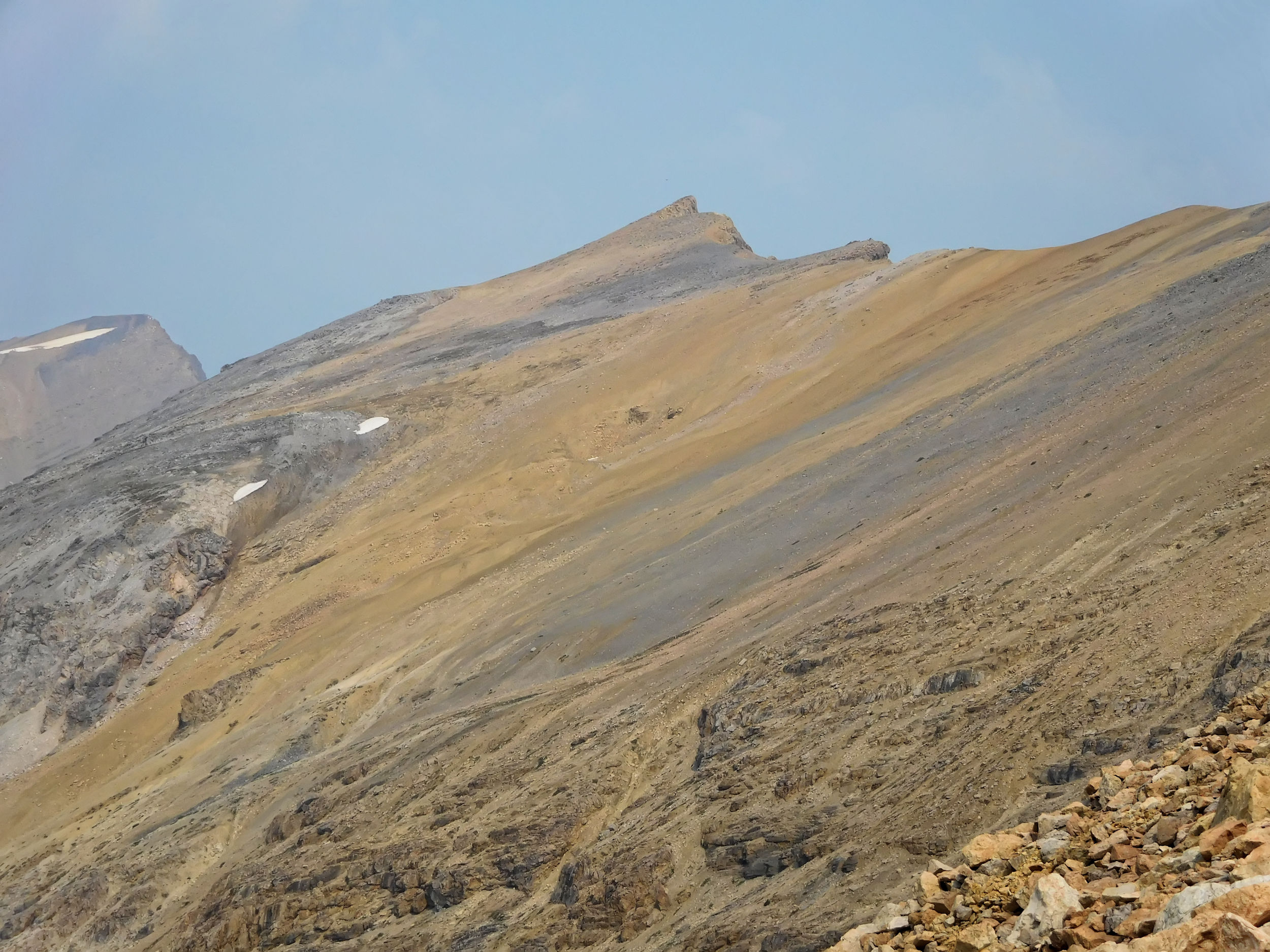
I look up to Molarstone Mountain on the east side of the trail. Its top, at 2880 m, is a 45 minute scramble right from the pass. Not an option for today, though, because I would have to leave my pack behind and I have spotted a family of Hoary Marmots close by. These bold creatures just wait for someone to put their pack down and it wouldn’t be the first time they try to steal a piece of equipment or a backpack from me. Climbing to the top of Molarstone Mountain could be done as a day trip from Fish Lakes or Mosquito Creek campground; another item on my wish list.
Molarstone Mountain 2880 m
On looking back, I get a glimpse of the main peak of Molar Mountain.
View back towards Molar Mountain peak
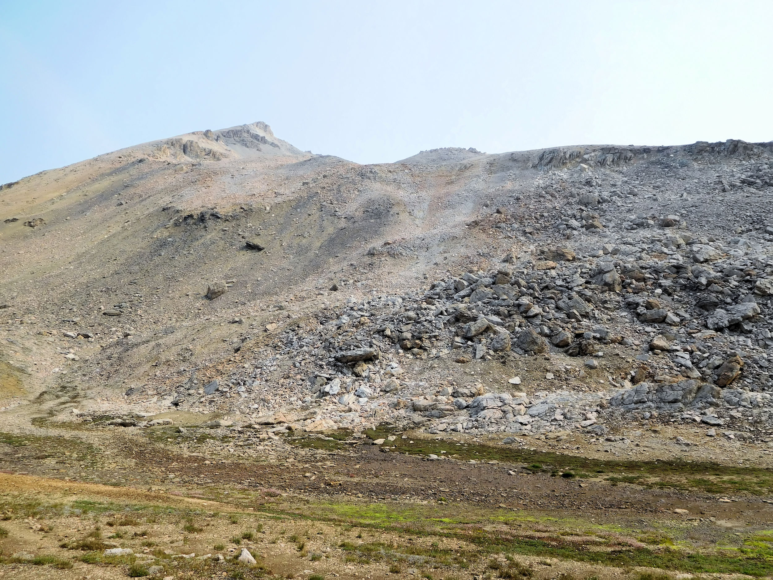
Finally I reach the cornice of North Molar Pass. Some ambitious hikers scramble up to the ridge here and traverse past The Pinnacles and The Fang all the way to South Molar Pass. To me the nose of this ridge seems impassable, unless you are a mountaineer or completely unafraid of heights.
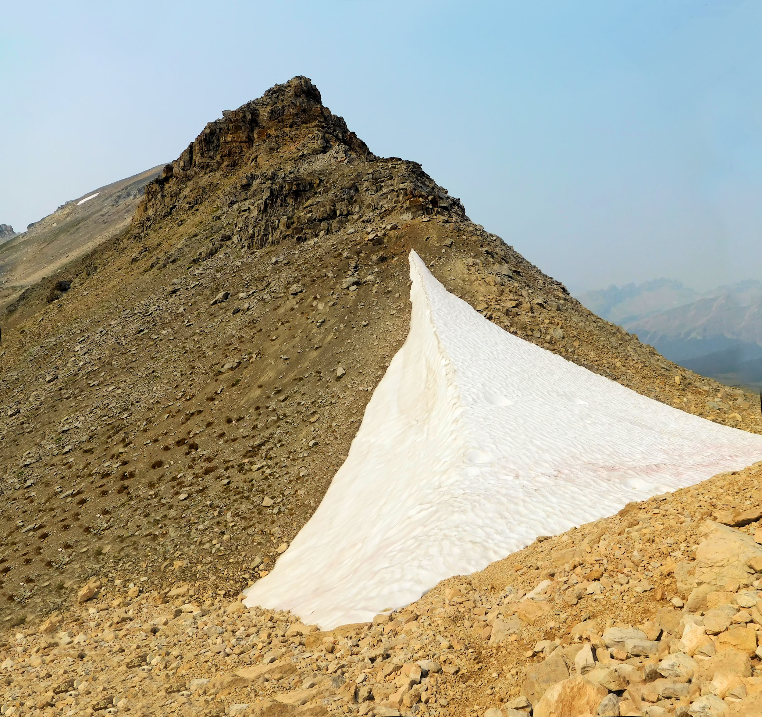
North Molar Pass 2603 m
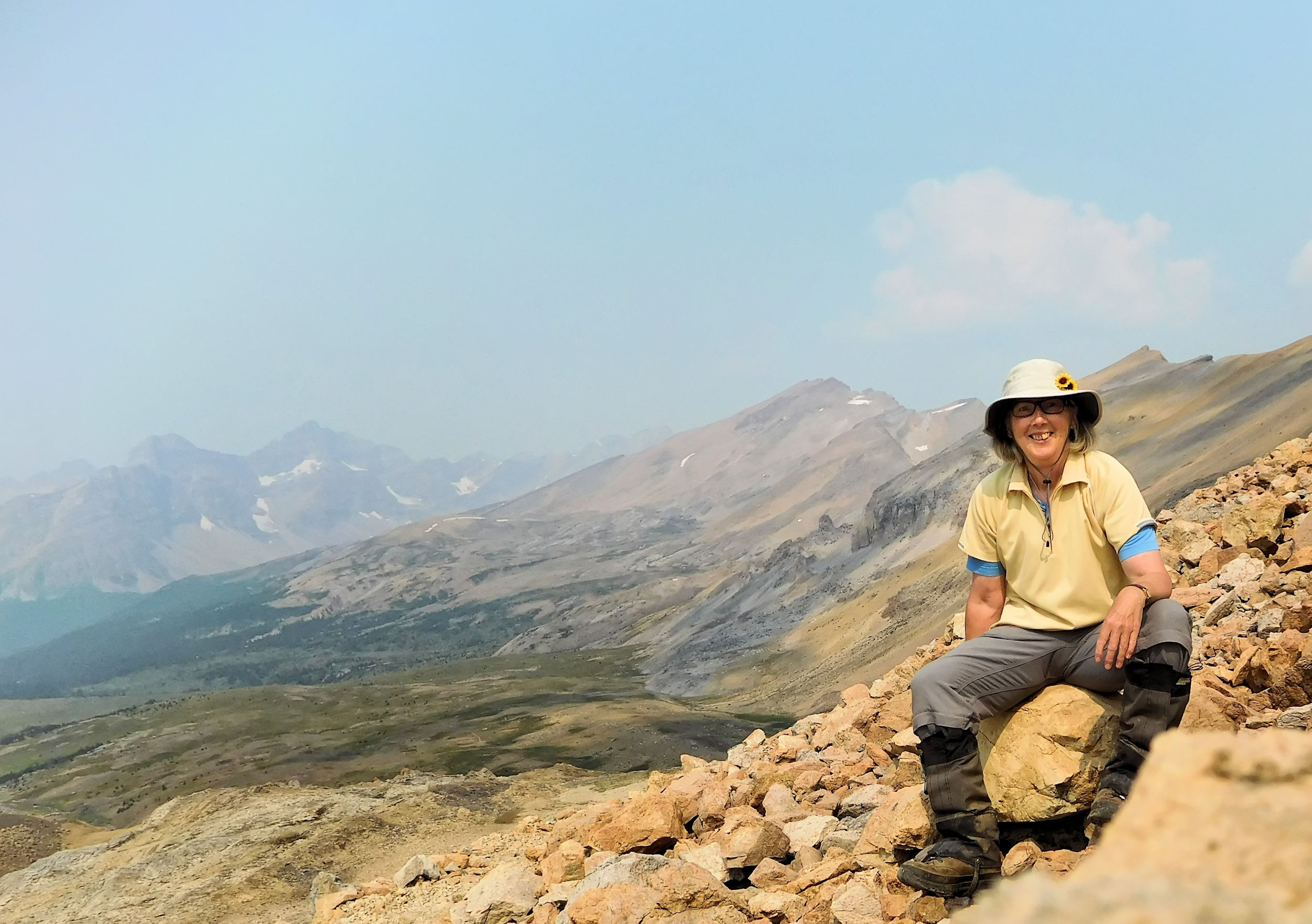
I take my time at the pass. The views of the peaks surrounding the Mosquito Creek valley are staggering.
View towards the Mosquito Creek valley
Beautifully streaked Molarstone Mountain
The Fang seen from the pass
Molar Ridge with The Fang and Noseeum Mountain in the background
In front of Molarstone and Mosquito Mountain, Watermelon Peak in the background
Closeup of Molarstone and Mosquito Mountain
Finally I begin the long decent from the pass.
Looking back up North Molar Pass
Looking back to North Molar Pass from further down
Giant Noseeum Mountain takes over the scenery once more.
Noseeum Mountain
First Mountain Arnica showing up again
Tarn in front of Noseeum Mountain
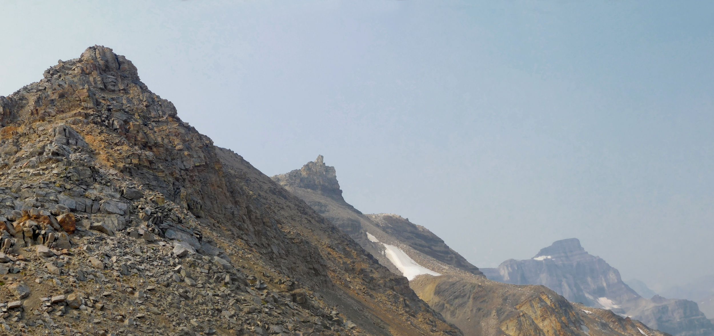
Some interesting pinnacles on the eastern slopes of the valley catch my eye. They are part of Molarstone Mountain.
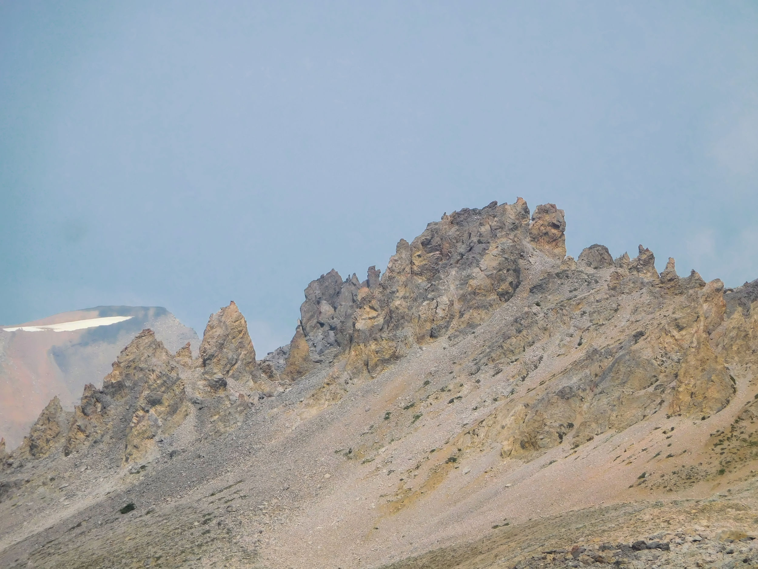
Pinnacles
Molarstone Mountain
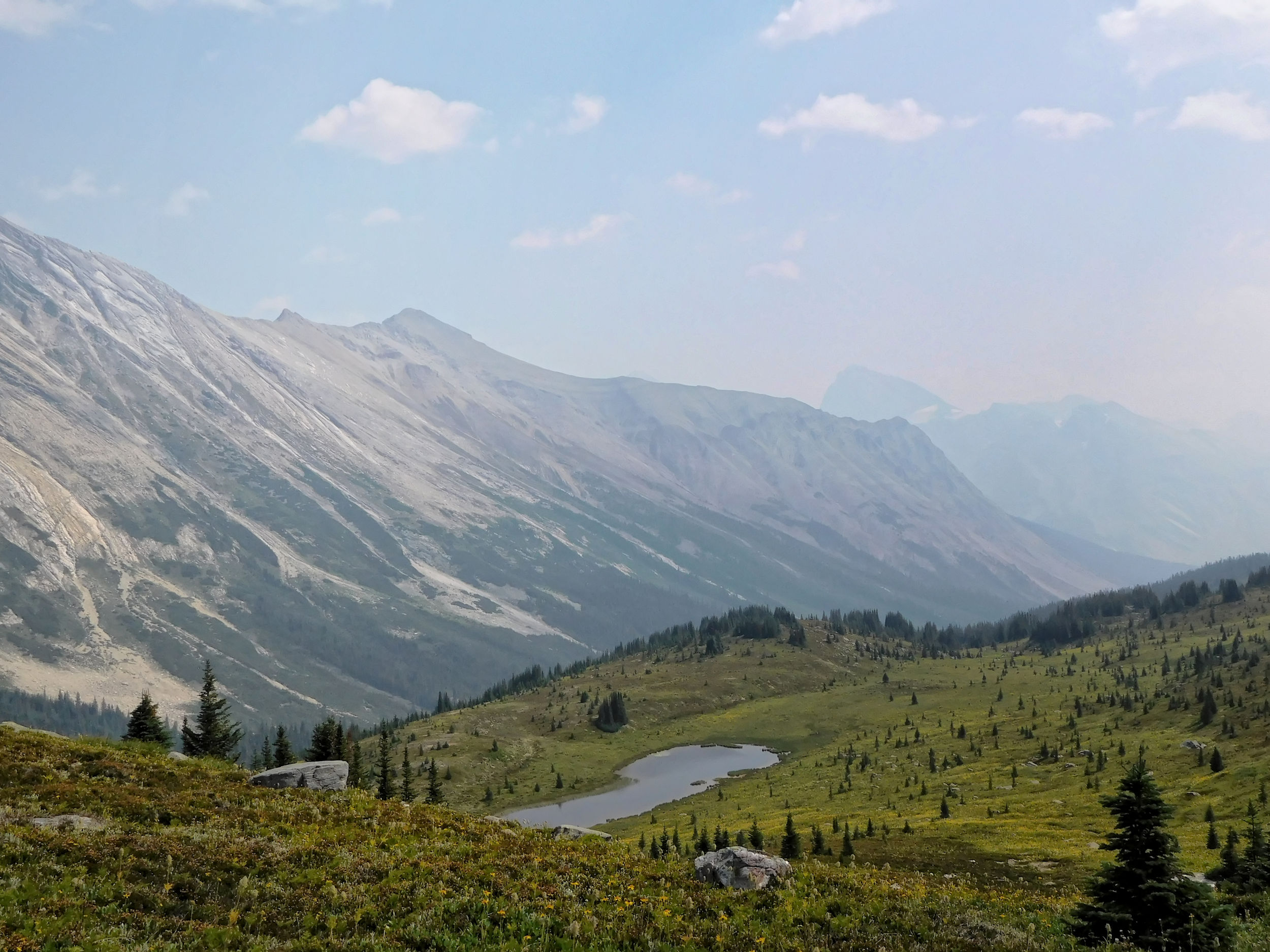
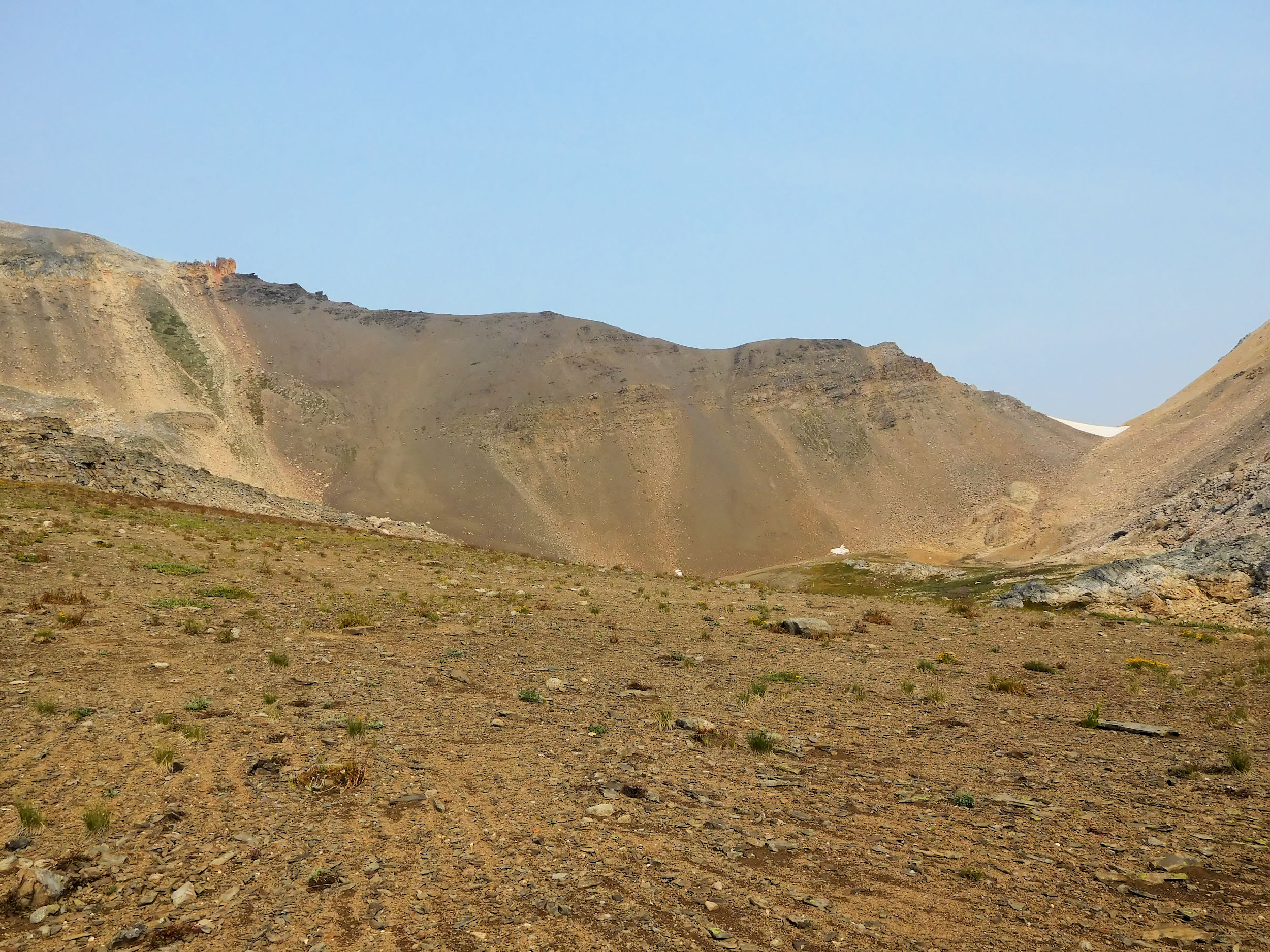
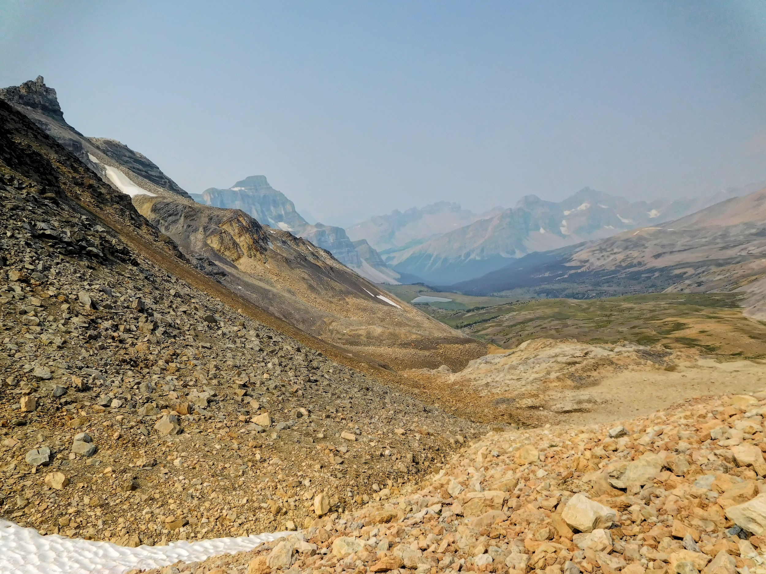
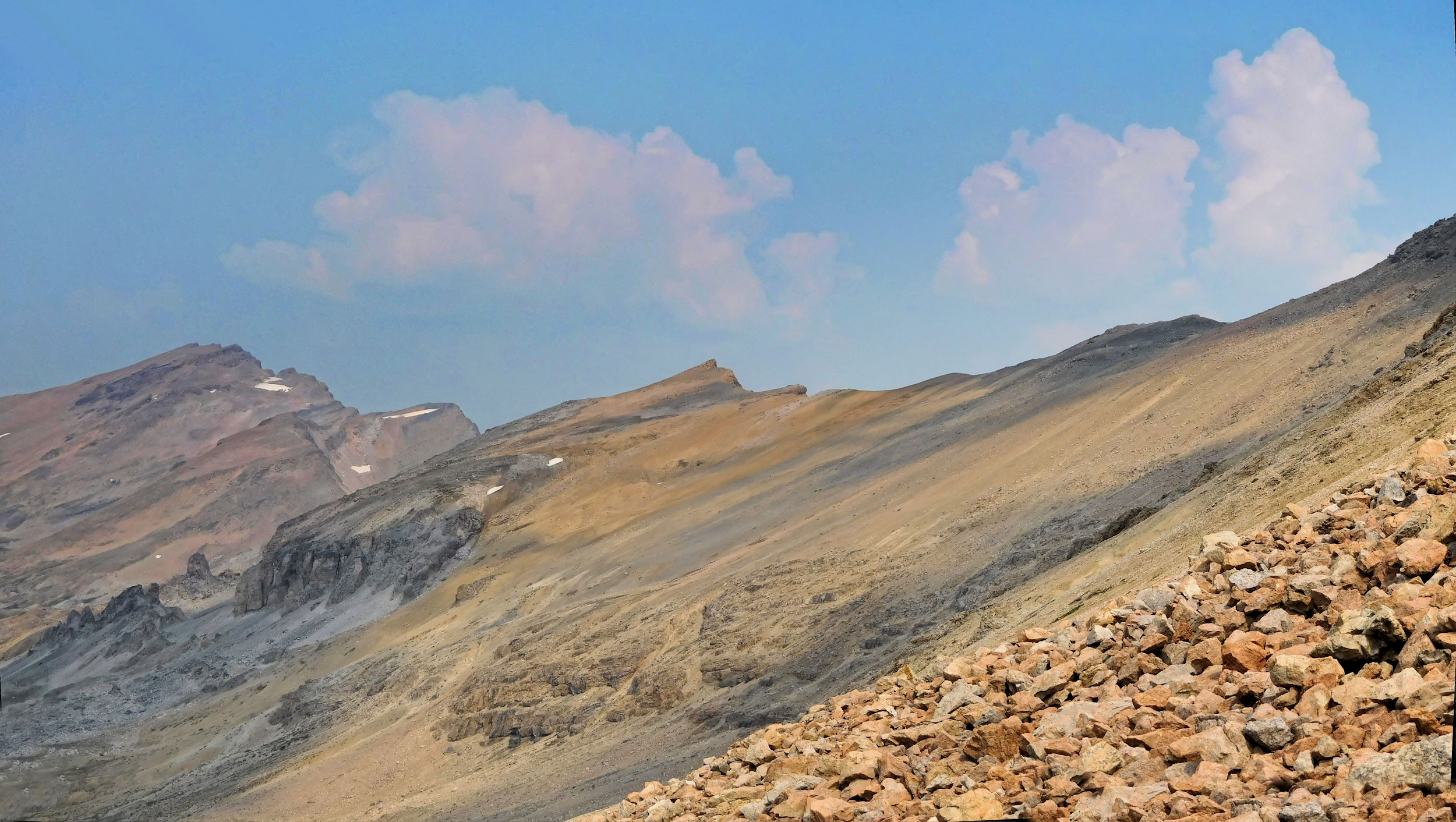
I have a long break on the shore of Mosquito Tarn. It is still too early for the campground and the views from the tarn are priceless. A gap in the eastern slopes provides a shortcut into the Pipestone valley or - if the descent on the other side seems too steep - to a viewpoint of Pipestone Pass. A future adventure might bring me there.
Ascent to the Pipestone Pass viewpoint…
…or a shortcut into the Pipestone valley
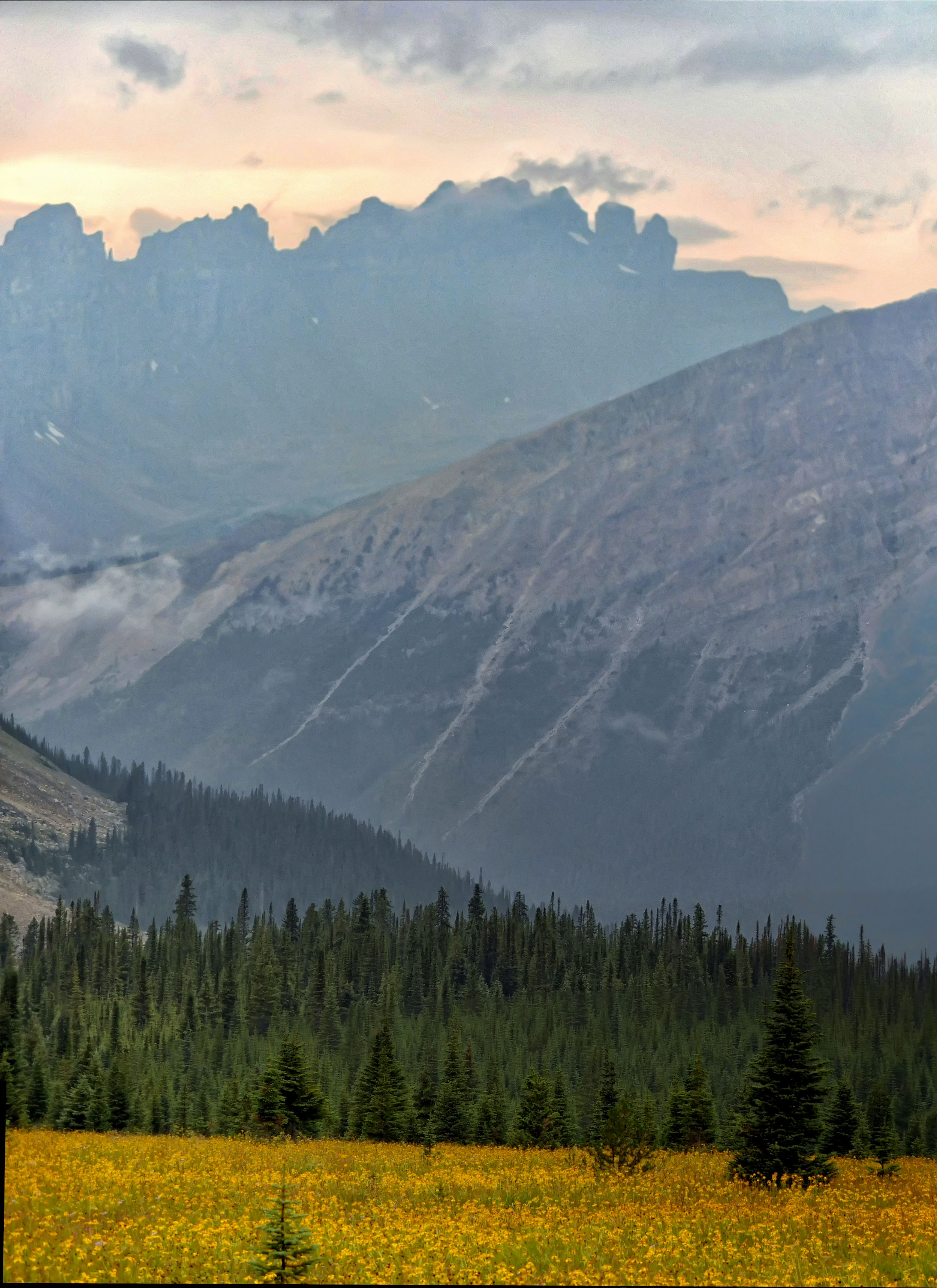
The Dolomites loom over the western end of the Mosquito Creek valley.
Dolomites to the west
On returning through the beautiful meadows with their carpets of arnica, I meet a family with two young children on their way to Fish Lakes. They look happy and I am amazed that the kids are up for such a strenuous hike.
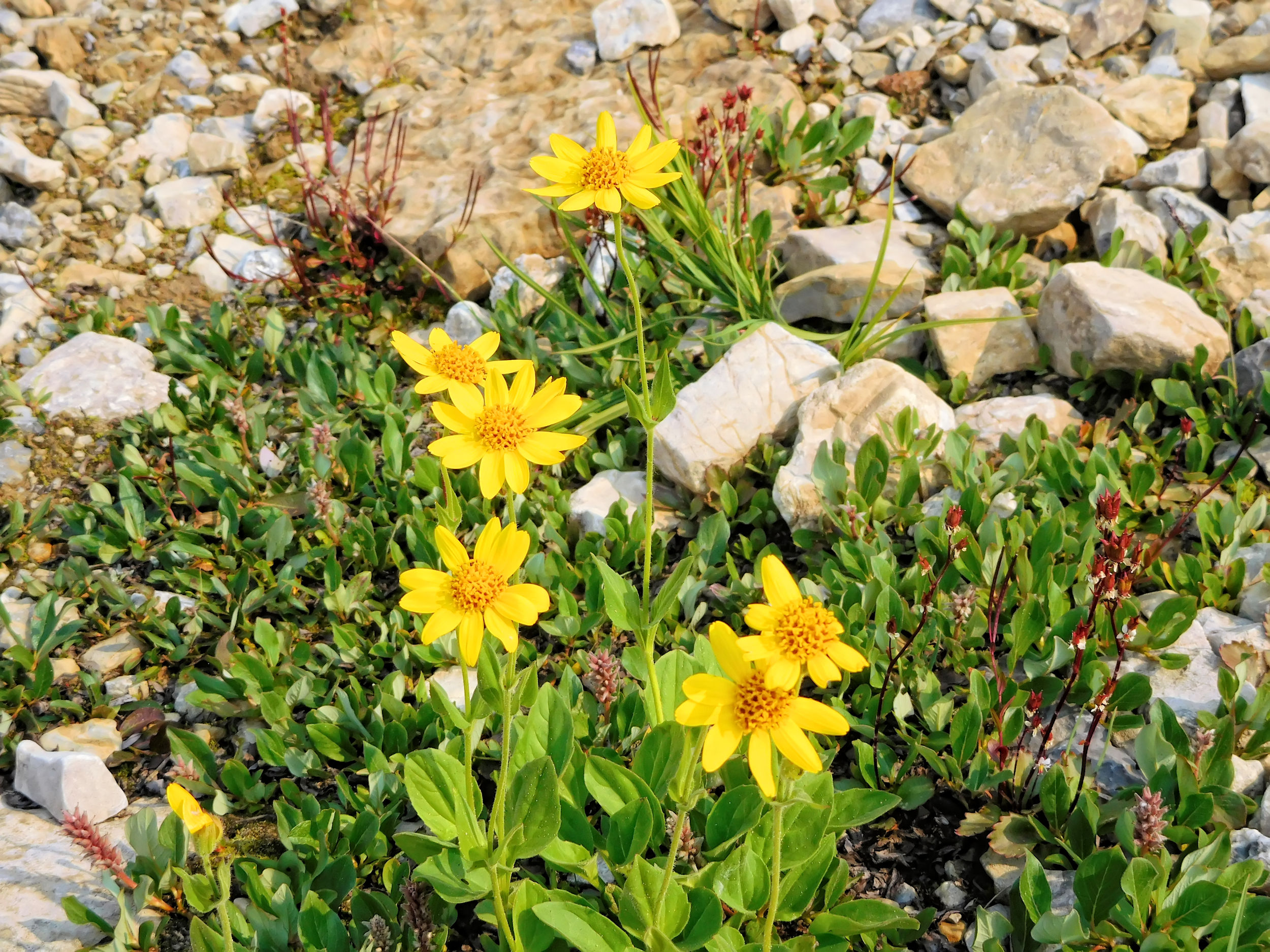
Mountain Arnica
The Fang with meadows below it
I reach the campground shortly ahead of the two girls who started out with me at Upper Fish Lake. They decide to use their booking and stay overnight for a good rest. Four of the five campsites are taken. Later that afternoon, thunder rumbles in the distance. It looks like a storm is moving in, then for a long time nothing materializes but a few drops of rain. Cooking dinner remains a mostly dry affair.
I am tired and retire to my tent early. In spite of the excited voices of the neighbour’s children who play hide and seek until darkness falls, I quickly fall asleep and have a good night. Eventually, a heavy rain shower comes down, accompanied by thunder. After that, the only remaining sound derives from the creek rushing by.
| Distance | 16.2 km |
| Time | 5 hrs |
| Incl. breaks | 6 ½ hrs |
| Min. Elevation | 1988 m |
| Max. Elevation | 2527 m |
| Ascent | 539 m |
| Cum. Ascent | 1060 m |
| Cum. Descent | 1027 m |
For the first time the night had a bit of a chill to it. The sky has remained clear and in the morning the sun is shining again. With nothing to pack up, I am on the trail early to explore the South Molar Pass area. It takes me about an hour to get to the fork between the North and South Molar Pass trails. The valley that leads up to South Molar Pass is very different from the open meadows on the other side: lusher vegetation and many more trees. The trail winds through dense forest that is interspersed by small meadows with flowers. The path is quite narrow at times and I cannot see what is ahead of me. I start making lots of noise because this is prime grizzly country and it is not a good idea to surprise one of them on the trail.
I am walking directly below Noseeum Mountain. The fireweed here is the tall kind, different from the dwarfed Mountain Fireweed found on the North Molar meadows.
Noseeum Mountain with fireweed
The trail ascends gradually. I arrive at the bottom of a beautiful cascade that meanders through rocks and flowers. I recognize it from ten years ago when I came here with the Skyline Hikers. We called it the Japanese garden. At the time, in early July, the flowers were partially covered with fresh snow which was quite attractive, too.
The Japanese garden

A snowy Japanese garden in 2010

From the Japanese garden the trail becomes steep and climbs out of the valley. South Molar Pass is just ahead.
View back over the valley
A lone hiker comes down the trail and I recognize him from my day hike to Pipestone Pass. Ian has spent a windy night at Devon Lakes and another one with a heavy thunderstorm at Molar Creek campground. It seems that yesterday’s storm came down mostly on the other side of the mountain passes. Ian has hiked a clockwise loop and up to here hasn’t seen another soul on the whole way.
In the distance in front of me I make out the silhouette of another hiker. He is sitting up at the pass and having lunch. When I approach, he tells me immediately about the grizzly bear that he had an encounter with right on the narrow trail. Fortunately, it was a good bear: startled for a moment - just like the hiker was - it instantly took off into the bushes. The hiker’s name is Rob and I thank him profoundly for taking care of the bear. Rob was hiking just 30 minutes ahead of me.
We continue along the trail together for a while. The fireweed grows in particularly thick patches here.
Patches of fireweed
Rob is very knowledgeable about this area and points out several landmarks to me. He lives close by and hikes here often. His dad has German background and comes from the same town as I do. What a small world! Eventually I stop for lunch by a creek that crosses the trail, while Rob continues on to find a certain lake further down the valley.
After lunch, I follow up on my plan to explore how to best access The Fang from this side of the Molar ridge. I have brought with me the old Skyline Hikers map and it shows a route that I want to try. The creek is a good landmark for orientation. I follow it up towards the mountain.
Higher up, the views get even better. Noseeum Moutain is dominating yet again. From Rob I have learned that Mount Andromache is behind it and the glacier is named Molar Glacier.
Noseeum Mountain
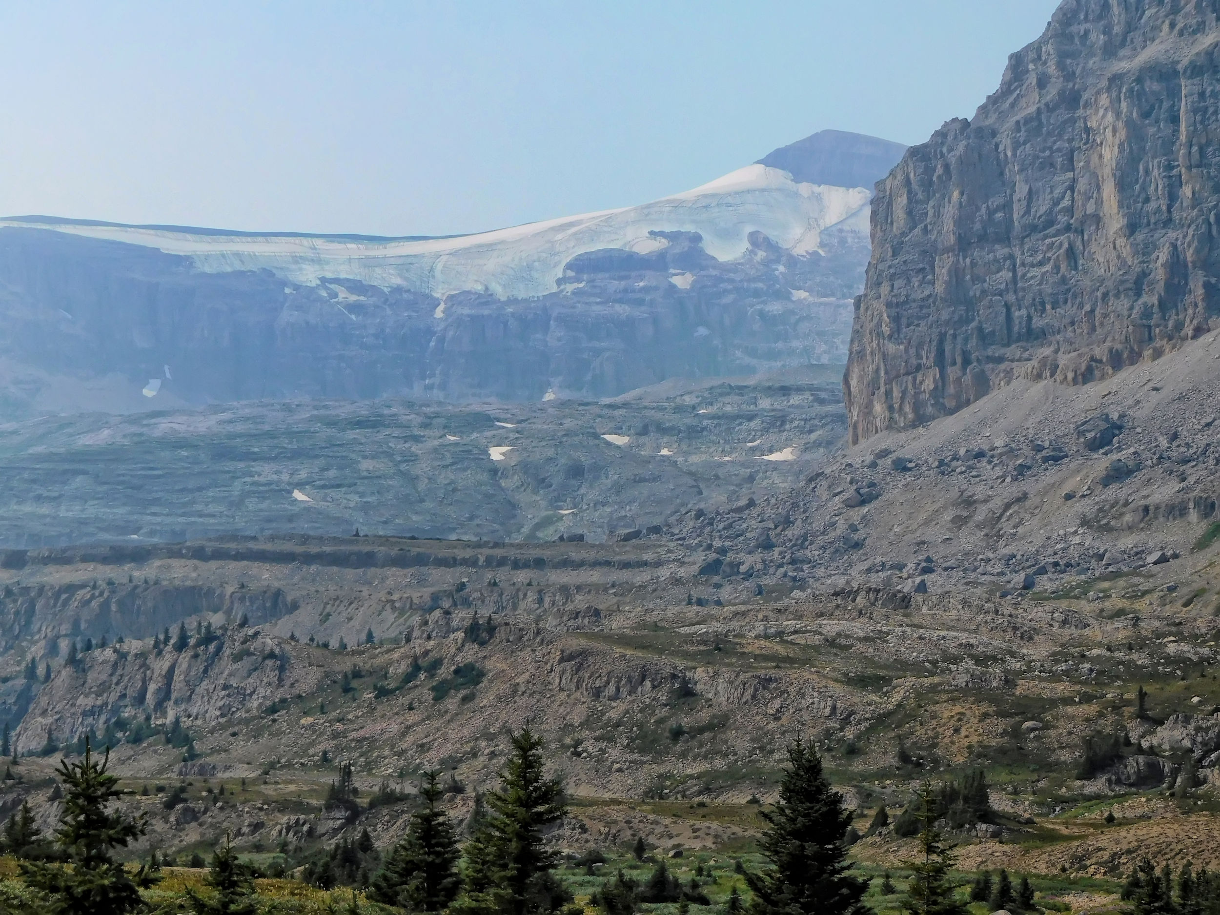
Mount Andromache 3033 m with Molar Glacier
I finally catch a glimpse of Molar Mountain itself against a hazy sky. Considering the shape of this monumental mountain, “molar” is a very fitting name.
Molar Mountain 3022 m
It is quite easy to hike up the meadow, the backside of The Fang always in focus. The meadows end in a vast field of big boulders.
Approaching The Fang from its backside
I follow the edge of a pile of boulders and reach a small tarn. From here I can even see Mount Hector and Little Hector peeking out behind Mont Andromache.
Tarn with Mount Hector, 3394 m, and Little Hector in the back
From the tarn I backtrack to a point from where a rock-strewn gully leads straight up. I figure that right here would be the best route to actually scramble up to The Fang.
Possible scramble to The Fang
The final outcrop of The Fang’s rock formation consists of unstable boulders. On a future clear day, I might try and reach the base of those boulders on the Molar ridge from here. It is yet another entry on my growing wish list.
Top boulders of The Fang
I return the same way I came up, and halfway down the hill I run into Rob again. We walk cross-country through the meadows until we descend steeply to the trail, joining it just below South Molar Pass.
Descending to the South Molar Pass trail
Back on the official trail, we part ways. I have a rest on a knoll next to where the trail drops sharply into the valley and watch Rob’s descent from here.
Returning from South Molar Pass
It is still a long way back to the campground, fortunately without any further bear encounters. As always after a day hike, I am happy to return to my tent waiting for me at the campground.
In the meantime, the family with the two young kids has returned from Fish Lakes. They don’t look so happy any more, particularly the eight-year-old son. Sleeping bags, clothing, inner and outer tent, everything is hung up to dry on a long clothesline. The father tells me that they got inundated by a terrible thunderstorm during the night at Fish Lakes campground. Their tent flooded badly and most of their stuff got wet. In the morning the tent was so muddy that he washed it in the lake. They are having supper while things dry out. The son is adamant that they not spend another night camping. His little sister seems mellower, but the son gets his wish: by 5 pm they are gone. Fortunately the highway is only a little more than an hour away.
The campground is almost deserted again, only one other tent is up for the night. For some reason the roaring of the creek seems louder tonight and wakes me up numerous times.
| Distance | 5.0 km |
| Time | 1 ¼ hrs |
| Min. Elevation | 1868 m |
| Max. Elevation | 2014 m |
| Descent | 146 m |
| Cum. Ascent | 153 m |
| Cum. Descent | 290 m |
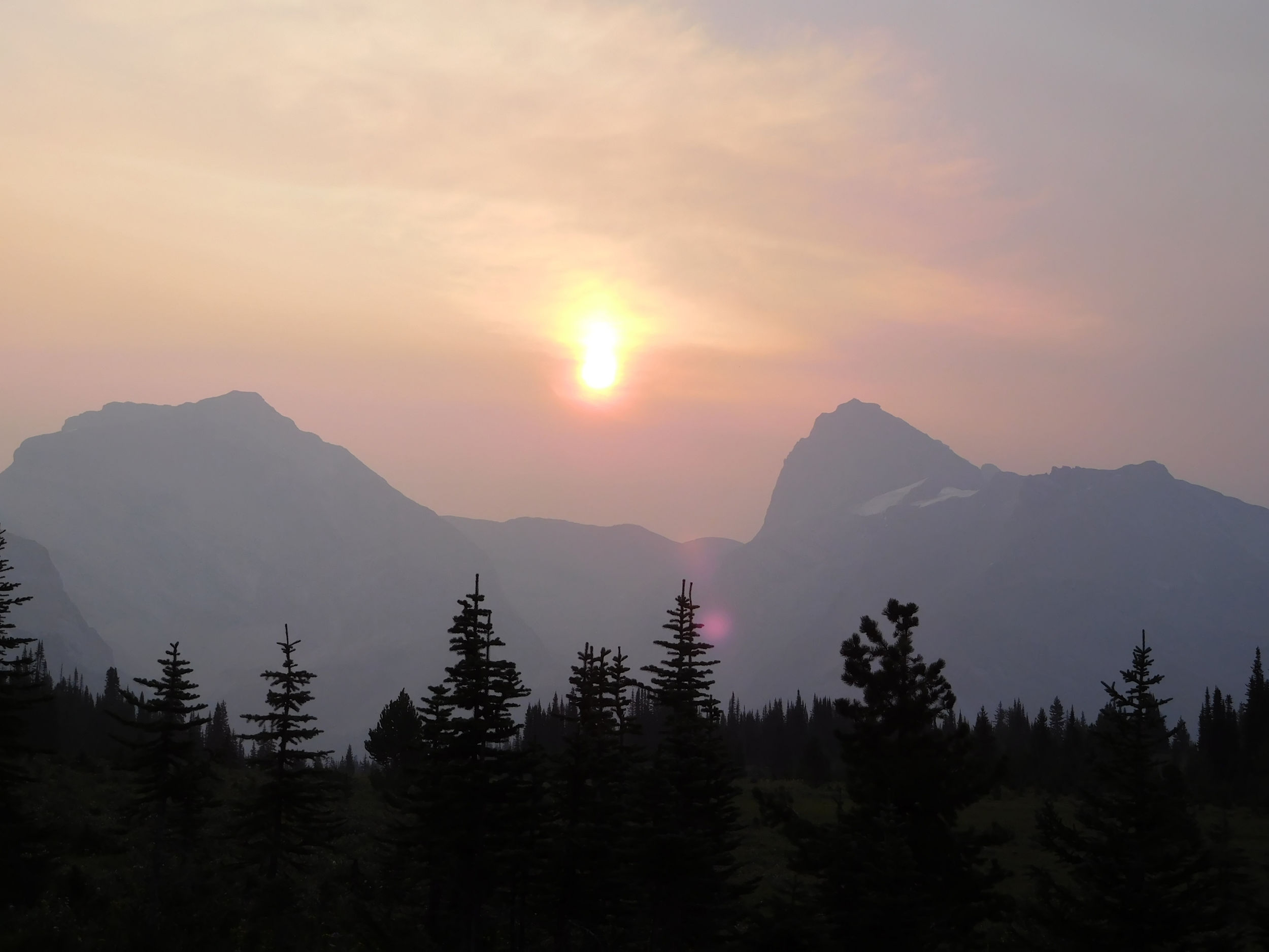
Smoke has drifted into the Mosquito Creek valley overnight and for the first time I can really smell it. One more reason I abandon the idea of another hike today. My time is limited to a few hours anyways, because I still want to hike out and drive on. Both, a return to South Molar Pass for further exploration or a hike towards the Dolomites would take a full day. Instead, I break camp and leave for home.
Leaving a smoky Mosquito Creek valley
I am making such good time that I don’t even consider stopping overnight in Golden as I usually do, but drive straight home. The smoke gets thicker and is worst near Glacier National Park and Revelstoke, where it is dark like nightfall. Fortunately there are no road closures. Near Chase the air clears and it stays decent for the rest of the way home.
I am happy that I beat the odds and enjoyed a great hiking adventure regardless of the smoke and the fires all around. I look forward to work on my growing wish list in the coming years.