 Via Jasper to Hilda CreekAugust 3

500 Kilometers in 5 ½ Hours
There are only seven days of rest between my first and second trip into the Rocky Mountains this year. The Parks Canada trail report lists the Brazeau Loop still as not recommended. From the visitor center I find out that they have cleared the trail from a lot of deadfall, but that it is still very muddy. It can’t be much worse than the Banff Highline trail I have just hiked, so I don’t let the information deter me.
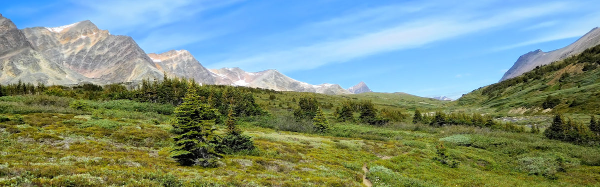
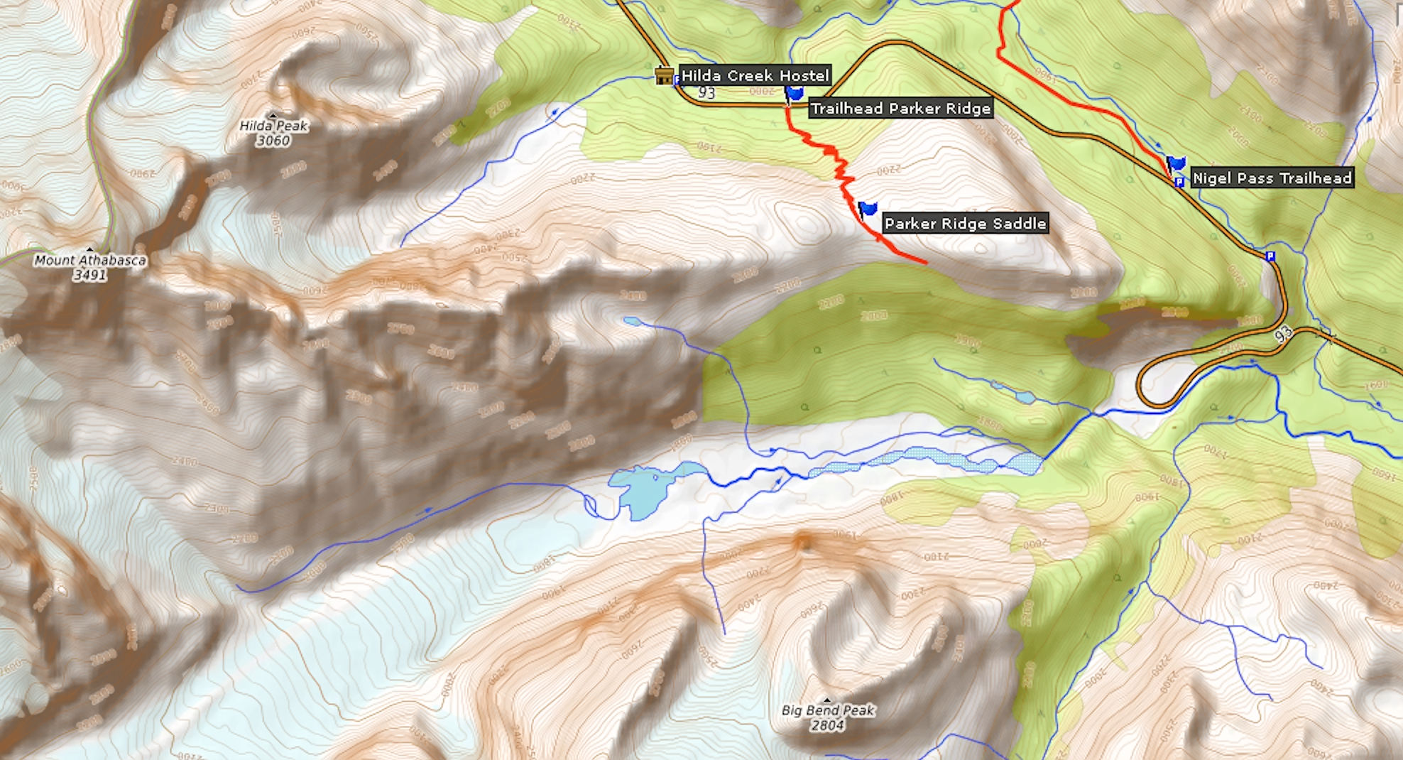
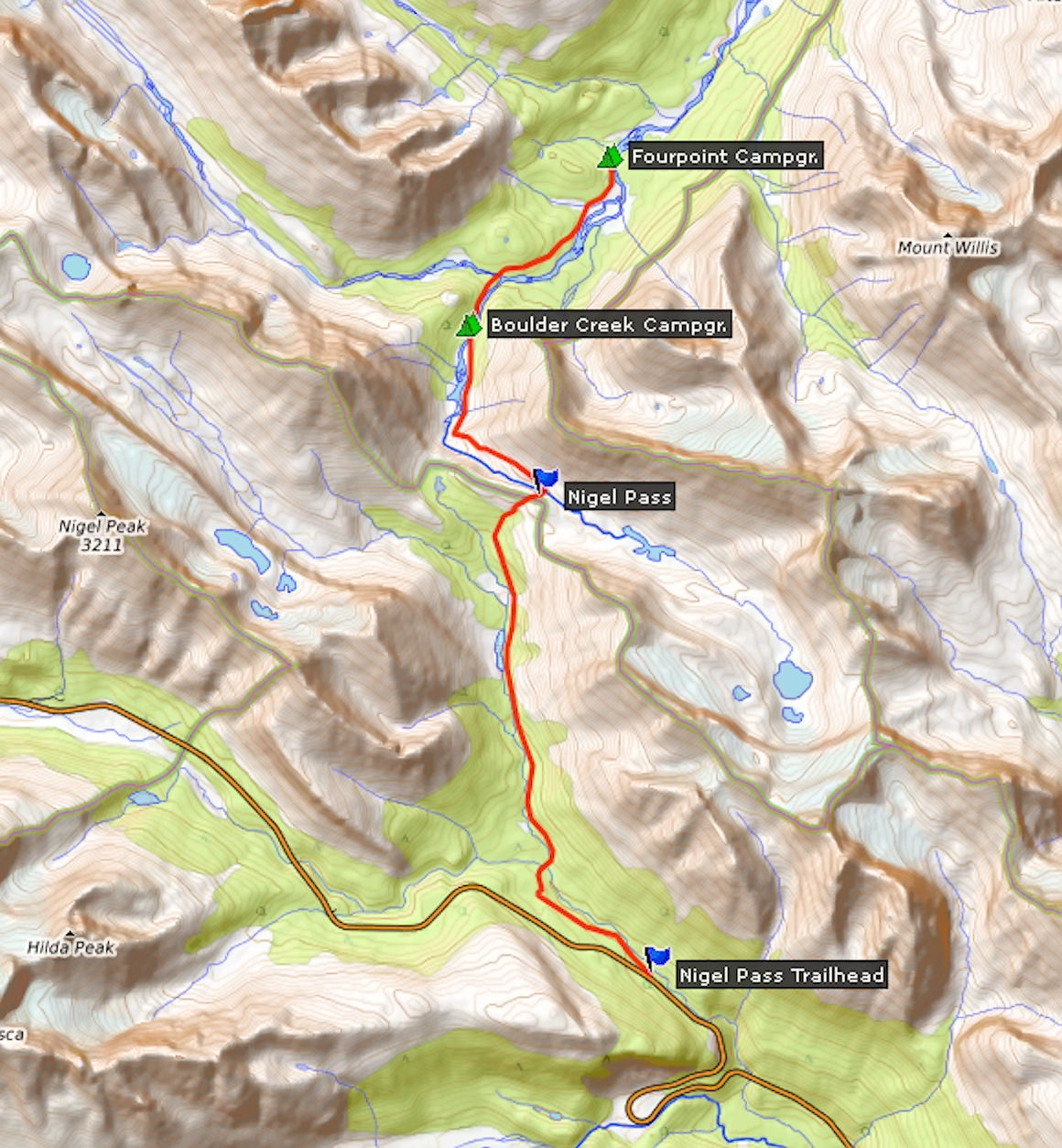
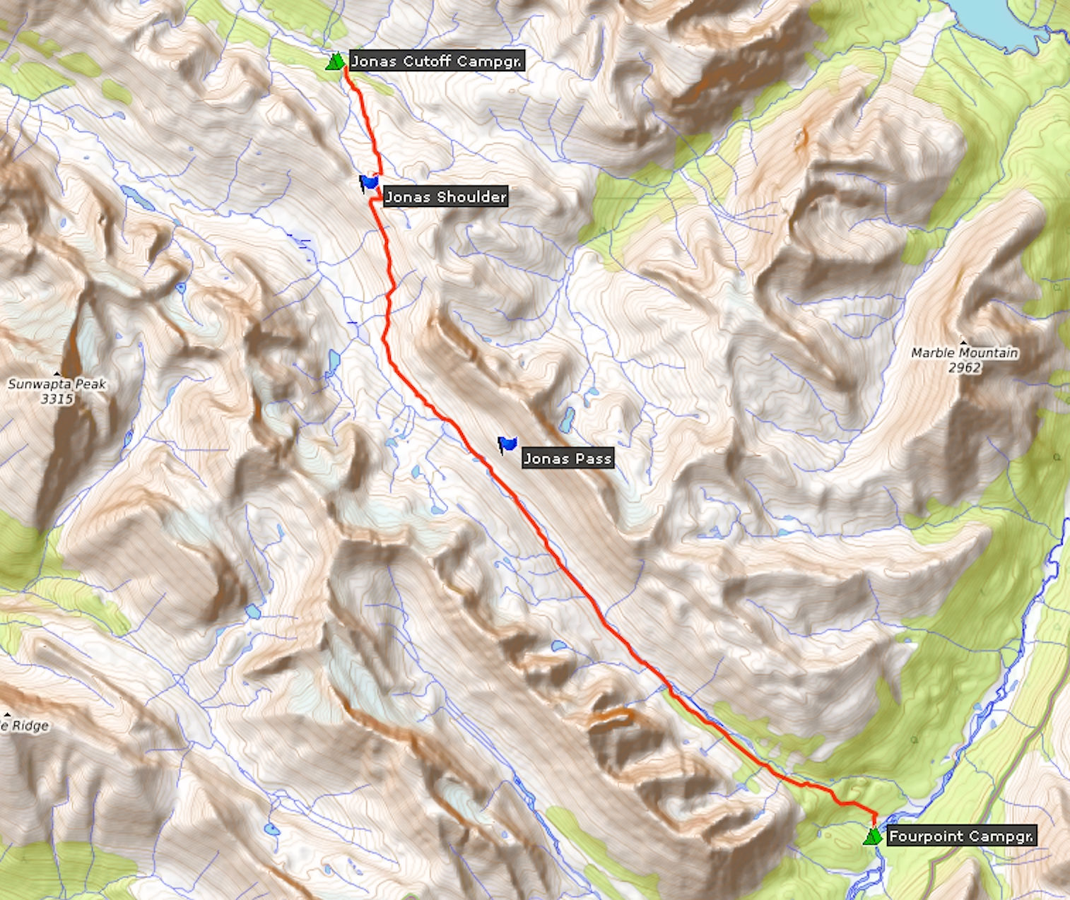
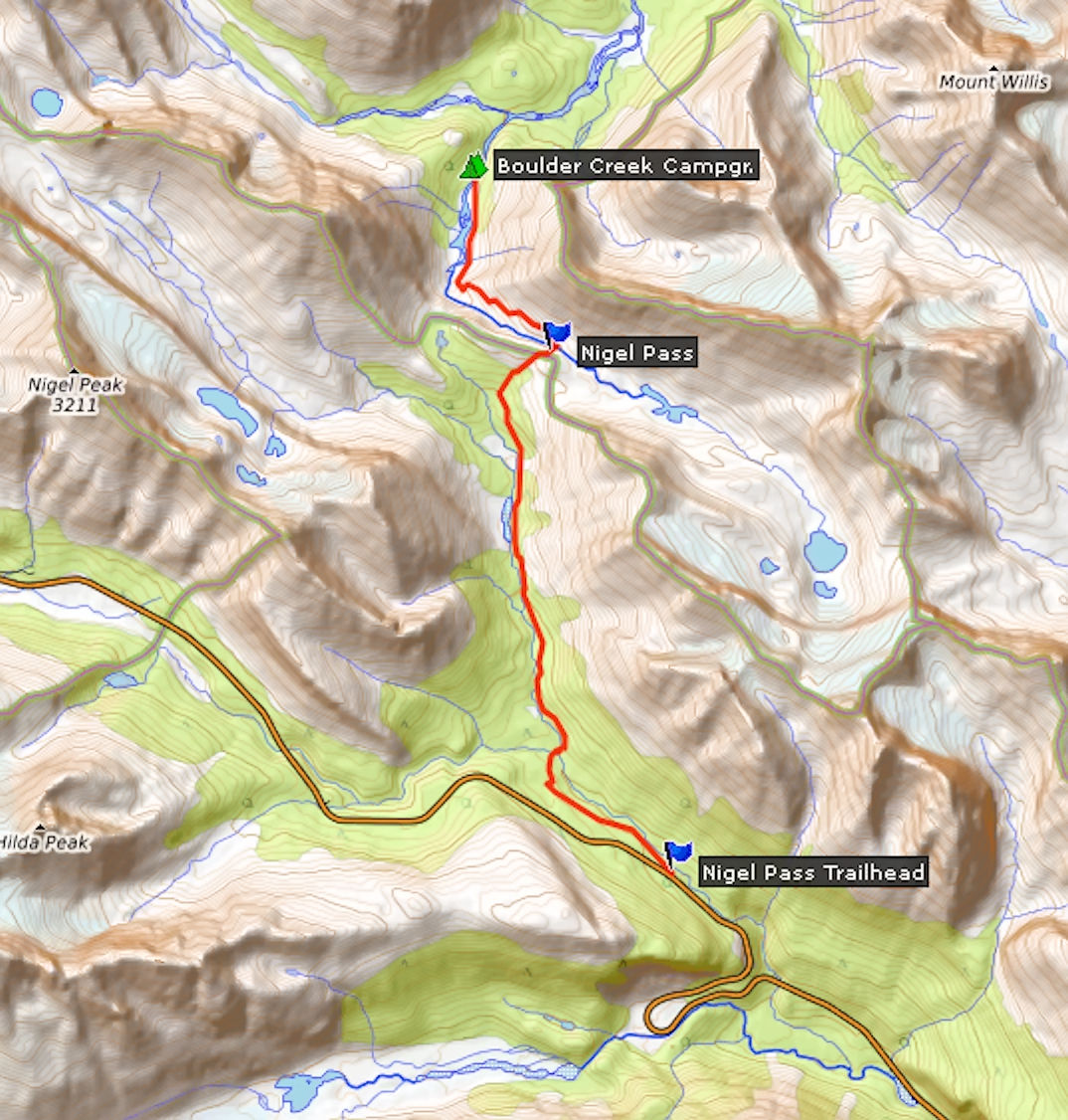
My destination for the first night is Hilda Creek Wilderness Hostel. It is located at the southern end of Jasper National Park and only ten minutes away from the trailhead for the Brazeau Loop. I won’t do the full Brazeau Loop this time; instead I’ll hike only the western half of it, both ways through the high alpine. Conditions permitting, I am going to extend the hike to Cataract Pass at the border between Jasper and the Wild Goat Wilderness. This route skips Brazeau Lake with one of the most beautiful campsites in the backcountry, but it avoids a 19 km slog through thick forest along the Brazeau River. My hike will cover about 90 kilometers instead of the usual 81.
The roughly 500 km drive via the town of Jasper takes me five and a half hours including breaks and refuelling. The weather is nice and invites to a stop at the Columbia Icefield.
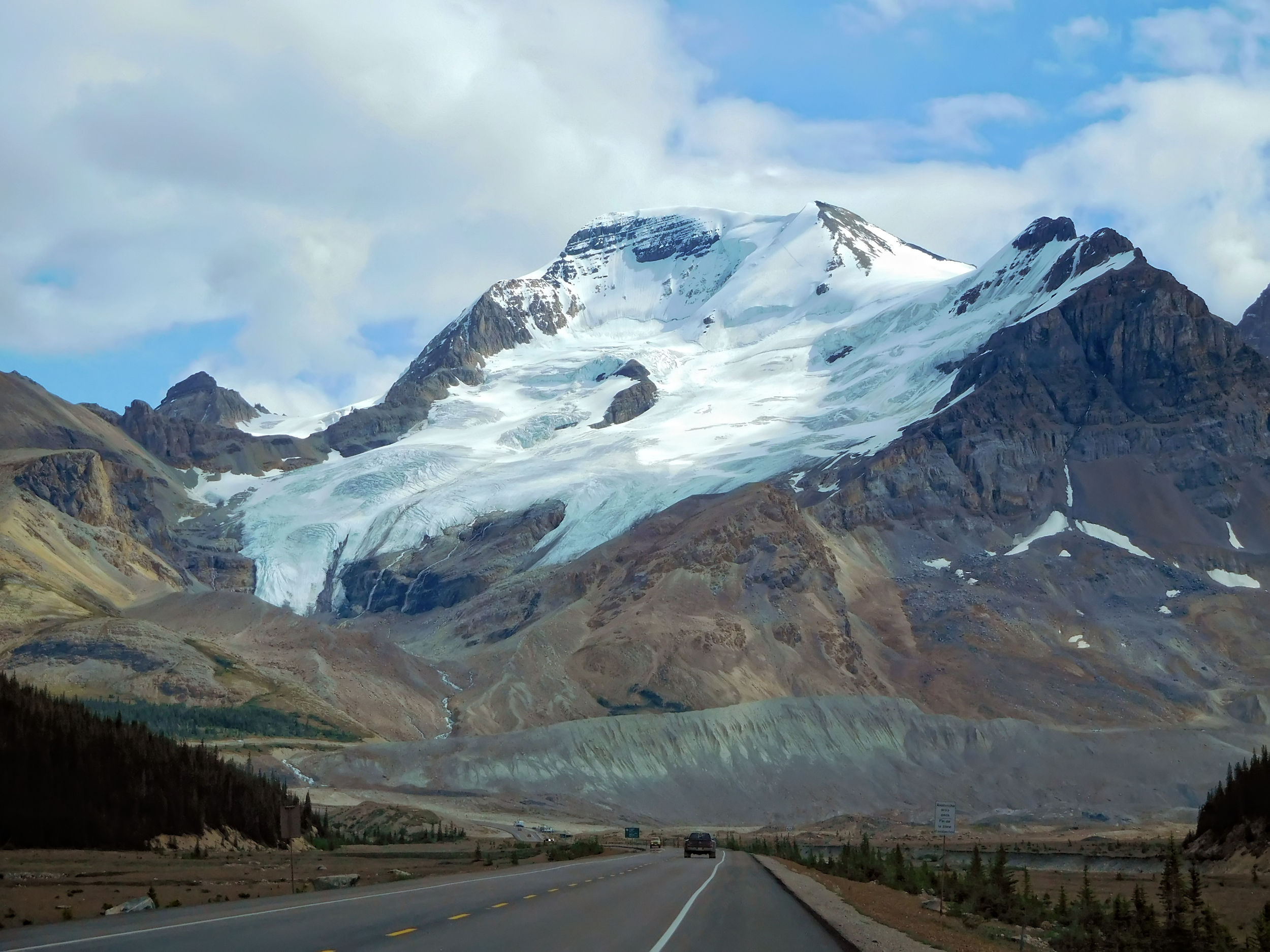
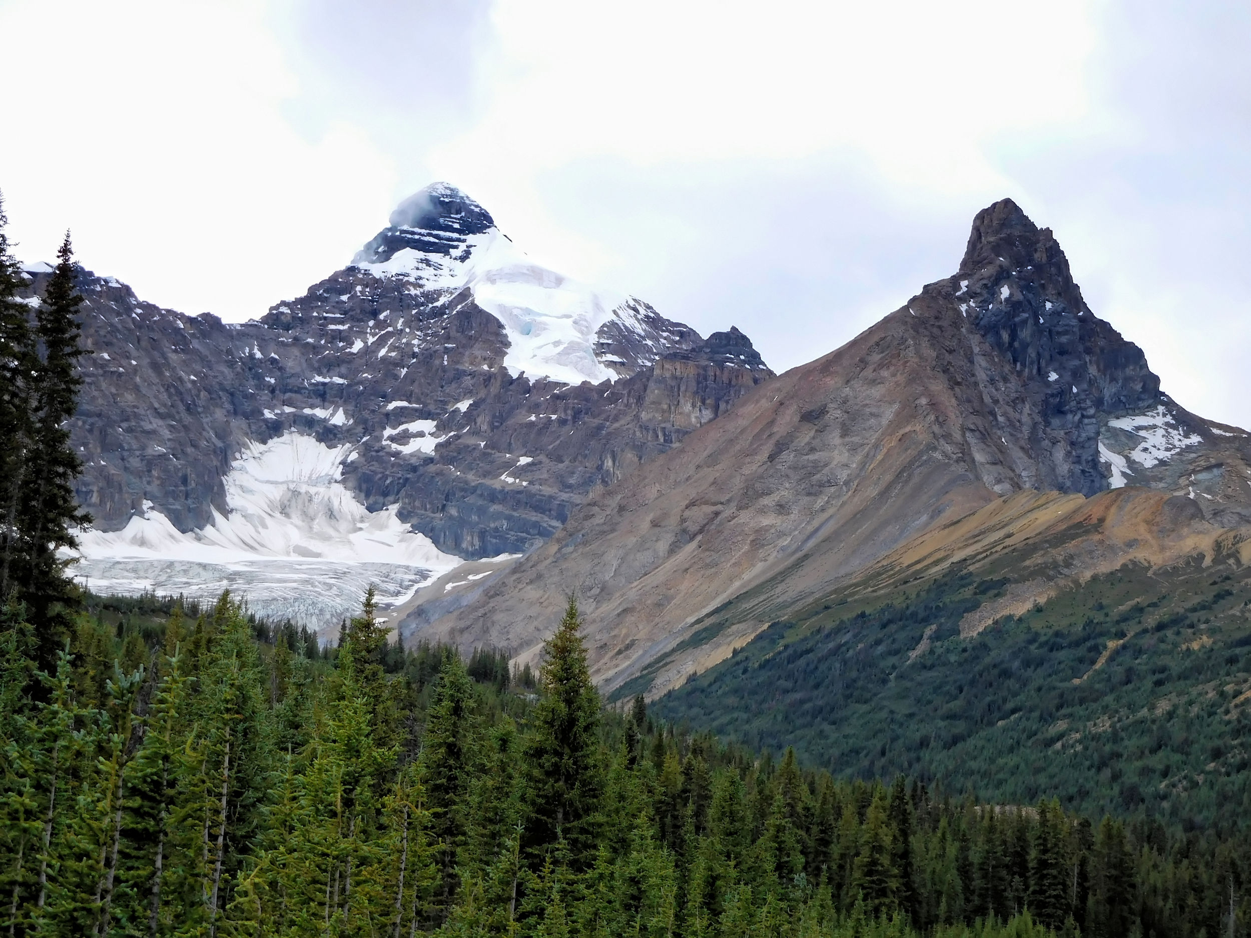
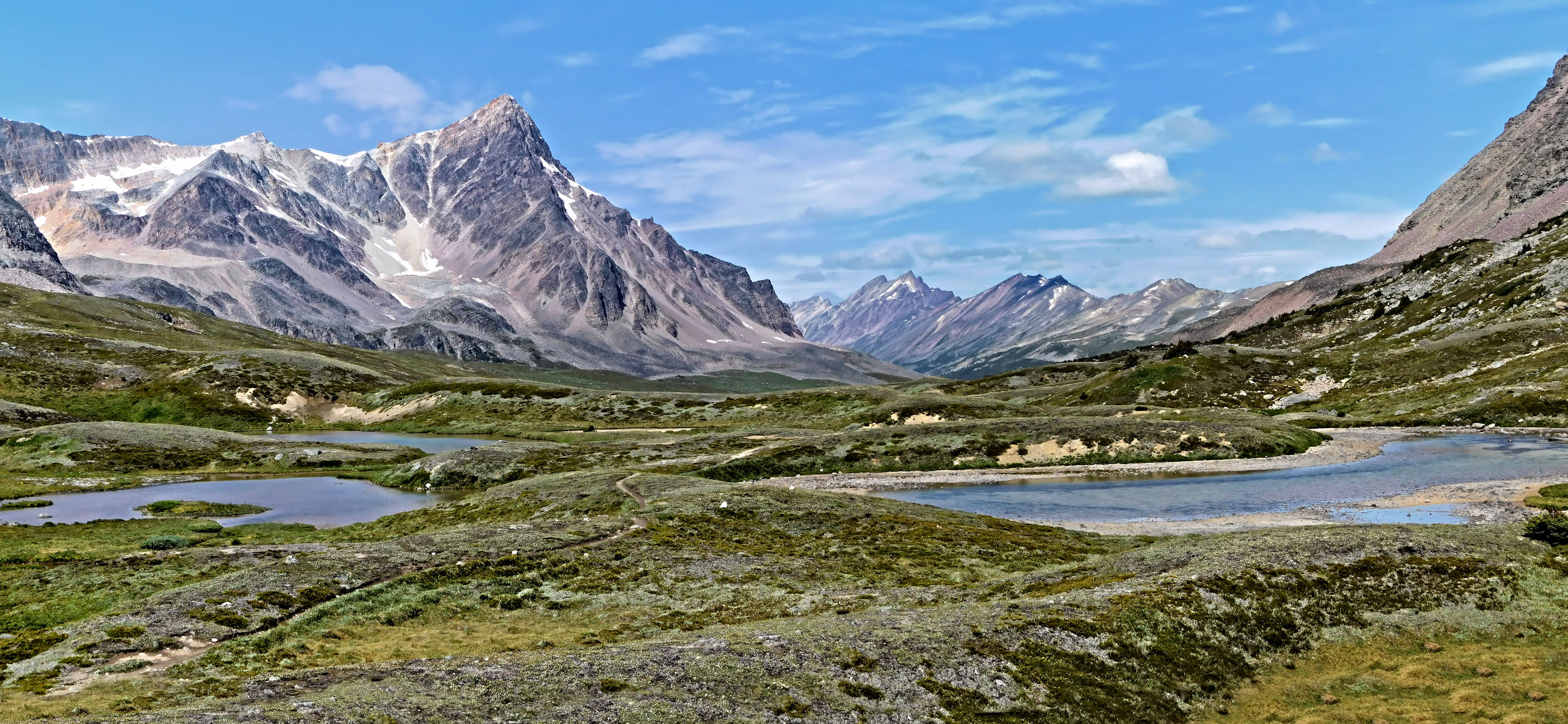
Mount Athabasca 3491 m
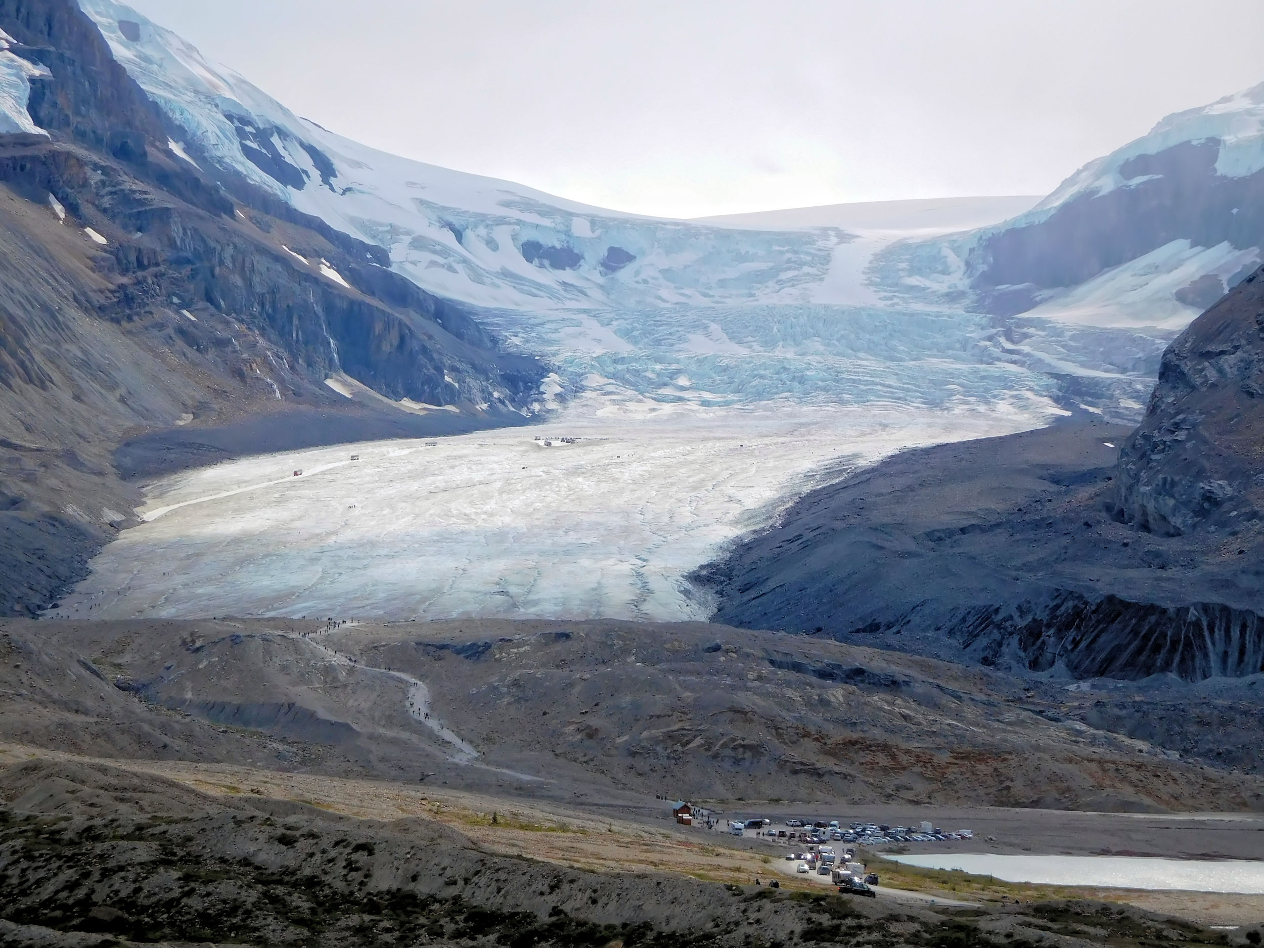
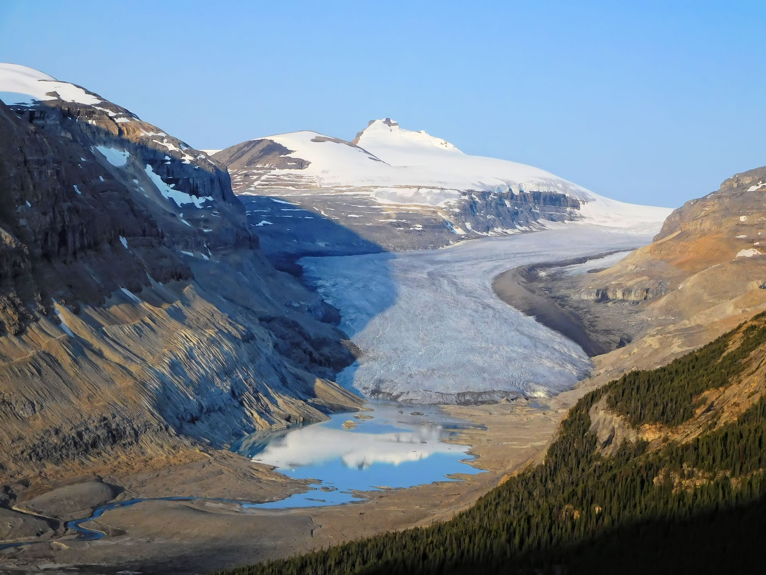
Athabasca Glacier
The Columbia Icefield is one of the largest ice fields south of the polar circle. It is located on the Continental Divide and is the source of the Athabasca and the North Saskatchewan rivers. It feeds eight big glaciers like Athabasca, Castleguard, Columbia, Dome, Stutfield and Saskatchewan. Around its edges are some of the highest mountains of the Canadian Rocky Mountains like Mount Columbia (3747 m), Mount Bryce (3507 m), Mount Kitchener (3505 m) and Mount Athabasca (3491 m).
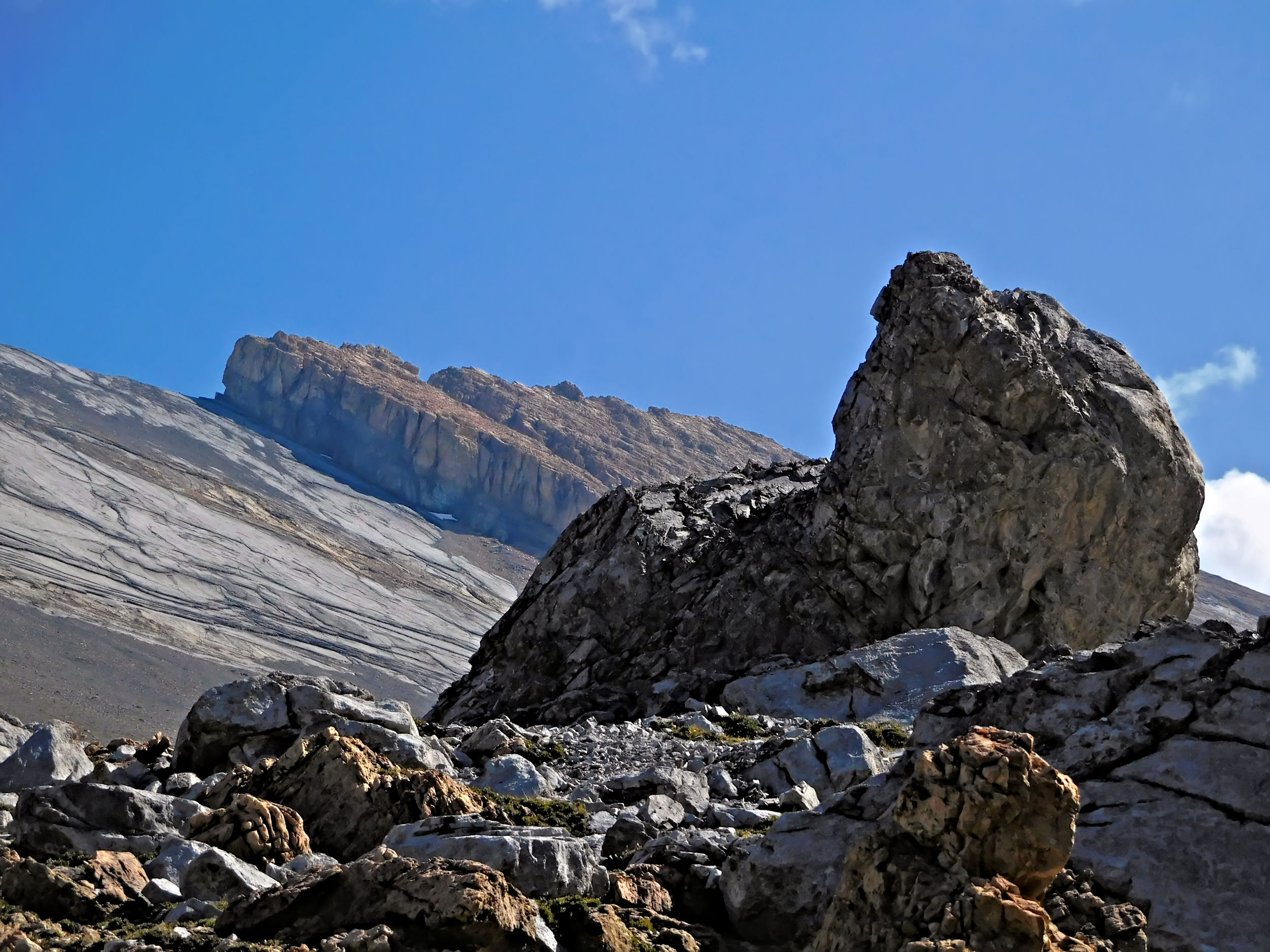
The views are worth the stop, but the Icefield Center is very crowded and I don’t linger there for long, since the Hilda Creek hostel is only 7 kilometers further down the road. You have to park at a trailhead on the other side of the highway and walk up to the hostel. I have prepared an extra backpack for the short trip. The small hostel is not staffed. I have two different codes to open the door lock of the main building, and fortunately one of them works. The lock for the bedroom building is broken. You can get in, but can’t lock the door. The hostel is in a beautiful setting, but it could use some repairs. Not a problem for the one night that I am staying here. The hostel sleeps six in bunk beds. When I have finished the chores, like opening the shutters, turning on power and the propane bottle, making my bed and lugging two big buckets of water from the creek, three more hikers arrive for the night.
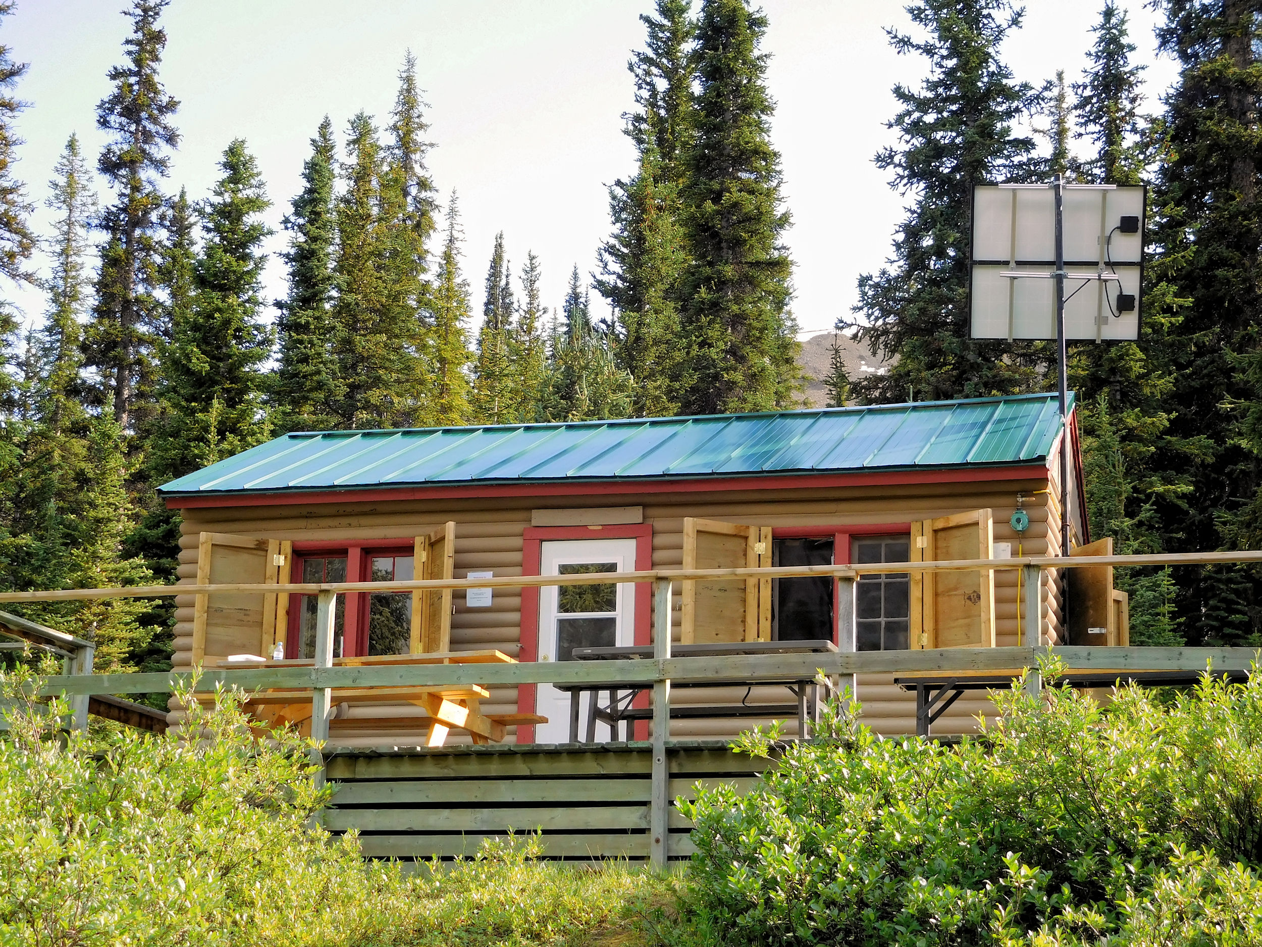
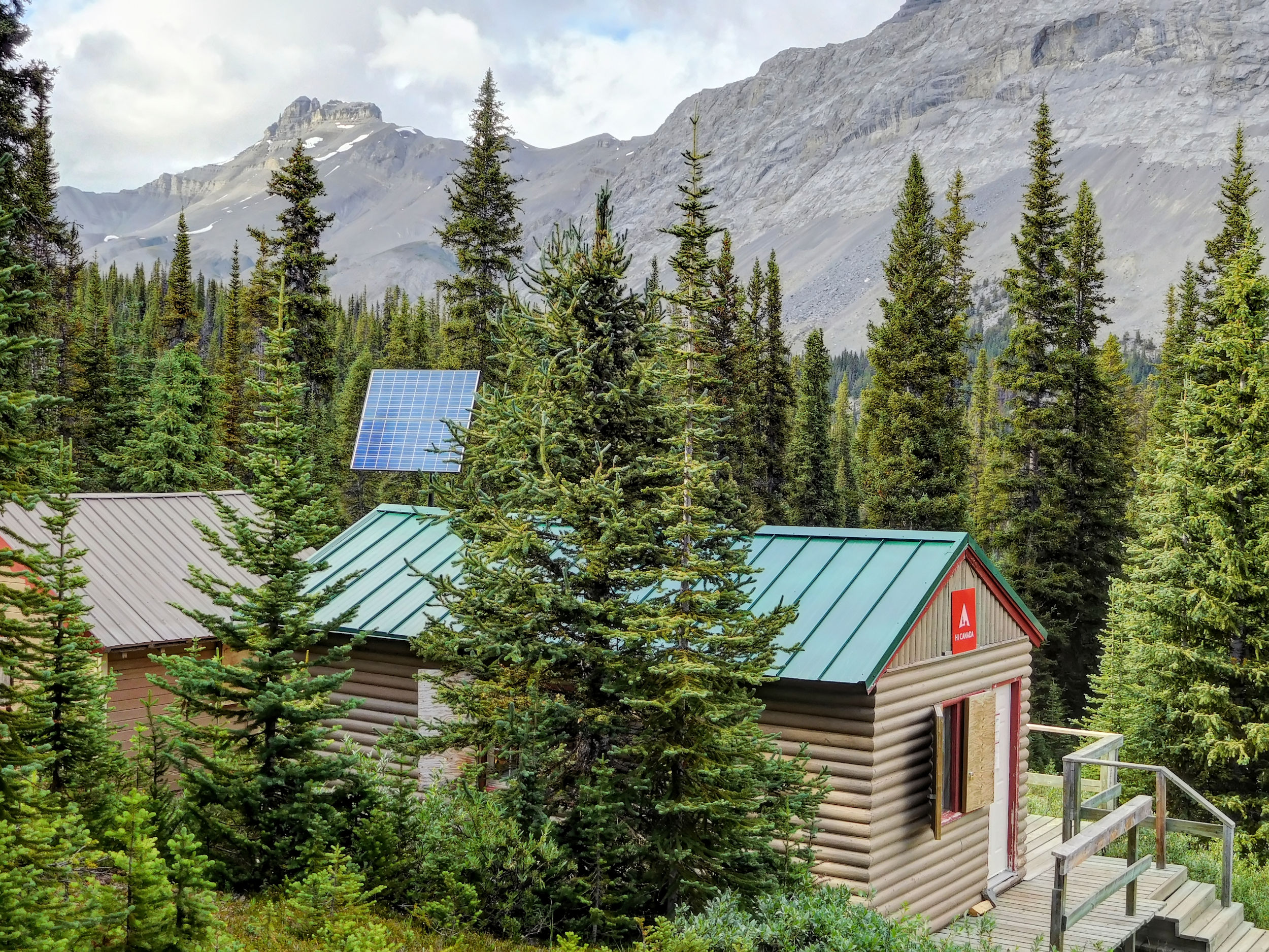
The hostel is situated above 2035-m-high Sunwapta Pass that separates Jasper and Banff National Park. Up here you have some outstanding views. I drag one of the worn armchairs out onto the deck and enjoy an early dinner. Later I stroll up on a narrow and steep path that leads to Hilda Glacier. The glacier itself is too far for an evening walk.
Mt. Athabasca 3491 m, Hilda Glacier and Hilda Peak 3060 m
My fellow hostellers hike up Parker Ridge to enjoy the sunset from there. I will explore the ridge early tomorrow morning before I start my hike on the Brazeau Loop.
| Distance | 5.2 km |
| Time | 1 ½ hrs |
| Min. Elevation | 2016 m |
| Max. Elevation | 2265 m |
| Ascent | 249 m |
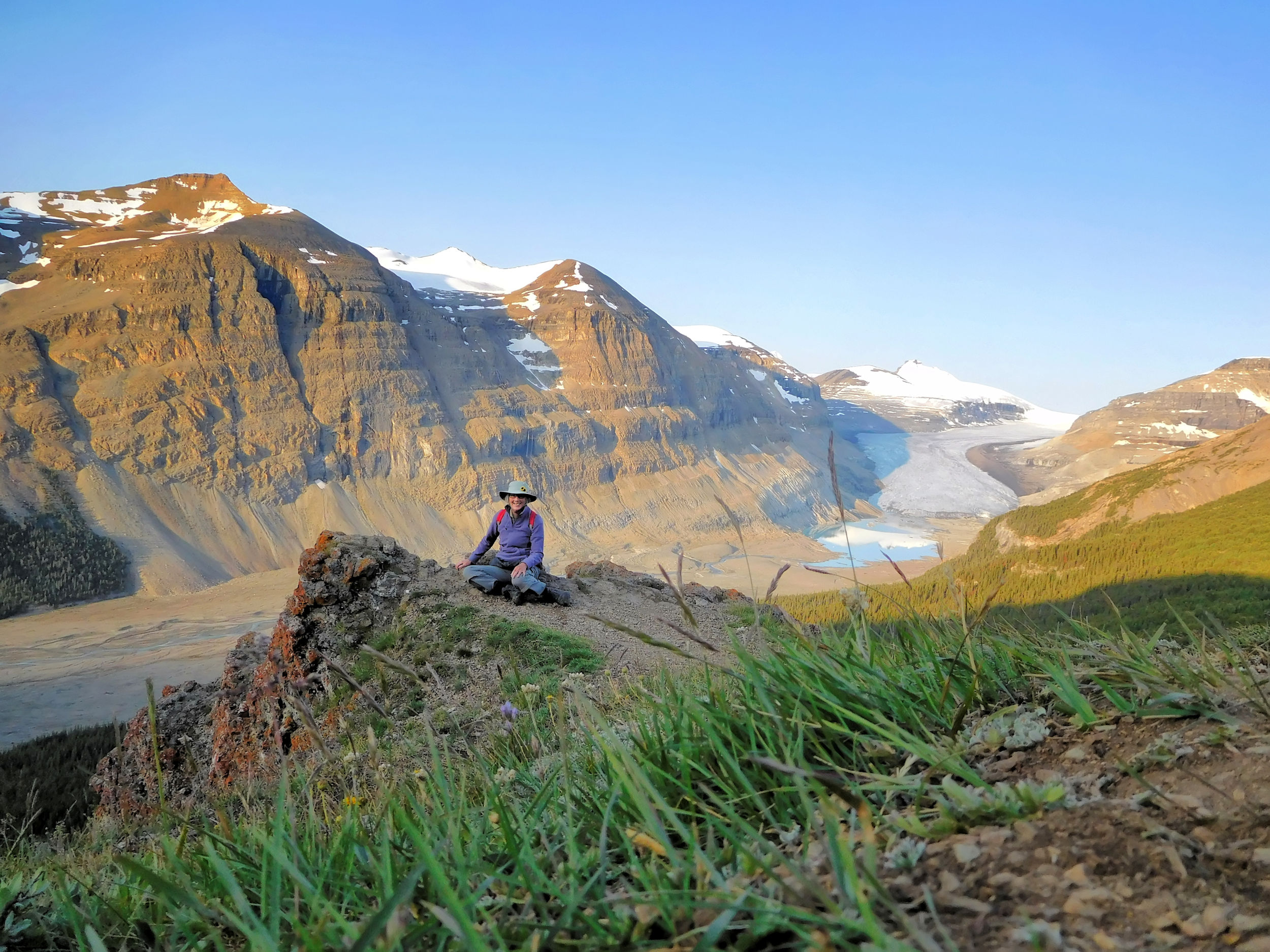
It has been a below-zero night and the windshield is frosted when I get back to the car. The Parker Ridge trailhead is only minutes away, so I got up early to make use of the unique opportunity of hiking this popular trail without the usual masses of other tourists. I am the first and only one at the trailhead. A well-built trail winds up for two kilometers to the col. It takes me only 40 minutes to get there. From the col you have the first view of Saskatchewan Glacier, the main outflow glacier of the Columbia Icefield. The glacier is the source of the big North Saskatchewan River. Like most of the Icefield’s glaciers it has melted considerably over the last decades.
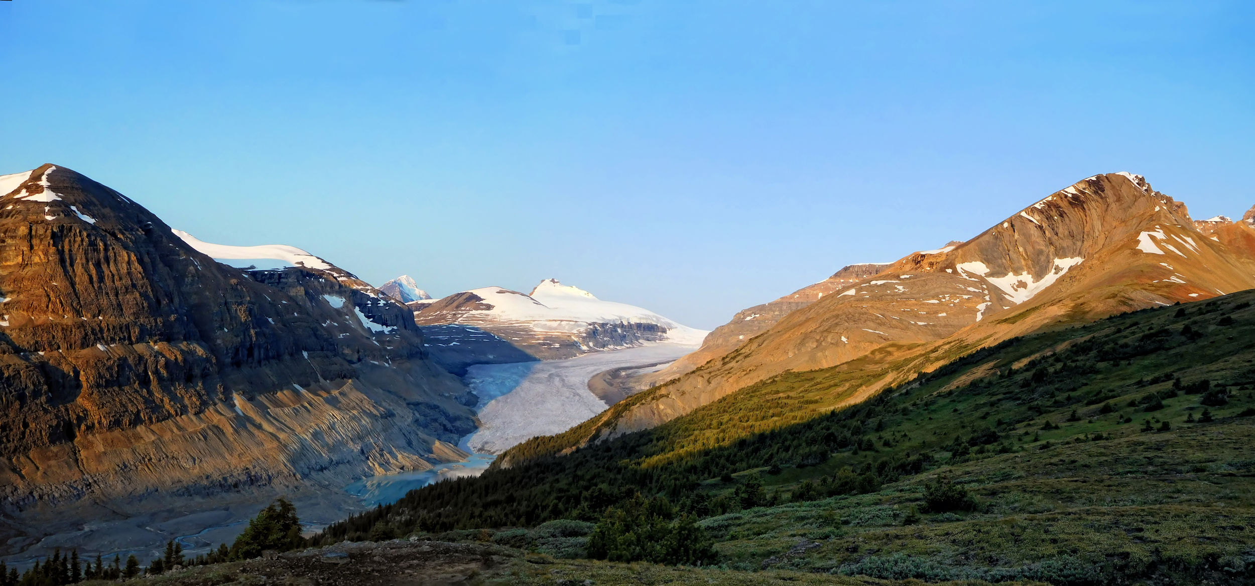
Big Bend Peak, Saskatchewan Glacier and Mount Athabasca
I walk about a kilometer past the col, where the view of the glacier gets even better.
Saskatchewan Glacier and Castleguard Mountain 3090 m
Saskatchewan Glacier and Big Bend Peak 2804 m
On my way back I admire Mount Athabasca and Hilda Peak under a cloudless blue sky.
Mount Athabasca and Hilda Peak
In the meantime, the parking lot has continuously filled and the first other hikers come up the trail. The side trip has taken me only 1 ½ hours and was well worth the effort.
| Distance | 13.9 km |
| Time | ca. 4 hrs |
| Min. Elevation | 1860 m |
| Max. Elevation | 2220 m |
| Ascent | 360 m |
On first try, I miss the turnoff for the Brazeau Loop trailhead because the sign for it is crossed through and therefore hard to read. I have to drive down all of Big Bend, a long and narrow switchback in the road, before I find a spot where I can turn around. Maybe the sign is supposed to deter a left turn into the parking lot. There are already lots of vehicles, but it is not full yet.
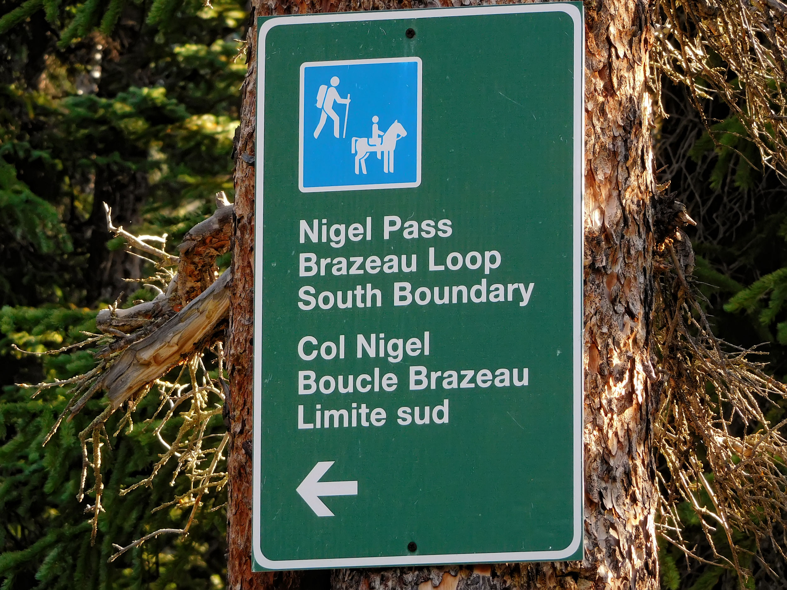
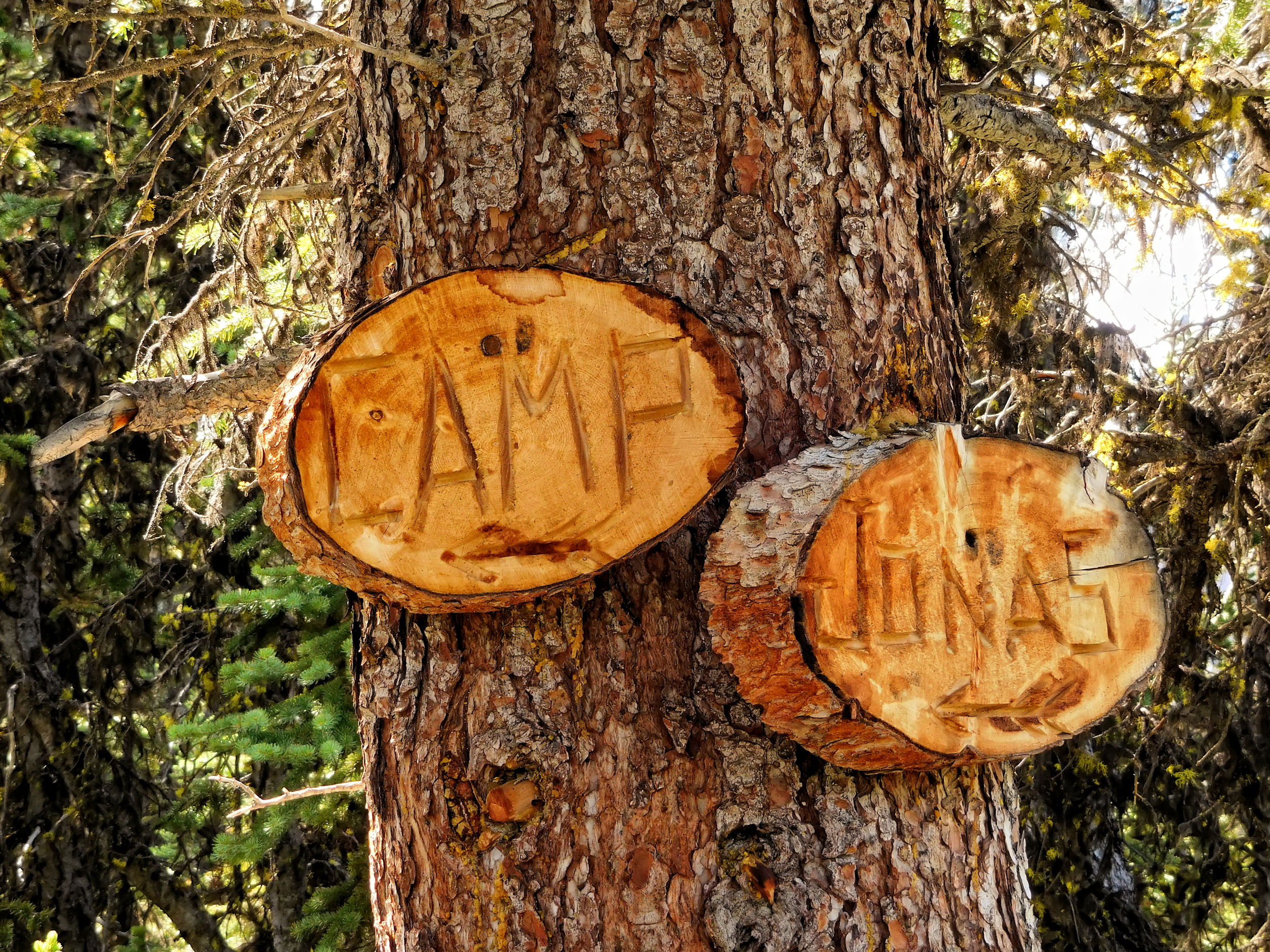
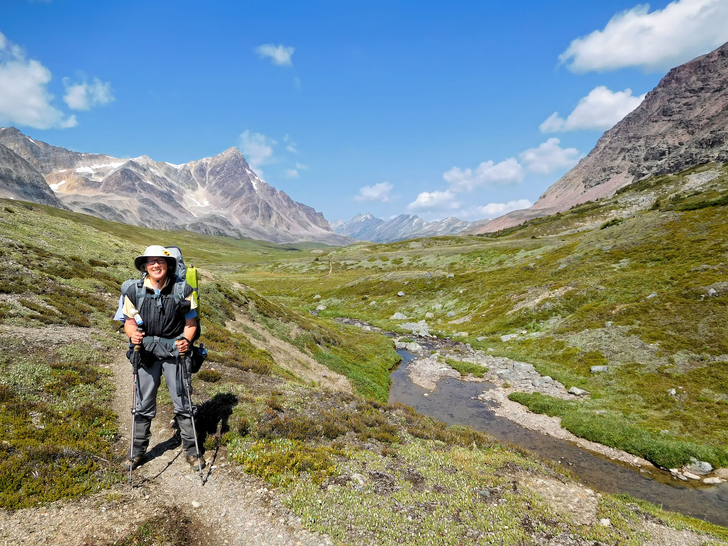
Together with a few day hikers I look around for the beginning of the trail. Our hiking books lead us to a creek where the bridge is out. After returning to the parking lot and studying the map near the gate, we find out that we have to walk 1.8 kilometers on the gravel road leading from the parking lot to an old corral. Here the road forks and passes a ranger cabin on the right where the signage for the Brazeau Loop begins. Our hiking books are obviously outdated and don’t describe this recent change. I reach the confluence of Hilda and Nigel Creek and cross both creeks. The day hikers have disappeared ahead of me; with their light daypacks they are much faster than me. I pass historic Camp Parker. Tree carvings (ca. 1940) bear witness of early hikers and travellers who used this site as a rest station on the then two-day trek over the Icefield Parkway. First Nations have camped here long before the first Europeans arrived.
I hike through the Nigel Creek valley. Repeatedly I have to cross side creeks, mostly on simple bridges made of hewn logs, or by rock hopping. The valley is supposed to be good grizzly habitat. Luckily I do not see one today.
Looking back to Parker Ridge
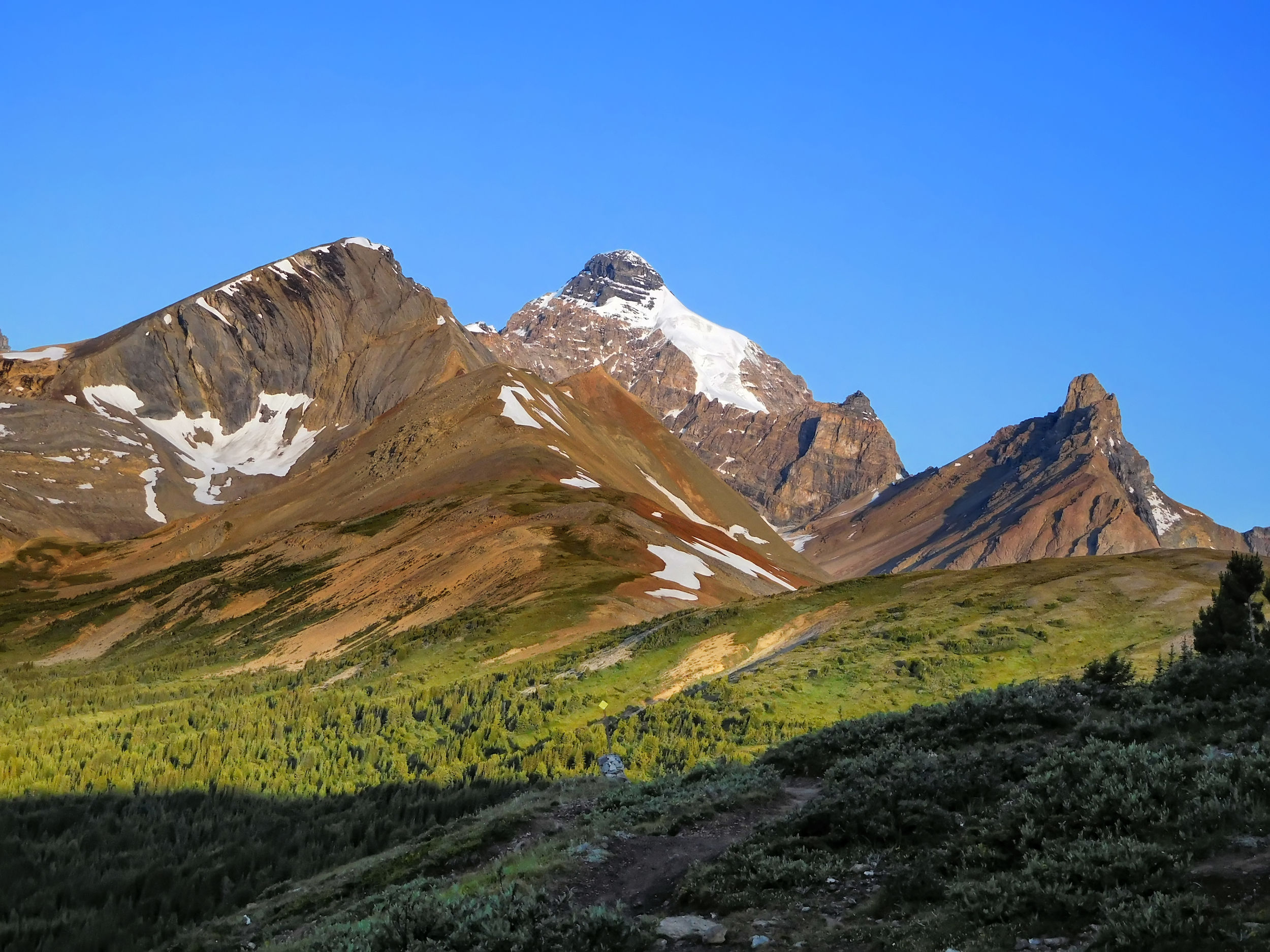
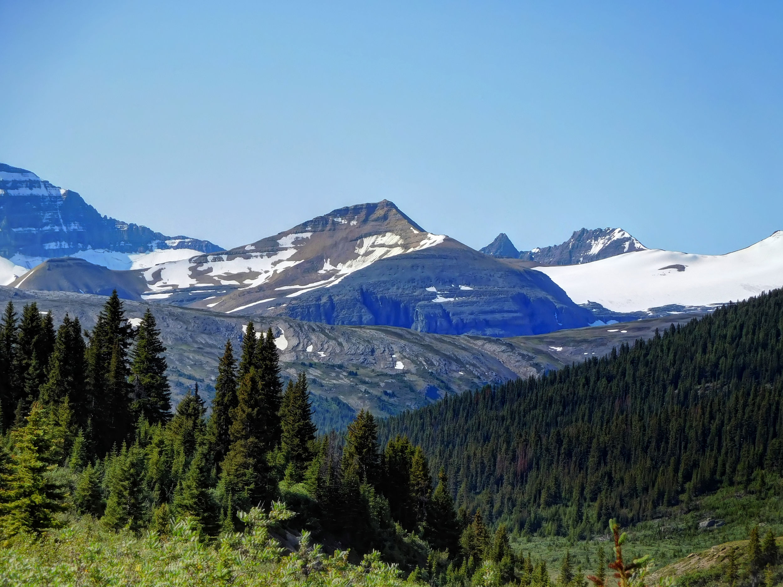
Nigel Creek runs through open forest and pretty meadows. After an ascent I reach the treeline and have a view of the Nigel peaks.
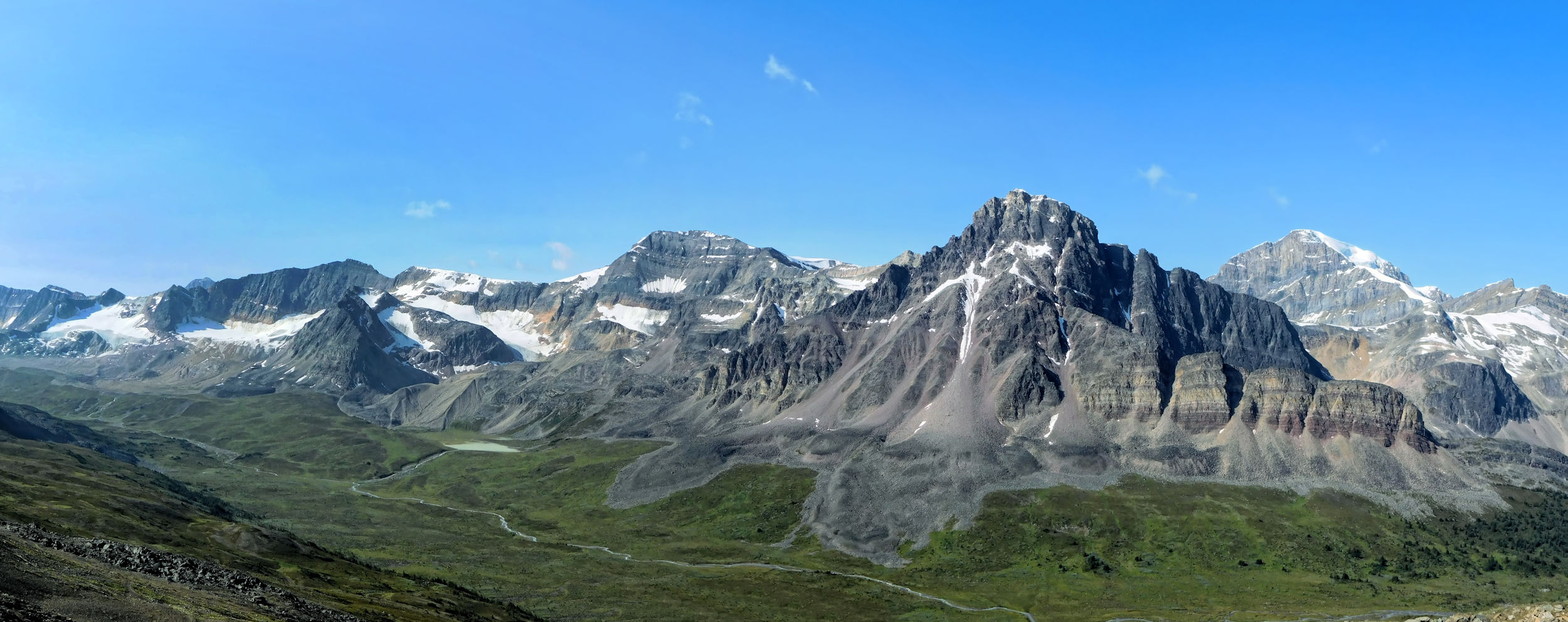
Parker Ridge, Nigel South Peak 3025 m and Nigel Peak 3211 m
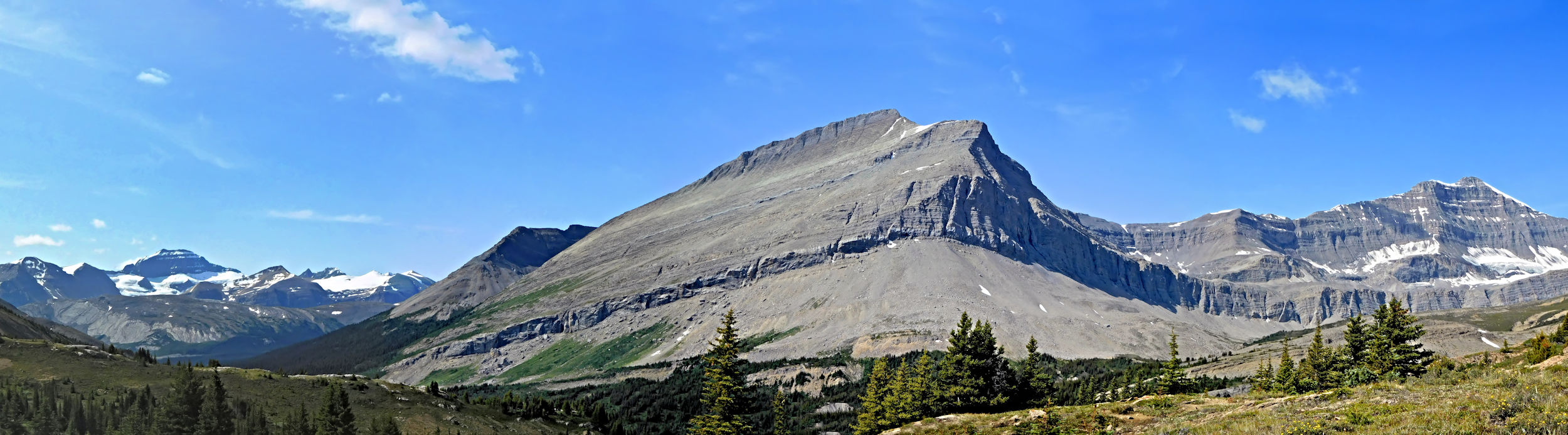
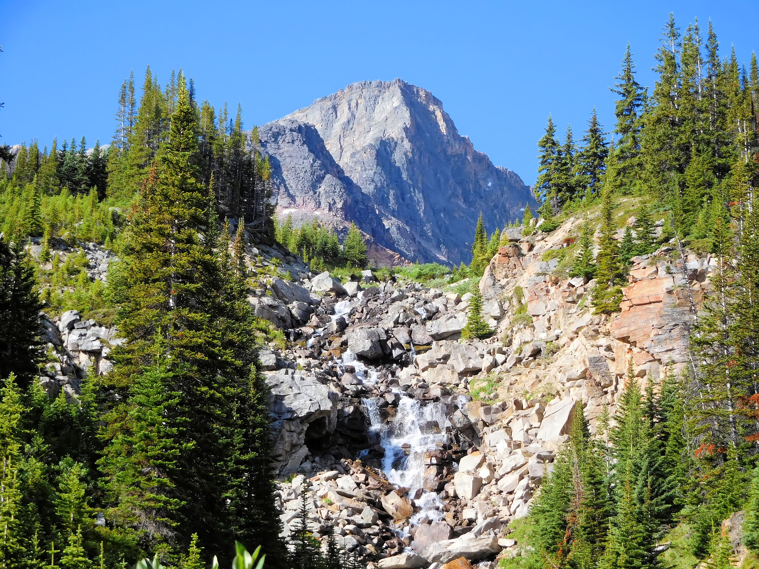
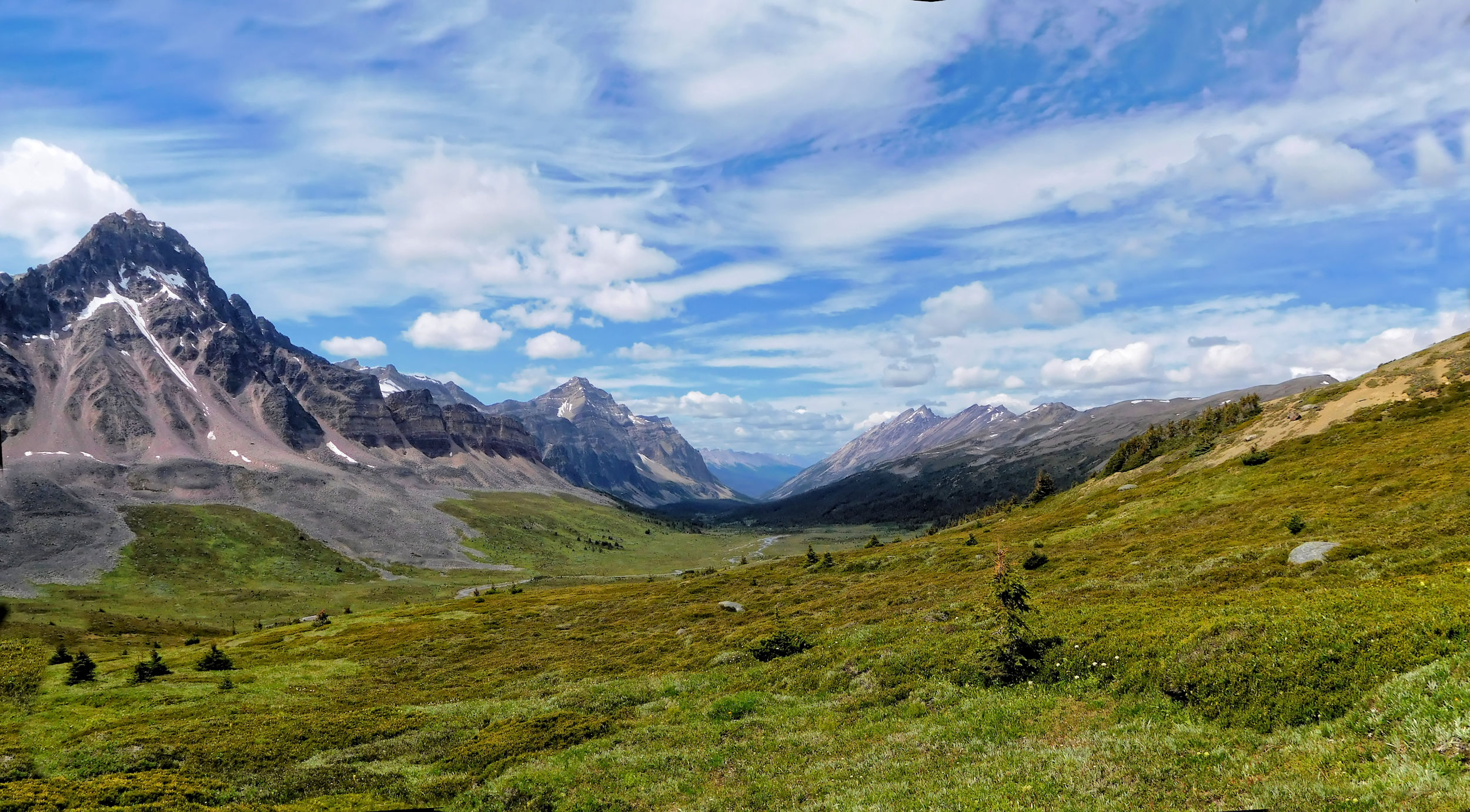
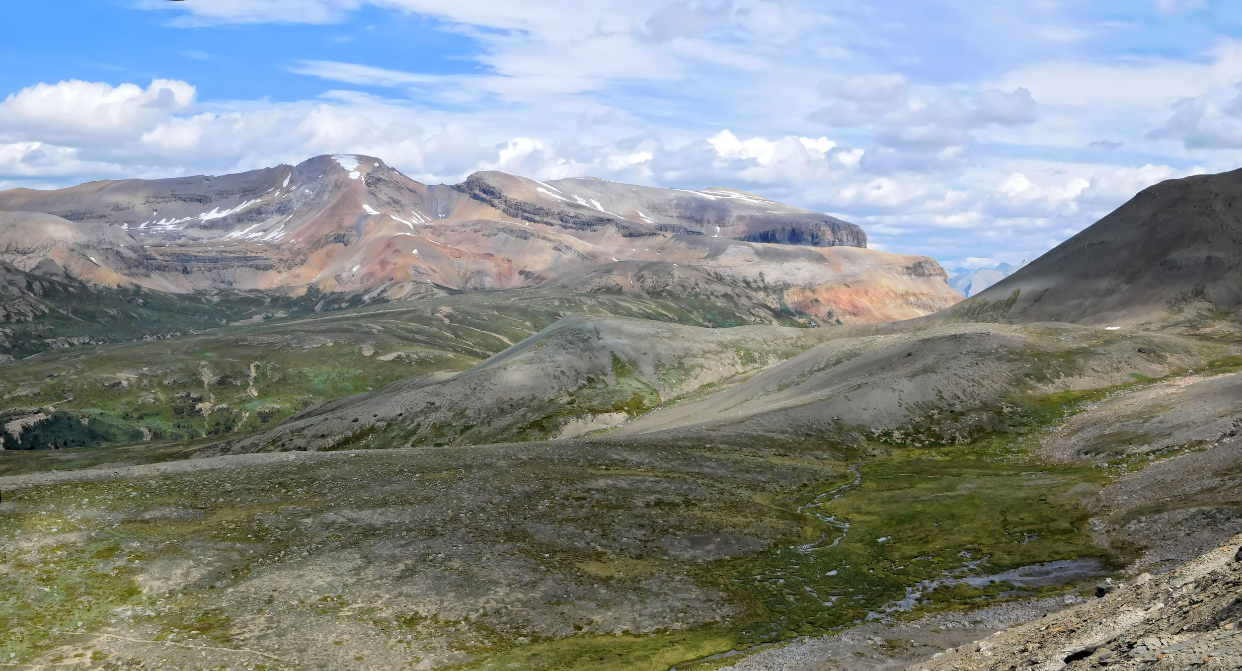
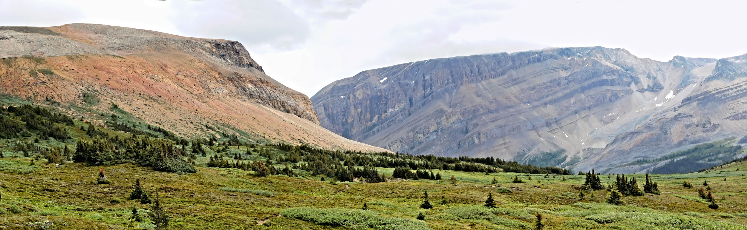
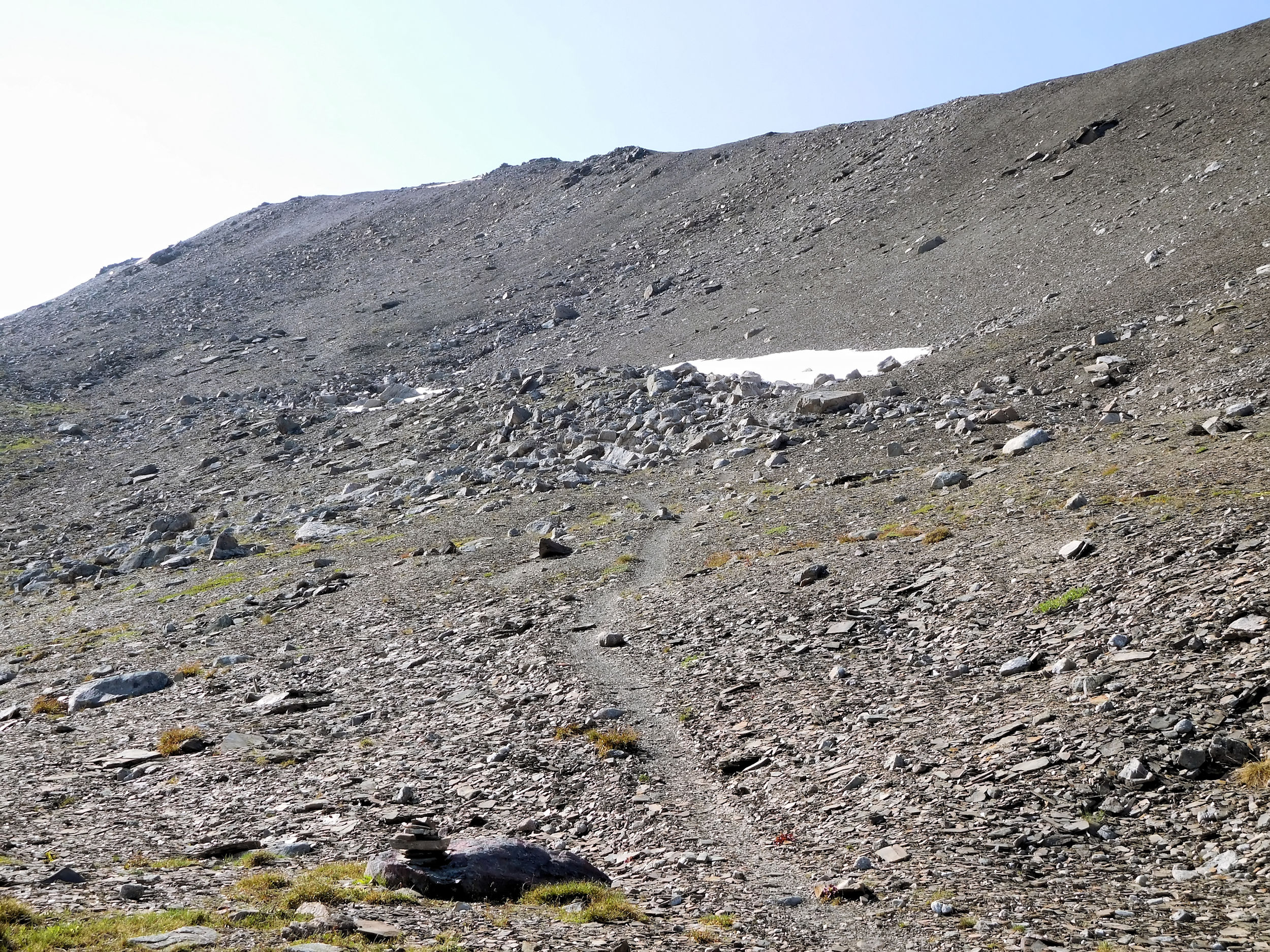
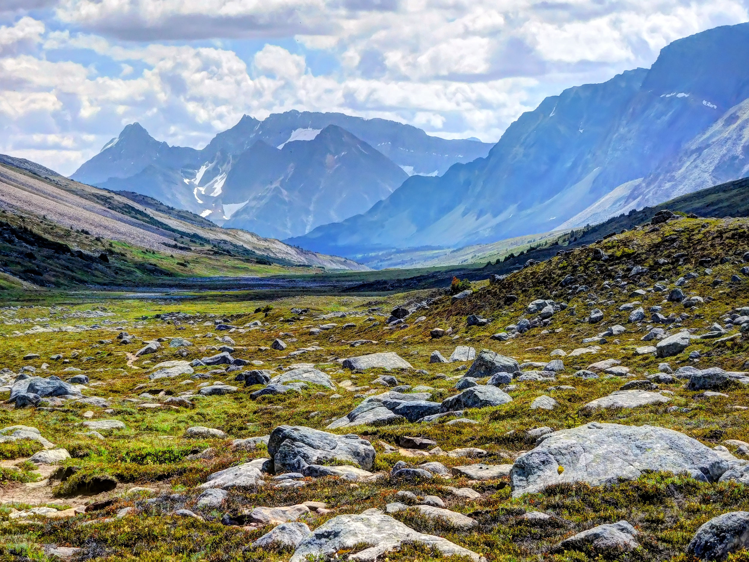
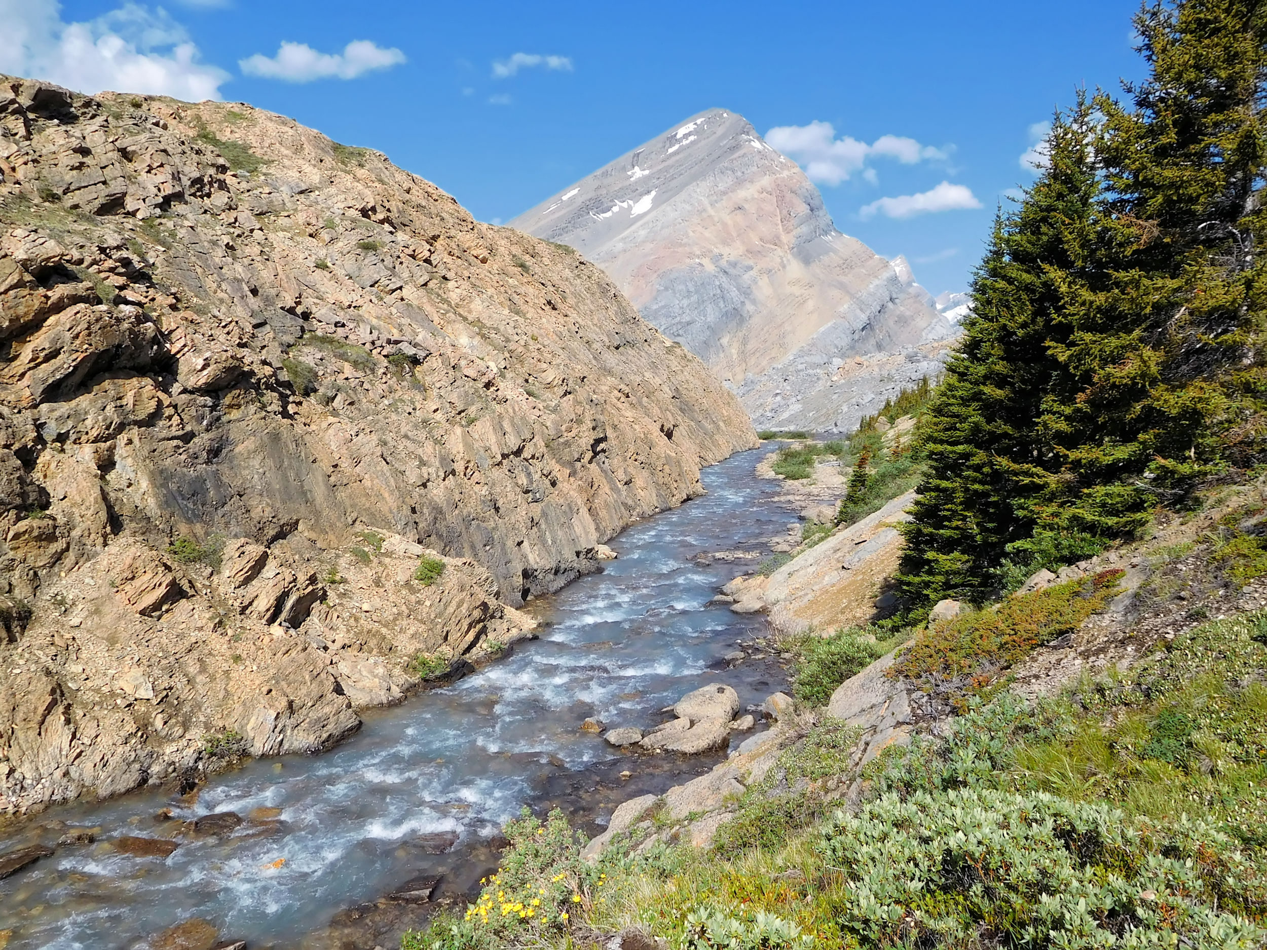
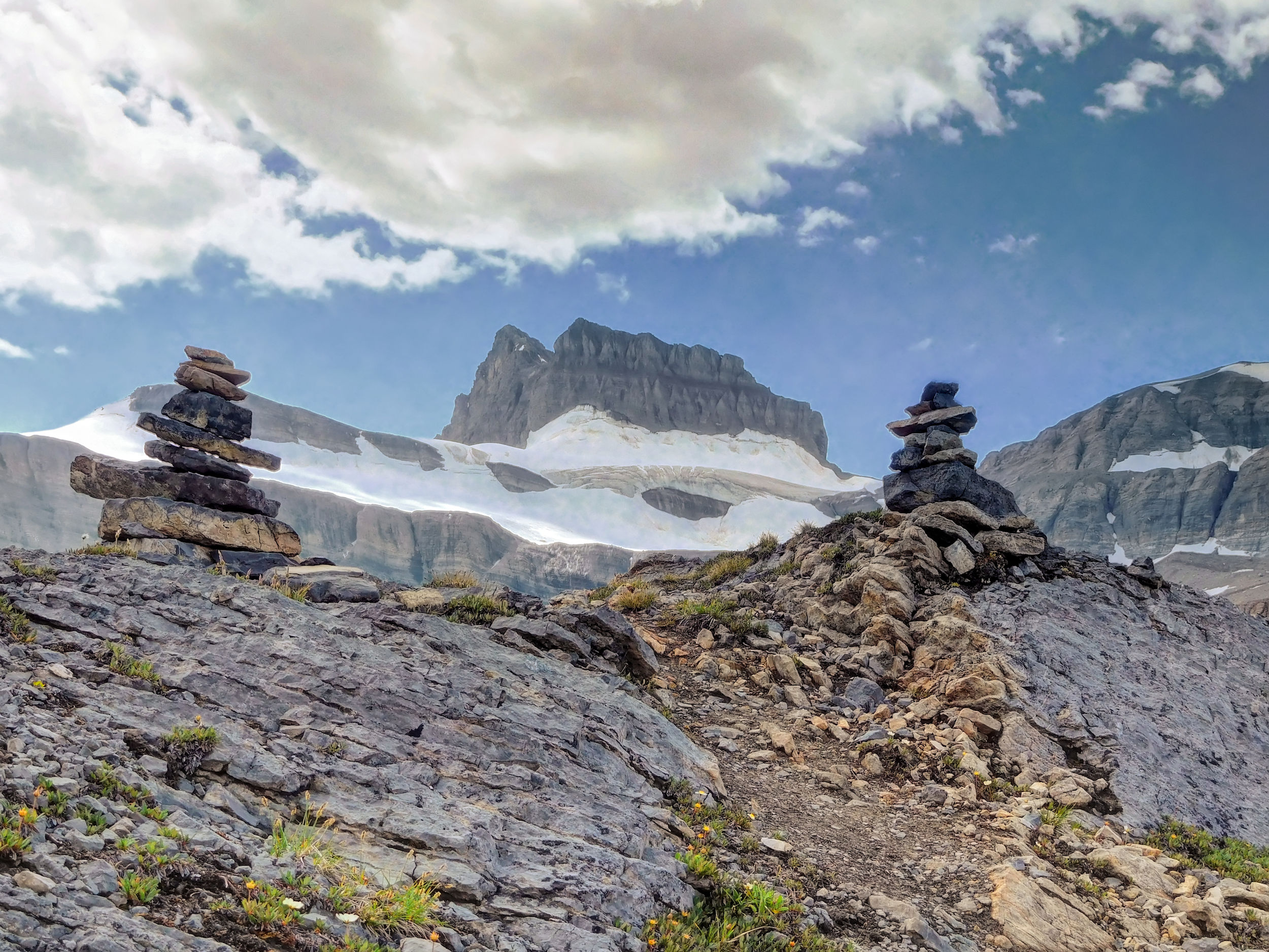
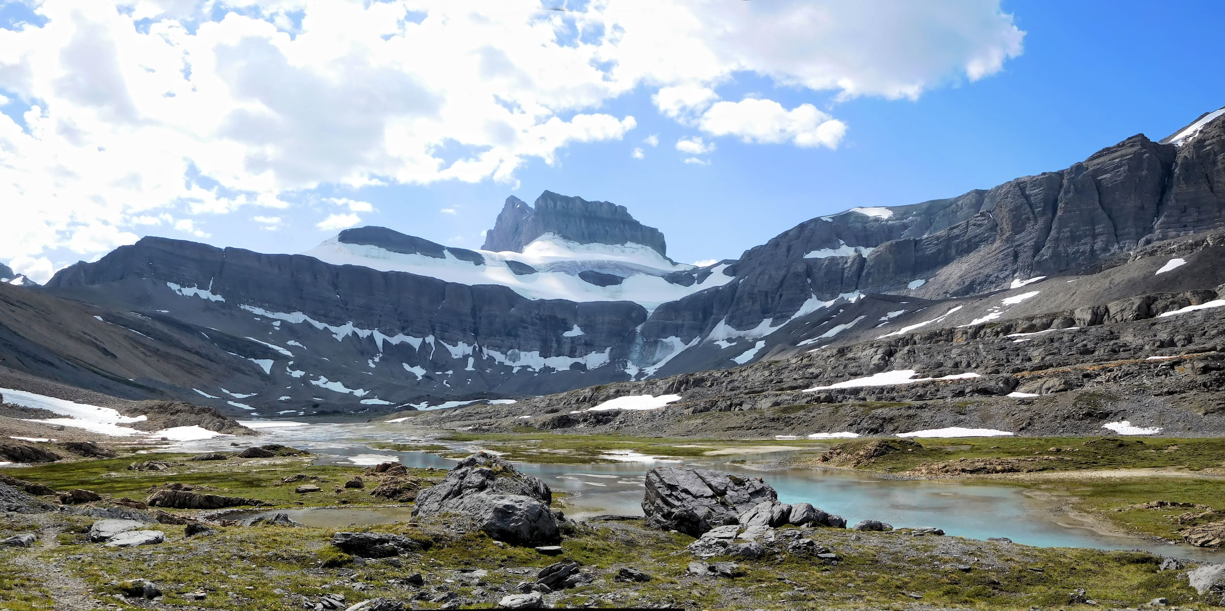
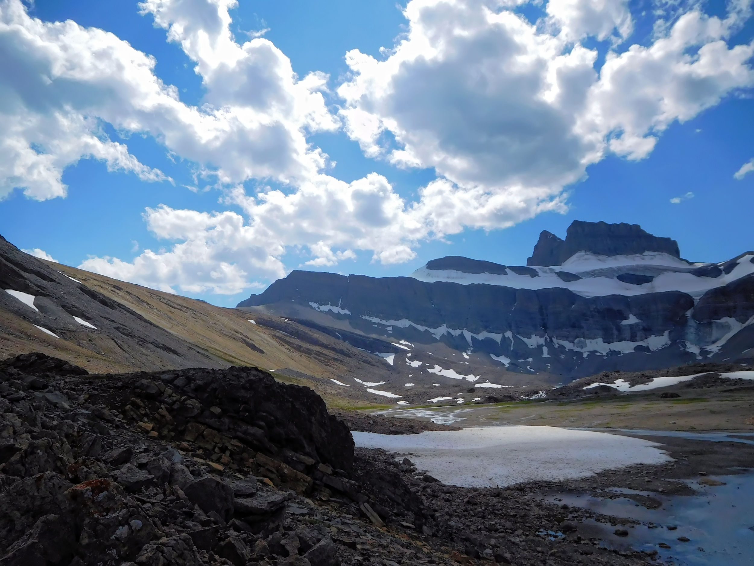
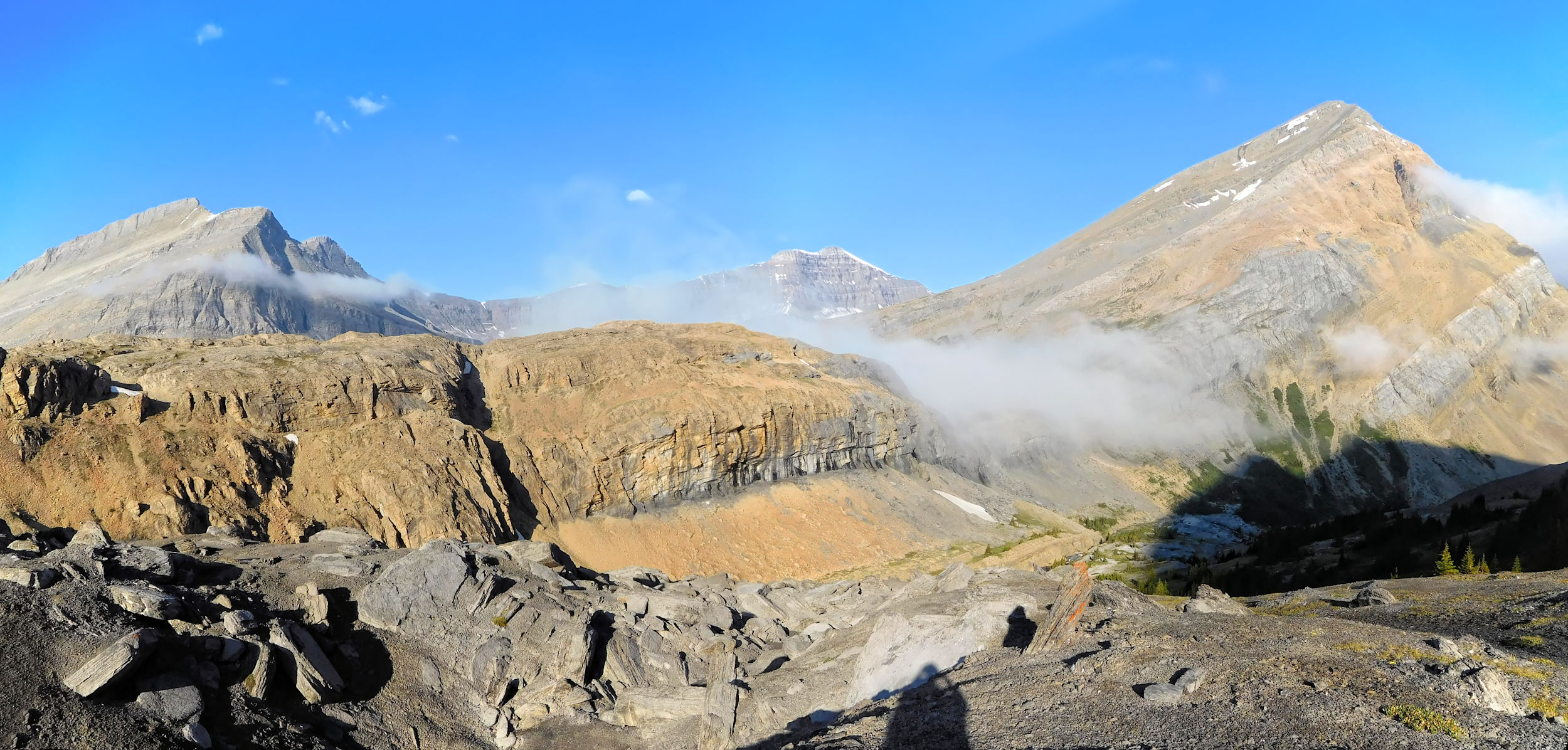
So far the route remains fairly gentle and the ascents are short. Only the last kilometer is on an eroded and steep path that climbs 120 meters up to Nigel Pass. Nigel Pass is very rocky and almost bare of vegetation. From here you look down on the Brazeau River that originates near Cataract Pass to the southeast and flows north into Brazeau Lake and onward. On this side of the pass, the rocks have a brownish orange color. The other side of the Brazeau River is dominated by a smooth, light gray limestone wall which is part of the Cirrus Mountain Massif.
Brazeau River
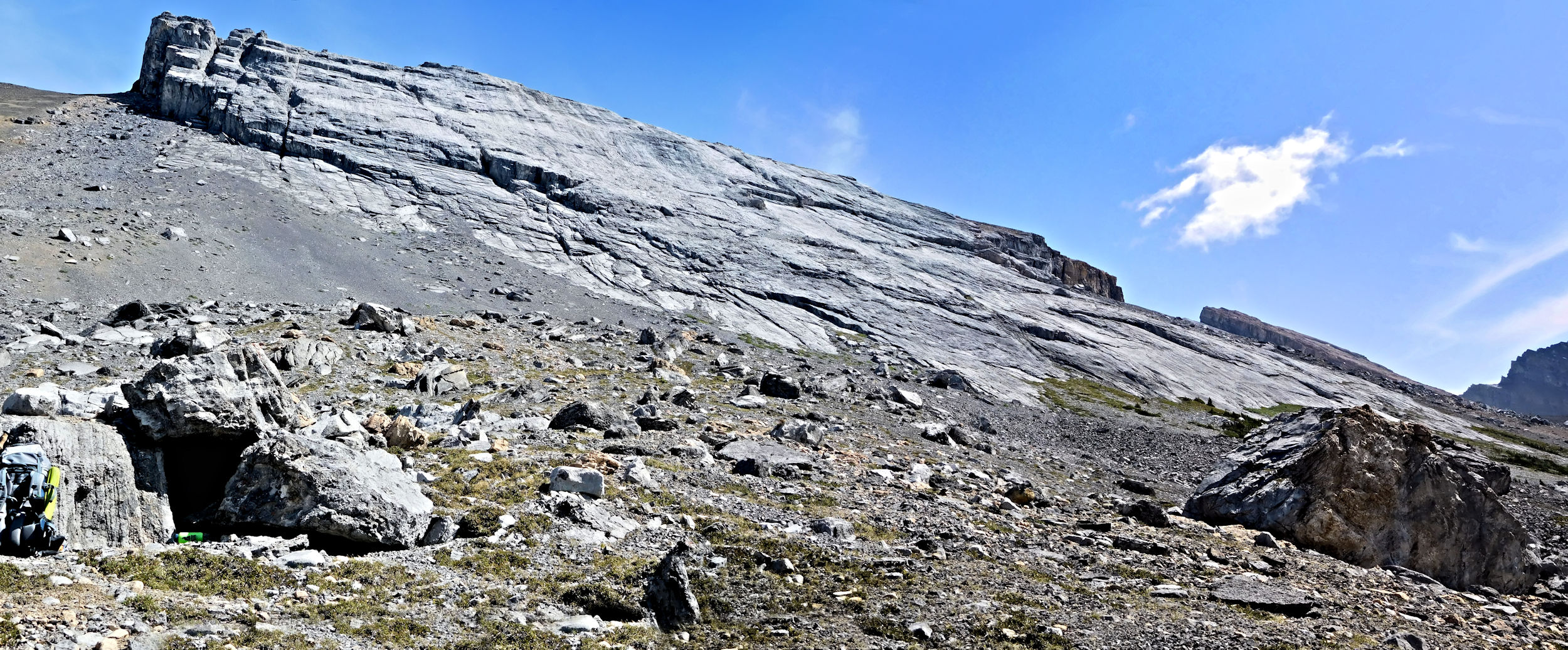
Limestone wall, Cirrus Mountain
Upper Brazeau Canyon towards Cataract Pass
Brazeau River and Nigel Peak
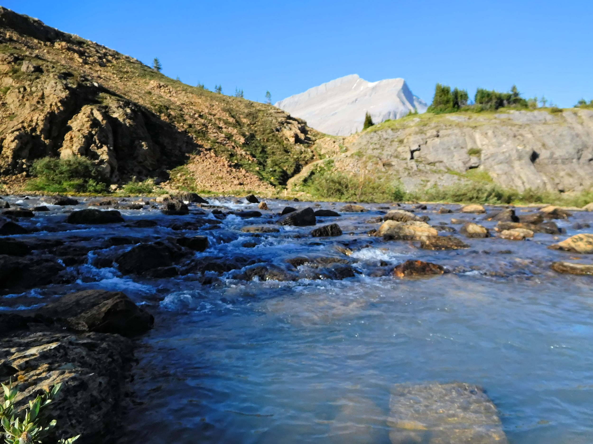
Nigel Pass is right on the border between Jasper and Banff National Park. Yesterday I left Jasper and entered Banff by driving over Sunwapta Pass. The Brazeau Loop trailhead is in Banff, but I am now returning into Jasper. I cross the river by rock hopping over a long row of smallish and unstable boulders. The Brazeau is quite wide here, but usually shallow. Right now, however, water levels are high enough to force me off the wobbly rocks into the water several times. Fortunately my boots are watertight.
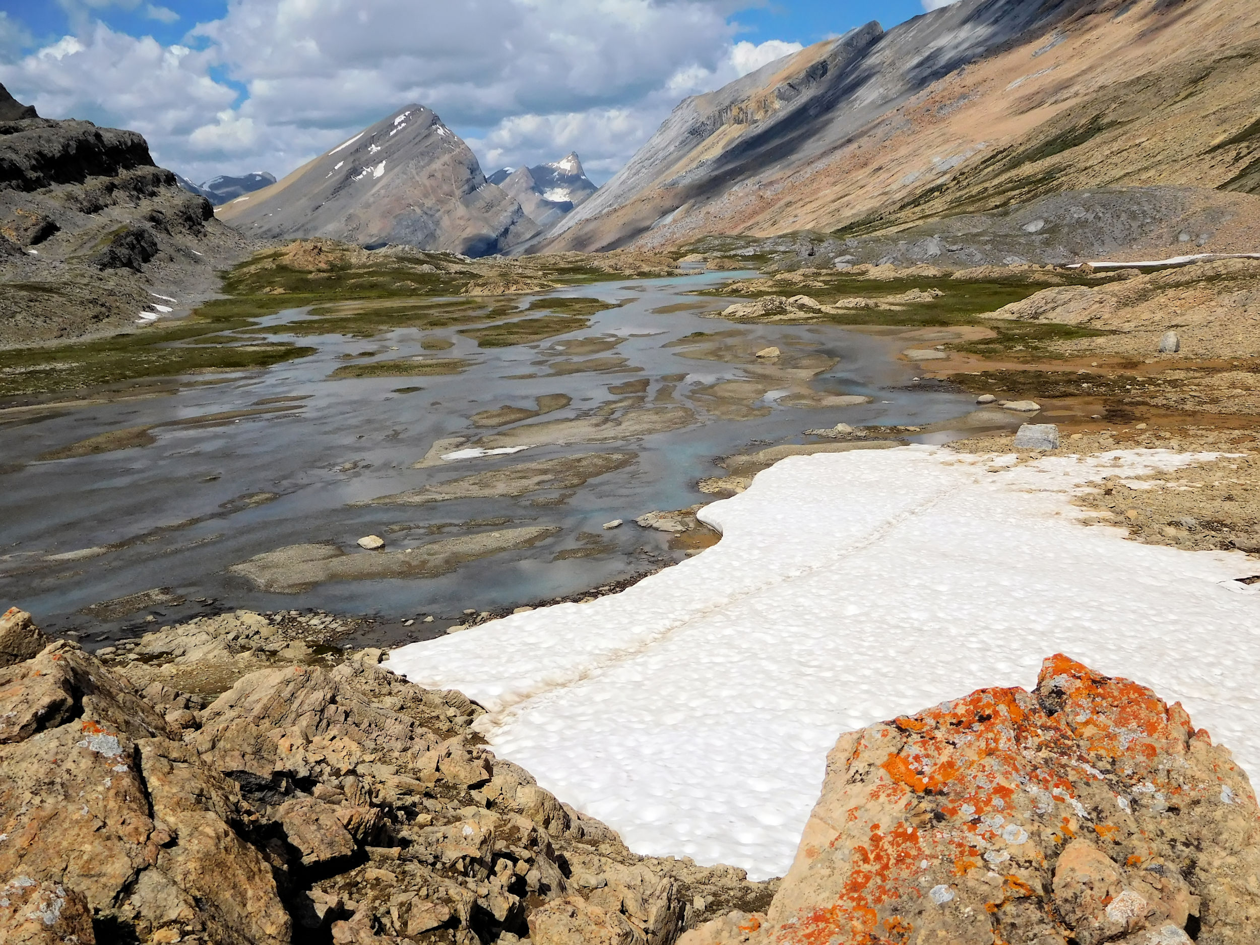
On the other shore the path climbs up to a viewpoint overlooking the valley of the northern Brazeau River.
Valley of the northern Brazeau River
Looking back to Parker Ridge and Mount Saskatchewan 3350 m
Nigel Pass is one of my favourite passes. Its barrenness, the unique rock formations and the big river below create a particular atmosphere. I sit down between boulders at the bottom of the Cirrus Mountain limestone wall and have a rest.
The rocky trail continues about another kilometer to the next viewpoint. Here the Brazeau River forms a mighty cascade, where the water rushes through a narrow canyon. I spot two hikers sitting on a ledge over the roaring waters.
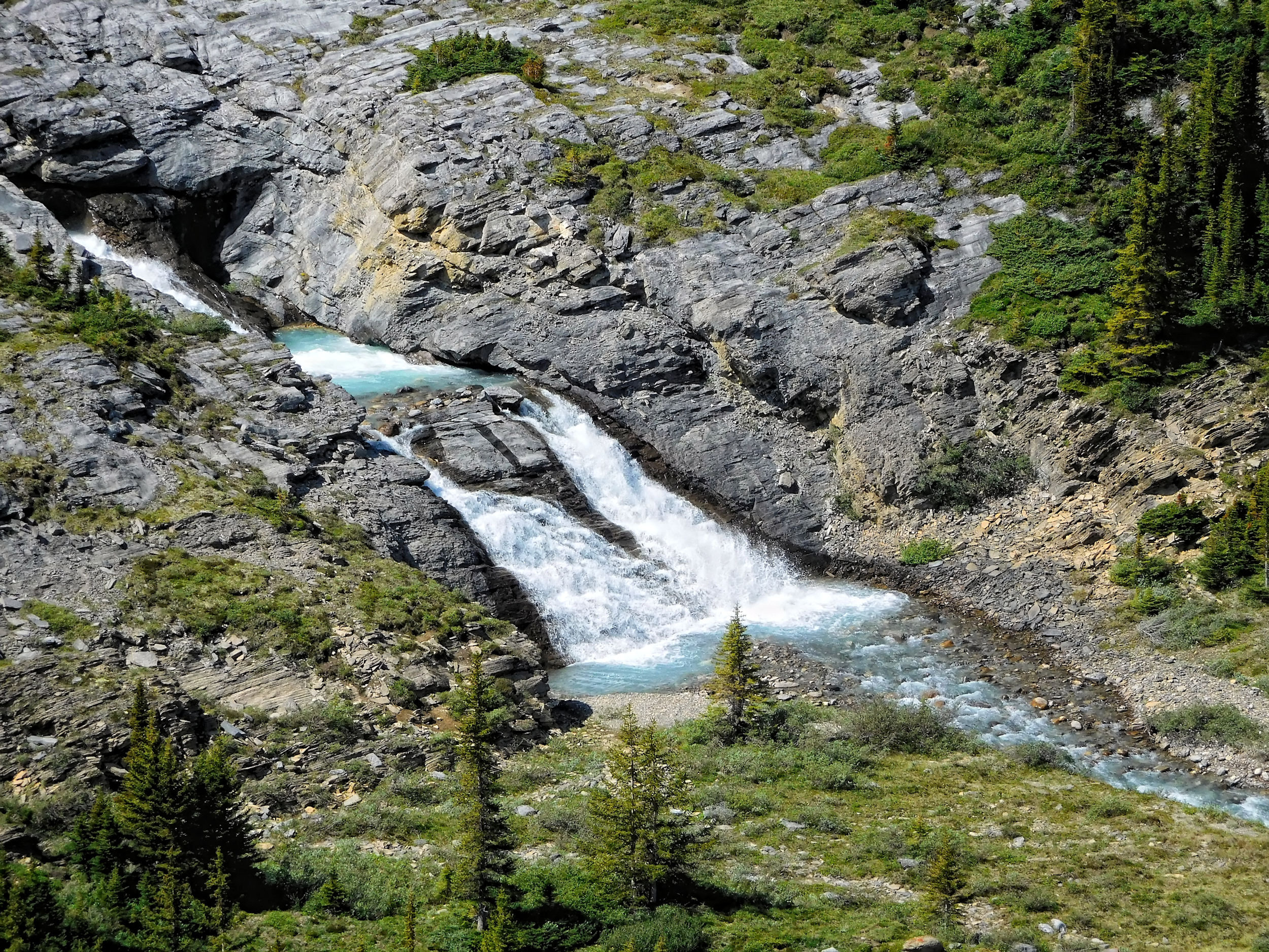
Cascade of the Brazeau River
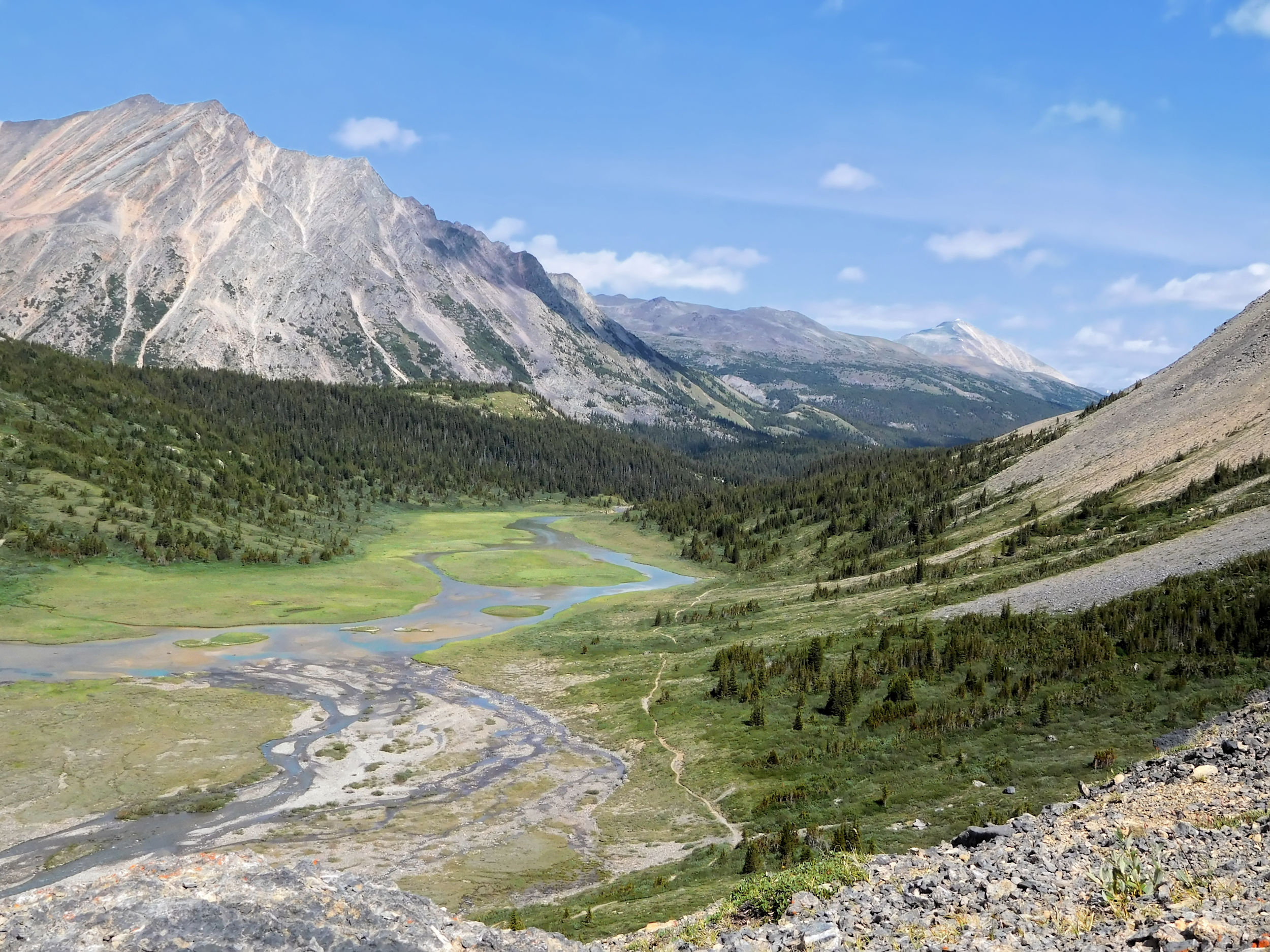
From here the trail descends steeply into the valley of the northern Brazeau. I cross a bridge and follow the western shore with its grassy meadows and willow shrubs, and I pass Boulder Creek campground. My destination for today is Fourpoint campground, another three kilometers away. The rest of the way is gentle and easy, all along the river.
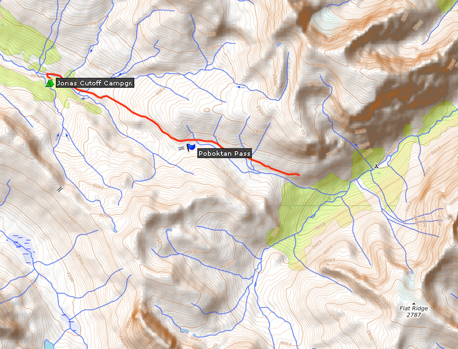
Fourpoint campground is located near the Brazeau River and provides 8 tent sites. Everything here is close by, which is welcome but uncommon in the backcountry, where the areas for food, tents, water and outhouses are usually far apart from each other. Recently they exchanged the food pole for metal lockers. You can’t see the river but hear its constant murmur. I find a quiet campsite and have an early dinner. Fourpoint campground is always busy because every hiker goes through here twice, no matter which way they hike the loop. Those who have returned from Brazeau Lake tell us that the trail along the river is pretty muddy. Those who come back from the alpine side report very good conditions and just a little bit of snow left on Jonas Shoulder, the highest point. The week before had torrential rains and conditions must have been bad everywhere.
This section of the Brazeau Loop between Nigel Pass and Jonas Cutoff is part of the Great Divide Trail (GDT), a more than 1200 kilometer trail that ranges from Waterton National Park in the south to Mt. Robson Provincial Park in the north. The official finish line of the trail is even further to the north in remote Kakwa Provincial Park. The trail follows the continental divide and leads over the highest passes in the Rocky Mountains. I talk to a couple from Ontario that has arrived here from Cataract Pass. After spending the night at Fourpoint campground they are going to hike over Jonas Shoulder through the Poboktan valley and out to the park road. They need to buy provisions for their next segment of the GDT. We find out that our paths have unknowingly crossed on my first trek in the Rockies a couple of weeks ago. They came through Egypt Lake campground in the afternoon where I was camped for the night and was inundated in a heavy thunderstorm. They got caught by that same storm while climbing up to Floe Lake late at night. In the dark and at high altitude the storm must have been extremely frightening. I had at least a tent over my head, even if the wind tried to blow it away.
I am pleased with the fact that after having hiked on the Brazeau Loop, I will have accomplished yet another segment of the GDT myself. Tomorrow’s hike covers 19 kilometers of it and leads over two passes. I retire early and have a good night’s rest.
| Distance | 19.1 km |
| Time | ca. 6 hrs |
| Min. Elevation | 1927 m |
| Max. Elevation | 2470 m |
| Ascent | 543 m |
Shortly before 9 o’clock in the morning I am ready to go. The hike today is supposed to be the most attractive one on the loop, and the weather is promising. The trail leads uphill through the trees. There is some deadfall, but you can go around or over it easily. Soon I reach the subalpine zone.

Again and again I have to cross side creeks that tumble into Fourpoint Creek. They carry a lot of water and come rushing down steeply. There are no bridges, just rocks to step on, and quite often the water is running so high and fast that I have to walk upstream or downstream to find a crossing. One crossing is especially challenging and involves some bushwhacking to find a suitable spot, but I still have to wade through the water to avoid falling onto sharp rocks.
I reach the treeline and have a view over the pretty valley of Fourpoint Creek. It looks like a good habitat for grizzlies. I stop often to scan the slopes around me.
Fourpoint Creek valley
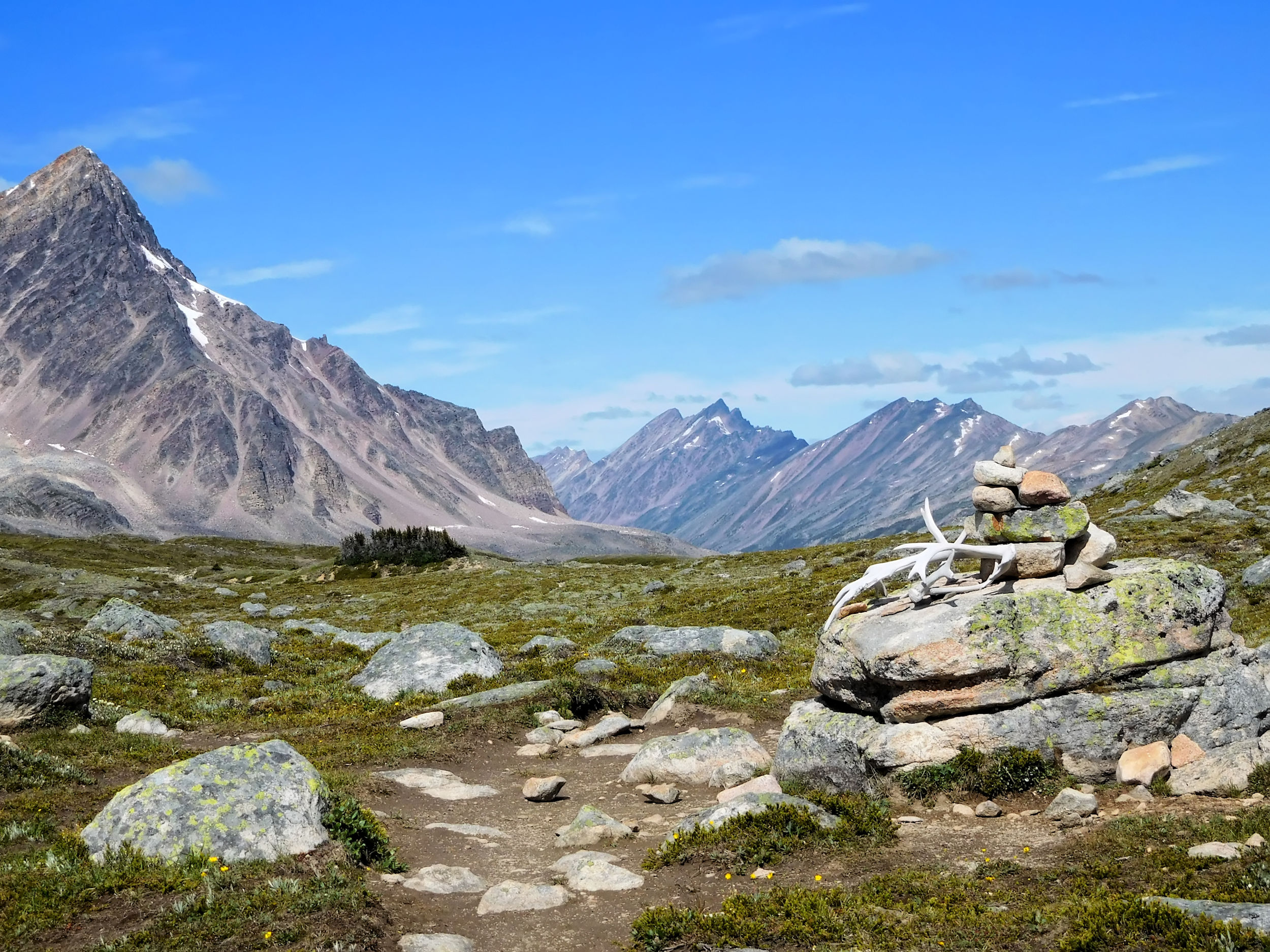
The antlers of a mountain caribou provide a nice foreground for a picture. These shy animals live here, obviously, but you hardly ever get to see them. A bit further on the trail, I disturb a family of grouse.
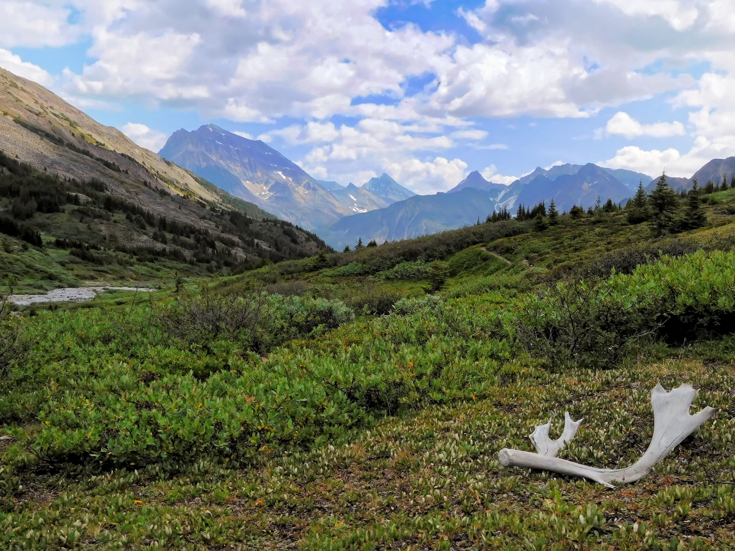
Cariboo antlers
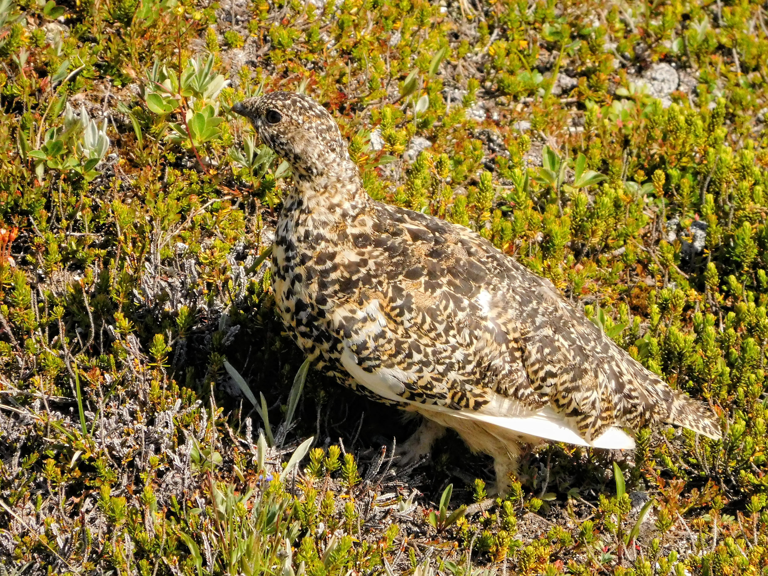
Grouse
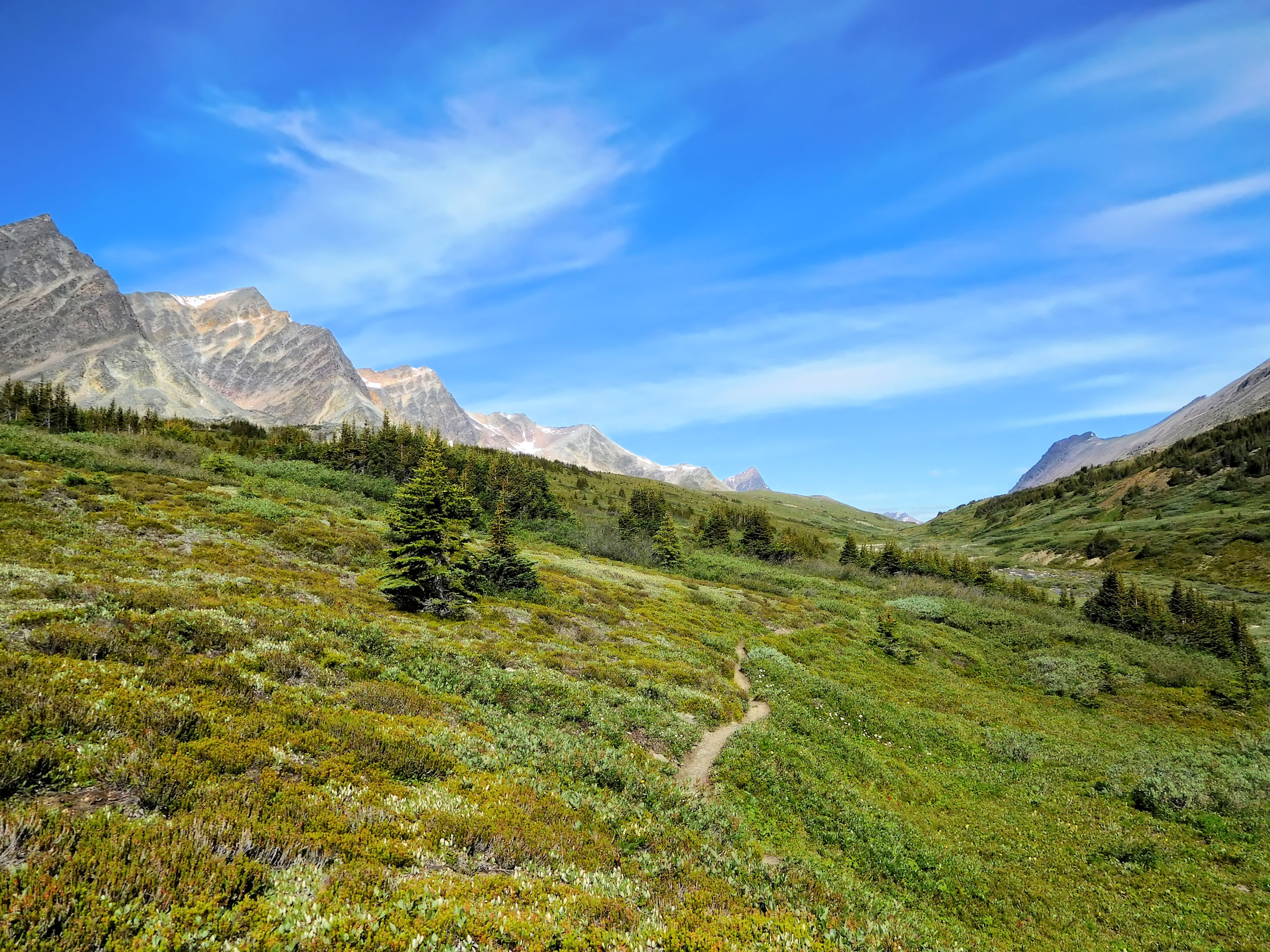
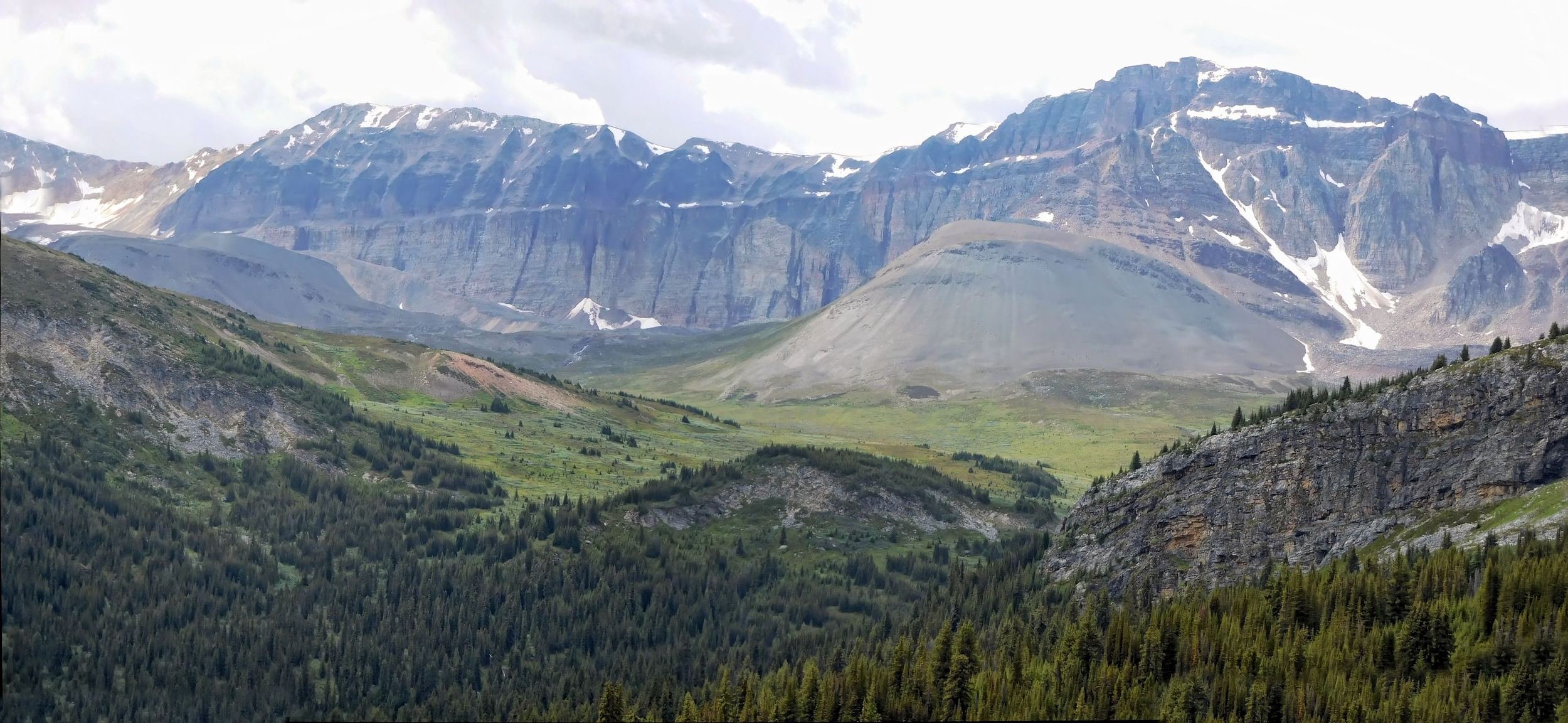
I have a short break at beautiful Jonas Pass.
Jonas Pass 2320 m
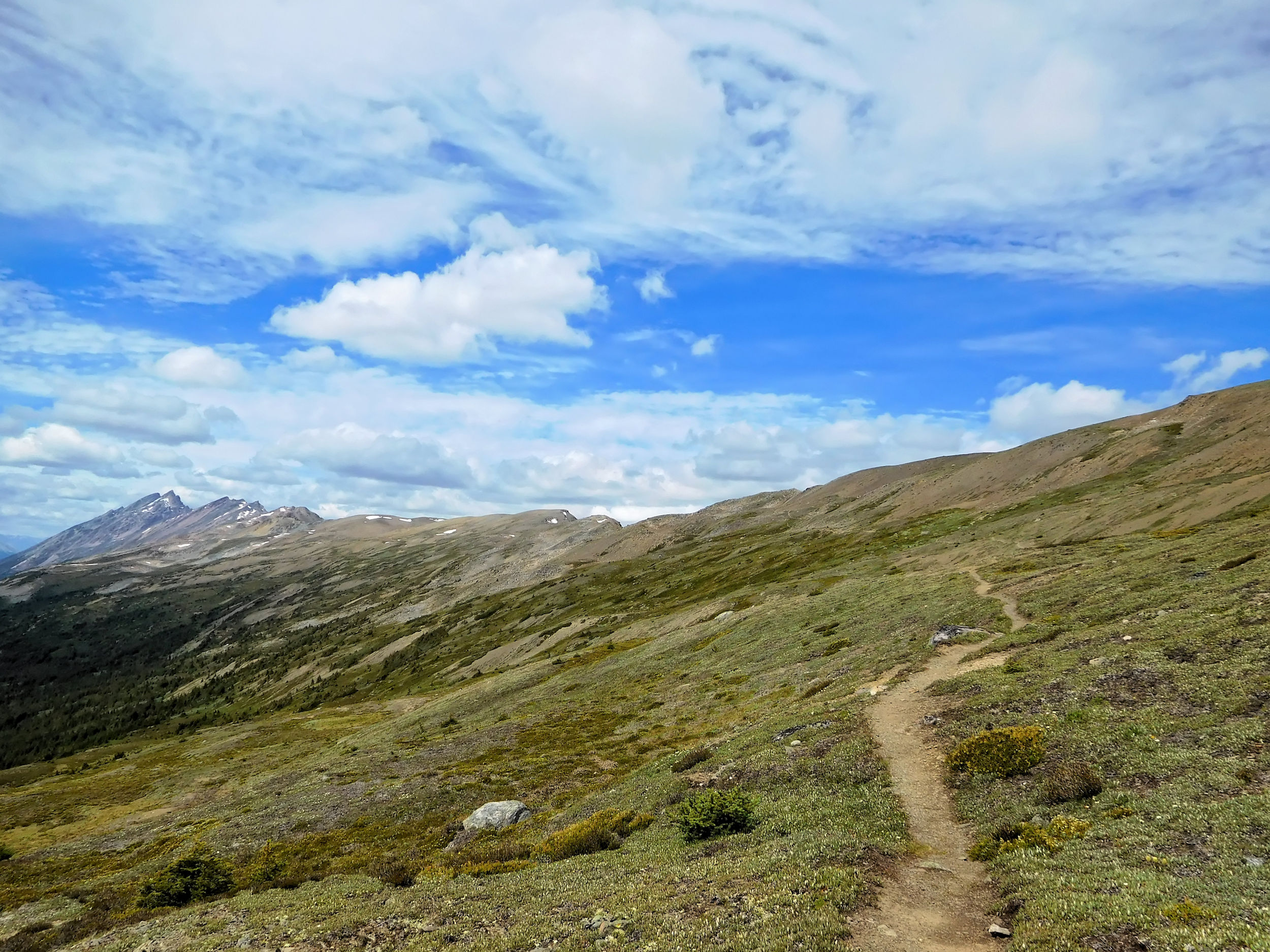
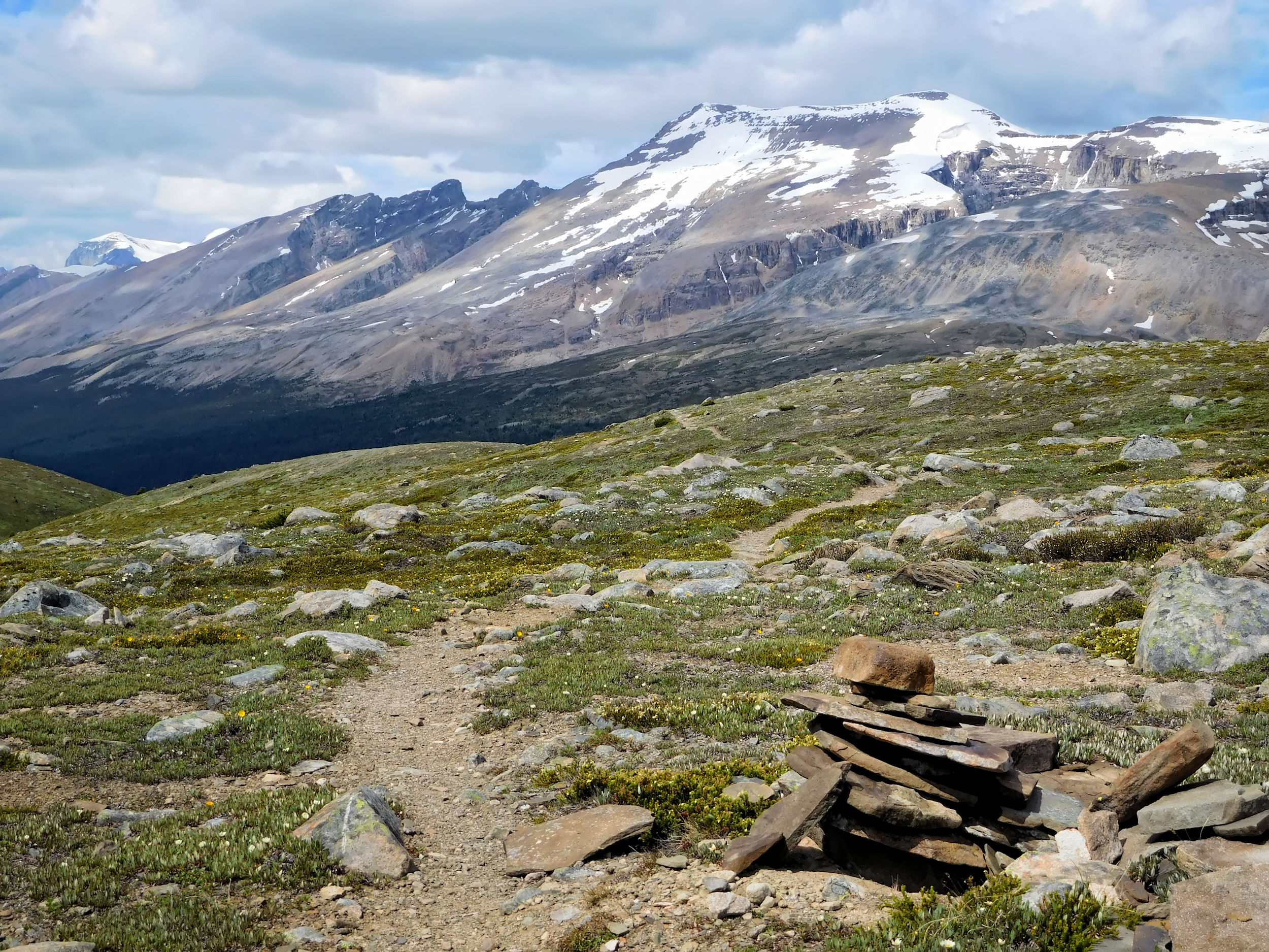
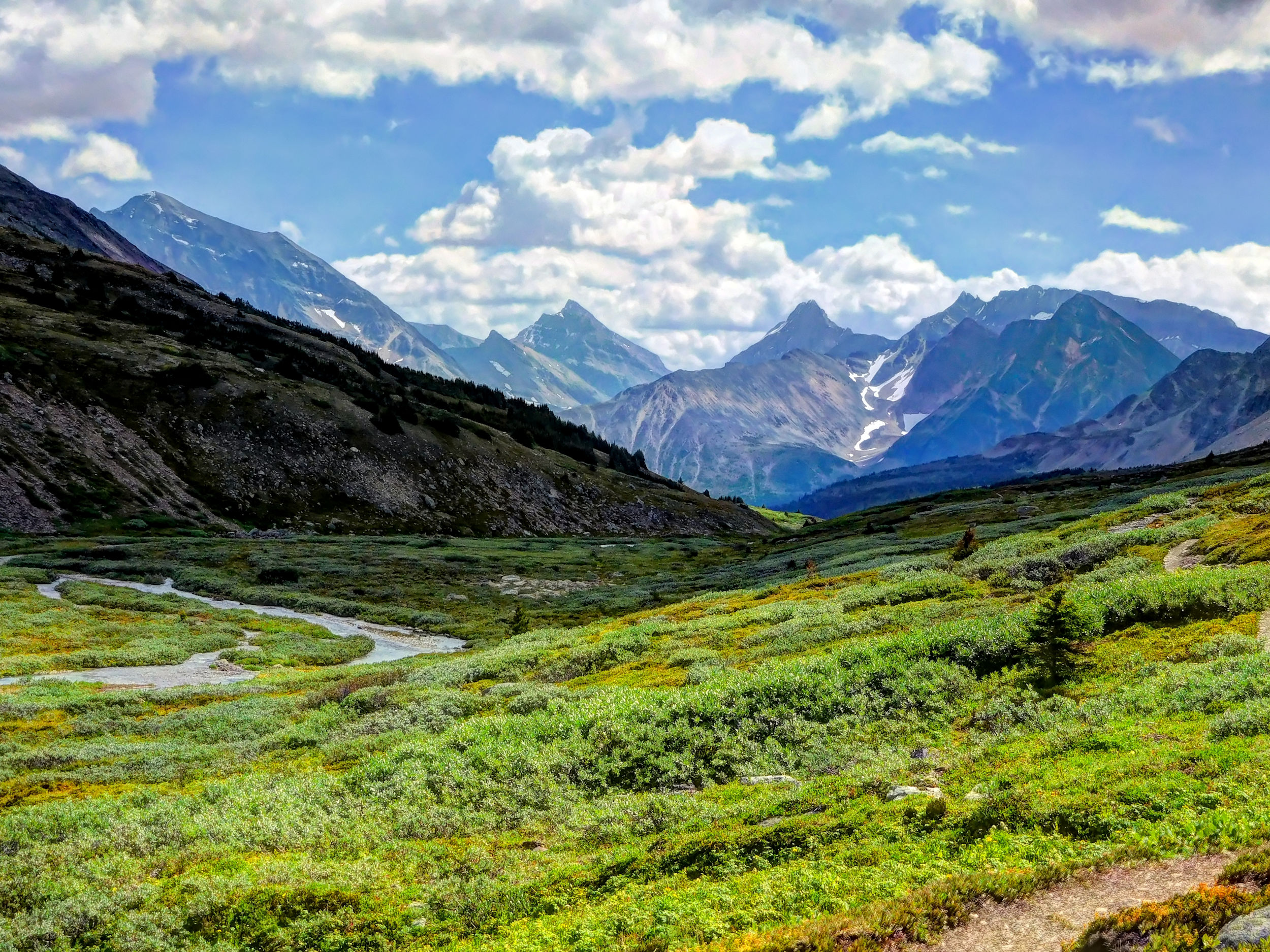
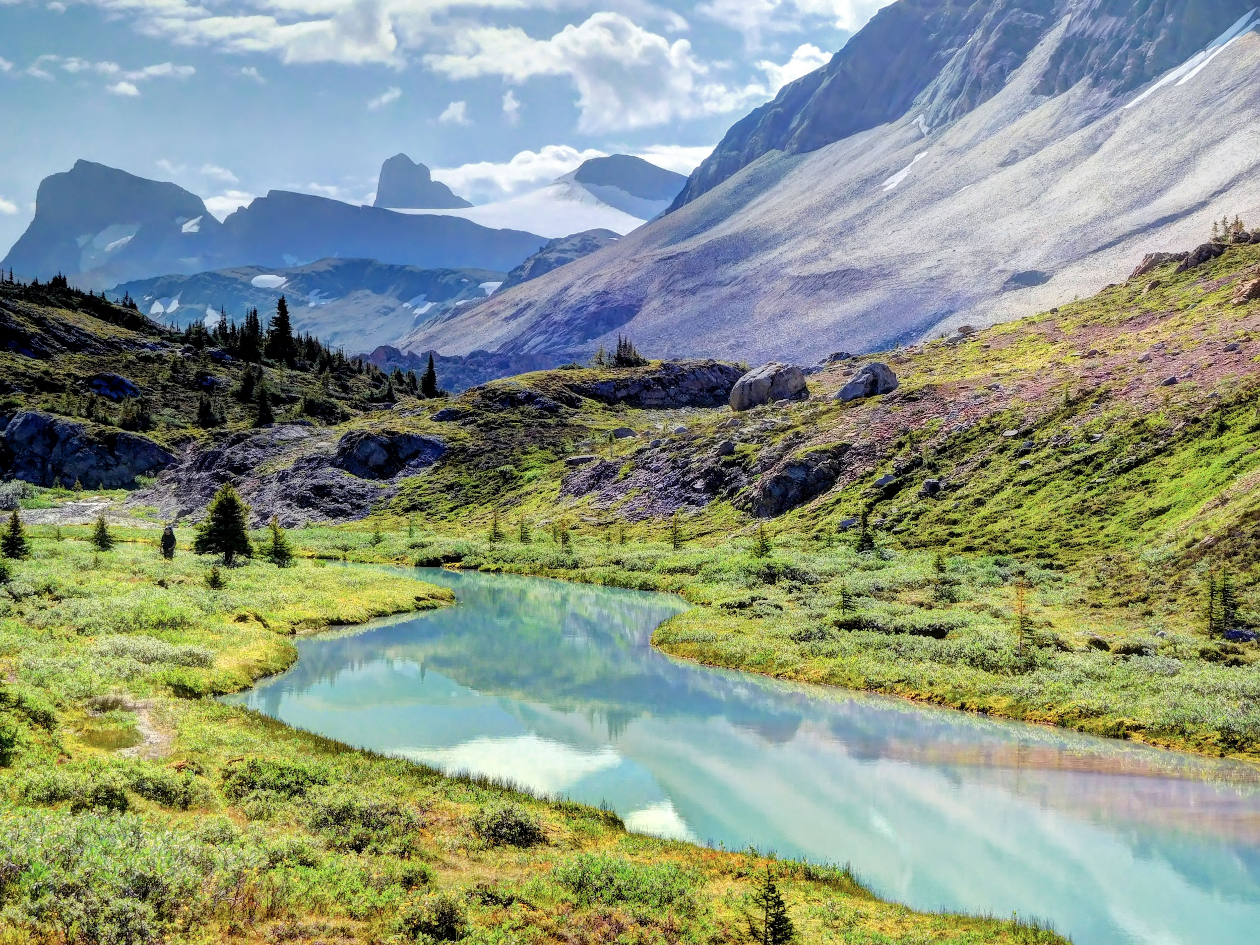
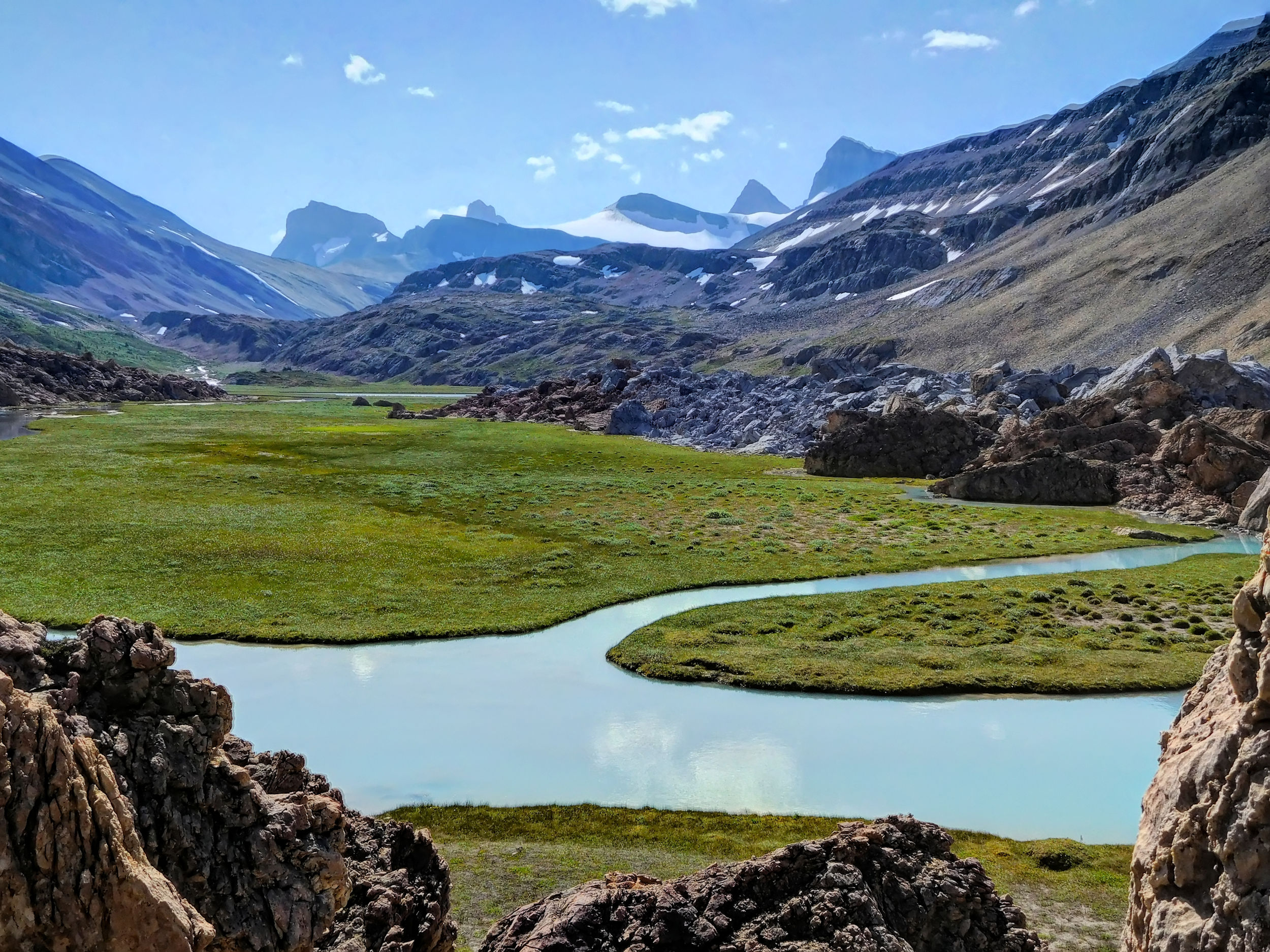
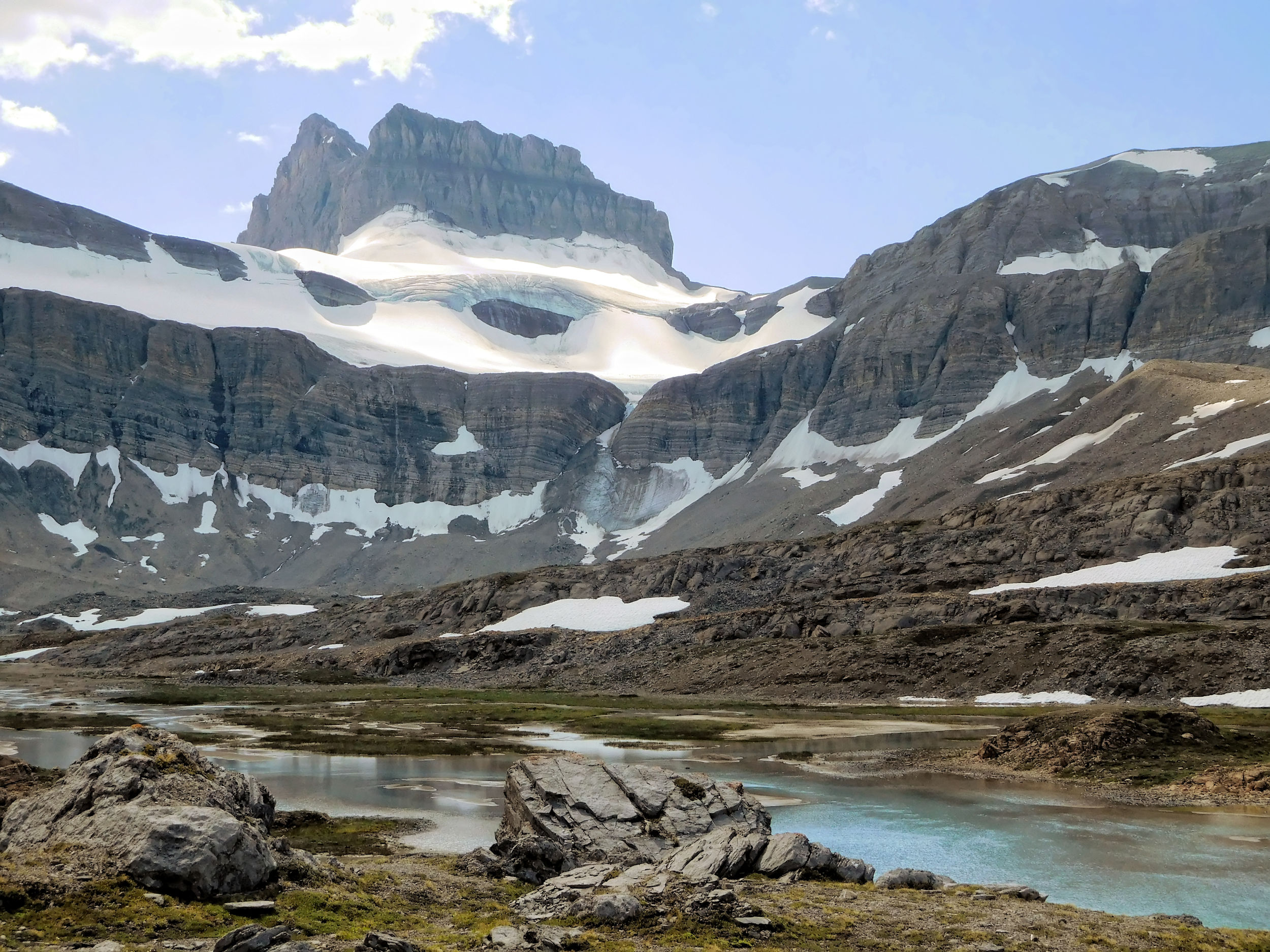
Behind the pass the trail descends gently and leads along a number of tarns. The views become even more dramatic. Walking along Jonas Creek, I don’t lose much elevation, which is good because the climb up Jonas Shoulder lies ahead.
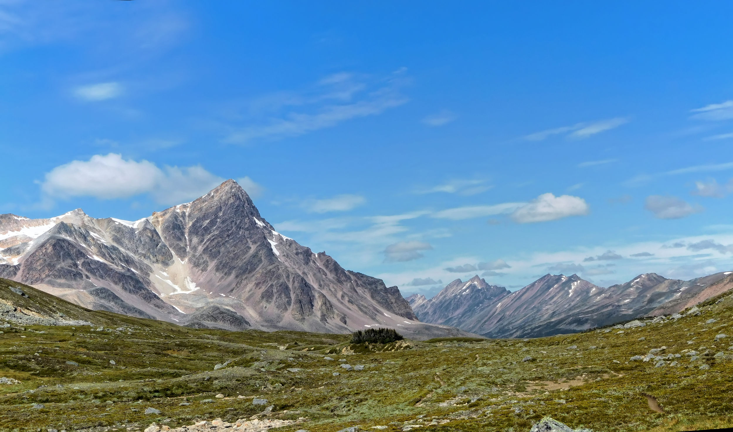
From Jonas Pass to the north
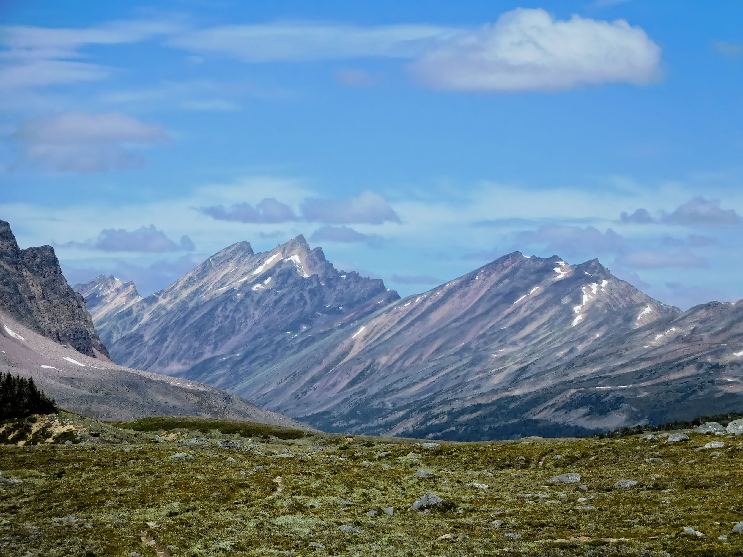
Waterfall Peaks
Tarns behind Jonas Pass
Jonas Creek valley and peaks of the Sunwapta Massif
Unlike me, most people hike the Brazeau Loop counter-clockwise, so once in a while I meet hikers coming down from Jonas Shoulder. One of them has found a water filter kit left behind on a rock near Jonas Creek. He left it in place because he hoped that somebody would come along and carry it in the same direction the owners have gone. I am pretty sure that the kit belongs to the couple from Ontario whom I met at the campground yesterday. They were on the trail really early, and the three of us are the only ones hiking clockwise today. I retrieve the kit and take it with me. Maybe the two come back for it or wait at the next campground.
Ascent to Jonas Shoulder and looking back to Jonas Pass
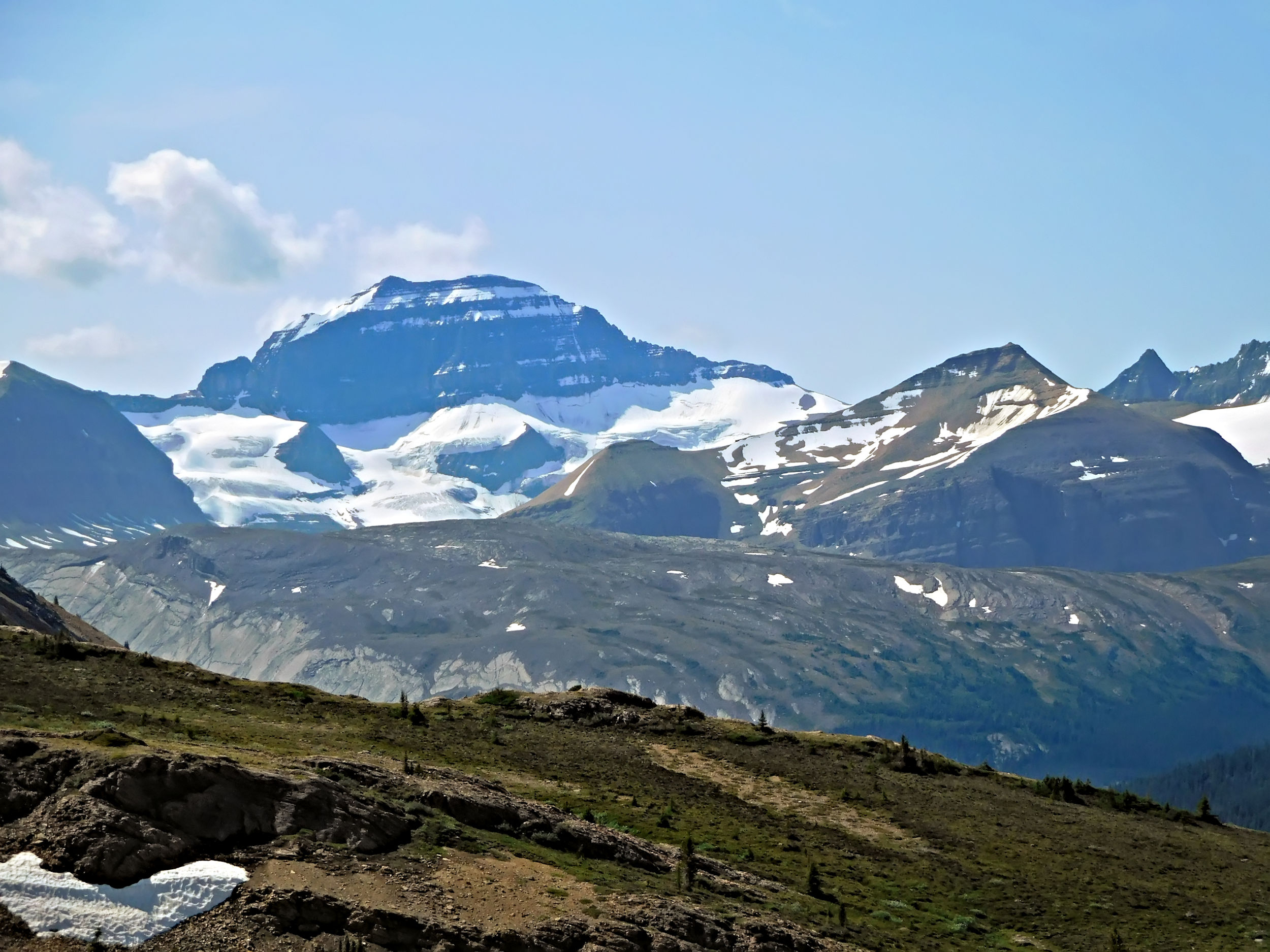
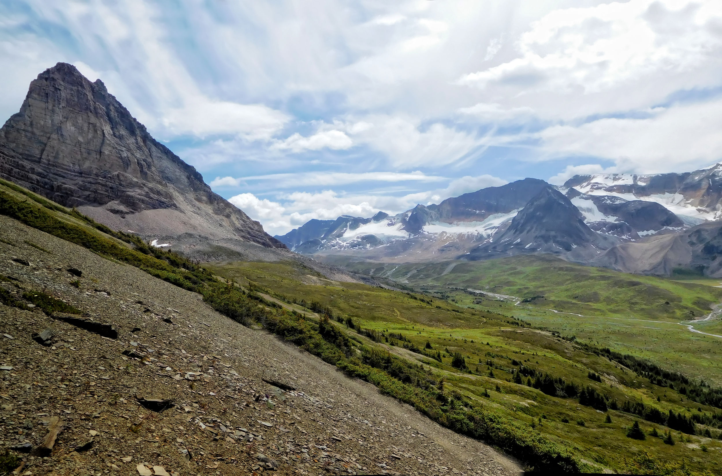
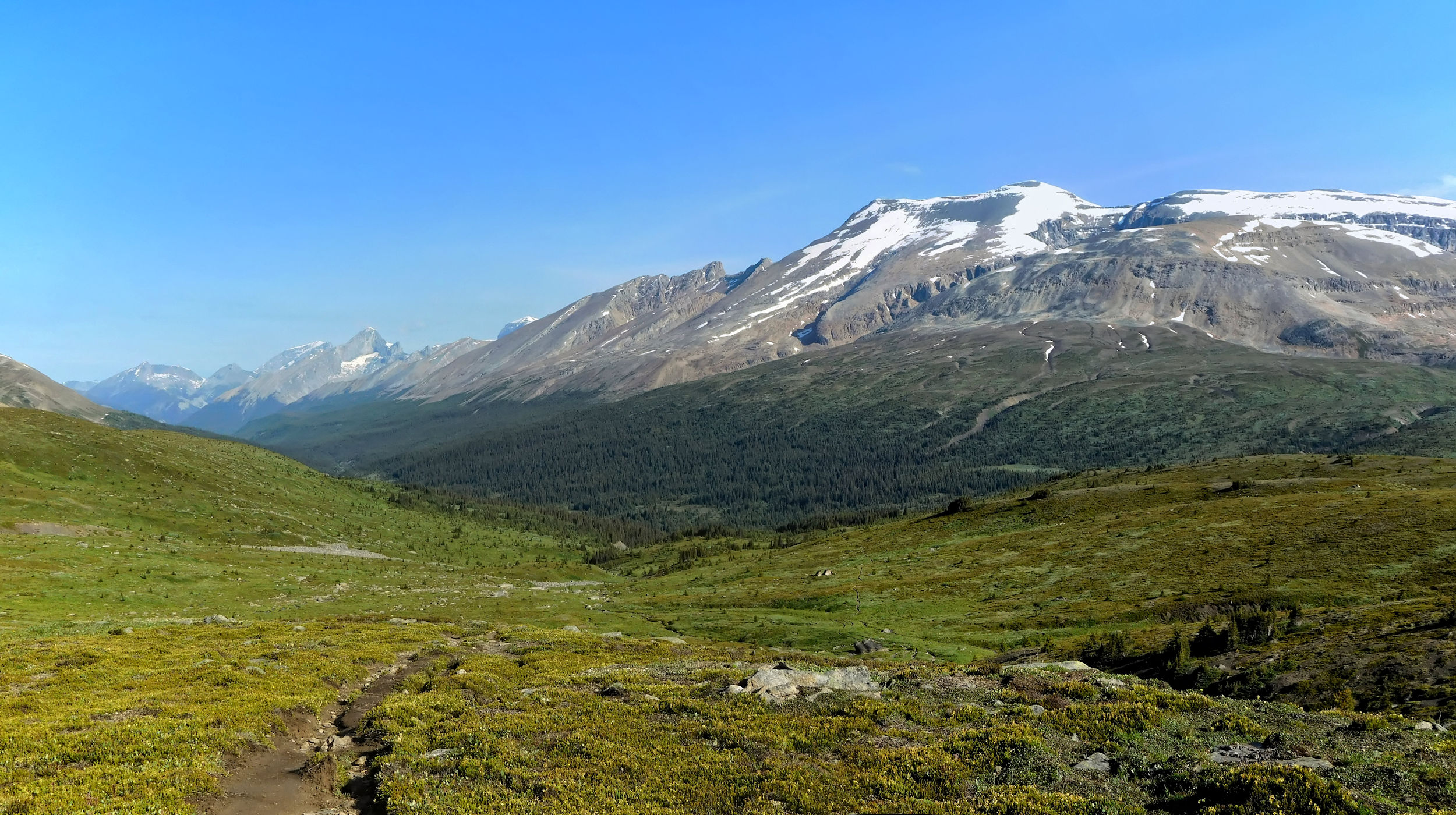
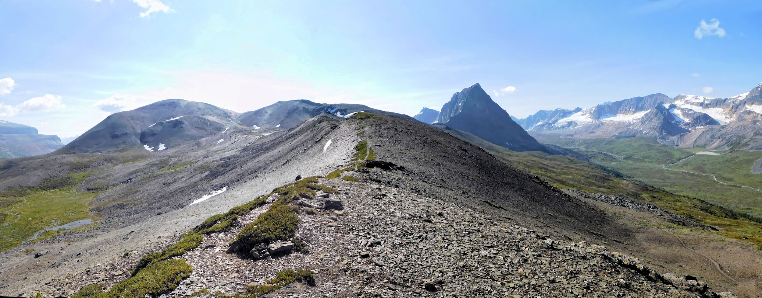
Jonas Shoulder is a long ridge. Its lower slopes are covered with grass. At 2450 meters it is the highest point on the Brazeau Loop.
Through a small gap in the ridge I cross over from Jonas Creek valley into Poboktan Creek valley.
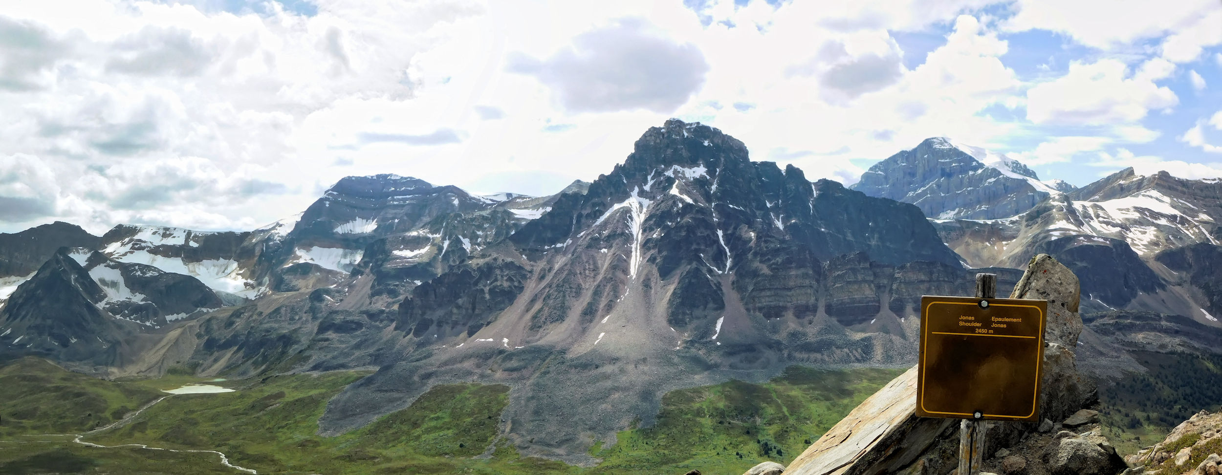
View from Jonas Shoulder to Sunwapta Massif 3315 m
View to the Poboktan side
Descent into Poboktan Creek valley, Poboktan Mountain 3332 m
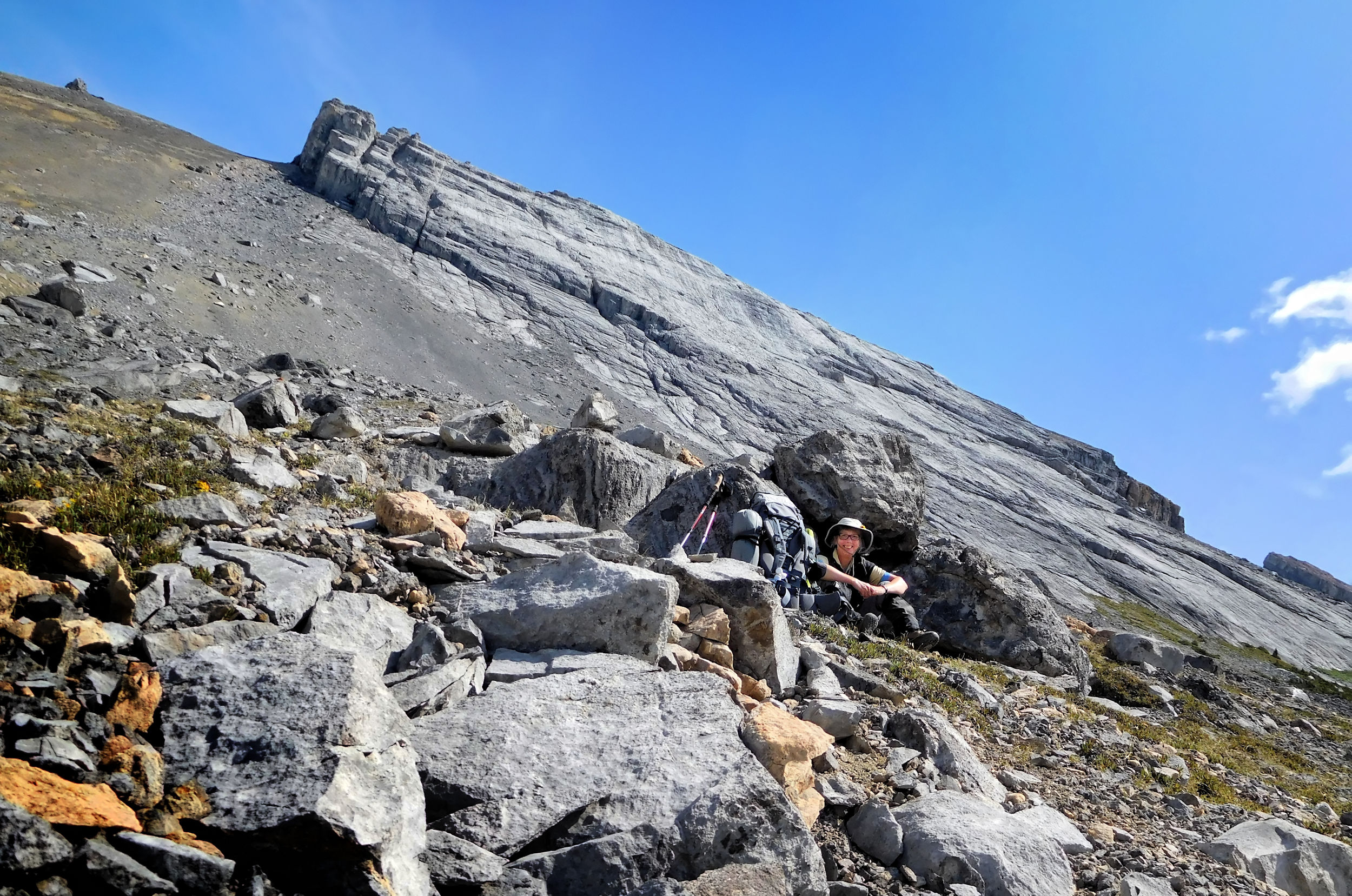
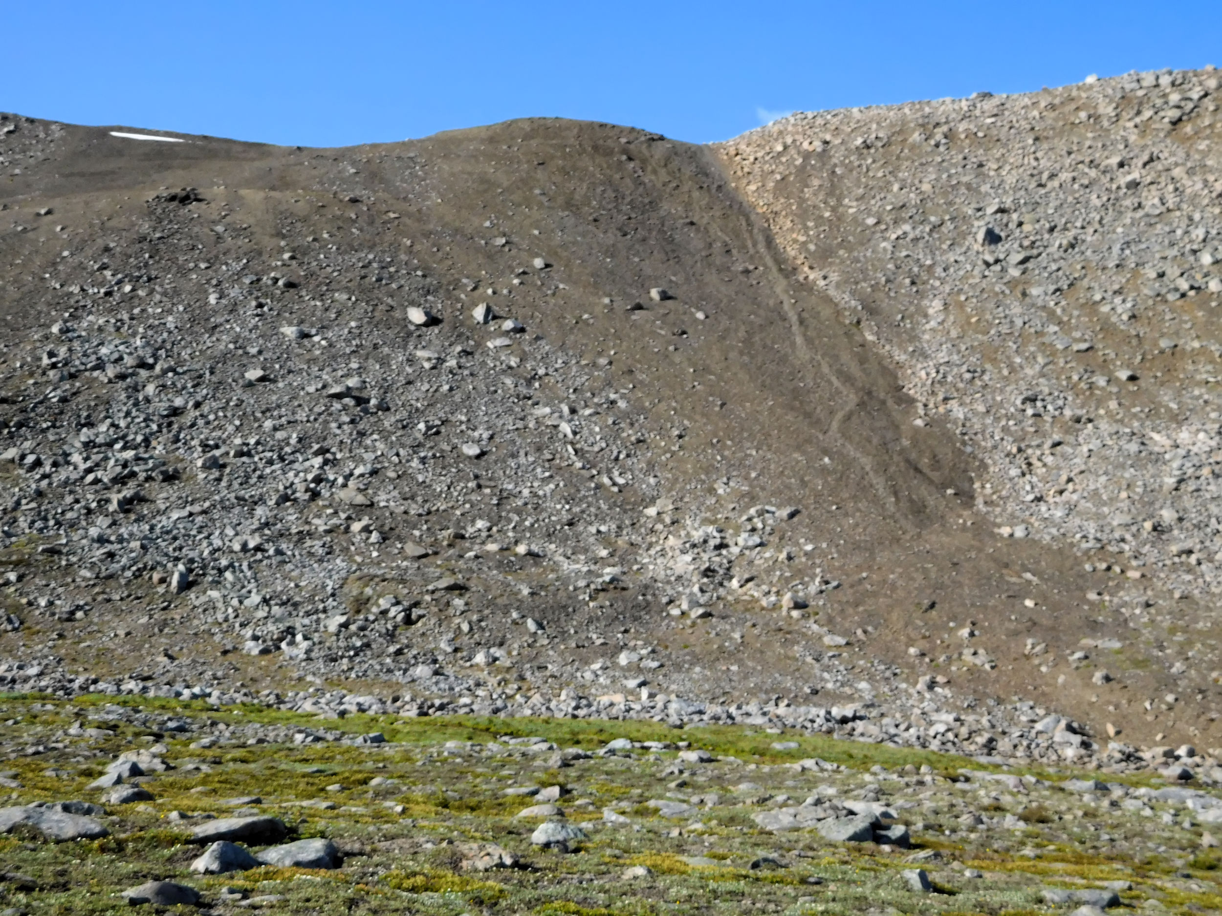
The descent from Jonas Shoulder is a steep 355-meter downhill. The trail is wet and partly hidden under the snow. The route is marked by cairns.
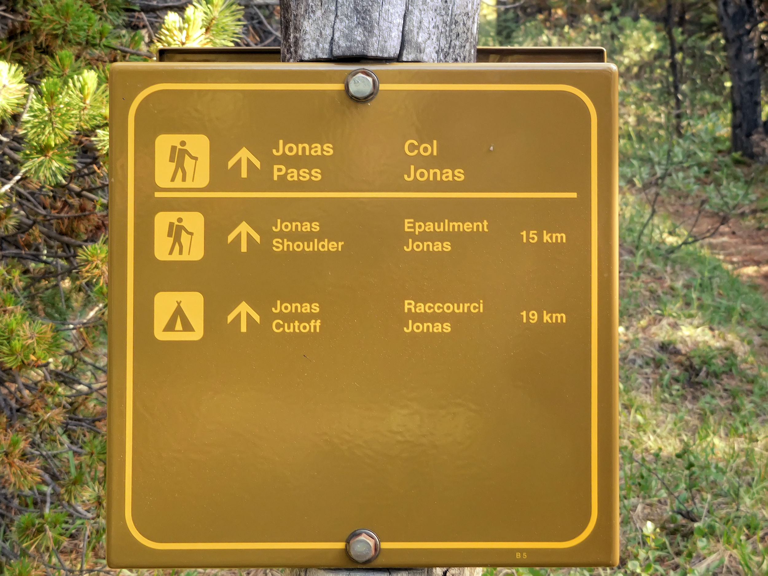
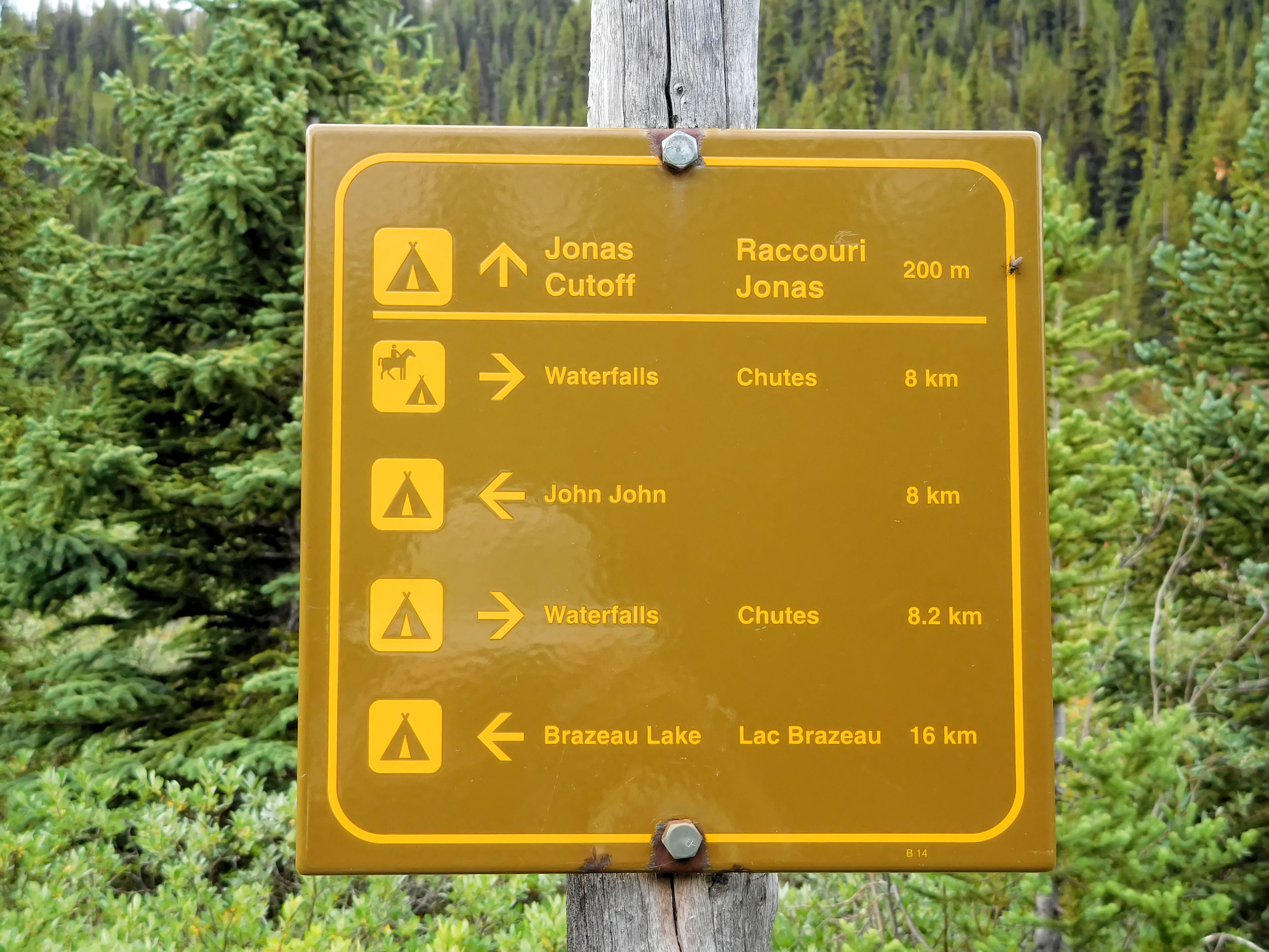
Jonas Cutoff campground
After the long hike I am relieved to be greeted by the lovingly carved sign for Jonas Cutoff campground. The campground is off the main trail, situated in a canyon right by Poboktan Creek. The tent sites are kept separate, but the areas for eating, food storage and drinking water are all close together. Some campers sunbathe at one of the picnic tables. They have come from Brazeau Lake where they enjoyed the sunny weather with a swim. Nobody has seen the two hikers who left their water filter behind. Obviously they have continued on without much of a break.
Some other GDT hikers overnight at Jonas Cutoff campground: a German couple from Bavaria and a young guy from the Czech Rebublic. The Czech is an ultra-light hiker. He is not even carrying a tent, just a bivouac to crawl in at night. Neither does he carry a stove; it’s all cold food for him like peanut butter sandwiches and such. His favorite meal consists of spoonfuls of Nutella directly from an over-sized jar. Well, he’s not even twenty and still tough. I pass the water filter on to him, as he is following in the footsteps of the Ontario couple. Eventually he might catch up with them. Most GDT hikers know each other or at least of each other, so I am confident the kit will find its way back to the owners at some point.
I will spend two nights at Jonas Cutoff campground and venture out on a day hike tomorrow.
| Distance | 11 km |
| Time | ca.4 hrs |
| Min. Elevation | 2135 m |
| Max. Elevation | 2300 m |
| Ascent | 165 m |
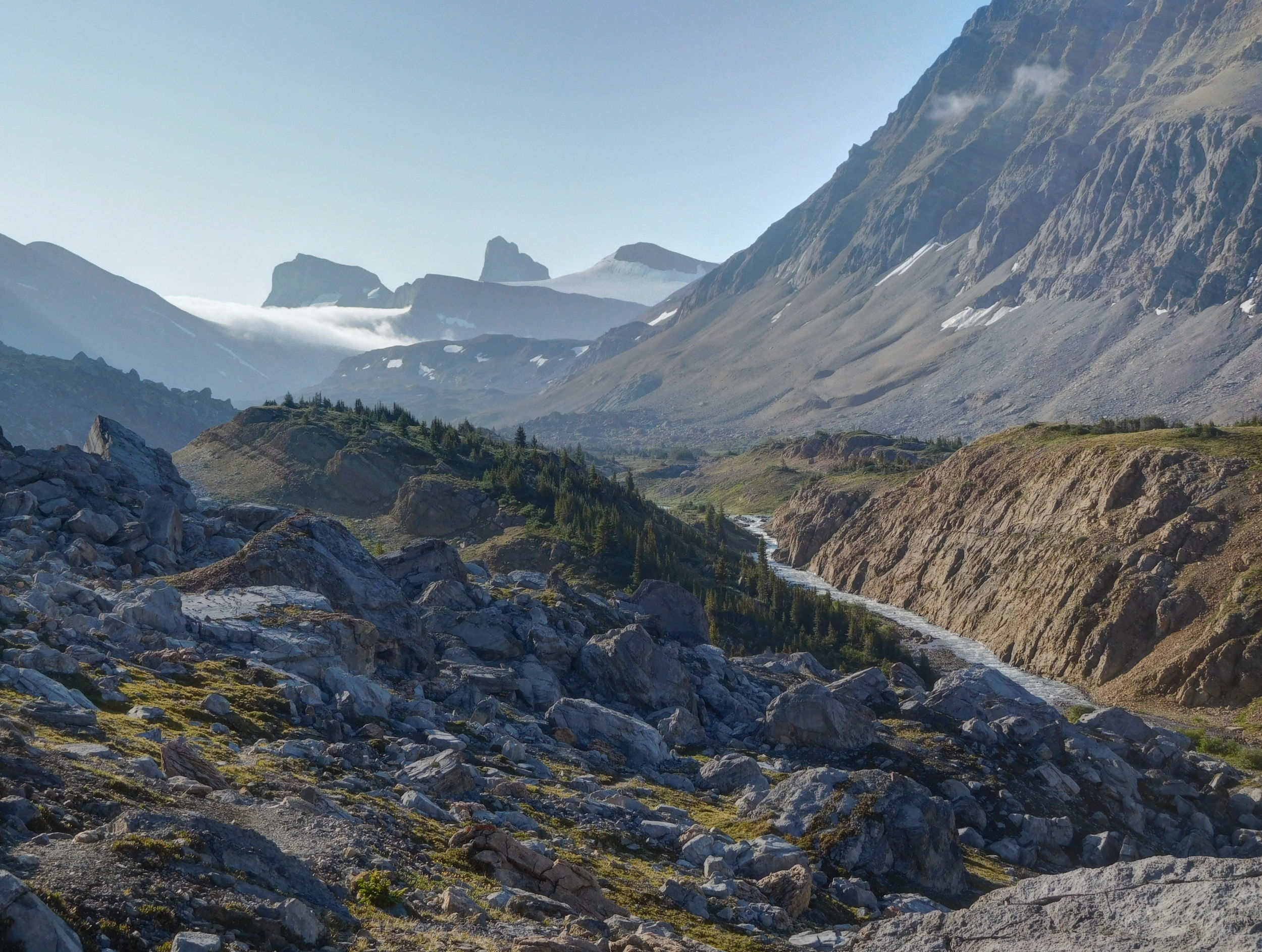
It is cloudy in the morning, even looks like it is going to rain. I walk out the northwestern end of the Poboktan Creek canyon. Crossing several bridges, I leave a marsh behind and reach the path to Poboktan Pass. Looking back, I see dark clouds moving in. I put on my rain poncho and wait out the rain under some dense trees.
View to the northwest into Poboktan Creek valley
After about half an hour the worst of the weather has passed and I start ascending Poboktan Pass. I run into an American couple from Kentucky and we have a nice chat.
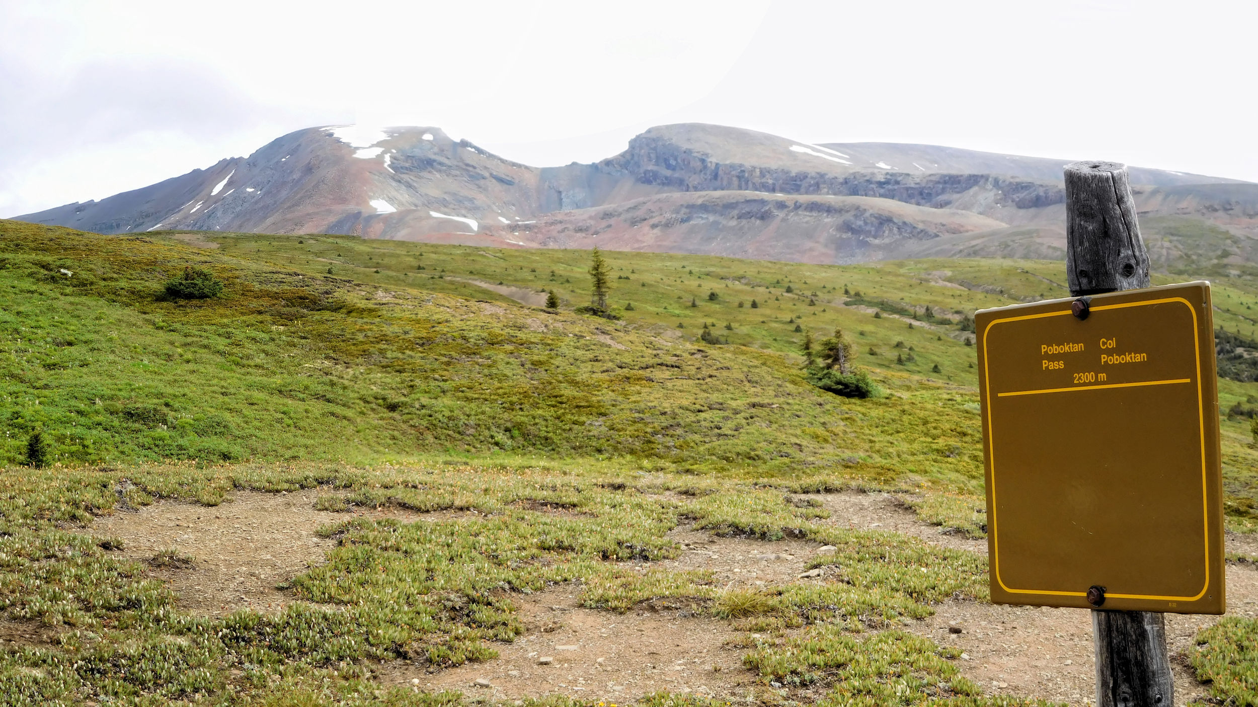
Poboktan Pass 2300 m
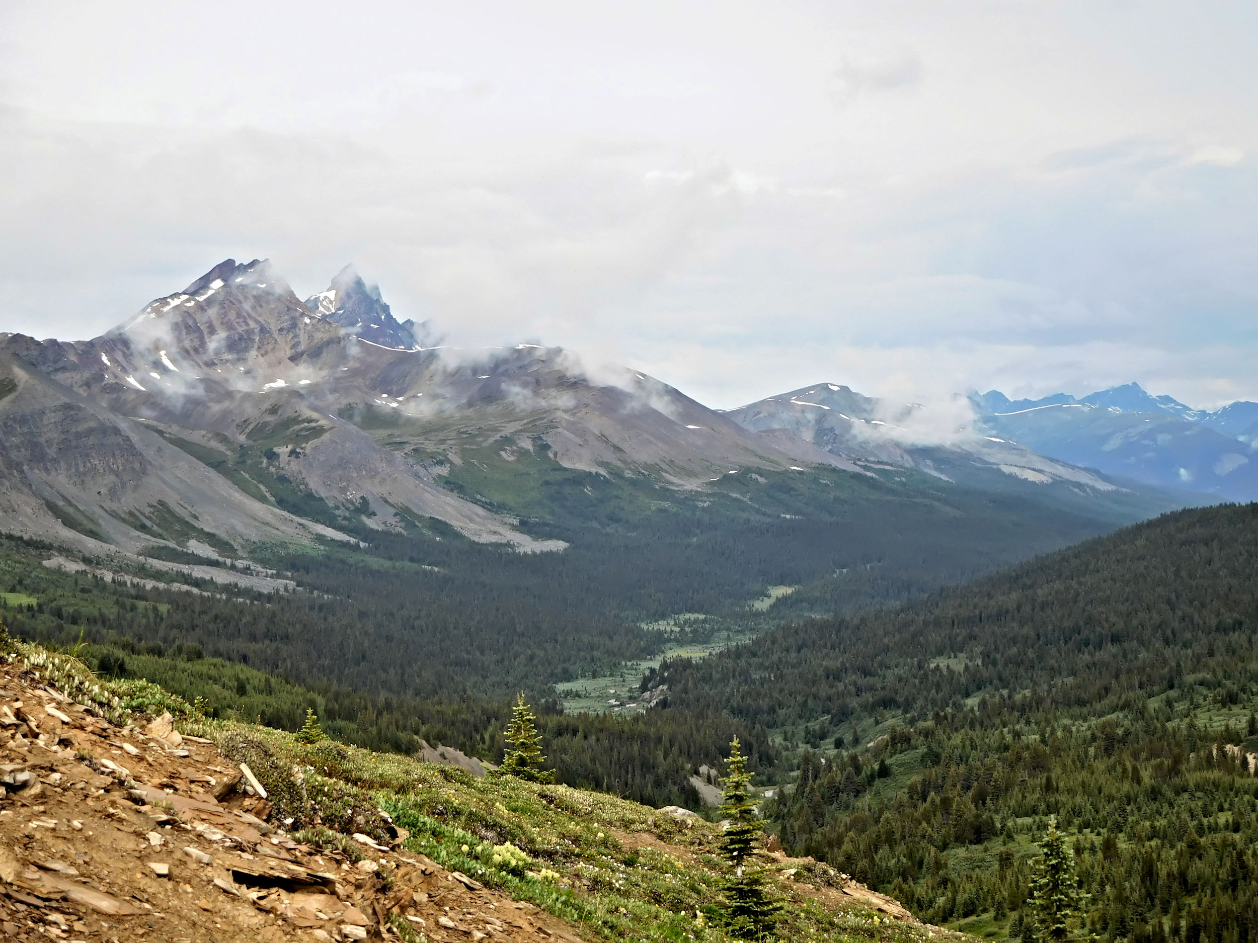
I hike past the pass and have some great views into John-John Creek valley, of Marble Mountain and Flat Ridge (2793 m).
Looking toward Poboktan Mountain and Marble NW 4
Marble Mountain 2962 m

Marble NW4 2917 m
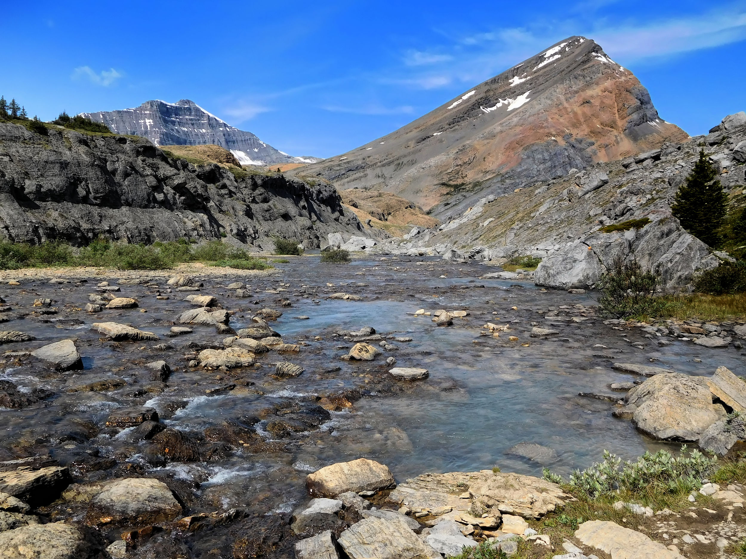
Before the trail descends steeply into the valley, I decide that this is my turn-around point and a good spot to have lunch. I sit on a rock and enjoy the view of the surrounding mountains and the valley below. The other half of the Brazeau trail continues downhill and leads via John-John campground to Brazeau Lake. From there, the loop can be closed by hiking along the Brazeau River and back to Fourpoint campground.
Soon the sky darkens again. I begin my return trip and hope that I won’t get wet. Just below Poboktan Pass a thunderstorm is rolling in. The northern sky has turned black and thunder rumbles in the distance. You don’t want to get caught by a storm on a pass, so I start jogging. Accompanied by thunder, I run back to the campground as fast as the trail allows. When the first raindrops start falling, I dive into my tent. Just in time!
It is only 2 o’clock and a somewhat boring afternoon in the tent ensues. I am happy that I brought my mp3-player and my phone with a book on it to read. I hear other hikers arriving and setting up camp. When the rain finally stops I meet some of them and I have a late dinner around 7 o’clock at night. The short trails from the tent sites to the picnic tables have become extremely muddy and slippery.
The weather has not been great today, but I still had an enjoyable day on the Brazeau Loop and I feel rested for the long way back.

| Distance | 19.1 km |
| Time | ca. 6 hrs |
| Min. Elevation | 1927 m |
| Max. Elevation | 2470 m |
| Descent | 543 m |
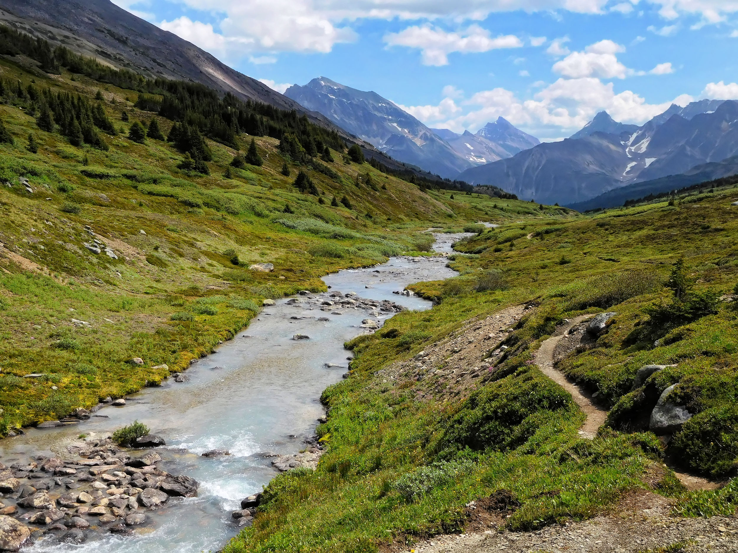
The rain has moved away and I wake up to cloudless skies. Today I am returning on the same trail that I have hiked in. It has been a beautiful segment of my hike and I am looking forward to do it again from a reverse perspective. The Poboktan Creek valley looks serene under a blue sky.
Poboktan Creek valley
The ascent of Jonas Shoulder is much steeper from this side.
Ascent to Jonas Shoulder
The view from the top of Jonas Shoulder is impressive again. There is hardly a cloud in the sky.
Jonas Shoulder, view of the Sunwapta Massif
Jonas Shoulder, looking back to the northwest
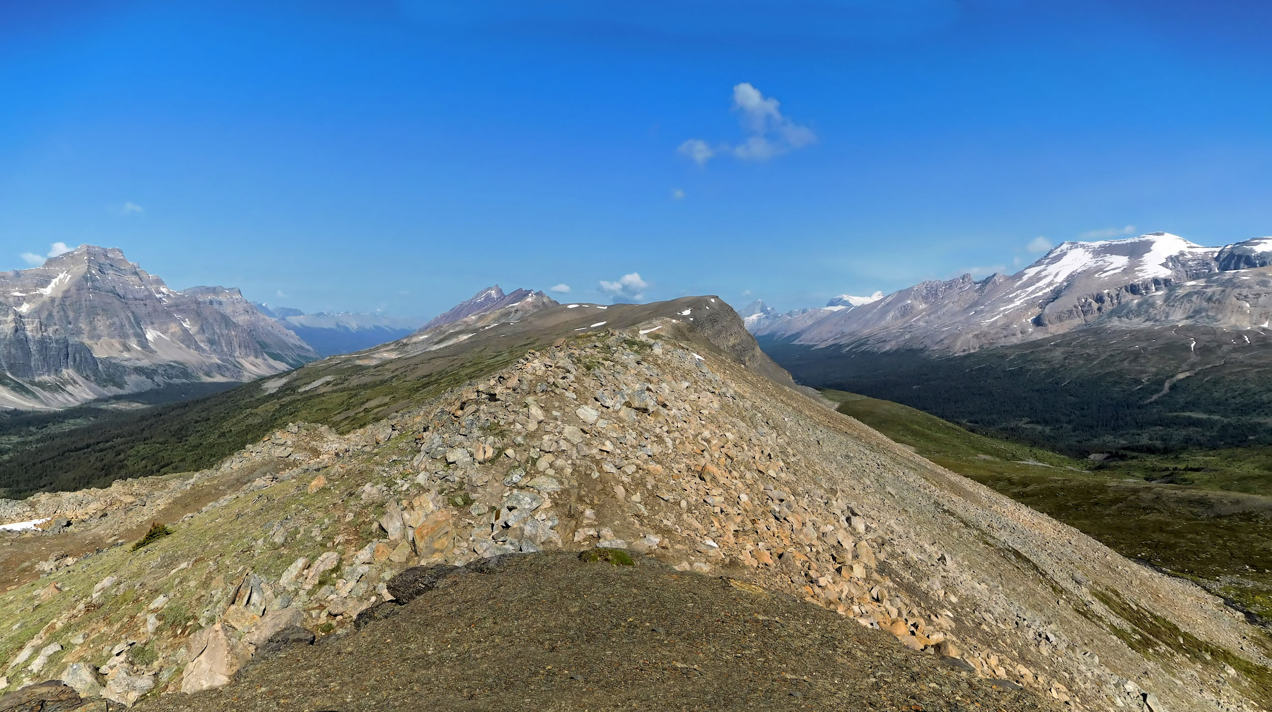
Jonas Shoulder, looking ahead to the southeast
I descend from Jonas Shoulder and hike down the valley towards Jonas Pass. Today I run into a few hikers who walk clockwise like I did two days ago.
On the way to Jonas Pass
At the pass I have a long break and dry my tent. Everybody seems to meet for lunch here today. A dad and his son introduce themselves quite formally, and a group of older hikers from Calgary arrives.
Past Jonas Pass
Meadows along Fourpoint Creek
Fourpoint Creek
Today I am much more at ease with crossing the many side creeks of Fourpoint Creek. Even the bad one at the end of the valley presents hardly a challenge this time. Maybe the water is lower or I am more confident or both. More and more wildflowers are blooming in the meadows. After a long rainy July, summer finally has arrived in these parts, too.
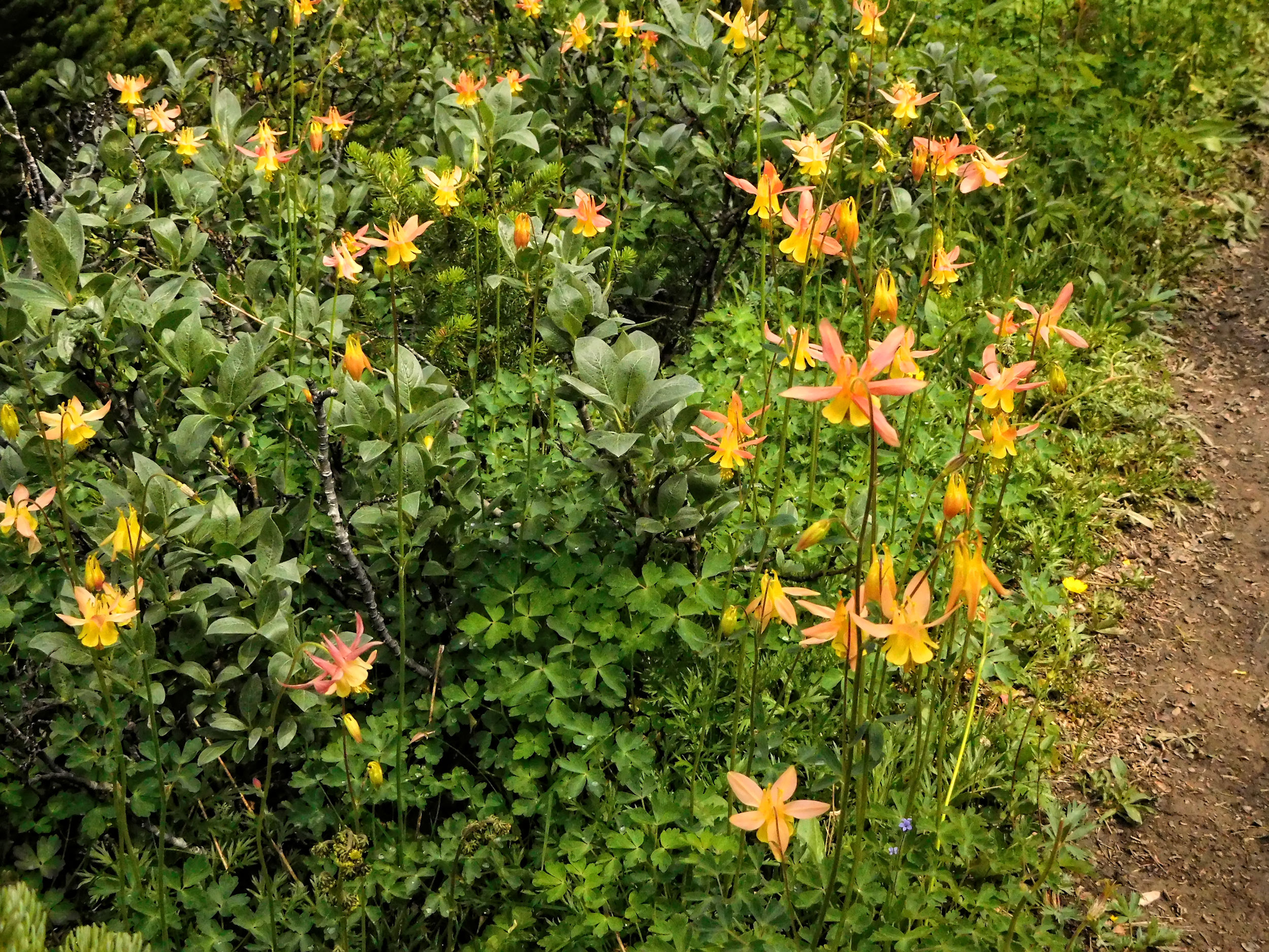
Wildflowers
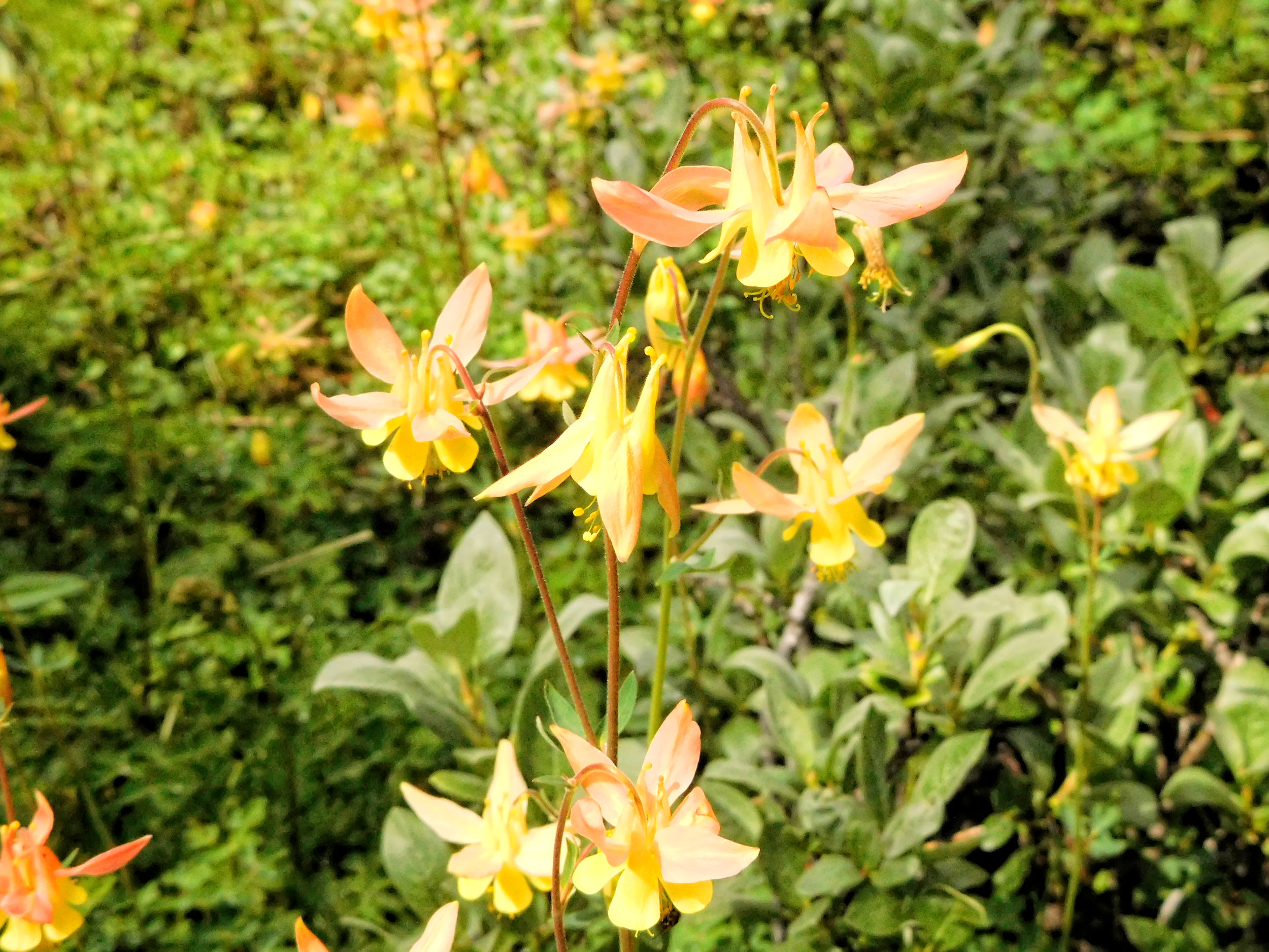
Yellow Columbine
In the early afternoon I reach Fourpoint campground. There is enough time for tea and something sweet before I have to think about dinner. Two women, mother and daughter, keep me company at the picnic table. Tomorrow I will rise extremely early because I am going to move tent to the next campground three kilometers away. From there I want to venture out on a day hike to Cataract Pass.
| Distance | 21 km |
| Time | Ca. 6 hrs |
| Min. Elevation | 1927 m |
| Max. Elevation | 2330 m |
| Ascent | 403 m |
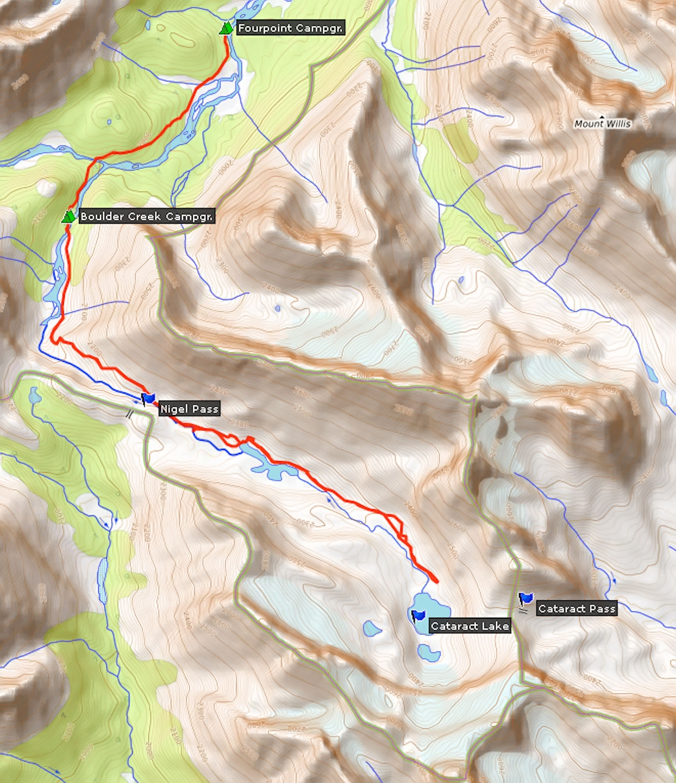
The next morning the weather is still beautiful, perfect conditions to explore Cataract Pass. I will travel through a valley away from the official hiking trail, but the route is part of the Great Divide Trail. The GDT hikers usually spend the night at Cataract Creek in the Wild Goat Wilderness outside of the park, then descend Cataract Pass into the valley and continue on to Nigel Pass.
I walk along the Brazeau River to Boulder Creek campground. There is only one hiker who spent the night. She is having breakfast and waiting for her tent to dry, while I set up mine with lightning speed.
Over the gravelly switchbacks I hike back up to Nigel Pass. I enjoy the views for a second time.
Brazeau waterfall
Upper Brazeau Canyon
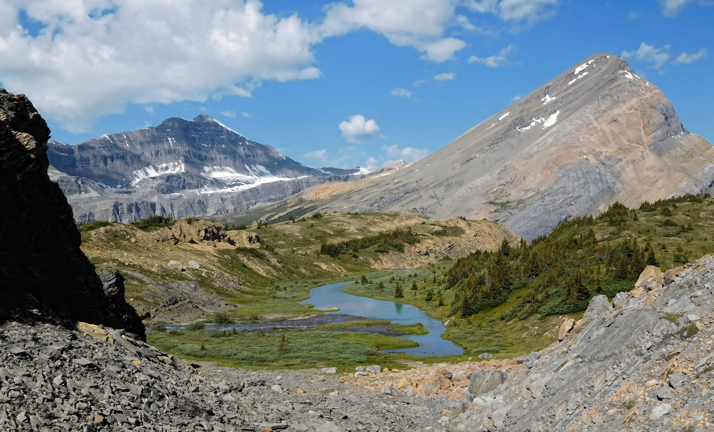
It is already noon when I finally reach the route to Cataract Pass. It takes me above and along the wild waters of the Upper Brazeau Canyon. Further upstream the river becomes much calmer and its color changes to a milky turquois.
Upper Brazeau River
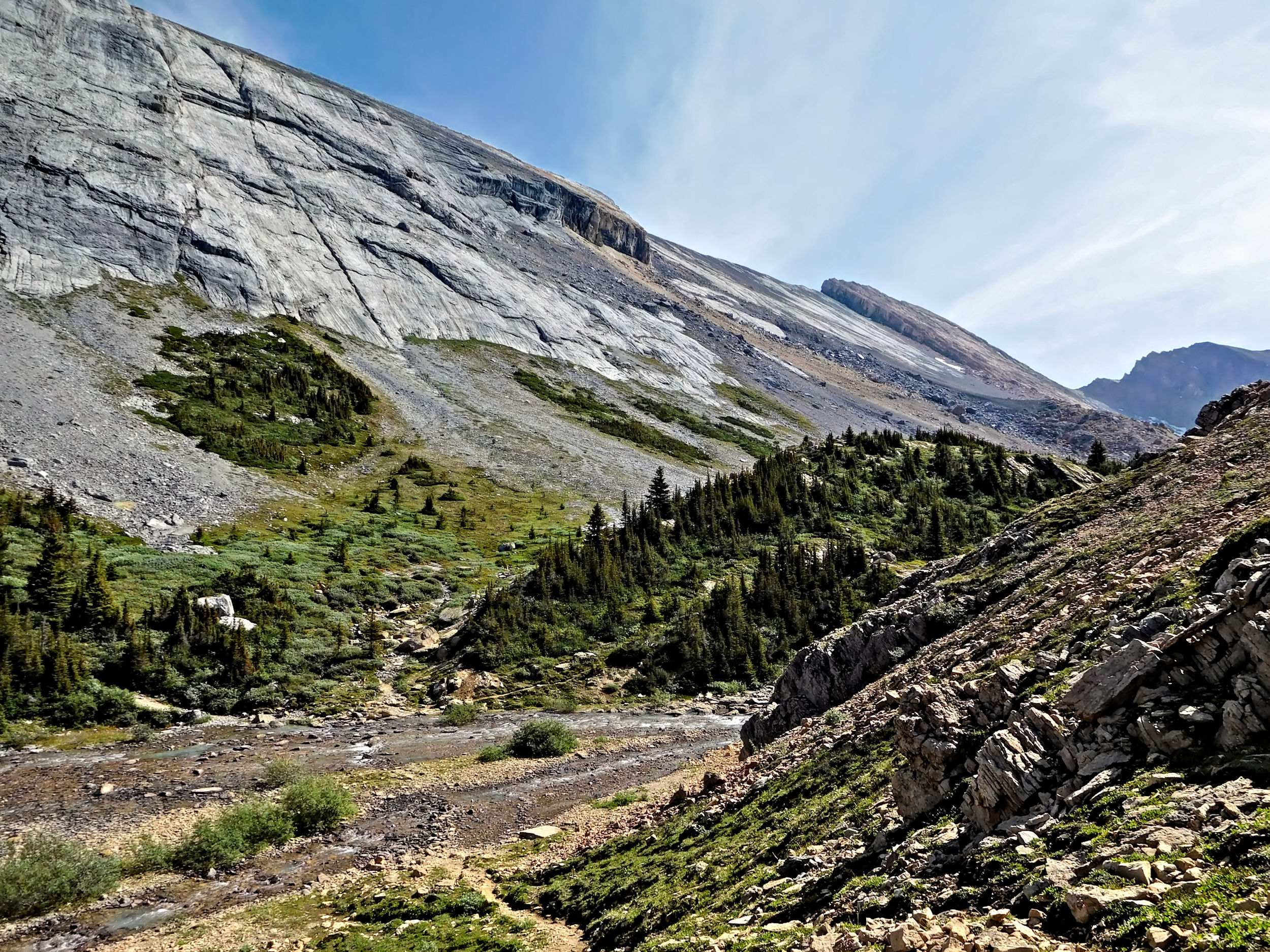
The well-trodden path through heather, grass and cinquefoil fades soon. I have to navigate through a field of boulders. Cairns mark the way.
Looking back to Nigel Pass
A second boulder field is even bigger and it takes more time to find my way through. In times with lower water levels it is easy to get around it, but now parts of the original route are under water. Frequent scrambles and searches for the next cairn slow me down considerably.
Rock formation of Cirrus Mountain
Upper Brazeau valley
Once through the boulder field, I follow the left shore of the river. At a blockage that forms a small cascade, I take the left canyon. I can’t lose my way, but I could run into a dead end. A couple is coming down from Cataract Pass. They suggest that it is another hour to the top. They are on their way out of the valley and I start to feel somewhat isolated. Being all alone among those mountain giants is magical and frightening at the same time.
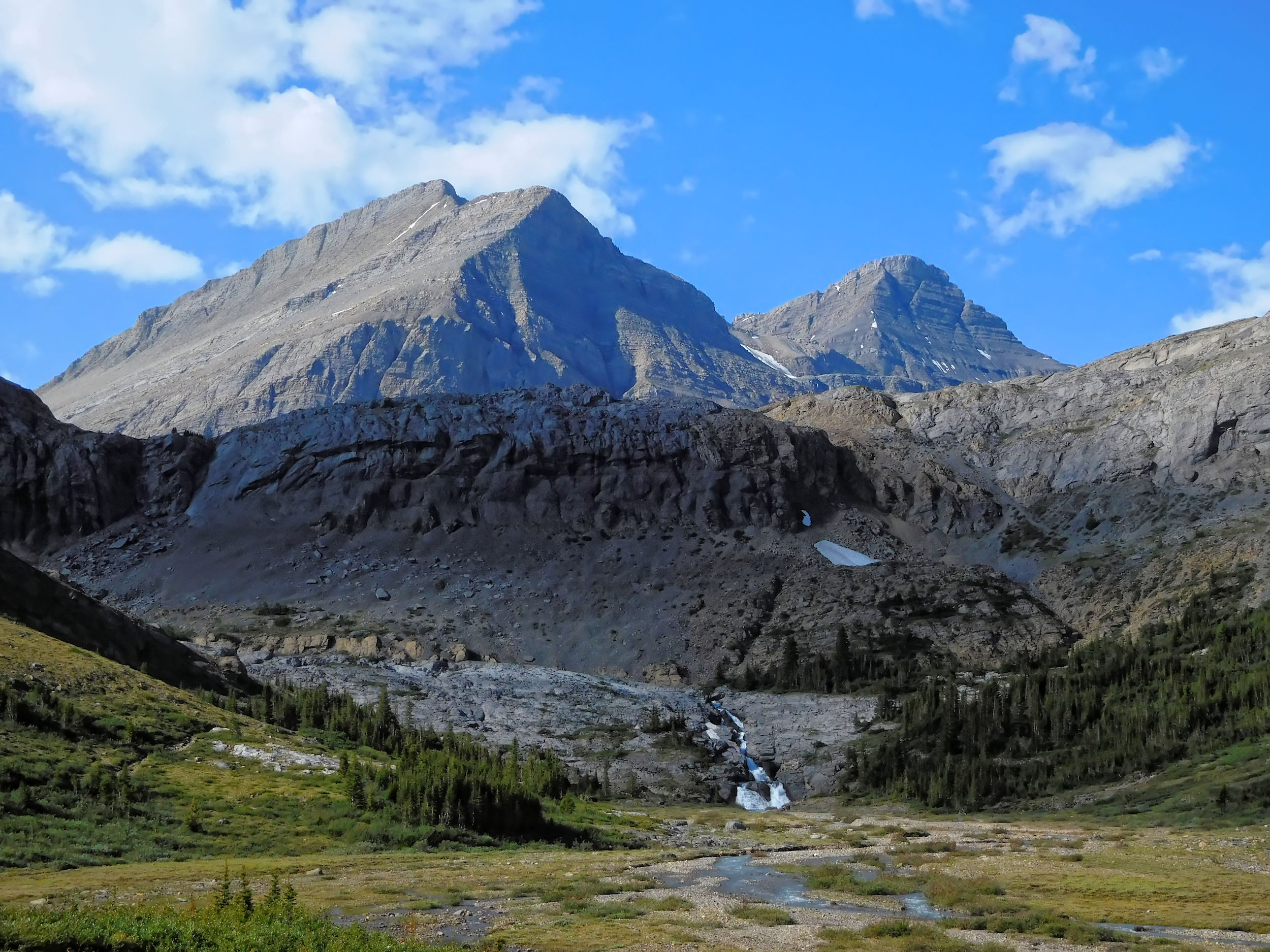
I approach the mountain range that has been ahead of me the whole way. It towers over glacier-fed Cataract Lake, where the Brazeau River has its origins.
Mountain range above the headwaters of the Brazeau River
I scramble on top of a moraine, where I have a perfect view of the massif and the Brazeau headwaters.
I am stunned by the vastness and beauty of it all.
Cataract Pass (to the left)
Cataract Pass is not far away and according to my hiking book it would take me only half an hour to summit it. I even spot footprints in the snow that show me the route to the base of the pass which I had lost several times. However, it is getting late and I don’t want to push it. I decide to stay on my perch on top of the moraine and enjoy the peaceful and majestic landscape for a while longer.
Looking back to Nigel Pass
I spend almost an hour in these incredible surroundings, before I gather myself up for the return. Just below Nigel Pass I run into a group of horse riders. They have tried to ride on the Cataract Pass trail, but it got too narrow for the horses. Instead they ascend Nigel Pass and have a rest on the other side. I hike down to Boulder Creek campground where my tent is waiting for me. Tonight all four campsites are taken, which means that I have company for dinner. Once again I have nice chats with fellow hikers that bring another beautiful day to a close. It is a nice thought to have reason for coming back here and make it all the way up to Cataract Pass another time.
| Distance | 11 km |
| Time | Ca. 3 hrs |
| Min. Elevation | 1860 m |
| Max. Elevation | 2195 m |
| Descent | 335 m |
I have an early start because I want to drive home from the trailhead without spending another night. Morning fogs waft over the Brazeau River, the night has been cold. The shrubs are covered in dew droplets that wet my legs when I go by.
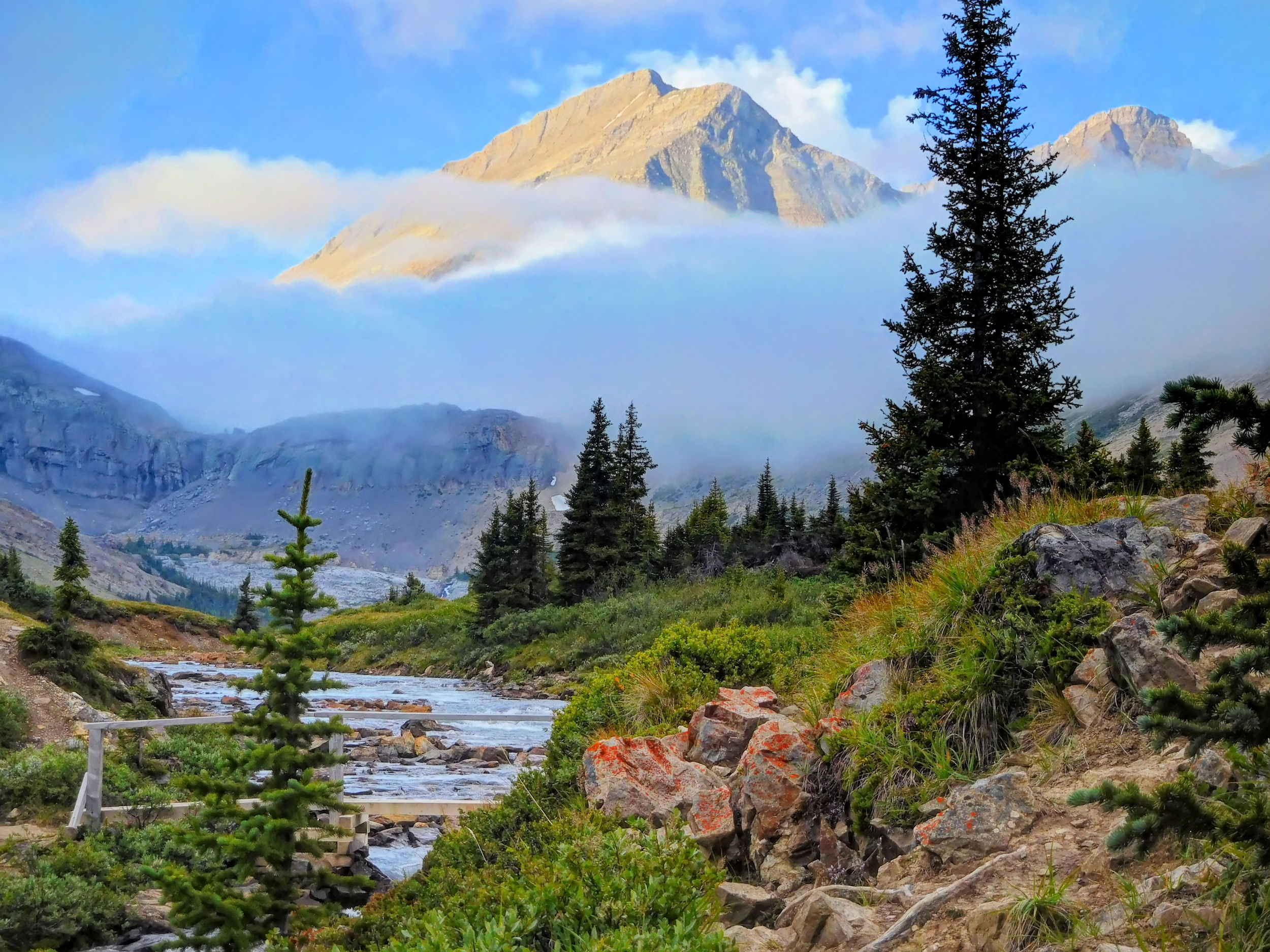
Nigel Peak and bridge over Boulder Creek
I cross Nigel Pass for the third time. This morning it fascinates with mist.
Nigel Pass in morning mist
When crossing the Brazeau River, I pick a bad route and have to wade a lot. Fortunately after all these days my boots are still waterproof enough to keep my feet mostly dry.
The mist dissipates eventually and I enjoy a sunny hike down into the valley.
On the gravel road, not far from the parking lot, a single backpacker comes up to me. We look at each other and can’t believe our eyes. It is Antoine from Quebec, whom I first met at Egypt Lake on my other trip this summer. While I was home resting my legs for the next trip, he continued his hike on the Great Divide Trail and now has arrived for this stretch on the Brazeau trail. He had come down Cataract Pass a couple of days ago, left the trail for a resupply and now continues on his way. What a lucky coincidence to meet him again!
It is only one more kilometer to the car, where I finally take off the heavy backpack. Even without food, it never feels much lighter than at the start of a hike. I put on fresh socks and light sneakers, a luxury for my feet. I am satisfied with another successful adventure behind me and am ready for the long drive home.