 Via Williams Lake to Anahim LakeSeptember 2

A drive of 460 kilometers in 6 hours
After having sat in front of the house for most of a smoky summer with wide-spread wildfires, our truck needs a bit of persuasion to start: the battery is dead. A booster cable connected to the battery of our SUV does the trick and so we begin our highly anticipated camping trip to the Cariboo-Chilcotin with only a small delay.
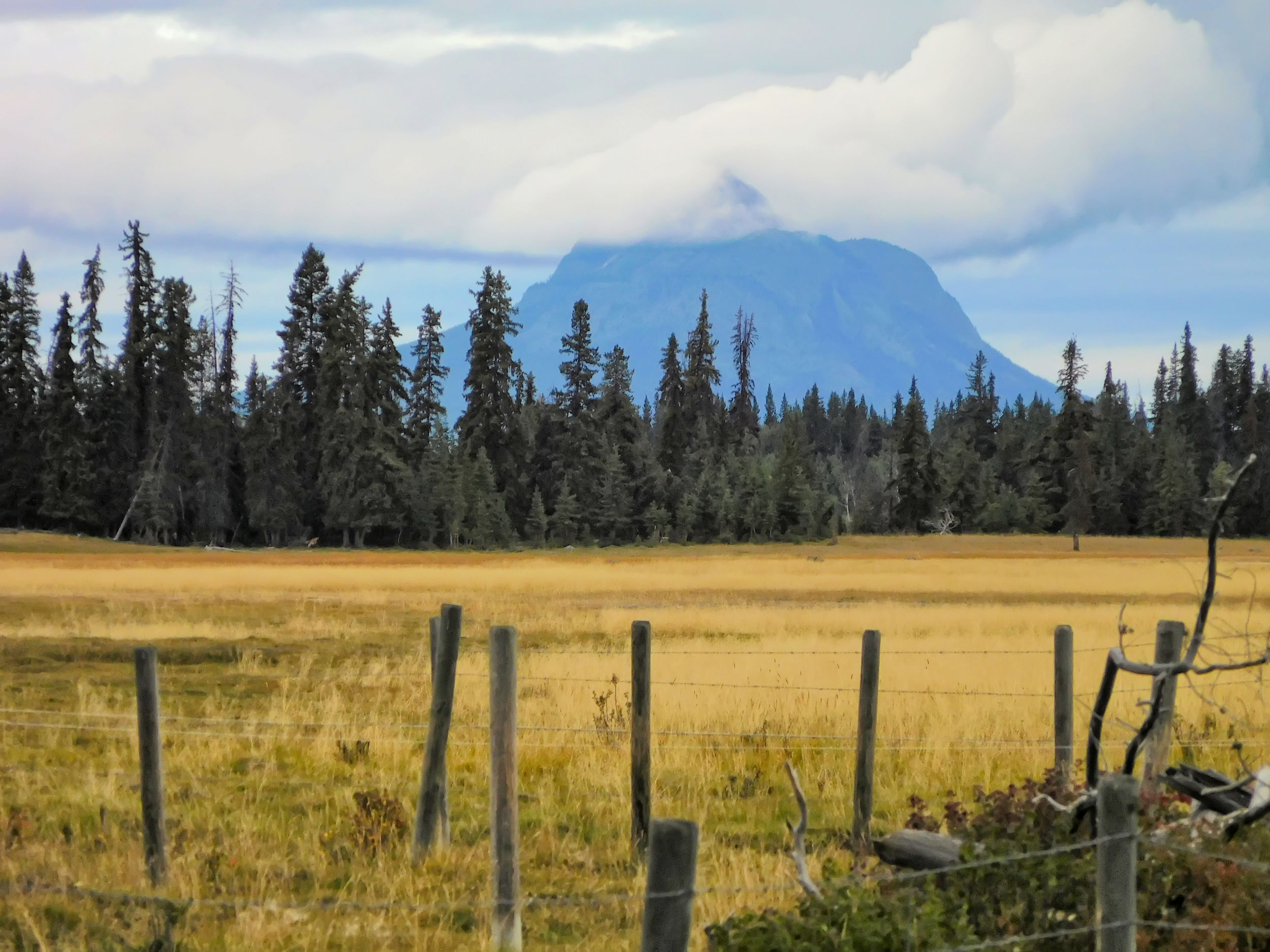
It takes us six hours to get to our destination, the Escott Bay Resort on the shores of Anahim Lake. Highway 20 is paved, but there are many gravel patches, potholed shoulders and bumpy stretches that slow you down. It is a nice drive through the vast landscapes of the Chilcotin plateau. As we go west, more and higher mountains appear on the horizon. There are many remnants of recent and past wildfires to be seen along the way. Fortunately for us, all of this year’s fires are now under control.
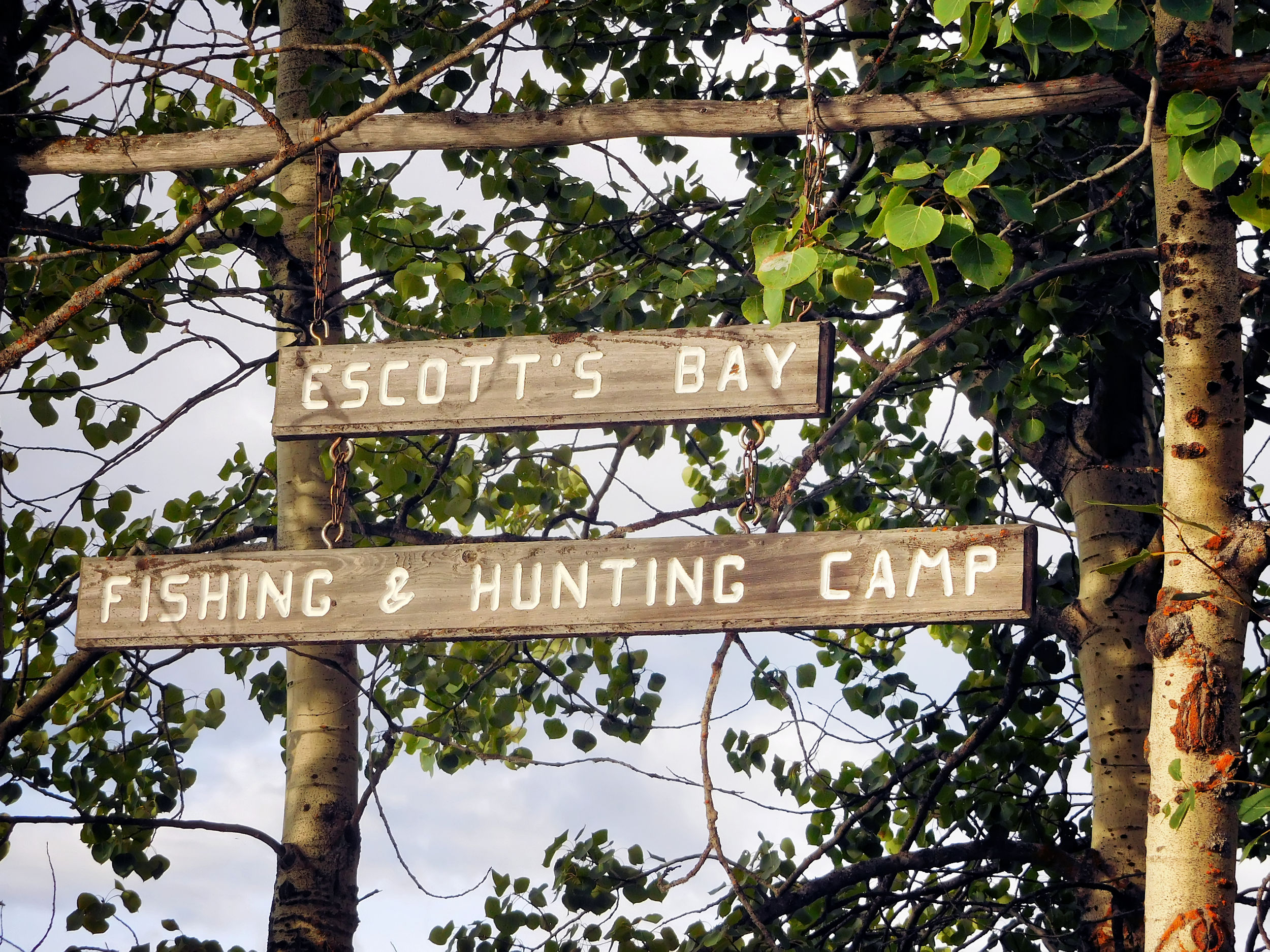
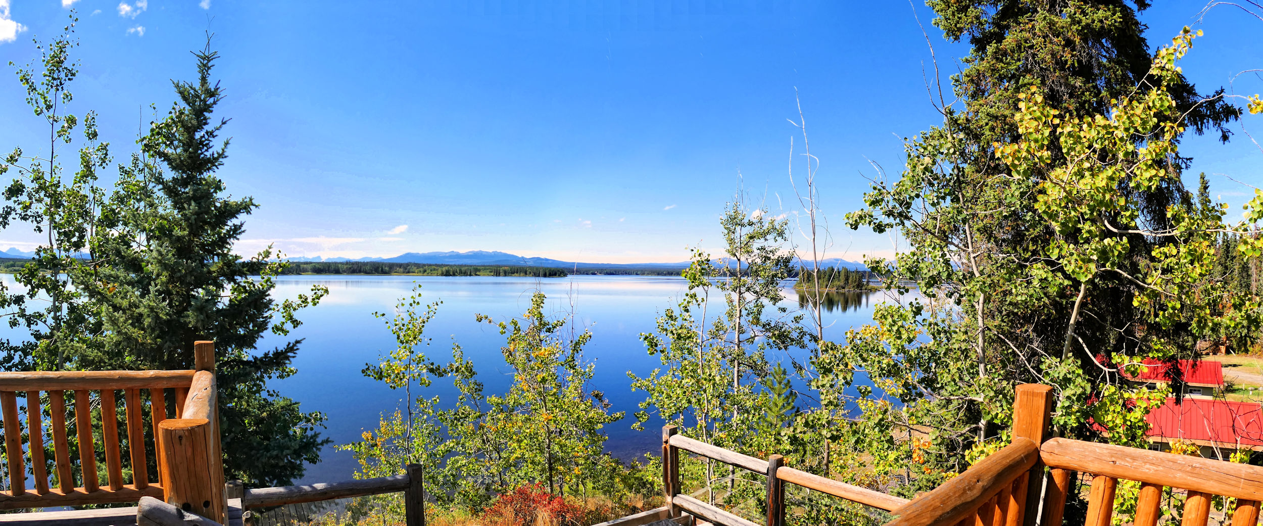
The Escott Bay Resort is located about seven kilometers out of the little hamlet of Anahim Lake and is one of two resorts on the lake. Karl and I will stay here together for the next couple of days. On Sunday, I will meet up with four hiking friends to backpack in the nearby Rainbow Range, while Karl will relax at the resort and enjoy some more fishing. He will pick me up again three days later.
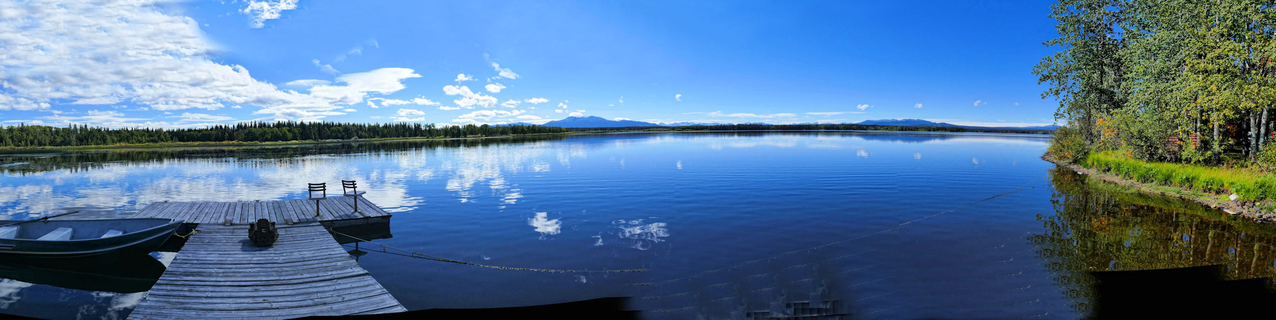
We park our camper right by the lake shore and have a great view through our windows and from the picnic table outside. It’s time for an early dinner and a relaxing evening.
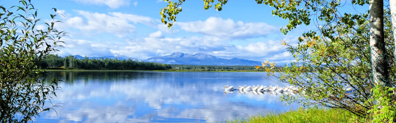
Anahim Lake from Escott Bay Resort
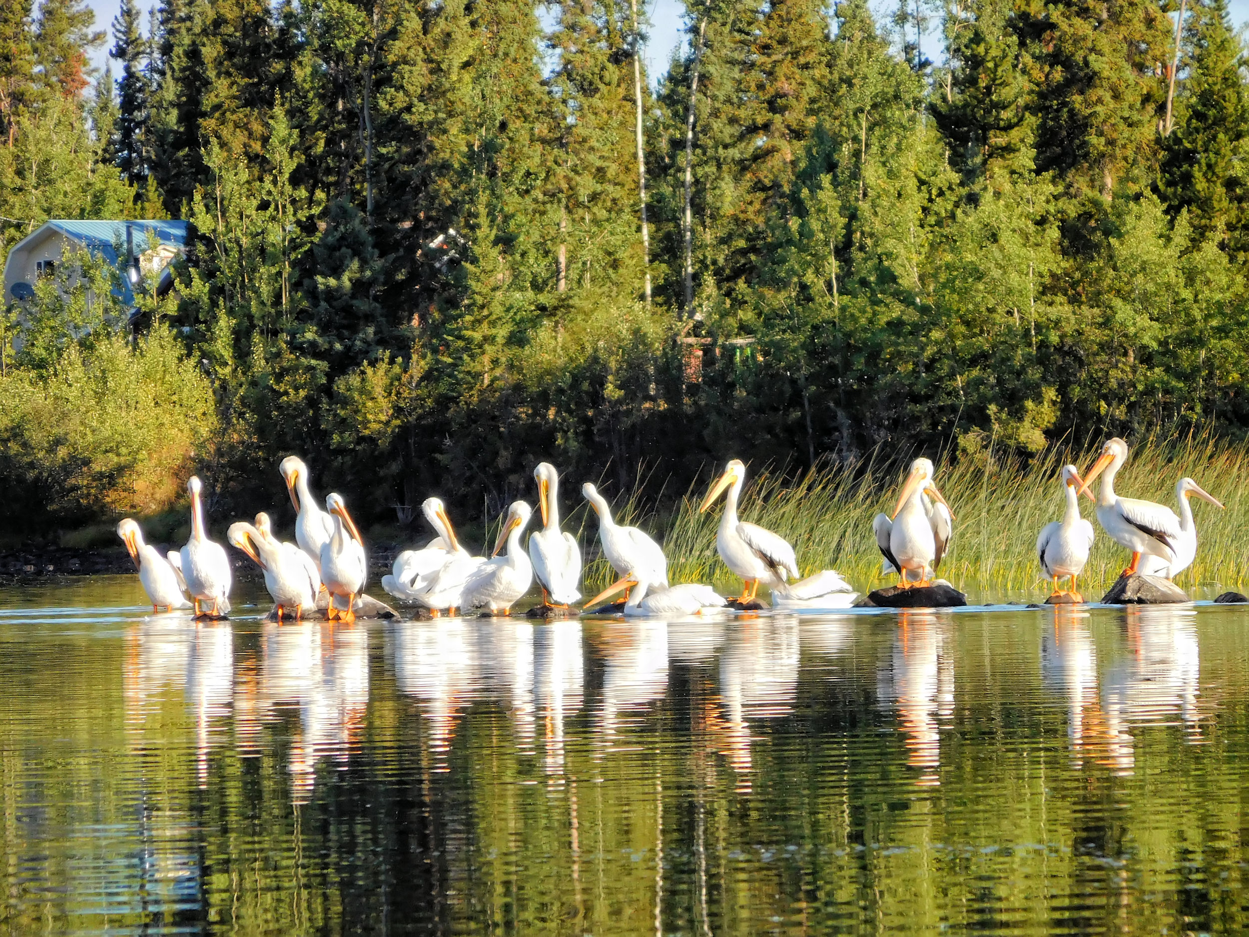
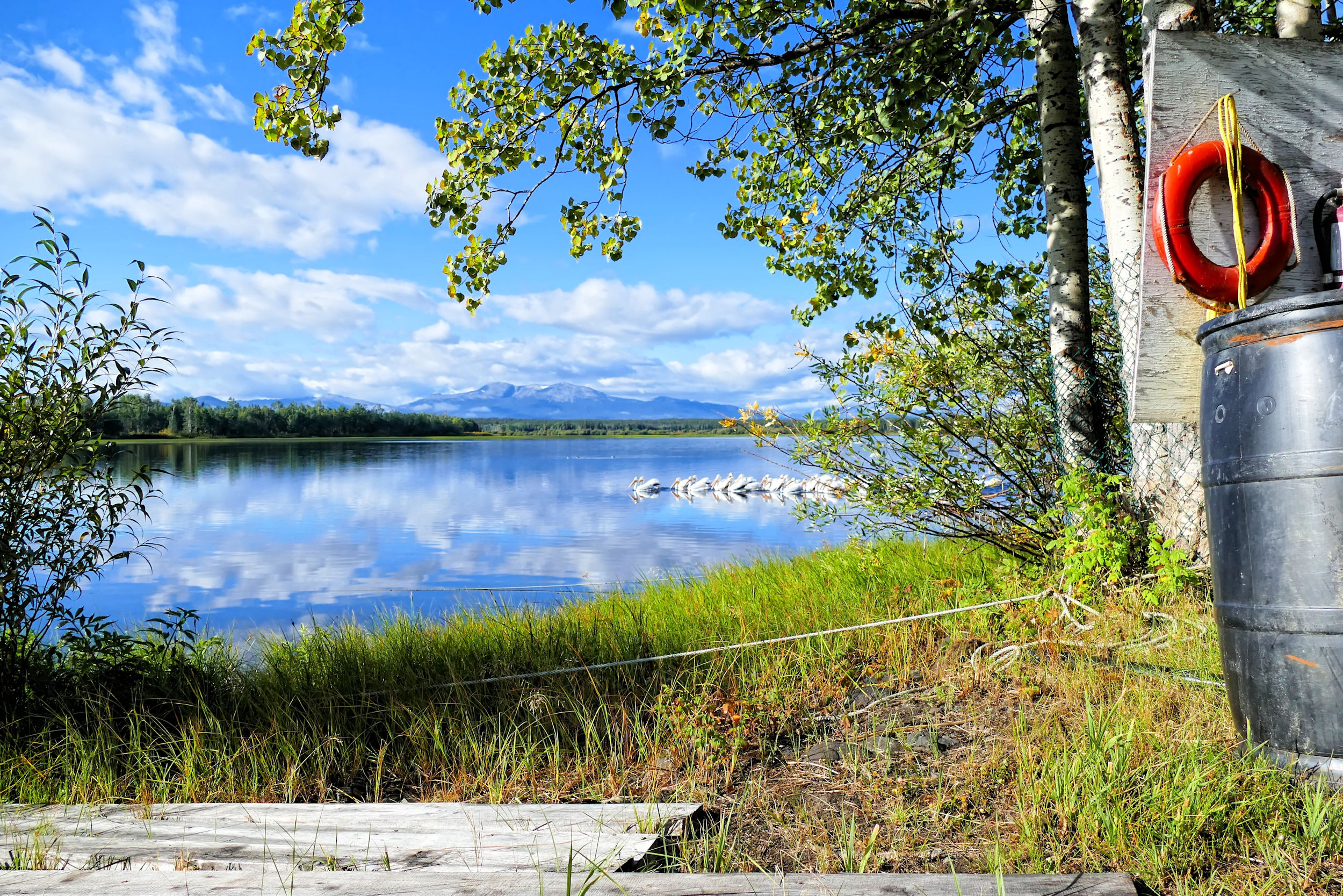
Just after breakfast a flock of pelicans swoops in. Every day they fly over from their breeding grounds at Alexis Creek and Nimpo Lake to spend the morning feeding on the lake. They are quite a sight.
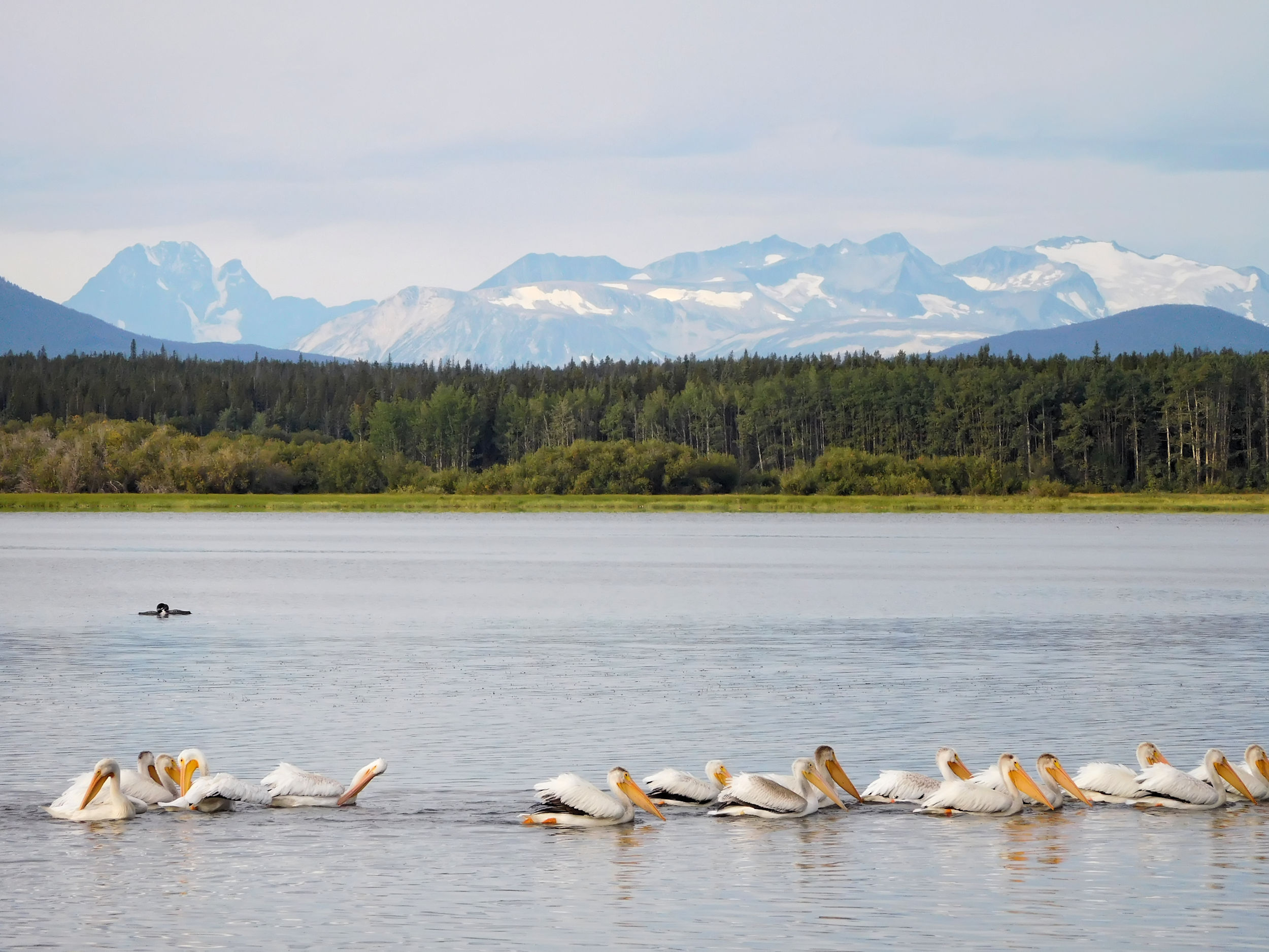
Pelicans on Anahim Lake, two loons in the back
The weather is calm and dry and I go for a paddle. The pelicans are shy and immediately move away when I point the tip of my boat at them. Karl needs his longest tele lens to get some good shots. Constantly moving, the pelicans are not an easy target.
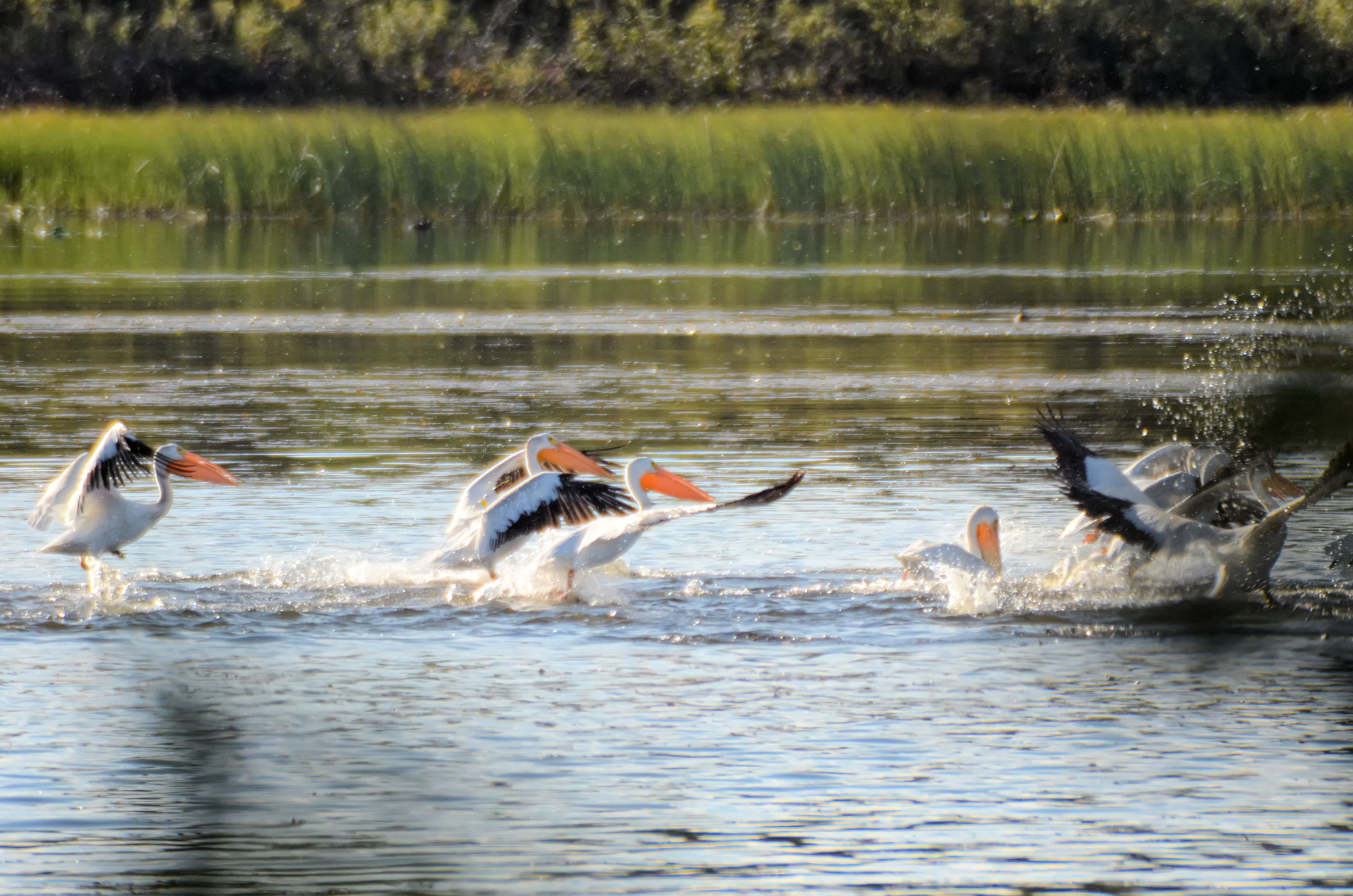
Pelicans swooping in
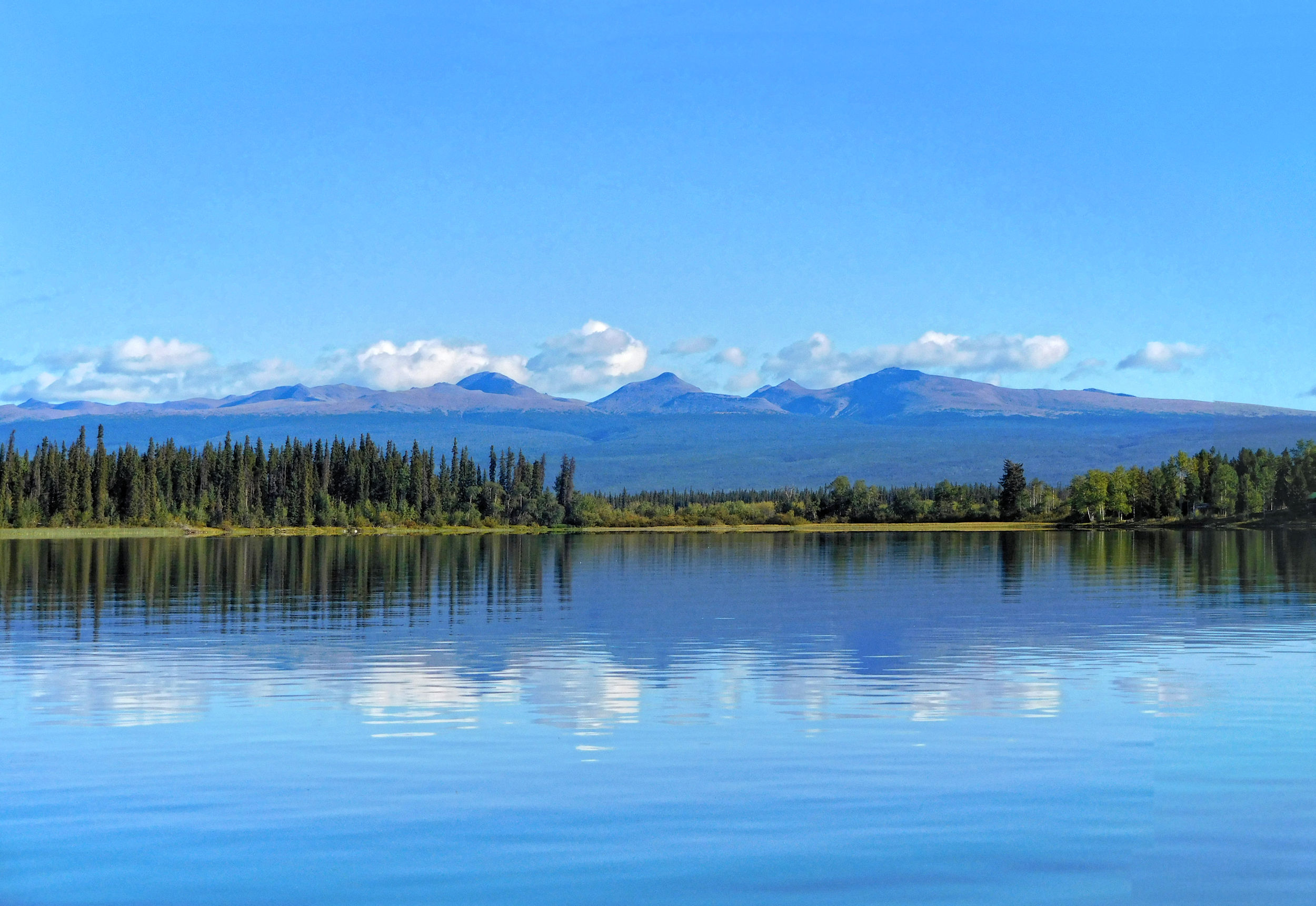
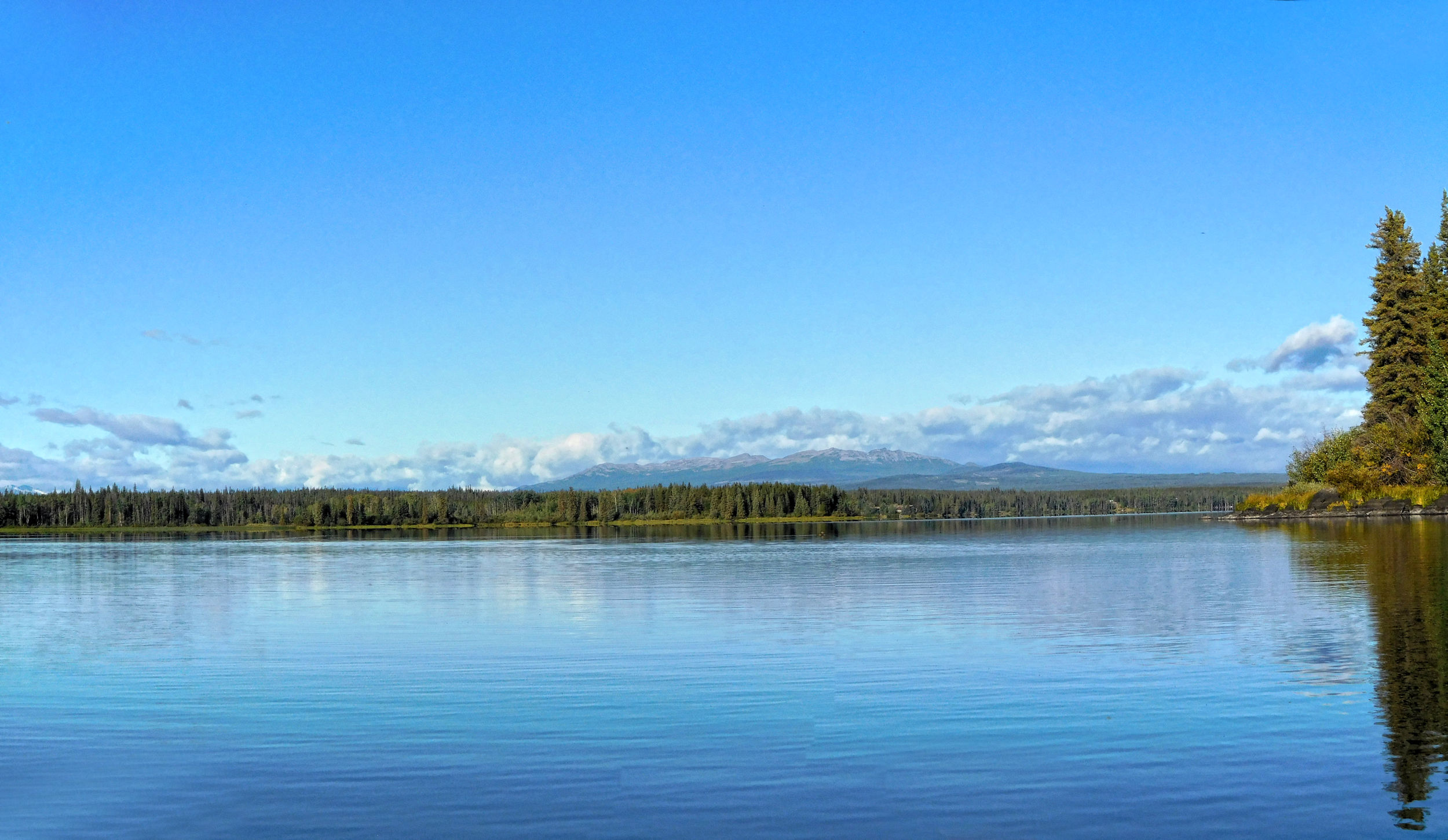
I enjoy the vistas from the water: Snowy Coastal Mountains to one side, the Ilgachuz Range to the other, the Rainbow Range straight ahead.
Ilgachuz Range
Karl goes out for a first fishing trip. He has many nibbles, but loses most of the fish. The two rainbows he lands are too small, so he releases them to live another day (better yet: another year). So no fish for dinner tonight. In the early afternoon we observe a rain front moving in from the west. It takes a while before it arrives, but the rain lasts for most of the night.
The next day is dry but very windy. I go for a walk instead of kayaking. I follow Christensen Road that leads through meadows and ranch land.

Anahim Peak
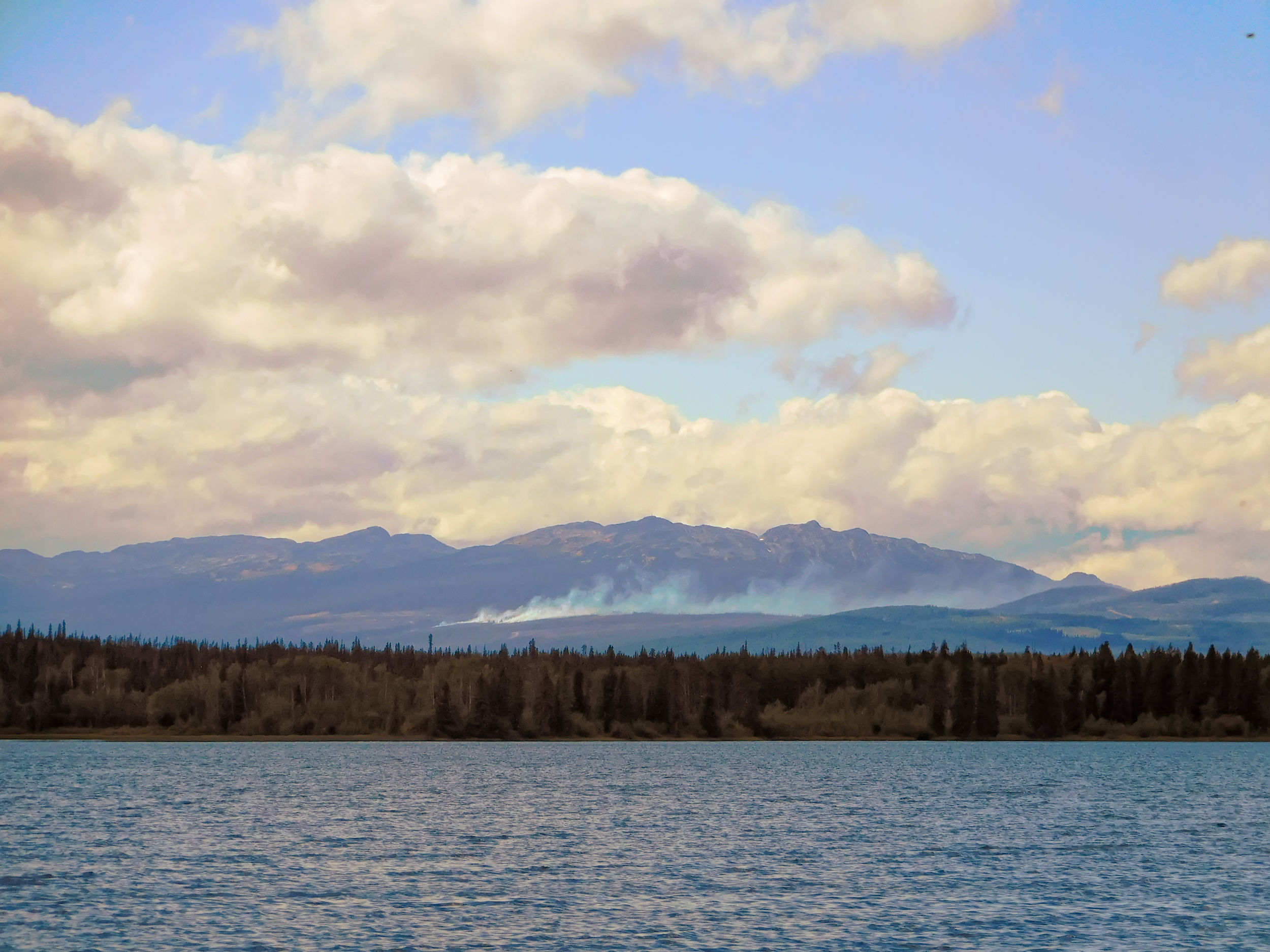
Wildfire near Anahim Peak
In the afternoon the wind becomes strong and gusty. We move our camper to a more sheltered spot in the back of the campground between some small aspens. We watch how the wind storm whips up the small fire that still burns near Anahim Peak. Despite whitecaps on the lake two American fishermen are out in their shallow fly fishing boat braving the storm.
The next morning is all sunshine again.
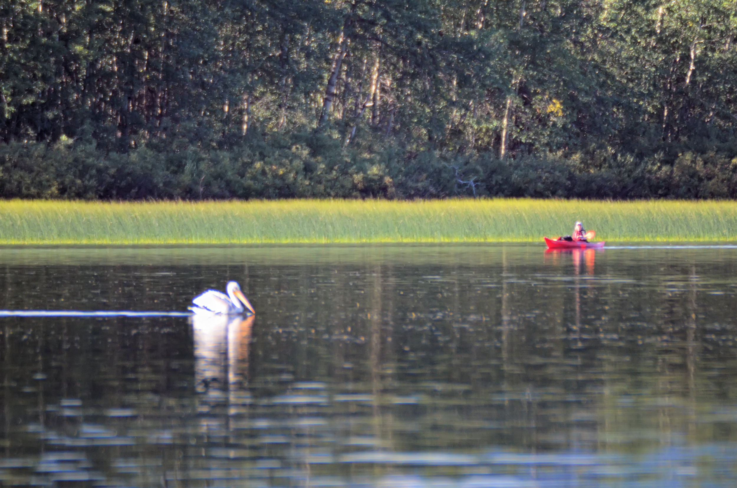
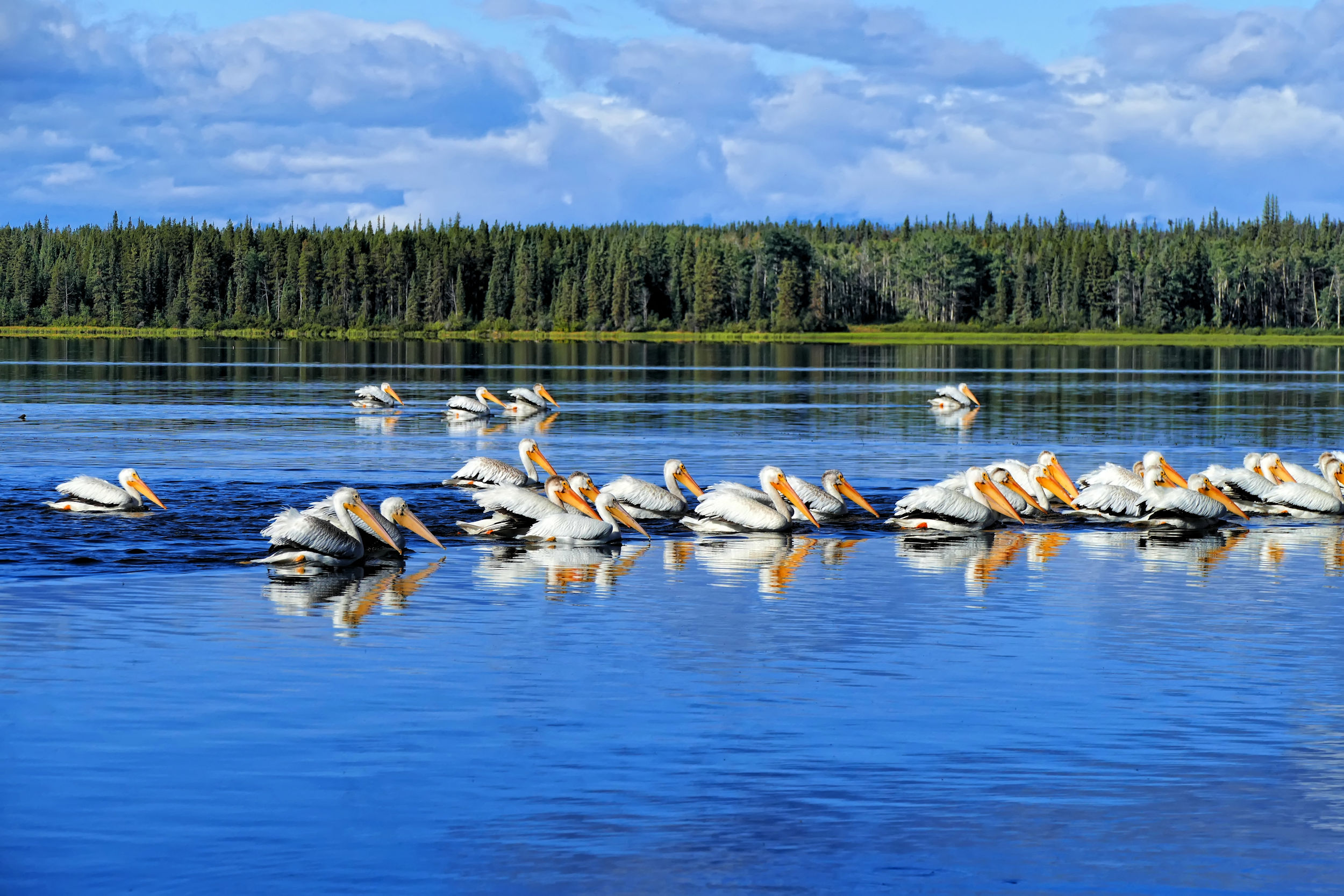
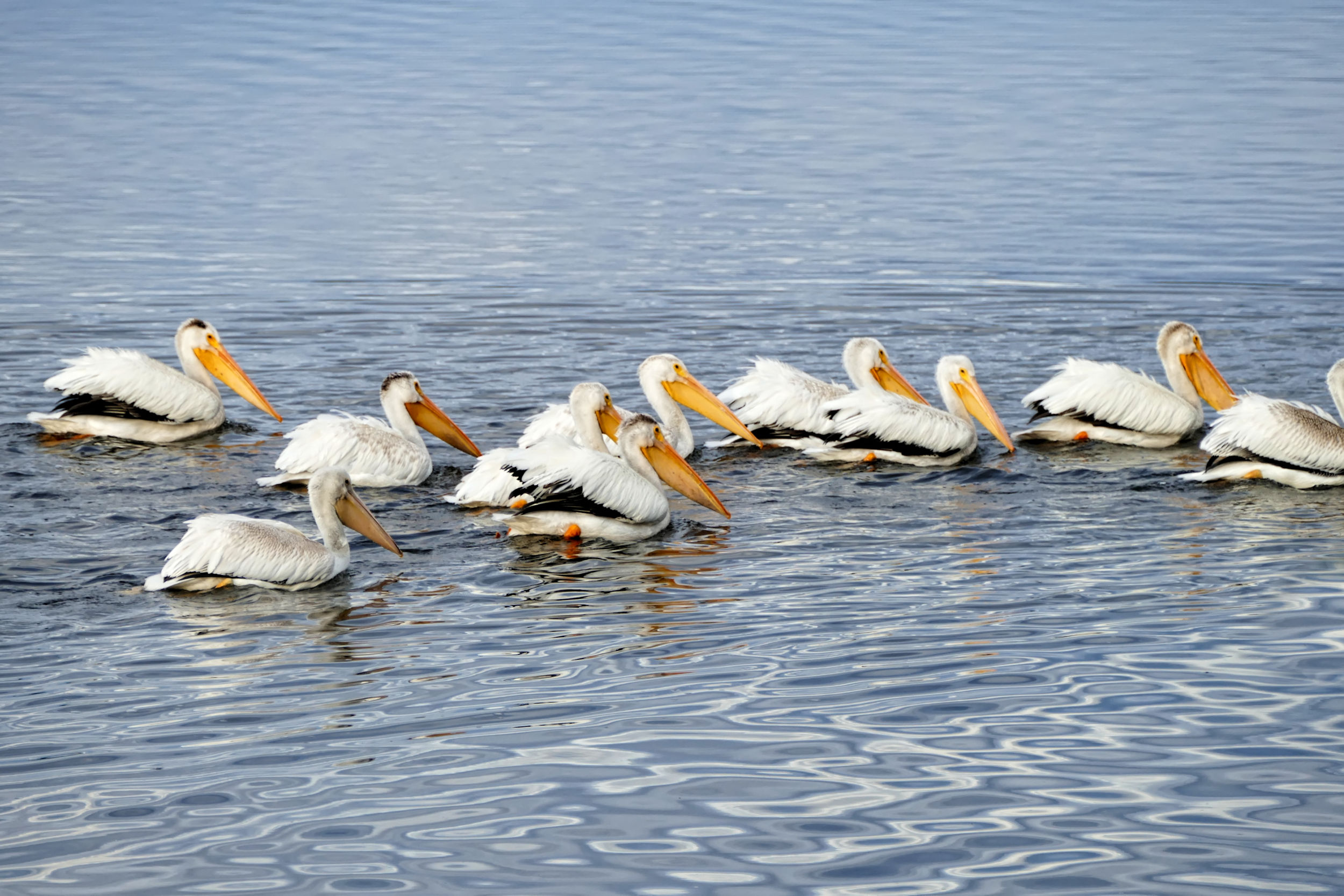
The morning allows for a beautiful paddle and some bird watching before I set out for the hiking part of this trip. Aside of the many pelicans, I spot ospreys, eagles, kingfishers, a Great Blue Heron, loons and many kinds of ducks on the lake.
Soon it is time for throwing some last-minute items for my hike into the backpack. Karl drives me to the meeting point at the Anahim Lake Tourism Information kiosk, where I meet up with my hiking friends just before noon. While we head out into the backcountry, Karl is spending the next few days fishing, pelican watching and all around relaxing at the resort.
View from the porch
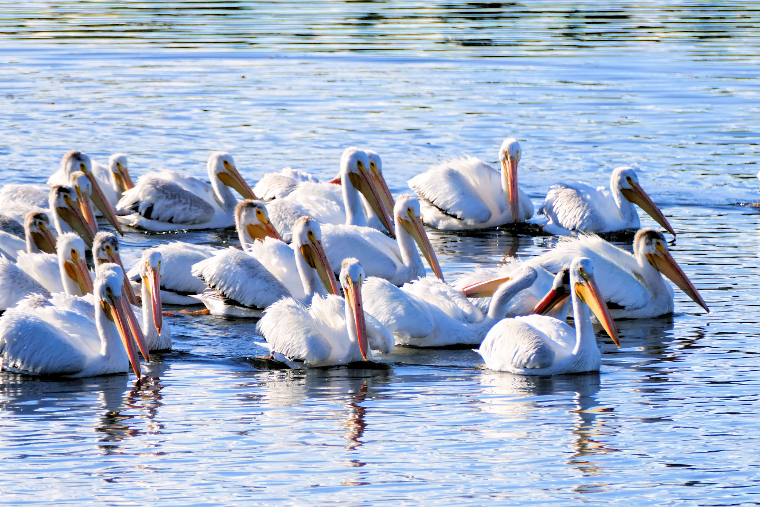
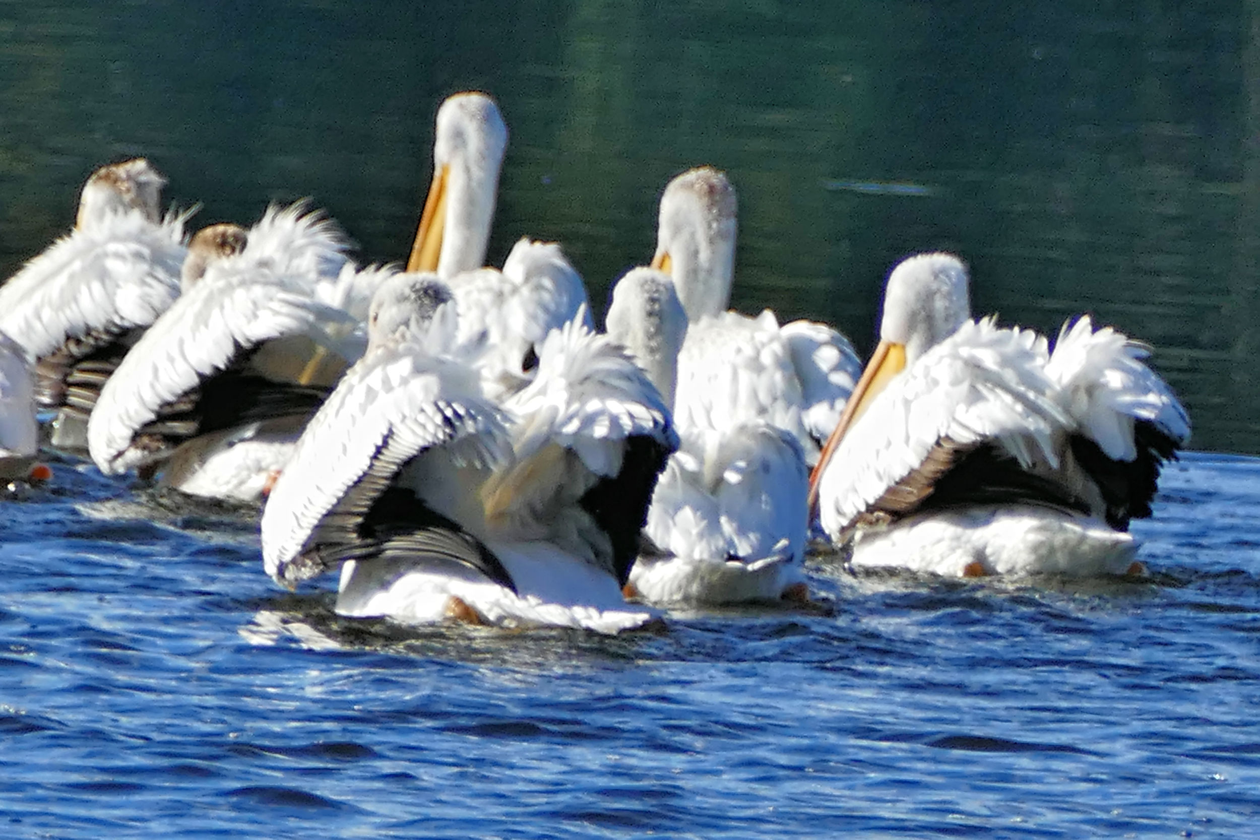
This breeding season was a good one for American White Pelicans (Pelecanus erythrorhynchos). Many juveniles are swimming among their elders at Anahim Lake.
Like adults, a juvenile American white pelican appears entirely white when swimming, except the juvenile’s head, nape, neck and upper wing coverts are a light, dusky grey.
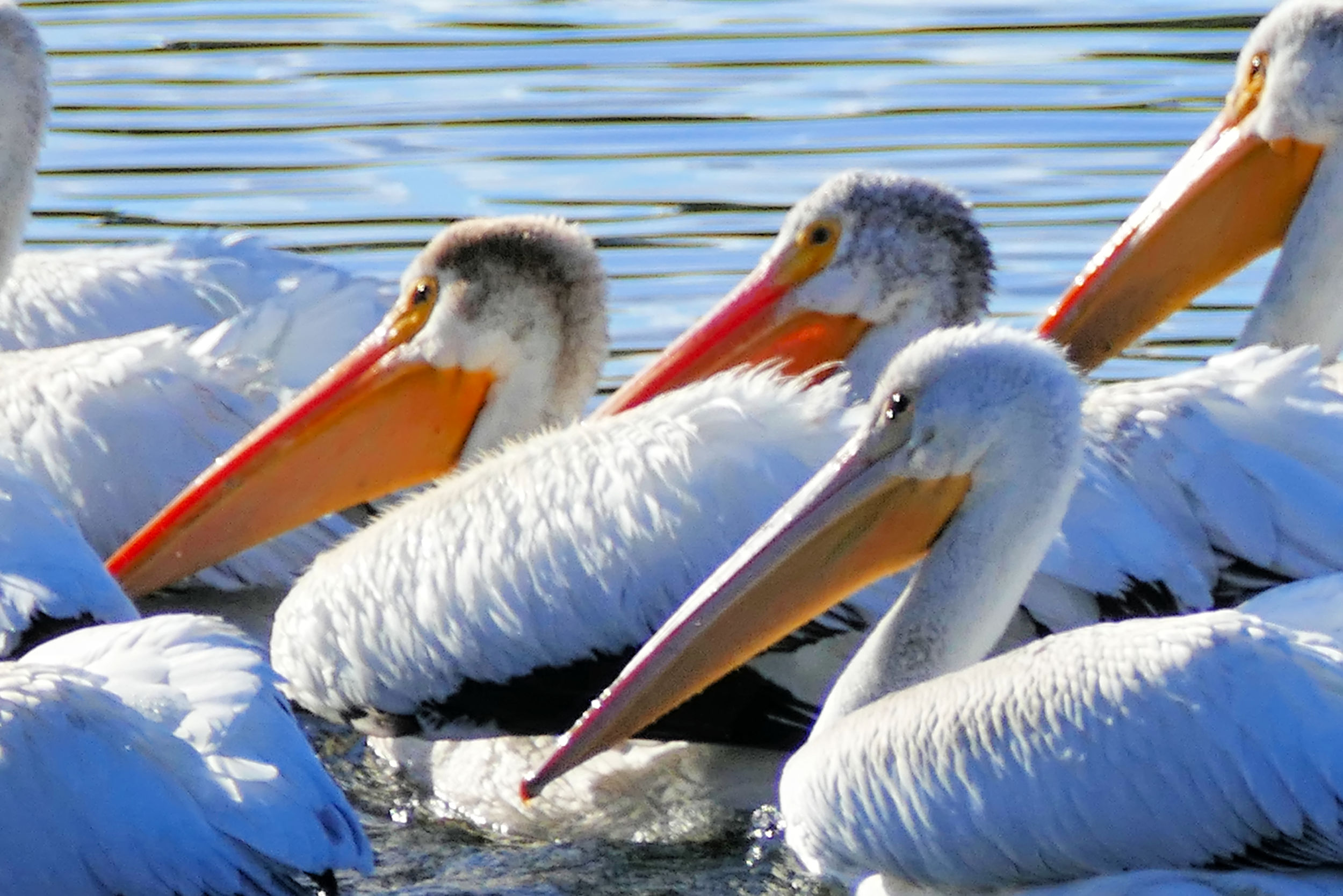
Closeup of young and adult pelicans
Now, in late summer, the birds gather in larger groups on rich feeding grounds in preparation for the migration to their winter quarters. Unlike other birds, pelicans do not dive for their food. Instead they catch their prey while swimming. They come together in groups of a dozen or more birds to feed, as they can thus cooperate and corral fish to one another. The adult birds in this group teach the youngsters how to catch the most fish: head down - butt high in the air - and whip up the shallow water with the strong legs.
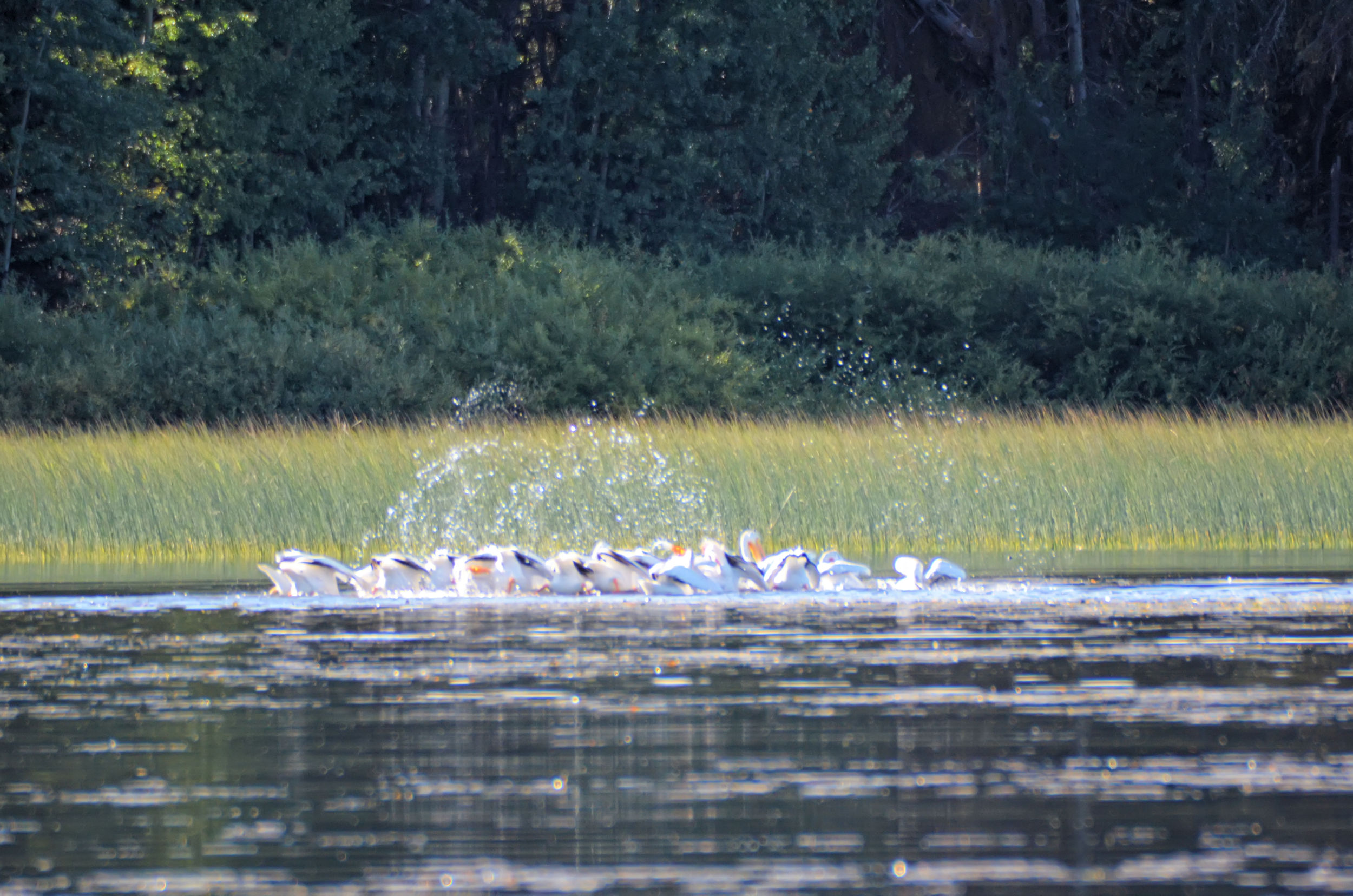
Pelicans feeding
Karl catches a couple of fish to eat, too. All is well in Paradise.
| Distance | 7.2 km |
| Time | 2 ½ hrs |
| Min. Elevation | 1496 m |
| Max. Elevation | 1780 m |
| Ascent | 284 m |
| Cum. Ascent | 492 m |
| Cum. Descent | 231 m |
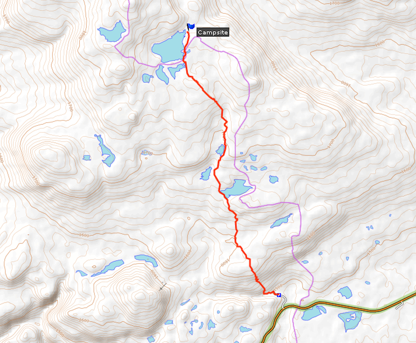
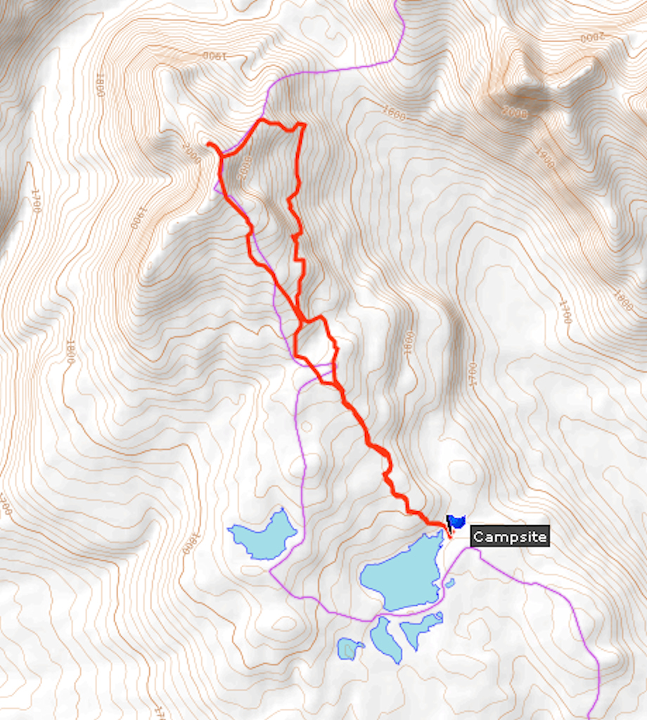
In the meantime my four friends and I drive to the Rainbow Range trailhead about 40 kilometers west of Anahim Lake. As soon as we leave the village, Highway 20 changes into a good gravel road. We enter Tweedsmuir Provincial Park and after six kilometers a side road leads us to the start of the trail. The infamous Heckman Pass, a very steep and winding stretch of the highway that descends into the Bella Coola valley, is just beyond the turnoff.
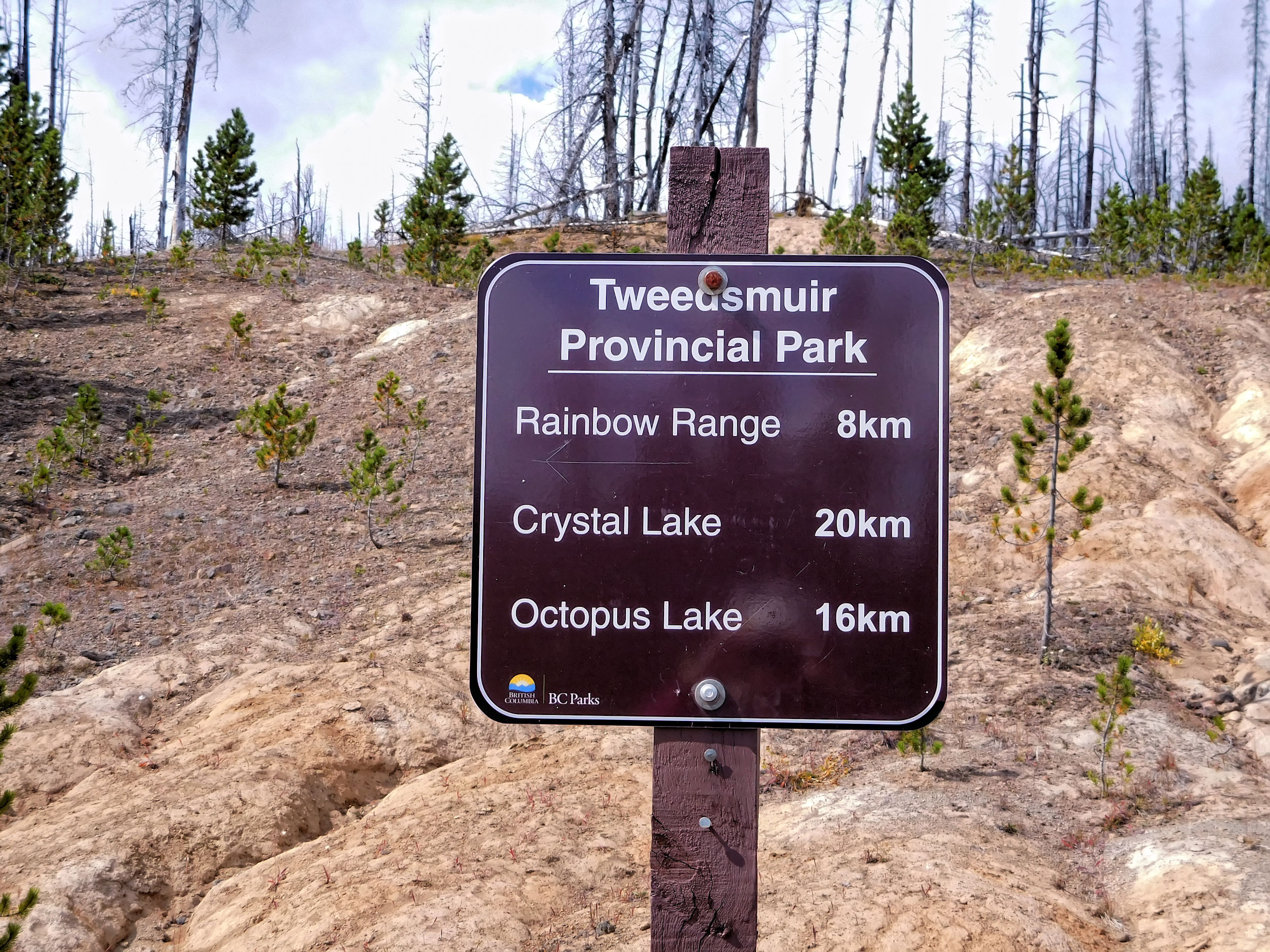
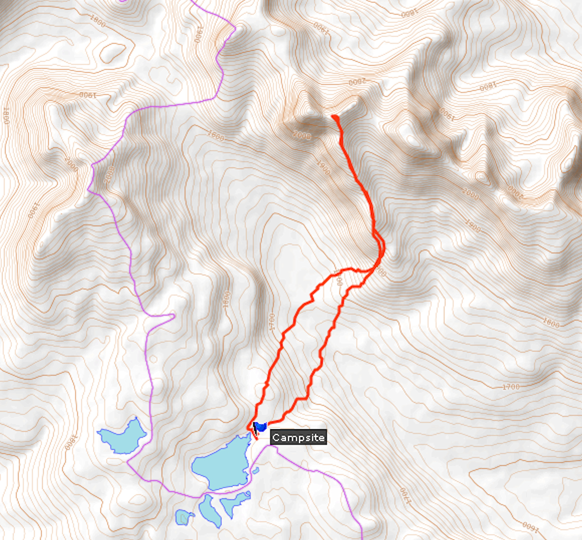
We have a late lunch at the picnic table before we start our hike. The first leg is not very long. We are heading for a campsite near kilometer seven on the Rainbow Range trail. This will be our base camp for two days of day-hiking. There are a couple of other trails starting at this trailhead, too. According to our friend who has hiked here many times before, they are mostly through forested areas while on the Rainbow Range trail we will reach the alpine very quickly.
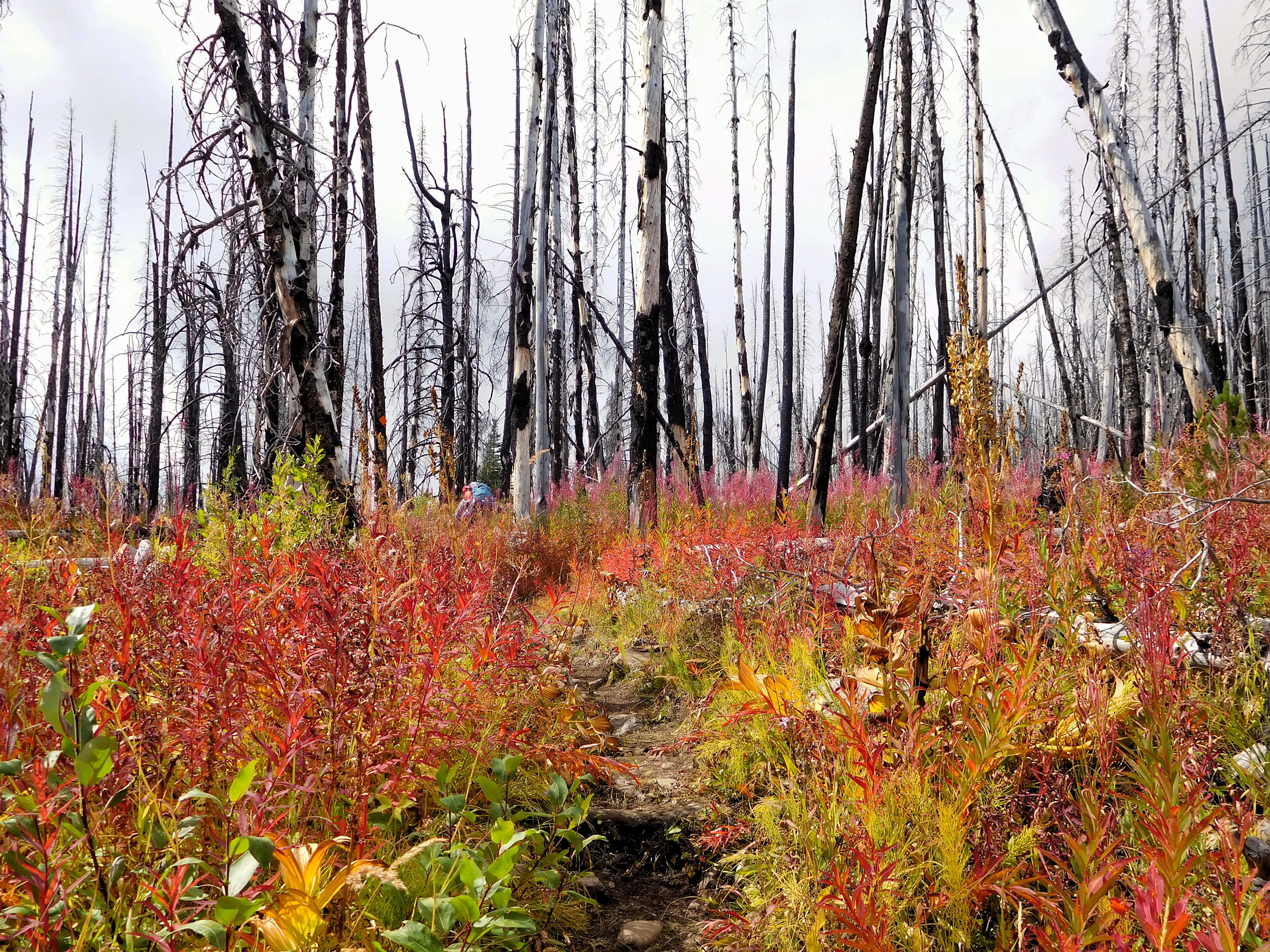
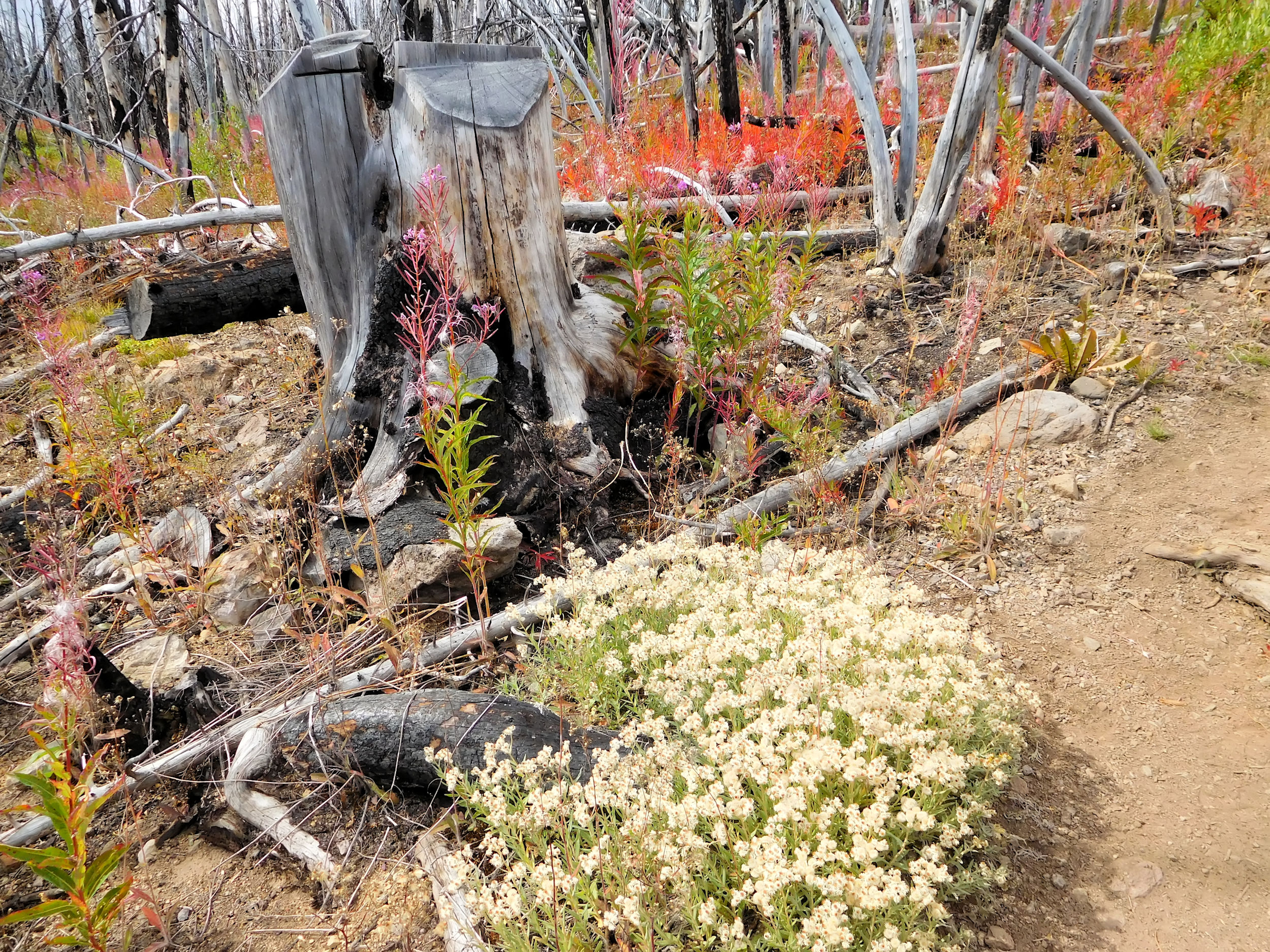
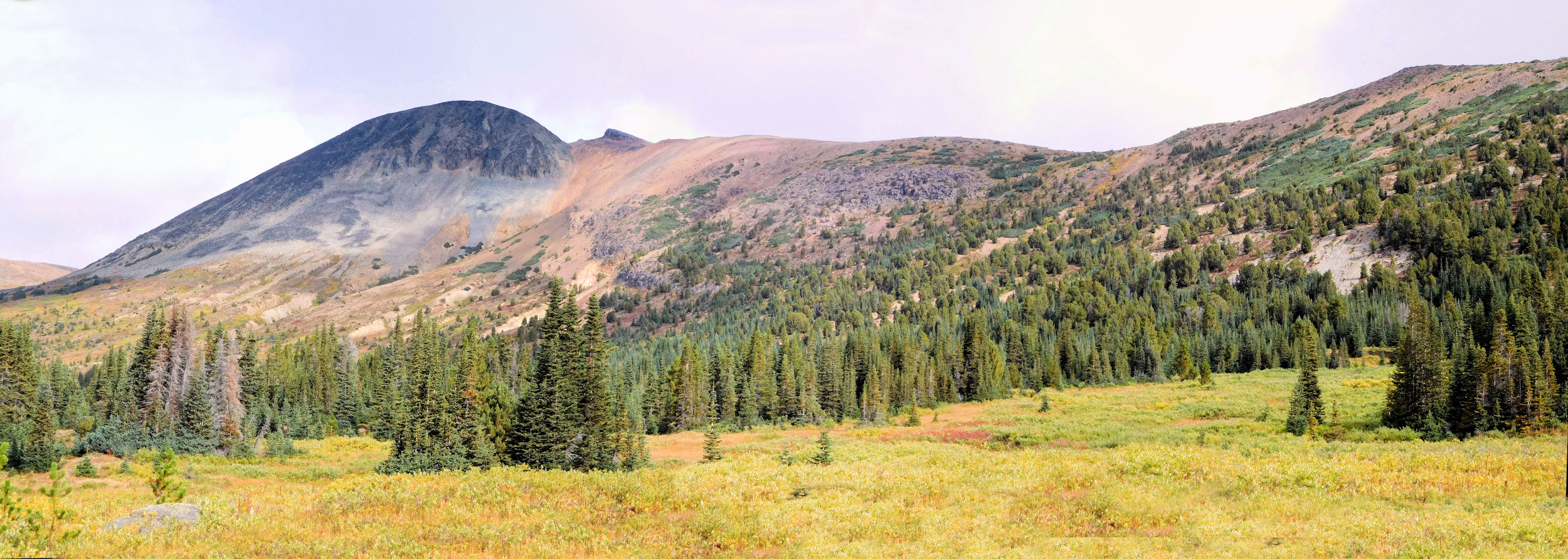
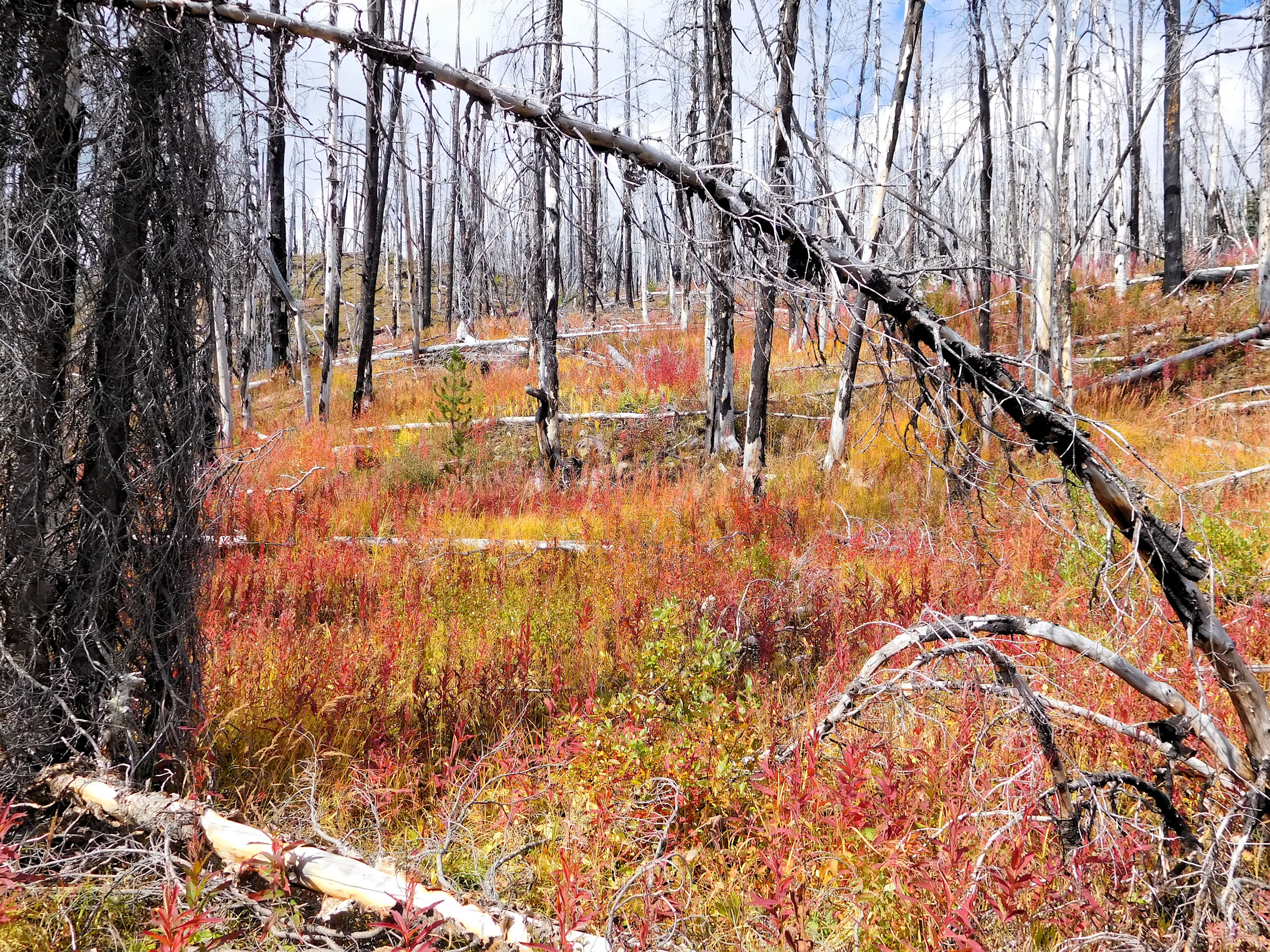
First we have to cross an old burn. The fires went through here more than ten years ago. The landscape is scarred but has its own beauty. Huckleberries grow here now and invite us to snack. If only our heavy backpacks wouldn’t make bending down low so difficult!
Soon the landscape opens up and we have beautiful views of the lakes and mountains all around.
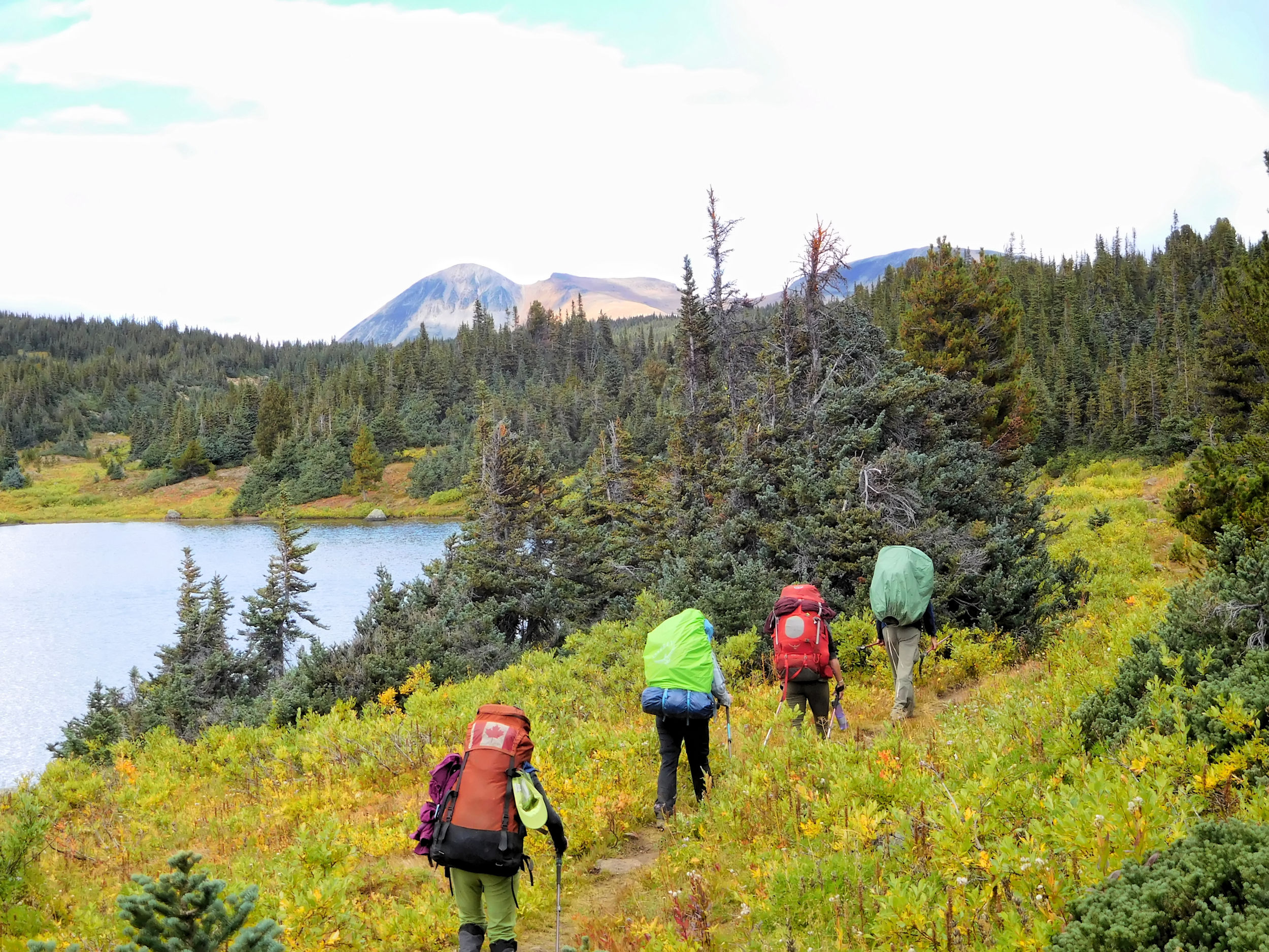
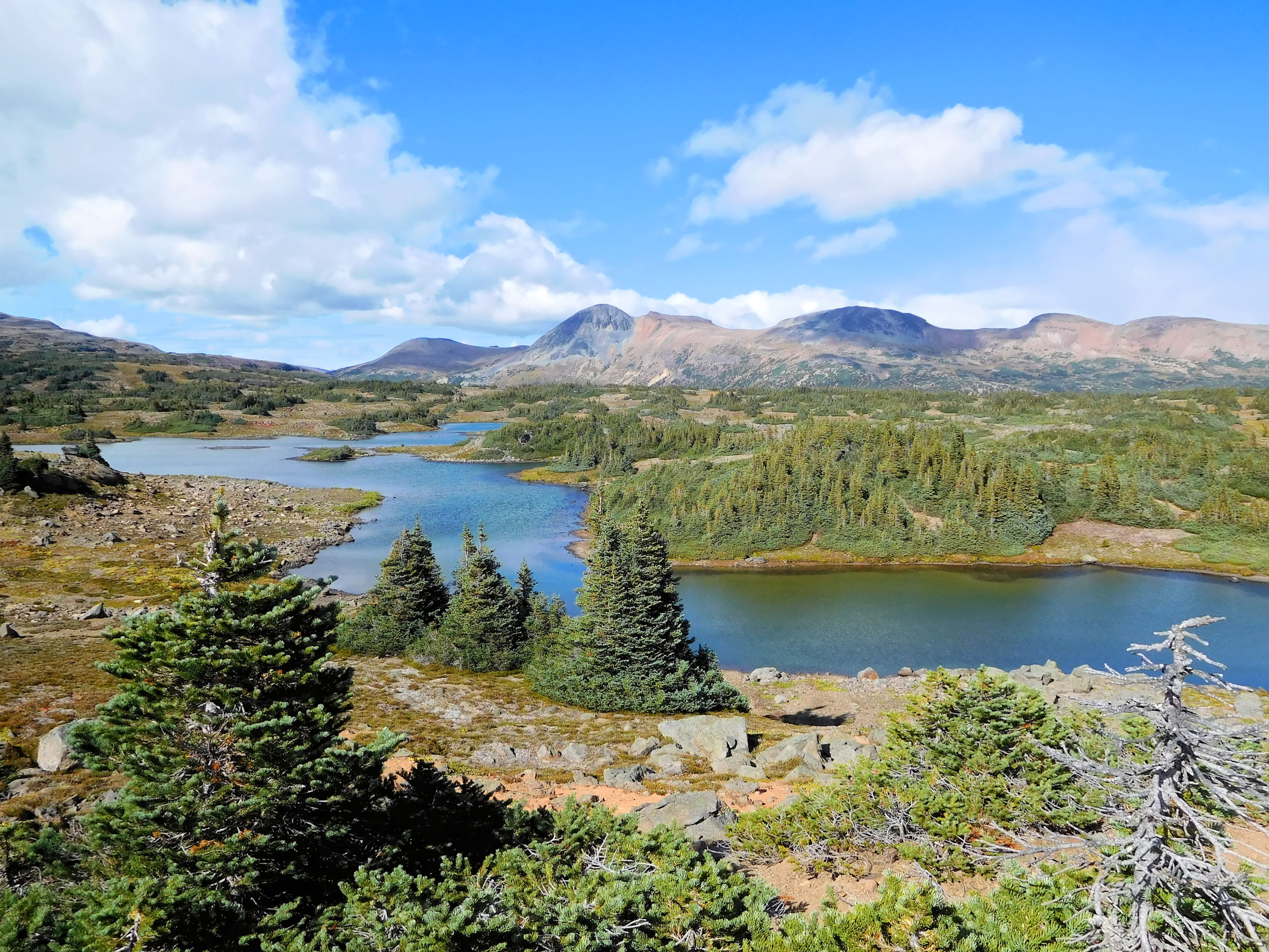
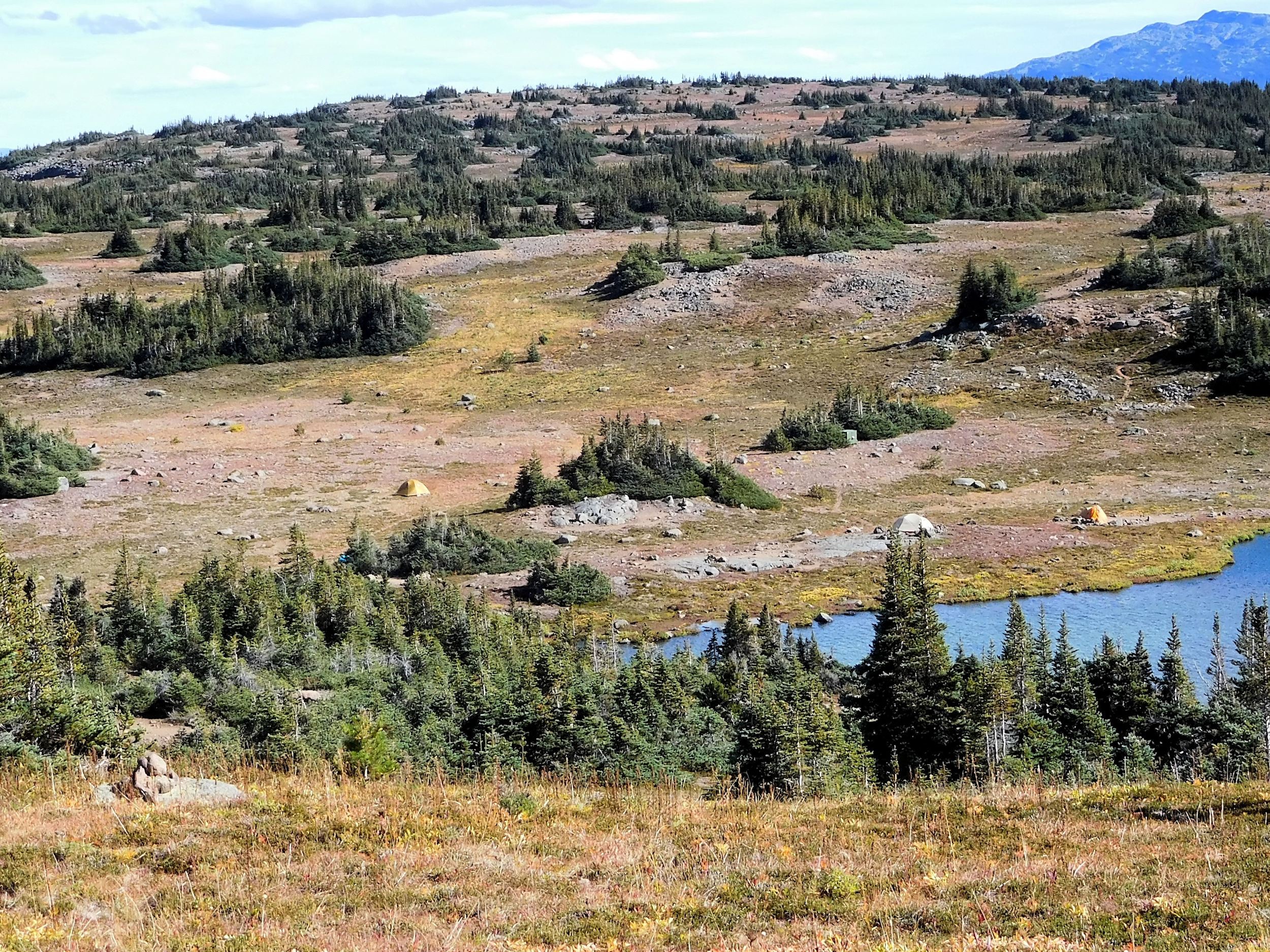
We arrive at McCauley Lake - or simply called M-Lake - with a campsite on its shore that provides a bear cache and even an open-air loo. The couple of camp spots right by the lake look very inviting, but a steady and cold wind is blowing in from the water. Two of us brave the wind for the spectacular views while the other three move into more sheltered sites behind some shrubs. Here it is almost impossible to find a site without rocks and roots poking through the tent floor. We learn what it means to sleep between a rock and a hard place.
Campsite
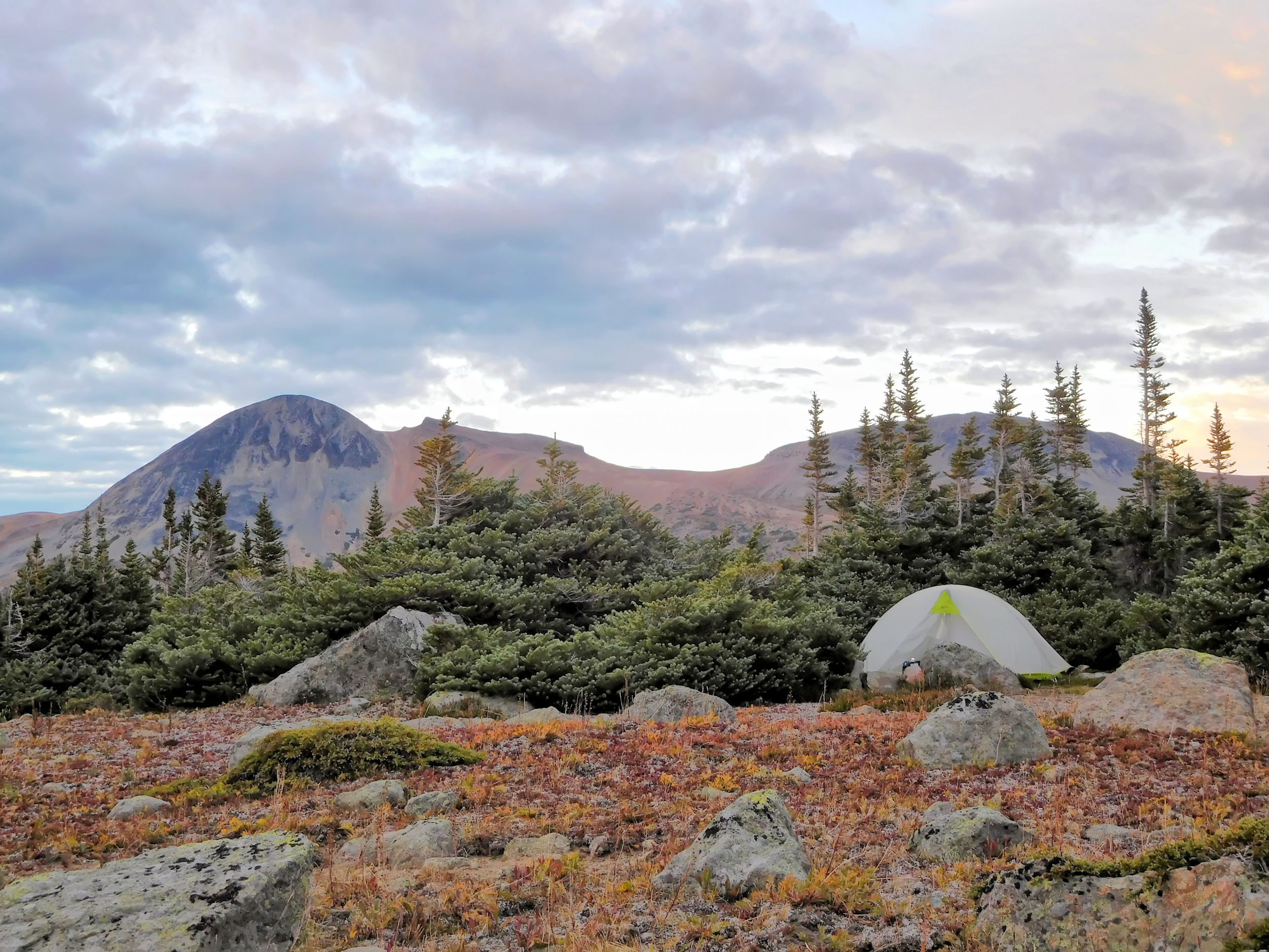
My secluded tent spot out of the wind
We find a place for our dining area behind a stand of low growing trees that surround the bear cache. Here we will be able to cook out of the wind. There are no picnic tables, so we have to find flat rocks to put the stoves on and some seats for ourselves. Two of us brought sleeping pads that can be folded into chairs, very handy under these circumstances. It is time for Happy Hour.
Both windows of one of our tents have come off of the tent fly. Just as we start duct-taping them it begins to rain and our repair job is ruined: duct-tape does not stick to wet surfaces. Fortunately someone brought an extra tarp. We place it between the canopy and the fly. Problem solved.
During dinner it rains on and off, but not too badly. A real rainbow in front of the Rainbow Range is very delightful. During the night it is not as cold as I expected. Still I am happy I brought my little extra blanket. After all, it is already September and we are camping in the alpine.
| Distance | 10.0 km |
| Time | 3 ½ hrs |
| Min. Elevation | 1646 m |
| Max. Elevation | 2176 m |
| Ascent | 530 m |
| Cum. Ascent | 704 m |
| Cum. Descent | 707 m |
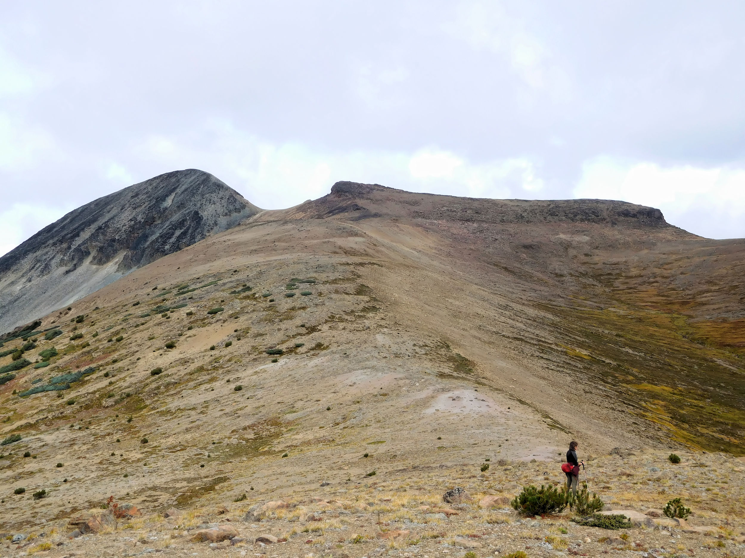
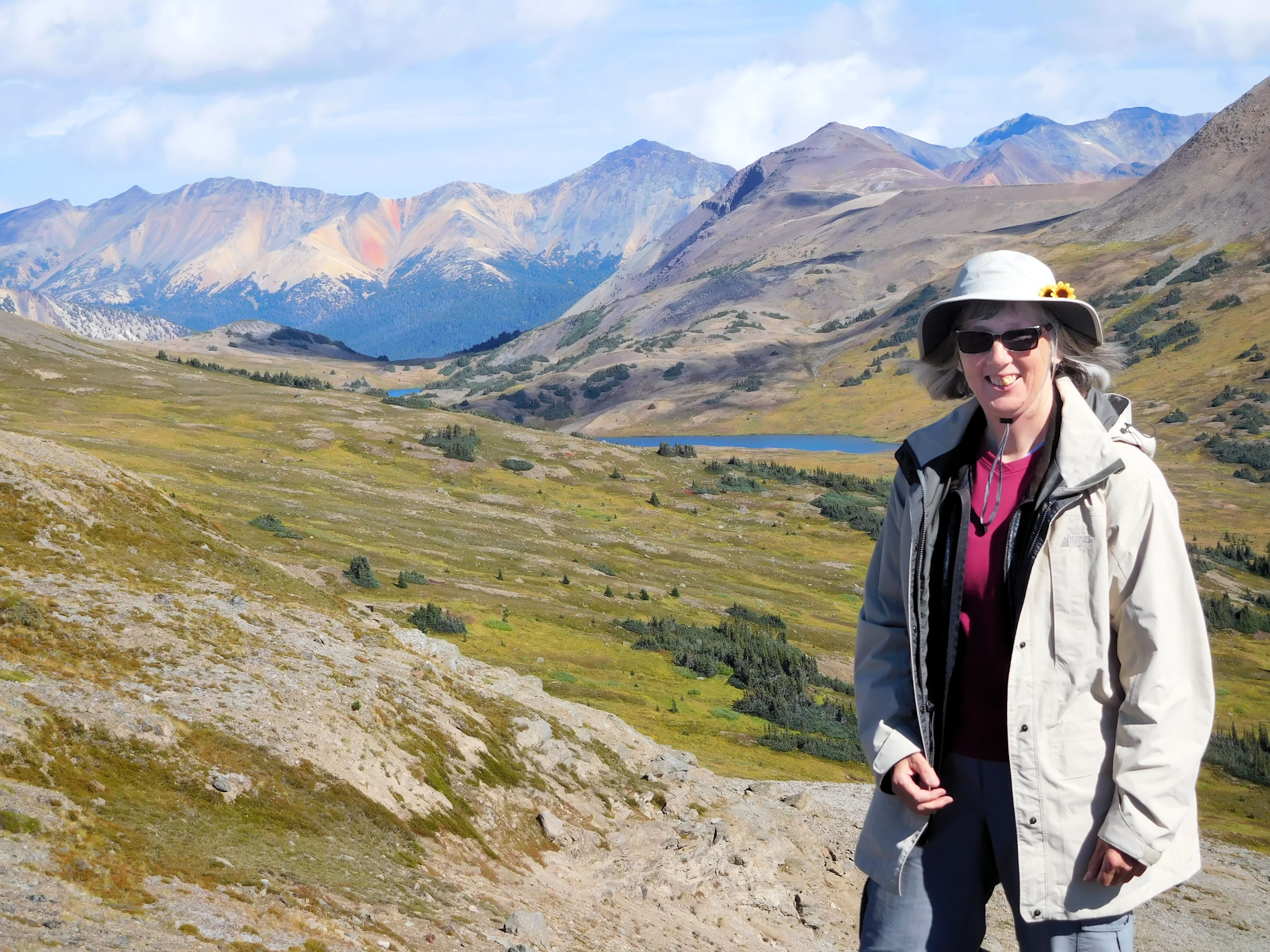
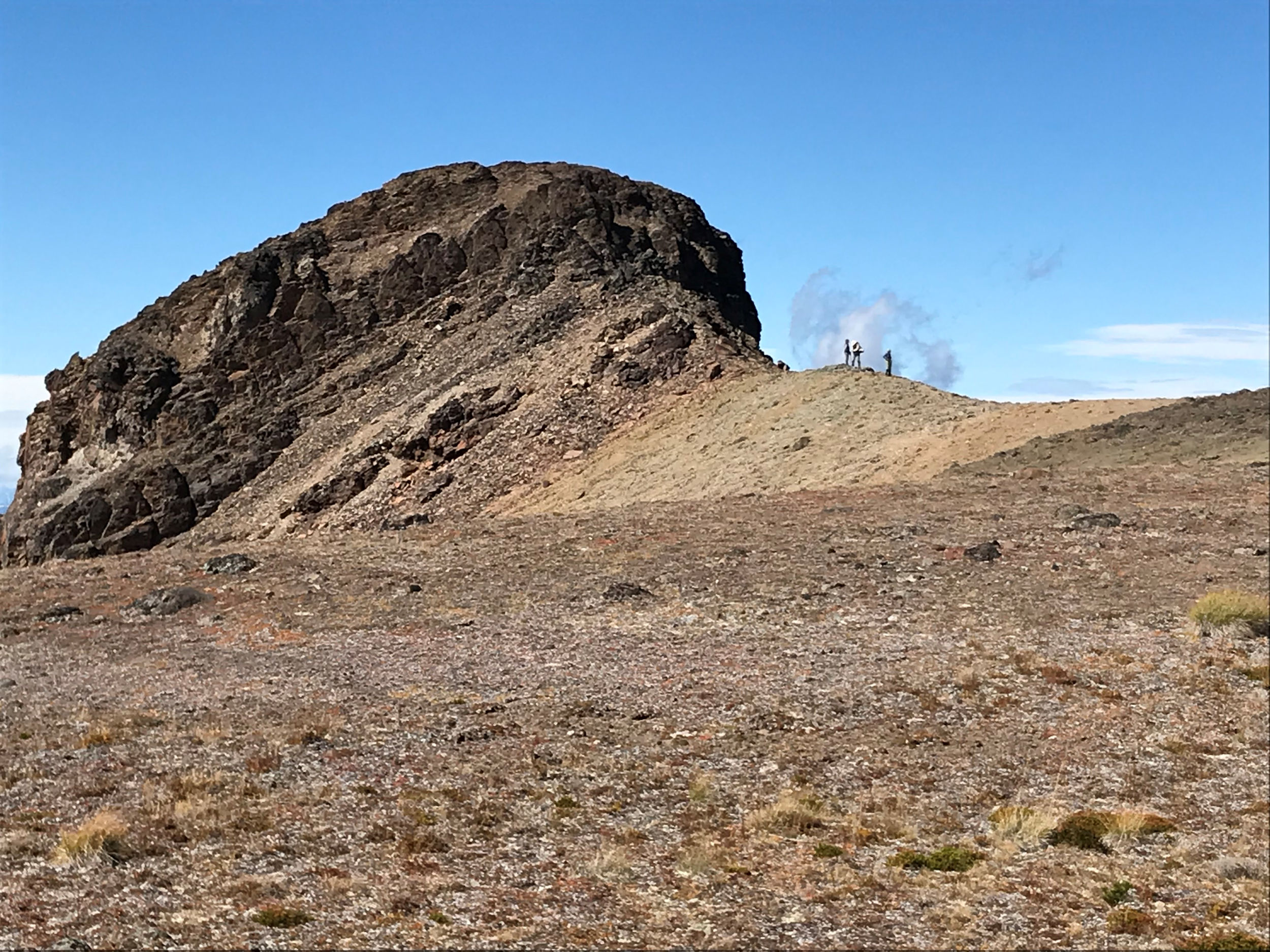
The next morning we are blanketed by thick fog. The air is so moist that you can almost think it is drizzling. We take our time with breakfast and getting ready. We hope that the mist will lift. Our plan for today is to climb up on a ridge and enjoy a view of the area.
Our destination for today: the little knoll on the ridge
By ten o’clock the air has cleared enough to start out. We walk down into and across the valley that separates us from the mountain and the ridge we aim for. The walking is fairly easy, just a very short stretch leads us through some dense bush and a somewhat marshy area. Soon we climb up the steep slope until we reach the lower end of the ridge and the ascent becomes gentler.
We spot a mountain goat across the next valley. It is too far away for a picture, but for sure the white spot is moving and not just a rock.
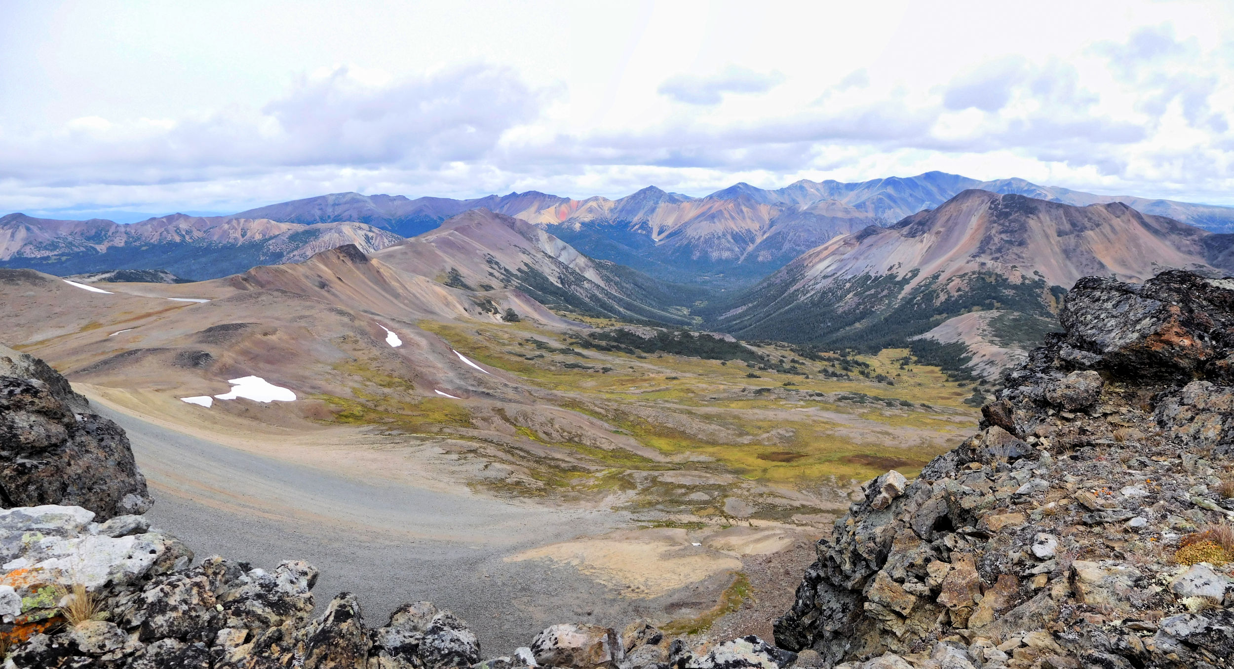
View back over the ridge, the Coastal Mountains in the background
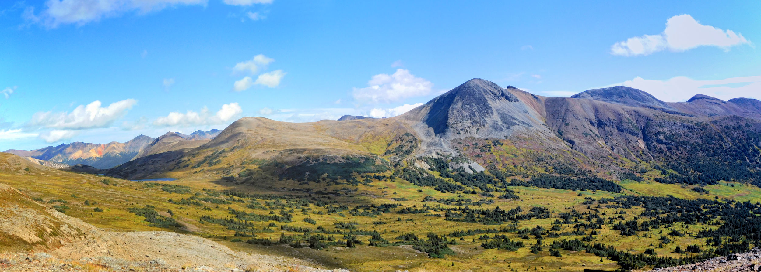
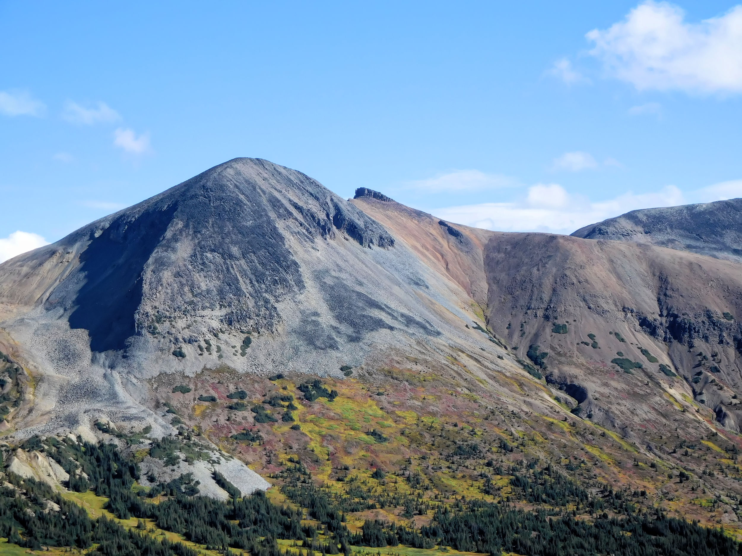
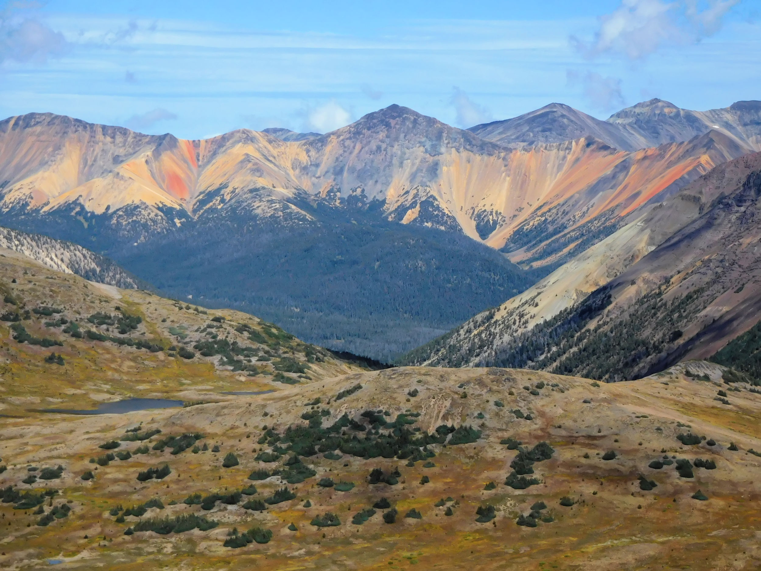
From the top of the knoll we have a spectacular view of a colorfully streaked peak of the Rainbow Range.
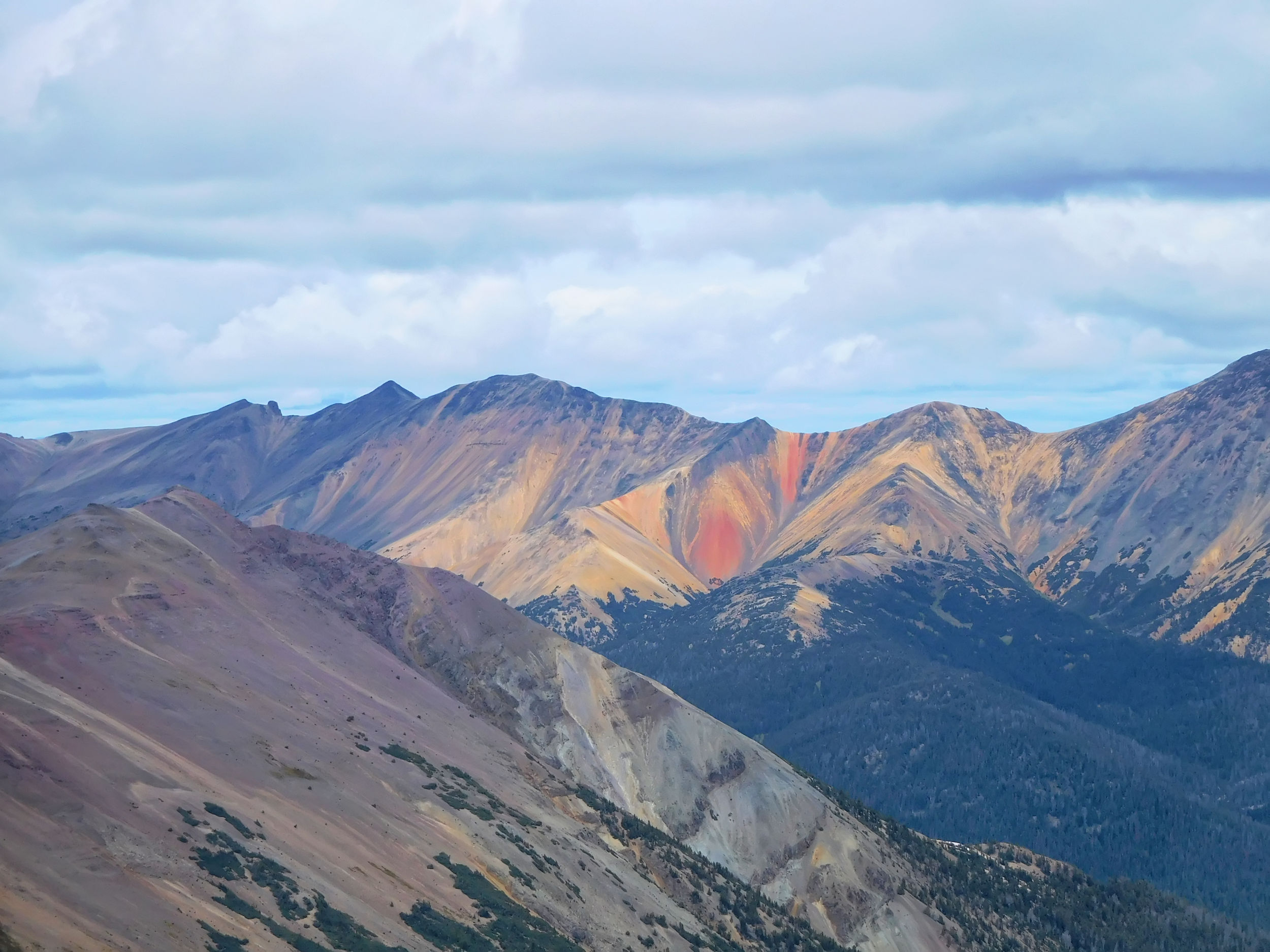
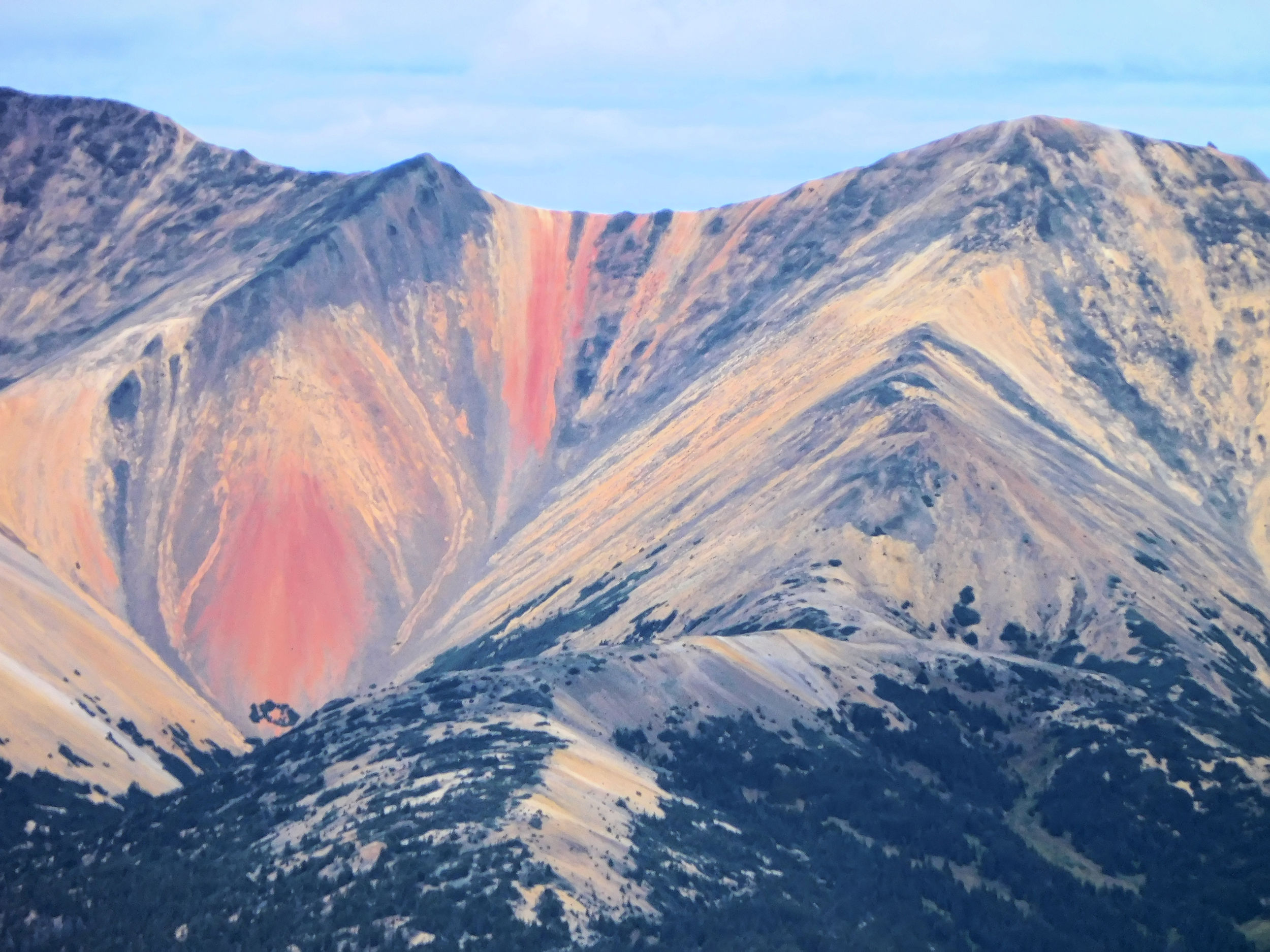
Closeup of streaked Rainbow Range peak
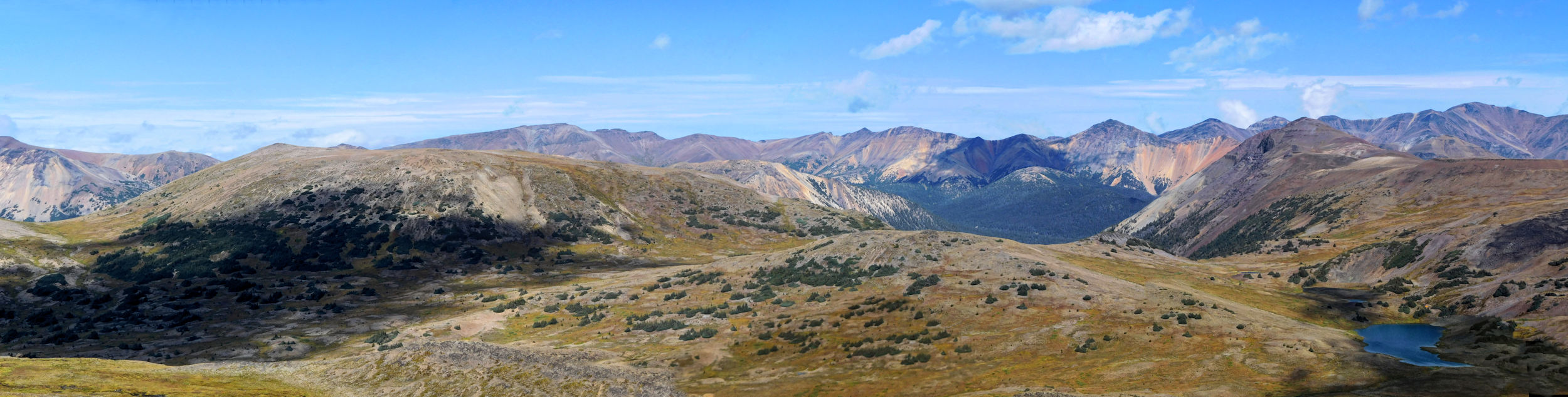
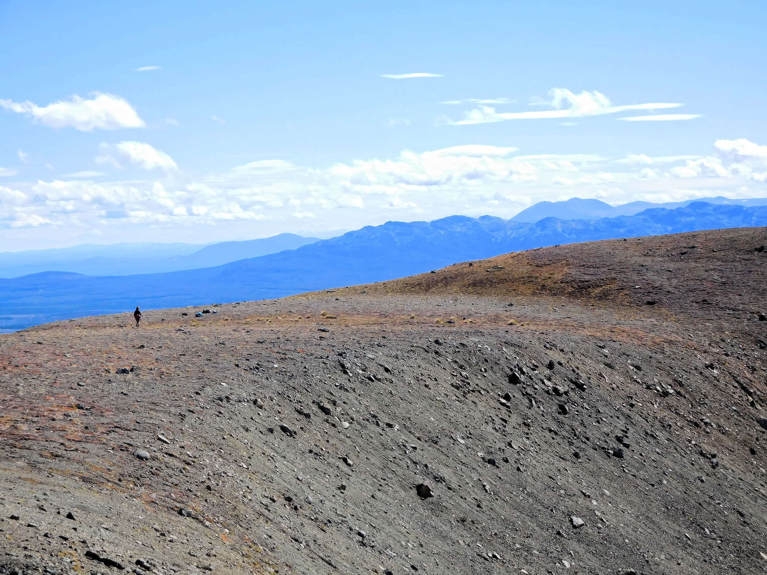
The panorama all around is awe-inspiring.
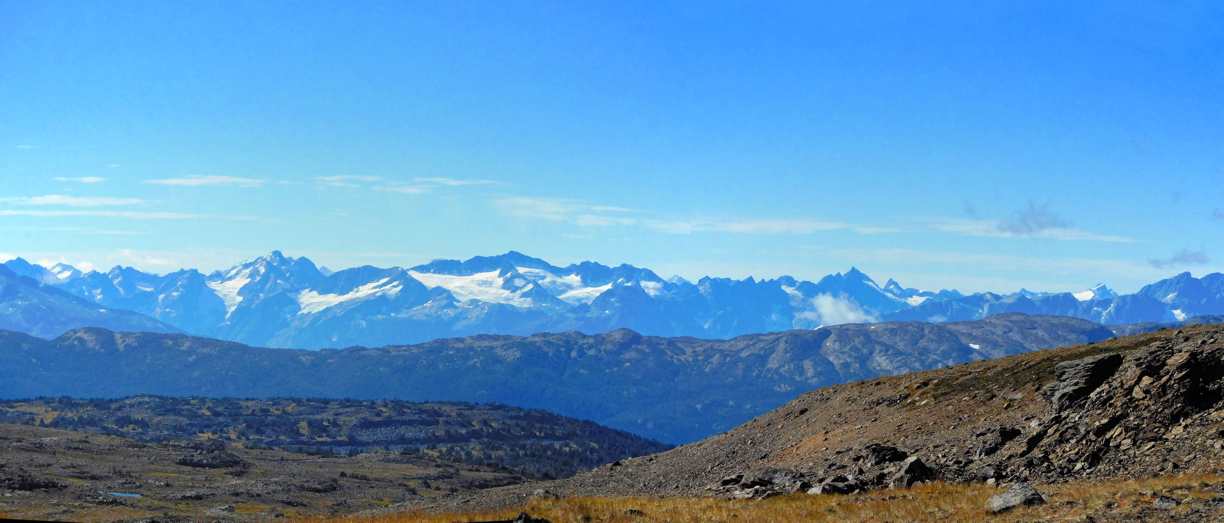
Even the Coastal Mountains peek through the clouds.
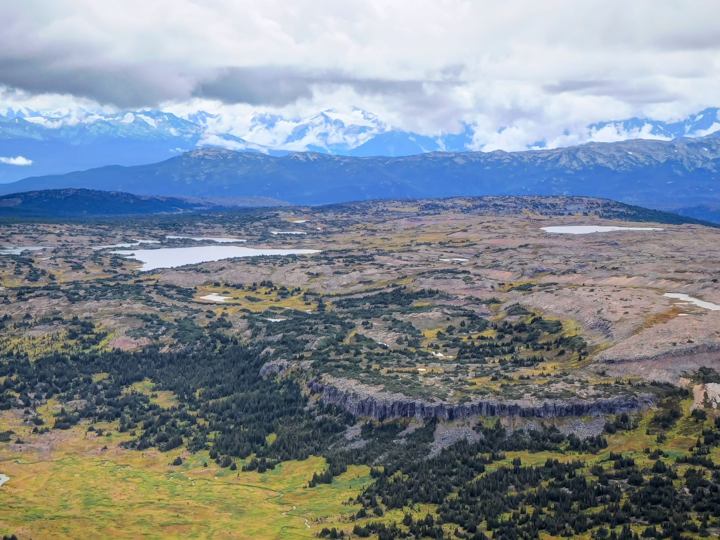
Coastal Mountain Range, McCauley Lake with camp in the front
To continue up onto the next peak would mean quite a bit of exposure on the far side of the saddle that we are not comfortable with.
Instead we have a lunch rest at our beautiful perch on the knoll, until the cold and strong wind makes us start moving again too soon.
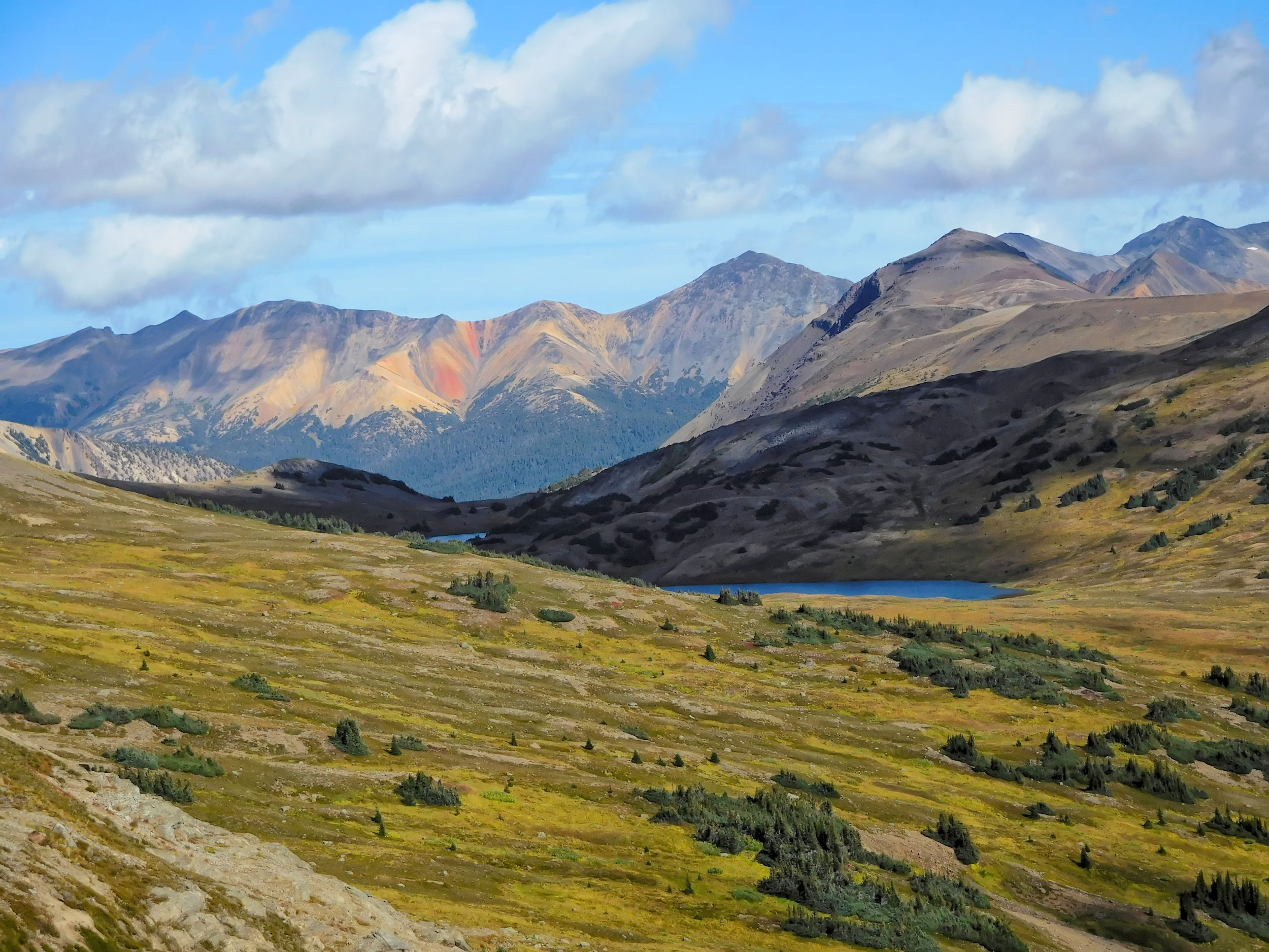
On our way back we take a slightly different route. It needs a bit more bushwhacking through dense vegetation. Next to a small waterfall we climb back to the plateau of the lakes. This is the outflow of McCauley Lake and we just have to follow the creek back to camp.
We have an afternoon tea and Happy Hour. Unfortunately it starts raining shortly after we have returned to camp. For dinner we brave the elements, huddled in our ponchos or rain jackets while the rain continues dripping on us. After dinner I urgently need to get out of the wet and warm up in the sleeping bag. Three of the others are hardy enough to still walk around the lake. It stops raining at about midnight. All of us would have had a quiet night, hadn’t it been for some mice visiting one of the tents. I was lucky that it wasn’t mine, too, because I forgot to close the lower zipper in the entrance.
| Distance | 10.3 km |
| Time | 3 ½ hrs |
| Min. Elevation | 1758 m |
| Max. Elevation | 2078 m |
| Ascent | 320 m |
| Cum. Ascent | 552 m |
| Cum. Descent | 558 m |
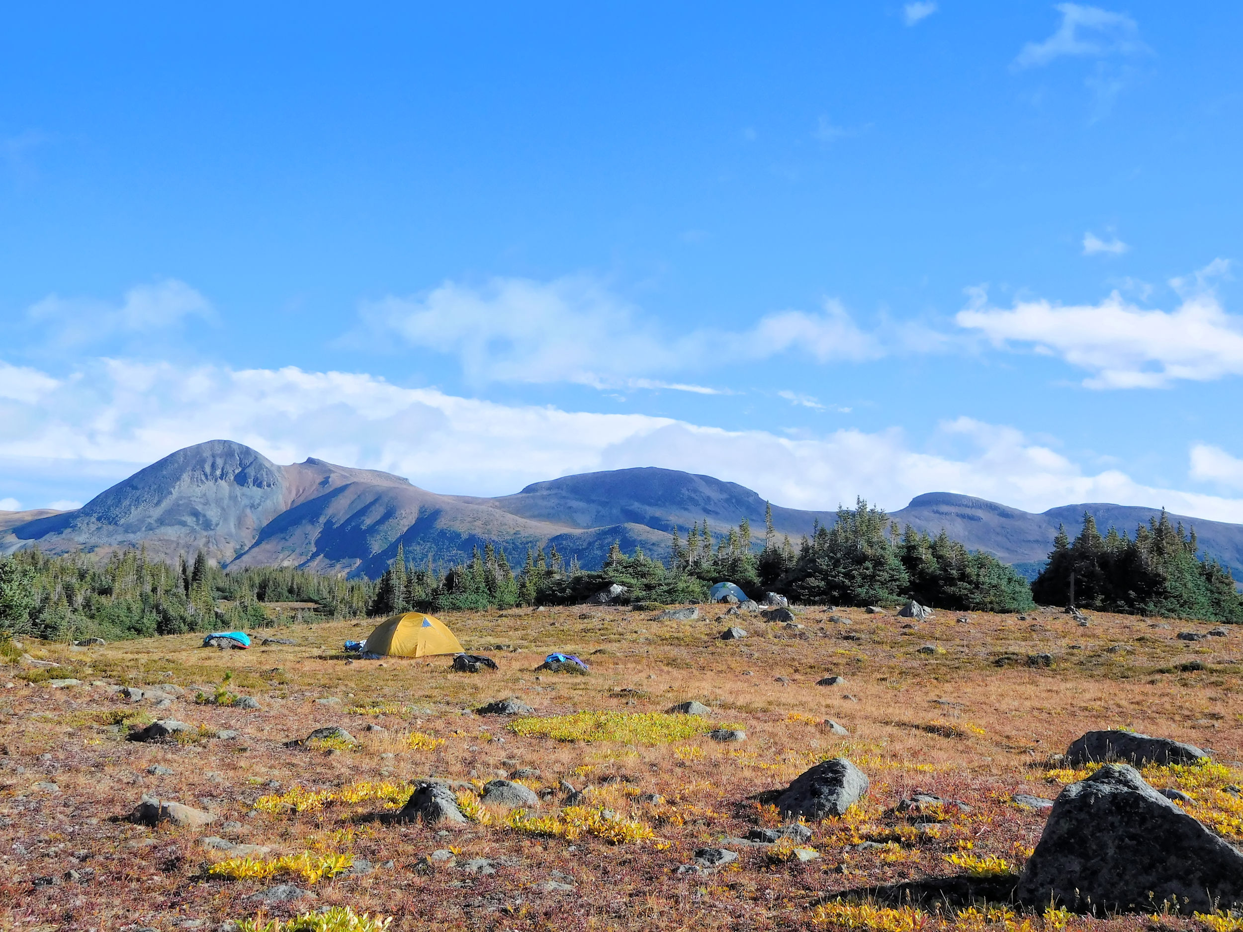
Our camp in bright sunshine
In the morning we are greeted by bright sunshine. The lake shows all its beauty with the mountains in the background.
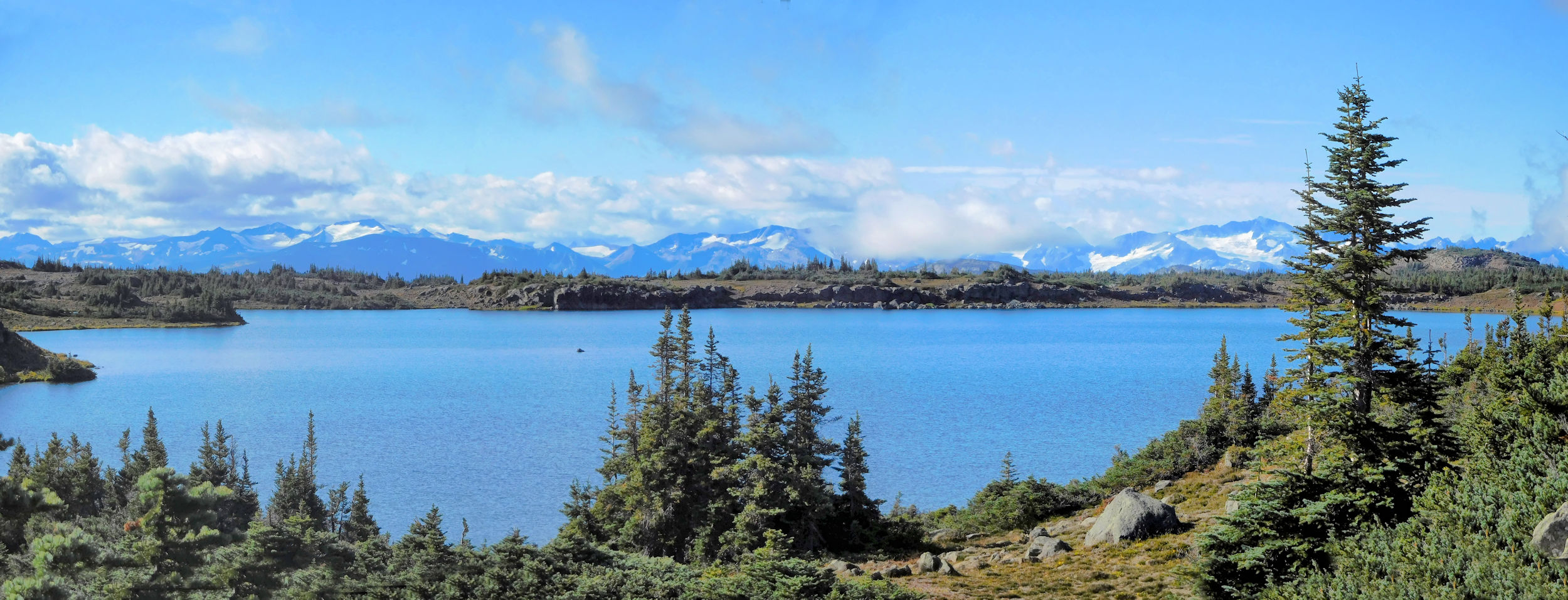
McCauley Lake and Coastal Mountains
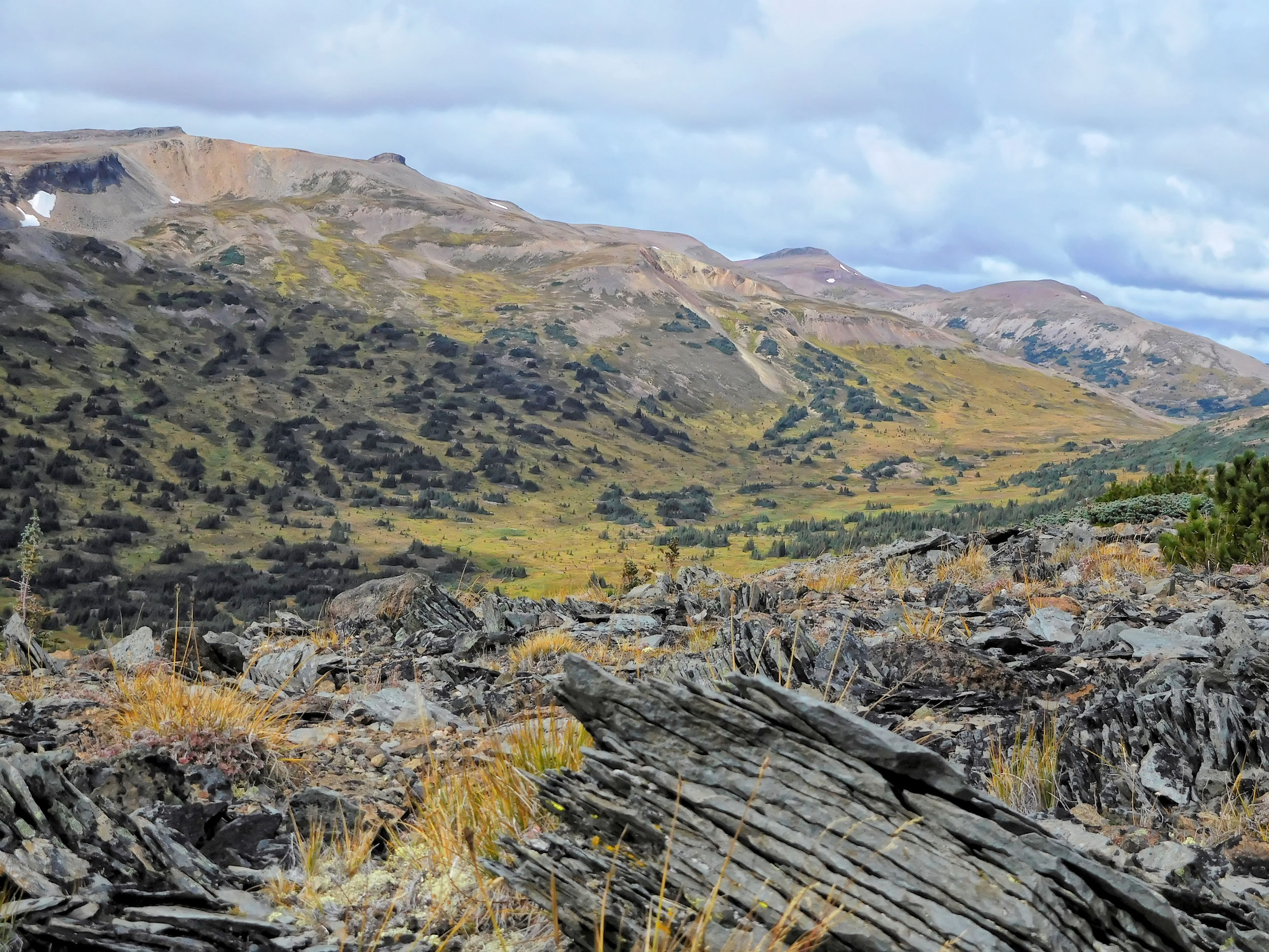
We take some time to dry our raingear before we start out on our next hike. Today we will explore the other side of the valley.
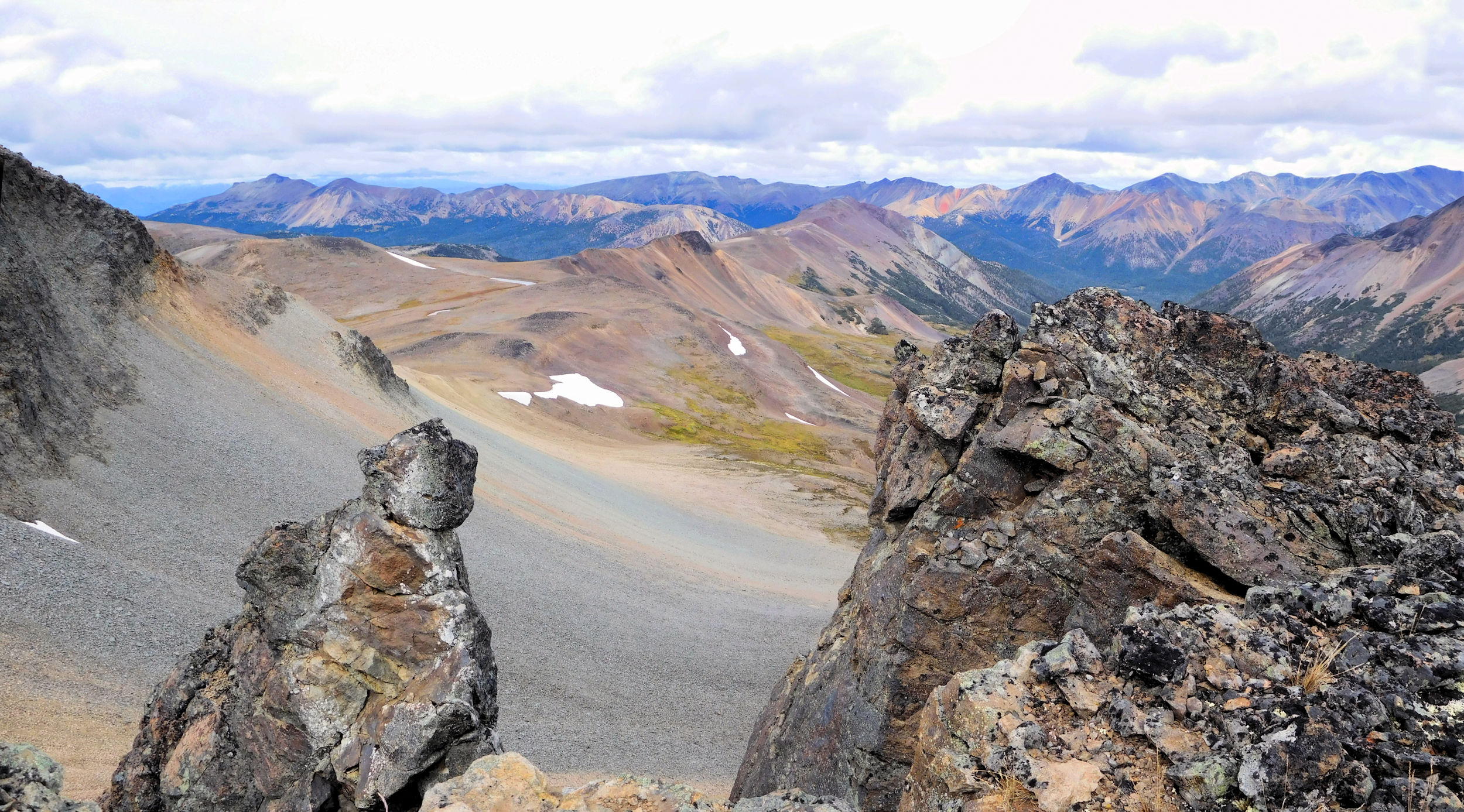
We follow the official Rainbow Range trail to a viewpoint. Here the cairns end. A little further someone has built an inukshuk.
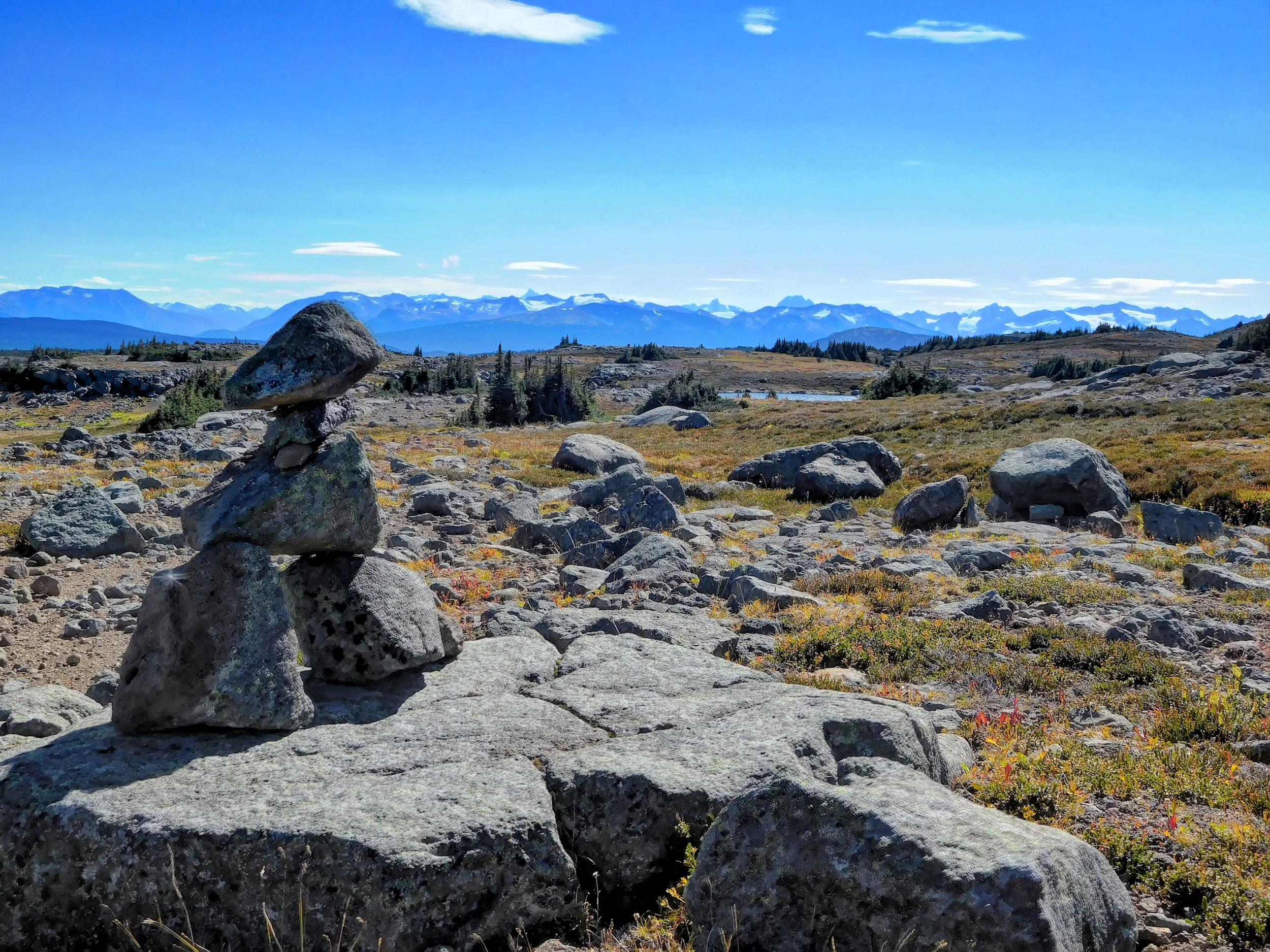
Inukshuk and Coastal Mountains
We have a good view of the ridge and the knoll where we hiked yesterday.
View of yesterday’s destination
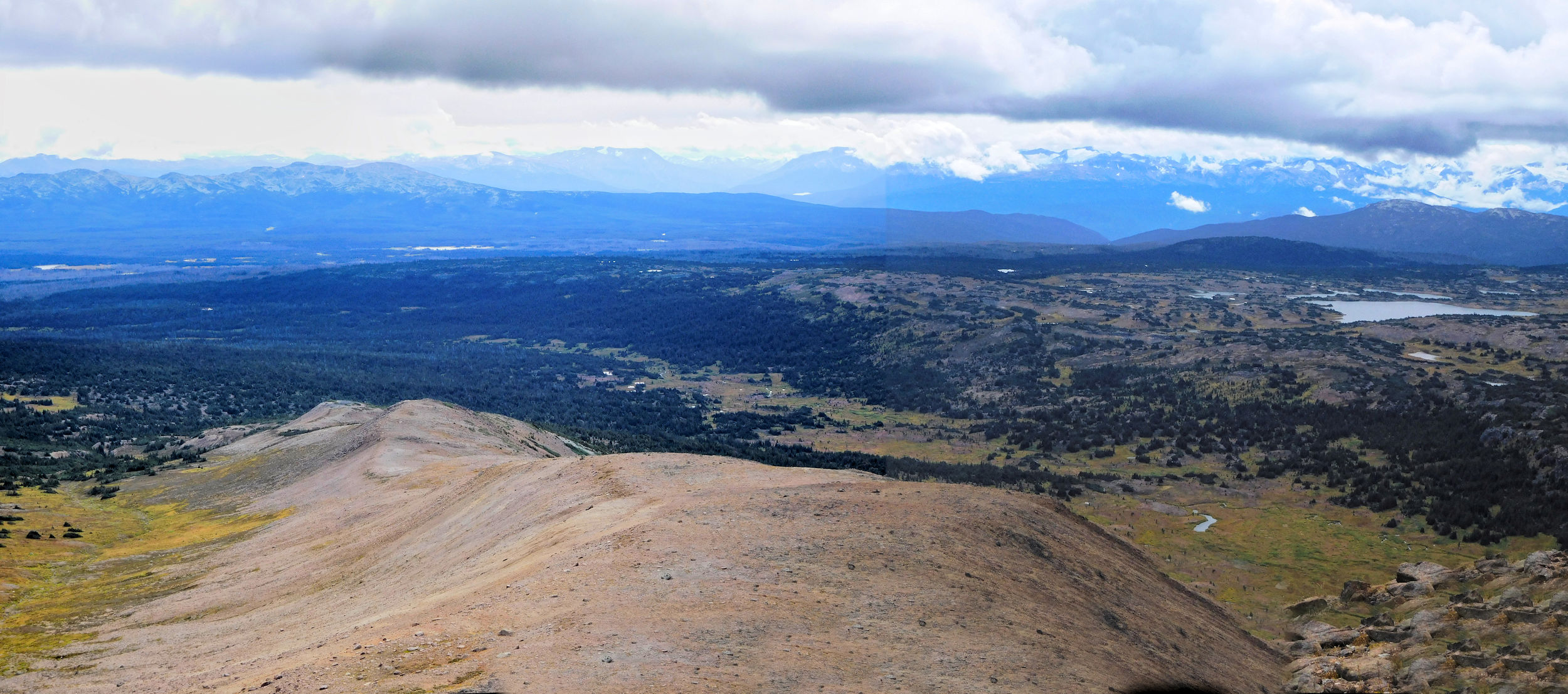
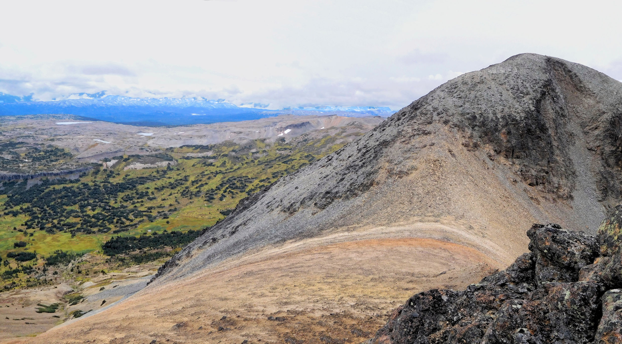
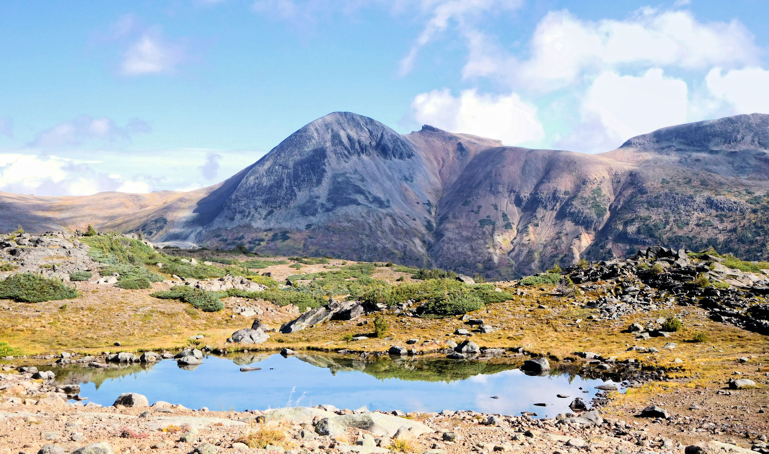
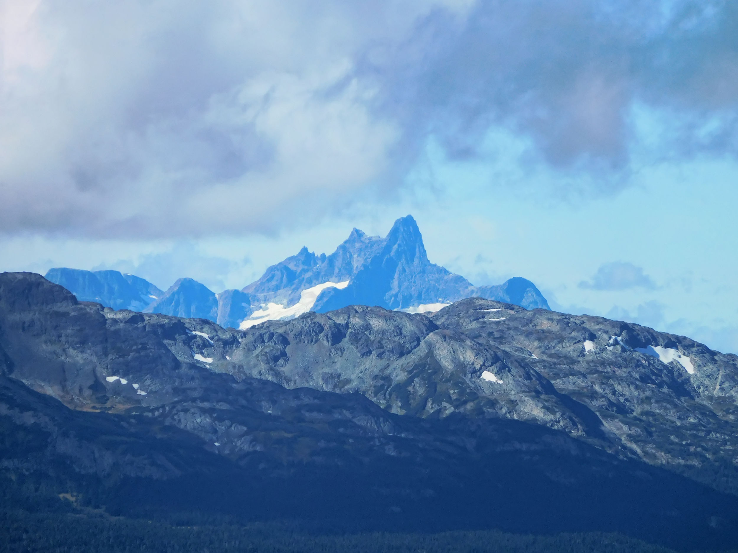
One of the coastal Mountain peaks is especially fascinating. The map does not tell us its name.
We climb up on a ridge and down a steep gravelly slope to avoid some cliff bands. After another steady climb, we reach an edge. From here we can see that we would need to traverse a deep chasm to get to the destination we had aimed for. Instead we climb the cliff to our left.
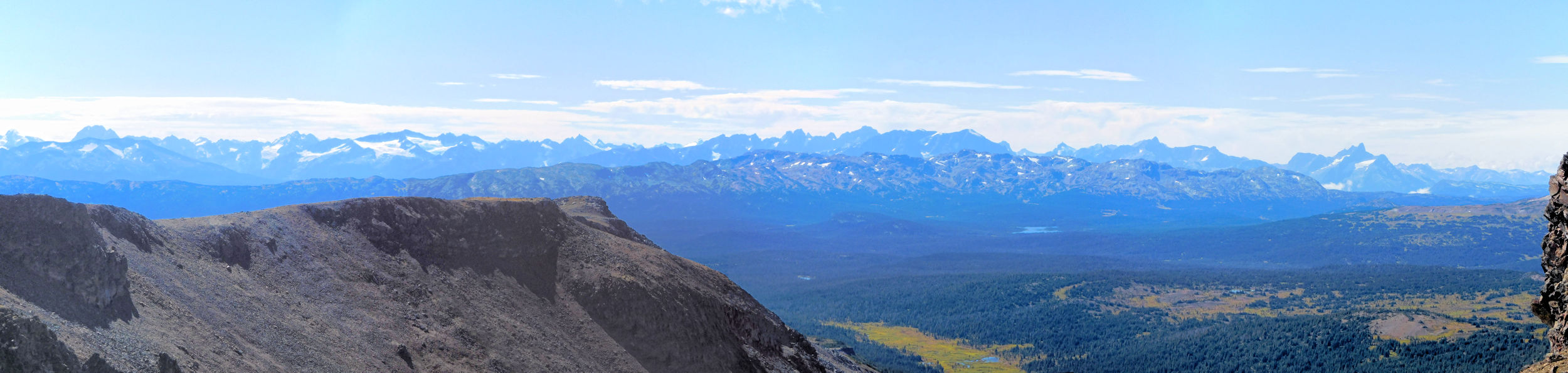
Coastal Mountain Range
From the top we enjoy some more beautiful views of the Rainbow Range.
We have a nice long lunch break up here. Unlike yesterday there is not much of a wind to drive us away.
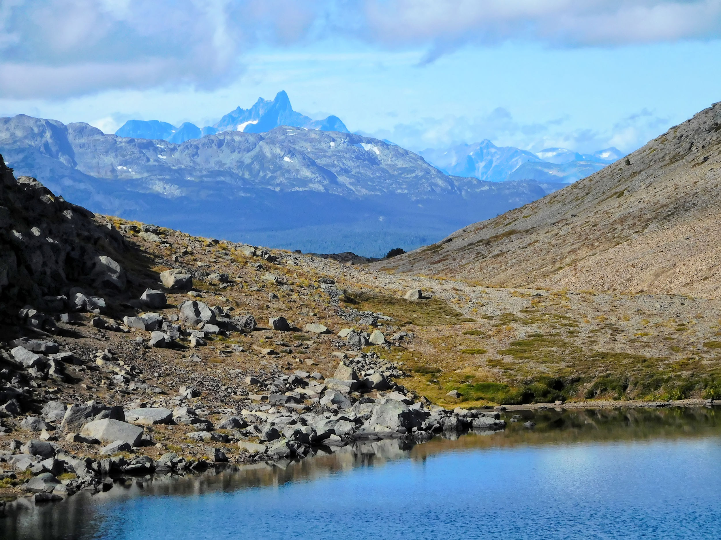
On the way down, I try yet again to capture the Coastal Mountain Range on the horizon. On a picture, however, it is not quite the same.
Near a huge black boulder shaped like a molar, we leave the backpacks behind and climb on a small narrow ridge. From a distance it looks scarier than it actually is.
Looking back from the ridge
A last view of the rainbow-coloured mountains
Slowly we find our way back to camp. Not without a mishap: One of our friends takes a fall on a gravelly downslope. Her elbow hits the ground with an ugly sound. Fortunately it was not the elbow but only a piece of shale that cracked on impact. She gets away with some bleeding scrapes on her hand that can be patched up quickly. Soon we are on our way again.
During Happy Hour in beautiful sunshine we review our adventures. It is so warm that one of us braves a swim in the lake, the bathing suit being one of the last pieces of clothing that hadn’t been put to use yet.
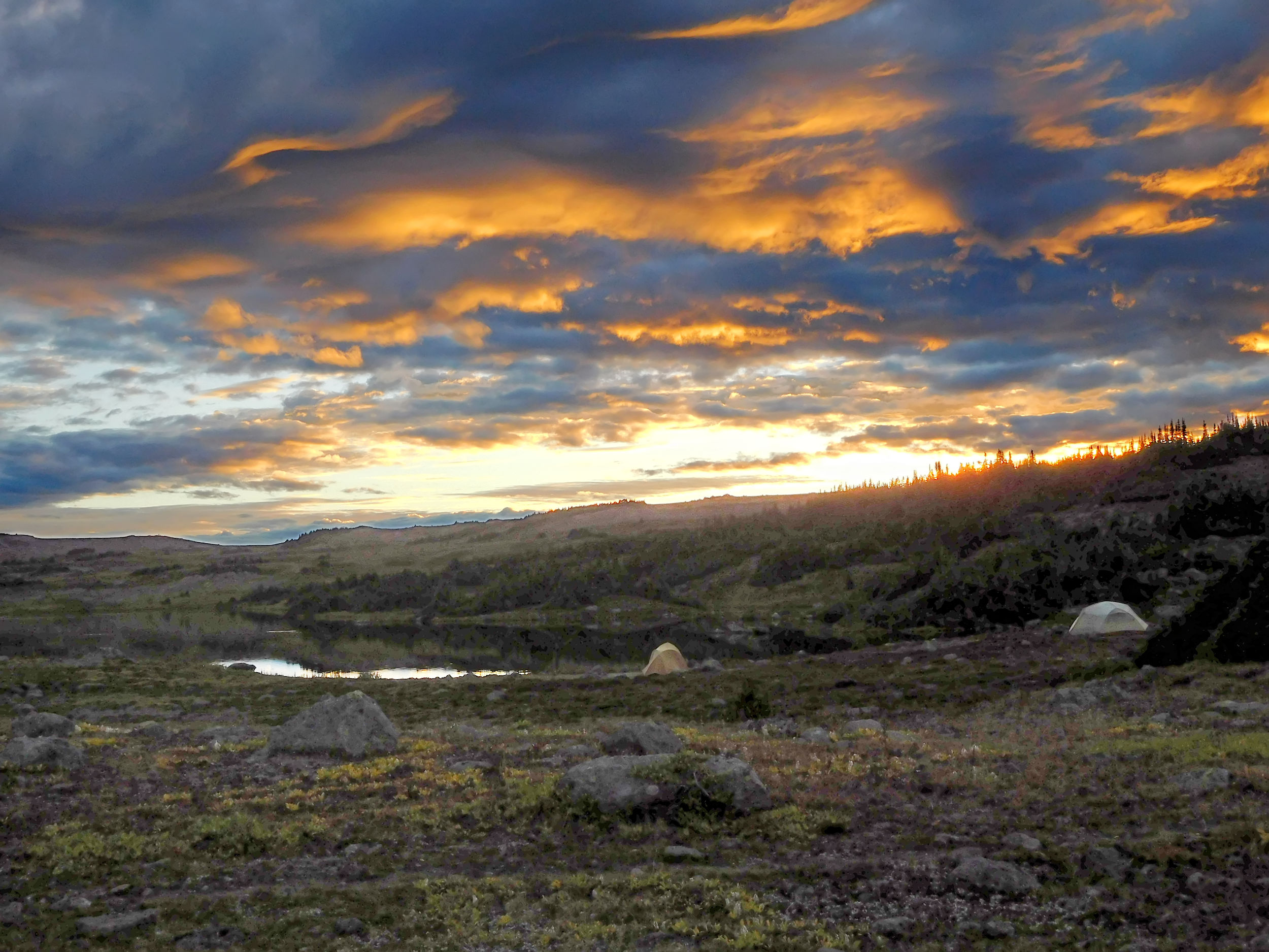
Soon it is time for dinner again. At night we are rewarded with a beautiful sunset.
| Distance | 7.2 km |
| Time | 3 hrs |
| Min. Elevation | 1496 m |
| Max. Elevation | 1780 m |
| Descent | 284 m |
| Cum. Ascent | 231 m |
| Cum. Descent | 492 m |
We hike out the same trail that we came in. Although it is mostly downhill and our packs are much lighter, it takes us three hours to reach trailhead. This is because we stop for a long and interesting talk on the way, and the huckleberries prove themselves irresistible, as well.
By one o’clock, we meet up with Karl at the Anahim Lake kiosk again. A great hiking adventure has come to an end, and we must part ways. My friends return to Williams Lake, while Karl and I spend another night in the Chilcotin - at One Eye Lake - before leaving for home the next day.