 Via Golden and Lake Louise to Larry’s CampAugust 21

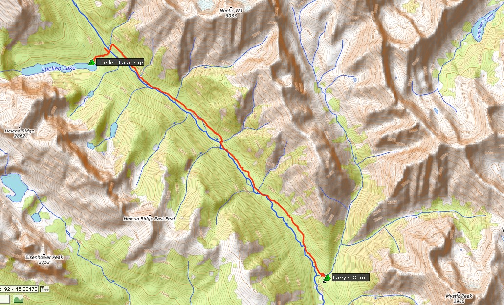
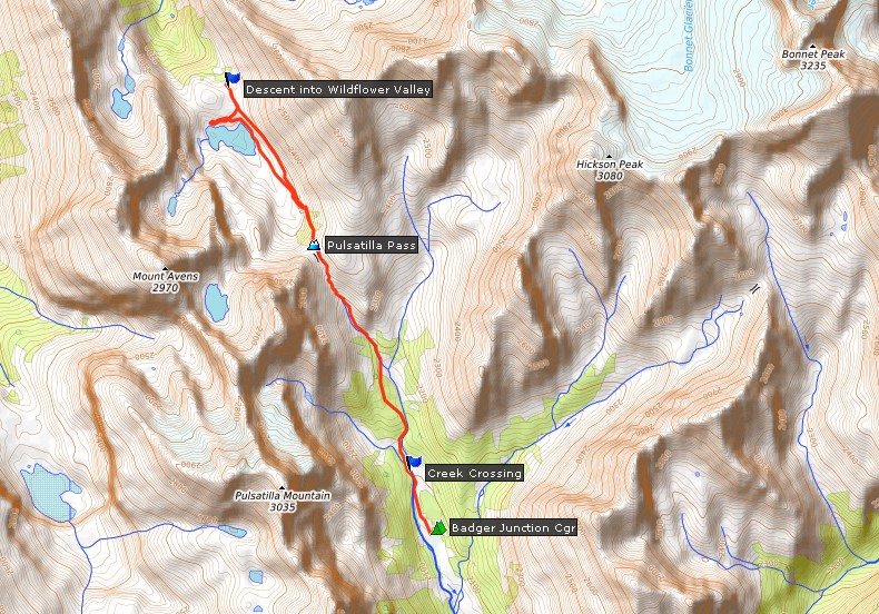
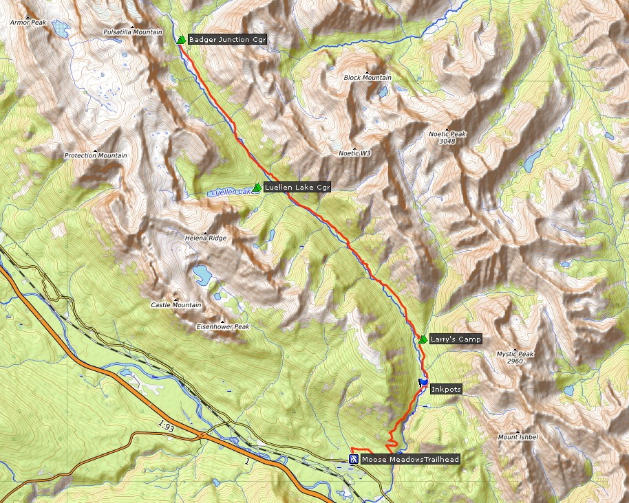
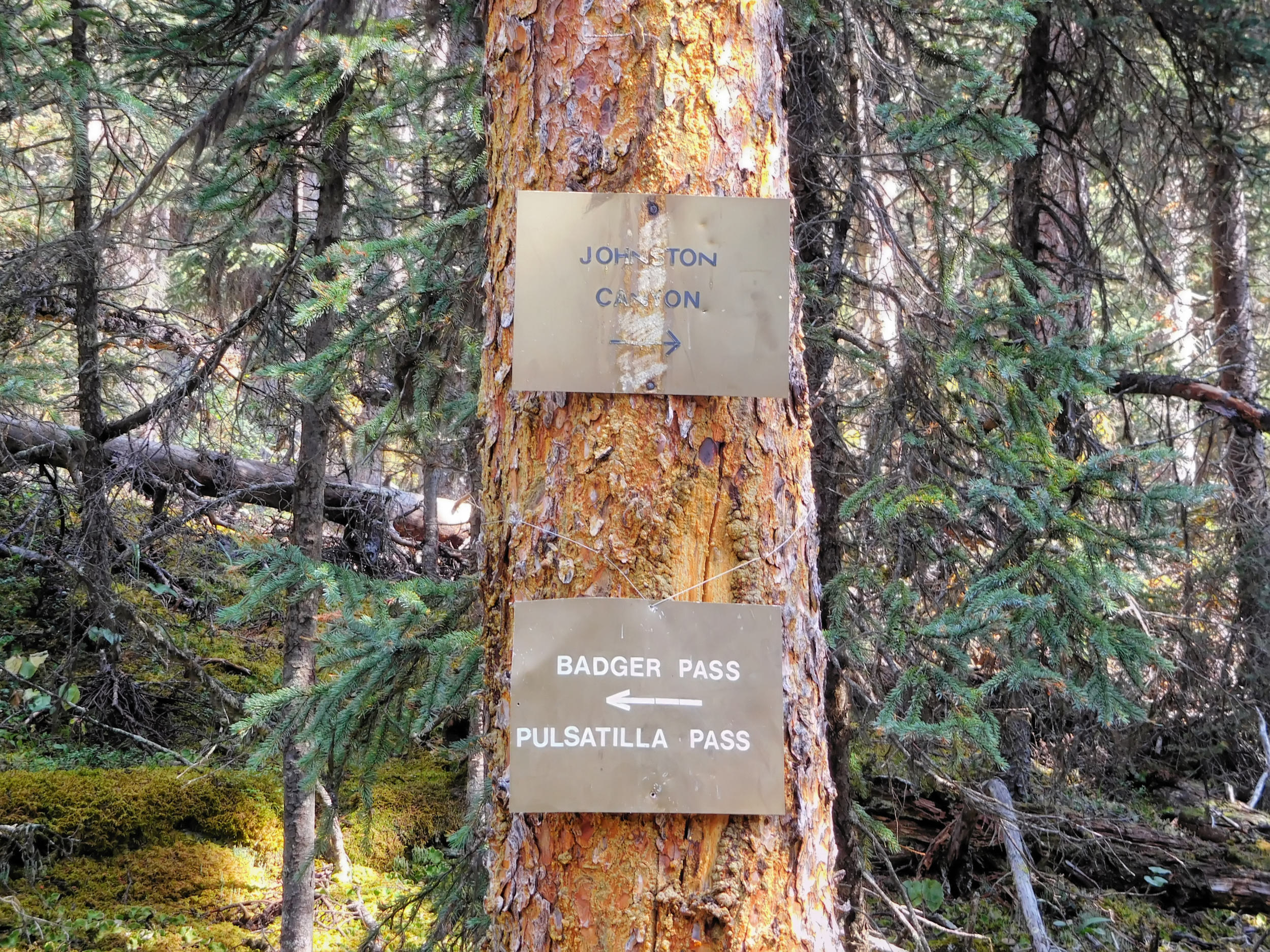
My second hike this summer is in the Sawback Range of Banff National Park. There are several ways to hike this area, depending on which trailhead you start and end at; even a round trip is possible. I will start at Johnston Canyon and follow Johnston Creek to its headwaters. On the way, I pass picturesque Luellen Lake and plan to do three day trips: Pulsatilla Pass, Badger Pass and Mystic Pass. After that, I will return the same way.
Since I have a long drive to get to Banff National Park and it will take me two or three hours to hike to the first campsite, I leave home at 6 o'clock in the morning. I make good progress up to Salmon Arm, but from there on the traffic is heavy. After Revelstoke I hit a weather front, an inferno of torrential rain, thunderstorms and extremely poor visibility. On top of that, there is a controlled burn in Revelstoke Park, preventing any stops.
I am relieved when I finally reach Golden and take a short break in the pouring rain. I continue through the large construction site for the extension of the TransCanada Highway behind Golden, which has been there for years. At the Yoho National Park visitor center in Fields I learn that the bad weather is expected to continue for at least two more days.
After a quick refueling stop at Lake Luise, I reach the Moose Meadows Trailhead parking lot. It is pretty empty, because on top of the miserable weather, Johnston Canyon is currently closed for renovations of the many boardwalks. This doesn't affect me, as I take a different trail into the upper canyon. At three o'clock in the afternoon, I have a very late lunch, while waiting for better weather.
Moose Meadows TH to Larry´s Camp
| Distance | 8 km |
| Time | 2 ¼ hrs |
| Min. Elevation | 1429 m |
| Max. Elevation | 1792 m |
| Ascent | 363 m |
| Cum. Ascent | 729 m |
| Cum. Descent | 441 m |
Finally - at four o'clock - the rain stops. I quickly put on my rain pants, throw a few last things into my backpack and off I go.

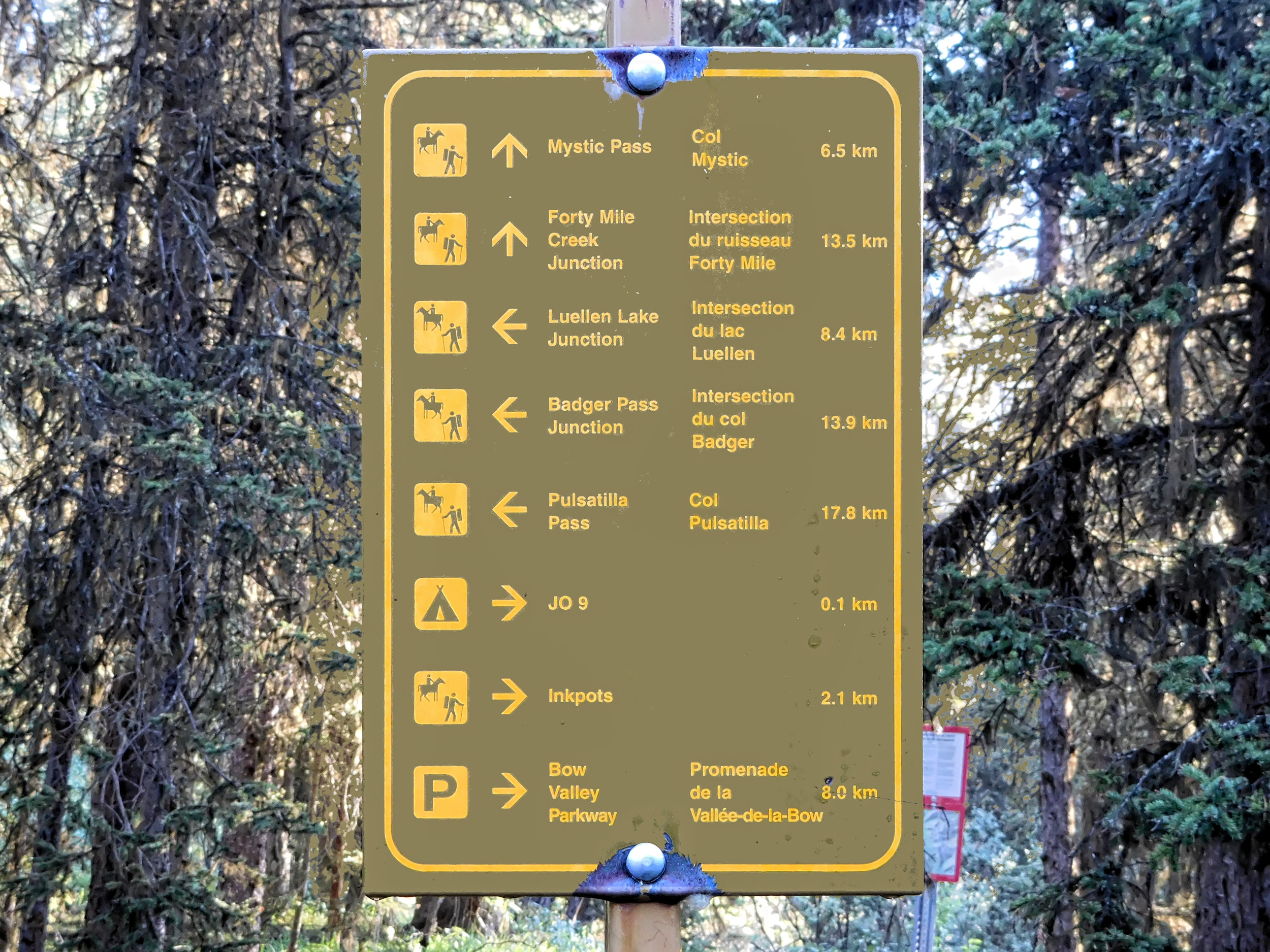
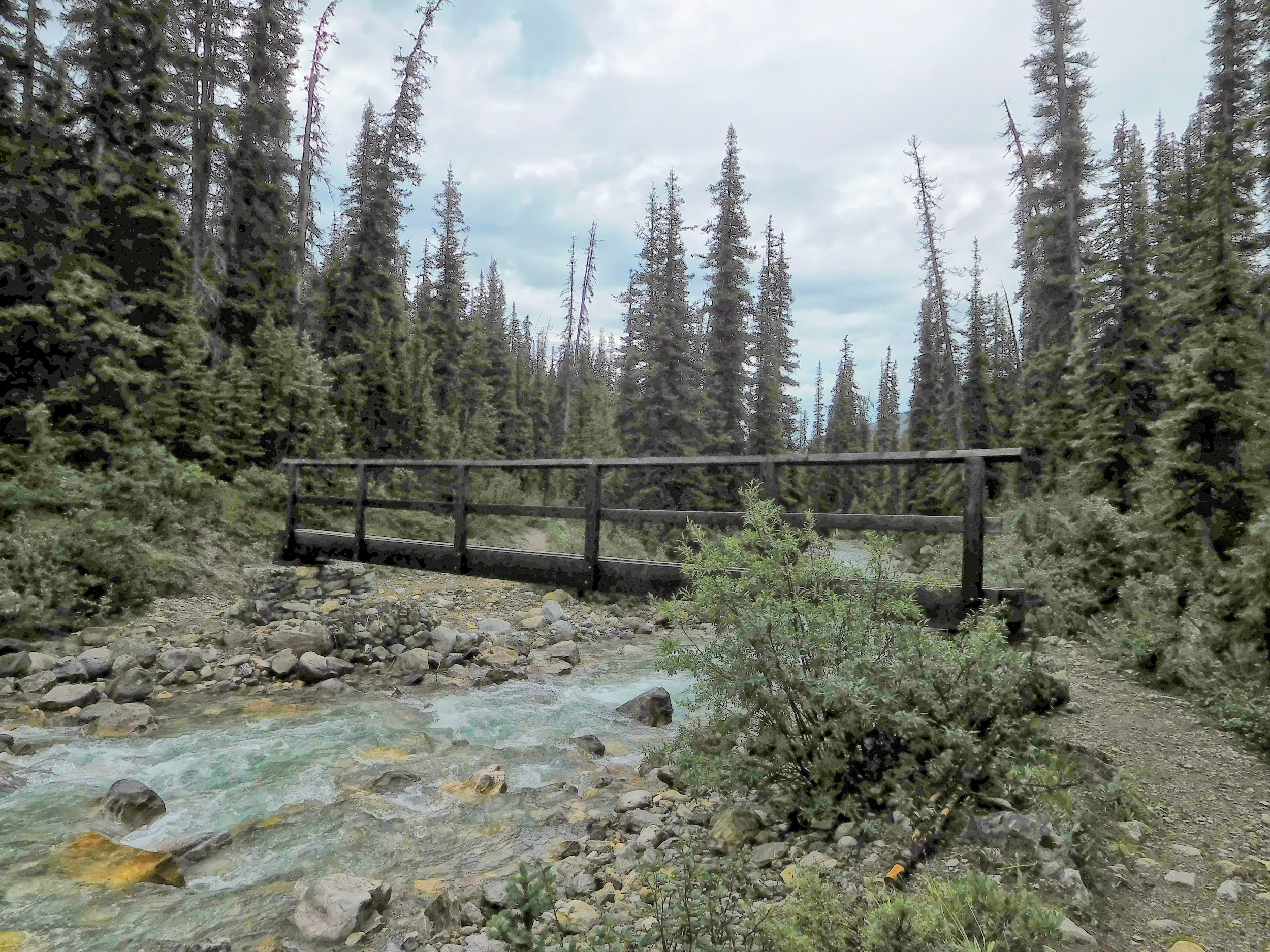
The trail is steep, but fairly wide and easy to walk. Except for a few large puddles, it is not too muddy. The perceived humidity is 200%. My destination for today is Larry's Camp, not yet indicated on the sign and a good two kilometers beyond the Inkpots, five interconnected pools which are very rich in minerals.
So far I have gained quite some altitude, but to the Inkpots it is all downhill again.
Today, not a single visitor lingers by the pools, whose many shades of blue would be spectacular in better weather.
Rainy Inkpots
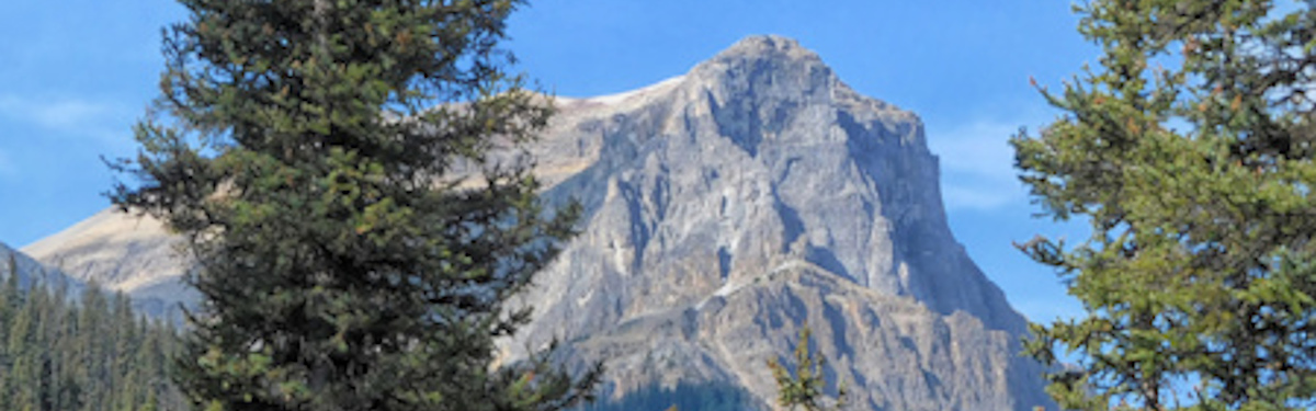
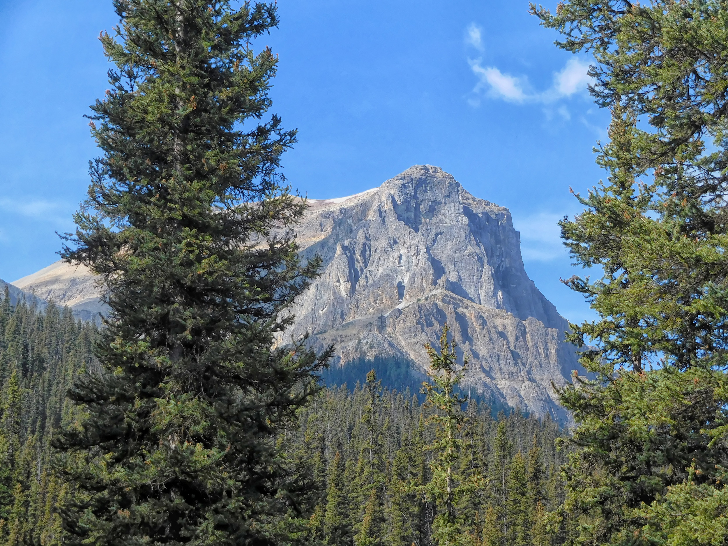
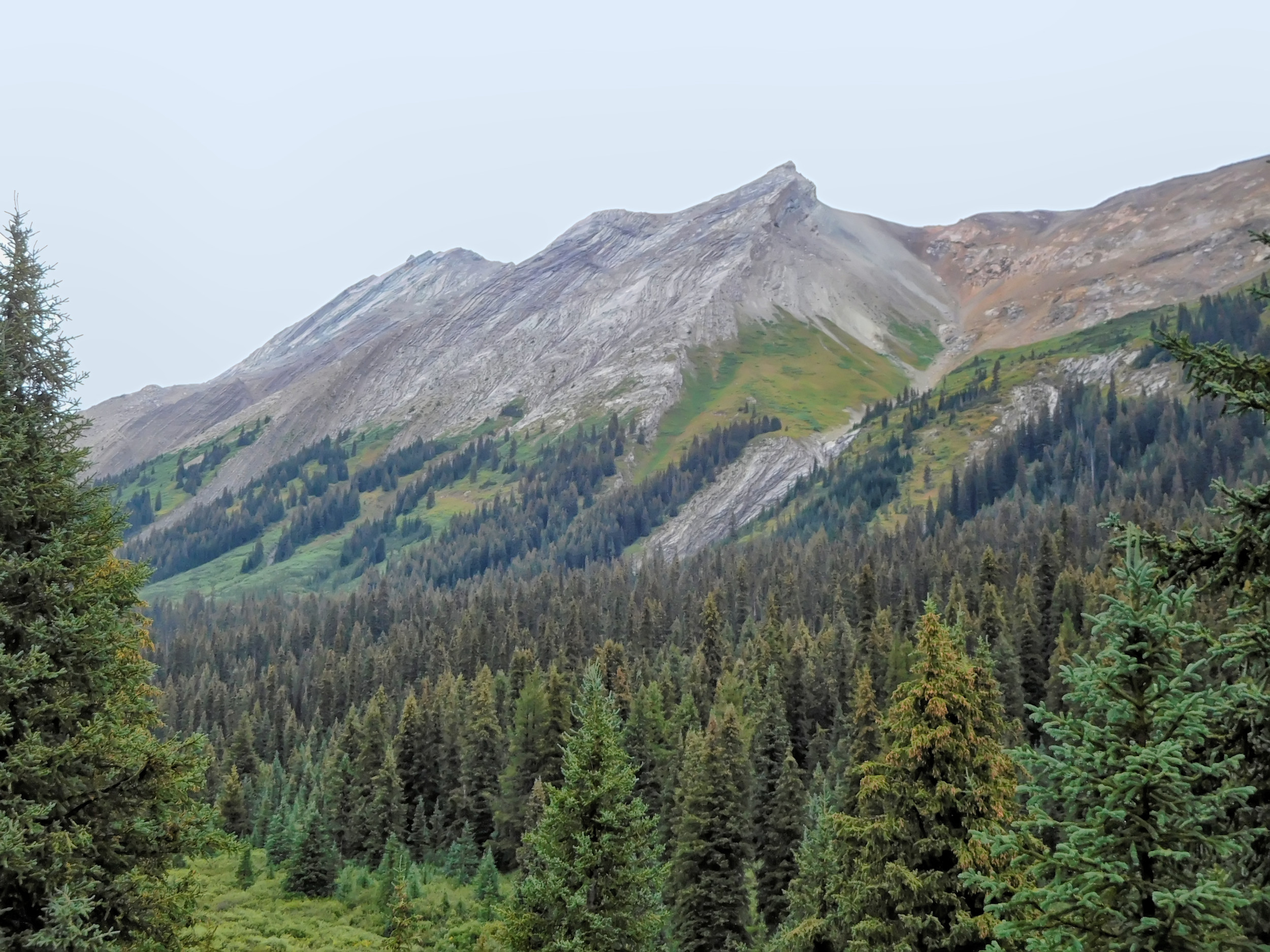
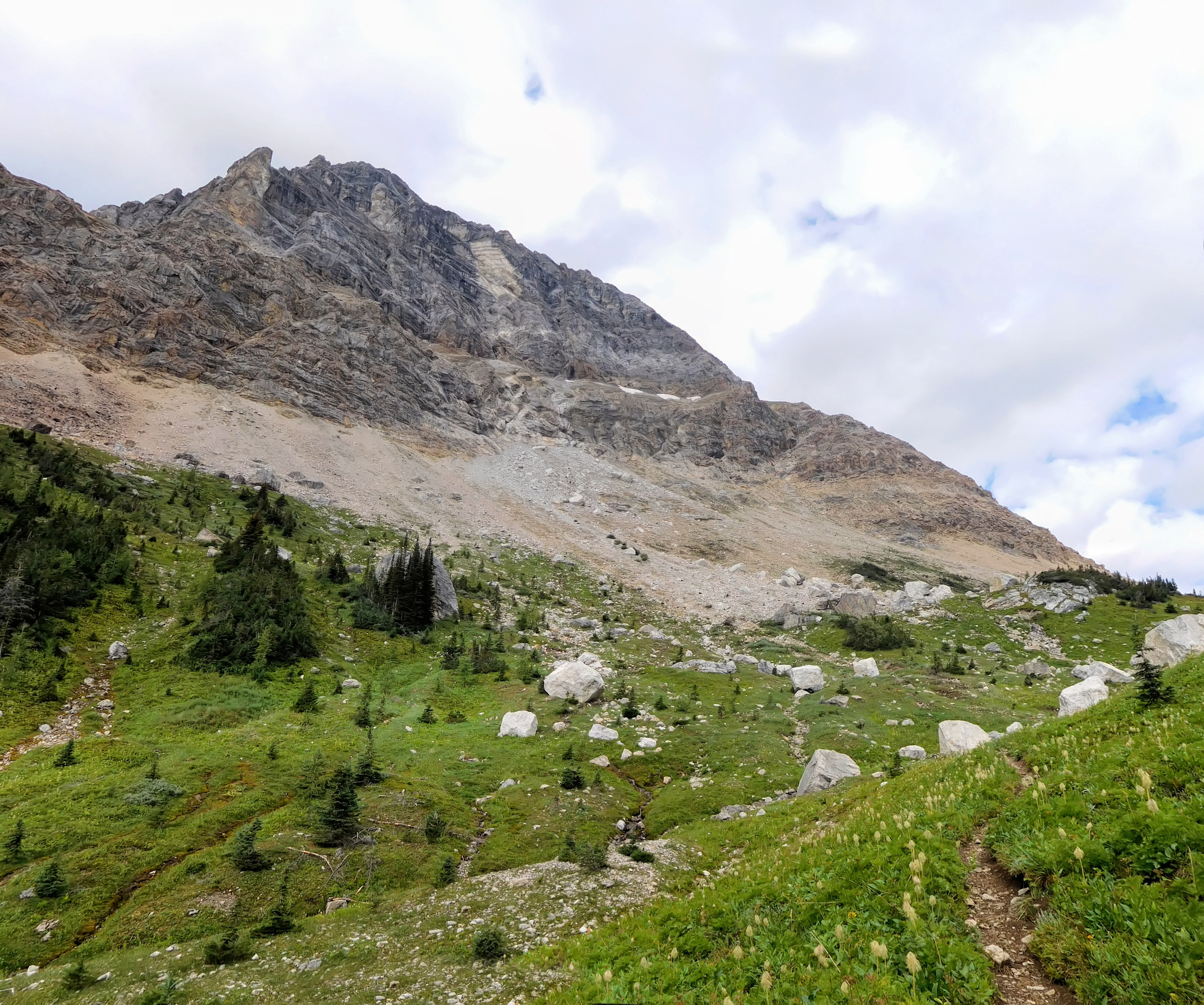
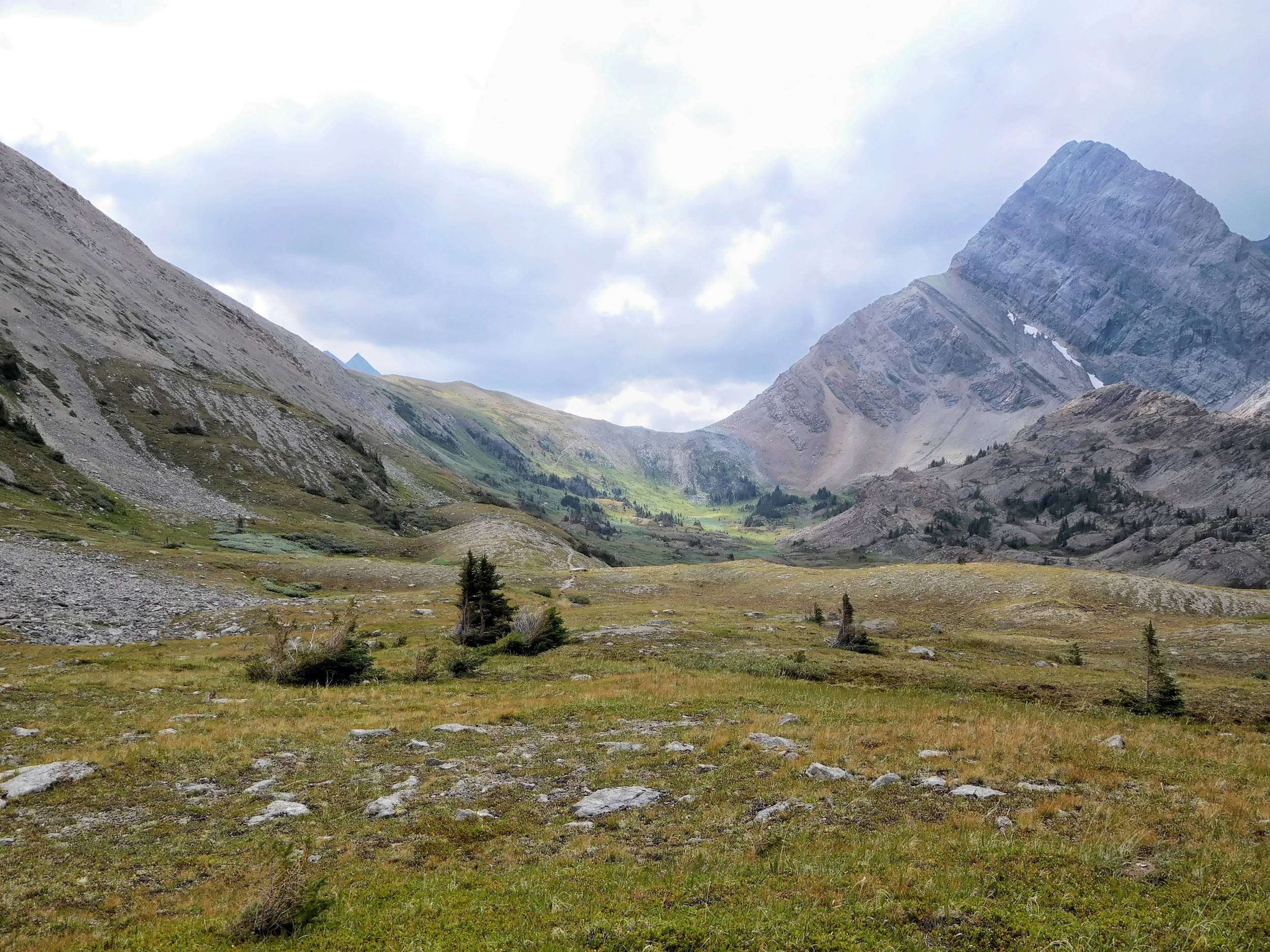
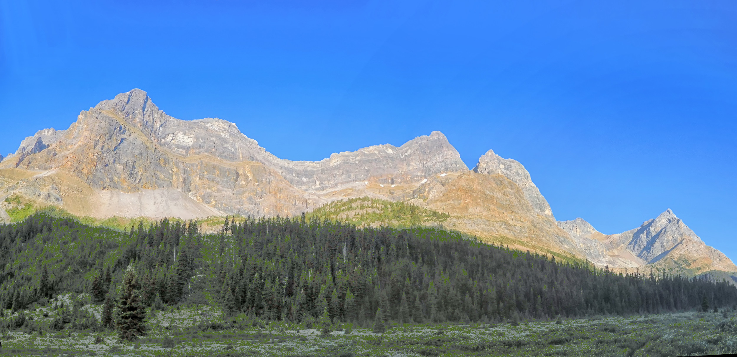
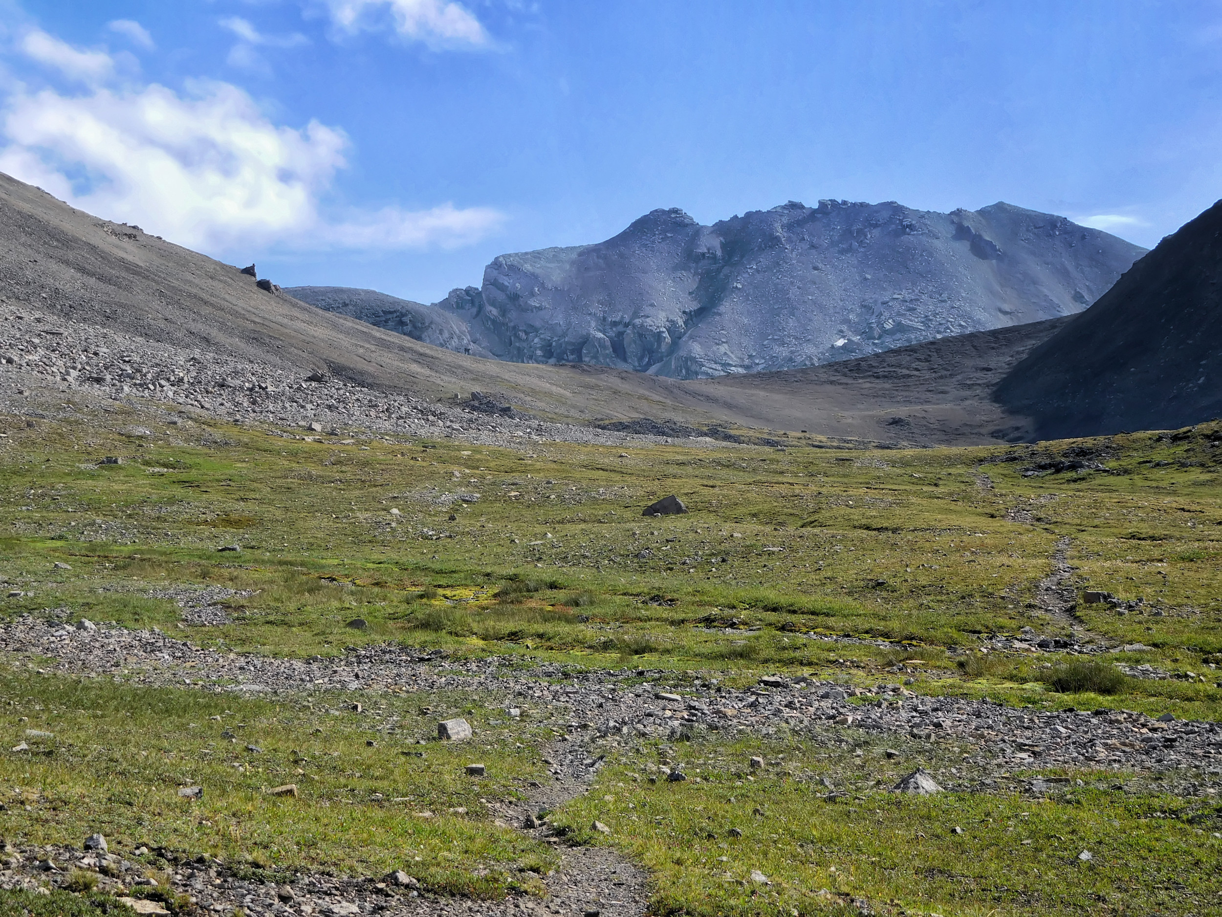
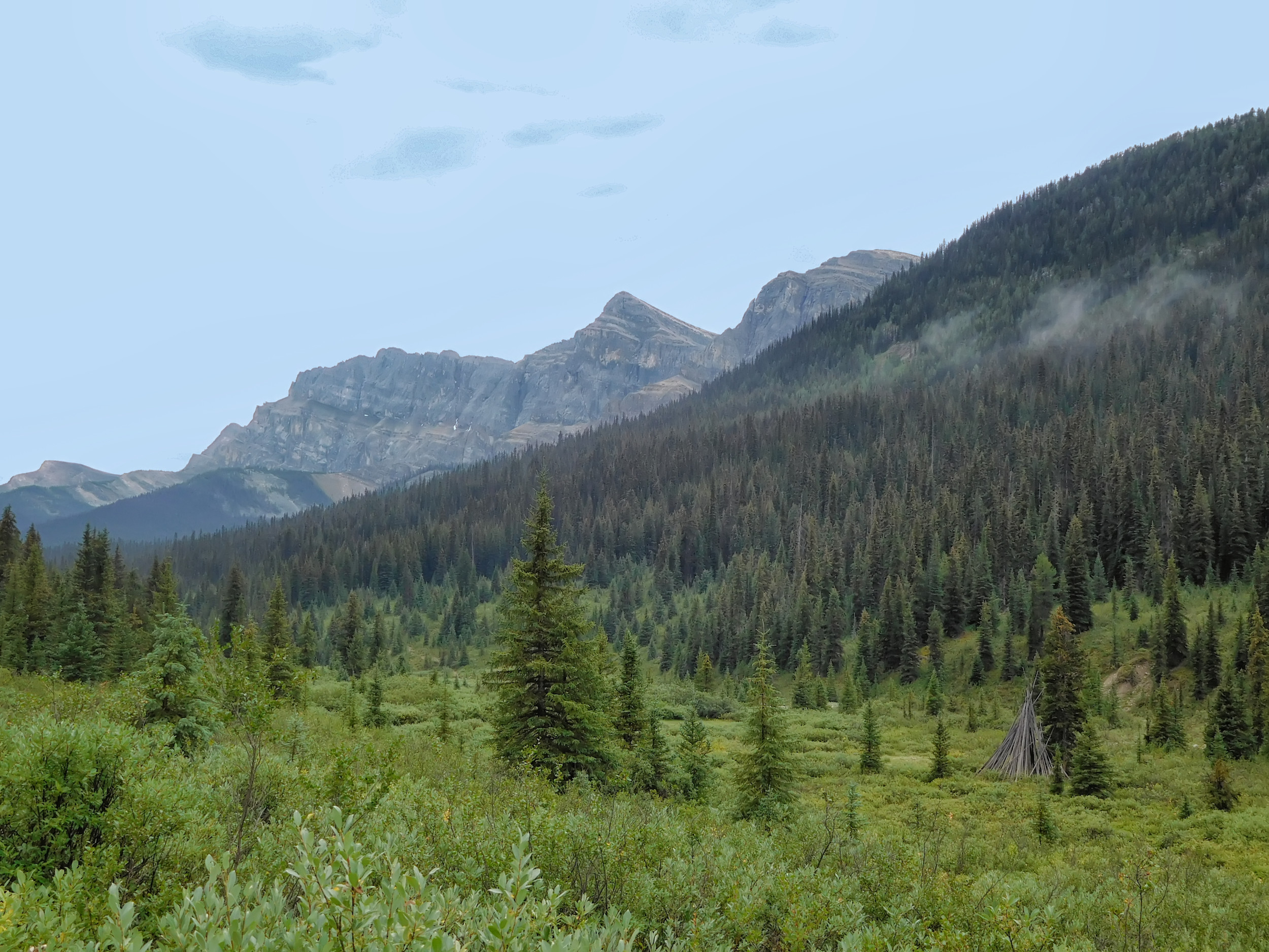
Past the Inkpots the trail narrows and goes uphill again. Soon it leaves the forest, and I have my first view of the Sawback Range.
Sawback Range
I reach Larry's Camp in a remarkably short time: it took only two hours, not three. It has not rained since I left and I stayed mostly dry. My fellow campers who arrived before me were less lucky or had worse timing and got very wet.
The campground is situated on a small tributary of Johnston Creek. It is very spacious and densely treed. I look for a site above the creek, but not too close to the bank, because the creek is quite noisy. There are two separate picnic sites with tables and bear-proof food lockers, but the site down by the creek is hard to get to on an extremely steep and now slippery path. The lockers have numbers that correspond with the campsite numbers. Since the campground is only half full, I stay on the more easily accessible upper picnic site and claim a locker there. However, to get drinking water at the bridge, I still have to go down a steep hill.
The weather remains dry for the rest of the evening, and surprisingly there are no mosquitoes. Since I brought a slice of pizza to eat, I don't have to cook dinner tonight. The other campers have already finished their meals, but they stay at the table and a nice conversation evolves. They are going to Mystic Lake tomorrow. No one is heading my way, but with all five sites at Luellen Lake campground booked, I will have company again at my next destination.
| Distance | 10 km |
| Time | 3 hrs |
| Min. Elevation | 1699 m |
| Max. Elevation | 2016 m |
| Ascent | 317 m |
It rained during the night, but in the morning I look up to a friendly sky. In the shade from the many trees I don't even try to dry the tent. There are still no biting insects around, so my breakfast is undisturbed and all the more enjoyable.
Since I will be stopping at Larry's Camp again on the way back, I had planned to store my food for the last two days here instead of carrying it back and forth. However, it seems unfair to the other campers and also somewhat uncertain because the food lockers each are assigned to a certain campsite. So I pack everything as usual.
I cross the bridge over the tributary and immediately come to a junction. To the right is Mystic Pass, which I plan to visit on my way back. Today I turn left and will be walking along the banks of Johnston Creek for most of the day.
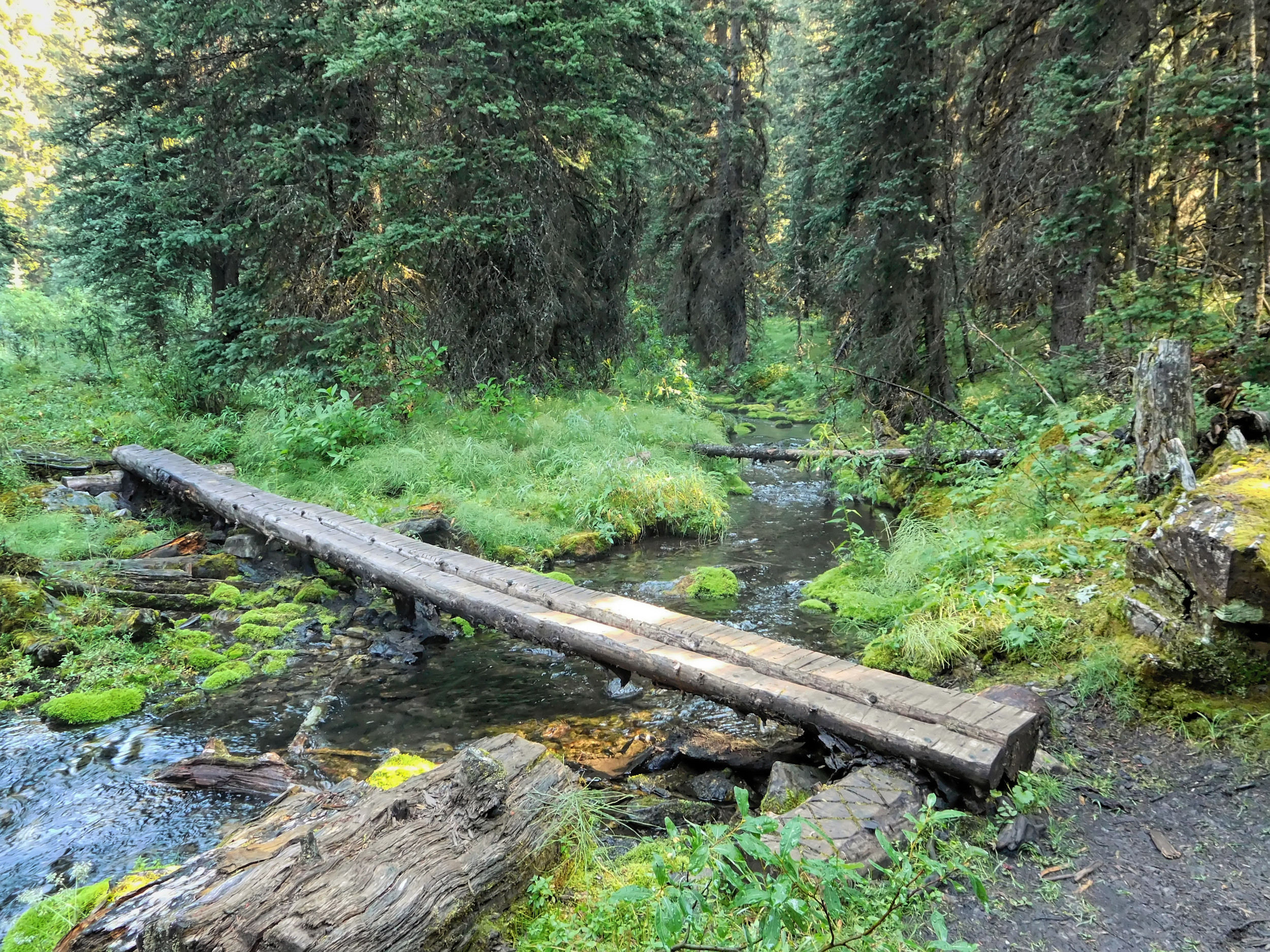
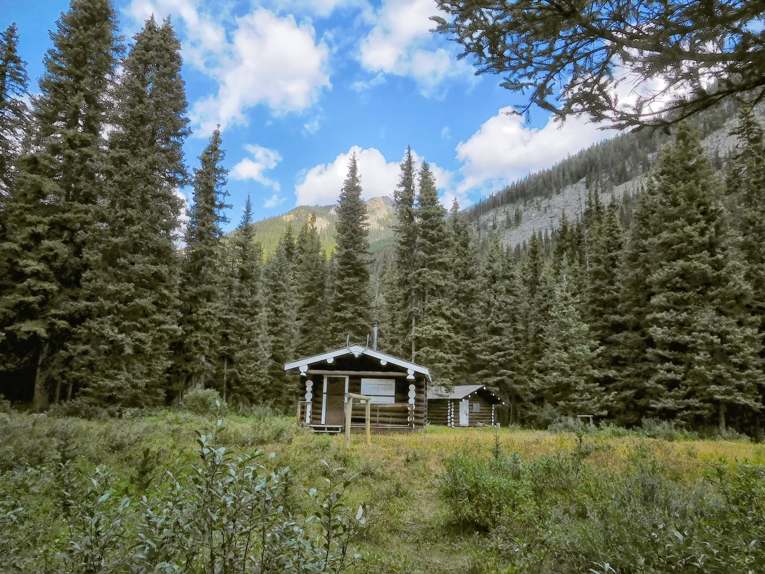
The trail follows the right side of the creek through dense forest. Many sections are overgrown by willows, shrubs and tall grasses. Even without rain I get very wet from the waist down and my hiking boots are soaked. In a particularly damp and mossy hollow, a footbridge leads over a side stream. Not far behind I discover a shuttered ranger cabin.
Along the way, there is a mile-long detour that leads steeply uphill and away from Johnston Creek, only to return to its banks a short time later. The forest is dense and views of the surrounding mountains are rare.
Helena Ridge
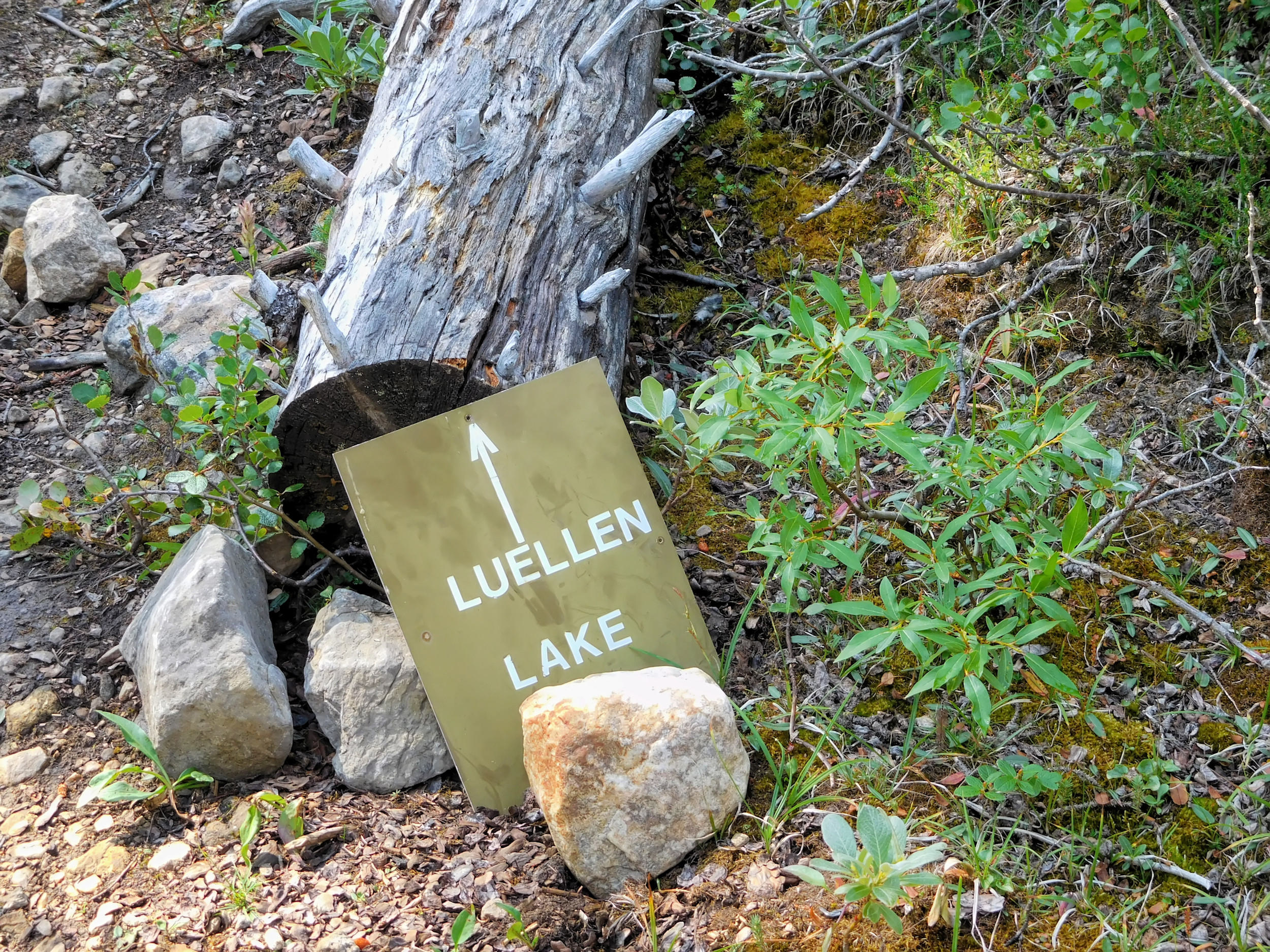
After almost three hours I reach the turnoff to Luellen Lake. First, I cross an extremely narrow and high bridge over Johnston Creek, which roars through a gorge here. On the other side a narrow track to the right leads to Johnston Creek campground. I want to take my lunch break there, but after ten minutes without finding any sign of a campground, I turn around.
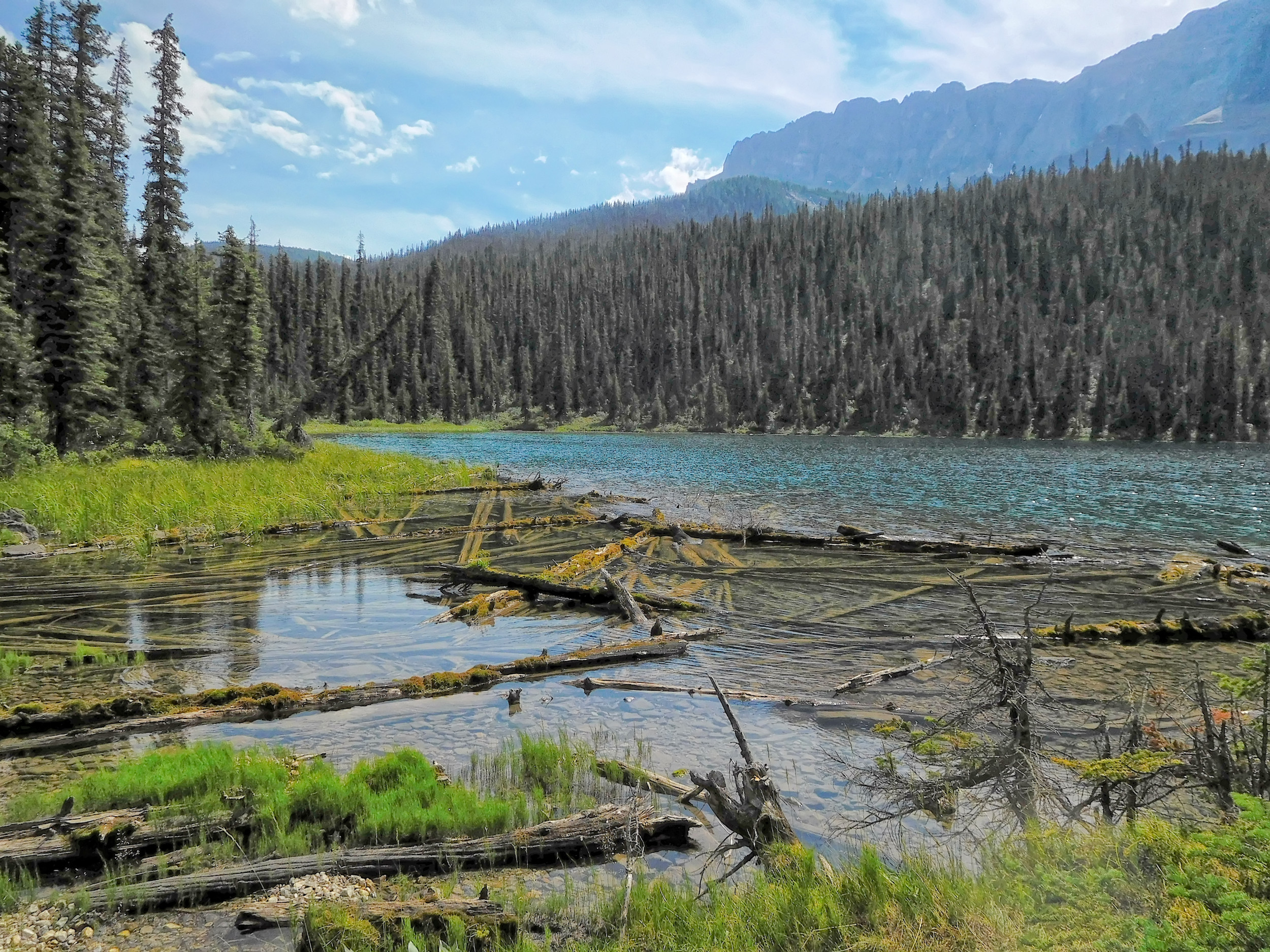
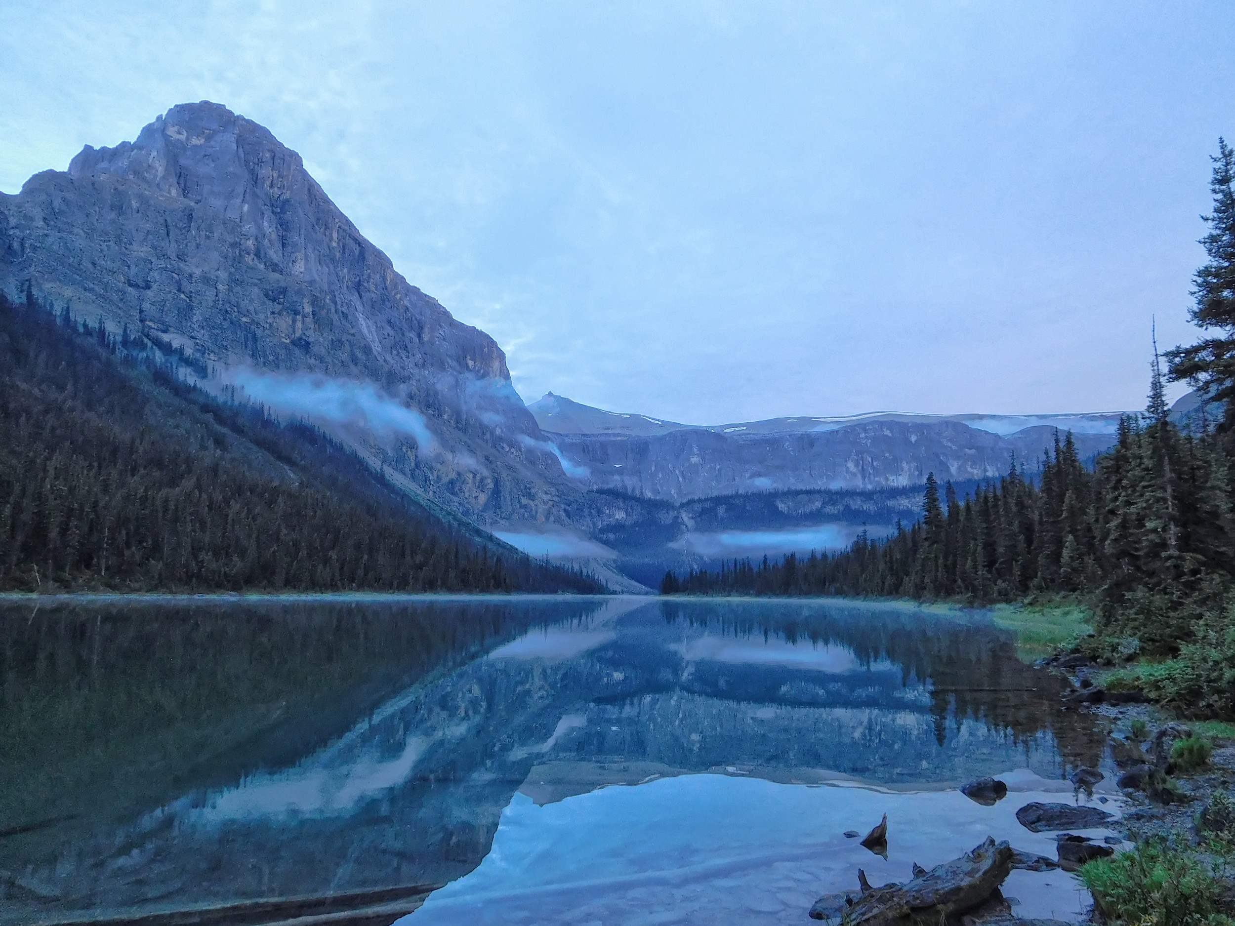
Luellen Lake is only half an hour further. After a short climb I reach the picturesque lake. The sun is shining, but the wind is blowing in strong gusts across the water.
I'm the first one here today and pick a campsite sheltered from the wind. I am late for lunch and hungry, so I have a snack at the picnic table before setting up my tent.
A narrow path winds along the shore and leads to a waterfall at the other end of the lake. It would be a nice afternoon excursion, but the path turns out to be too wet. I'd rather take off my hiking boots and let them dry in the sun.
In the meantime, two more hikers have arrived. The sky is getting darker, so I decide to quickly cook dinner. A good decision, because suddenly it starts thundering. The sun is still shining and it is unbearably hot in the tent. The rolling thunder continues for over an hour while more and more clouds gather in the sky. Late in the afternoon, the storm finally hits. The two women next to me manage to put up their tent just in time before the first heavy downpour. Thunder, lightning and more showers follow for the rest of the evening and overnight.
| Distance | 7.5 km |
| Time | 2 ½ hrs |
| Min. Elevation | 1919 m |
| Max. Elevation | 2098 m |
| Ascent | 179 m |
During the night the storm has subsided and in the morning there is no wind at all. Little clouds of mist rise from the lake.
The sky looks good, it might stay dry today.
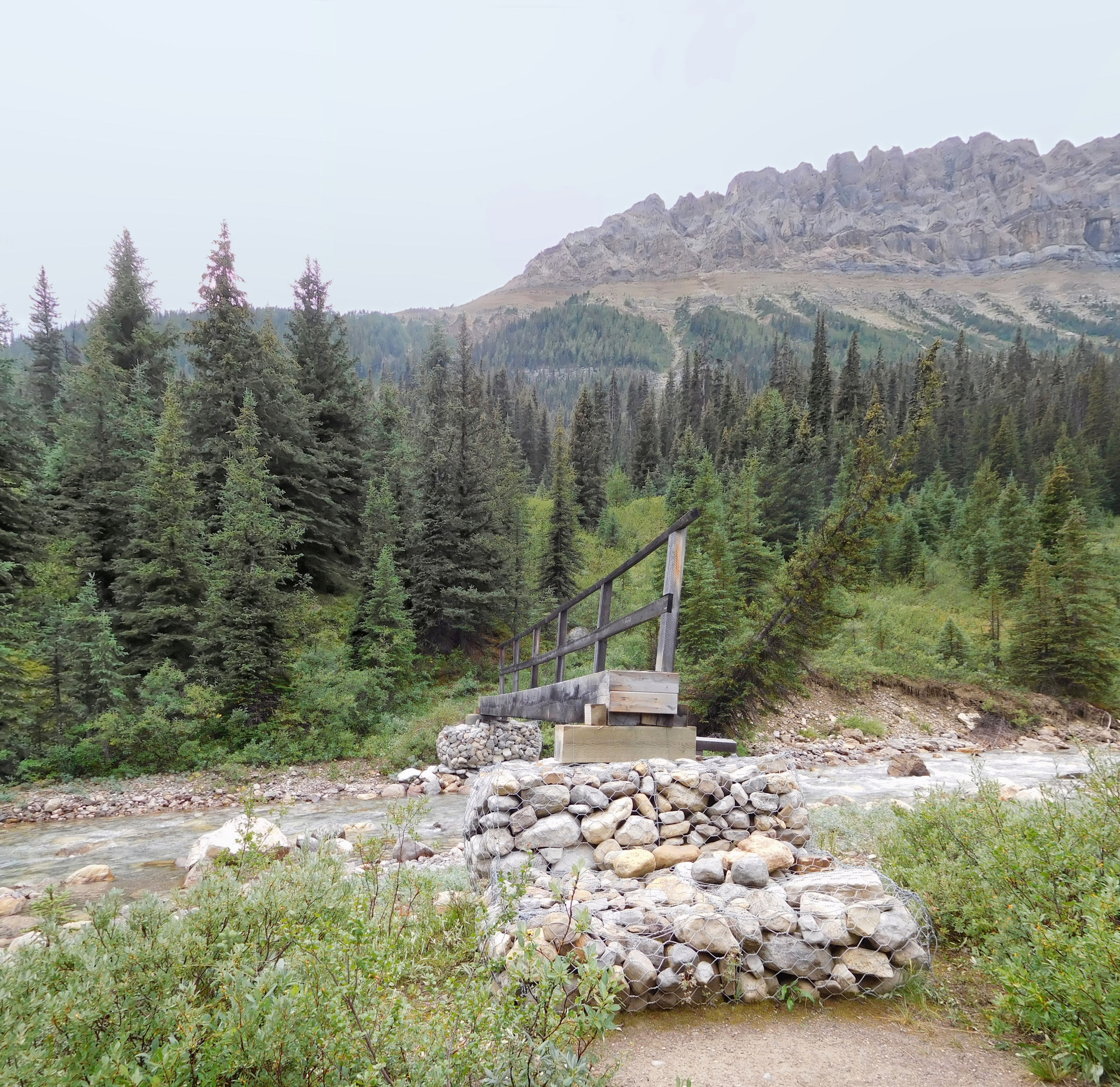
I slip into my wet socks and boots. The sun did not shine long enough yesterday to dry them. I cross the bridge again and continue northwest through Johnston Creek Canyon. The ground vegetation is even denser here and soaking wet from the recent rain. I feel like walking through a car-wash.
Several times I cross the creek on the narrow and high bridges that are common here. On the one hand, I am glad that these bridges have a railing. On the other hand, each time my backpack bumps it, I come close to losing my balance and falling into the water. One of the bridges is missing a piece of the railing just behind the entrance, which makes the crossing even trickier.
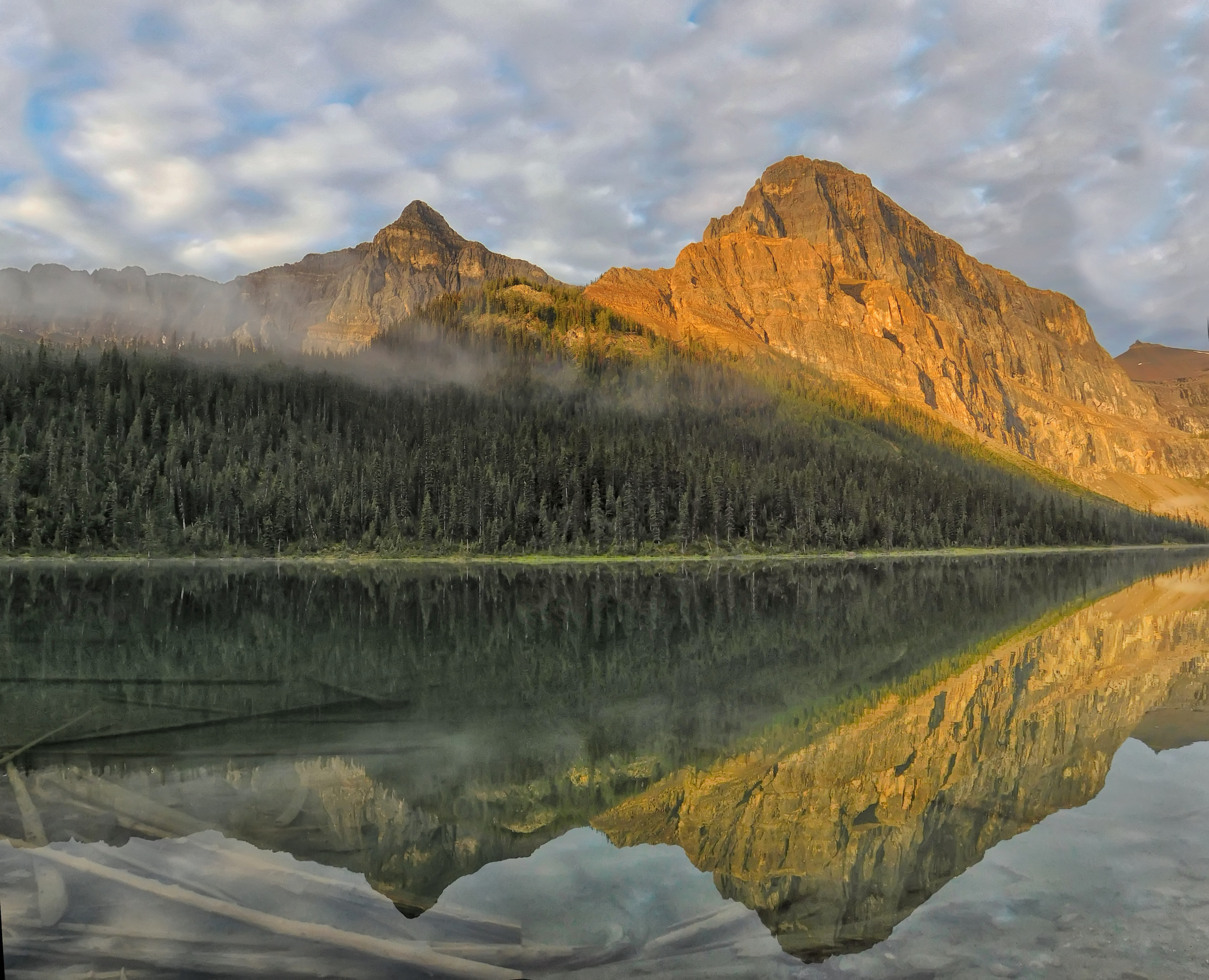
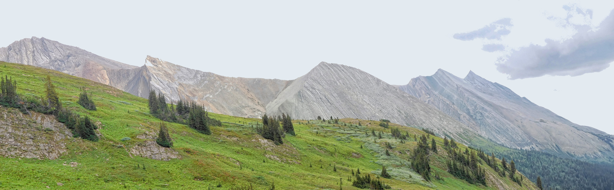
The forest opens up into a meadow and to the right, the serrated ridges of the Sawback Range appear. They live up to their name.
The trail passes through an abandoned camp of the Skyline Hikers of the Rocky Mountains, a hiking organization that runs week-long summer camps in the Rocky Mountains, which I have also attended twice before. Like all the other camps, they visit Johnston Creek Canyon about every ten years. A tall teepee marks the site. The long poles for the camp's prospector tents are kept this way during the inactive years.
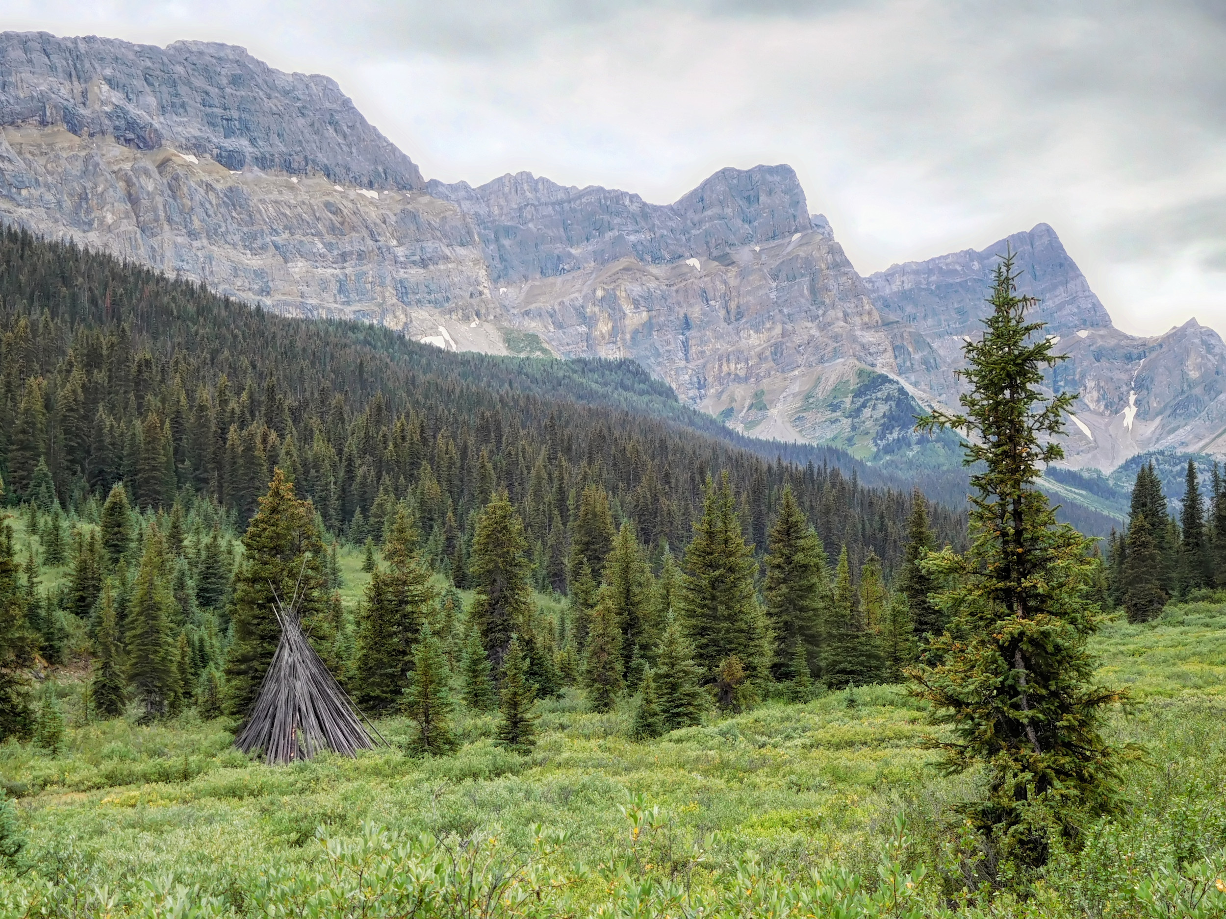
Skyline Hikers’ Camp
The sky has darkened again before the ground has had time to dry. At least it's not raining.
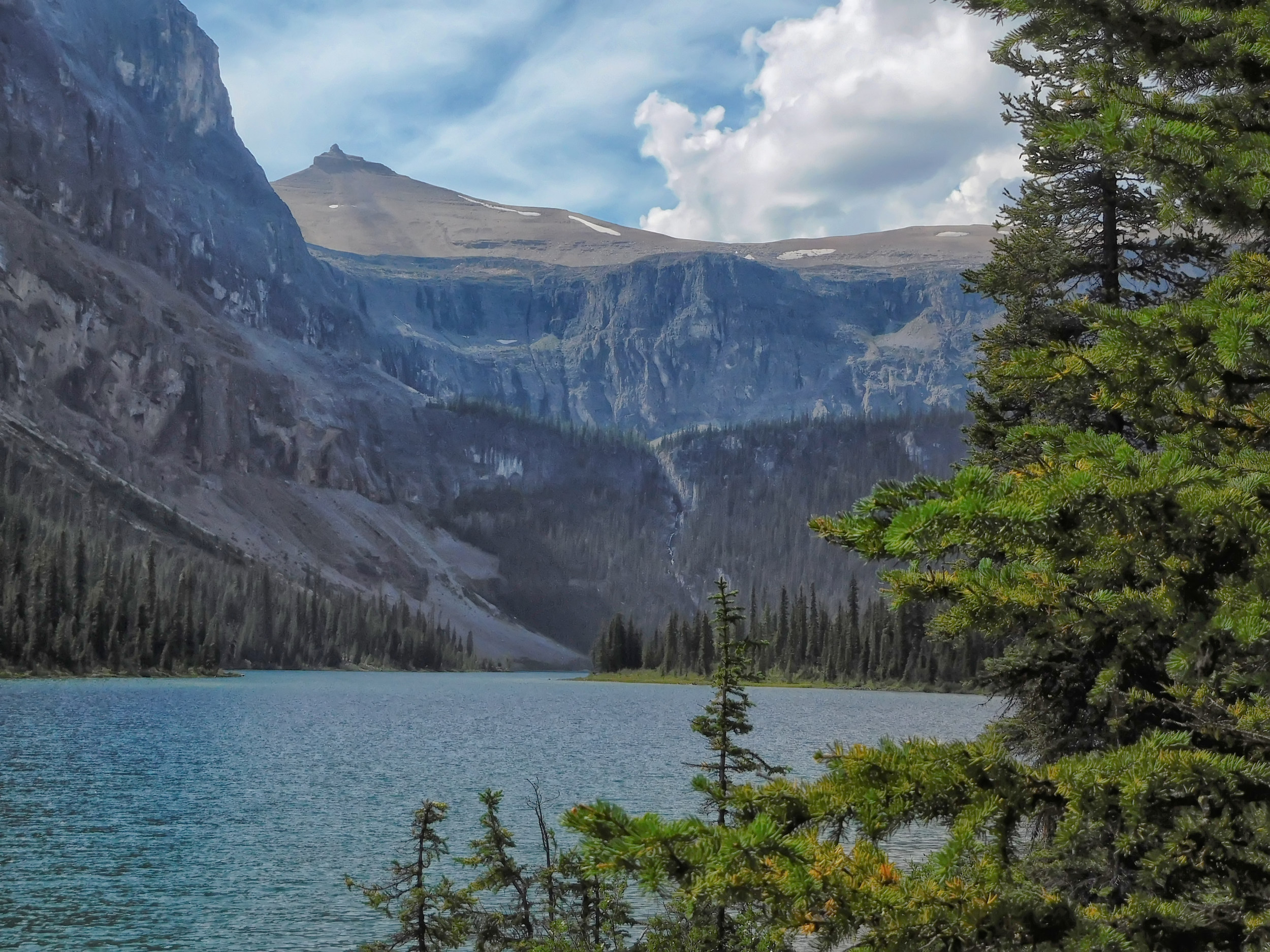
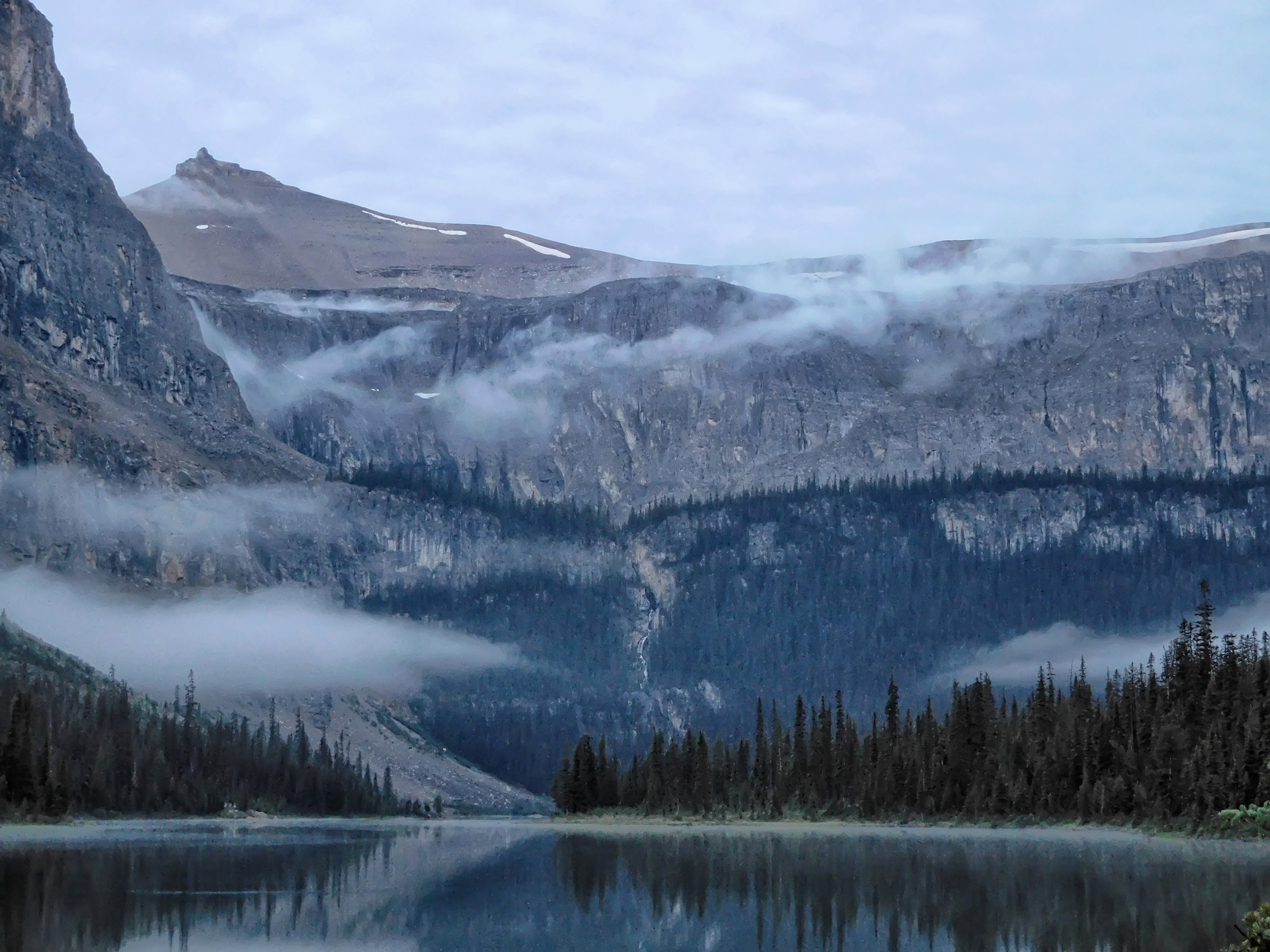
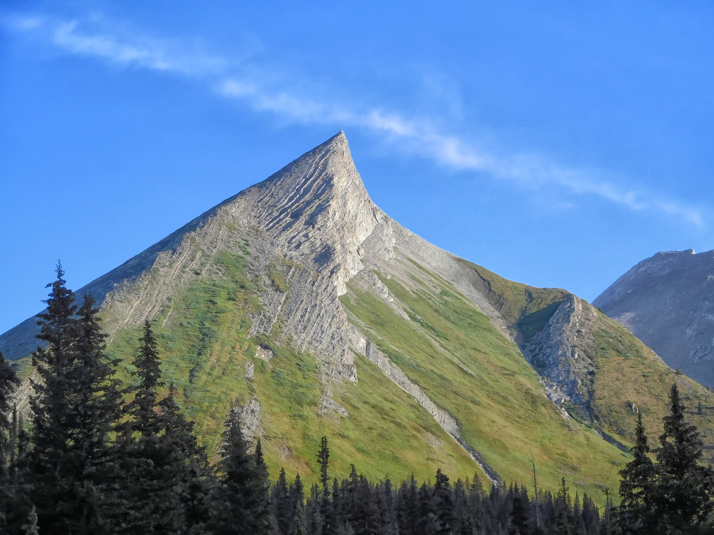
On the left side of the valley rises the southern outlier of the Pulsatilla Massif.
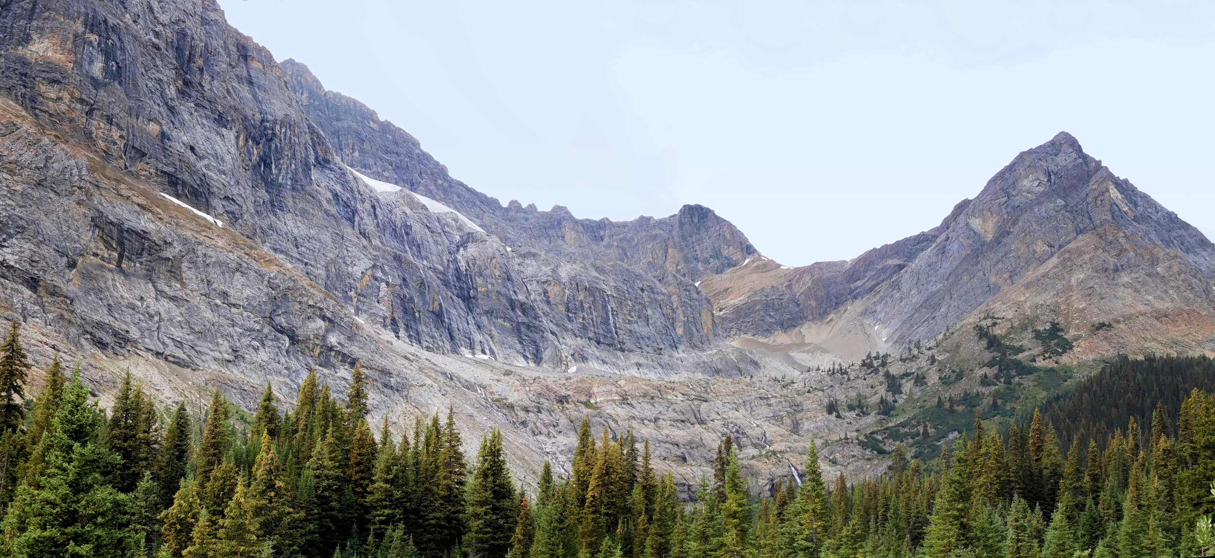
Pulsatilla Massif
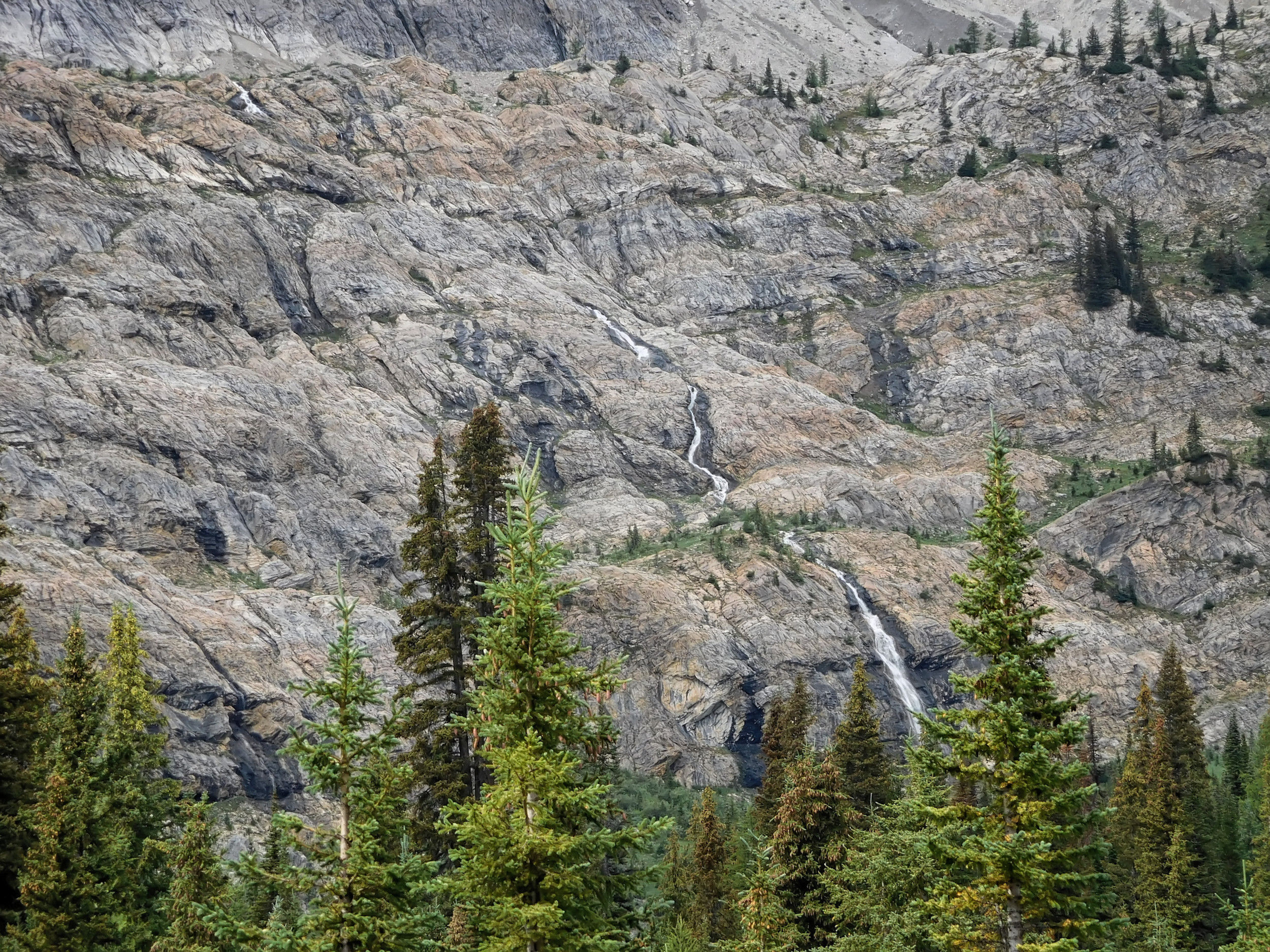
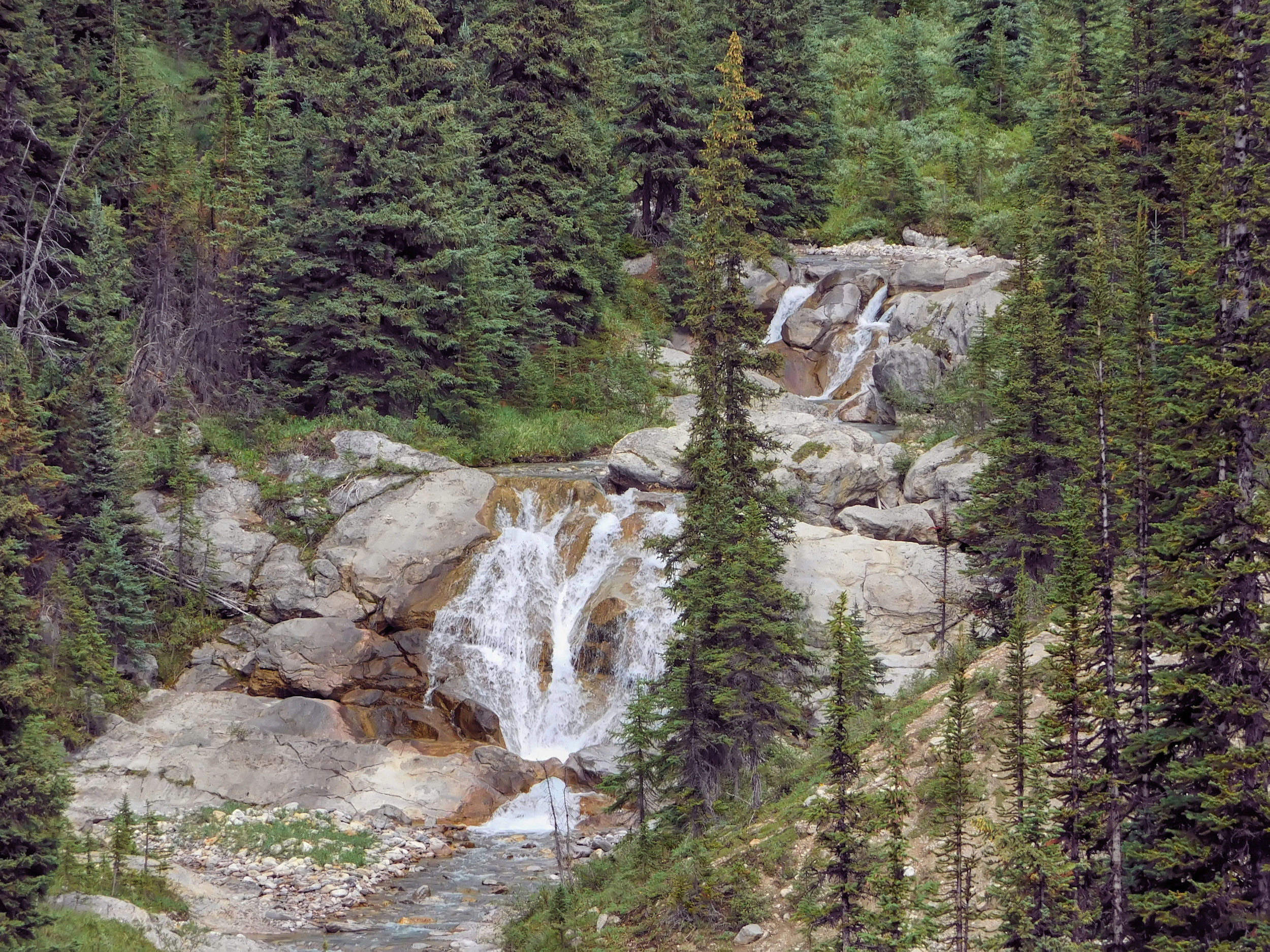
Waterfall on the Pulsatilla Massif
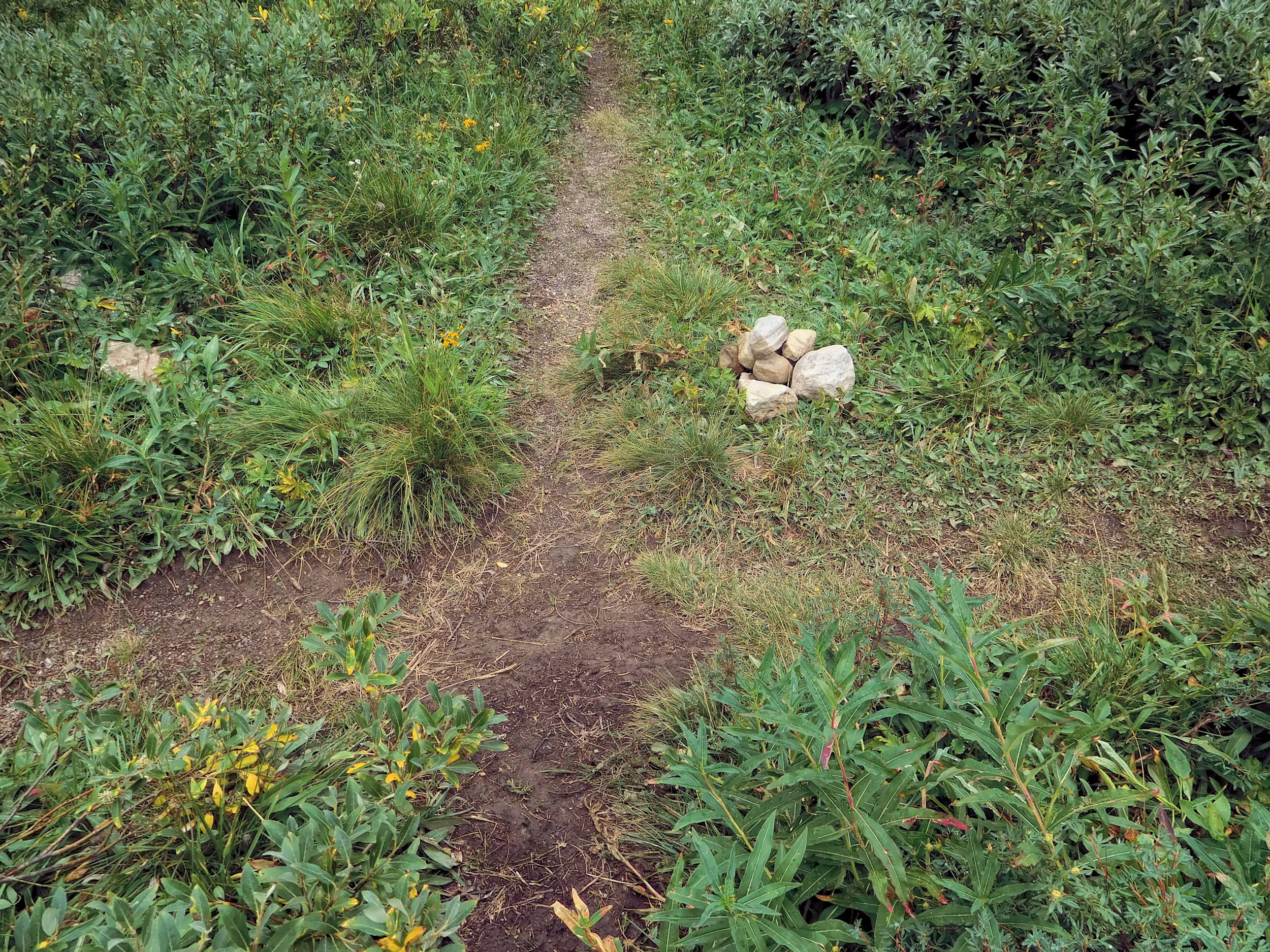
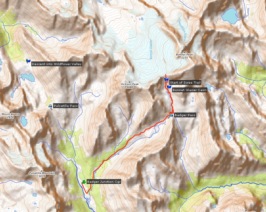
After a little more than two hours I reach Badger Junction campground. I almost miss the turnoff because it is only marked by a small cairn of light-colored rocks. At the first campsite I find a sign, but it is not visible from the main trail.
I like campsite number 3 best because it is sheltered by many trees. The bear-proof food lockers again have numbers and are specifically assigned to the tent sites, so you can use them as your own little pantry. For water I walk straight ahead at the cairn to a small trickle that carries just enough water to scoop up with a cup.
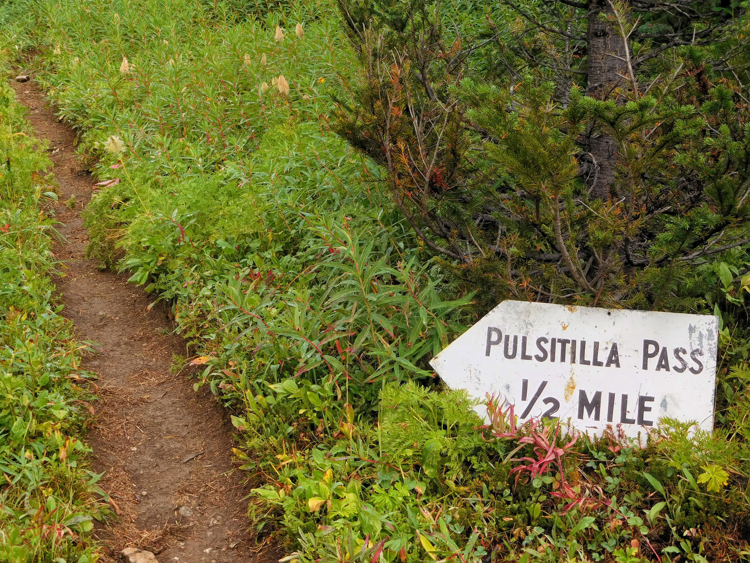
I have just pitched my tent when it starts to drizzle. It is only early afternoon and much too early to retreat to the tent. Luckily the rain stops soon and I grab my daypack for a walk towards Pulsatilla Pass. This pass is actually my destination for tomorrow, but it can't hurt to take a look around. At the cairn I turn right and walk along Johnston Creek. The creek has become shallow and forked. The trail splits into several tracks that follow the many rivulets. Eventually I arrive at a large channel where the trail ends. A rocky path winds up into the forest, but it leads back the way I came. The sky looks like rain again, my feet are soaked and so I give up for today.
The campground is still empty. Before the rain starts, I prepare dinner. Three other hikers arrive: two named Ken and the other one Olli. All three are Americans and have just met on this hike. They spent the night before at Wildflower campground, which is on the trail that connects Skoki Valley with Pulsatilla Pass. Their route followed Wildflower Creek through a densely forested valley notorious for its bogs and many stream crossings. Their hiking boots, pants, and gaiters look the part. I ask them for the way to Pulsatilla Pass. They suspect I may have missed a stream crossing, but after their own countless creek crossings that day, they cannot remember any details.
While the three are eating it starts to rain again and I retire to my tent. Olli comes by to get a second opinion on the water quality. He wonders if he should use the chlorine tablets he brought. He's from San Diego and in those southern climes clean spring water is not always a given. Here in the Rockies, just filtering the water is good enough.
We spend the rest of the evening in our tents as it begins to rain again.
| Distance | 13 km |
| Time | 4 ½ hrs |
| Min. Elevation | 2077 m |
| Max. Elevation | 2404 m |
| Ascent | 327 m |
In the early hours of the morning, another shower hits the tent. When it stops for a while I get up. The weather seems to be clearing; there are even a few blue patches in the sky. I have breakfast with the three Americans. We look at the GPS data on Olli's cell phone and I get an idea where I went wrong yesterday.
Upon leaving the campground, one of the Kens puts another layer of rocks on top of the cairn because the three of them had missed the turnoff as well. I leave in the opposite direction. The map on the sign next to the campground causes only more confusion. Someone has scratched out the supposed path to Pulsatilla Pass. Looks like I'm not the only one who gets lost out here.
A welcome sign
When the path and the stream begin to branch out, I keep to the far left and come to the creek crossing shown in Olli's GPS data. A short time later I reach another sign that reassures me that I am now on the right trail.
The forest ends and I walk uphill through the meadows. Numerous marble-like boulders line the path.
On the way to the pass
A huge boulder blocks the path that now winds around it.
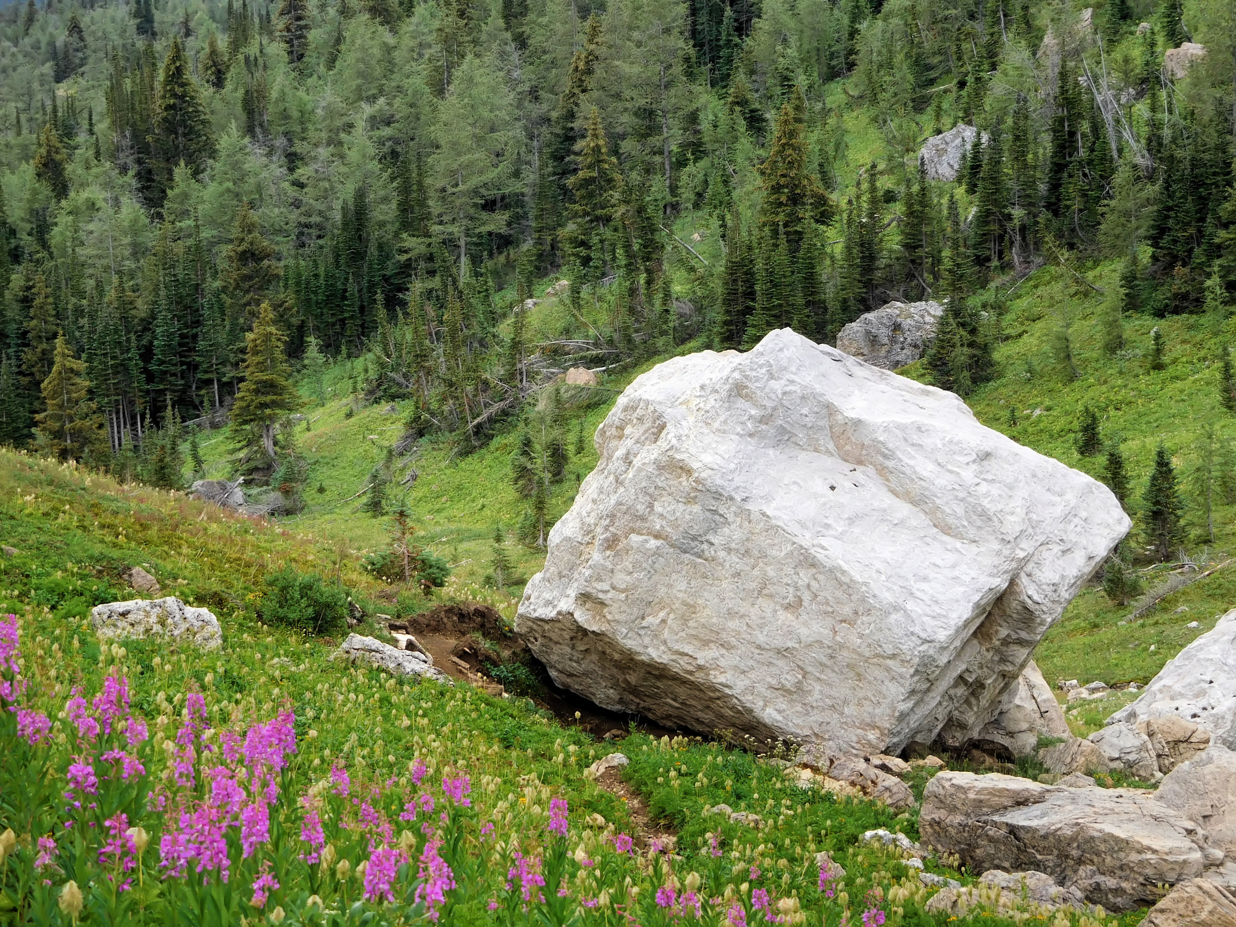
Huge boulder on the trail
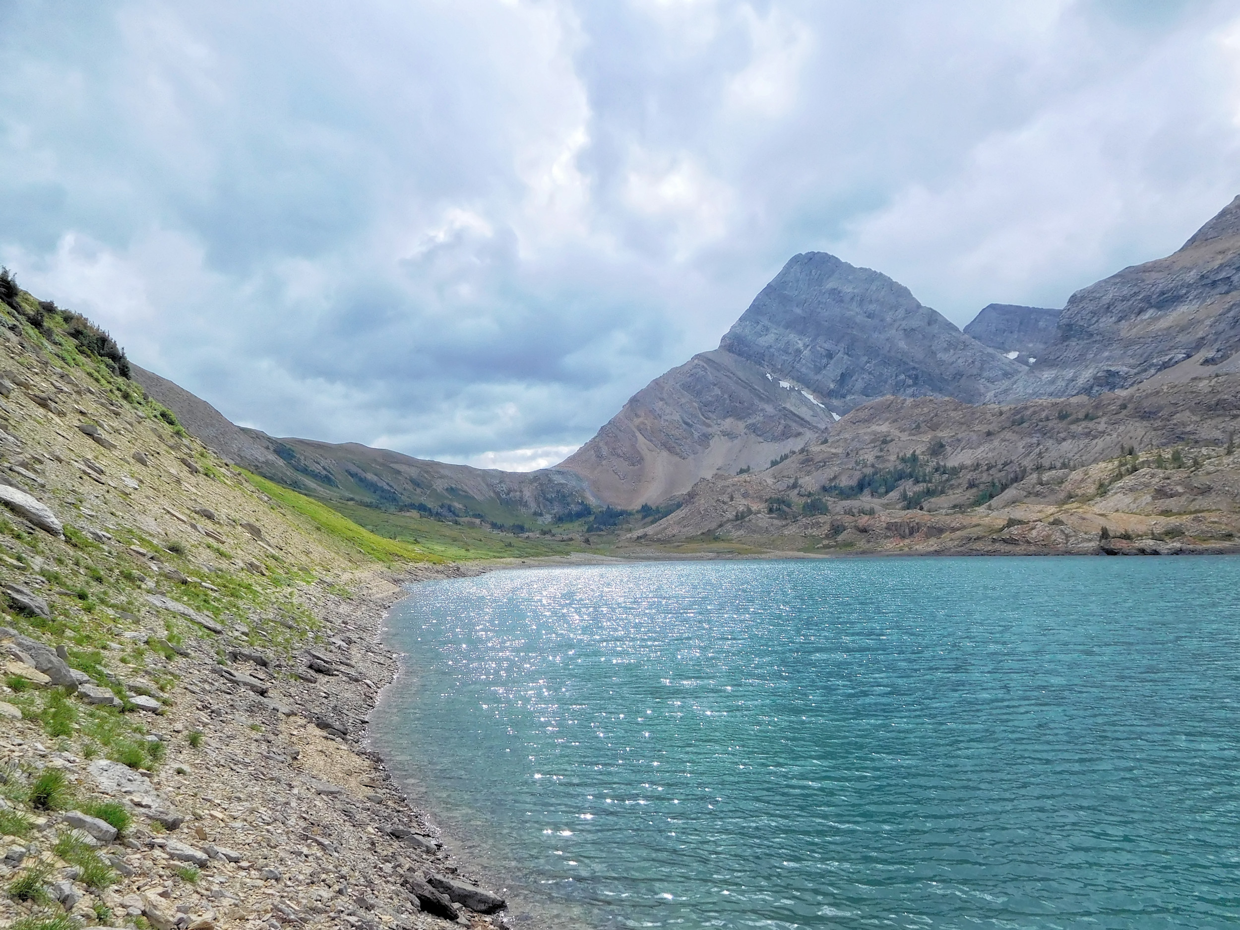
The last part of the climb to the pass is steep, but the reward is a fantastic view of Pulsatilla Lake.
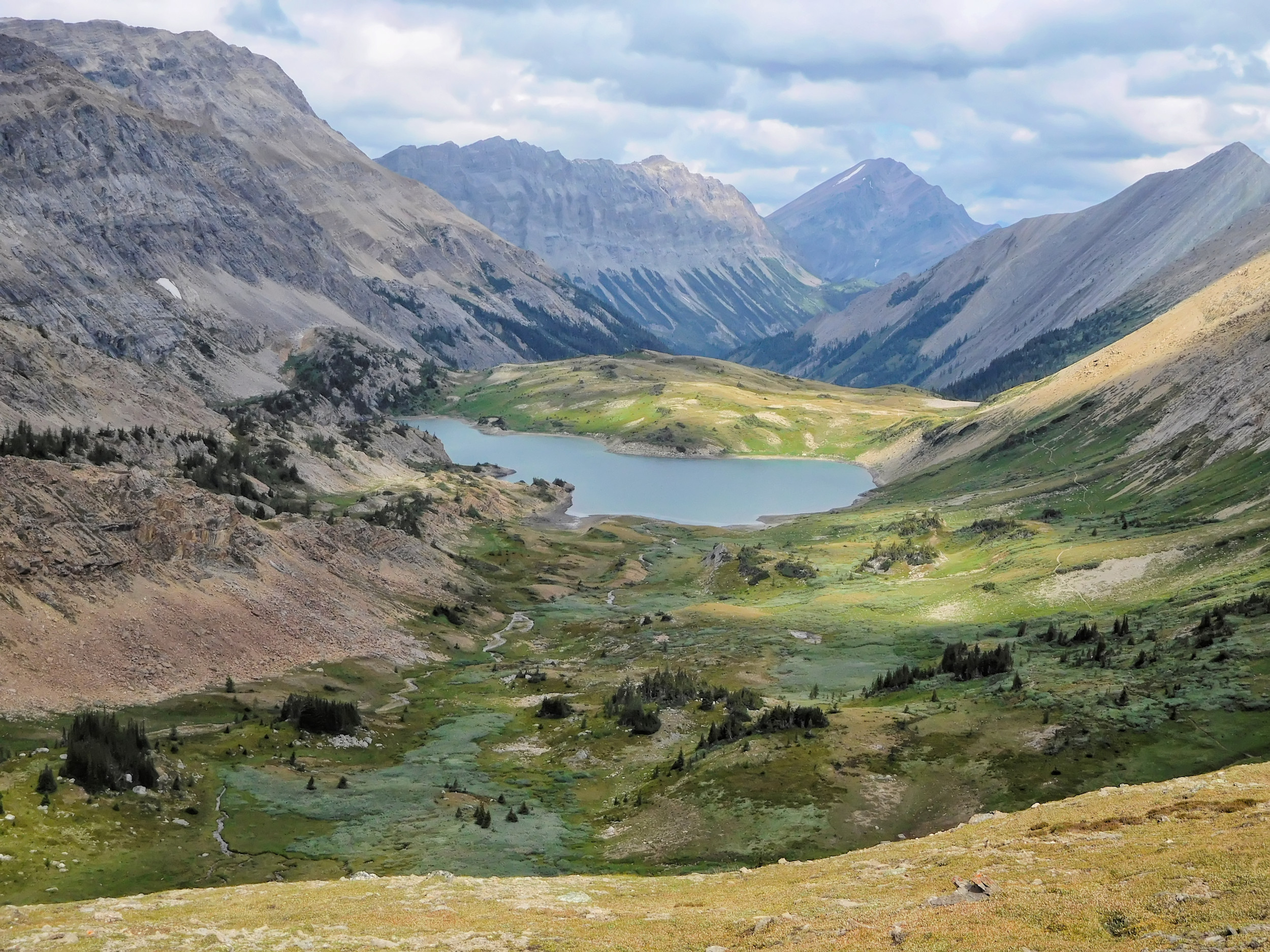
Pulsatilla Pass 2345 m
The weather is getting better. On the other side of the pass it is already sunny and the color of the lake is turning bluer by the minute. I hike down the pass towards the sunny skies. The path leads along the steep slope high above the lake. If you slip, you slide right down into the frigid looking water.
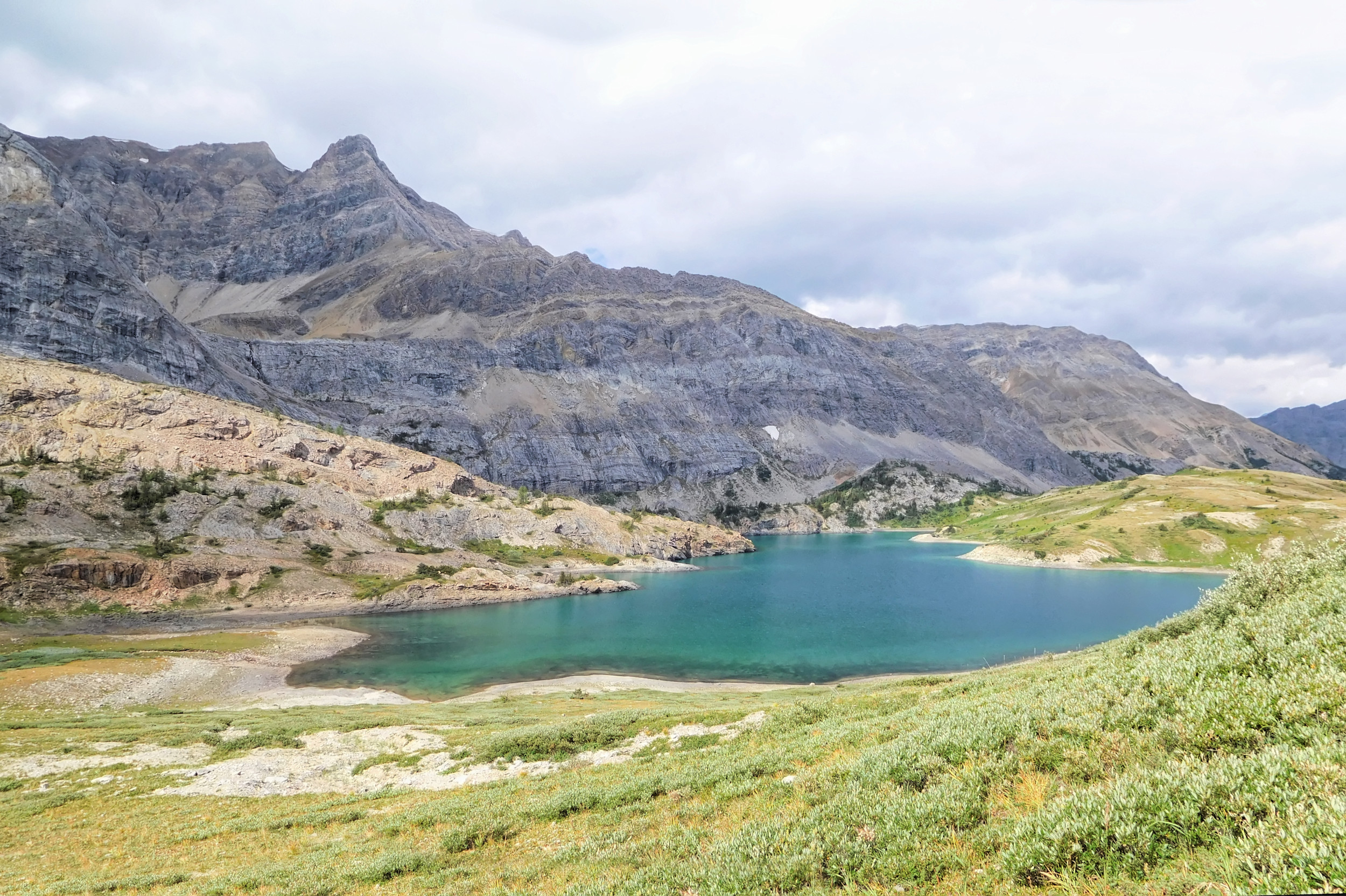
Pulsatilla Lake
A look back to the pass confirms that the sky is still gray there.
Looking back to Pulsatilla Pass
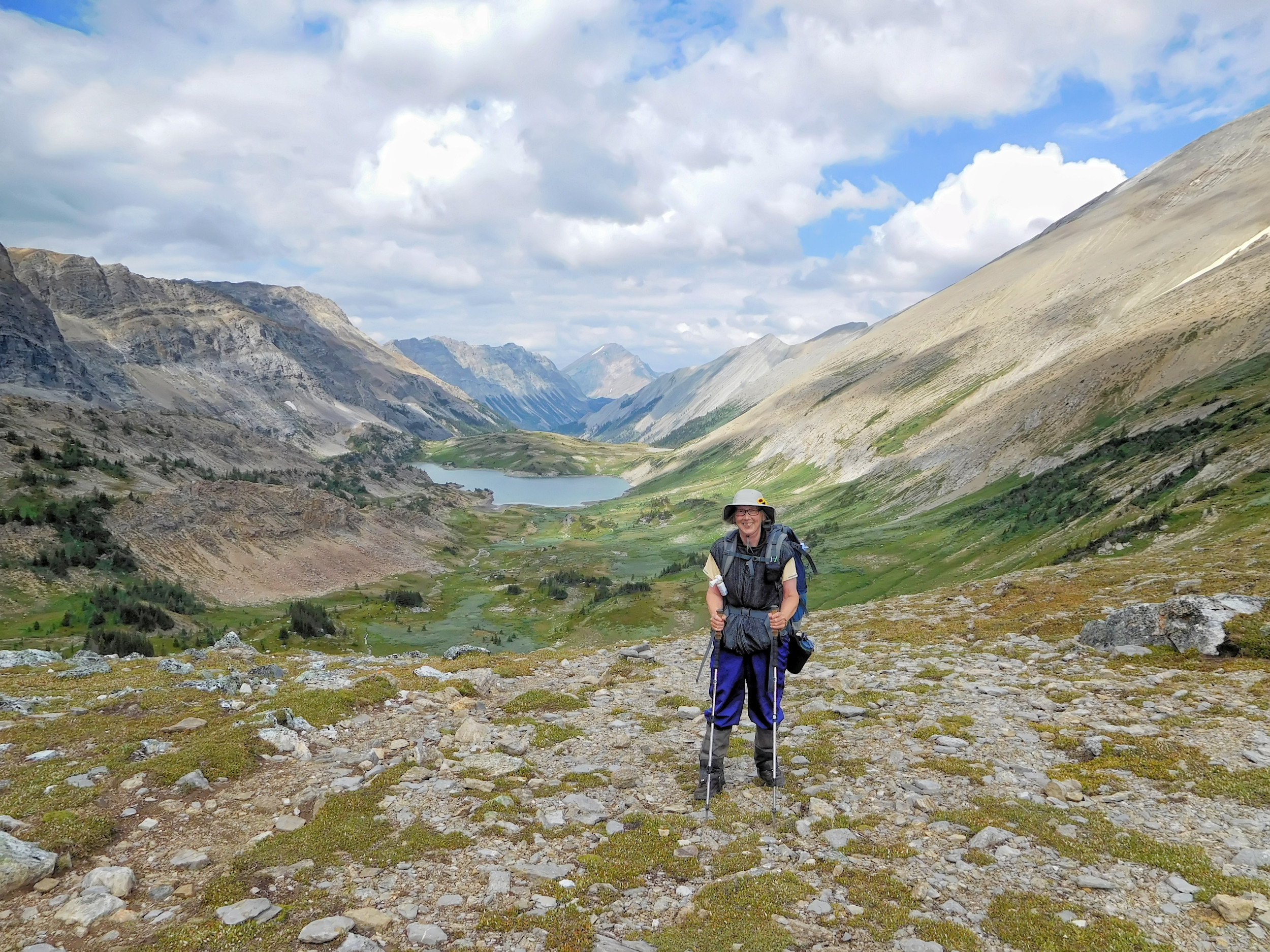
I hike to the end of the plateau where the descent into Wildflower Valley begins. It is my turnaround point for today and I take my lunch break there. The mountain in the distance is Fossil Mountain in Skoki Valley, where I hiked in the summer of 2020.
View over Wildflower Valley
On the way back I drop down to the lake to see if it is possible to walk around it.
Down to Pulsatilla Lake
Since the opposite side of the lake is very rugged and steep, I stay on this side and right next to the water to head back to the pass.
From a distance, I spot two men at the top of the pass and something bright and colorful flapping in the wind. When I reach them, it turns out that they are drying their tents and some other equipment. With the frequent rains, our conversation soon turns to the subject of waterproof gear. They swear by their lightweight low-cut hiking boots that get wet quickly but dry at least as quickly. My high-cut leather hiking boots protect my ankles better, but on this trip they have been wet since day one. We use the opportunity to take each other’s pictures on the pass.
While the two of them make their way downhill towards the lake, I take a long break on top of the pass. The weather is really nice now.
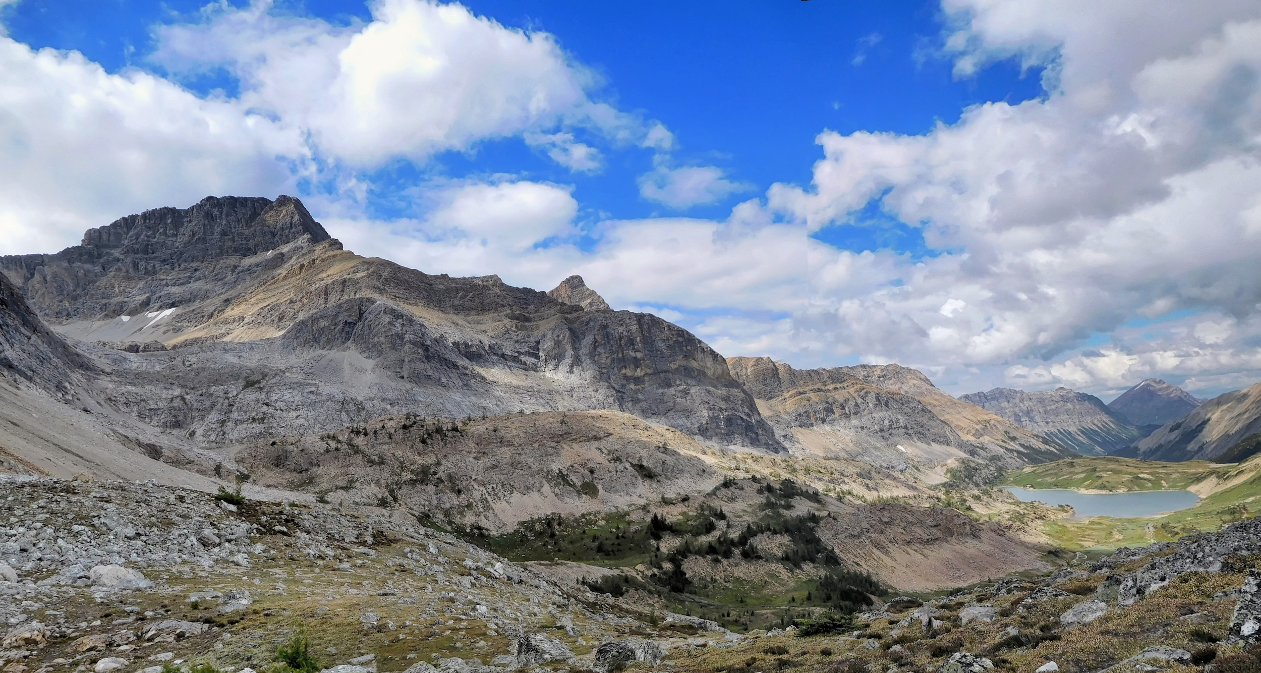
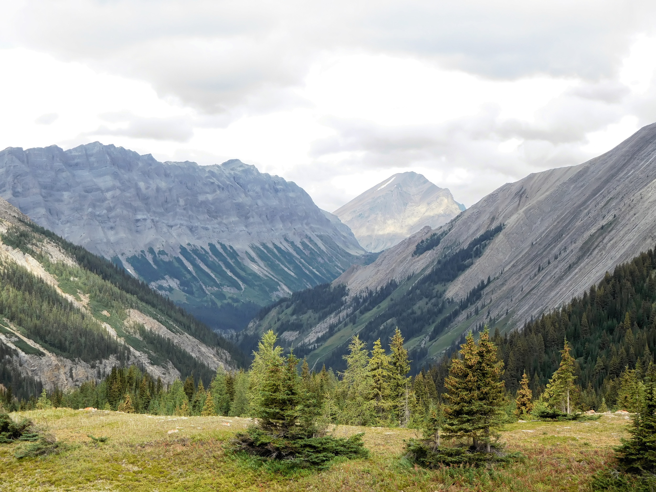
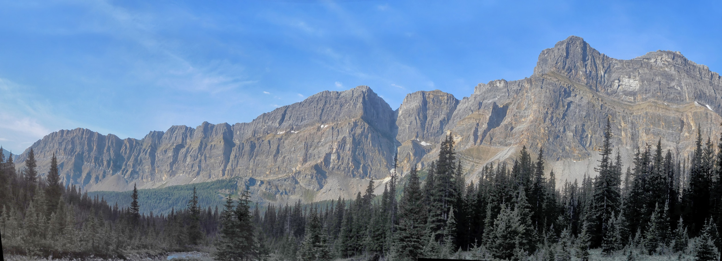
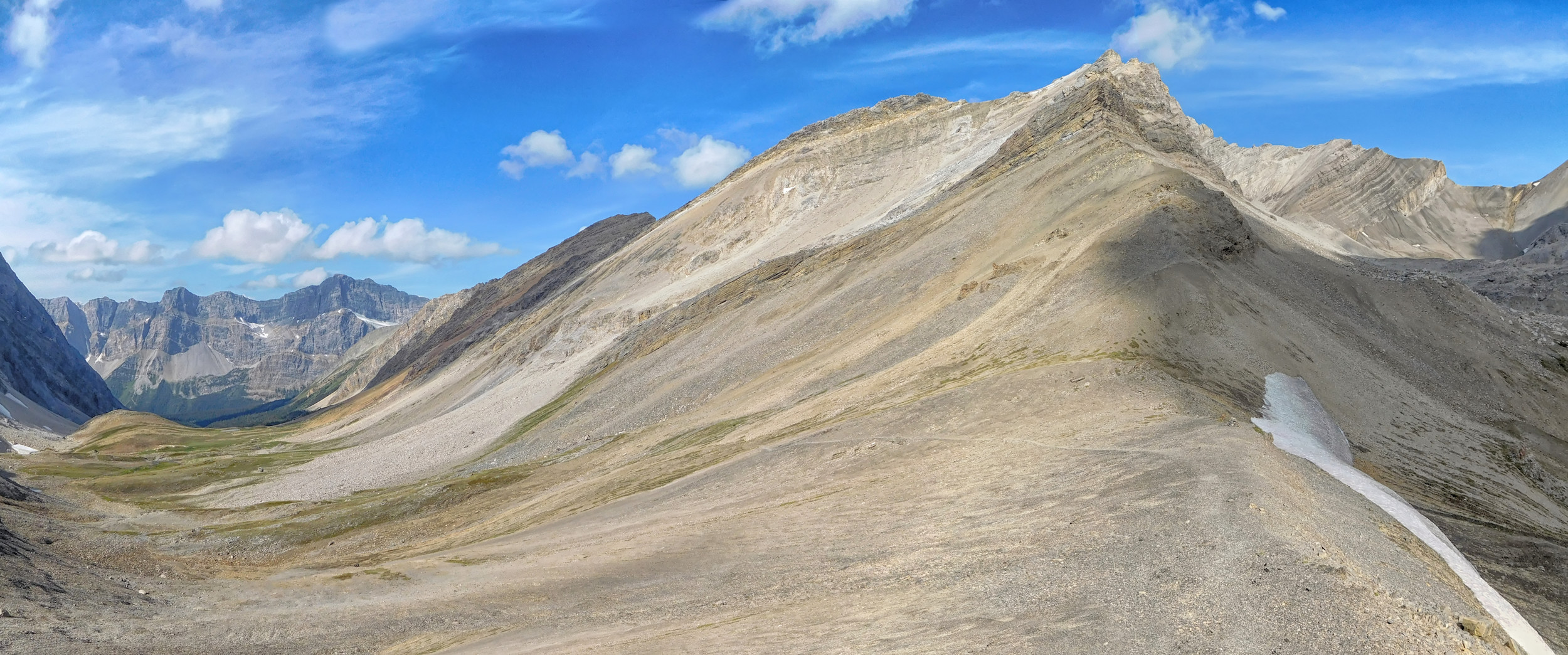
Eventually I pull myself away from this beautiful place to head back to Johnston Creek Canyon, where the sky is still overcast. The Sawback Range is impressive, even against the gray background.
Sawback Range
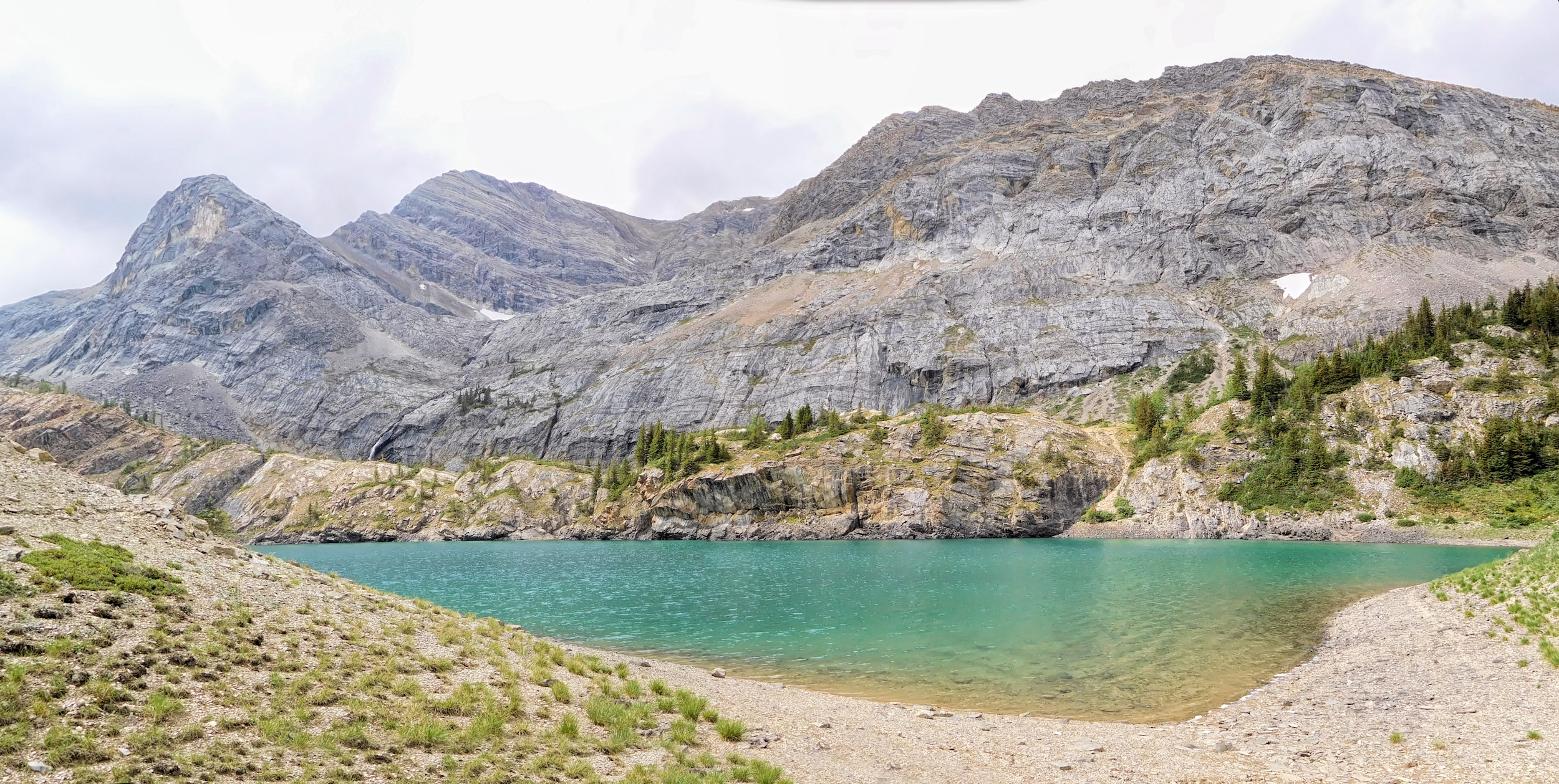
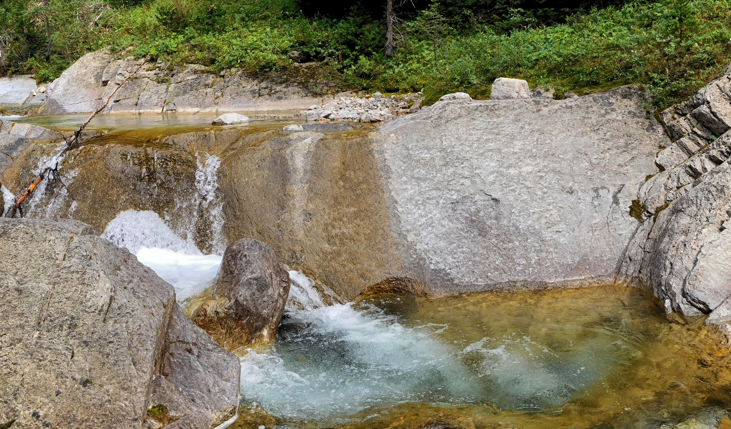
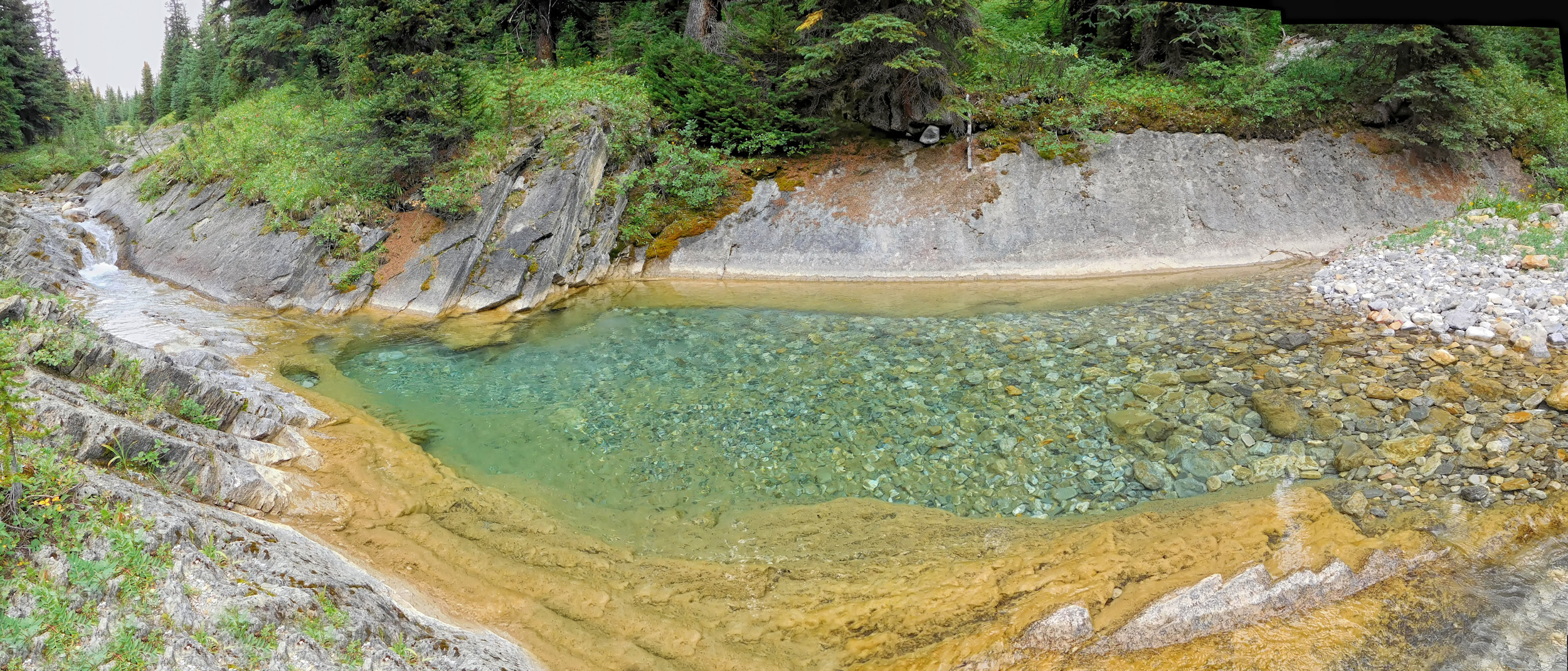
Here, so close to its source, Johnston Creek once more is at its most beautiful. The pools and cascades along this section of the creek are very pretty.
Not far from the campground I meet Cheryl, who is on her way to the pass. She is from Calgary and, like me, hiking alone. She is on a loop hike, so I might see her again later at Larry's Camp.
I spend a pleasant evening with a Kananaskis couple and their son, their two white shepherd dogs, and a young Austrian. The Austrian has come to Canada for the world championships in dodgeball and is taking the opportunity to hike. He does not have a tent, but spends the night in a hammock. The Kananaskis family is very adept at preparing dried camping food. The dishes they serve compare well to a high-end restaurant!
The evening chill finally sends us off into the warm sleeping bags in our tents. For the first time it’s a really cold night. The usual rain shower comes down, but it is short lived.
| Distance | 20.4 km |
| Time | 5 ½ hrs |
| Min. Elevation | 2069 m |
| Max. Elevation | 2911 m |
| Ascent | 842 m |
In the early morning everything is covered in dew, in some places it even looks frosty. Cheryl and the Austrian are also up early, and the three of us enjoy a quiet breakfast at sunrise. It looks like a dry and beautiful day, just in time for my trip to Badger Pass.
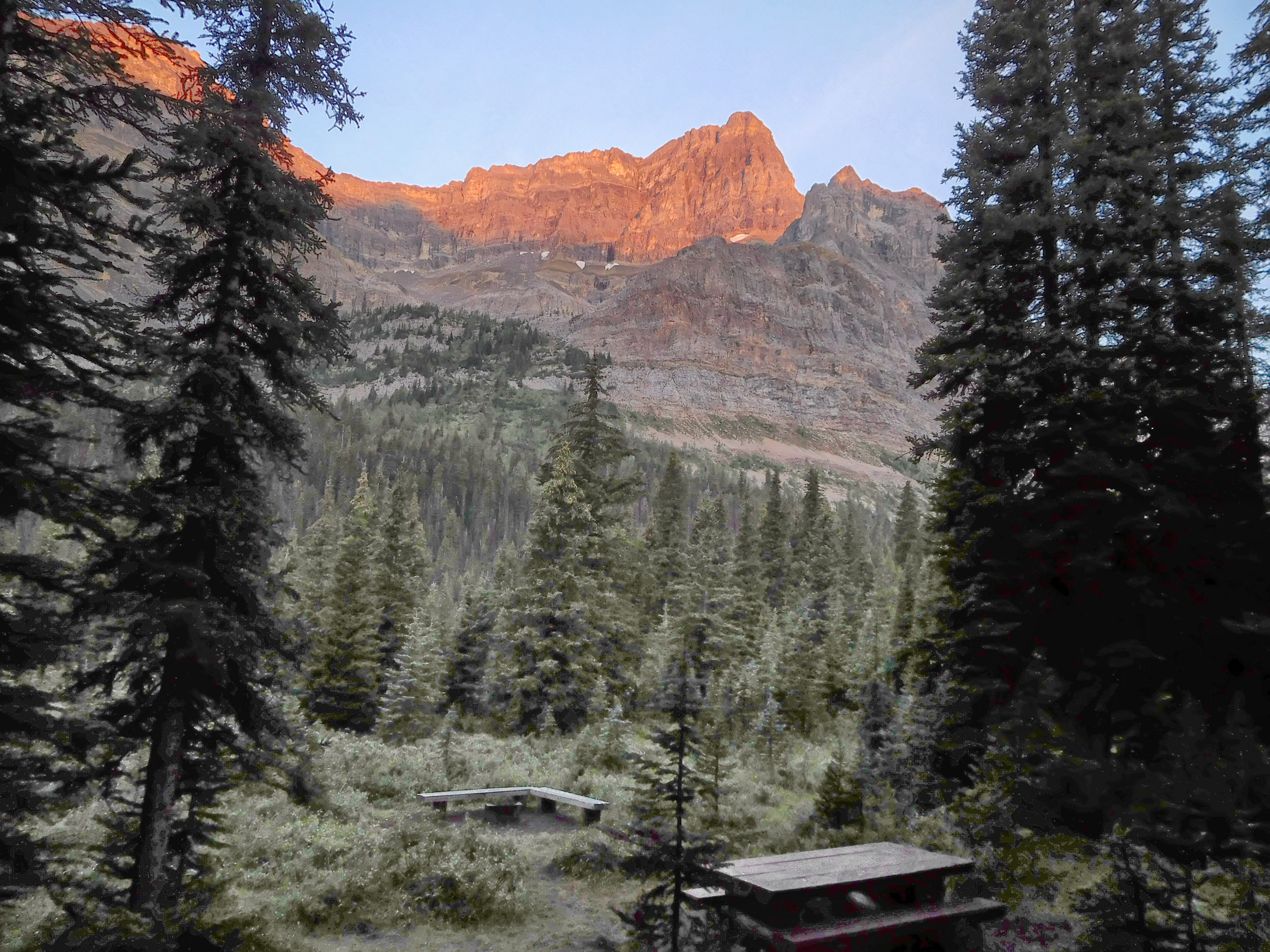
Breakfast at sunrise
Today I treat myself to a fresh pair of dry hiking socks. The others I tie to the outside of my backpack. Leaving them on the clothesline hasn't brought me any luck with the many rain showers we had.
Cheryl and the Austrian also want to go to Badger Pass today, Cheryl even further on the next stage of her loop hike. I am the first to leave and follow the main trail back to the signed junction, although the hiking guide says there is a shortcut from the campground.
Pulsatilla Mountain
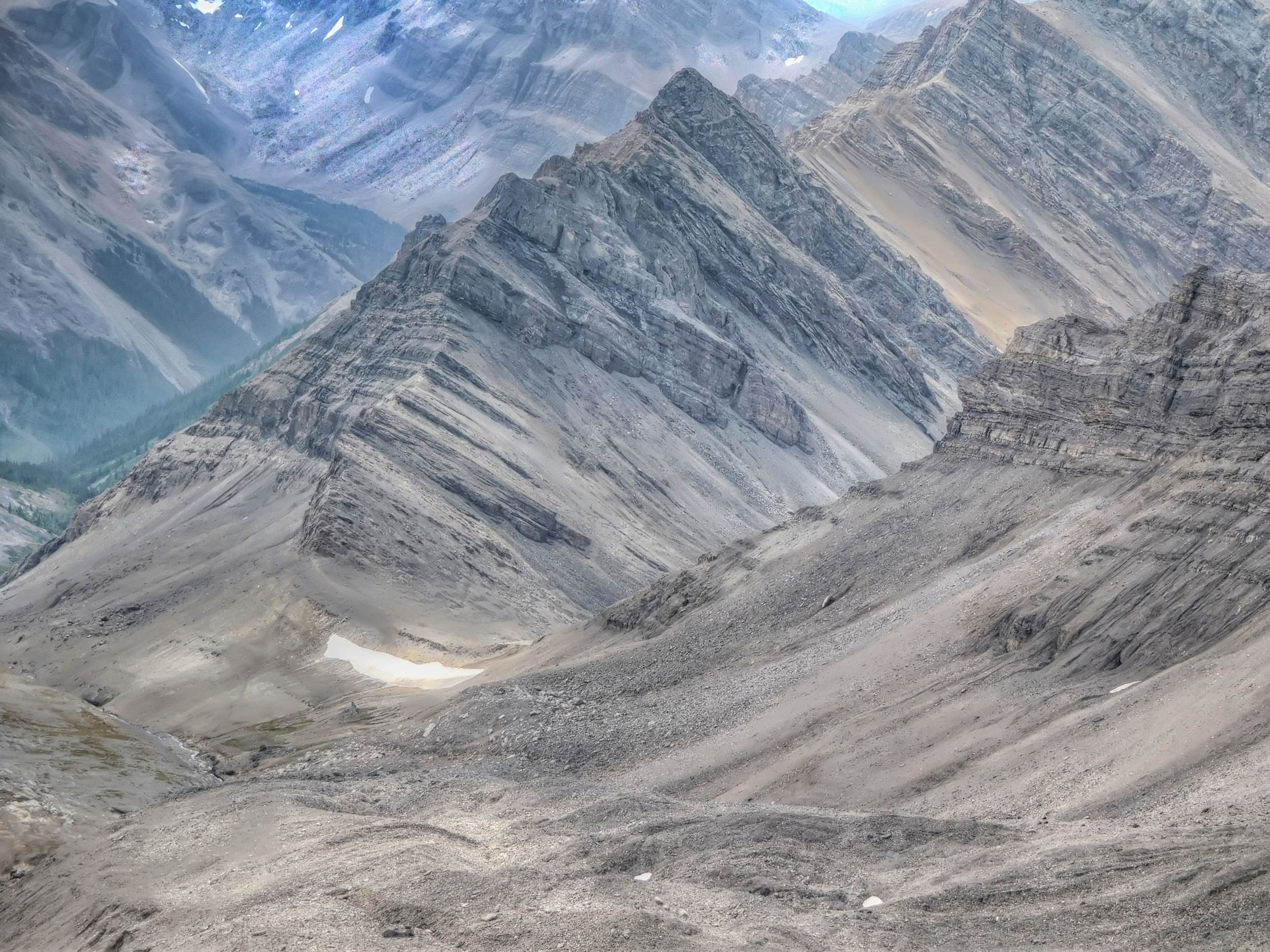
After the turnoff, the trail climbs the high bank of Badger Creek and then drops down to the water. A little further on, the trail is washed out for more than half a mile, but this section is well marked with cairns. A prominent unnamed peak, a spur of the Hickson Massif, dominates the scene. Across the valley is the Badger Peak Range.
Badger Peak Range
The path winds through subalpine forest: true bear country. Again and again I call and sing in order to at least announce myself to the bears. The weather seems to hold. There are a few clouds in the sky, but they are mostly passing by. At the edge of the trail a marmot is hiding under a rock. Badger Pass is said to be named after the badgers that supposedly live here. But I don't really believe that you can find badgers in the high mountains.
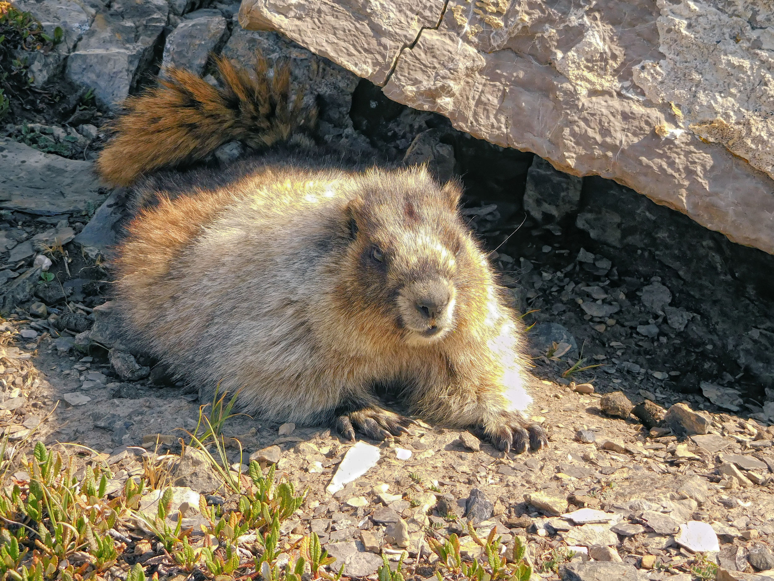
Not a badger!
The climb to the pass is gentle. The other side of the pass is much steeper than this one.
Badger Pass ahead
The view from the pass is impressive, a lunar landscape devoid of vegetation. At 2570 meters, the pass is one of the highest in the trail network of the Canadian Rockies.
Badger Pass 2570 m
Before I started on this trip, I had made plans to climb from Badger Pass to the next ridge, which in good weather offers a fantastic view of Bonnet Glacier. I can see my goal far above me, beyond the boulders, right above a patch of snow. Close to the top there is a boot-trodden track in the scree that I can just make out with my naked eye.
Route to Bonnet Glacier Ridge
It will be a long and tiring climb. But it is still early and the weather seems to remain stable today, perfect conditions for a little adventure. To be on the safe side, I set a time by which I will turn back at the latest.
From Badger Pass I descend steeply over slippery scree, dodging the cornice. Not a walk in the park for a long-distance hiker with a full pack, but fortunately I am carrying only the essentials today. Then I follow the drainage of the Cascade River upwards to its origin. It's not always easy to find a passable route between the boulders, and sometimes I lose sight of my destination. But you can't get lost, because it's always uphill.
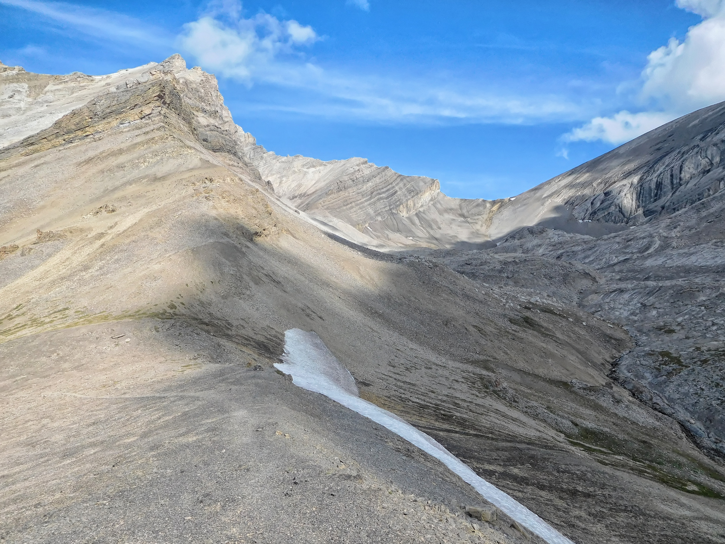
I am already panting, when I reach the path in the scree and the steepest part is yet to come. The track is so faint that even up close it is barely more recognizable than from afar. It is rather easy to walk on, but I have to catch my breath every few minutes. I am relieved when I finally reach the crest. The sudden view of the glacier field and the surrounding mountains blows me away.
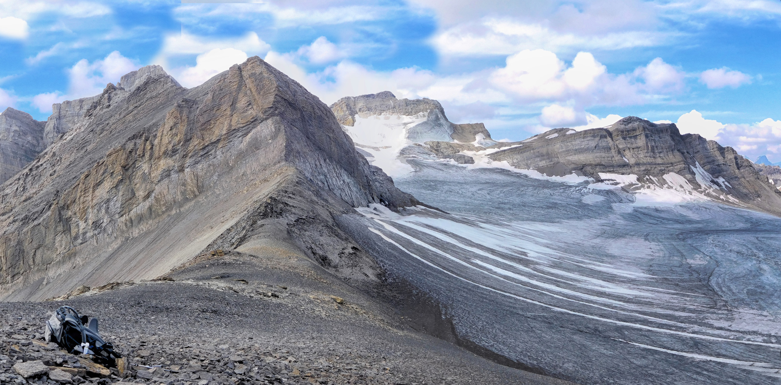
Bonnet Glacier Ridge
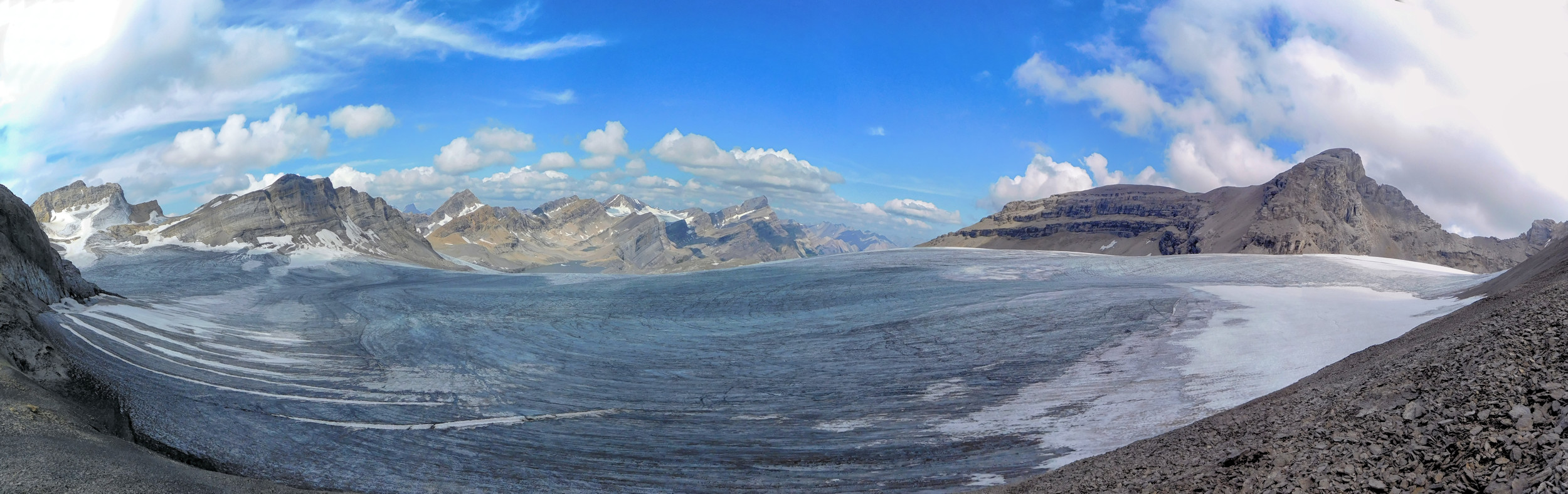
Bonnet Glacier
Hickson Peak 3080 m
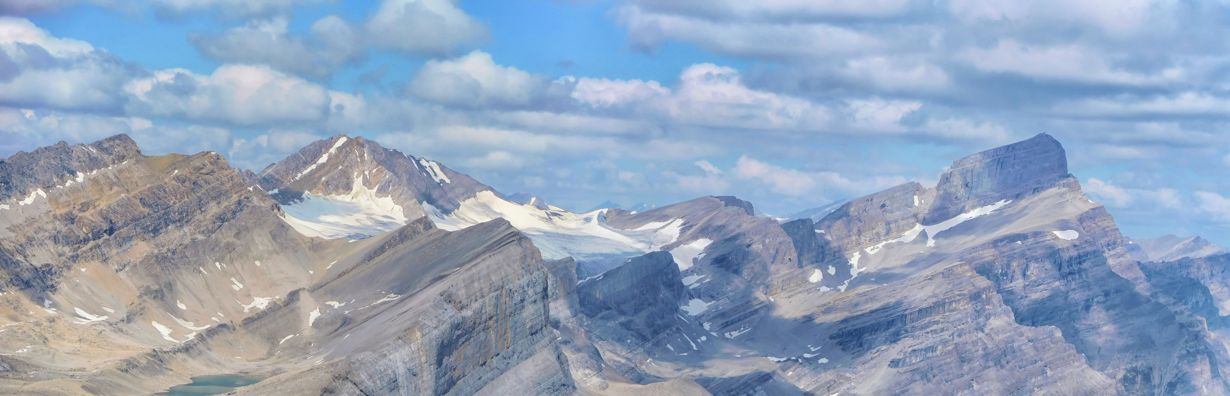
I didn't have time to take any pictures during the climb, but from up here you can clearly see the route I took.
Looking back to Badger Pass
Badger Pass Close-Up
From the ridge you could climb even higher, but I don't want to overdo it and push my luck with the weather. An altitude of almost 3000 meters should be enough, I don't know if I've ever climbed that high before.
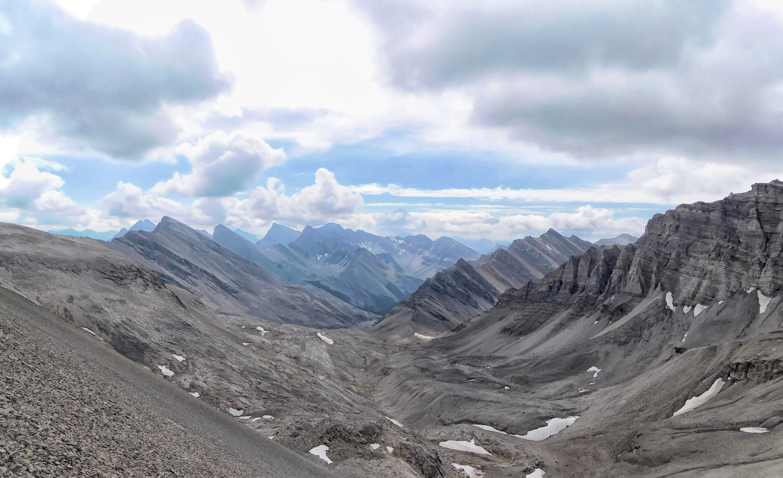
I don't stay on the ridge for long and make my way back to Badger Pass. The descent over the steep scree track is surprisingly easy and despite my worries I do not slip too much. On wet ground it would be a different story. An easier line through the drainage brings me back to Badger Pass in no time. From there down to Johnston Creek Canyon I walk very slowly, because now that I have safe ground under my feet again, I am in no hurry at all.

Back to Johnston Creek Canyon
I run into Cheryl who had a very unfortunate start from the campground. She followed the confusing sign and accidentally ended up on the trail to Pulsatilla Pass. She didn't realize she was going up the wrong valley for a long time and added at least two hours to her hike.
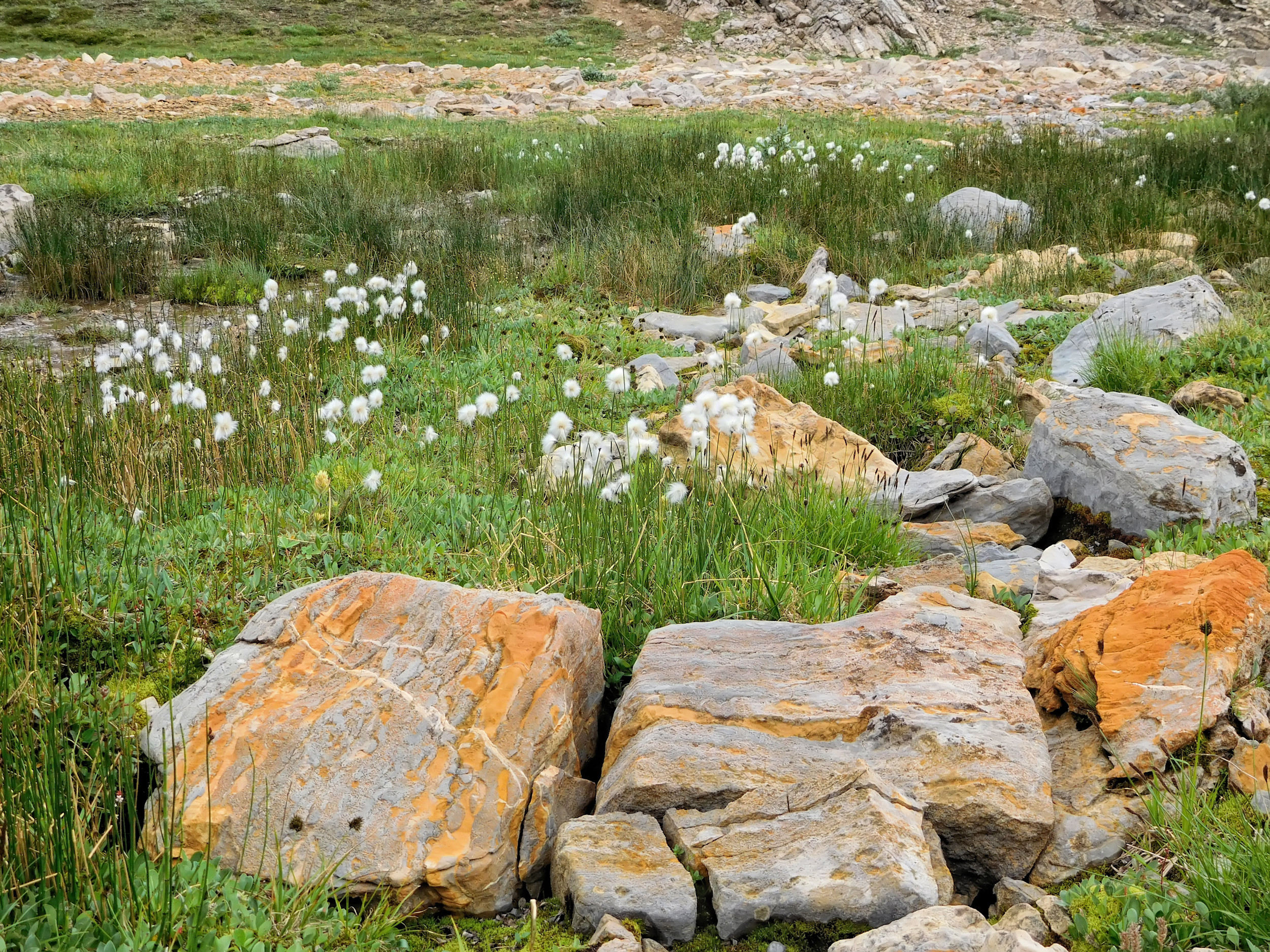
Cottonwood grass
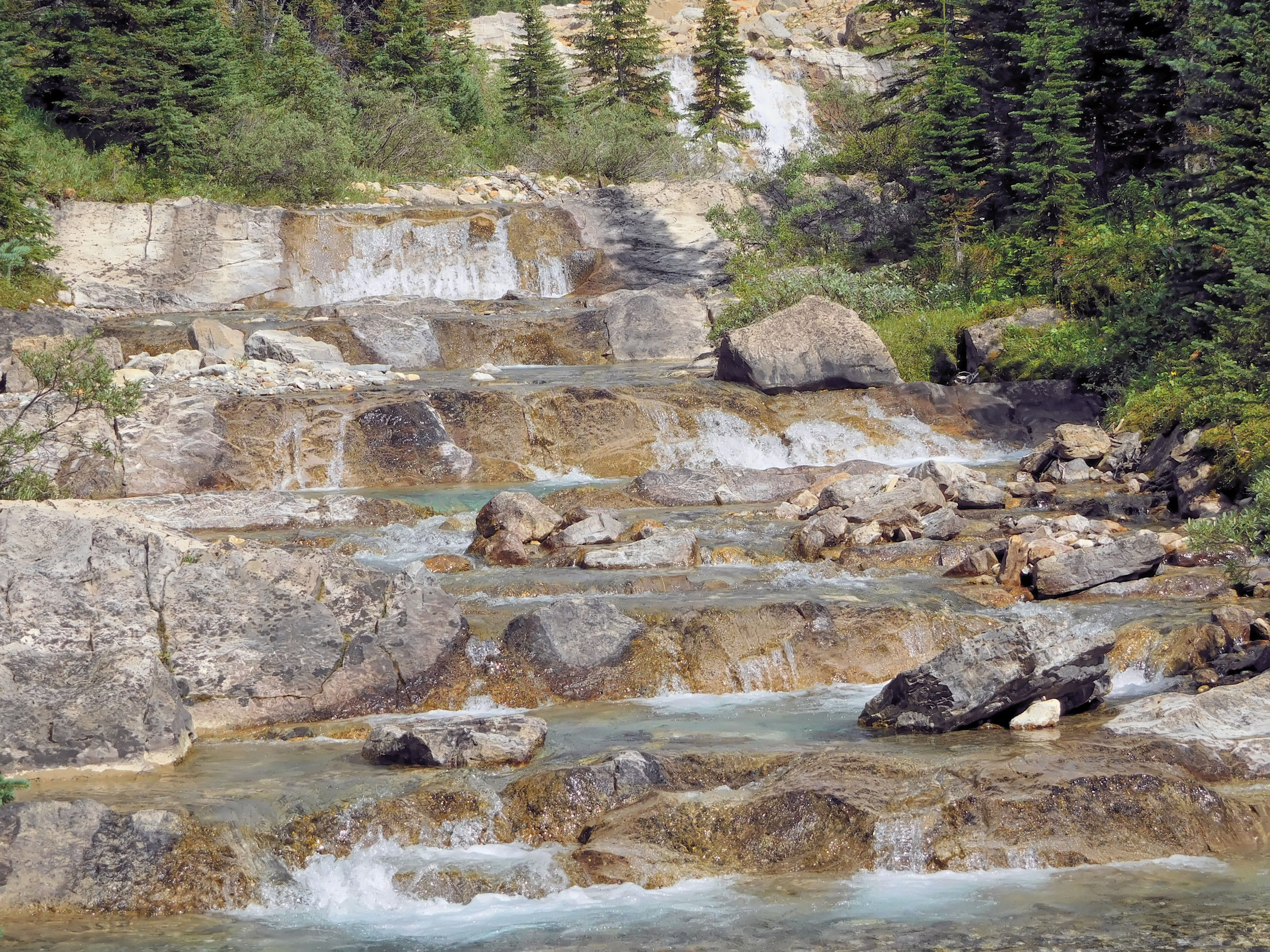
At a small side creek I rest again and filter fresh water. Badger Creek delights me with cascades and waterfalls.
When I arrive back at the campsite, I am exhausted but very happy. However, after constantly hiking in wet boots, I have developed a painful blister on my heel. The socks on my backpack have dried, but they are hard as cardboard and stink. At least the boots are a little less wet than before.
Three new hikers have arrived. They liberally use mosquito repellent, although there are hardly any bugs out today. Around six o’clock the good weather ends with another thunderstorm and heavy rain. I am tired anyways and go to bed early.
| Distance | 23.1 km |
| Time | 7 ½ hrs |
| Min. Elevation | 1429 m |
| Max. Elevation | 2098 m |
| Descent | 669 m |
The next morning, the weather gods are kind and I have breakfast and break camp without rain. But the sky is gray and the ground is wet. I take care of the blisters on my feet with band aids and tape. Then I walk down Johnston Creek Canyon. On the now familiar trail, I pass the Skyline Hikers’ teepee again.
This bridge has the steepest access of them all. I almost have to crawl up on all fours.
After a little more than two hours I reach the turnoff to Luellen Lake. I take a break and re-tape my blister. The foot does not look good. While I have a bite to eat, the three other campers from Badger Junction campground catch up with me. I recommend a trip to Luellen Lake to them.
It is still three hours to Larry's Camp. By now the sun is out again, but two hikers coming from the trailhead have a forecast for more bad weather tomorrow. I consider canceling my planned day trip to Mystic Pass.
Upon arriving at Larry's Camp, I read in my hiking guide that the trail to Mystic Pass climbs 530 meters and is very steep. All the while, the blister on my foot hurts with every step, especially going uphill. And then there's the bad weather forecast - no, I'll leave the trip to Mystic Pass for another time and hike all the way out to the parking lot today.
But first I want to dry the tent, so I string up a clothesline in a sunny spot next to the outhouse. As soon as the tent is flapping on the line, I hear thunder. Another storm is coming. With lightning speed (pun intended) I pack up again and put the rain cover on my backpack. Although it is pouring, I don't even put on my rain jacket. I can change later at the car. I shelter in the trees for about twenty minutes until the rain diminishes a little.
Finally I set off. It continues to rain and, of course, I get drenched to the skin. Behind the Inkpots I meet a couple from Quebec, the only visitors right now and also caught by the thunderstorm. On our way back to the parking lot, the rain stops as suddenly as it started. The well-built trail has suffered quite a bit: trees are lying across and the large puddles have turned into lakes.
When I finally get to the car, I put on some dry clothes and make myself something hot to eat
On the drive home, I get caught in another deluge between Golden and Revelstoke. At the construction site near Golden, mud and rocks are being washed onto the road. Later I learn that on my original return date, a serious accident closed the highway here for a day and a half. Once again I am lucky and make it home safely.
My hiking summer had some extremes: scorching heat and lots of mosquitoes at Sunset Pass and Floe Lake, and then the soggy conditions here. Luckily, most of the rain fell at night. I had another beautiful and memorable adventure, with the side-trip to Bonnet Glacier as an absolute highlight.