 To BanffJuly 21

640 kilometers in 8 hours
It's a miracle that my 2020 hiking trip can take place at all. When I booked in January, the world was still fine. Then the pandemic began, and all national parks, campsites and the backcountry stayed closed between March 25 and June 22. The backcountry is open now, but with the cold temperatures in early summer snow still lingers in the alpine areas of the mountains, especially on the passes. I take my chances and leave for my summer trip as planned.
My preferred hostel, Castle Mountain Wilderness Hostel located between Lake Louise and Banff, is closed, that's why I'll be spending the night at the HI hostel in Banff before heading out into the backcountry. The drive to Banff is about 600 kilometers and takes about eight hours including breaks for eating and refueling. The weather is good. I left early and arrive at the hostel in the afternoon. They have put only two people In the six bed room. Using the kitchen needs an advance booking, but that's not a problem as the hostel doesn't have many guests at the moment. I still have time to walk into town. The hostel is a long way out near Tunnel Mountain campground, so the walk gives me some exercise after the long drive.
At dinner time it is much quieter in the hostel kitchen than I'm used to. Only one other group of three is in my time-slot. You talk a little, but otherwise you have to avoid each other in order to keep the prescribed social distance. After supper I walk an evening round on the Hoodoos trail near the Bow River that my roommate recommended to me. I go to bed early; tomorrow will be a busy day.
| Distance | 23.4 km |
| Time | 6 hrs |
| Incl. Breaks | 7 ½ hrs |
| Min Elevation | 1646 m |
| Max Elevation | 2362 m |
| Ascent | 716 m |
| Cum. Ascent | 1655 m |
| Cum. Descent | 1312 m |
In the morning the hostel kitchen remains closed. Guests are invited to a free pancake breakfast at the hostel restaurant. I cannot stay around for that because by eight o’clock I want to be on my way. Staff opens up the kitchen area for me so I can retrieve my food from the fridge. I am having a quick breakfast in the car.
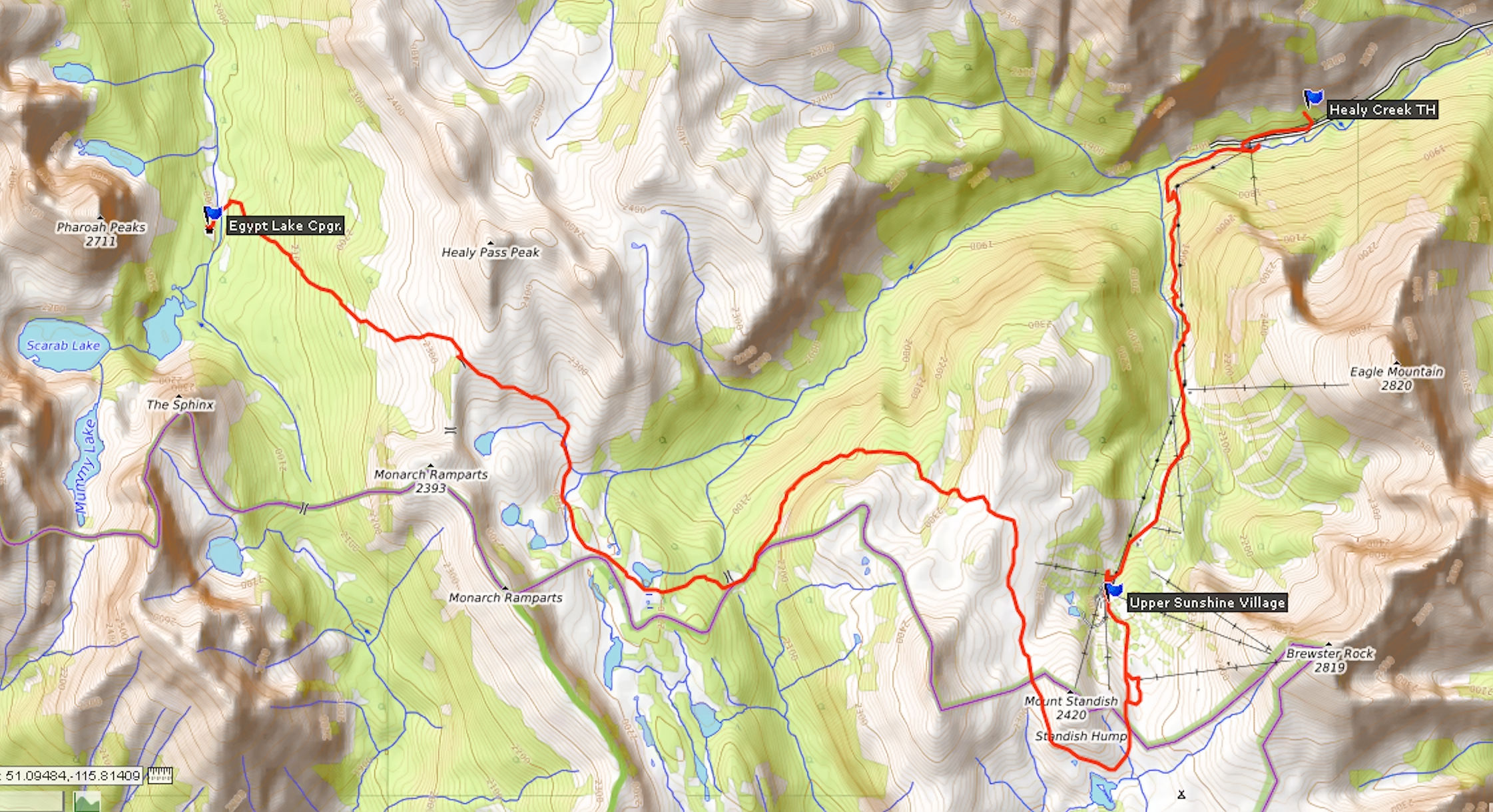
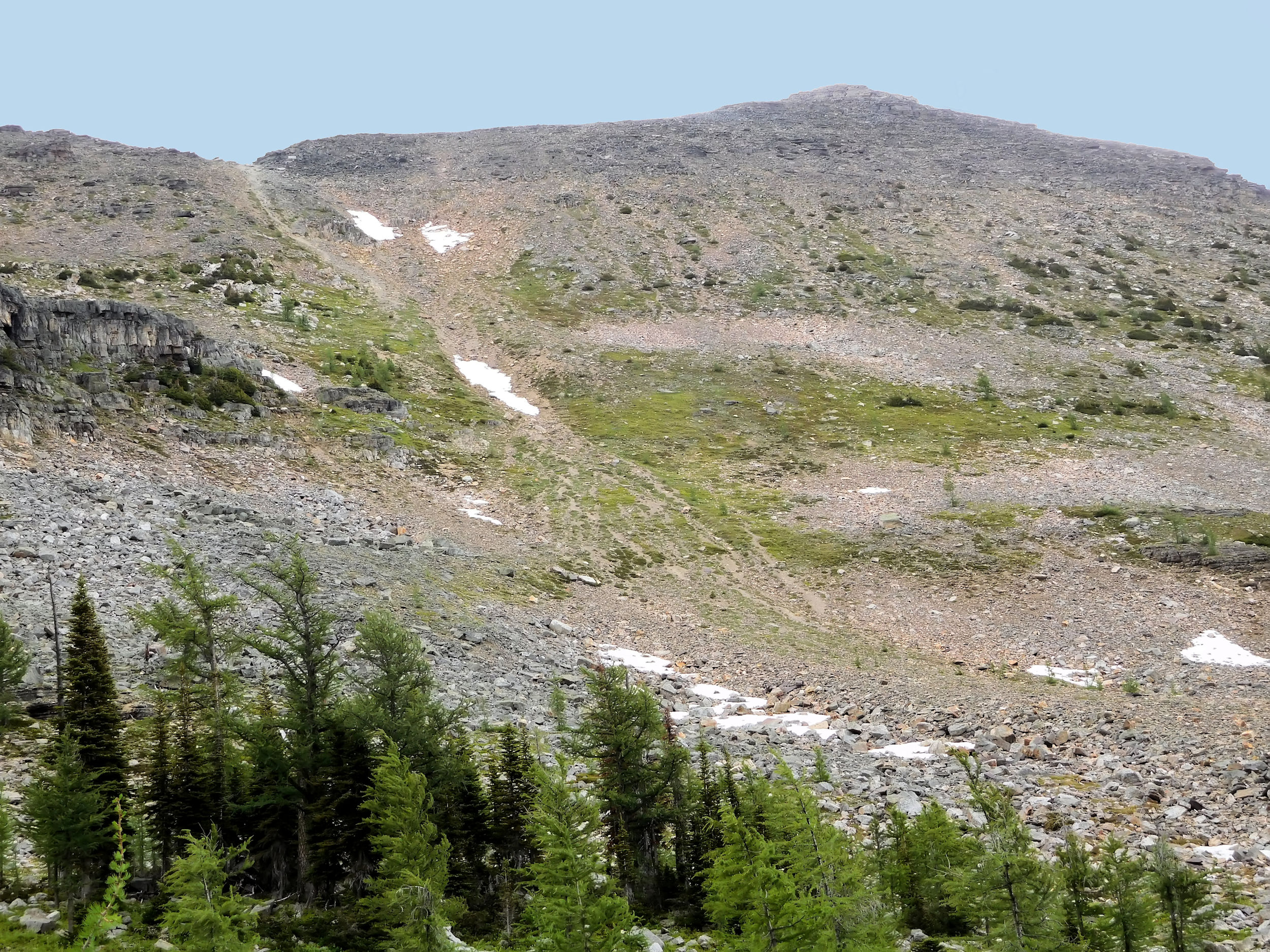
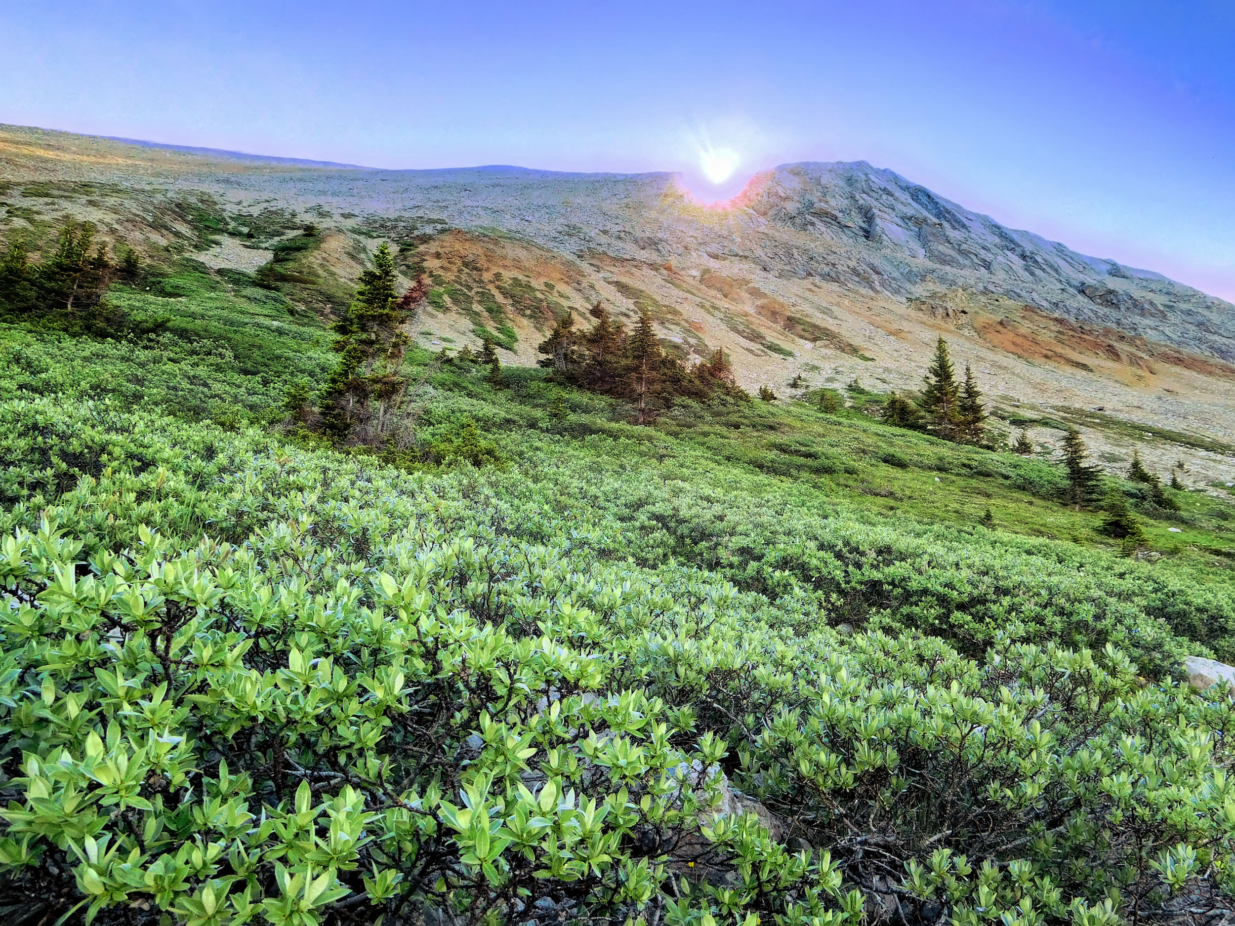
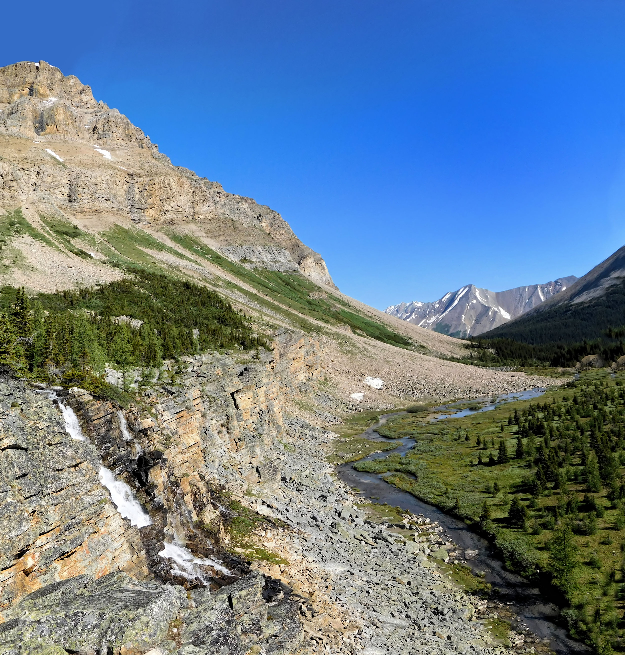
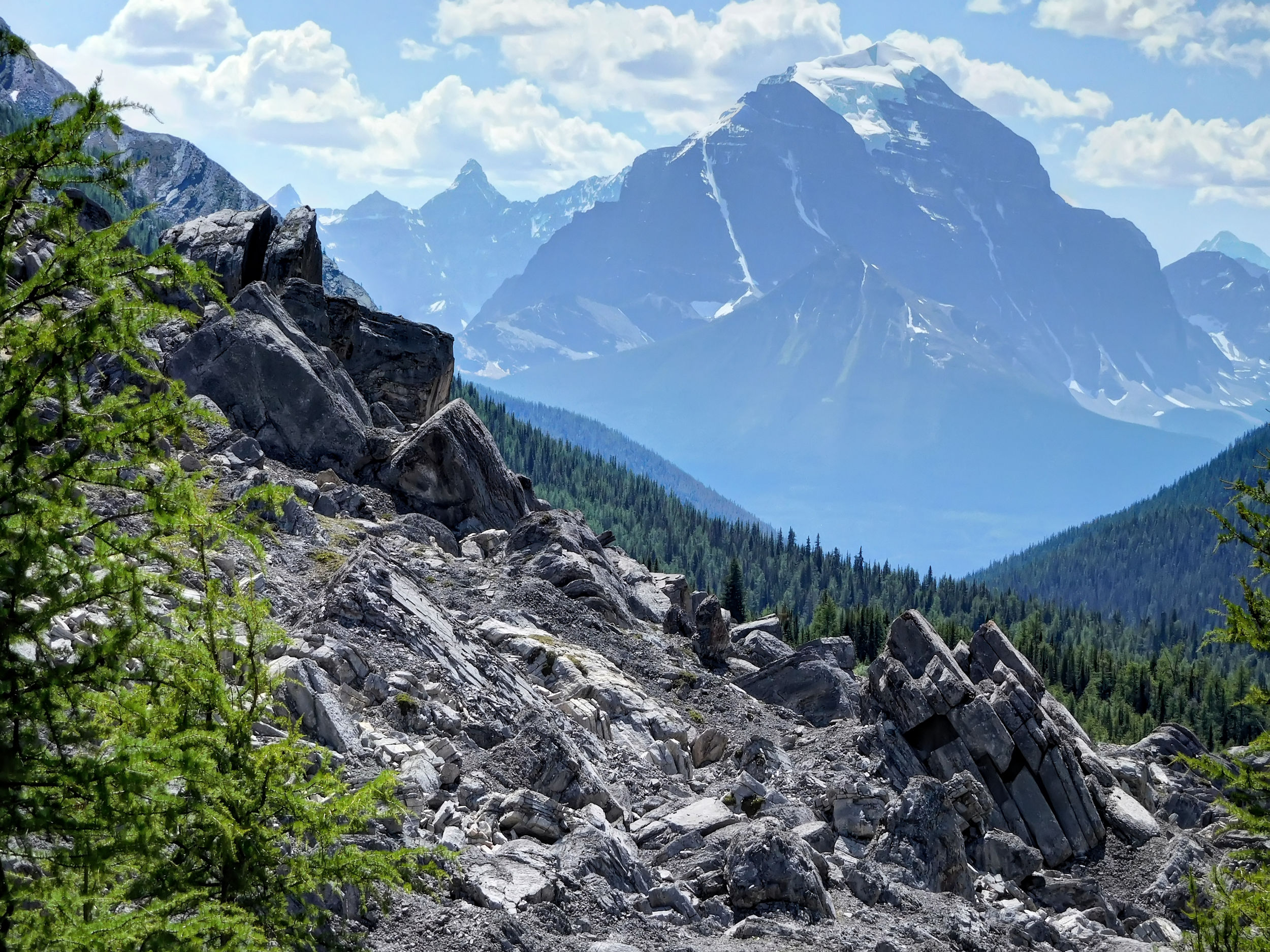
I leave Banff and drive 9 km west to the turnoff of Sunshine Village Road. This road winds uphill for some 8 km to the base station of the gondola that connects Sunshine Village to Upper Sunshine Village. In the winter Sunshine Village is a busy ski-area and in the summer it is famous for its wildflower meadows. This summer the village remains closed and the gondola is shut down. It means that I have to walk the 520 meter ascent. I have the choice between either ascending the steep service road that follows the gondola for 7.2 km or hiking the longer and less steep Healy Creek trail that follows the creek through dense forest. It is sunny and there is a good chance of views, therefore I pick the more tedious route along the service road. This will also allow me to hike a loop over Simpson Pass instead of going in the same way that I’ll return in a couple of days.
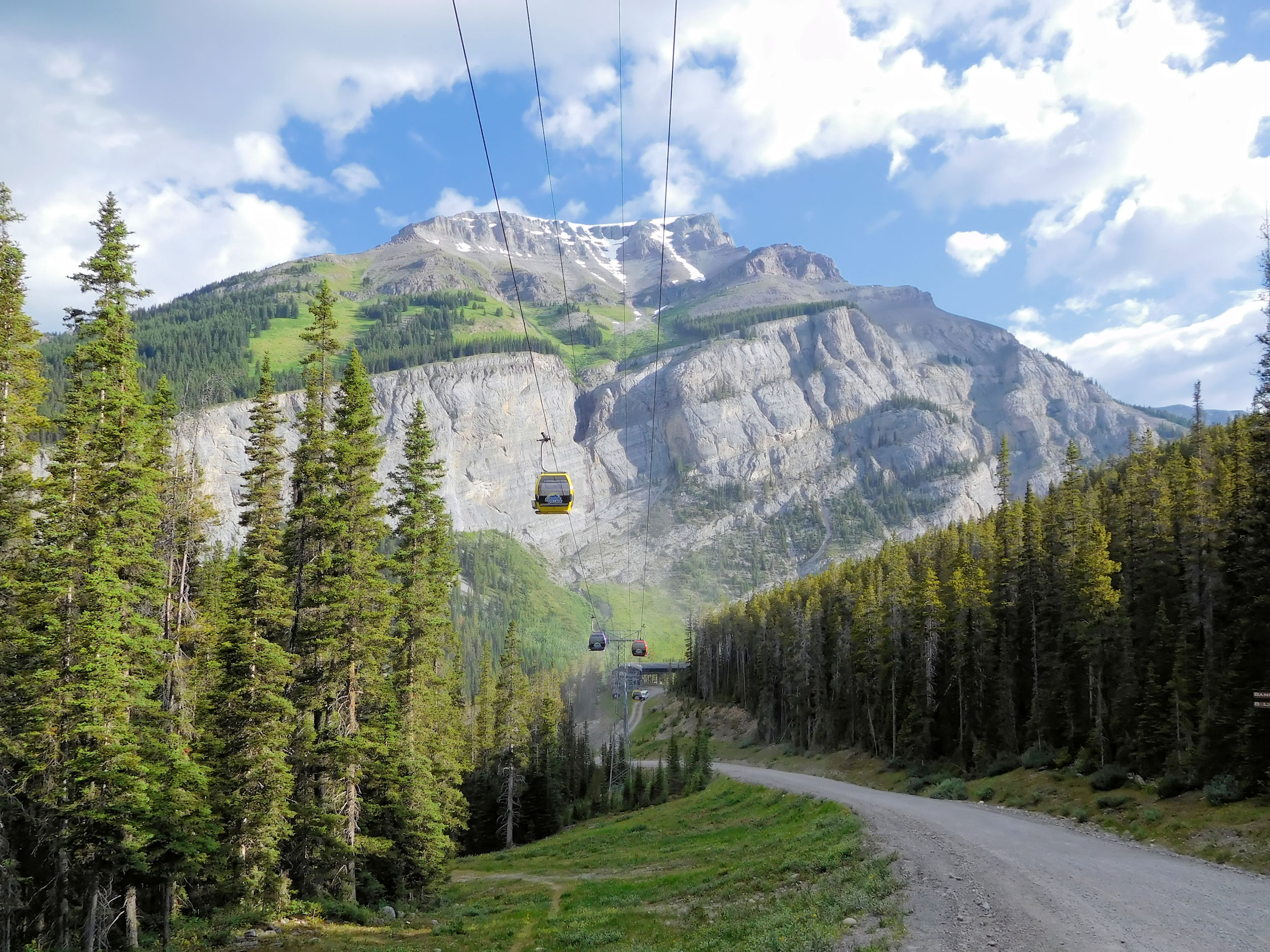
In 2020 the gondola stands still
I put some last minute items into my backpack. I am bringing food for only two nights, so it weighs only 16 kg. Still it needs quite an effort to position the big pack onto my back. The service road is quite wide and has many switch-backs. The rough gravel makes walking tiresome, and the service trucks that pass me slowly cause a lot of dust. The views are rewarding, though. I cross below the cables several times, when suddenly the gondolas start moving for what I assume is a test run. I wish they could take me along for the ride.
In spite of my early start, the sun is getting strong and I feel quite hot when I reach the Upper Sunshine station after about two hours. The village looks very untidy, as if everything had been abandoned in a hurry after winter. There is not a single sign for hiking and nobody is up here whom I could ask for directions. My GPS suggests a small steep trail to the far right of the village. I follow it but I feel uncomfortable about it. When two other hikers appear down by the station, I return.
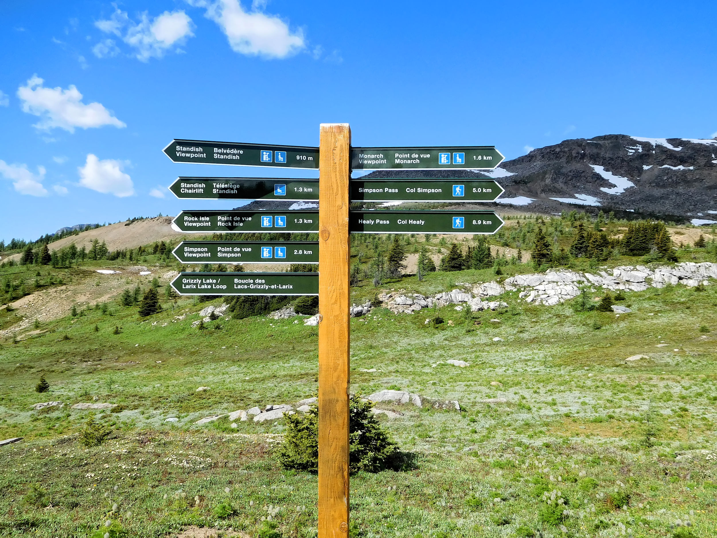
Trail signs, finally!
The two are coming back from Assiniboine Provincial Park. This is the wrong direction for me, but they found a maze of signs including one to my destination, Simpson Pass. After some searching I find the sign, but it points to Simpson Pass outlook and not to Simpson Pass proper. Turns out that I have to do an eight kilometer loop now to reach the turnoff to Simpson Pass. I should have stayed on that first unsigned little trail, which was the correct one.
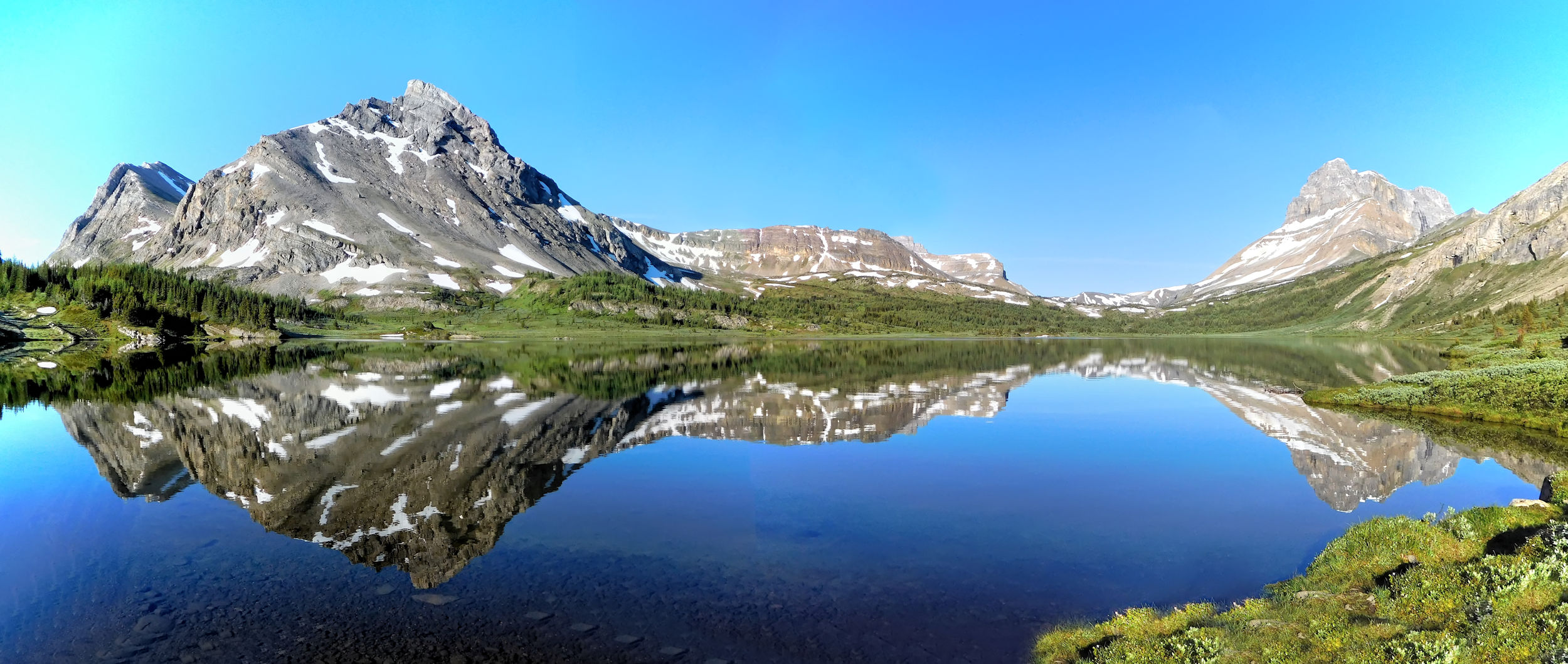
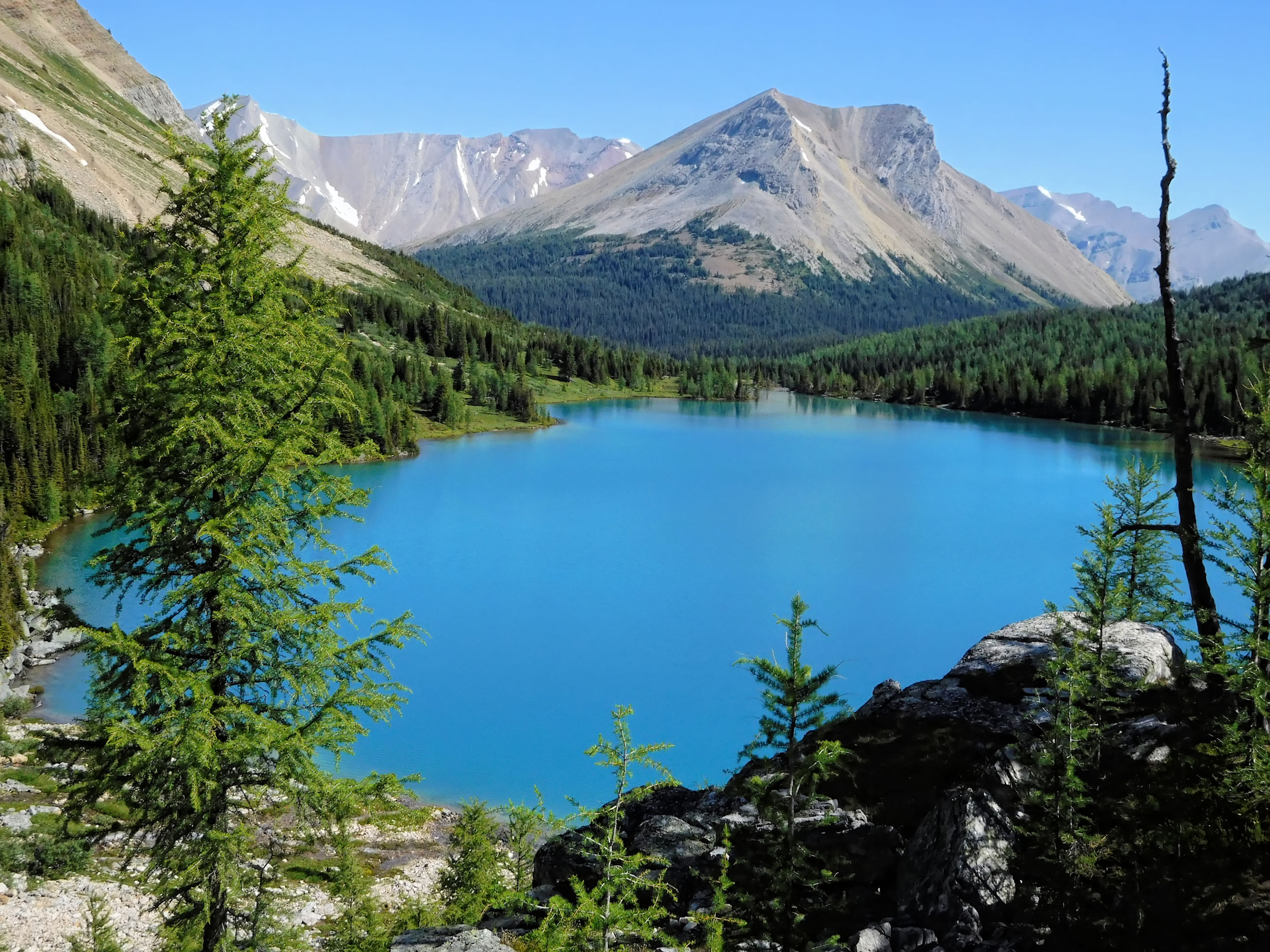
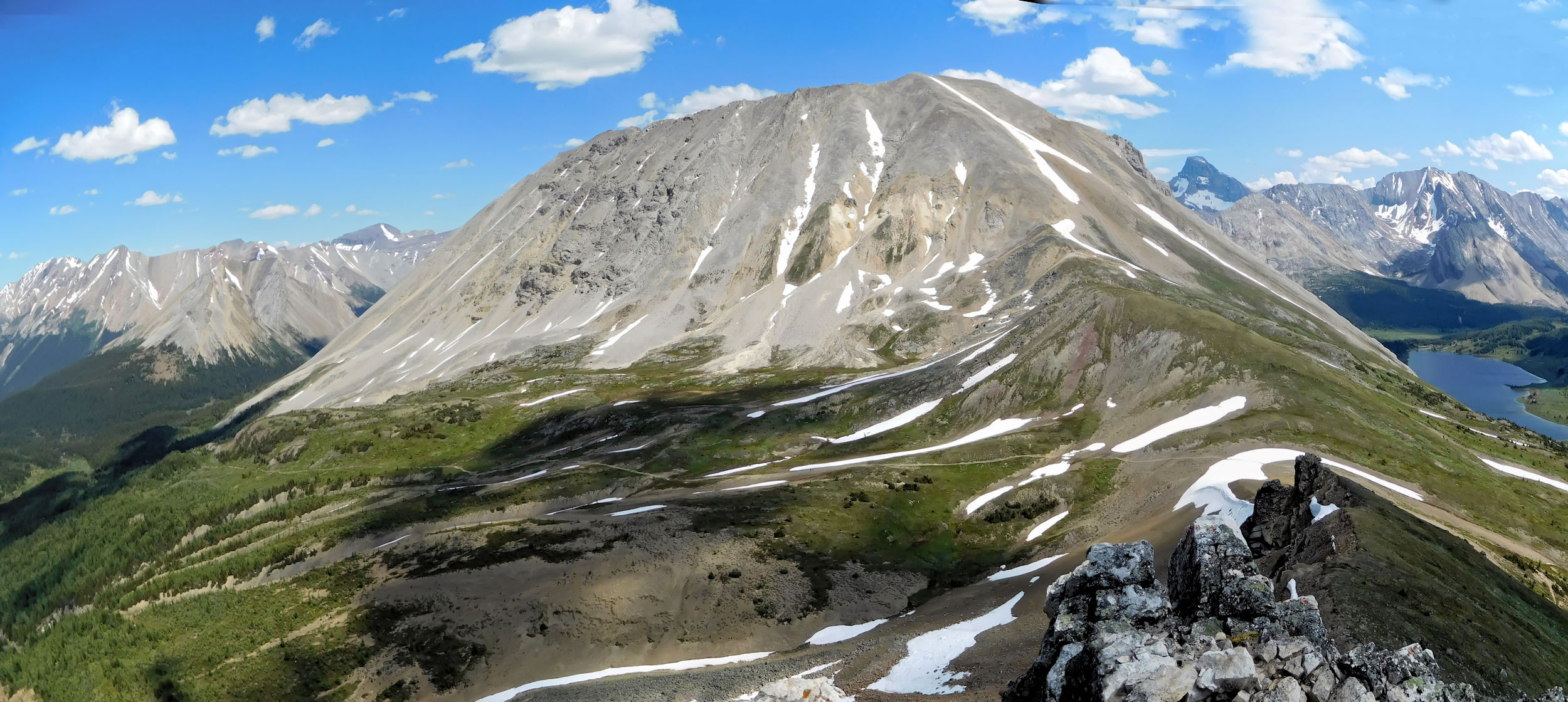
The loop leads me through a stunning alpine landscape. I pass by Rock Isle Lake, walk through Twin Cairns Meadow and reach Wawa Ridge with Monarch Viewpoint. I am the only one hiking here today, which is very special. Usually you share this area with hundreds of people that come up in the gondola. However, the loop will add four extra kilometers and a whole hour to the planned 19.5 km of my first day, which was ambitious to begin with.
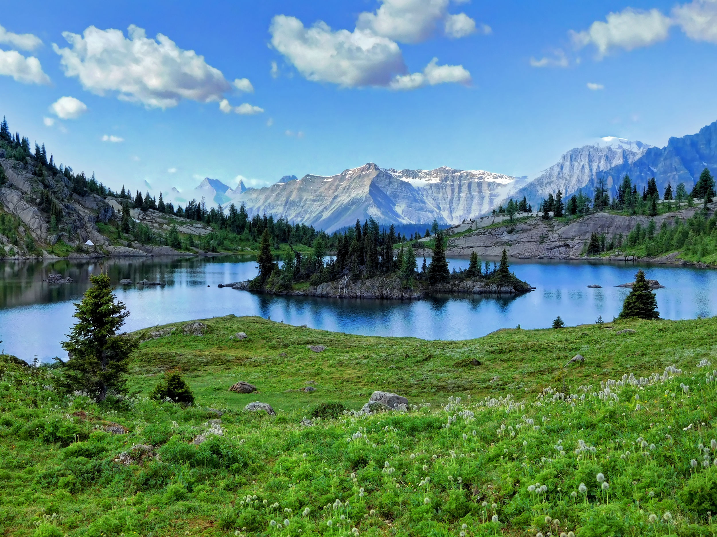
Rock Isle Lake
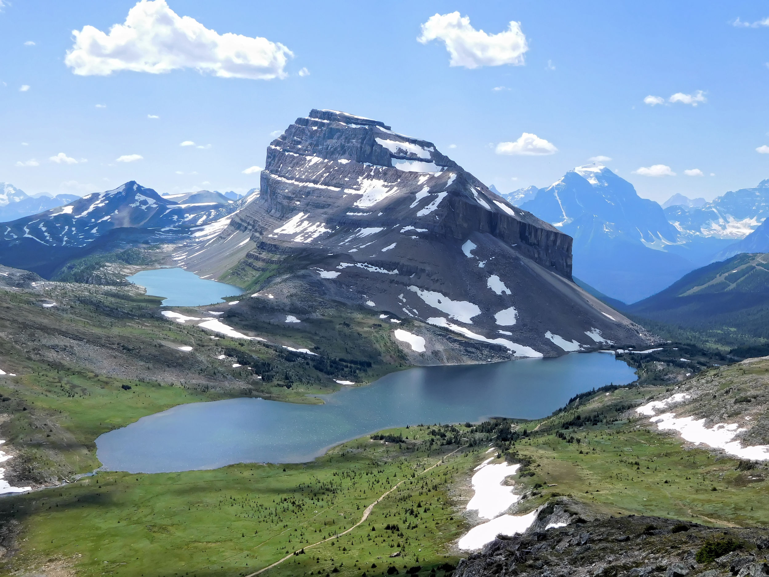
Monarch Viewpoint (2360 m) is impressive. Here the majestic mountain shows itself in all its glory. Finally I have a lunch break while enjoying the view. I am sure now that I will reach my destination for the night.
Monarch 2895 m
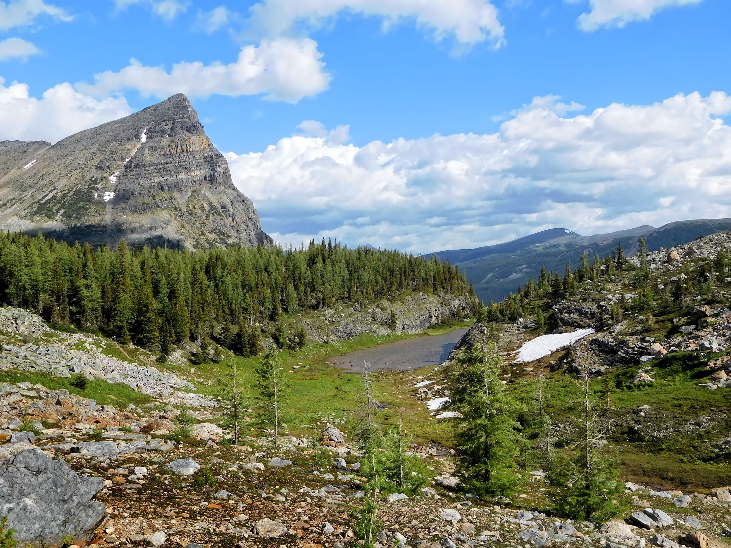
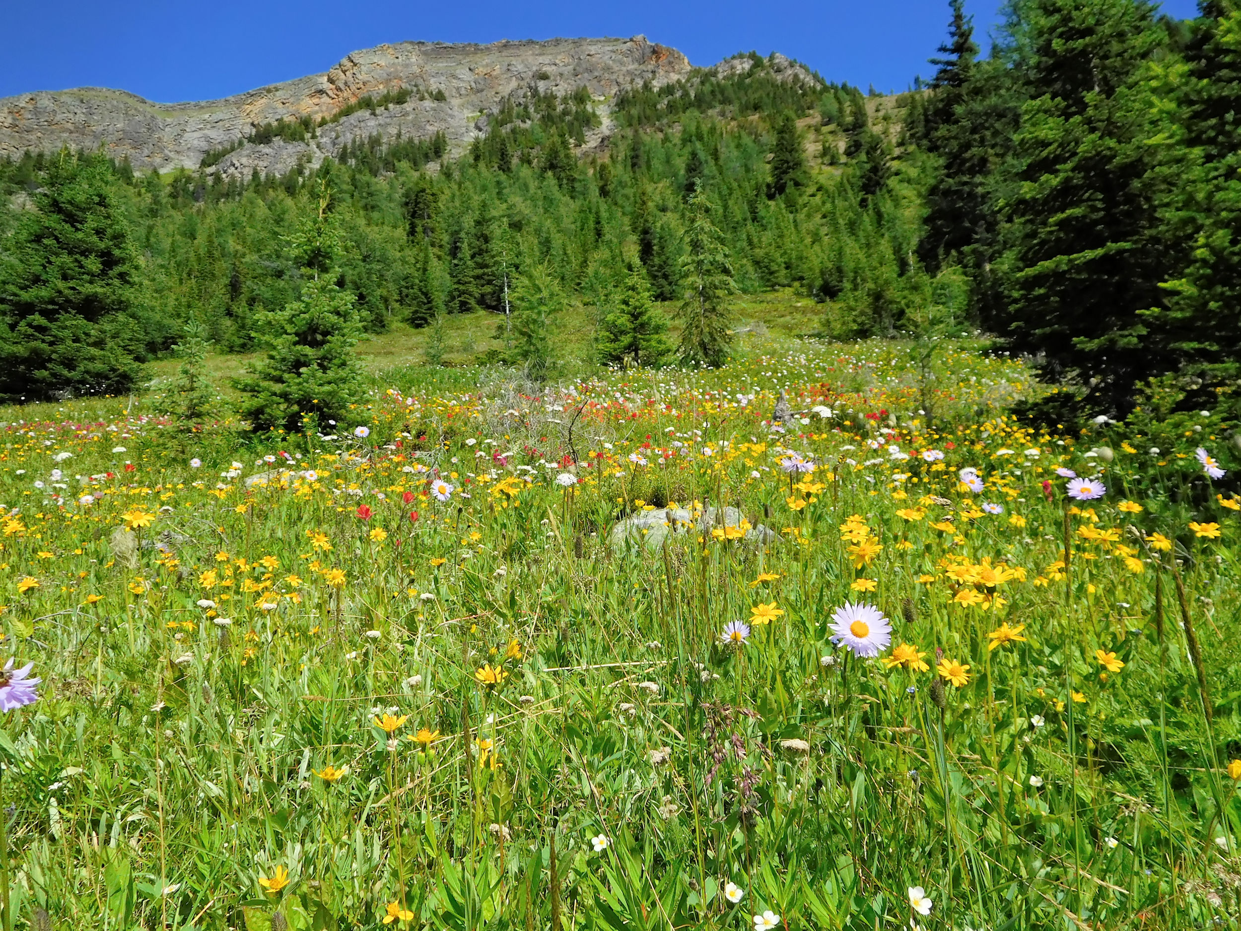
From the viewpoint I walk downhill for the first time today. The trail leads through forest, around a rockslide and down into a valley. After several ups and downs I reach the border between Alberta and BC which is marked by a concrete post. Simpson Pass at 2135 meters is not your typical pass, but a lovely area with ponds and small meadows interspersed with trees. Because of the cold weather, the wildflowers are late this year. It is just a bit too late for the Glacier Lilies that flower during snowmelt and too early for the summer bloom. But even between seasons there is always the enjoyment of a few colorful flowers.
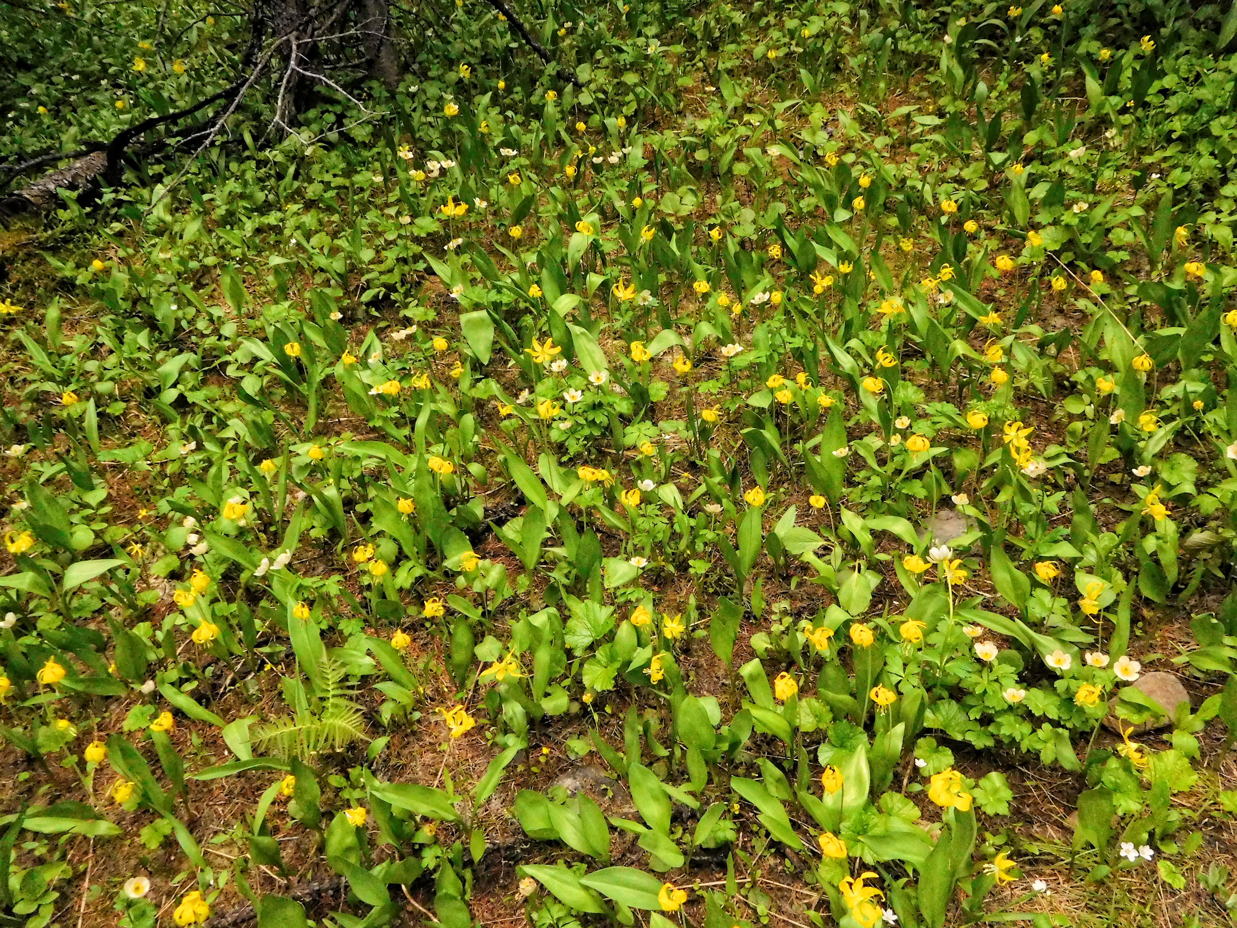
Last Glacier Lilies
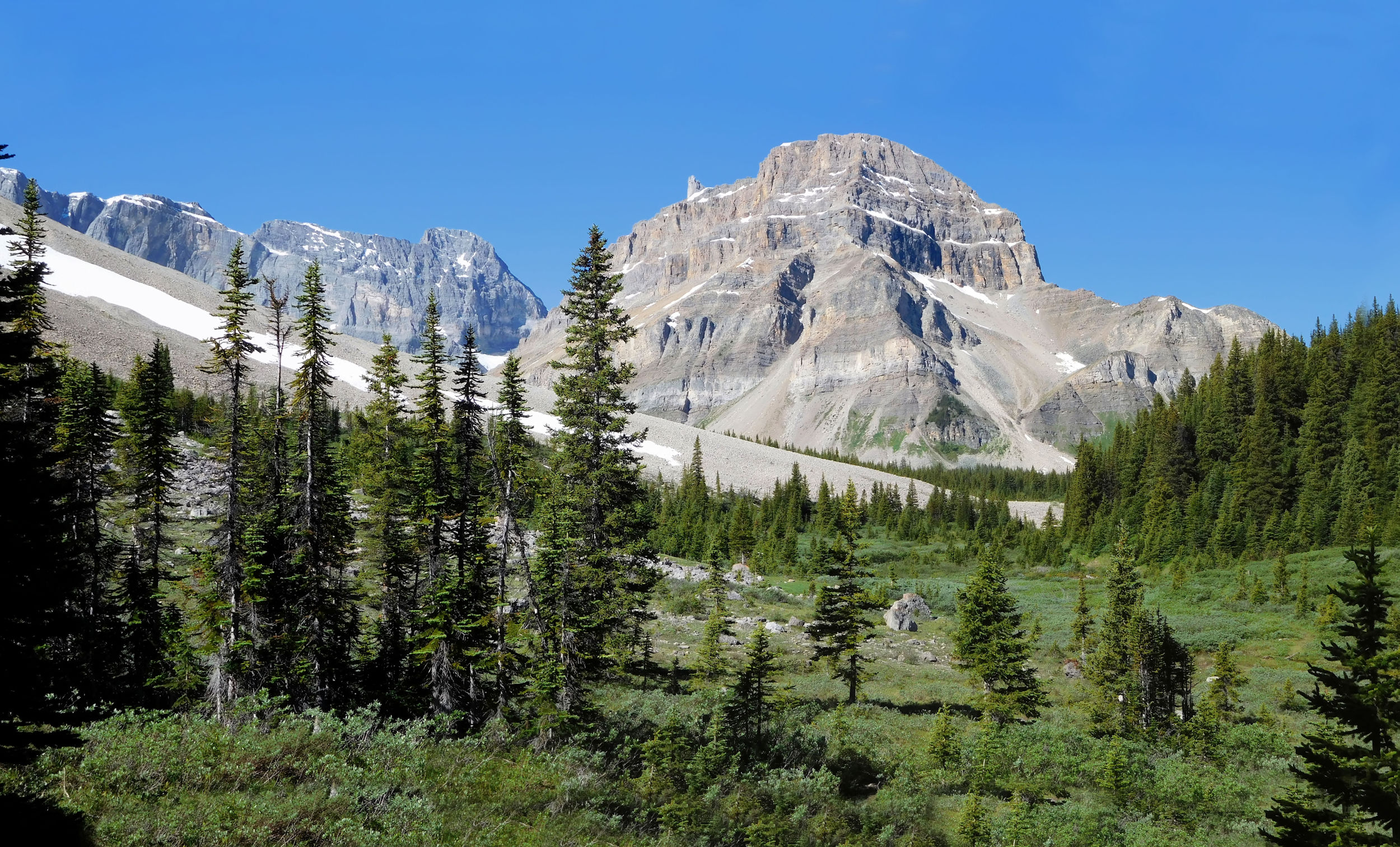
Soon my trail joins the Healy Creek trail. A rustic and picturesque bridge crosses the creek and has invited two other hikers to rest. I don’t cross the bridge but begin a steady climb to Healy Pass. It is the last ascent for today and it is a big one. At this elevation the snow has only melted very recently, and I still discover some Glacier Lilies in a shaded place.
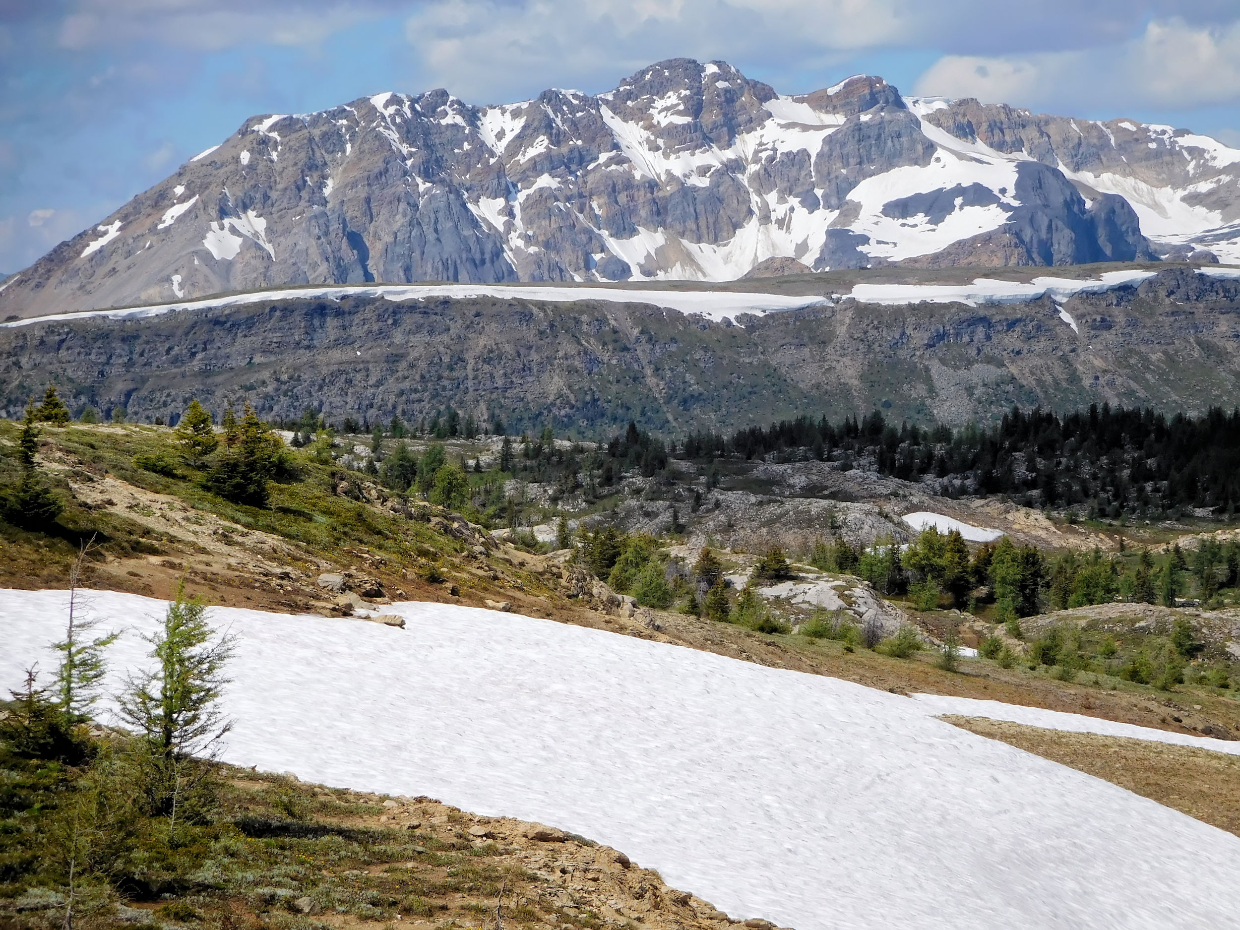
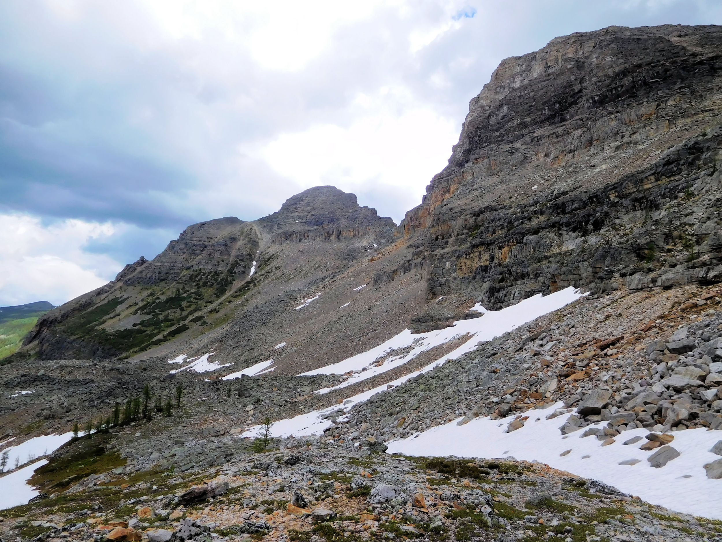
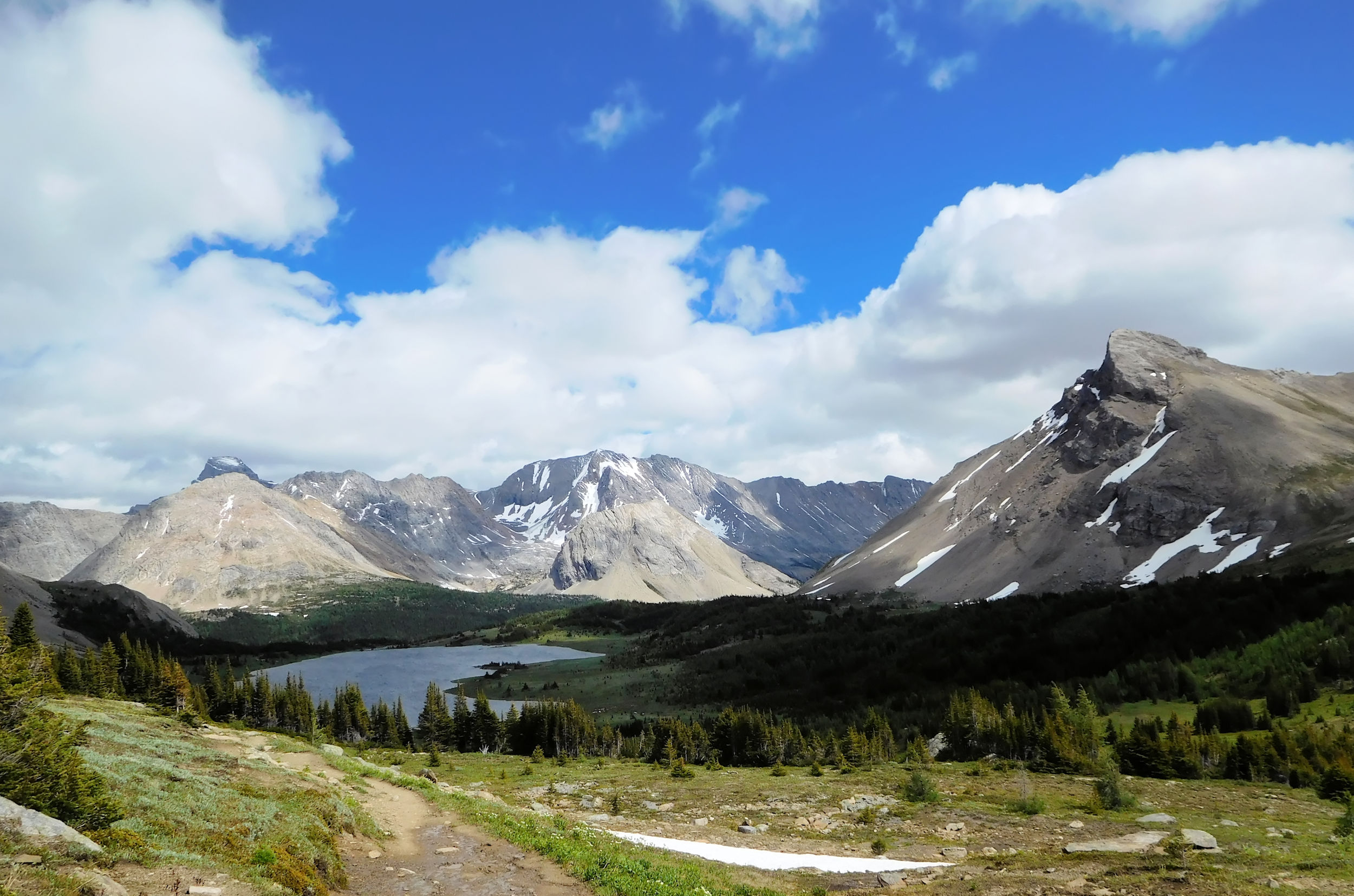
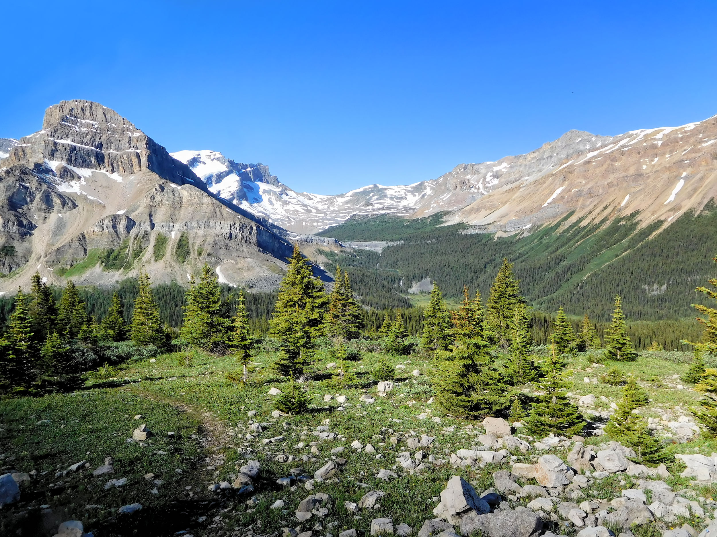
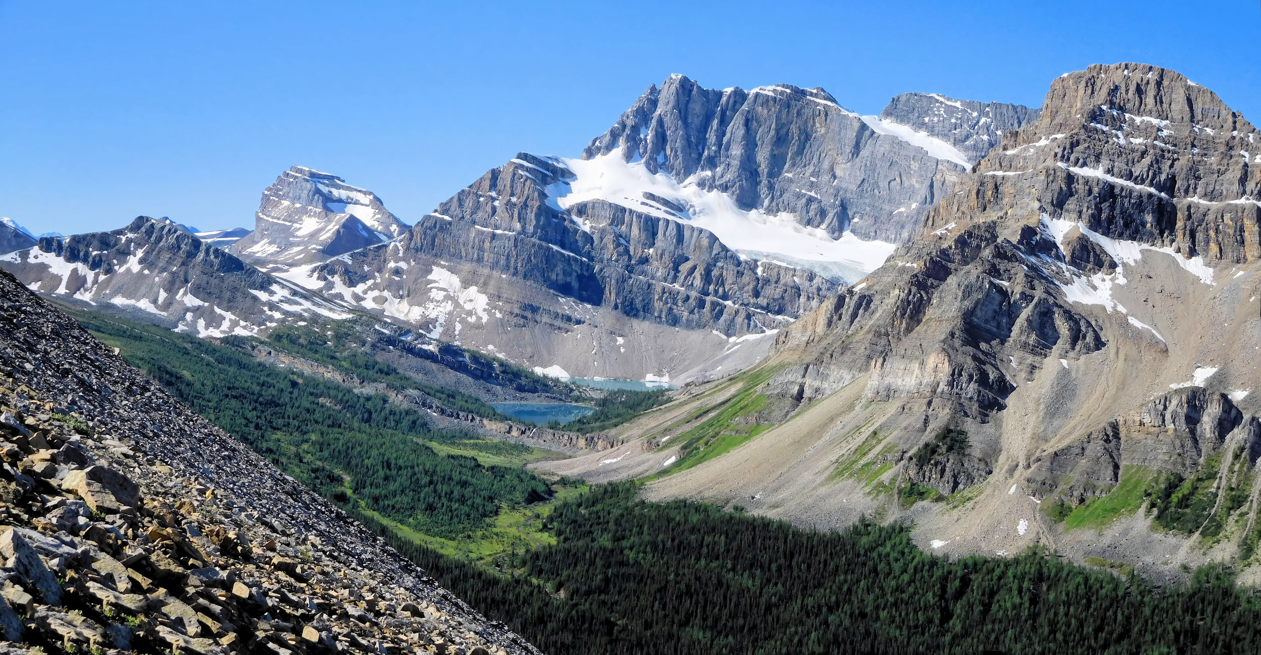
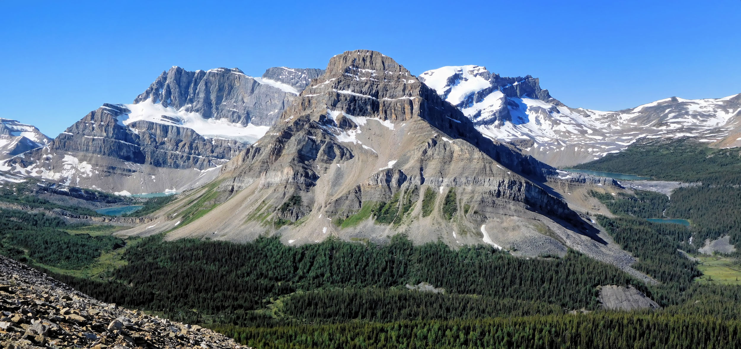
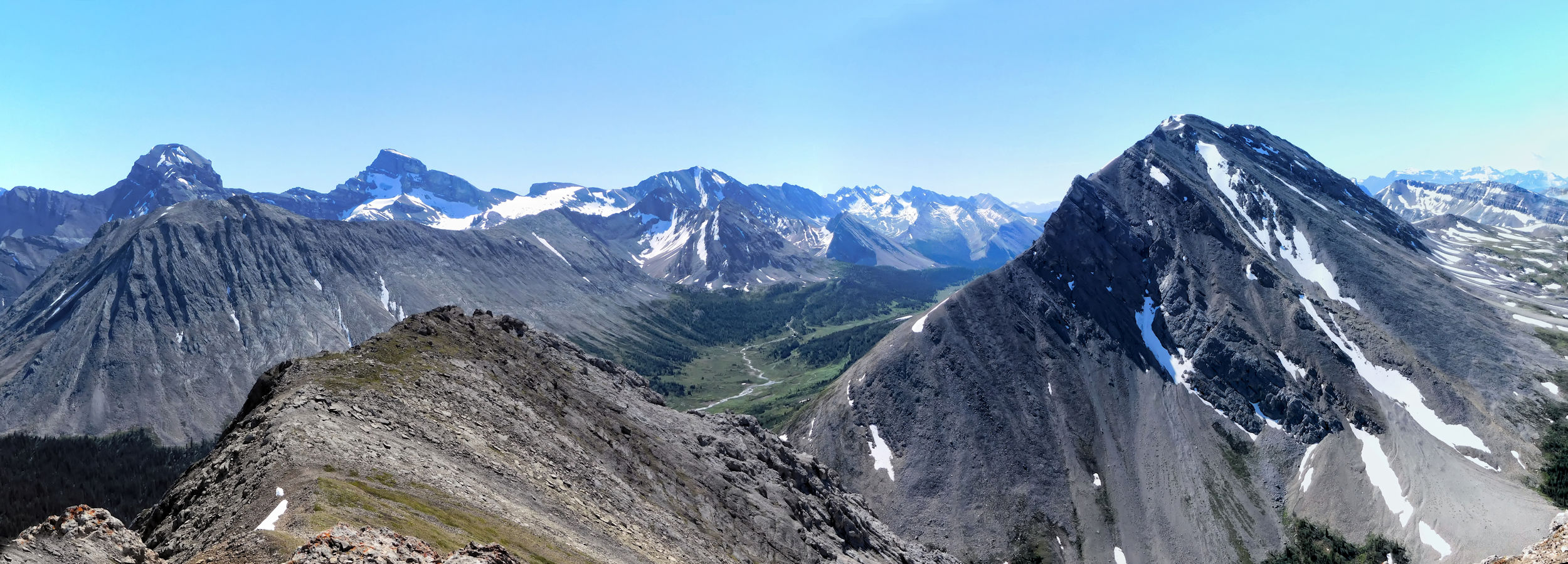
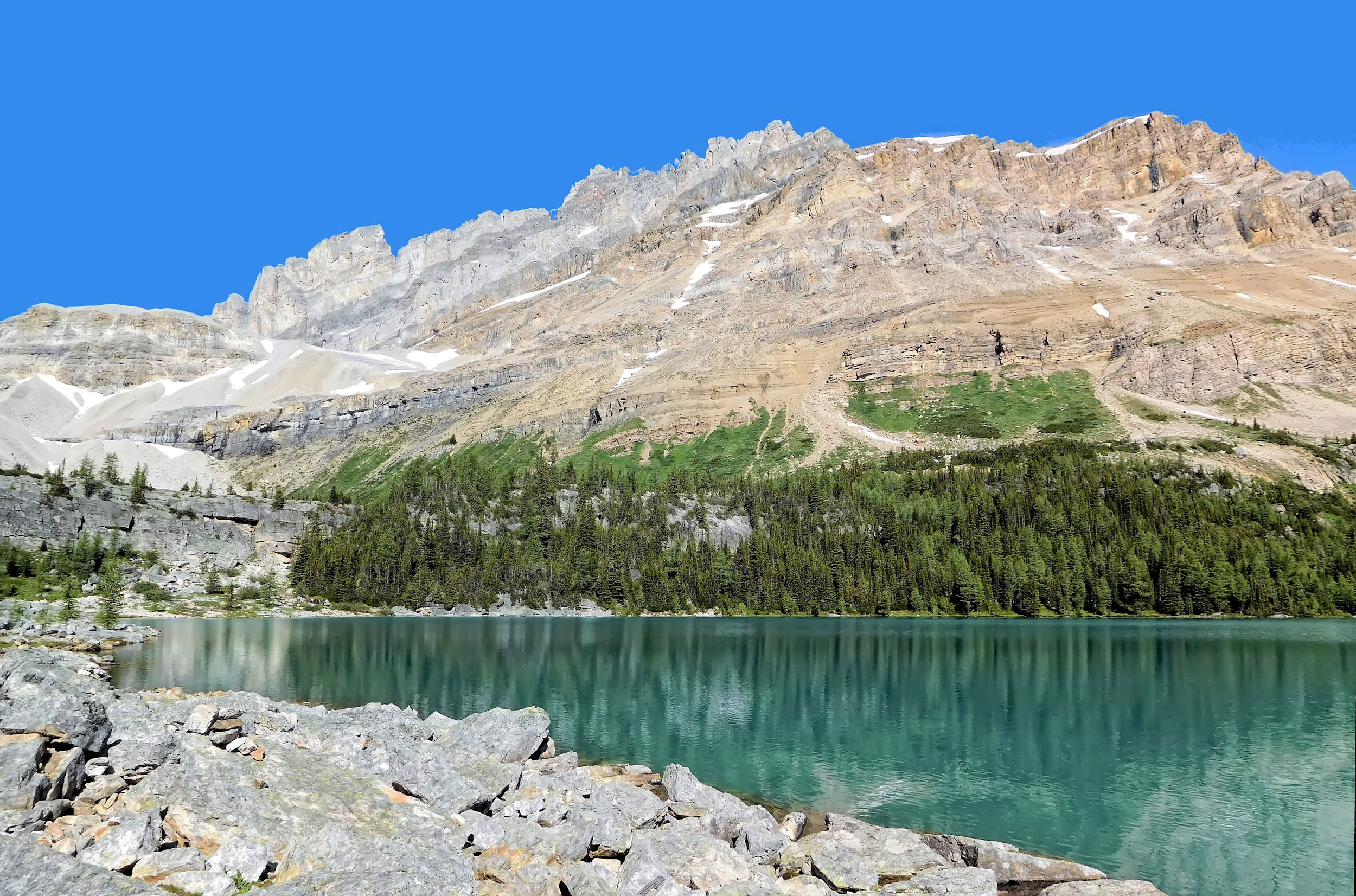
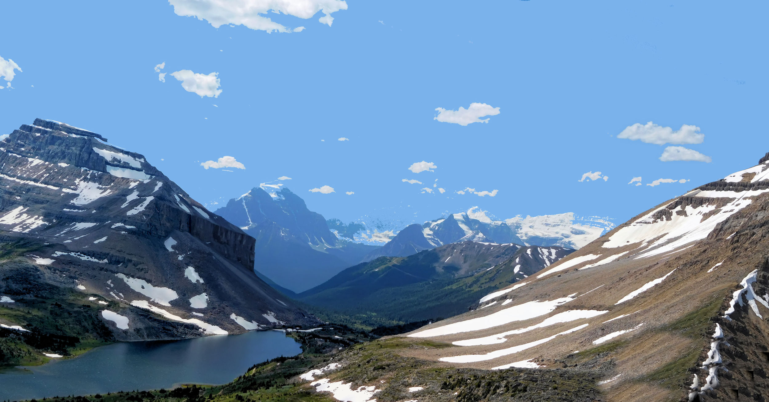
I need quite a few breathers until I reach Healy Pass at 2330 meters. On top the 360 degree view is spectacular. To the left you see the Monarch and a 3.5 km long ridge leading towards it: the Monarch Ramparts. The ridge used to be a beautiful hike, but Banff National Park has closed the area for any off-trail hiking because of the sensitive vegetation and soil erosion. It makes me sad, when I spot a backpack in front of the barricade that some hiker has left in order to explore the closed area.
Monarch and Ramparts
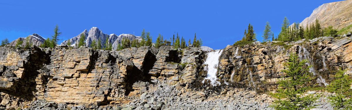
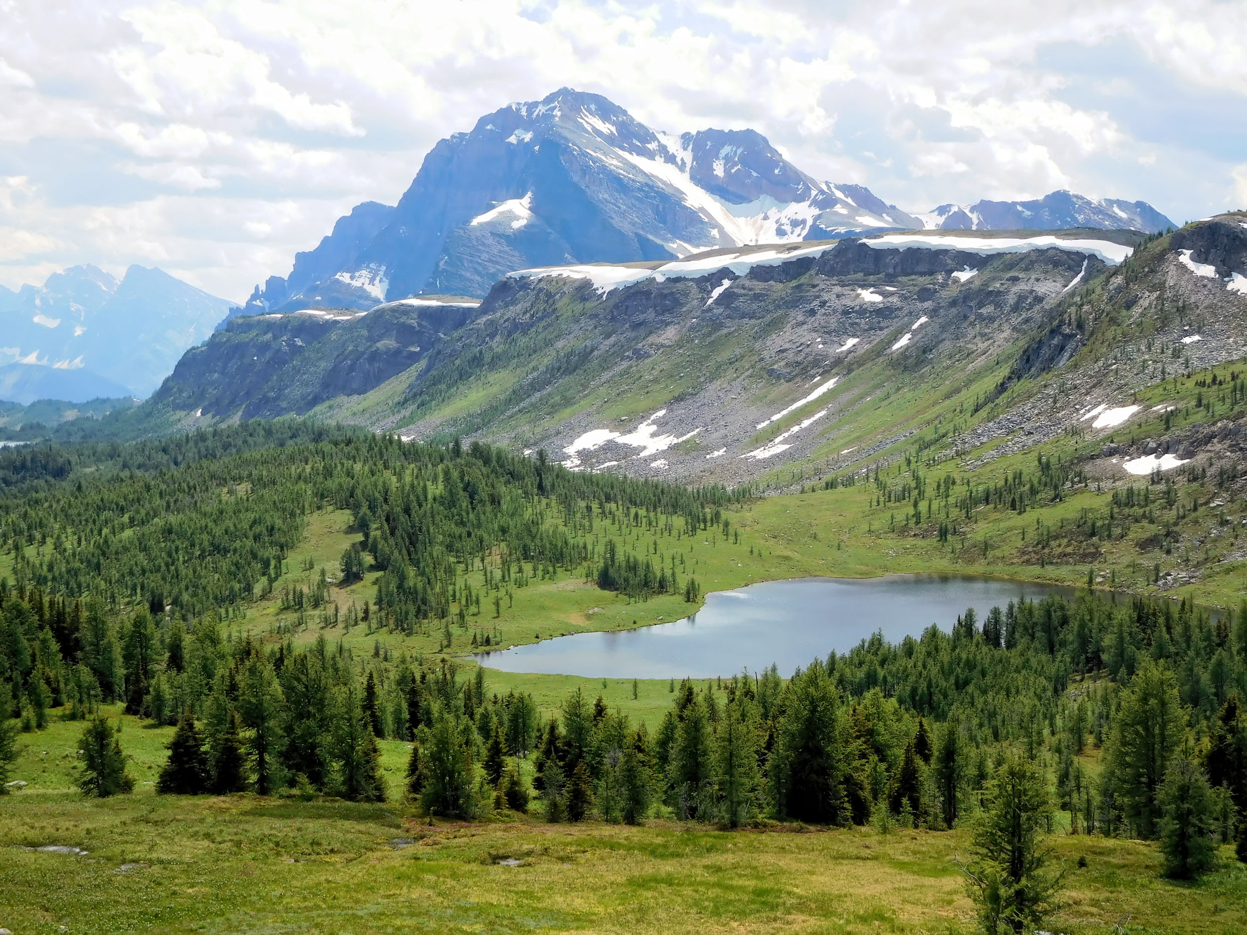
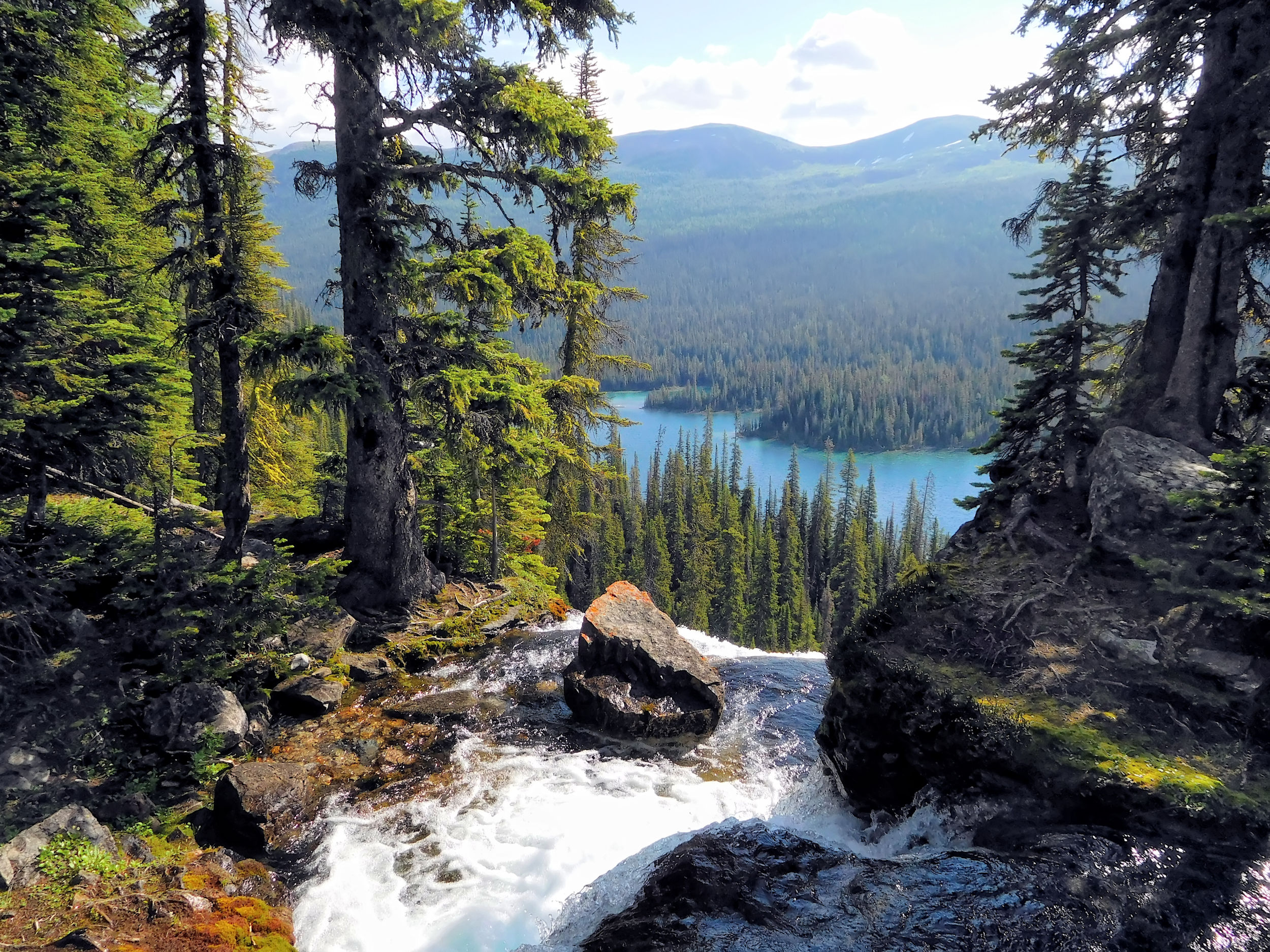
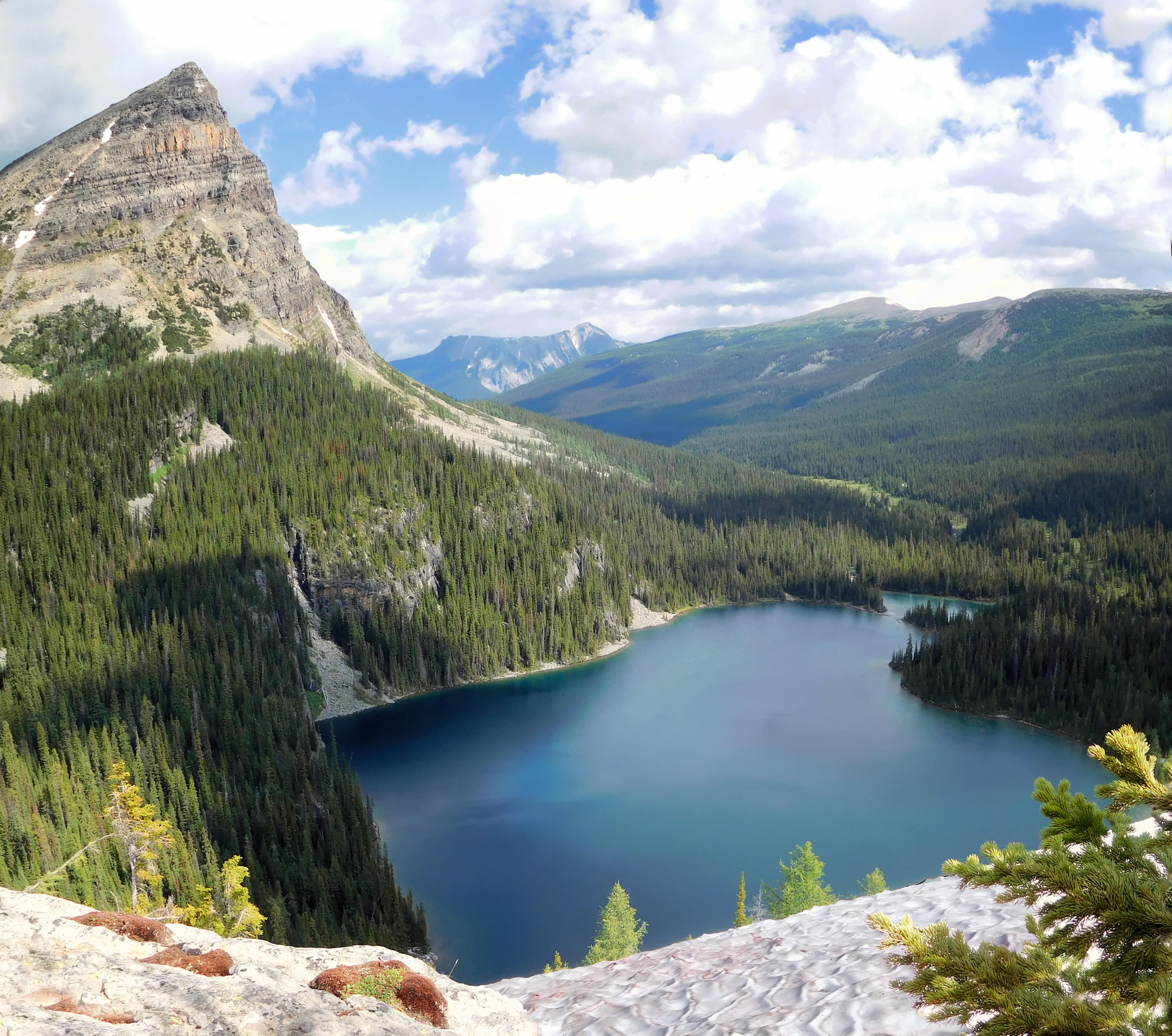
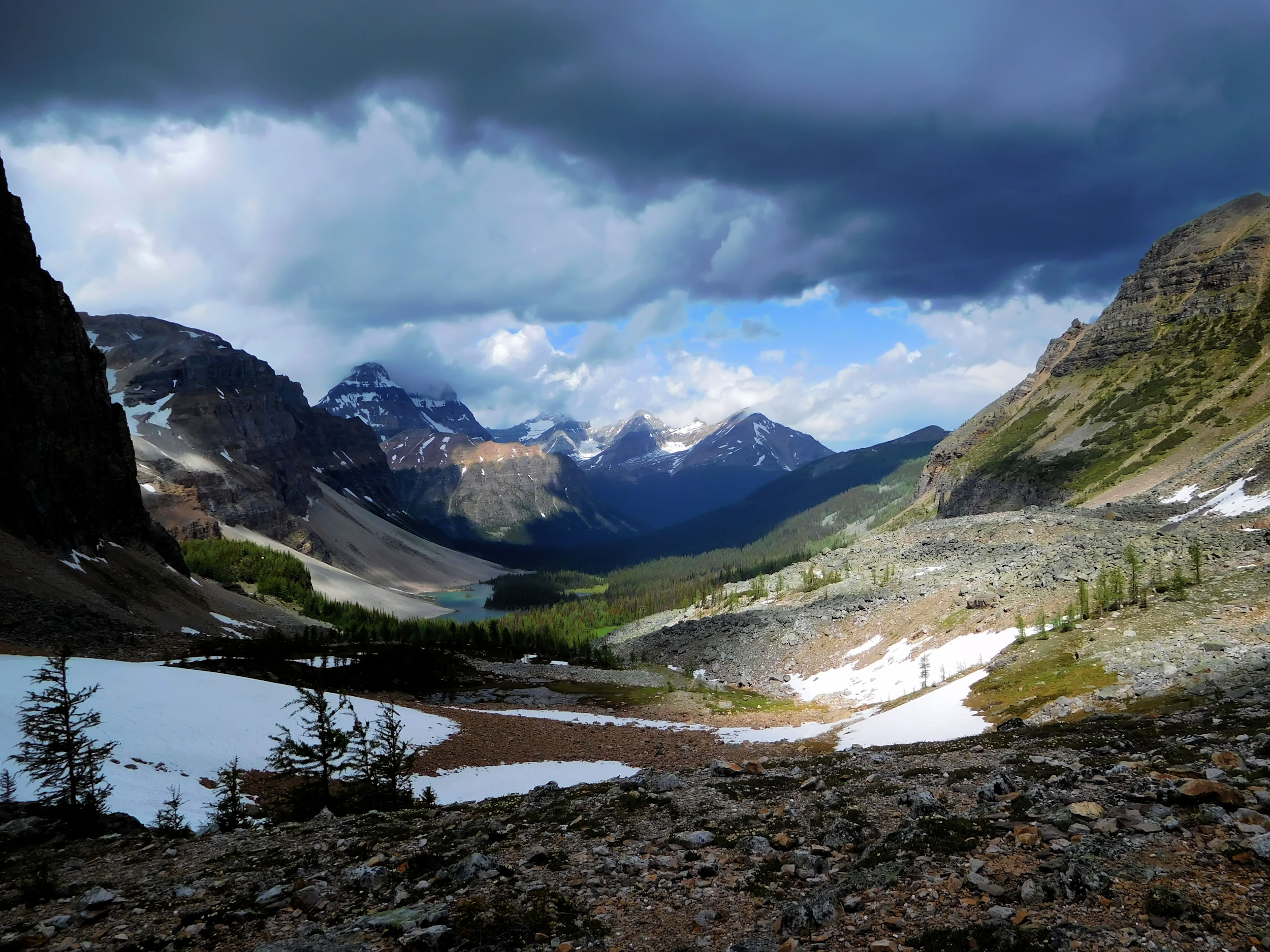
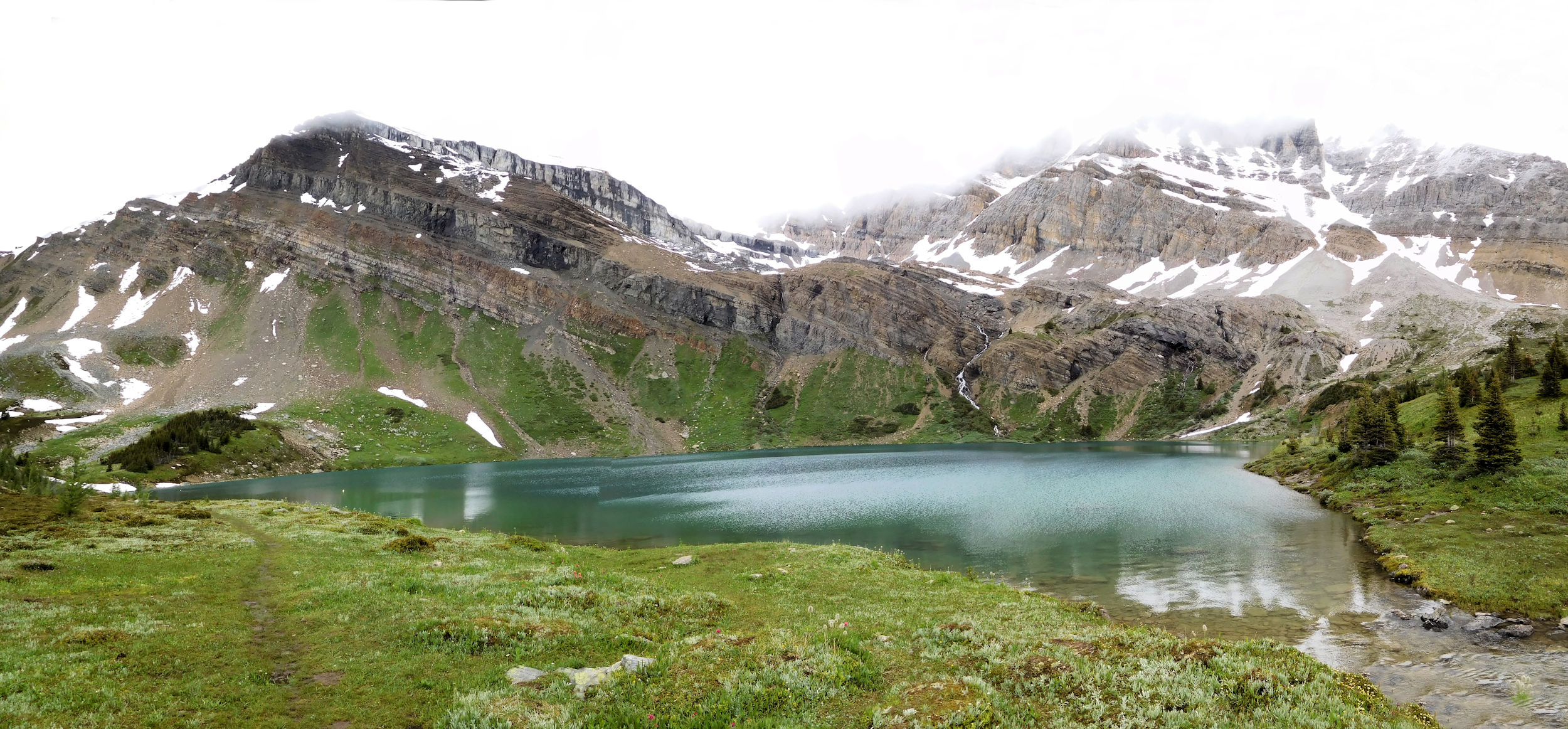
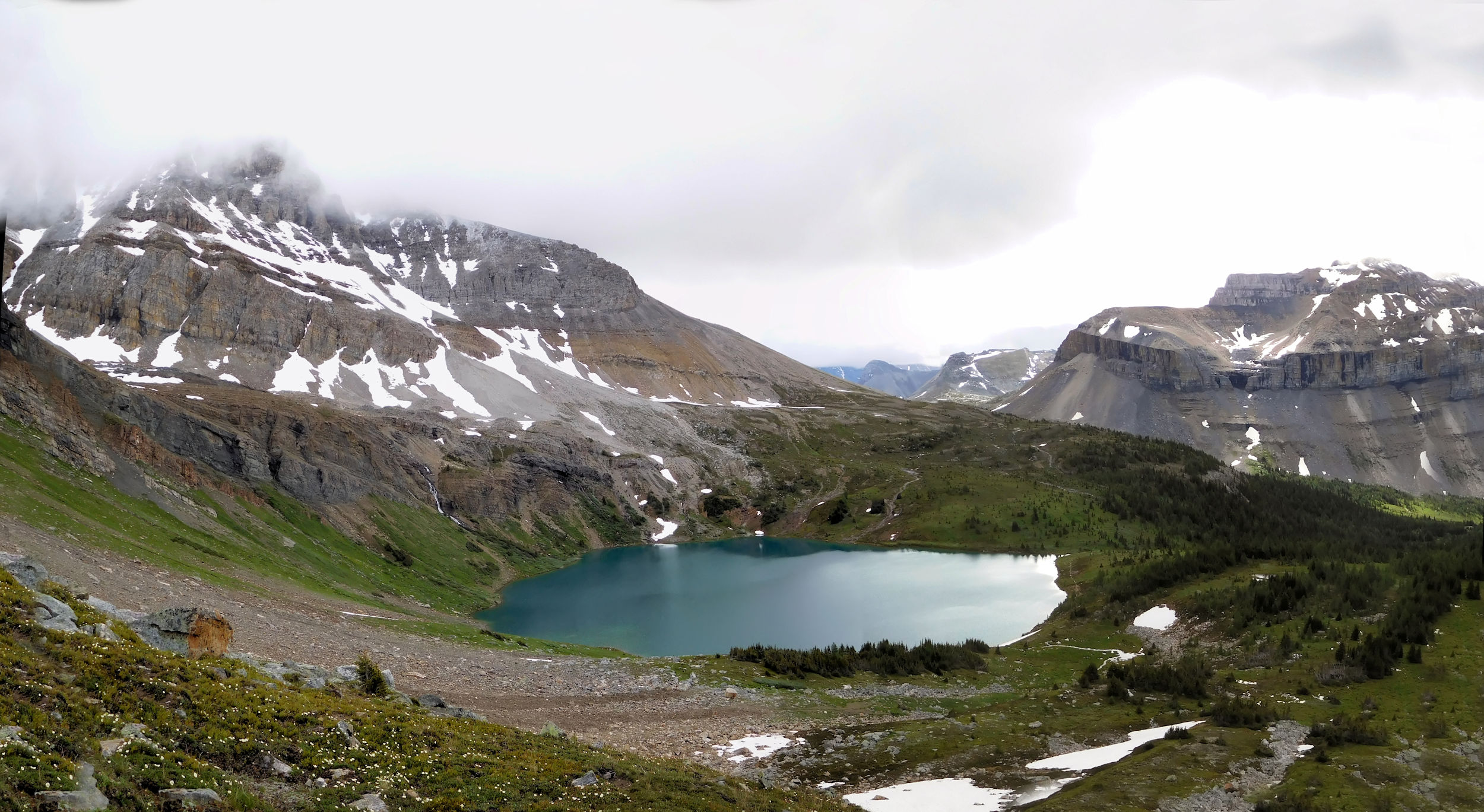
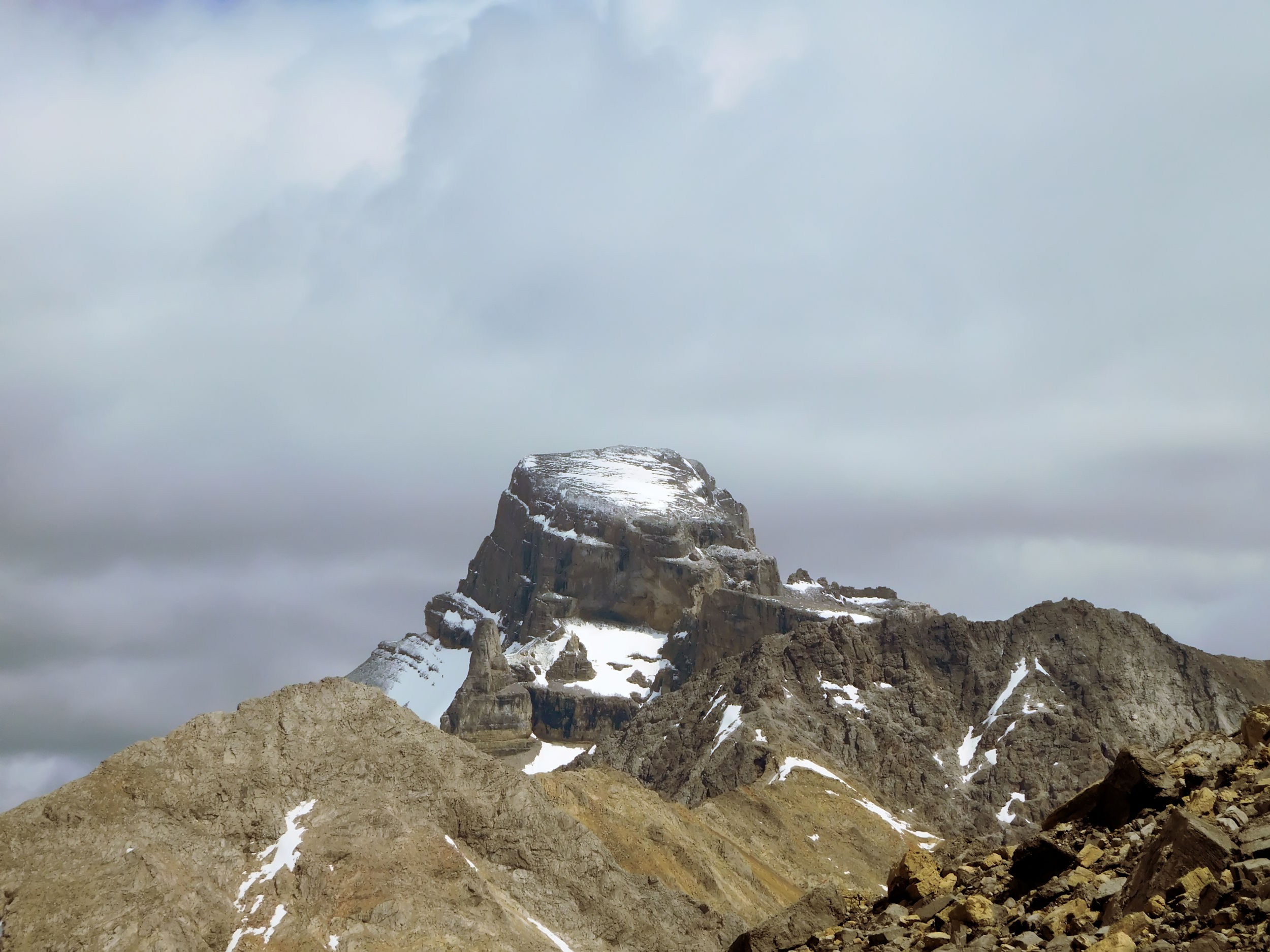
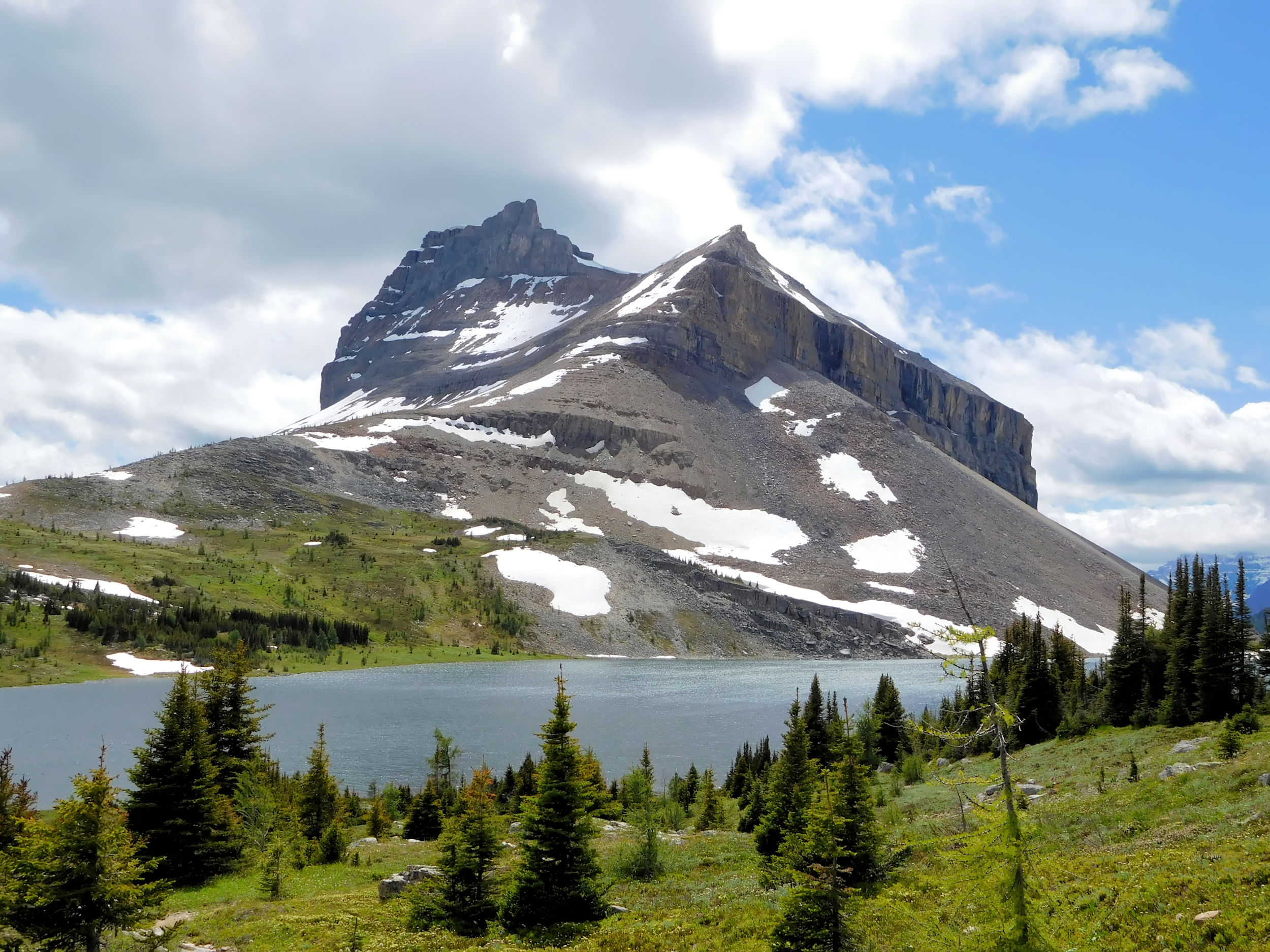
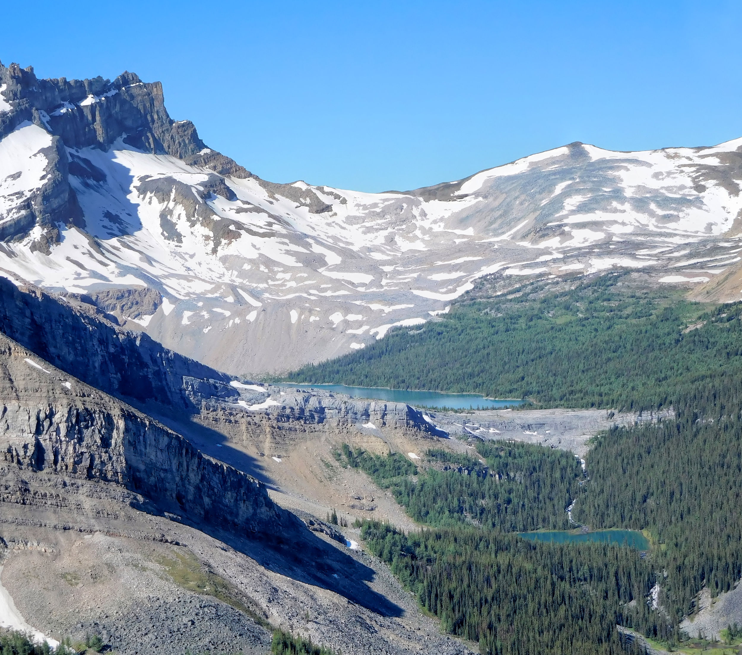
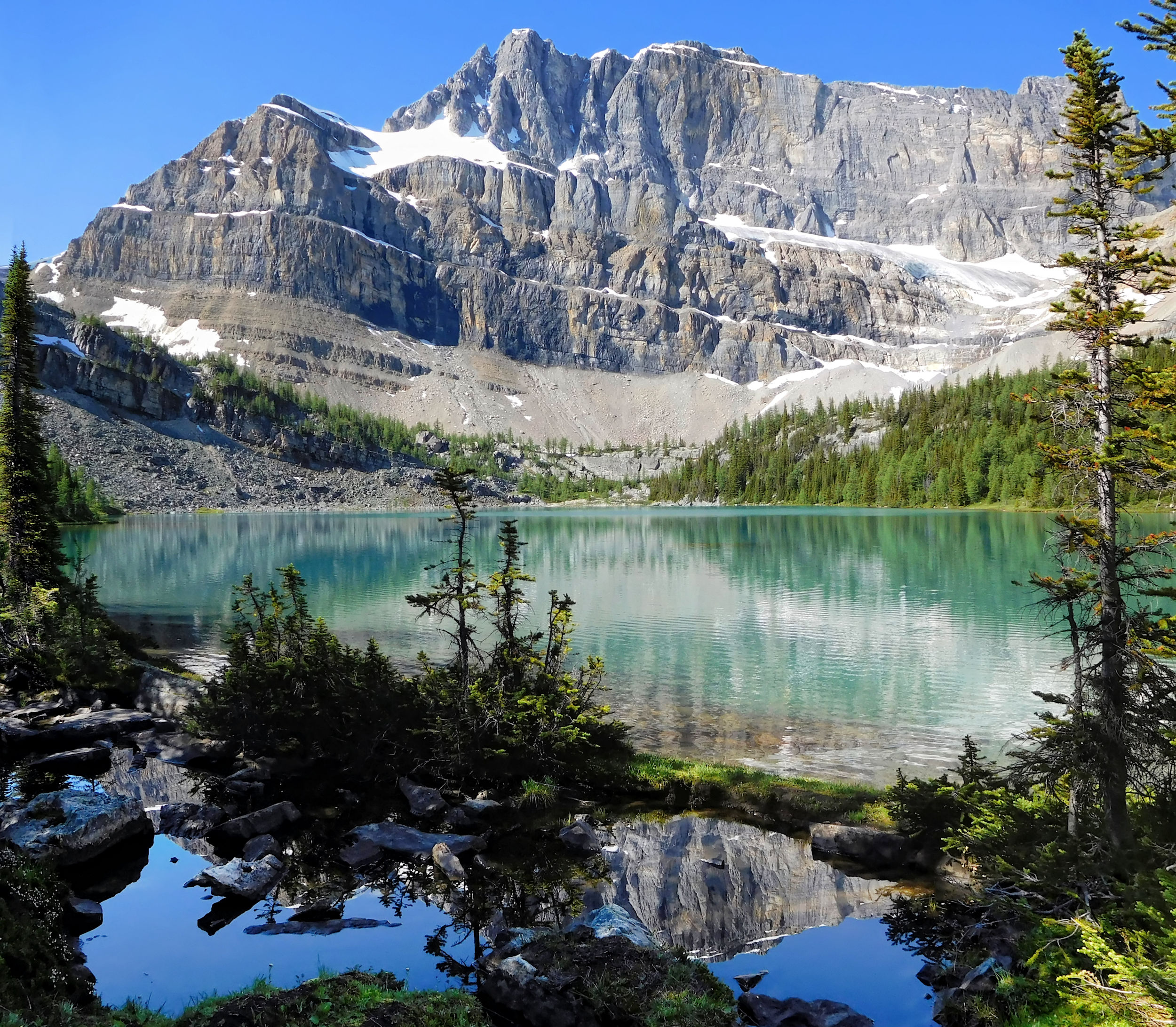
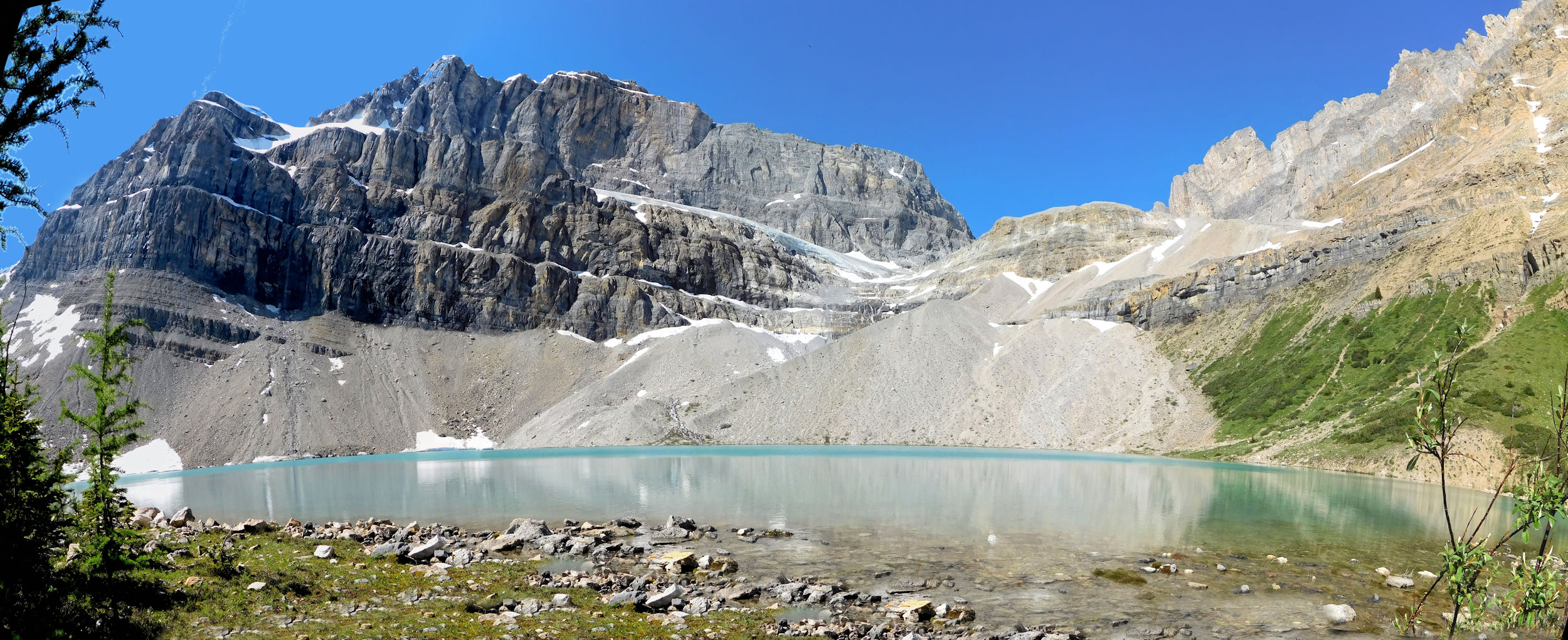
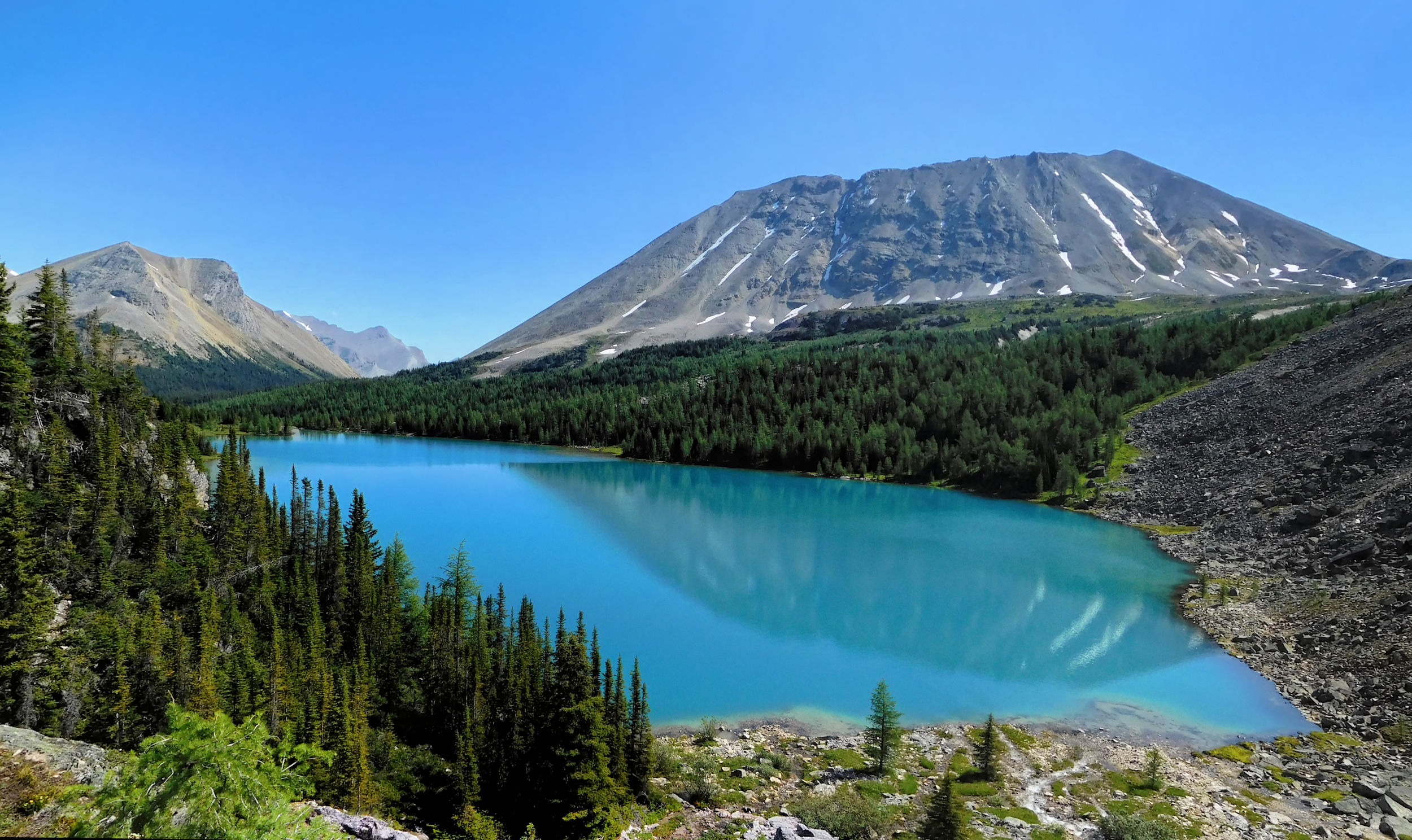
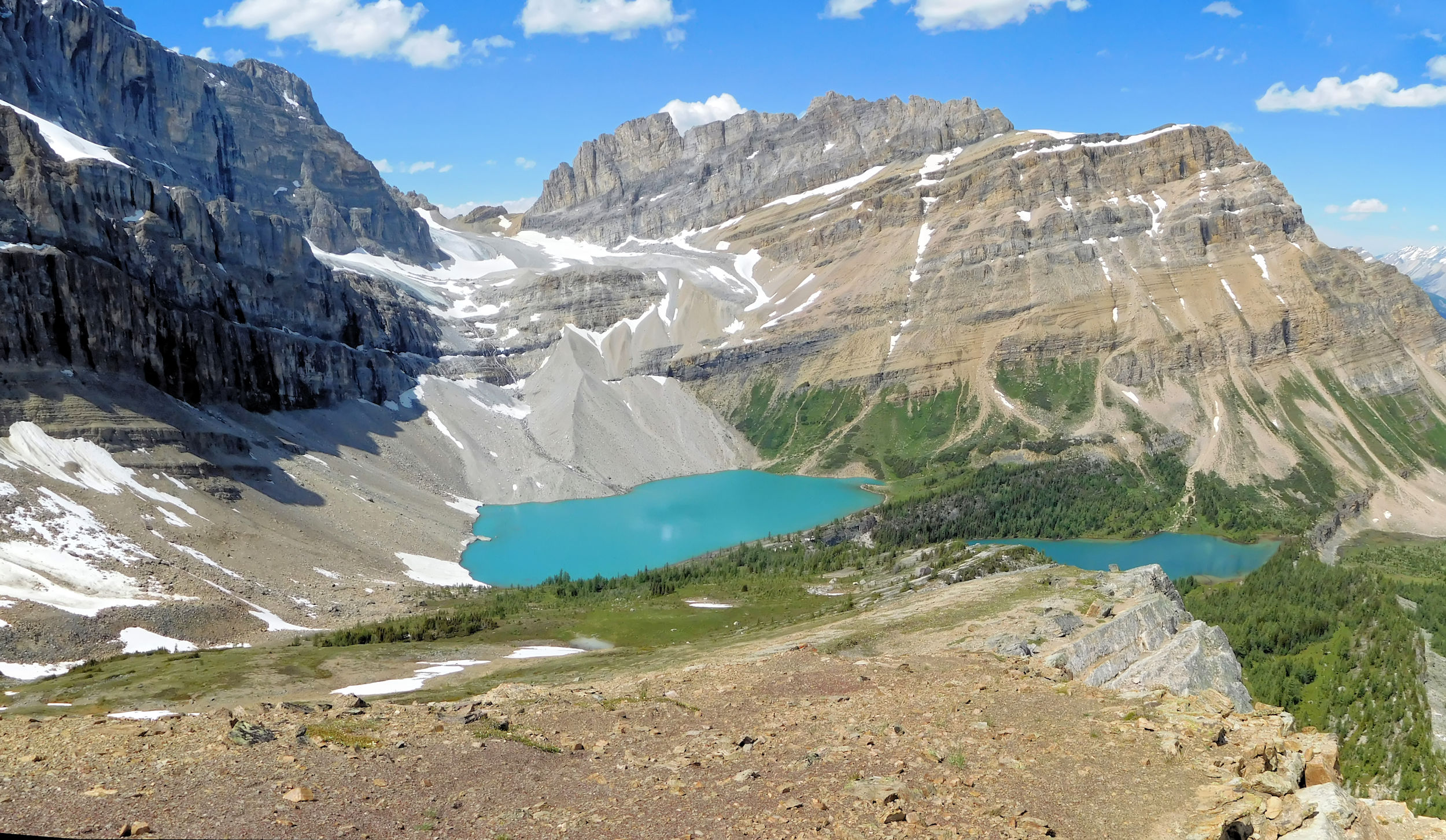
Healy Pass Peak (2570 m) towers to the right. Like the Ramparts this peak is off limits. With its relatively easy scramble to the top it attracts too many hikers. Ahead are Egypt Lake and Scarab Lake above it. Both lakes are connected by a 30 m waterfall that tumbles from Scarab into Egypt Lake. Scarab Peak, Sphinx and Pharaoh Peak form a beautiful backdrop to the lakes.
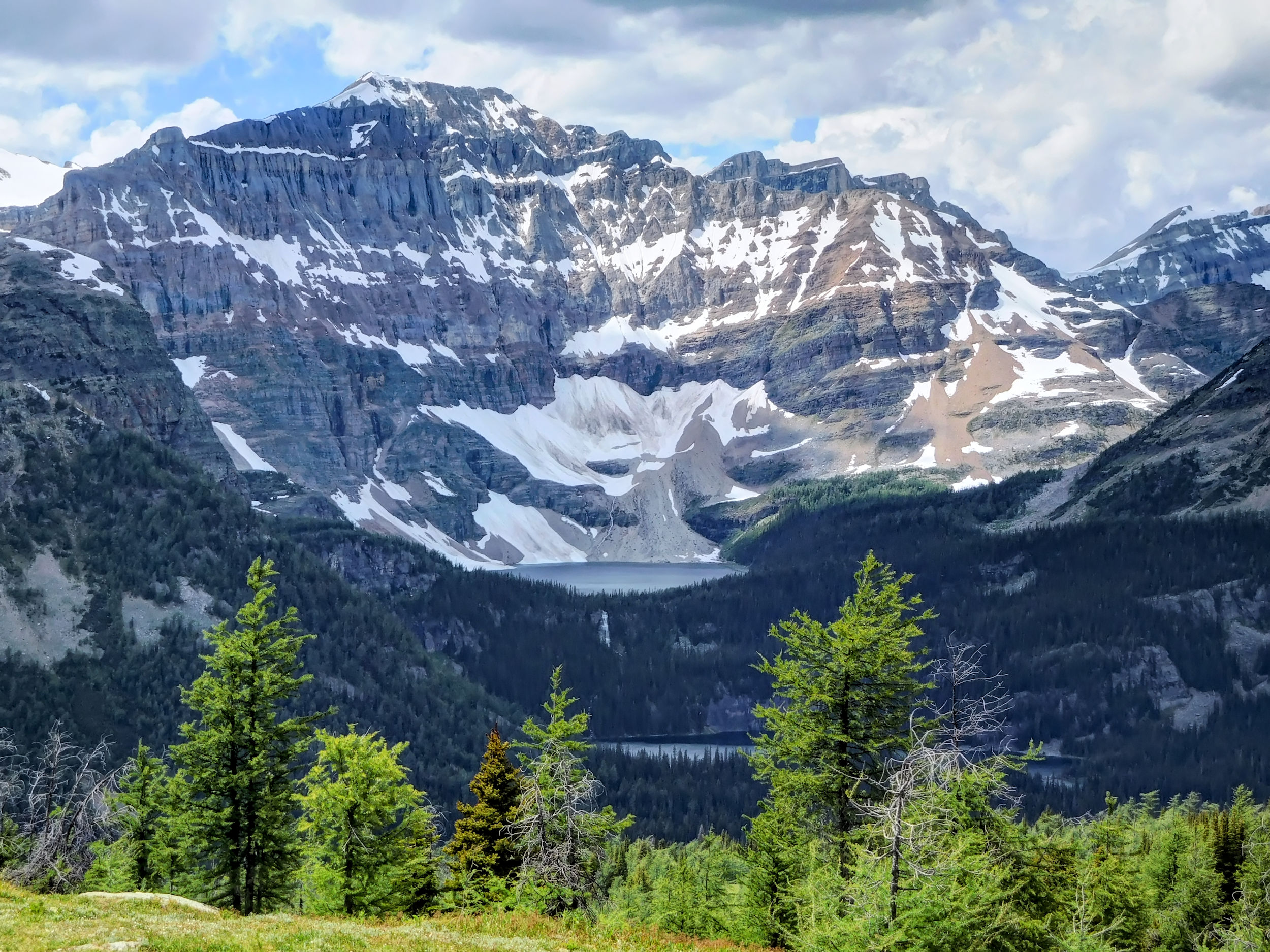
Scarab and Egypt Lake in front of Scarab Peak 2918 m
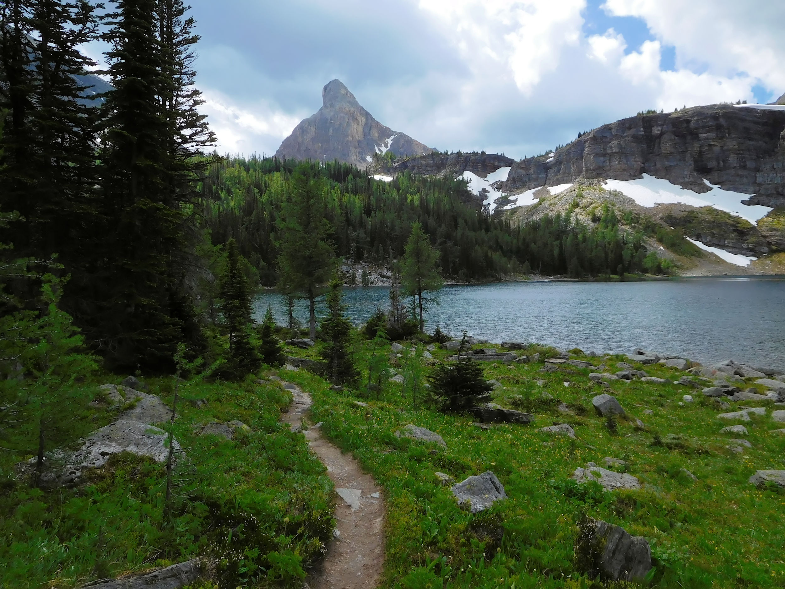
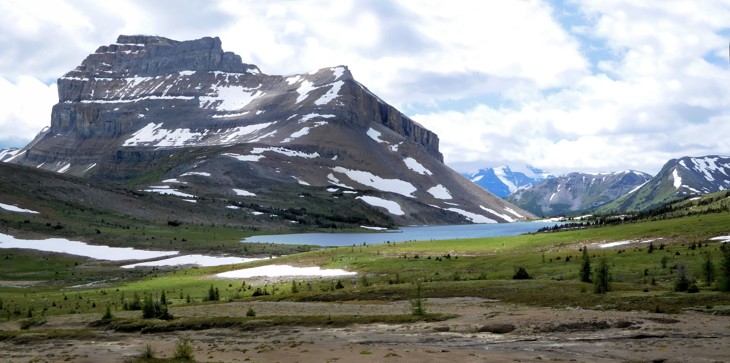
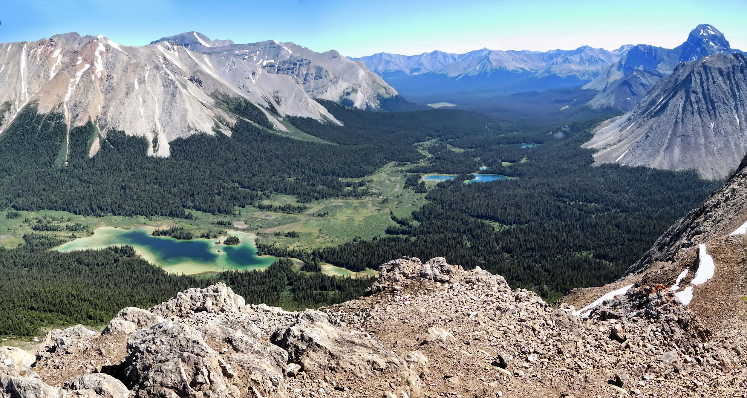
The last 2.9 km are all downhill. At the bottom of the valley I pass a ranger station and cross a bridge over Pharaoh Creek. I have reached my destination: Egypt Lake campground.
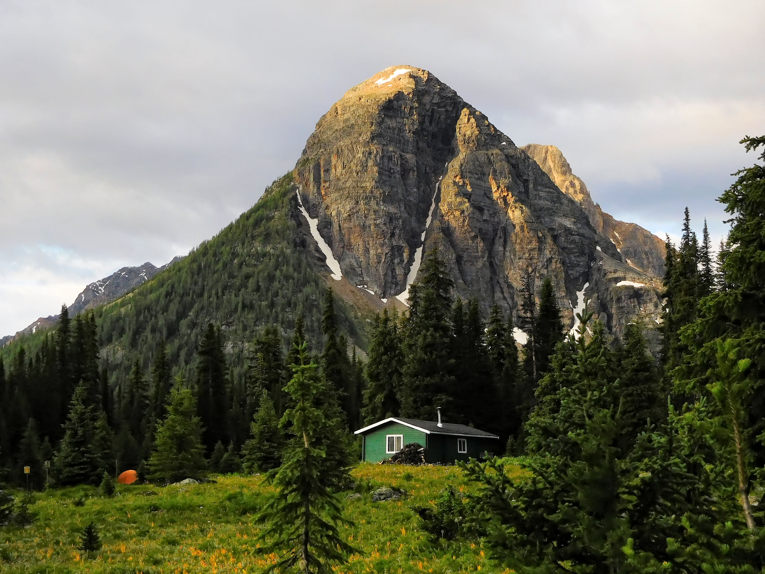
Egypt Lake campground and Sphinx/Sugarloaf Mountain
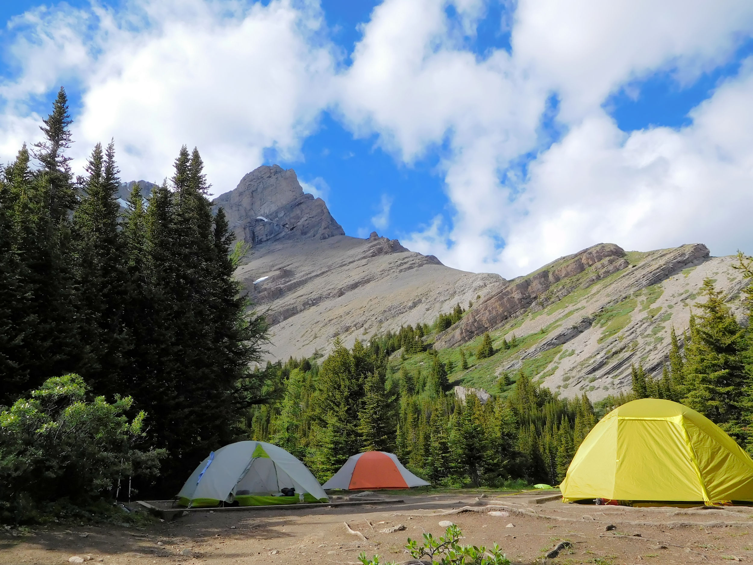
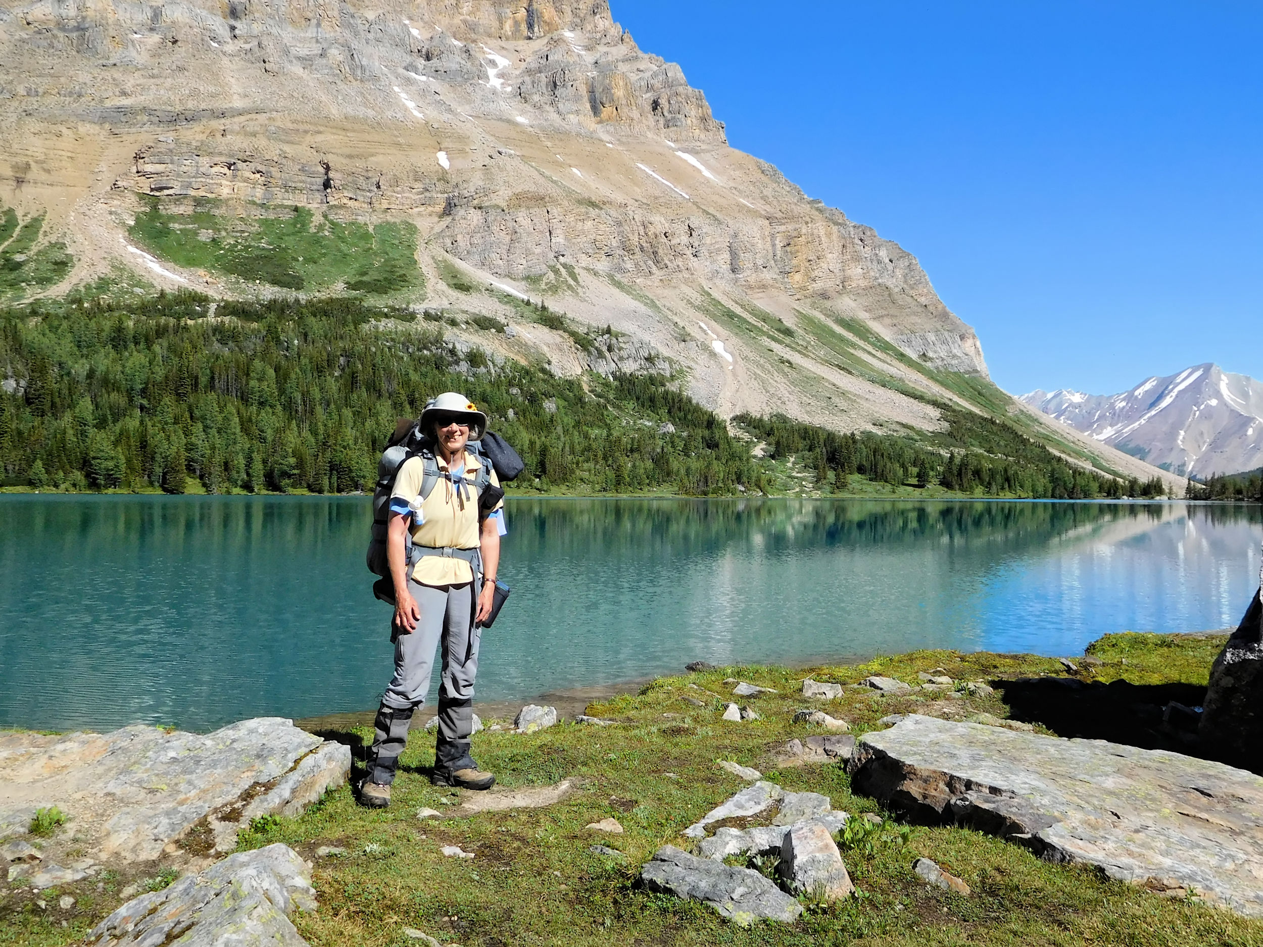
Egypt Lake campground has 13 campsites. Last year I had to move my tent after it got flooded in a heavy thunderstorm. The new site is still available and I happily pick it right away. It is level and has a thick cushion of wood chips to prevent water from pooling under the tent. It is located next to the Egypt Lake shelter which sleeps 12 on platforms but it is closed for this year. The outhouses, the water and the food lockers are not too far away. In the backcountry you are not done yet with hiking when you have reached the campground. For safety and hygiene reasons the different areas for eating & cooking, sleeping, drinking water and the outhouses are kept quite far apart, connected only by steep and sometimes muddy footpaths. I hardly ever can make use of my light camp sandals.
I set up camp and carry my food bag to the cooking area. Metal food lockers keep the food safe from bears and critters. Drinking water is accessed by a steep and rocky trail that leads from the cooking area down to the bridge over Pharaoh Creek. You better don’t forget too many things at the tent site or you end up running back and forth a lot.
While preparing dinner and fighting off hordes of mosquitos, I have a nice chat with the two hikers at the picnic table next to me. I tell them about the thunderstorm of the century that I encountered here last year. One of them likes to take pictures of lightning. His wish is granted, I am afraid.
Sheet lightning and a distant rumbling wake me up. Not again, I think. Last year I ended up with all my stuff wet, and the hiking plans for the next day had to be cancelled. The thunderstorm approaches, but does not quite reach us. Thunder, lightning, rain and gusts of wind circle around us, but we escape the brunt of it. Eventually all is calm and I fall asleep again. Later some other hikers report that the storm hit Skoki which is my destination in a couple of days.
| Distance | 12.0 km |
| Time | 4 hrs |
| Incl. Breaks | 7 hrs |
| Min. Elevation | 1996 m |
| Max. Elevation | 2309 m |
| Ascent | 313 m |
| Cum. Ascent | 1109 m |
| Cum. Descent | 1109 m |
The next morning everything is wet outside, but the rain has stopped. I am first for breakfast and all the mosquitos gather around me. I am wearing my bug jacket and forget repeatedly to take off the hood when spooning my cereal or taking a sip of coffee.
My destinations for today are Scarab Lake and Mummy Lake. On a steep trail that switchbacks up a headwall I hike out of the valley. The trail is very rough and looks like a creek bed. It is not quite as wet as last year, but water is running over the trail in many places. This time I just carry a daypack, which makes travelling much more relaxed. Also, this trail is easier to go up than down.
The turnoff to Scarab Lake is clearly marked. After 1.9 km I reach its eastern shore. The lake is surrounded by flower meadows, Scarab Peak and an unnamed peak to the south.
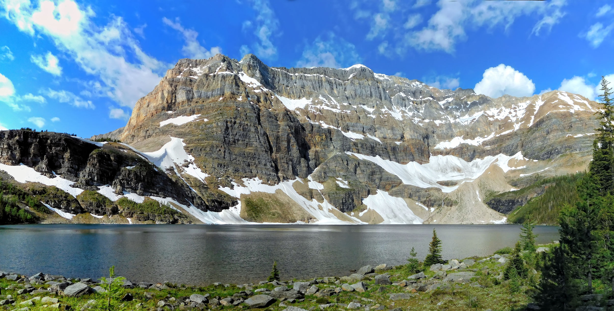
Scarab Lake and Scarab Peak 2918 m
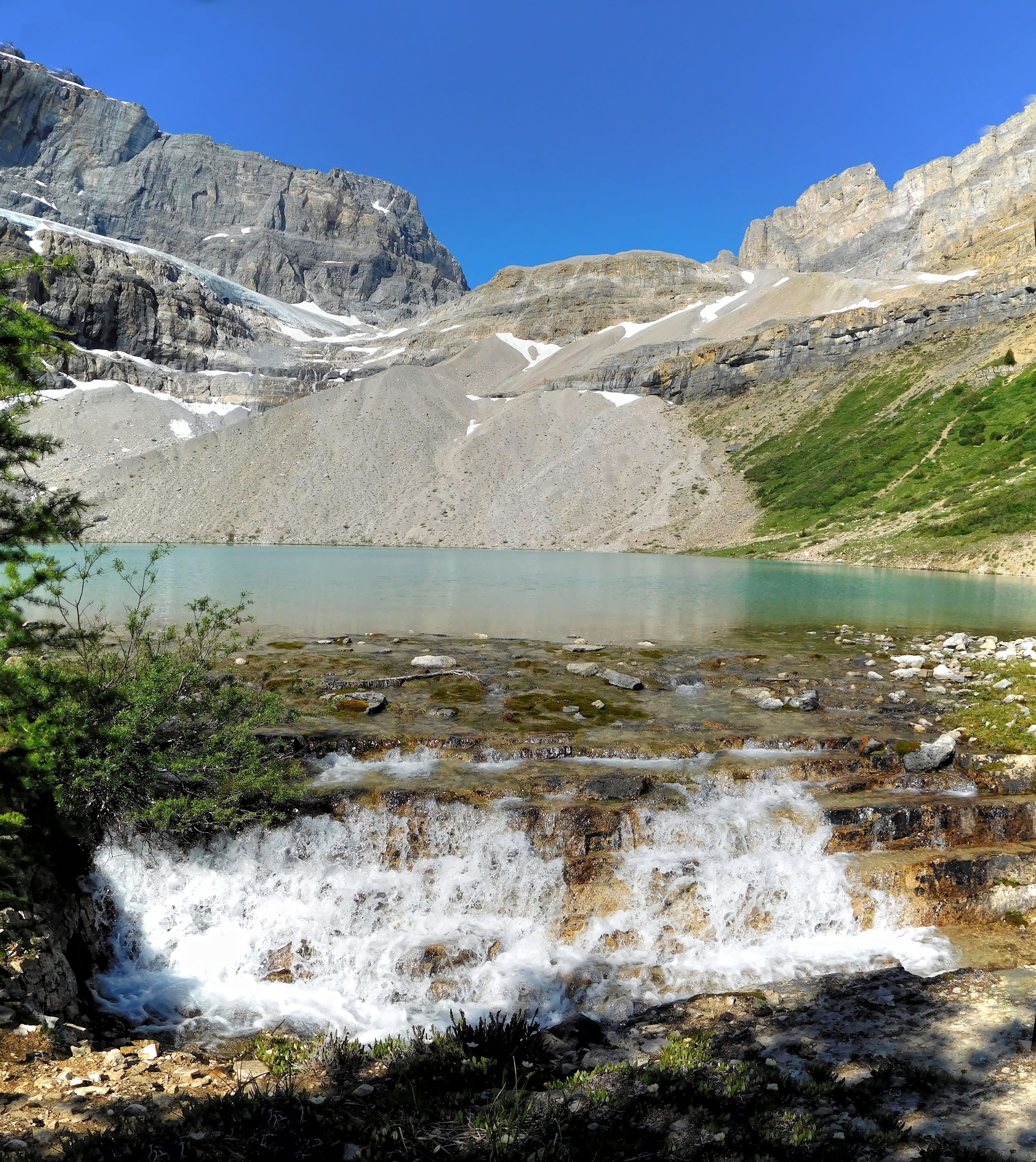
A maze of little side trails leads me to the top of the famous waterfall that tumbles from Scarab Lake into Egypt Lake. I am not inclined to lean too far out over the roaring waters, even if I miss the chance to catch the full drama on my pictures.
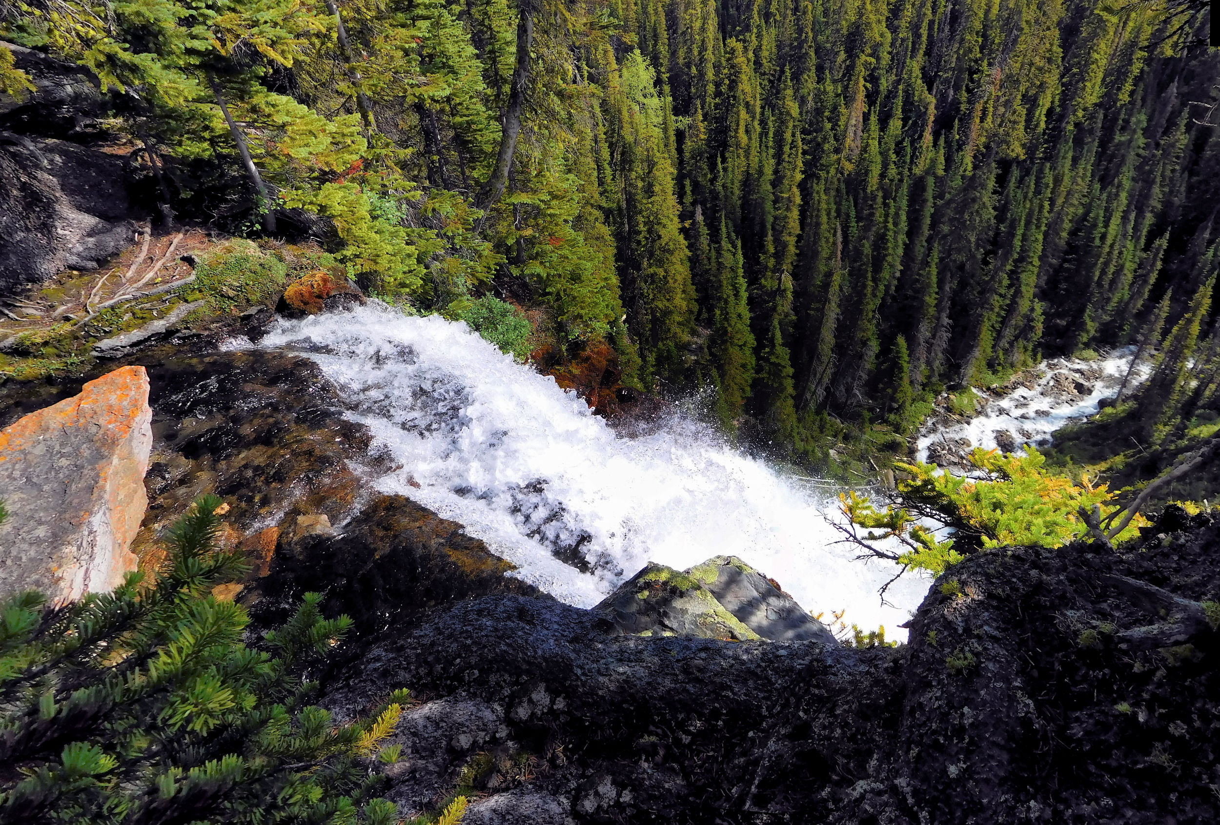
Waterfall above Egypt Lake 30 m
Close your eyes and go!
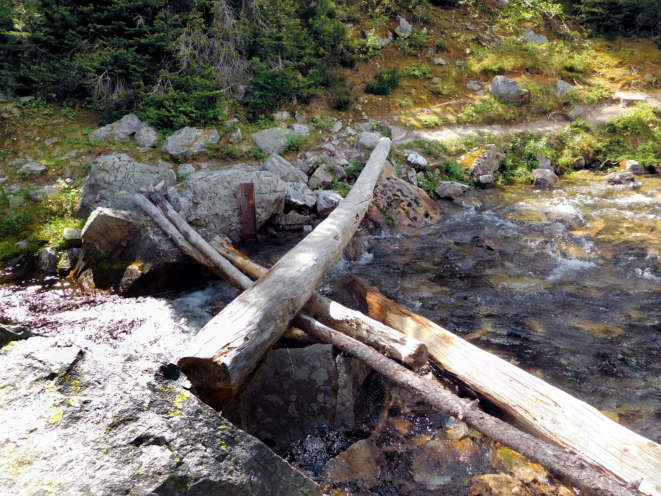
If you don’t mind an unstable log, you can climb to the other side of the falls. I have to cross it anyway as the trail to Mummy Lake continues on that side.
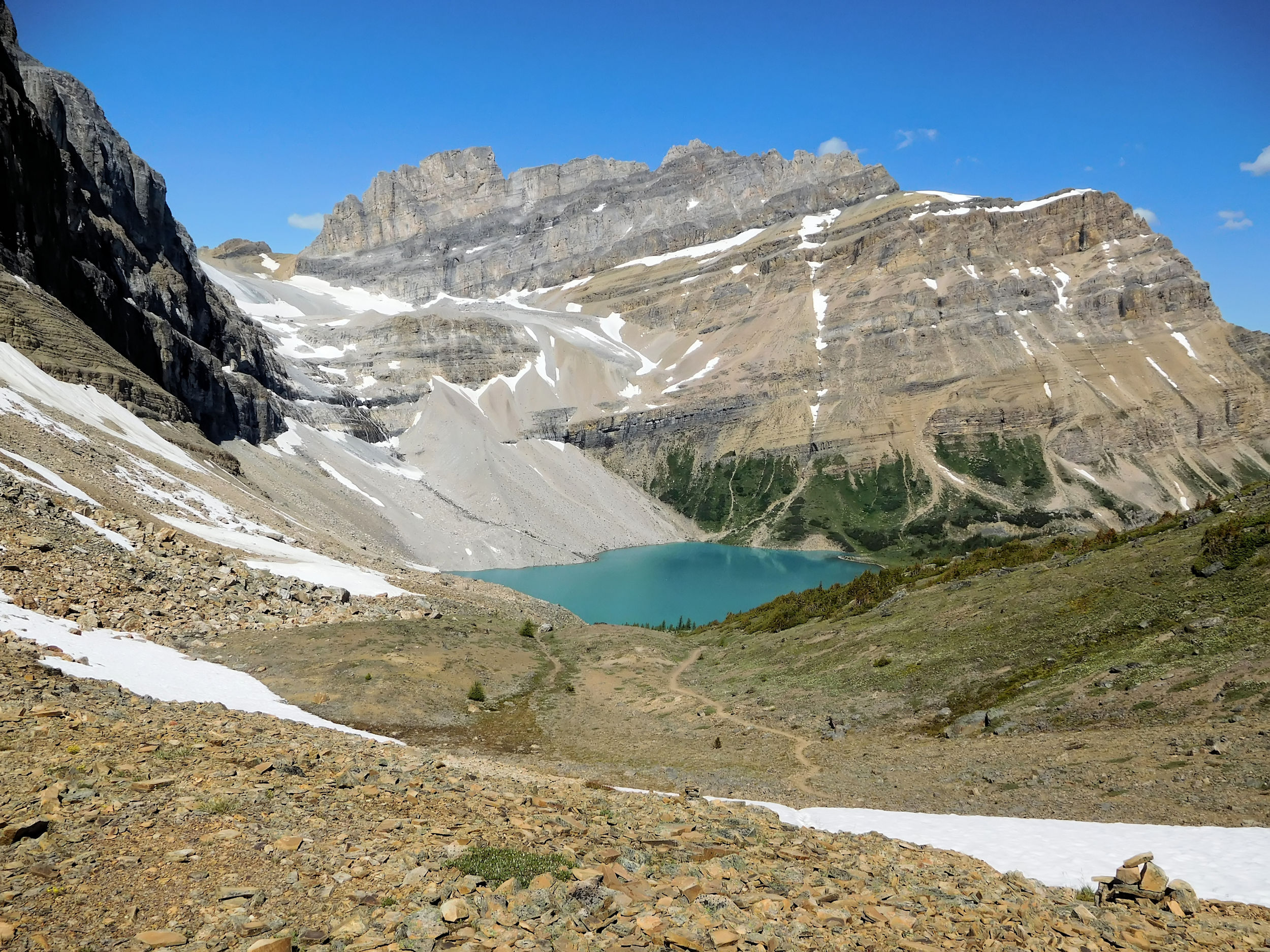
It is steep from here on; I leave the trees behind and reach the alpine zone. On my approach, the distinctive unnamed peak behind the Sphinx becomes more impressive, while Mummy Lake turns out to be not that spectacular. My guide book explains that the lake has lost a lot of water over the years and now is only a shadow of its former self.
Unnamed Peak
Mummy Lake and Pharaoh Peak
The names of the mountains are confusing, because Sphinx and Sugarloaf are the same, while the peak behind it has no name. The col between the peaks is the starting point for a scramble up to the Sphinx/Sugarloaf Mountain. Snow is still lingering and the route looks rough at best, so I change my mind about attempting it. Later, at the campground I talk to two women who crossed over the col into the neighbouring valley to reach Talc Lake and joined the trail back to the campground from there. Doable but not easy, they said.

It is exposed and very windy up here. After a short rest I start heading back and run into another hiker, who looks for a more protected spot to have a cook-stove lunch. Following him initially, I find a glorious viewpoint over Egypt Lake and Greater Pharaoh Peak. There is a cornice on the edge above a deep drop. I crouch down for the picture because the wind is so strong that it could blow me over and down.
Egypt Lake and Greater Pharaoh Peak 2713 m)
Lunch on the shores of Scarab Lake
After crossing the wobbly log bridge for a second time, I have my lunch break at Scarab Lake. The trees protect me from the wind. It is a calm and peaceful place.
I have plenty of time to extend my day hike to Whistling Pass. I return to the turnoff and continue to my left, steadily ascending through a subalpine rock garden. The wind is blowing dark clouds across the sky. It looks like rain is coming, maybe even a thunderstorm, but the sun always returns.
I scan the slopes of the three Pharaoh peaks and soon I spot an obvious place where to start the scramble up to Greater Pharaoh Peak. According to the guide book the scramble ends at 2700 meters and is strenuous but not difficult. On my return I meet two hikers coming down from the peak and they tell me that it took them 1 ½ hours up and 1 hour down. I think I have to return to Egypt Lake for a third time, because the views from Greater Pharaoh Peak are supposed to be out of this world.
Route to Greater Pharaoh Peak
Pharaoh Peaks
I reach Whistling Pass, a magnificent viewpoint overlooking the Ball Range and Haiduk Lake. The wind is howling and the sky presents a dramatic display of clouds.
Whistling Pass and Haiduk Lake
As expected, the return down the headwall into the valley is much more tedious than the way up. Nevertheless, after it’s done I carry on to Egypt Lake, 1 km off the main trail. In spite of its name, the campground is not located at the lake.
I bathe my tired feet in the cold water. The strong wind ripples the surface, no reflections to be had today. The Sphinx is exactly opposite from me and I recognize the gap with the snowbank where I stood just a few hours ago. Looking into the forest, I glimpse the silvery ribbon of the waterfall.
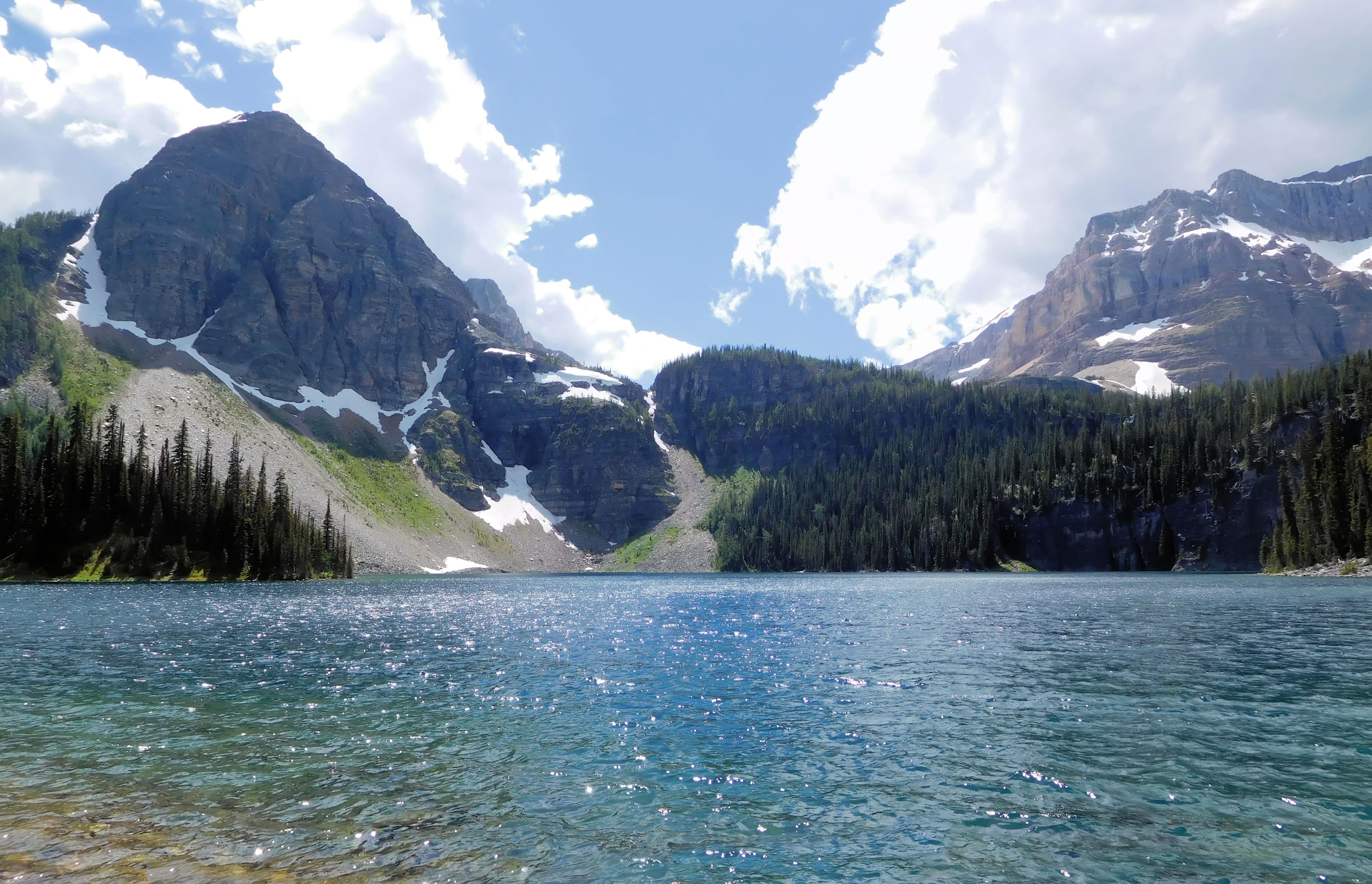
Egypt Lake and Sphinx/Sugarloaf Mt.
In the evening I swap stories with new neighbours at the picnic table. The wind keeps the mosquitos down a bit, but there are still way too many mixed in with the food on my plate. Overnight the bad weather reaches our valley and it starts raining. I am not saddened, however; the day was spectacular.
| Distance | 13.4 km |
| Time | 3 ½ hrs |
| Incl.Breaks | 5 hrs |
| Min. Elevation | 1634 m |
| Max. Elevation | 2363 m |
| Descent | 729 m |
| Cum. Ascent | 860 m |
| Cum. Descent | 1169 m |
I wake up to gray skies, but luckily the rain has stopped. Tent fly and groundsheet are wet and will be heavy, but I am happy that the inner canopy of the tent remains dry. And I am spared from packing my backpack while it is raining.
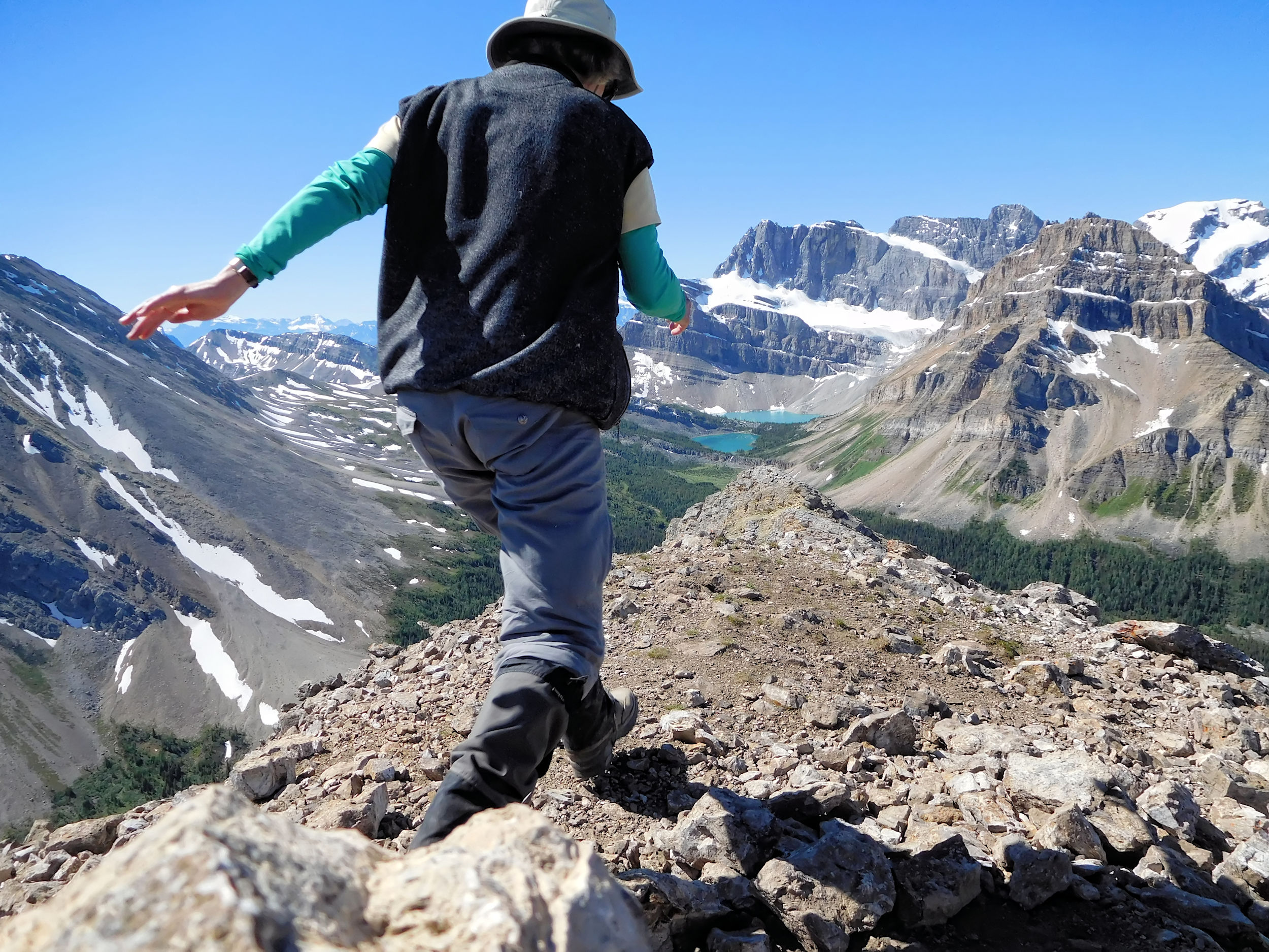
I ascend Healy Pass. One can still see the mountains under low clouds, but the views are not what they were two days ago. Below the pass, black clouds approach from the Monarch. It starts raining, then hailing. Quickly I seek protection under a stand of dense firs and pull my poncho and the rain cover from my backpack. Whereas the backpack is easily wrapped in its cover, the poncho is a different story. It is huge and somehow I have to pull it over me and my backpack that sticks up over my head. While I struggle with the poncho, the tree branches and the wind, two other hikers show up and come to my help. With the poncho belted around my waist I have the shape of Quasimodo, the backpack being my hump. The main thing however is to stay dry. We wait for another hail shower to end and then walk over the pass into the Healy Creek valley.
This time I cross the picturesque bridge. The trail that I took from Simpson Pass stays to my right. In this weather the bridge does not invite to rest. The Healy Creek trail leads along the creek and through dense forest. The trail is easy to walk even when wet. It drizzles on and off, but I have left the worst of the weather behind at the pass. Eventually the sun comes out. It takes me five hours to reach Sunshine Village. The parking lot has filled, which is no surprise to me as I ran into quite a few other hikers coming up. I am relieved to unload my heavy pack. I make a quick phone call home and then drive to Lake Louise where I will begin the next segment of my hike: through Skoki Valley.
| Distance | 7.6 km |
| Time | 2 ¼ hrs |
| Incl. Breaks | 3 ¼ hrs |
| Min. Elevation | 1693 m |
| Max. Elevation | 2220 m |
| Ascent | 527 m |
| Cum. Ascent | 714 m |
| Cum. Descent | 205 m |
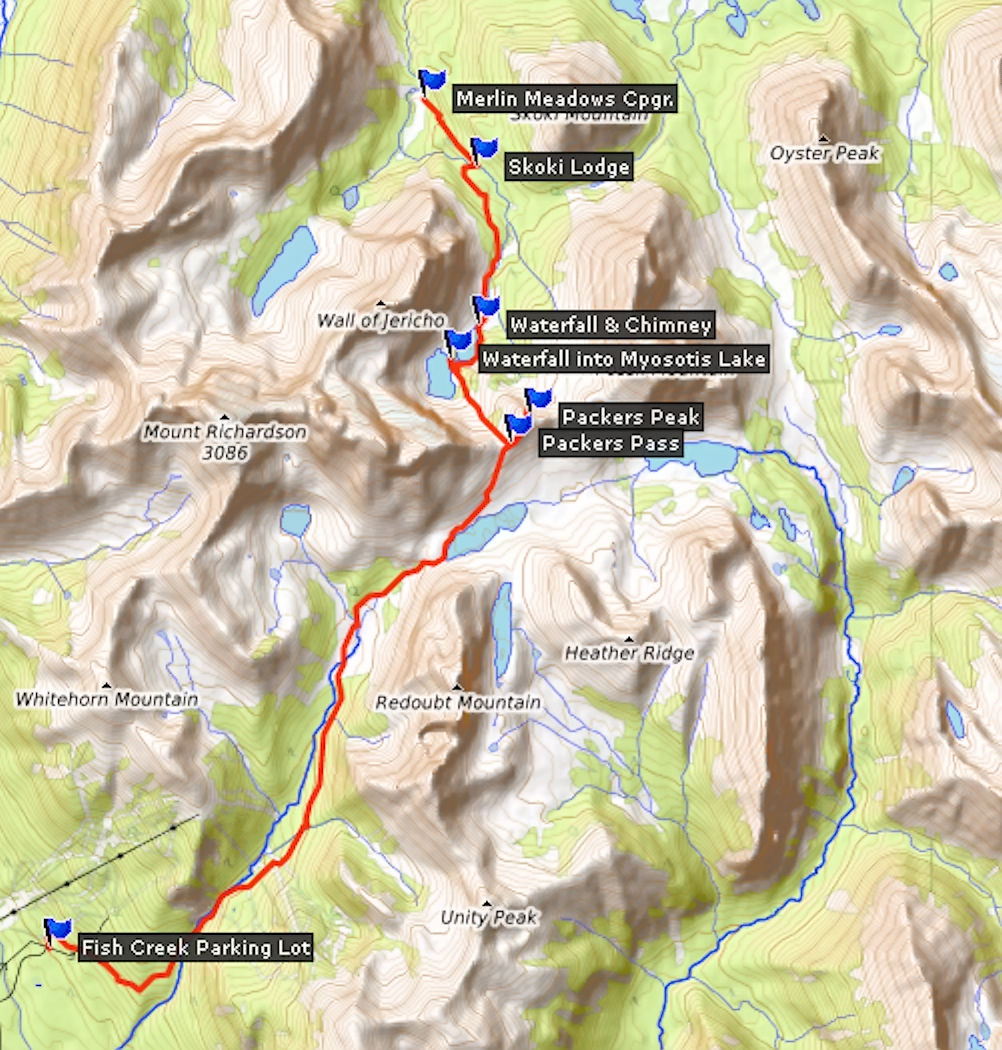
Walls of thick black clouds surround Lake Louise. Torrential rains come pouring down again and again. I drive to the Fish Lake trailhead just north of town which provides access to Skoki and also to the Whitehorn ski area. I stay in the car waiting for another rain storm to pass. Big dark clouds are hanging down to the bottom of the valley. Disheartened I return to the town center in order to check with the visitor center for a current weather forecast. It is going to stay the same for at least a day or two. Briefly I consider spending the night at the Lake Louise hostel and to postpone the start of my hike for a day, but finally I decide to stick to my plan.
I return to the trailhead, prepare my pack for the next stage and put on my rain poncho right away. I have finally found a way to pull it over me on my own. I do it backwards, swing the long tail over my backpack and pull it over my head to the front, before I stick my head and arms through the respective openings.
The Skoki trailhead is four kilometers away on the Temple fire road. This gravel road leads across the Whitehorn ski area to Temple Lodge. In good weather there would be a nice view back over the mountains near Lake Louise, but not today. Over time the breaks in the rain become longer and the rain lighter. Hiking uphill, it is getting too hot under the poncho and have to take it off.
After a while the wind starts gusting and the heavy rain returns. I get a lot of practice for putting on the poncho. I am almost at the end of the gravel road when a Parks Canada information kiosk provides a very welcome refuge from the pouring rain. I wait what feels like a long time (20 minutes), make already plans how I could fit my tent under the roof, when the heavy rain finally turns into a drizzle. I continue on my way.
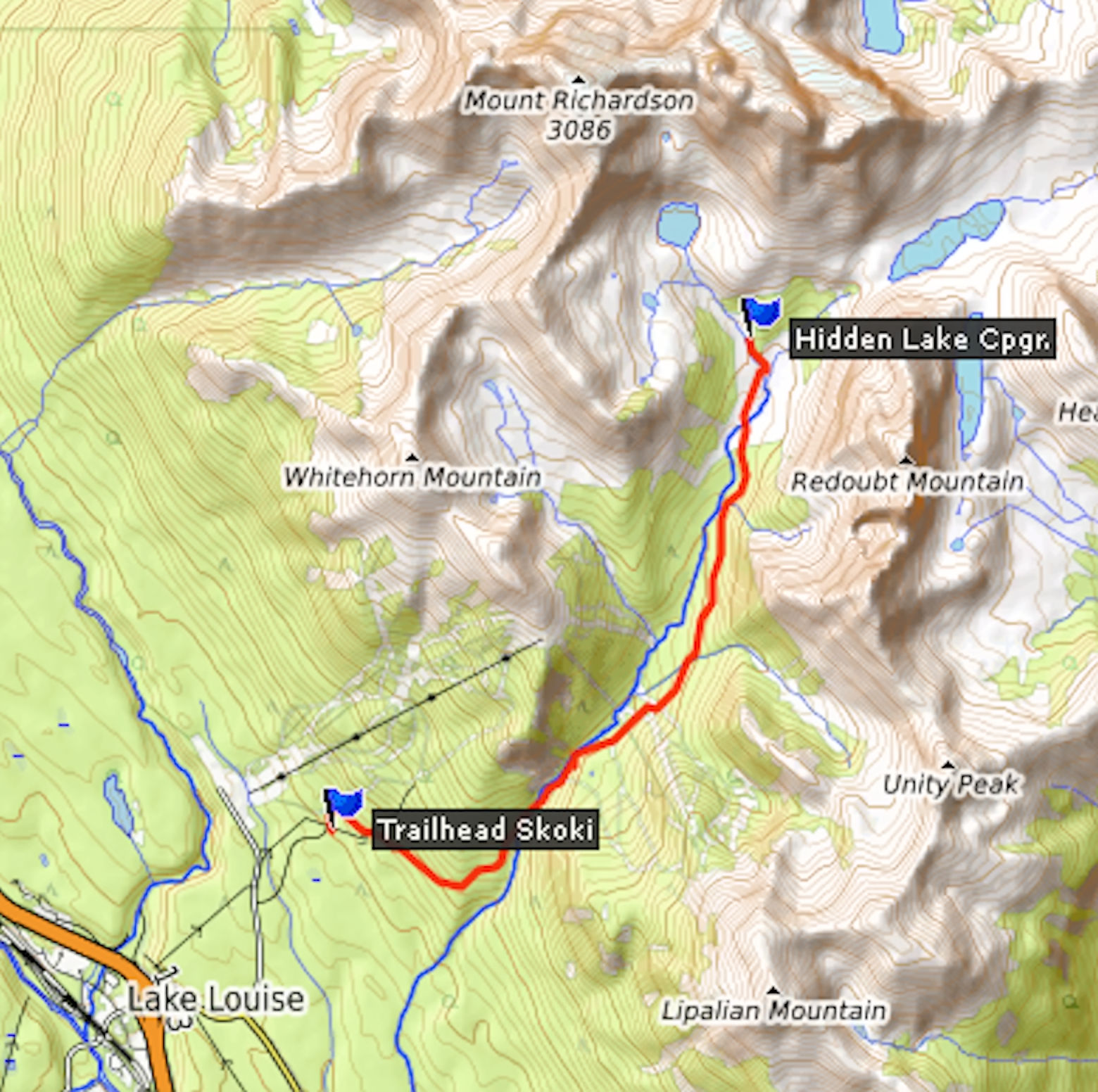
The Skoki trailhead is well-marked by a big wooden sign. The road ends, and a wide trail begins. It is shared with horse riders and therefore a bit rough. Another 3.1 km bring me to the turnoff to Skoki Halfway Hut, a historic log cabin that in the 1890s served as a rest station for skiers on their way to Skoki Lodge. Today it is a museum. I don’t take the time to visit, because I want to reach the campground and set up my tent before it starts raining again.
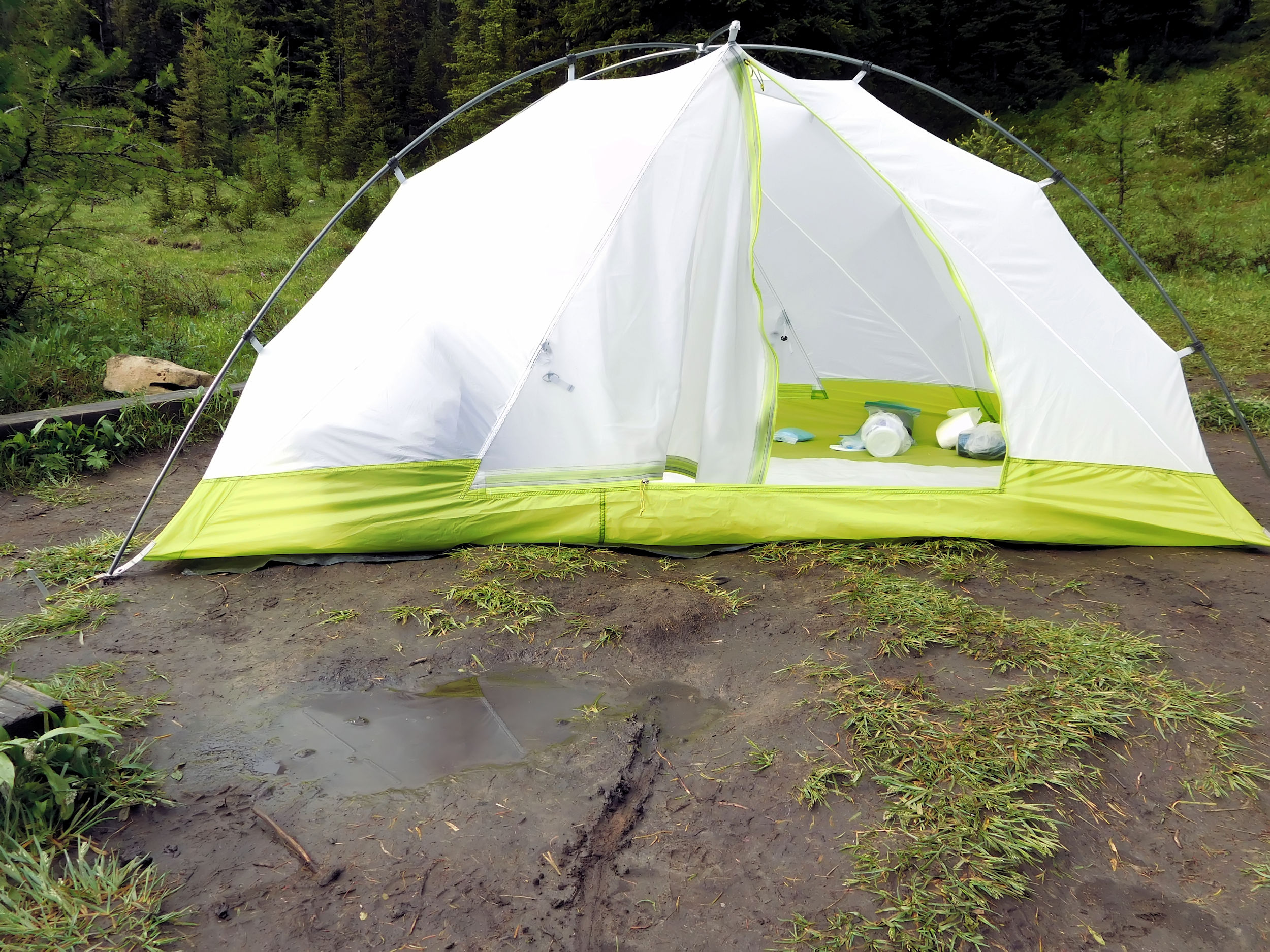
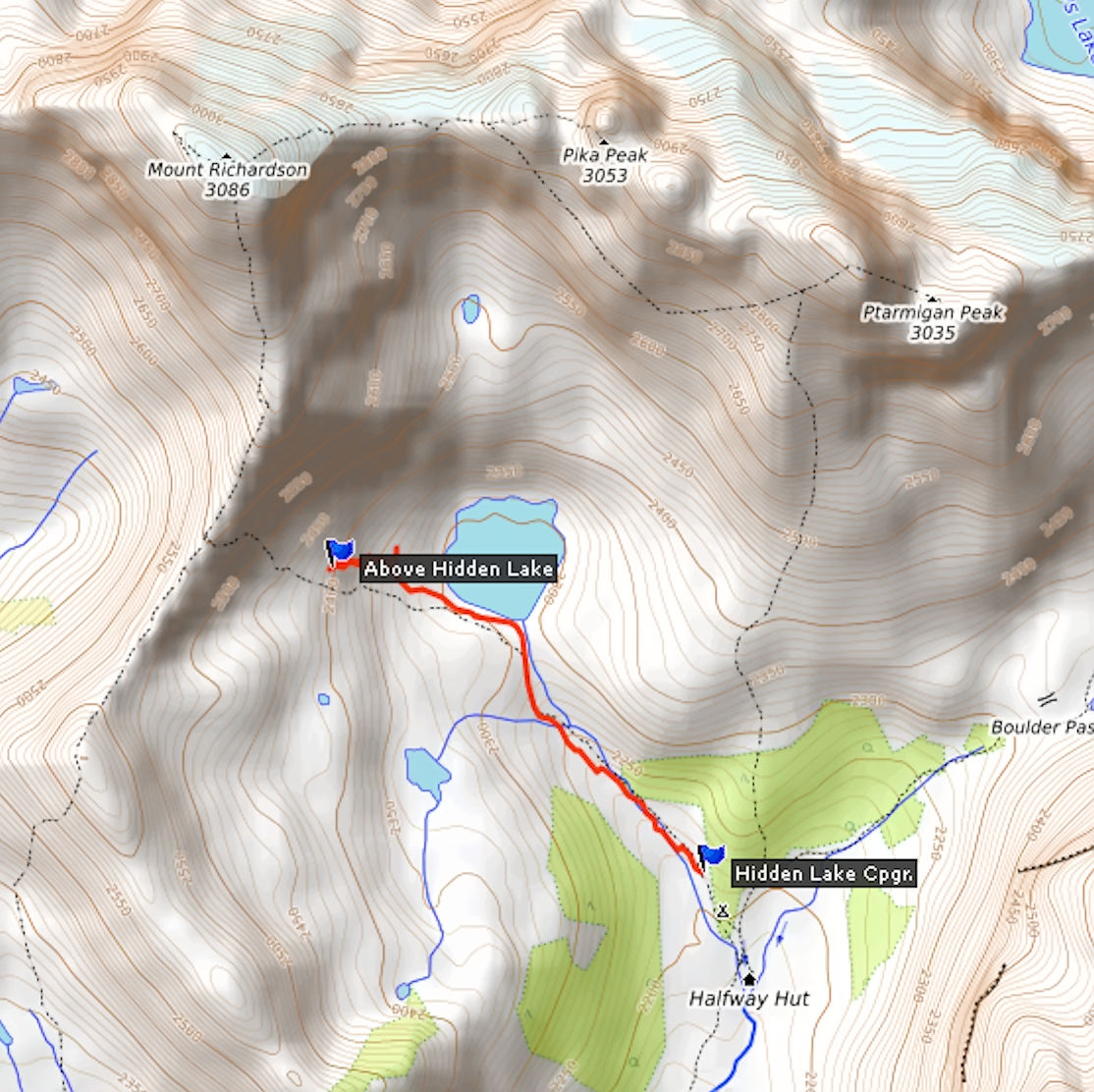
At kilometer 7.3 a well-trodden trail leads another 100 meters down to Hidden Lake campground. By now it is 6pm and there are already a number of people and tents. The campsites have suffered in the heavy rain. I look for one with the least water puddles. While I investigate how to best position the tent to avoid most of the mud, my backpack that leans against the site number peg falls over with an ugly tearing sound. The rain cover got tangled up with the sharp edge of the metal sign and now I have a 30 cm long tear in it. Luckily it is only the cover and duct tape will take care of it.
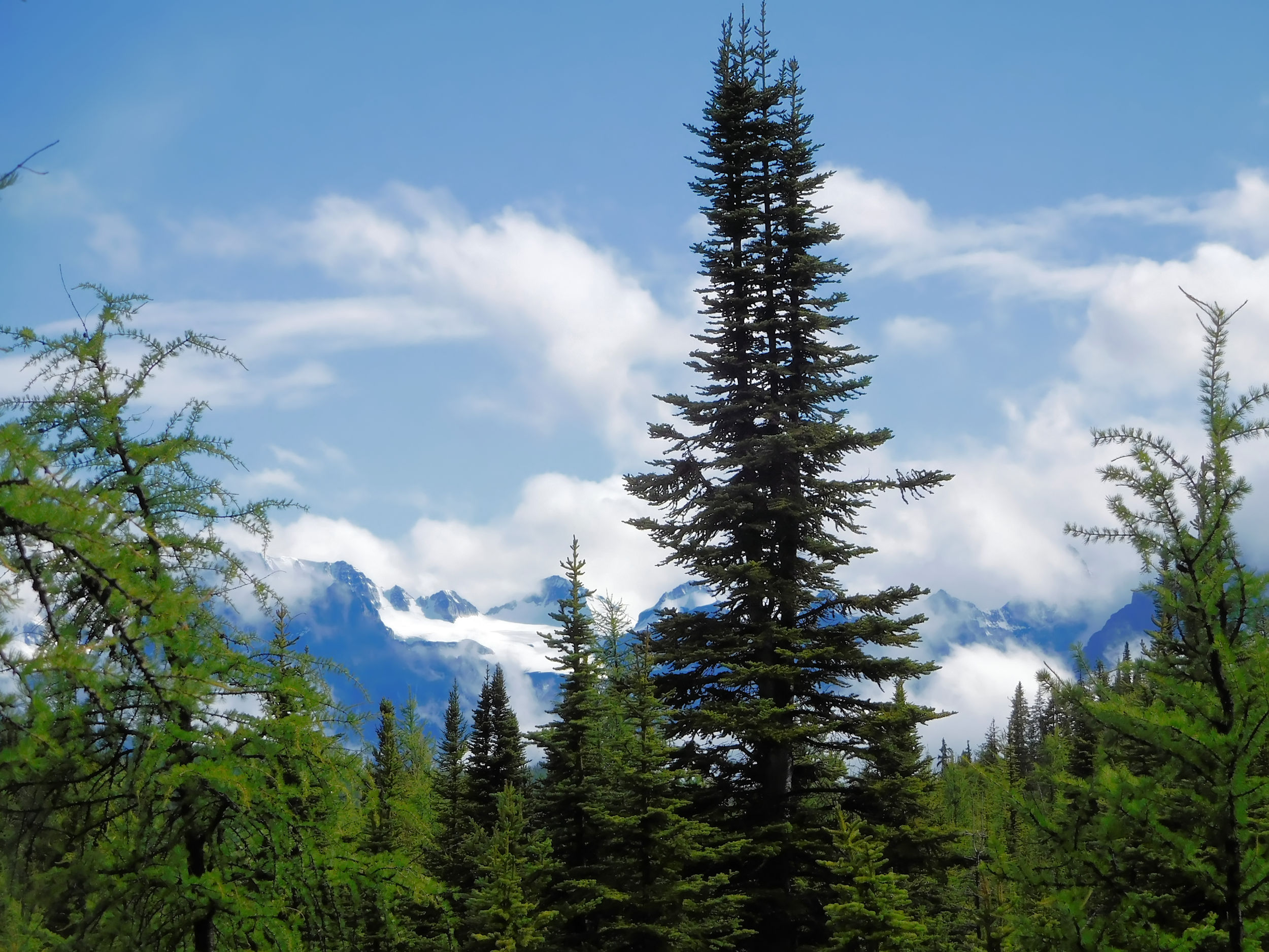
I set up my tent and dig some trenches into the hard ground. At least it has stopped raining. The clouds lift and, yay, the sun shows up again. If I stand on my toe tips I can make out Temple Mountain above the trees.
View from Hidden Lake campground
At dinner time I meet the other hikers. They are a large family that congregates here once a year. They are very friendly, especially David, the patriarch. Before I settle down for a well-earned rest in my tent, I have a visitor. A young buck nibbles calmly on the shrubs behind my tent.
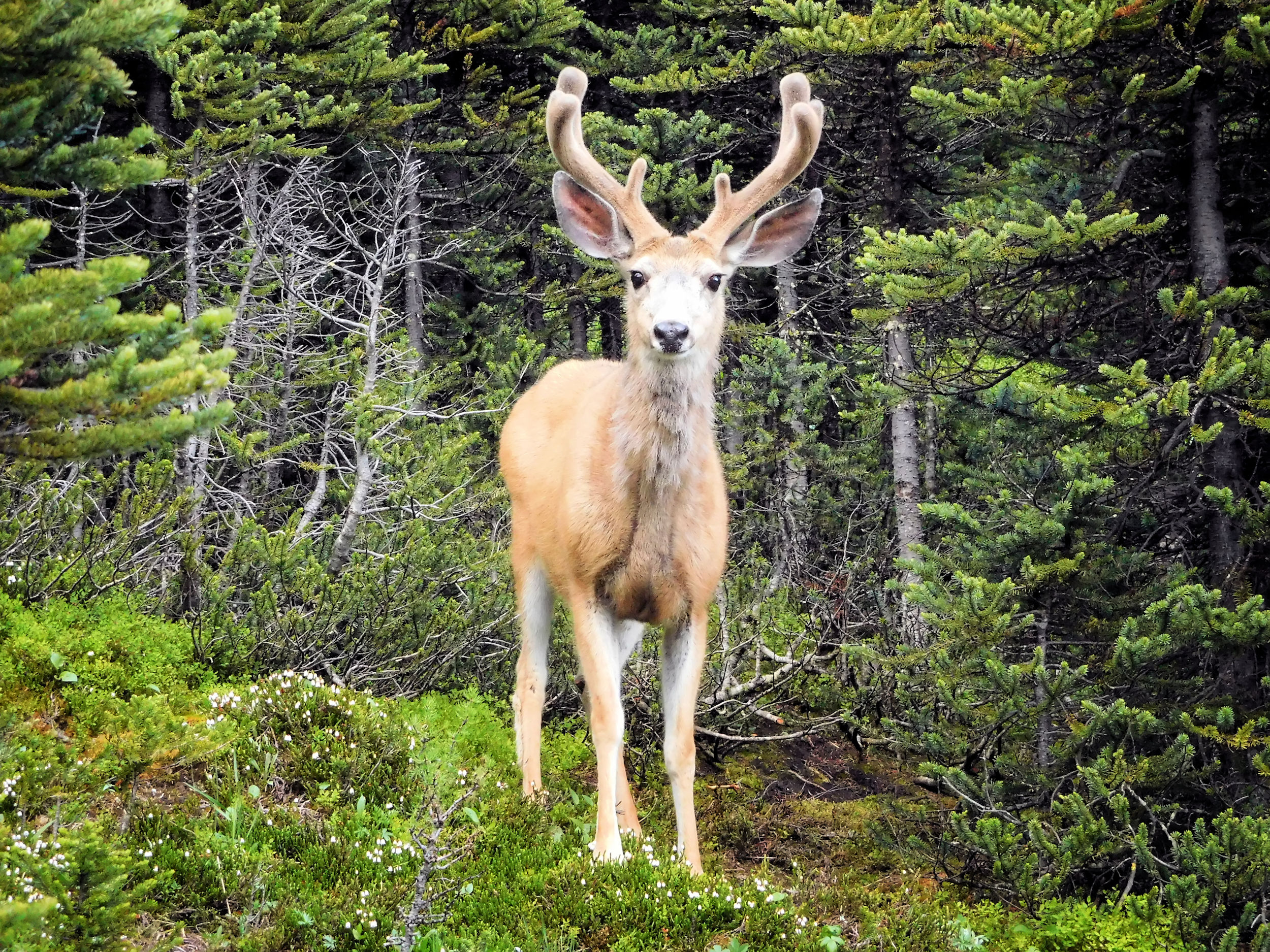
An imposing guest
Later, three young guys arrive at the site next to me. They have a dog, too, and it is beyond me how they all fit into their small igloo tent. For the whole evening they play cards and laugh their heads off. It sounds like some booze could be involved, too. The dog is completely silent. Like me he sleeps soundly through a cold but rainless night.
| Distance | 4 km |
| Time | 1 ¼ hrs |
| Incl. Breaks | 2 hrs |
| Min. Elevation | 2215 m |
| Max. Elevation | 2407 m |
| Ascent | 192 m |
| Cum. Ascent | 233 m |
| Cum. Descent | 233 m |
After a hearty breakfast I want to explore Hidden Lake, only two kilometers away. I meet David, who got up even earlier and has just returned from there. He recommends going beyond the end of the trail and watching for lots of Alpine Forget-Me-Nots.
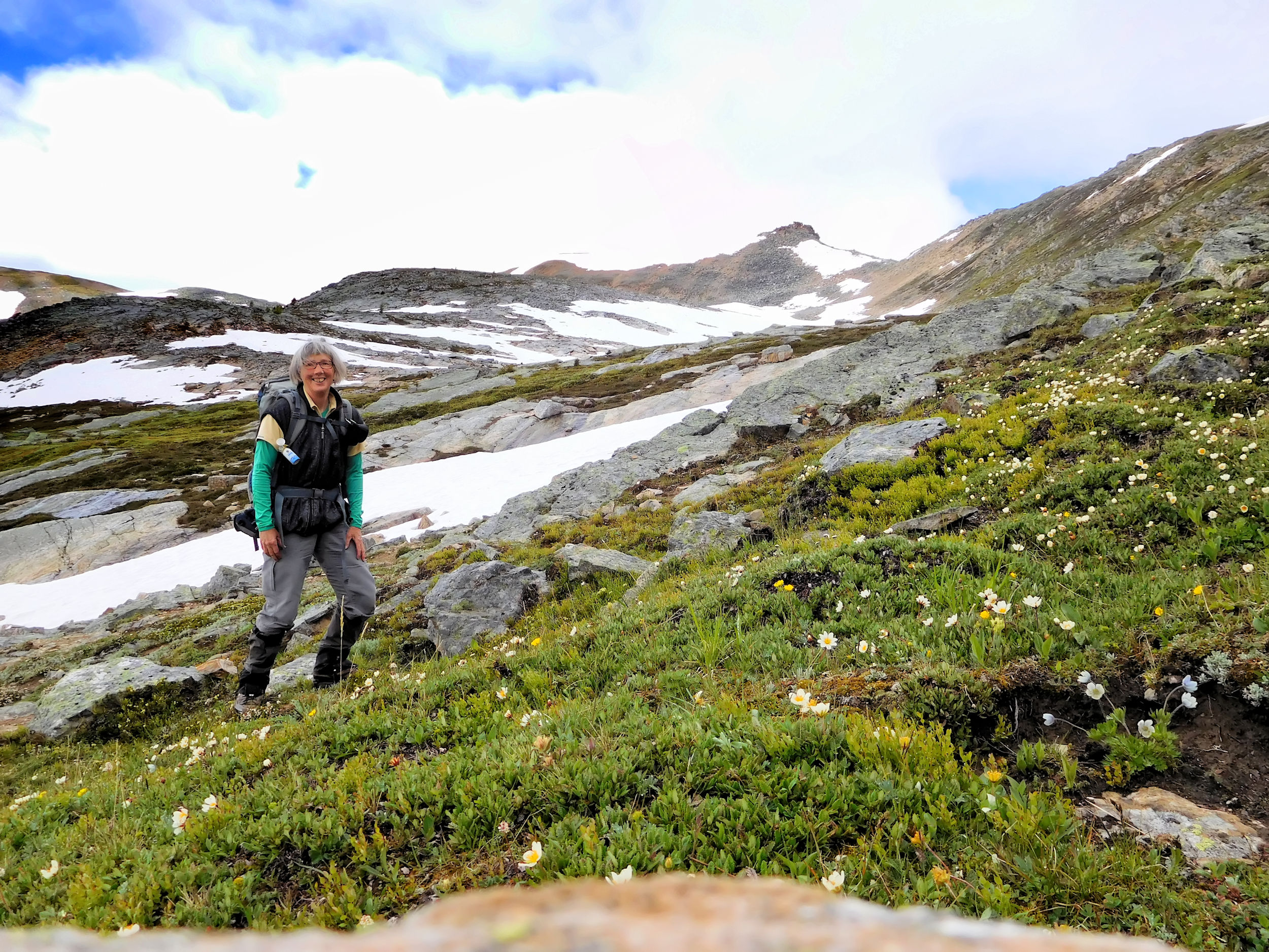
Above Hidden Lake
The trail is obvious and ends above the lake. The dwarfed blue flowers that David so admired are everywhere. I climb a little bit higher and sit down on a rock to enjoy the views. I am surrounded by 3000 meter peaks: Mount Richardson, Pika Peak and Ptarmigan Peak. Morning fog still lingers and hides the tops of the mountains.
Mt. Richardson 3086 m and Pika Peak 3053 m
Pika Peak and Redoubt Mountain
Just after 11:00 I arrive back at the campground and say good-bye to David, who is going on a day trip to Skoki Lodge with the whole family. I pack up my tent and have lunch, before I start on my way to Baker Lake.
| Distance | 6 km |
| Time | 1 ¾ hrs |
| Incl. Breaks | 2 ½ hrs |
| Min. Elevation | 2180 m |
| Max. Elevation | 2364 m |
| Ascent | 184 m |
| Cum. Ascent | 289 m |
| Cum. Descent | 220 m |
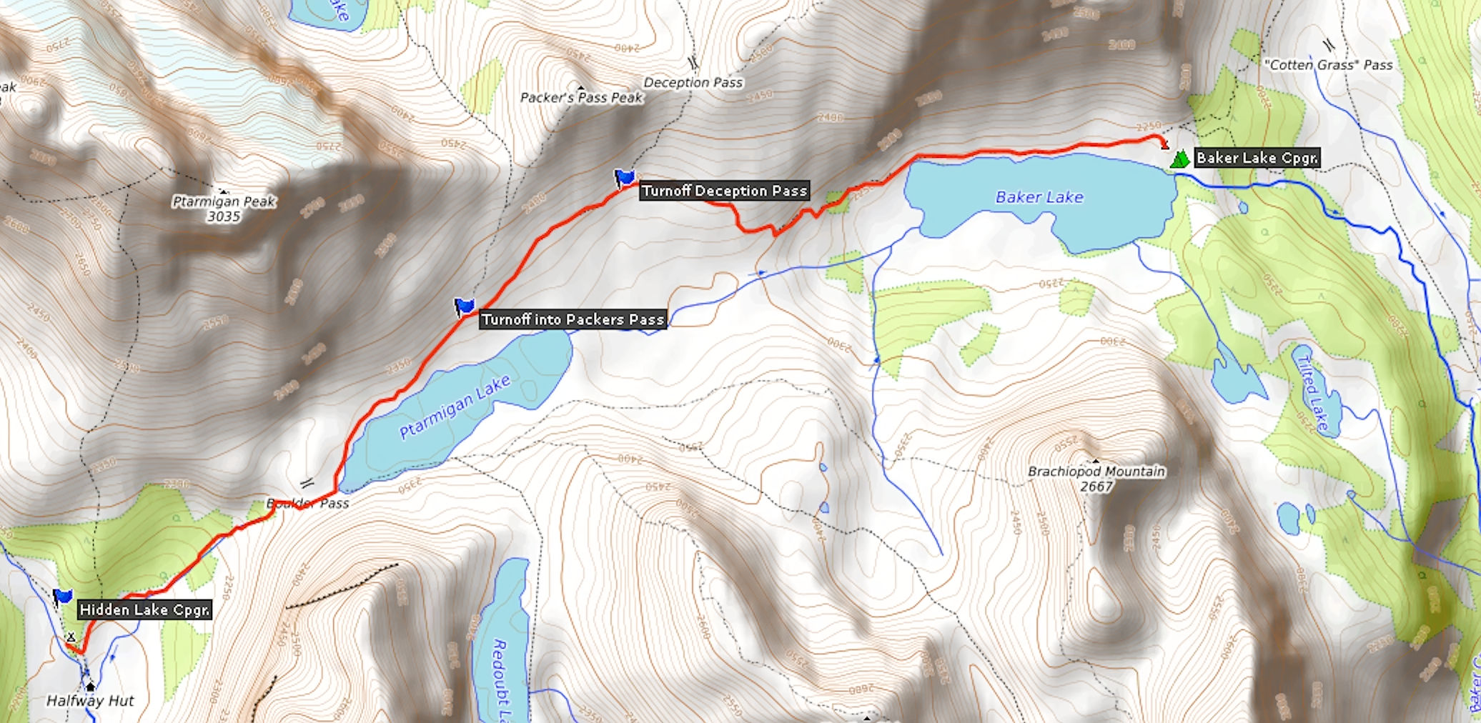
The trail leads over Boulder Pass which at 2345 meters is almost the maximum elevation for today. The pass lives up to its name, huge boulders are all around.
Redoubt Mountain towers next to the pass.
Redoubt Mountain 2902 m
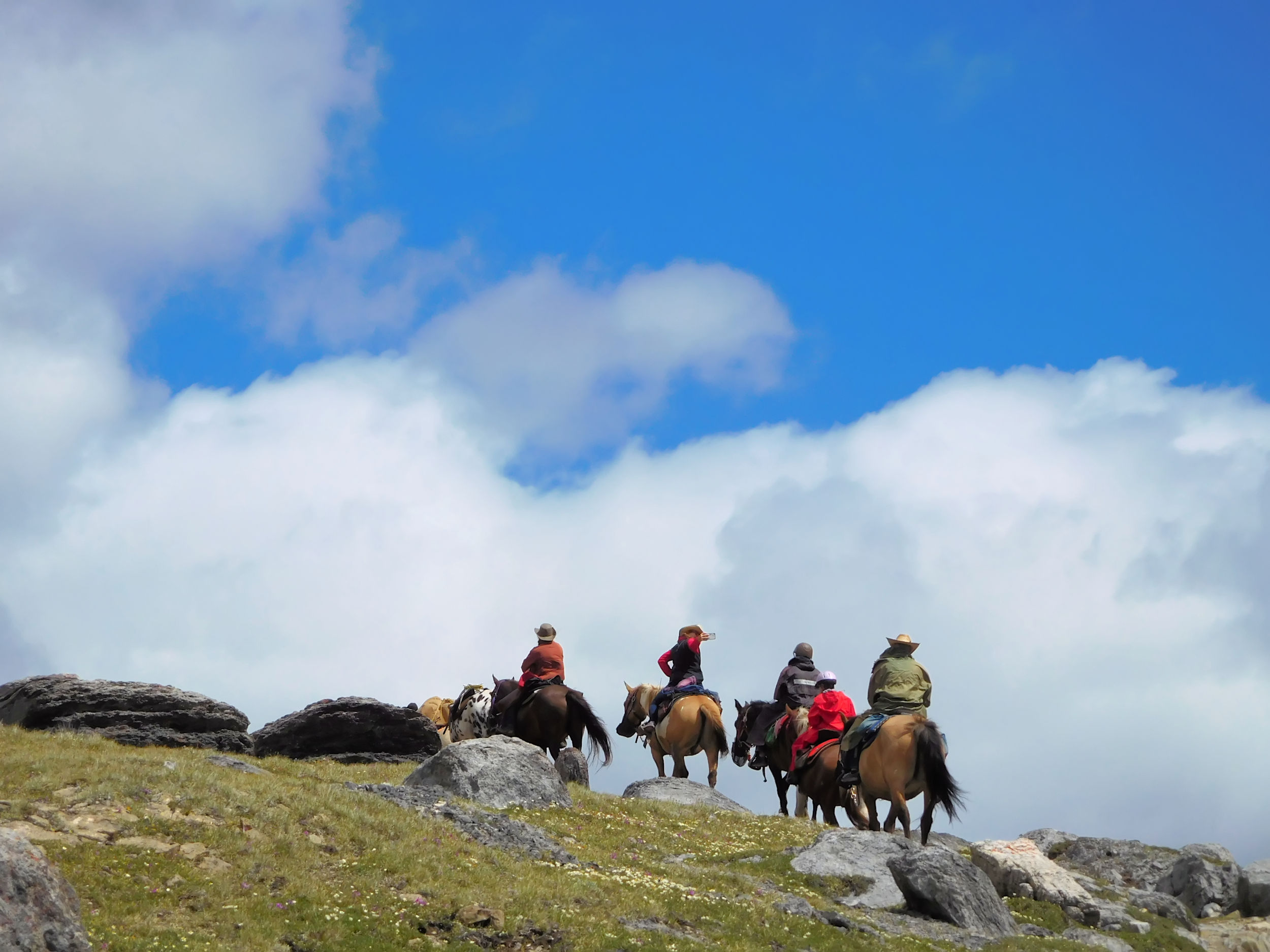
An interesting rock formation at the bottom of Ptarmigan Peak reminds me of Haida totem poles. A group of horse riders passes by. A lady carries her little dog in front of her in the saddle. No need to walk for him today.
Petrified totem poles?
From Boulder Pass it is a leisurely descent to Ptarmigan Lake. A strong wind blows through the valley and ripples the water. There is still some snow on the trail. Just a week ago the valley was accessible on snowshoes only.
Ptarmigan Lake
I spot some anemones (Western Anemones) by the trail and crouch down to take a picture of the lake with these beautiful flowers in the foreground. When I try to get up I forget about the heavy pack on my back and fall down on my bottom into the mud. My pants are dirty now, but I managed to raise my hand holding the camera and saved it from the elements.
Western Anemones on Ptarmigan Lake
Mount St. Bride 3315 m
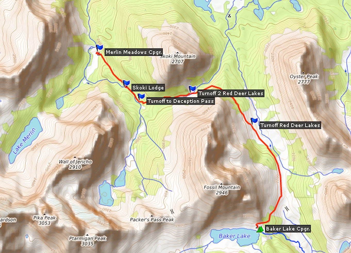
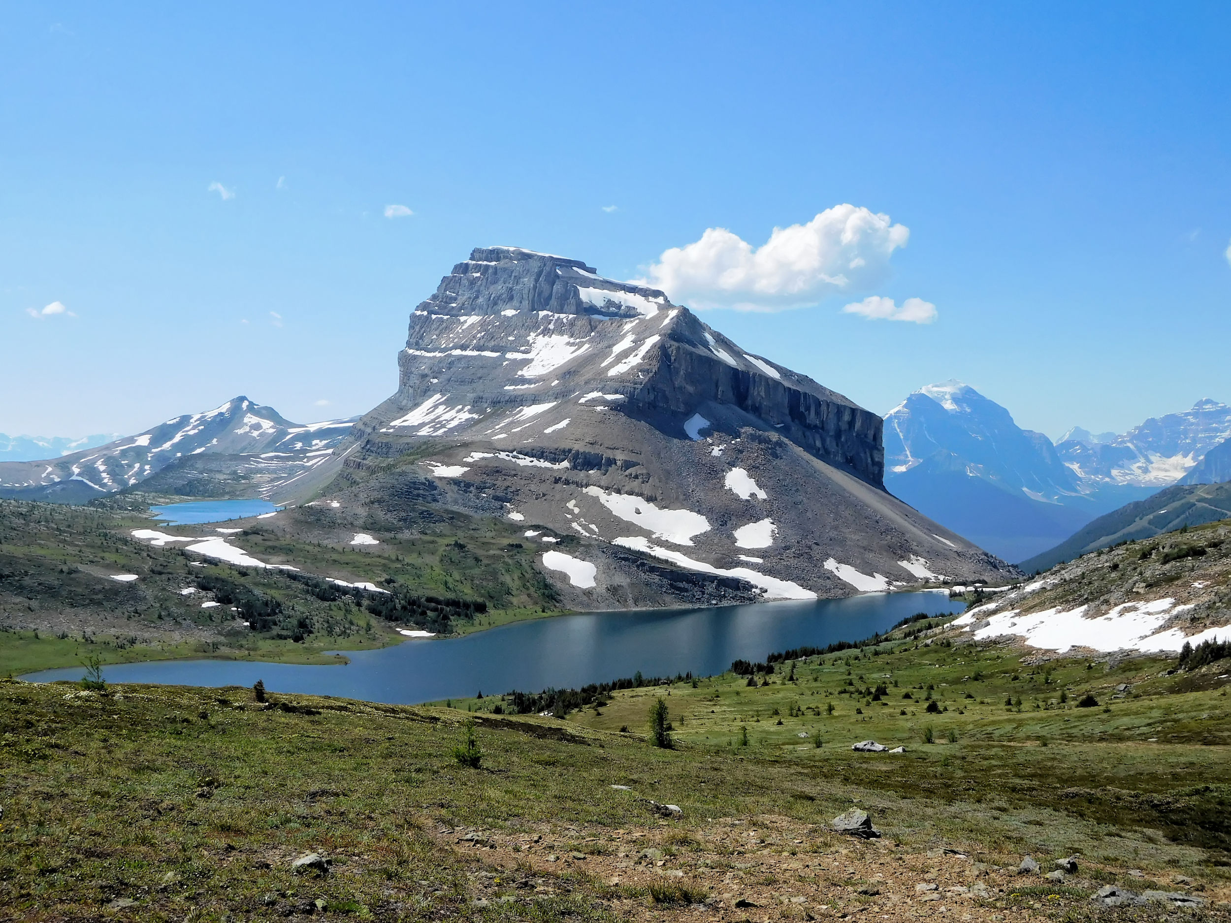
The trail follows the lakeshore and offers a view of imposing Redoubt Mountain. On this segment of the trail there are many other hikers. Halfway along the lake a steady climb begins and I reach the turnoff to Deception Pass, with 2364 meters the highest elevation for today. Most of the hikers follow the route over this pass to Skoki Lodge, only a few continue on to Baker Lake.
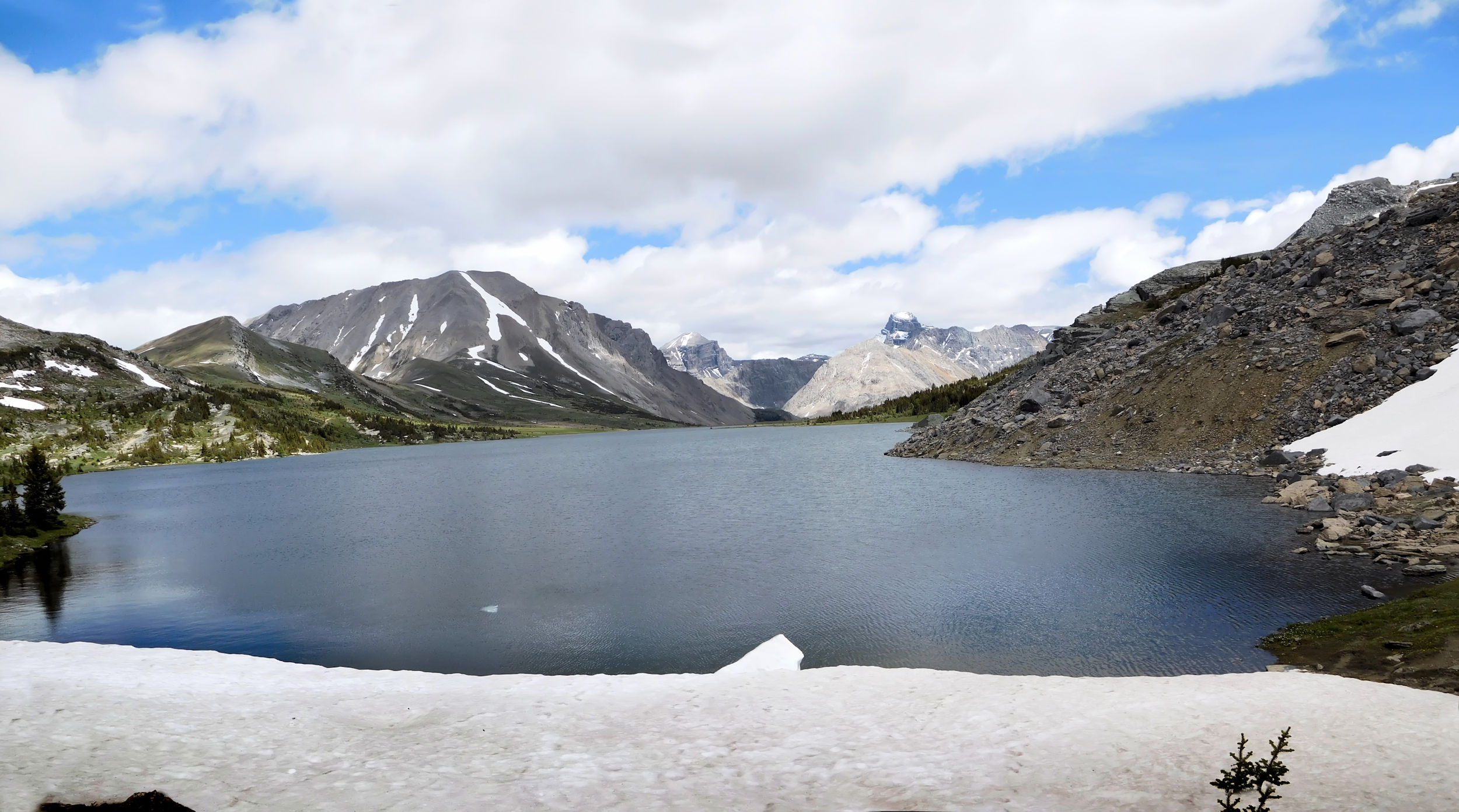
Ptarmigan Lake and Redoubt Mountain 2902 m
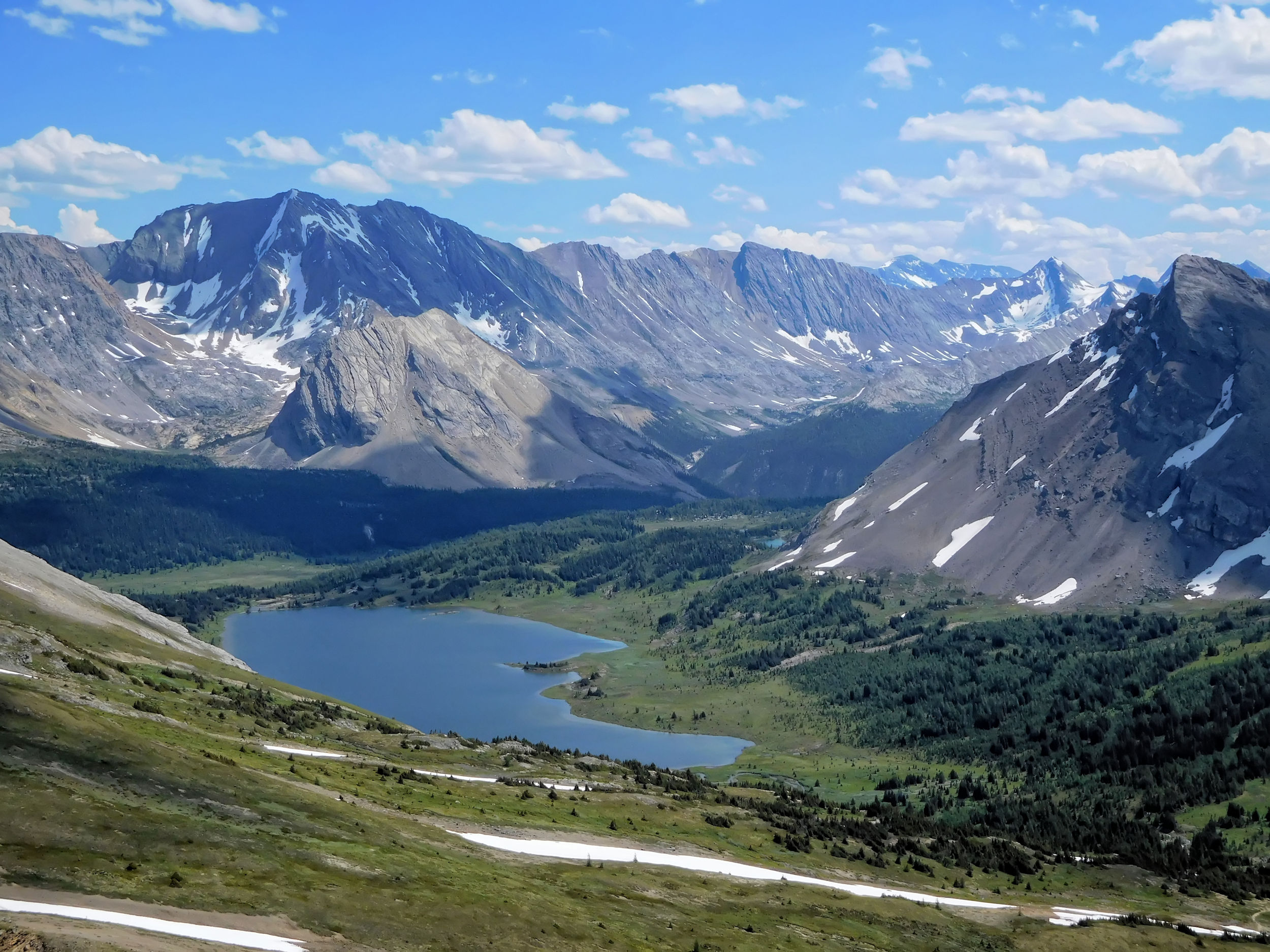
Soon my destination for today comes into view. The campground is located at the far end of Baker Lake.
Baker Lake ahead
Redoubt Mountain behind
The tent sites at Baker Lake are close together and don’t offer much privacy. I find one with a nice view. A steep path leads down to the outflow of the lake where the source for drinking water and the food storage pole are located.

View from my tent: Brachiopod & Anthozoan Mts.
Baker Lake campground
At dinner time I share a table with two young physiotherapists from Calgary, and we have a nice exchange of hiking stories. I end the day with a little walk along the creek that flows out of Baker Lake. It forms a cascade leading into a pretty waterfall.
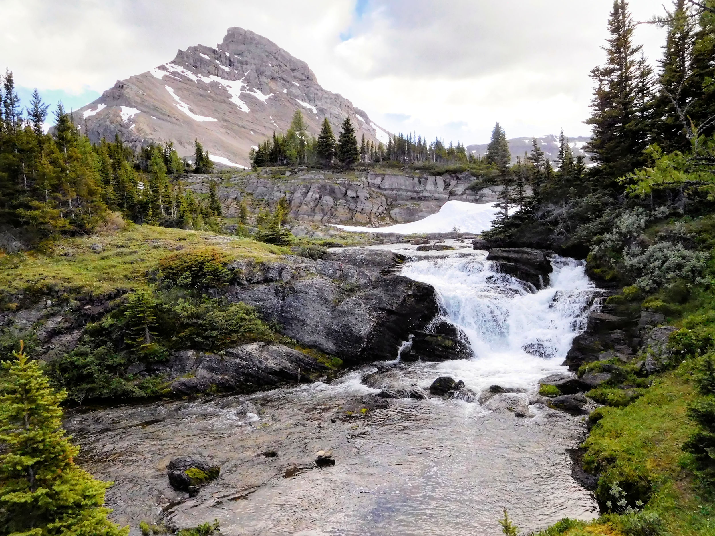
Waterfall past Baker Lake
Obviously the campground is also home to porcupines. I meet one of them on my walk and another one flees from my campsite when I return. These funny looking creatures are no campers’ friends. They chew and destroy everything that smells or tastes of food, sweat or salt. Even the outhouses are not safe from them and are wrapped in a fine-meshed wire for protection. The silly thing has toppled over my hiking poles that I had stuck into the ground. Clearly, I have returned just in time before it had a taste of the hand straps. I hang the poles on a tree like the other hikers have done. The next morning I will find a small bite in my tent fly, but nothing that can’t be easily repaired.
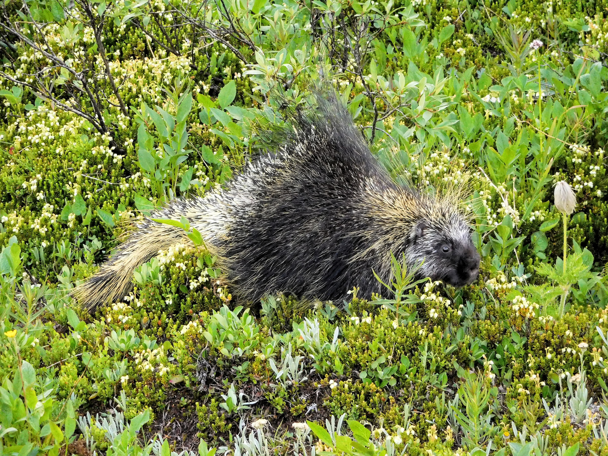
Porcupine alarm
Bedtime
All tents are more or less within earshot. An older couple with their grandson occupies the neighbouring one. Grandma reads him a bedtime story that I enjoy very much as well. Not so much the steady snoring that soon follows from all directions.
| Distance | 8 km |
| Time | 2 ½ hrs |
| Incl. Breaks | 3 hrs |
| Min. Elevation | 2063 m |
| Max. Elevation | 2267 m |
| Descent | 204 m |
| Cum. Ascent | 283 m |
| Cum. Descent | 488 m |
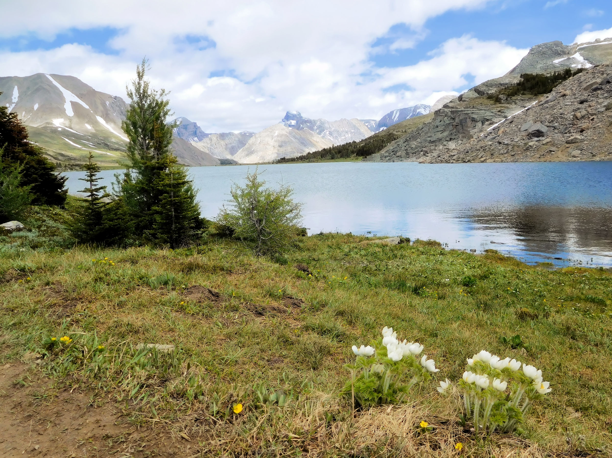
I wake up to a calm day with brilliant blue skies. Without wind, the panorama around Baker Lake is out of this world.
Baker Lake with Redoubt Mt. and Ptarmigan Peak
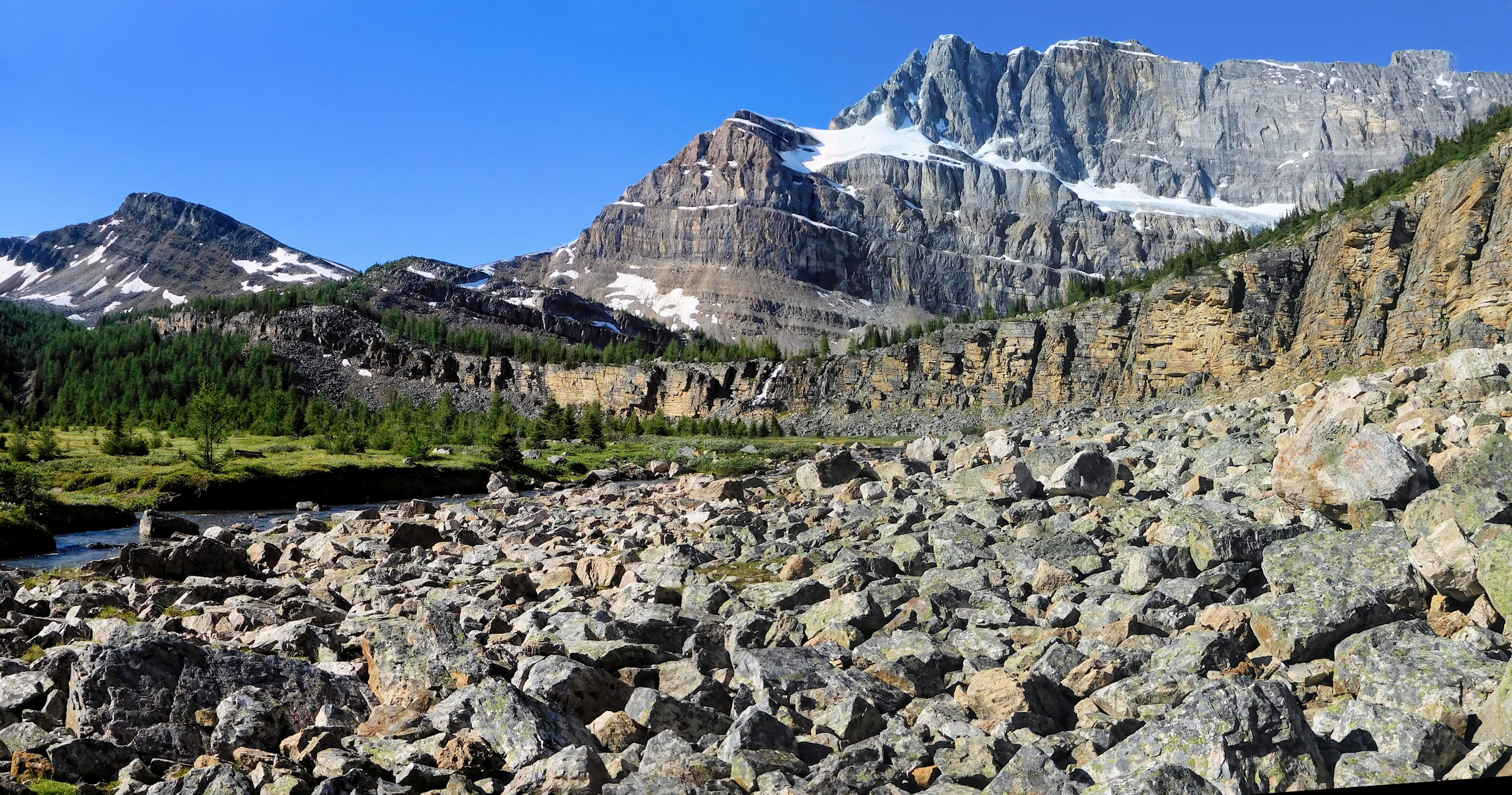
The trail continues into the valley between Oyster Mountain and Fossil Mountain and goes on to Cotton Grass Pass (2190 m). The pass is at a lower elevation than Baker Lake and therefore it does not feel like an ascent at all. The landscape is a mix of willow shrubs, grass and meadows. The trail is muddy in places. Oyster Mountain on my right has a long ridge and might be worth a future explore.
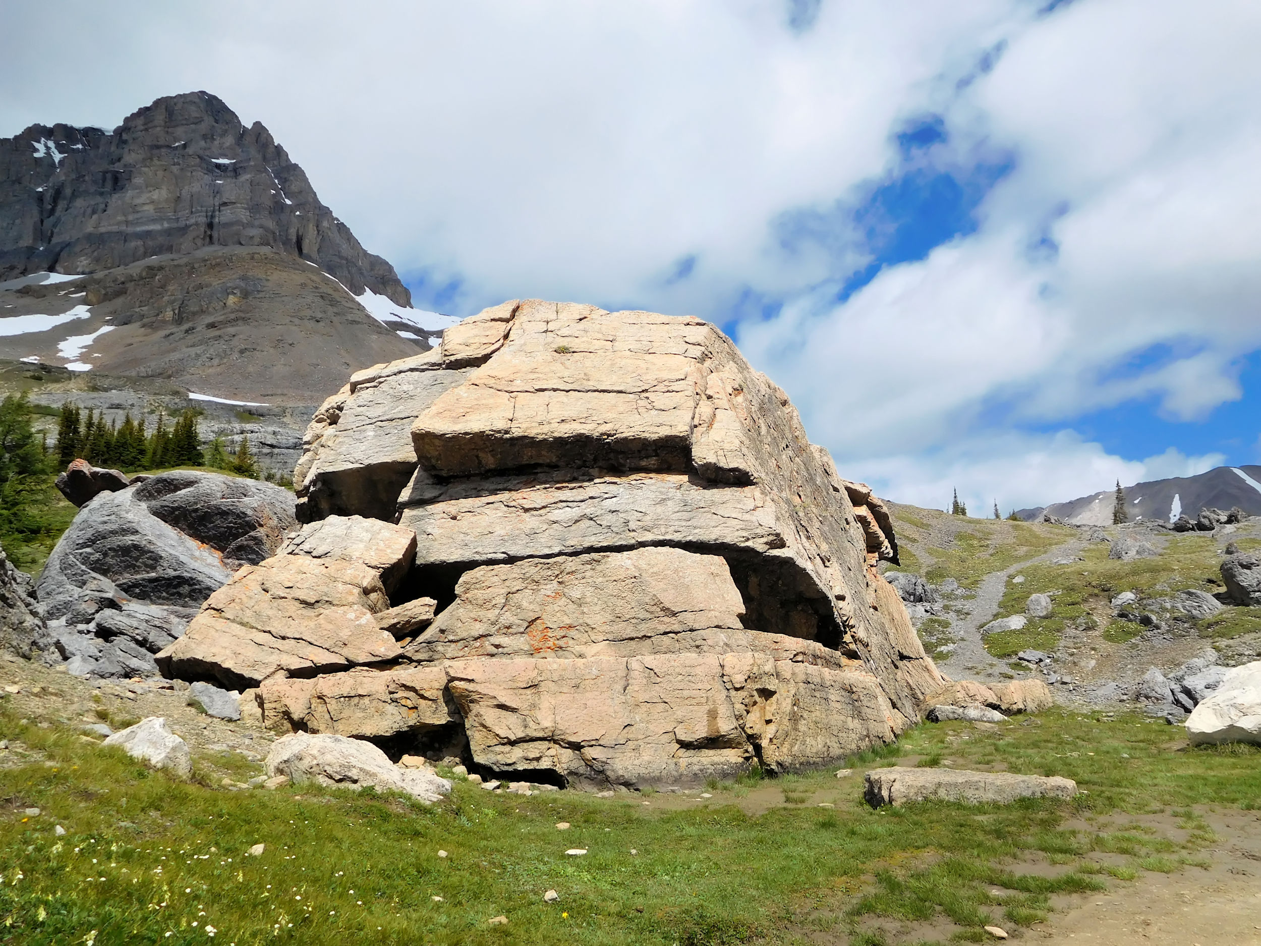
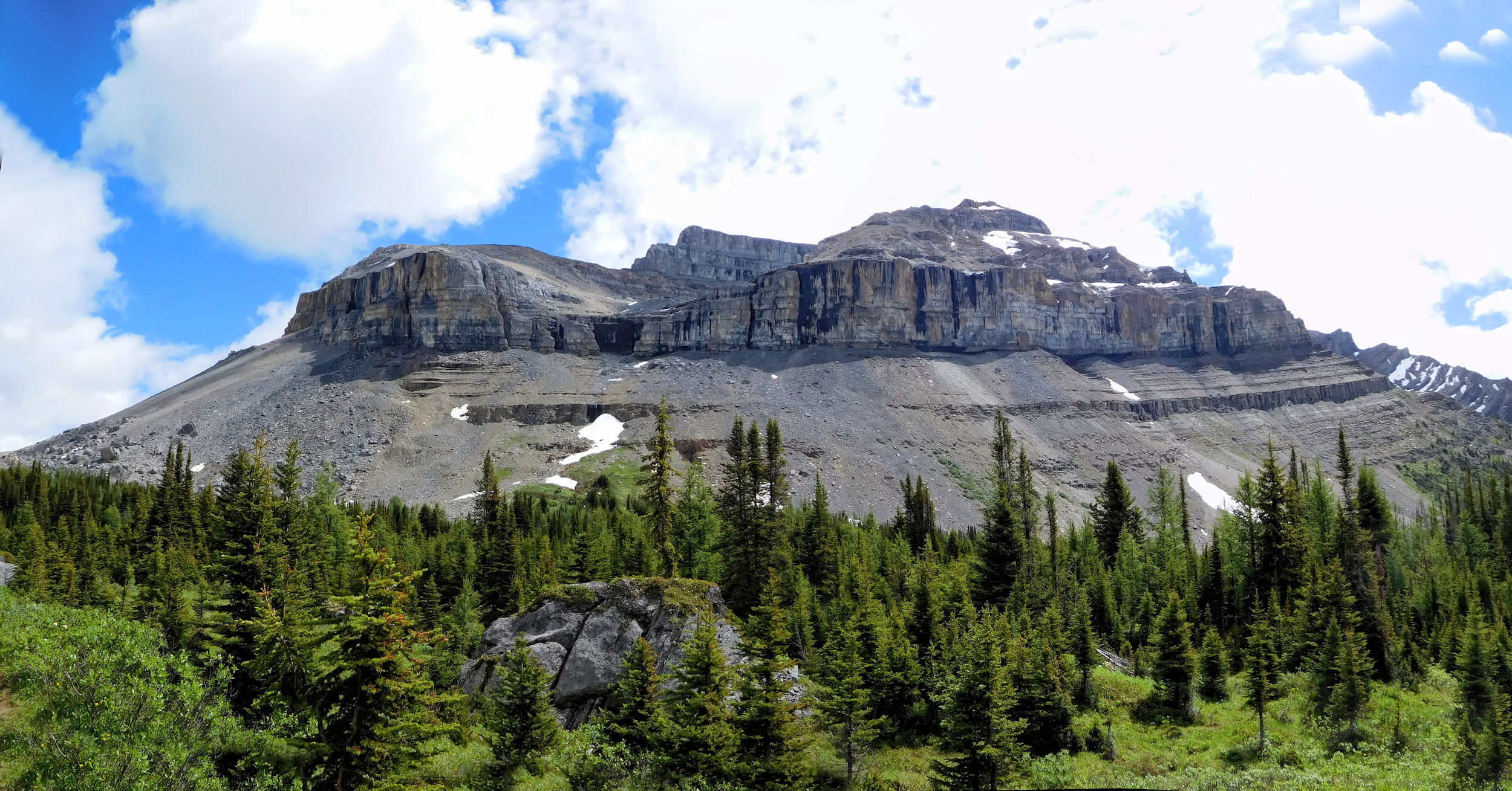
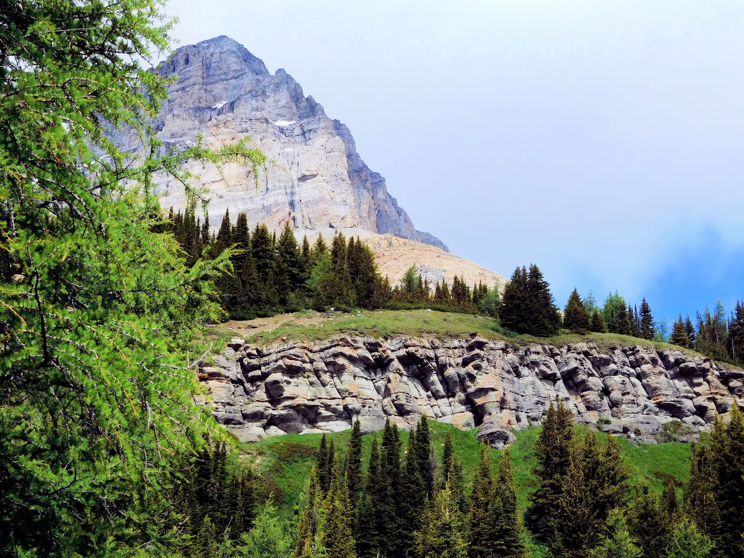
I reach a turnoff to Red Deer Lakes. My hike, however, climbs over the shoulder of Fossil Mountain up to Jones Pass (2250 m). The trail is dry here and looks less travelled; it is not used by horses. A view opens up onto the southeastern slopes of Skoki Mountain, to my left is Fossil Mountain. Ahead of me I can see the Wall of Jericho (2910 m).
Just below Jones Pass
Behind the pass there is another turnoff to Red Deer Lakes, a possibility for a future additional loop. Red Deer Lakes are the origin of the mighty Red Deer River that flows through Alberta and Saskatchewan. It is a marshy area with many mosquitos, dominated by the Pipestone Range.
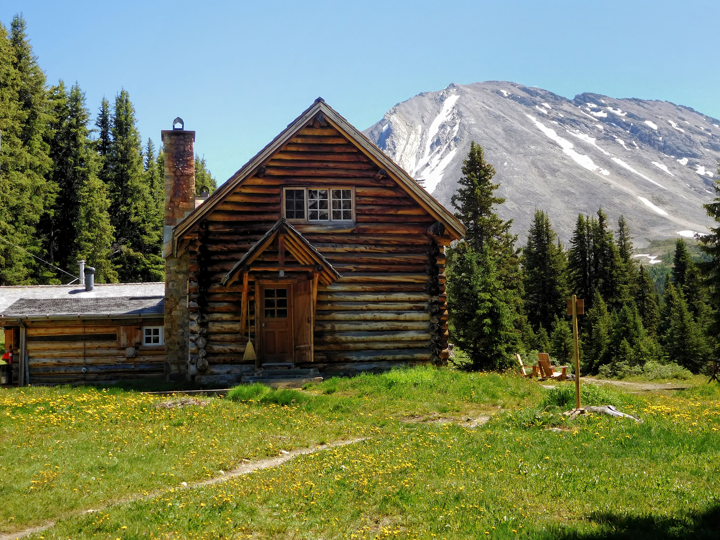
Yet another turnoff leads to Deception Pass, but I go straight ahead to reach Skoki Lodge. Always worried about backcountry lodges being too touristy, I am positively surprised by this one.
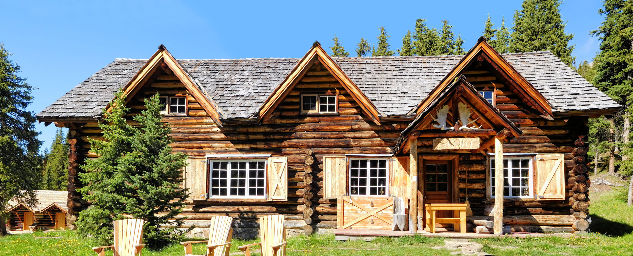
Skoki Lodge

The lodge already opened in 1931 as the first commercial ski lodge in Canada. A bunch of ski enthusiasts from Banff, all members of the Ski Club of the Canadian Rockies, built the lodge from logs they felled close by. Except for a few extensions made between 1935 and 1936 the lodge is still in its original state. It looks rustic and welcoming. The outbuildings are especially lovely, and somebody took a lot of effort to make beautiful signs. Unfortunately the lodge is closed for this summer.

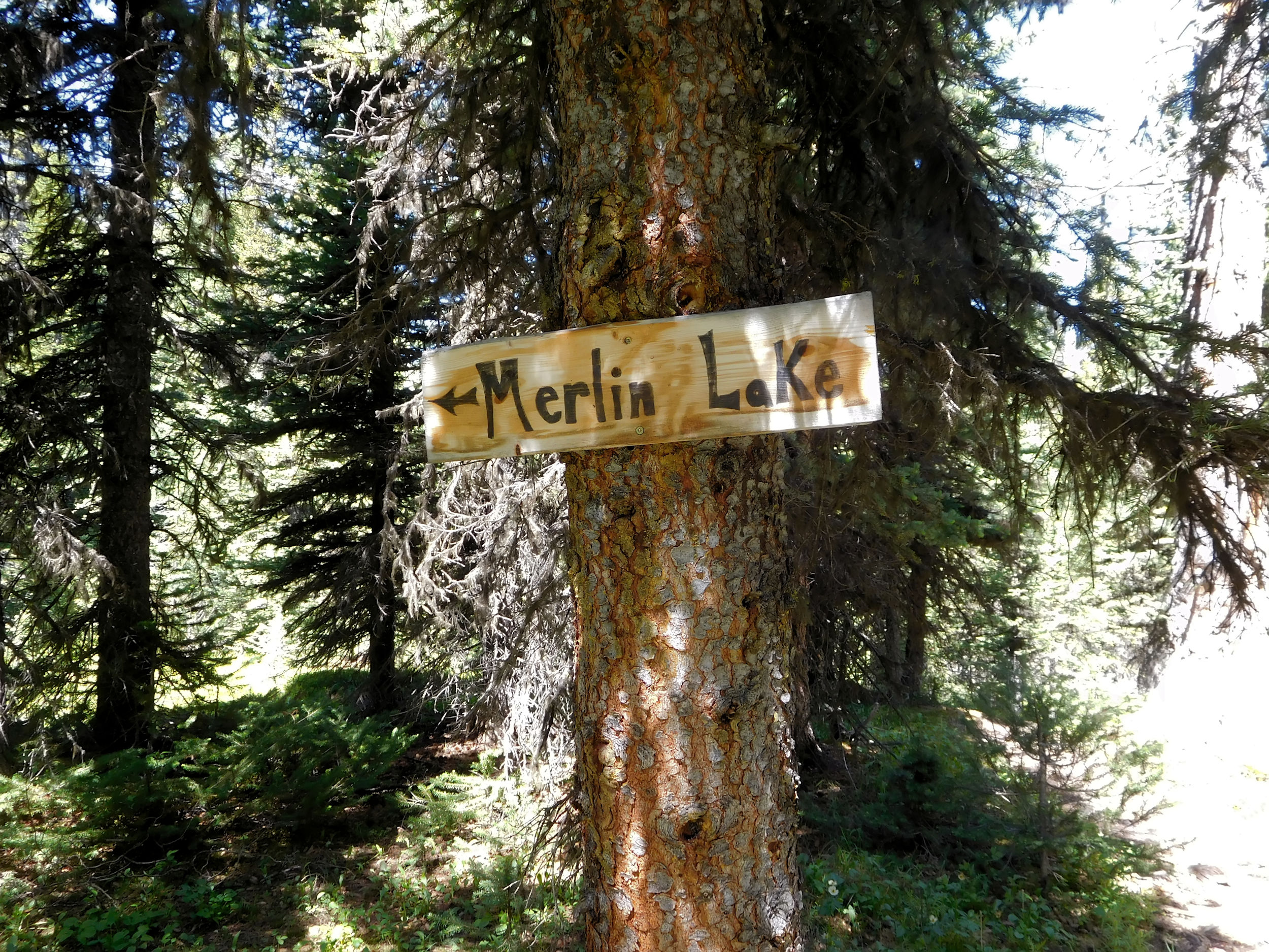
Merlin Meadows campground sign
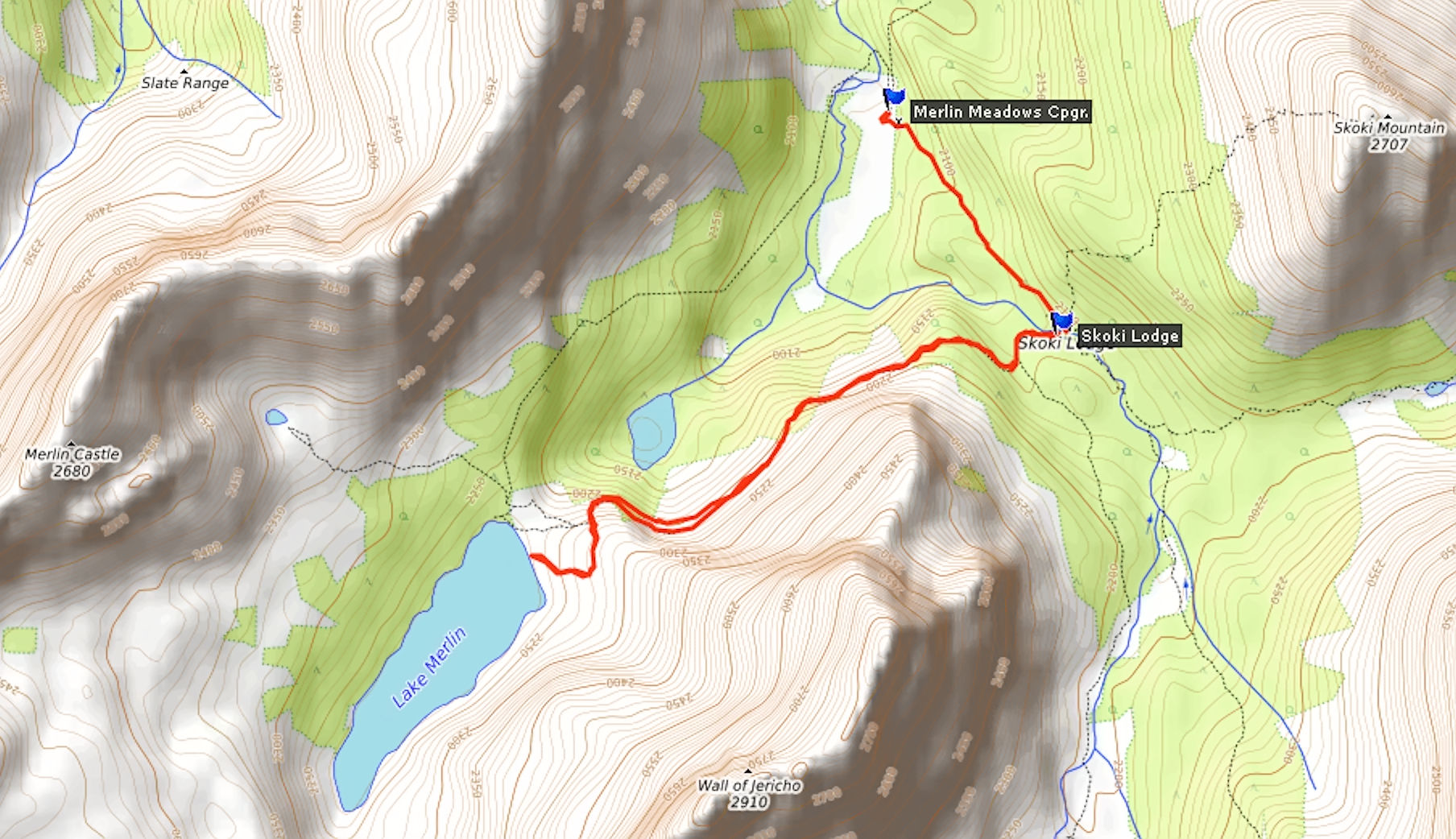
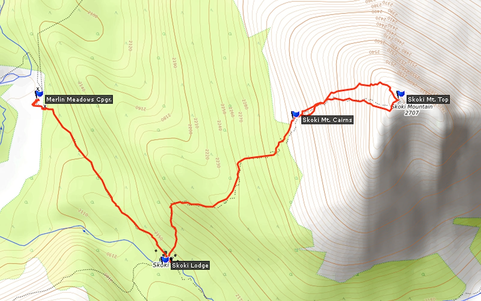
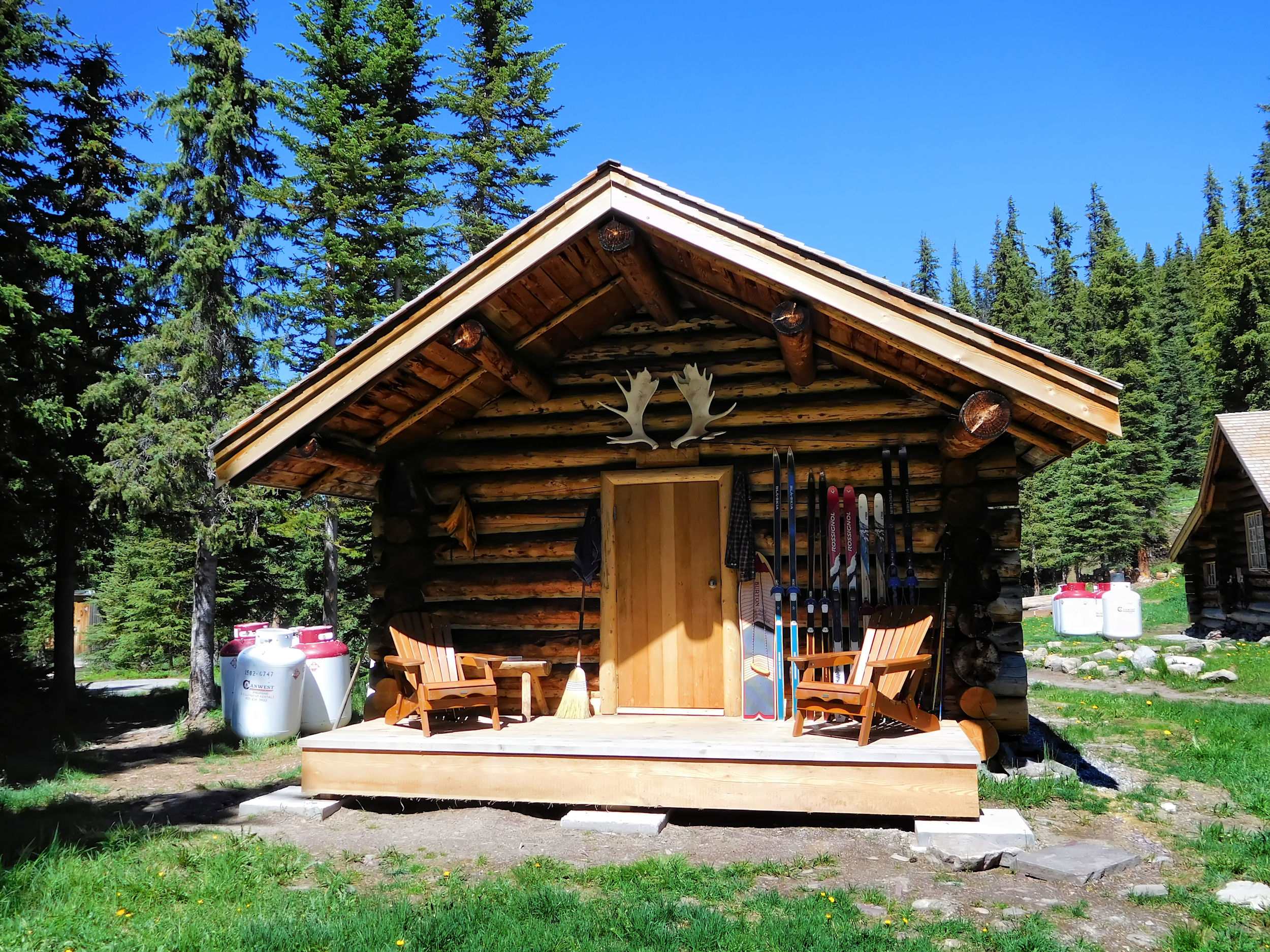
From here it is not far to Merlin Meadows campground. This campground does not have numbered sites and people can pick them randomly. By the entrance is a big fire pit and I am surprised to meet the three guys from Hidden Lake campground again. They were going to Baker Lake today but had a change of plan. While Skoki Lodge is closed for overnight guests, it serves tea, soft drinks and, most importantly beer outside. Sounds like the guys stayed out late yesterday.
I pick a site at the far back of the campground, which is shaded, hopefully quiet and not too far from the creek and the food storage pole. It is quite hot today. While I have lunch, the three guys and their dog return from an attempt to reach Merlin Lake by crossing Merlin Meadows. This marshy trail starts at the campground but is currently flooded. In Ojibwa Skoki means “bog”. Maybe James F. Porter, a mountaineer from Illinois, was thinking of Merlin Meadows when he was naming the area in 1911. I put my trail description away; to reach Merlin Lake we have to go back to the lodge.
| Distance | 8.3 km |
| Time | 2 ½ hrs |
| Incl. Breaks | 4 hrs |
| Min. Elevation | 2063 m |
| Max. Elevation | 2292 m |
| Ascent | 229 m |
| Cum. Ascent | 570 m |
| Cum. Descent | 570 m |
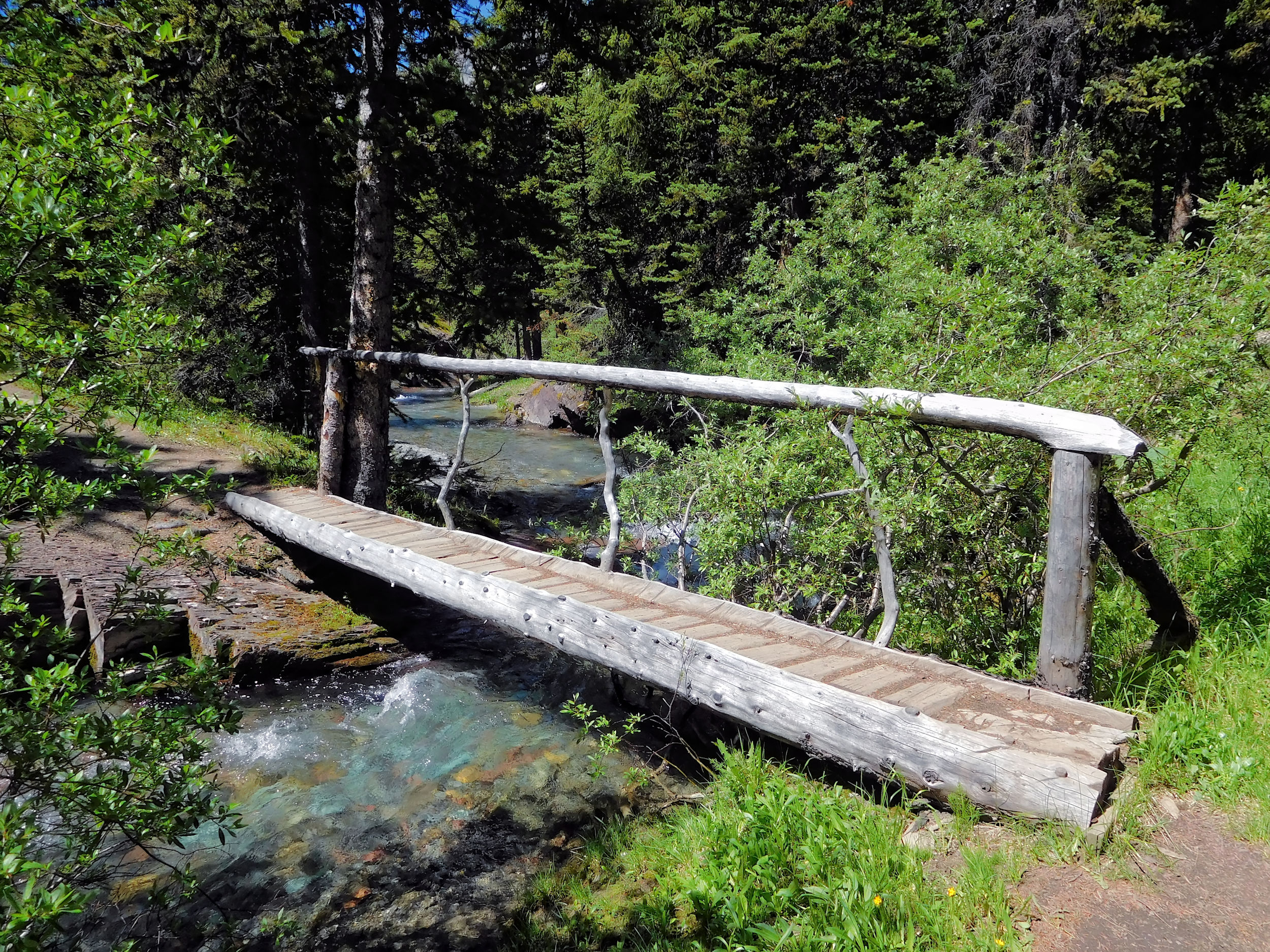
The guys are already on their way when I head out to Merlin Lake after lunch. From Skoki Lodge the trail is well-marked. I cross a narrow bridge over Little Pipestone Creek.
I reach a fork in the trail that is marked by an actual over-sized wooden fork. Merlin Lake is to the right. I hike through a boulder field below the Wall of Jericho (2910 m) and look back into the valley with the campground at its end.

Looking back into the valley
The trail fades and from here on is marked by cairns. The lake in sight is not Merlin Lake, but the much smaller Castilleja Lake.

Castilleja Lake
I recognize the distinct rock formation of Merlin Castle. The mountain behind it with the same name is 2680 m high.

Merlin Castle
The trail becomes very narrow and hugs the shoulder of the Wall of Jericho. It is rocky and slippery.
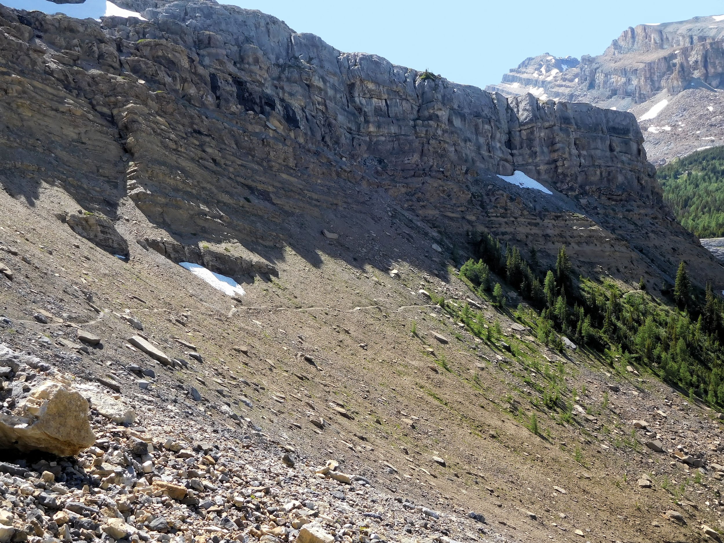
Wall of Jericho
Finally you have to scramble on all fours through a wall of loose boulders and rocks up to the top of a ridge. I am glad to do this with nothing heavier than a daypack. Once when I have lost the route through the rocks, I start wondering how I will manage the descent. I am relieved that I am not on my own. The three guys are somewhere ahead of me. The dog must be a climbing artist.
Eventually the steep wall is behind me and I follow a chain of cairns from the ridge down to the lake. Merlin Lake is vast and framed by mighty Mount Richardson, the same mountain that I already admired from Hidden Lake. I find my three scouts and their dog sunbathing on a big flat rock by the water. They had to help the dog only occasionally, as he was able to make good use of his four paws. I have a long break and soak up the magnificent view.
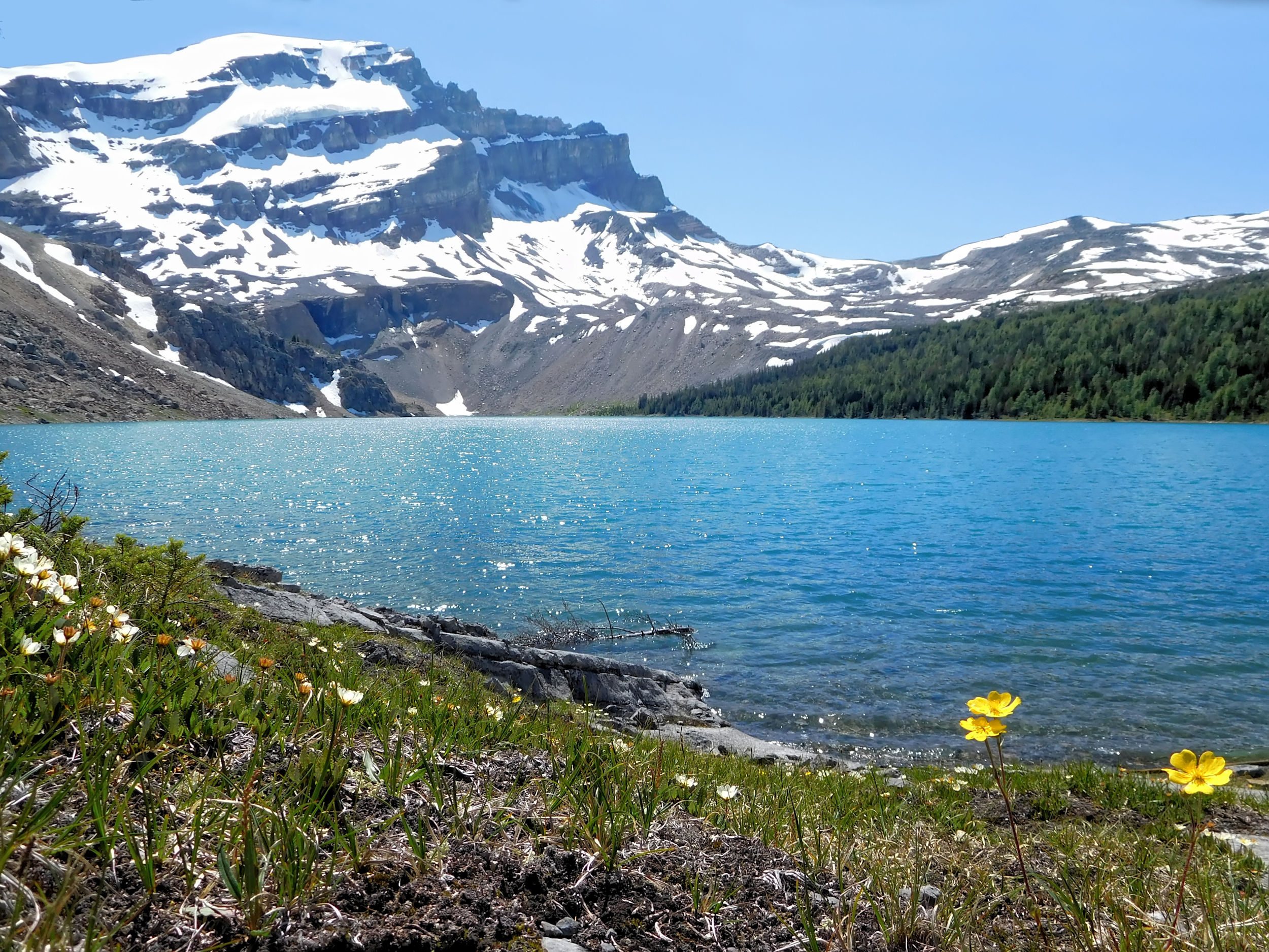
Merlin Lake
In spite of the cold wind the guys leave for a different spot to have a swim in the lake. I start on my way back. The climb down is less tricky than feared. I never lose the route through the rocks because from above the next cairn is much more easily spotted.
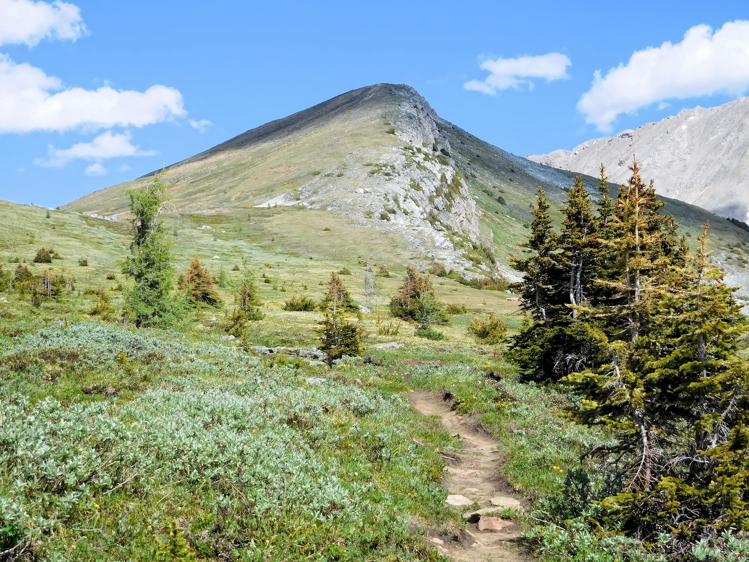
On my way back along the Wall of Jericho, Skoki Mountain comes into full view. I want to climb it tomorrow, but the route - along the ochre-coloured line - looks extremely steep. Am I really up for that?
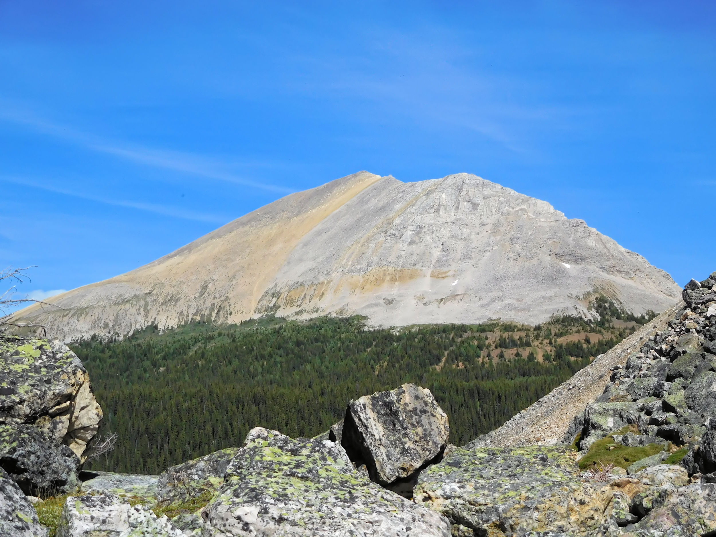
Skoki Mountain 2707 m
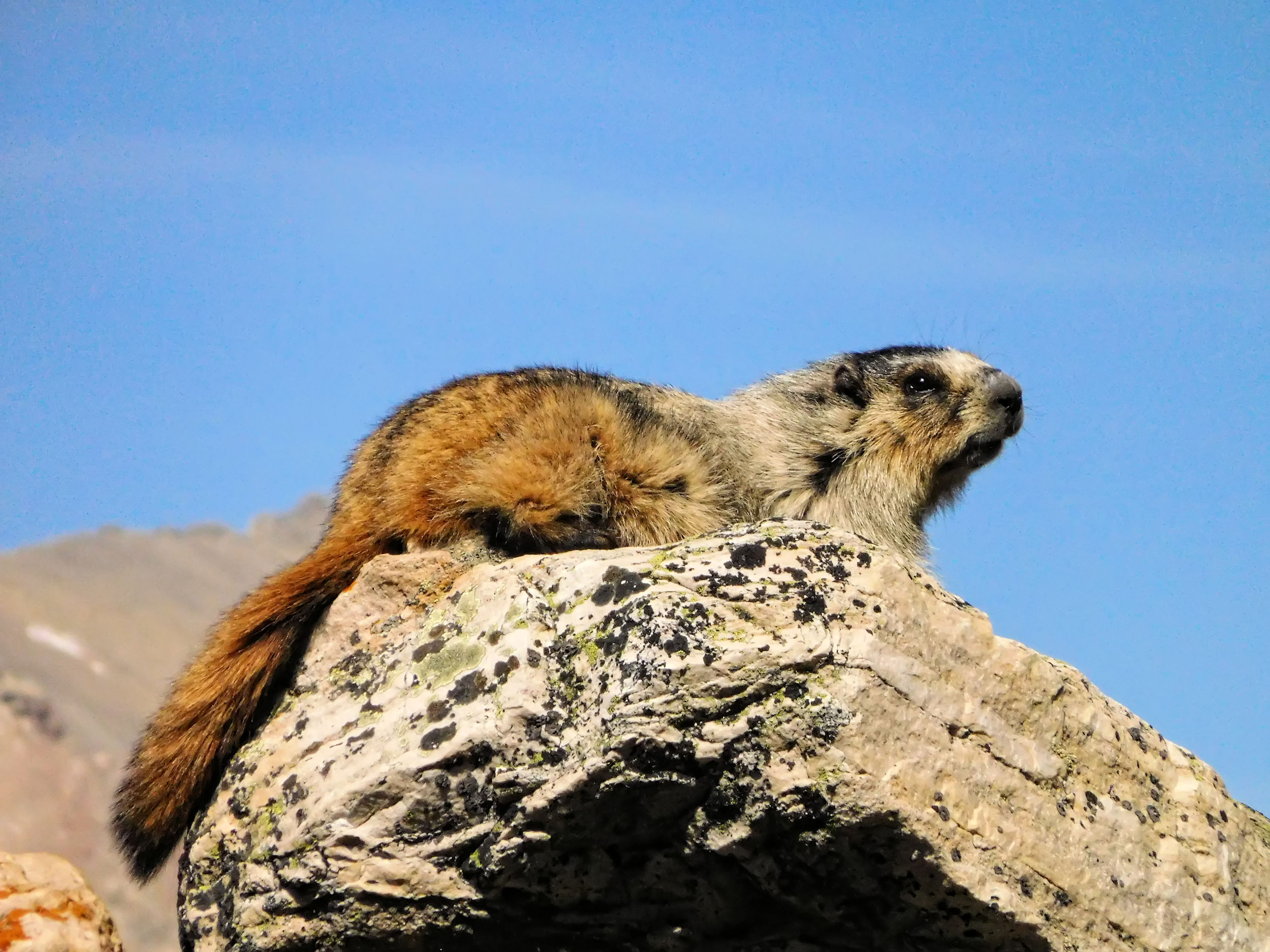
A marmot poses for a picture between the boulders. When I return to the campground, I am quite tired. I walk a little further to a spot by the creek where I can bathe my feet. A deer is hanging out between my tent and the cooking area. It looks sickly; maybe something is wrong with it. I feel sorry for the deer but I don’t want to feed it. One of the many grizzlies that roam through Skoki Valley will take care of it eventually.
By the camp fire the three guys show off with a video on their phone that has them all jumping from a cliff into the cold waters of Merlin Lake. They have to leave tomorrow, but tell me about another woman hiking solo who climbed Skoki Mountain yesterday. She came back totally enthused and did not find it too difficult. The guys think that my two hikes today for sure qualify me to attempt Skoki Mountain. I am happy about the encouragement and I will see what the weather is going to be like in the morning.
| Distance | 6.5 km |
| Time | 2 ½ hrs |
| Incl. Breaks | 5 ½ hrs |
| Min. Elevation | 2063 m |
| Max. Elevation | 2688 m |
| Ascent | 625 m |
| Cum. Ascent | 782 m |
| Cum. Descent | 782 m |
I wake up to another beautiful sunny day, even the wind has calmed down. So there is no reason to not try the scramble up Skoki Mountain. While having my breakfast I hear shot-like sounds. Maybe someone spotted grizzlies in the valley and tries to chase them away, hopefully not towards us.
Once again I walk up to Skoki Lodge. The path to the mountain top starts right behind the outhouses. There is a caretaker today at the lodge, cutting wood and doing some burning. I wave and think to myself it is a good thing that somebody knows where I am going. I won’t see another soul up there today. At first I hike uphill through the forest. I had an early start to avoid the hottest part of the day. The sun is just rising above the mountain when I emerge from the trees.
Sun rising above Skoki Mountain
At the treeline the trail ends. There is a whole assembly of cairns here, so I won’t miss the re-entry into the woods on my return.
Fossil Mountain, Mount Richardson, Merlin and Castilleja lakes
Already at this elevation the views are wonderful: the valley to the south-west and Molar Mountain to the north. It was eleven years ago during a camp of the Skyline Hikers of the Rocky Mountains at North Molar Pass, when I developed the passion for my annual treks into the mountains.
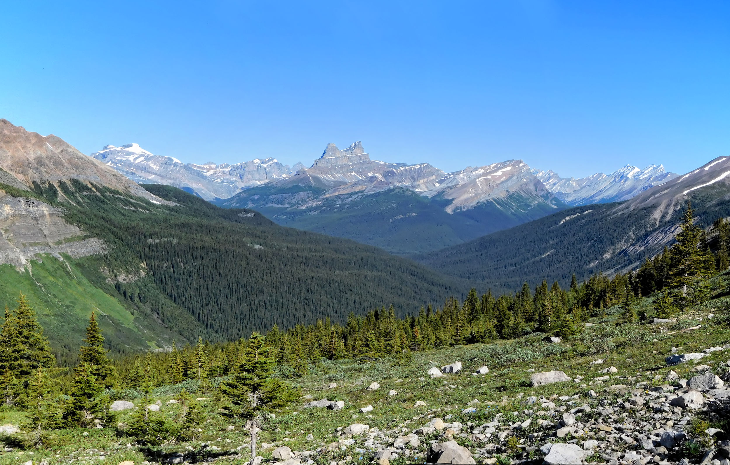
Molar Mountain 3022 m
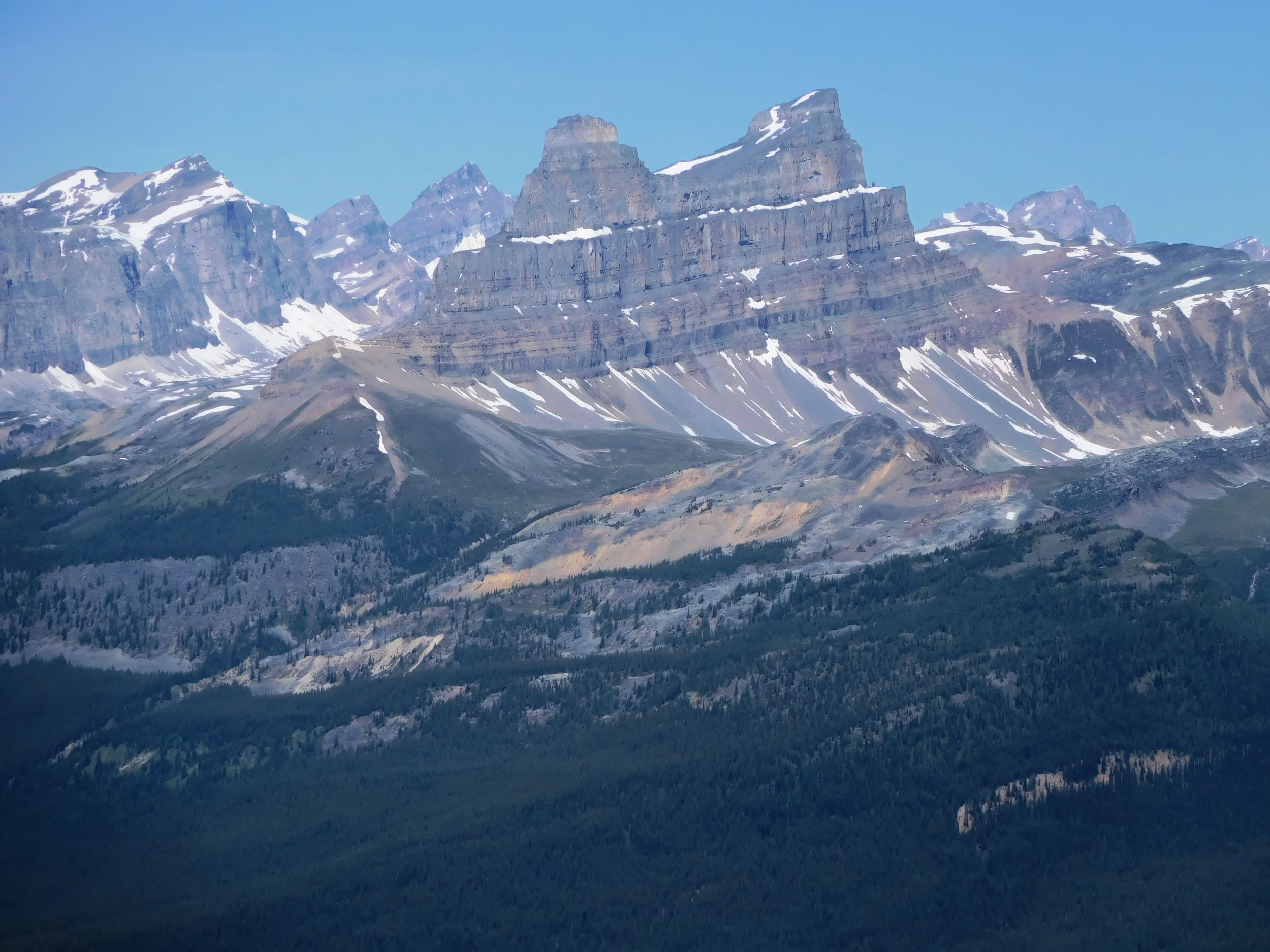
Molar Mountain Close-up
Skoki Mountain scree
The grade becomes very steep now. I have to find my way over ochre-coloured scree. The scree slides back under my feet but I still make progress. I try to follow a line as level as possible but it seems to be equally steep everywhere, the slope looks and feels almost vertical. I don’t want to slip and have to concentrate on where to put my feet for the next step. I switchback and alter between left and right turns to go easier on my knees and ankles. Sometimes I can follow the tracks left behind by others, but they are faint and get easily lost in the rubble. Looking down, I confirm that I can still see the group of cairns. I have also set a waypoint on my GPS, of course. Soon I look only up and strain my neck to aim for the next distinctive rock to climb up to. Finally I reach the ridge and walking on its spine to the top is much easier. From the lodge it took me two hours to climb up here, one to the cairns and another one over the scree to the top.
The 360 degree view from the peak is mindboggling. After I have added my own rock to the big pile forming the top cairn, I have a fine lunch break right there. A cone is hidden in the cairn. It contains a booklet for hikers to register. From time to time I change my sitting position all around the cairn in order to enjoy the views in every direction.
Skoki Lakes
Wall of Jericho and the lakes on both sides
Merlin and Castilleja lakes
Oyster and Fossil mountains, Mt. St. Bride and Mt. Douglas to the east
Red Deer Lakes
I have the peak to myself, so I take a selfie with my camera timer. On a perch like this it is not without risk to jump into the right position for the picture. I need several tries.
Selfie 1
Selfie 2
There is no wind, the sun is warm, and the views are awe-inspiring. I could remain here for hours. Eventually I gather myself up for the return trip. I follow an even steeper but more visible route. Going downhill, the scree can be your friend. I scree-run digging my heels into the rubble and sliding for short distances at a time, almost like a skier. I still switchback to slow down, as I cannot afford to roll an ankle or fall. You have to always be prepared to suddenly hit a stretch of hard ground. It takes me just under an hour to reach the group of cairns, almost the same time as going up. I make a small leap of joy from the rubble onto firm ground again only to finally roll my ankle with this last step. Fortunately my sturdy hiking boots save me from the worst. After just a short while I manage to walk without a limp again. Things can go wrong so quickly.
I can feel the long downhill in my legs, particularly the knees, so I am delighted to reach the lodge. The caretaker I saw in the morning has opened the lodge for selling refreshments. A group of female trail runners occupy one of the picnic tables. At first I order tea, but when I see the Australian leader of the group having a beer, I quickly I change my order. I am thirsty and want something cold. Germans and Australians love their beer any time of the day, and we cheer each other. The girls started their run at the Fish Creek parking lot and have come all the way over Boulder and Deception passes. They will return via Packers Pass, almost 26 km and three passes in one day. They don’t have to carry big backpacks, just some essentials.
The caretaker tells us that he saw a grizzly bear by the outhouses early this morning. He recognized him as an older chap that makes his rounds through the valley every summer. He used bear bangers to chase him on. That explains the sounds I had heard during breakfast. Apparently the bear has never been any trouble, but I am still relieved I did not encounter him.
The girls start running for their home stretch and I hike the last kilometer to the campground. Nobody is there yet as it is only 2:00 in the afternoon. I sit in the shade, look some more at Mt. Richardson and relive the nice adventure I just had.
Mount Richardson seen from Merlin Meadows
Soon other campers arrive. Everybody is getting busy with their numerous chores like filtering water, cleaning, cooking, eating and chatting. Today I retire to my tent even earlier. Another strenuous hike lies ahead of me, sadly the last one on this trip.
| Distance | 17.6 km |
| Time | 5 hrs |
| Incl. Breaks | 8 ½ hrs |
| Min. Elevation | 1696 m |
| Max. Elevation | 2584 m |
| Descent | 888 m |
| Cum. Ascent | 978 m |
| Cum. Descent | 1360 m |
I already start packing at dawn using my flashlight in the tent. It will be a long day with another highlight: Packers Pass. At the same time it will be my hike out of Skoki Valley. The tent is wet from the dew and will be heavy, but the skies are blue yet again.
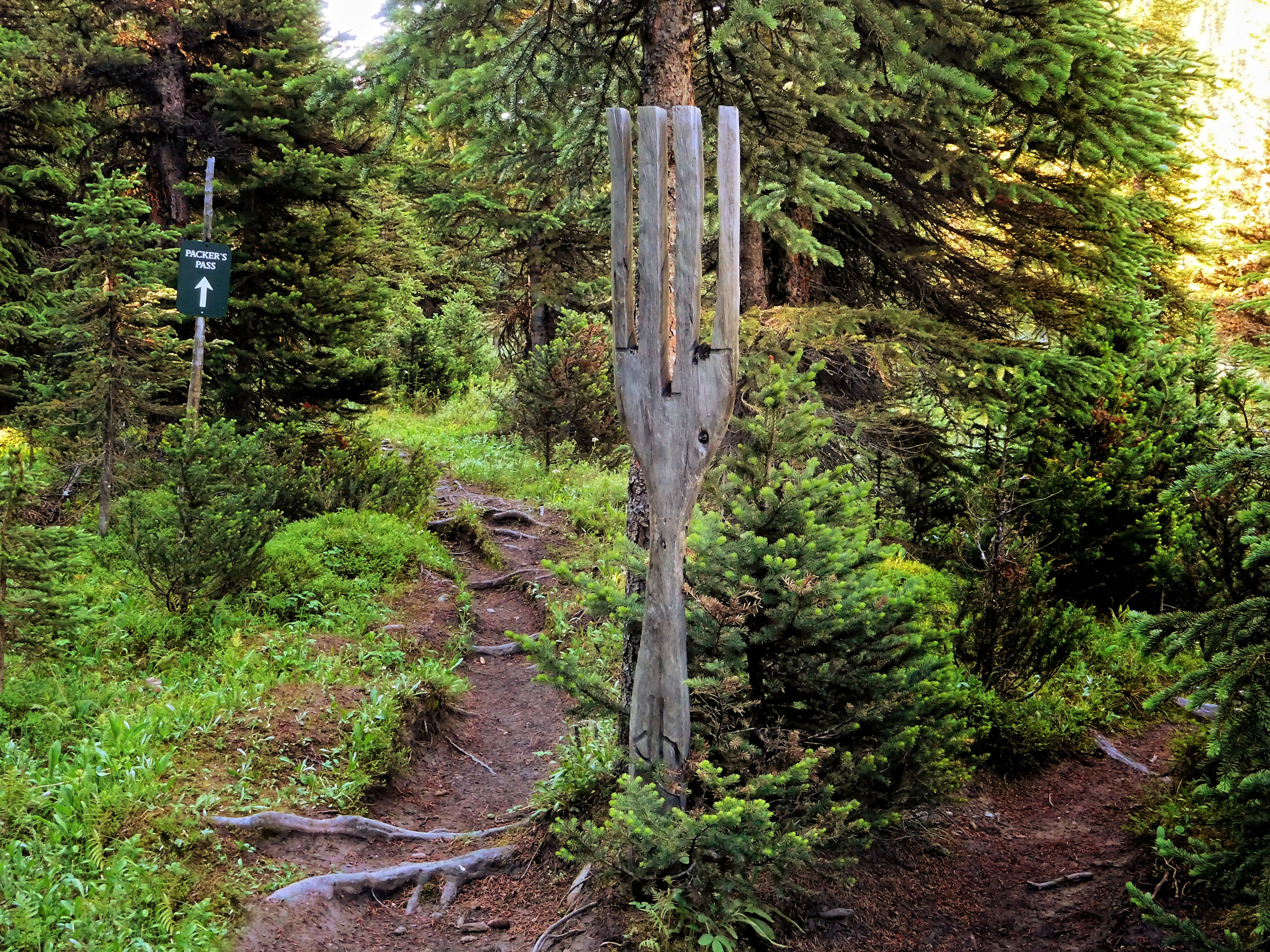
Wooden fork in the trail
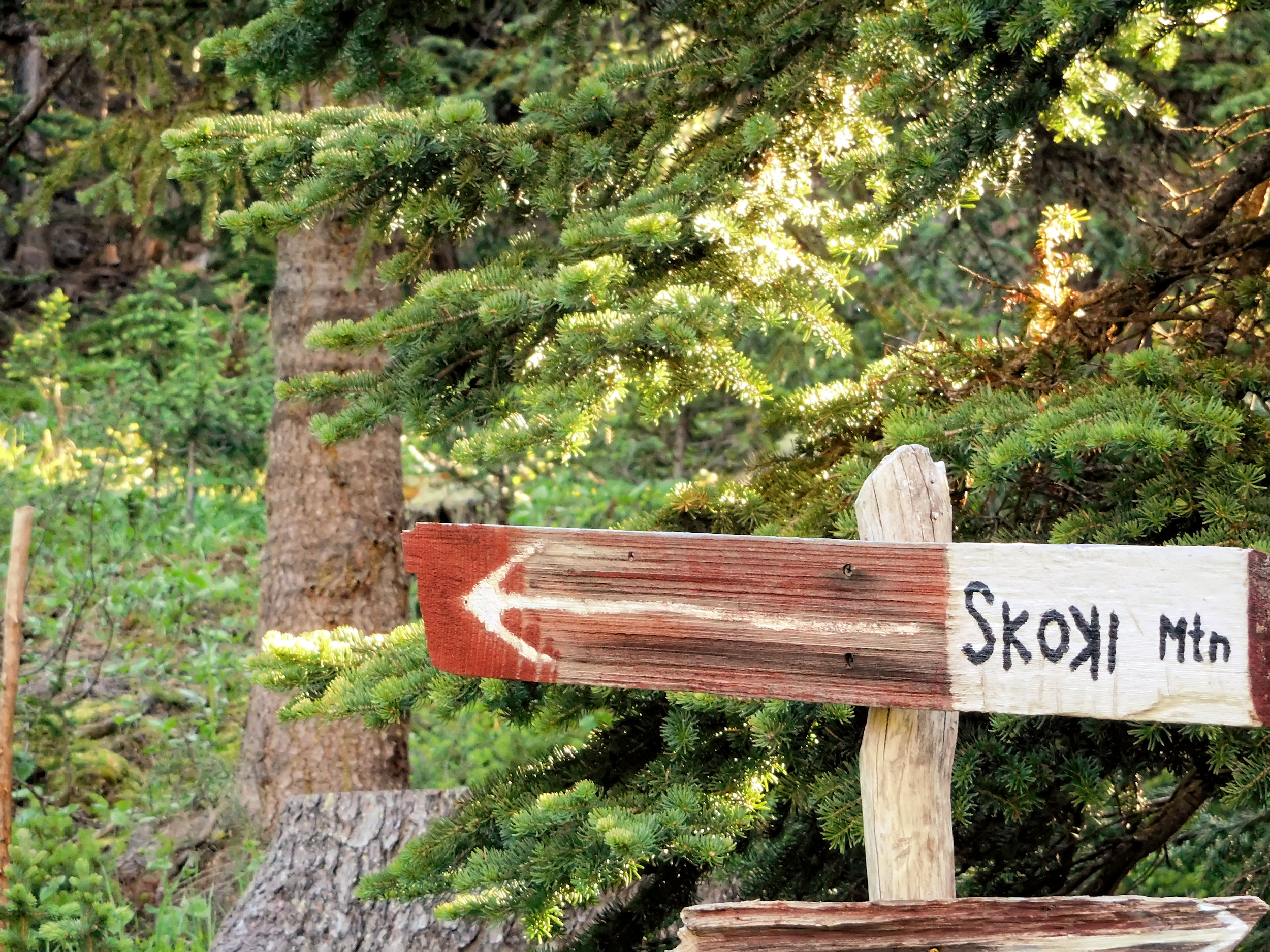
I am ready to go by 8:20, a good time for me on a day when I have to break camp, which takes me about two hours. For the last time I walk past Skoki Lodge. At the wooden fork I go left this time. The trail leads through forest and then follows the valley of Skoki Creek. Soon the cliff comes into view that I have to conquer.
Cliff below Myosotis Lake, Ptarmigan Peak in the background
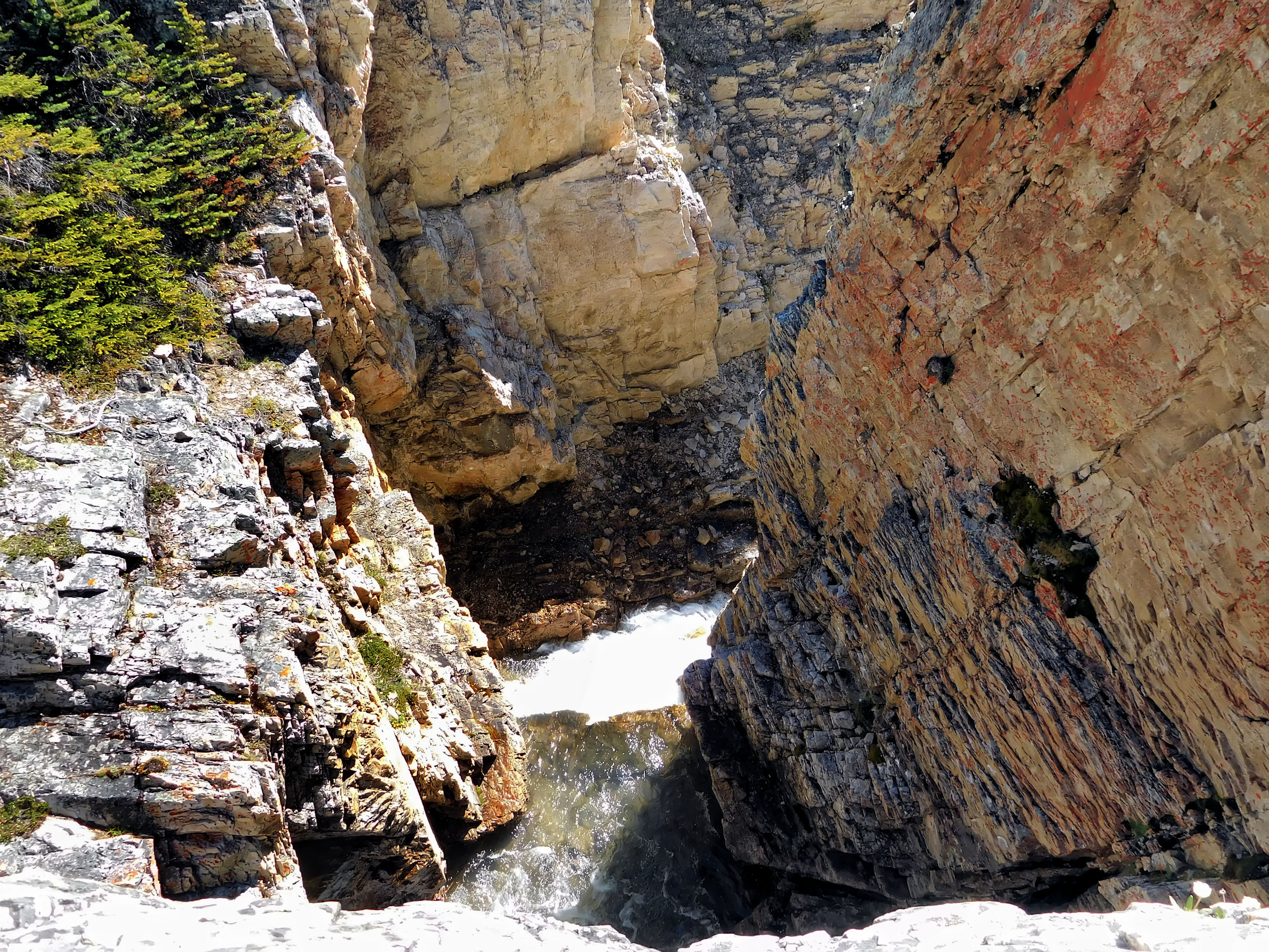
The route is to the left of the waterfall and leads through a gap in the rocks. I cross the creek and follow some cairns to the bottom of the wall.
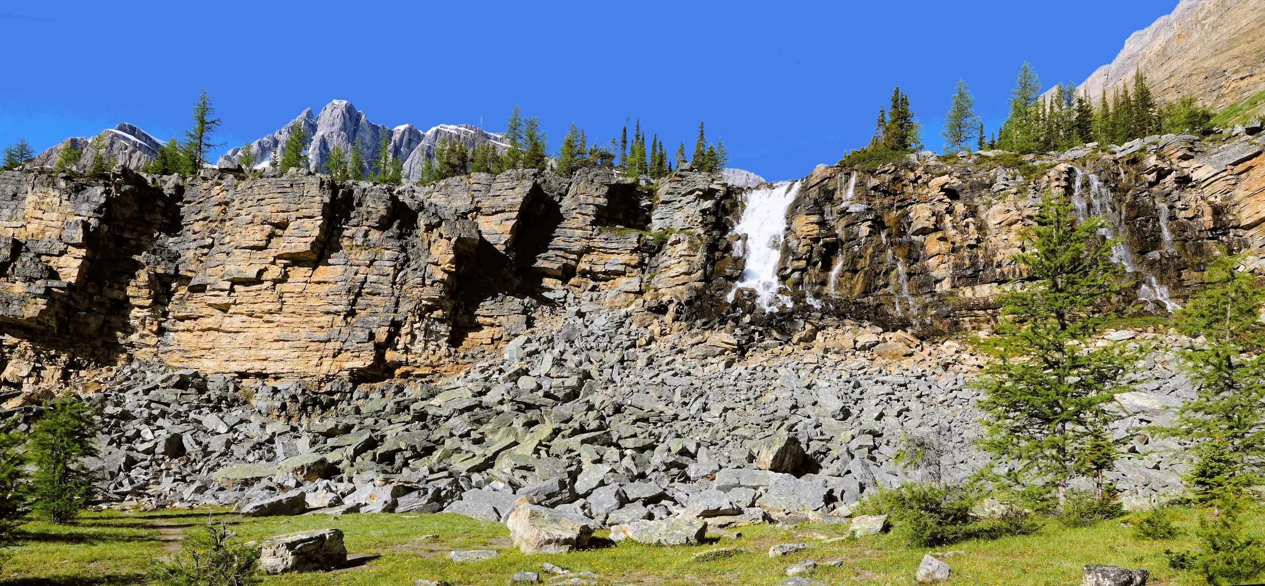
Waterfall, outflow Myosotis Lake
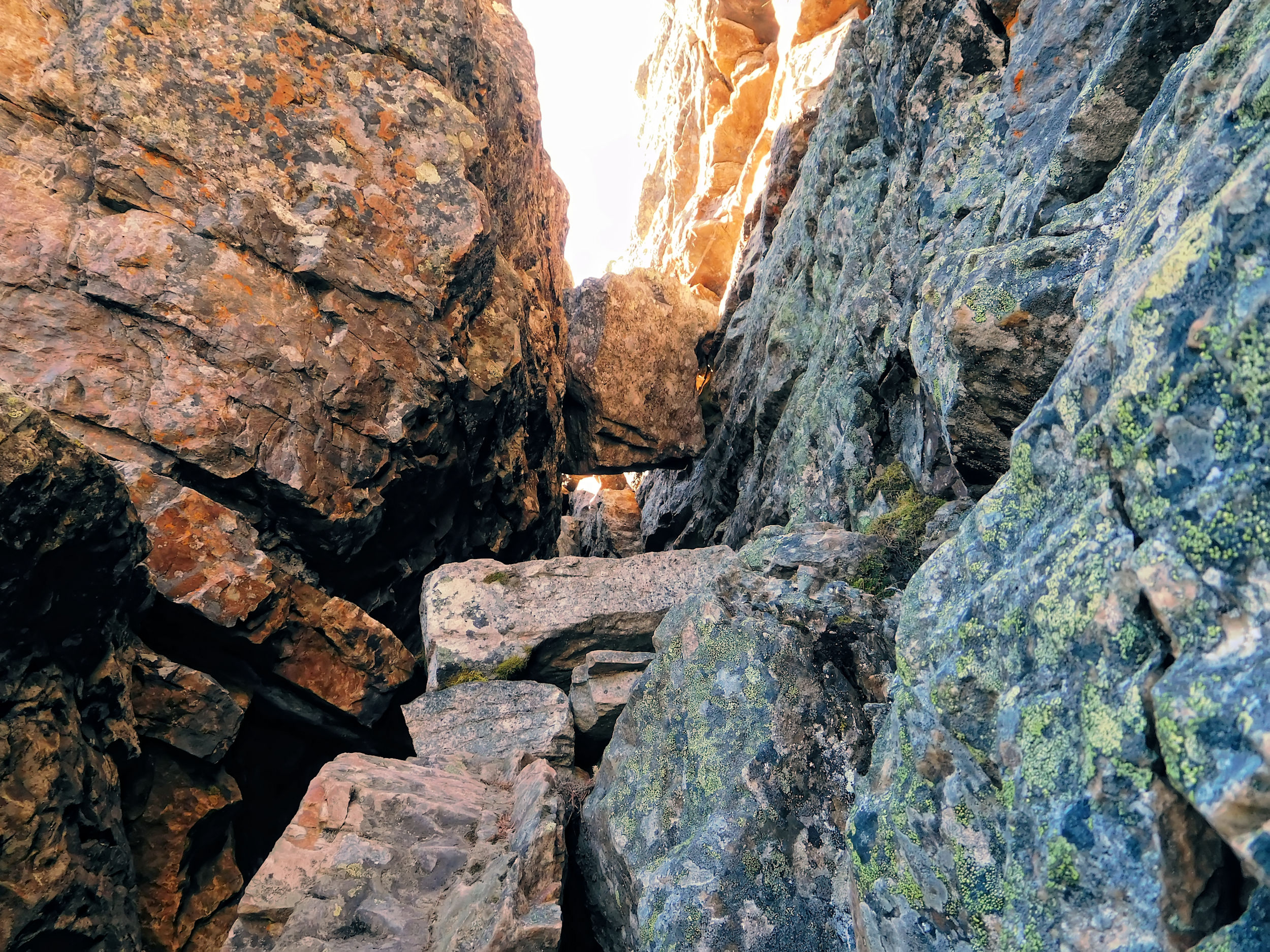
Chimney
Once I am close enough the pathway becomes obvious. The chimney I have to crawl through is quite narrow and with my big pack I get stuck in it. I wiggle back and forth and almost think I have to crawl backwards and take off the backpack, when the tent bag strapped to the side of my pack gives and I am through. I’ve made it!
View from the exit of the chimney
I take off my backpack and climb as close to the falls as possible to take a picture.

Looking back from the falls to Skoki Mountain
The trail continues along Myosotis Lake. Ptarmigan Peak and the Wall of Jericho provide the background panorama.
Myosotis Lake with Ptarmigan and Pika Peak
Myosotis Lake and the Wall of Jericho
In front of the Wall of Jericho
A chopper flies over my head. Nobody is looking for me, I hope? Of course, there is no reason, even if I am the only hiker on this route today. After another ascent I reach a rock ledge. From here I enjoy the extraordinary hue of Myosotis Lake.
View of Myosotis Lake and Skoki Mountain
The ledge leads me to a side path that is still hidden under the snow. I reach Zigadenus Lake and the waterfall that tumbles from it into Myosotis Lake. The two lakes with the tongue twisting names are also simply called Skoki Lakes. Fed by glaciers, they are famous for their brilliant blue colour.
Zigadenus Lake
Waterfall from Zigadenus Lake
into Myosotis Lake
I scramble over some boulders to find the best angles for my pictures. A marmot is sunbathing on the ledge above the lake. I hope it is too lazy to take an interest in my backpack that I have laid down at a safe distance from the drop.
Myosotis Lake with Fossil and Skoki Mountain
I leave Zigadenus Lake and begin the ascent of Packers Pass that has an elevation of 2470 meters. The pass was named this way because until the 1960s it was the main supply route for Skoki Lodge. This route is shorter than the one over Deception Pass and in spite of its roughness and the chimney the packers preferred it. They carried up to 35 kg on their backs and were paid only pittances. These days the lodge is supplied by helicopter.
Zigadenus Lake and the Wall of Jericho
Close to the pass the trail is hidden by snow, but there is no doubt about the direction. I reach the pass and a perfect view of Ptarmigan Lake and Redoubt Mountain. I spread my wet tent to dry in the sun and wind while I have a short break. The wind is strong; I need quite a few rocks to keep the tent tarps on the ground.
Ptarmigan Lake
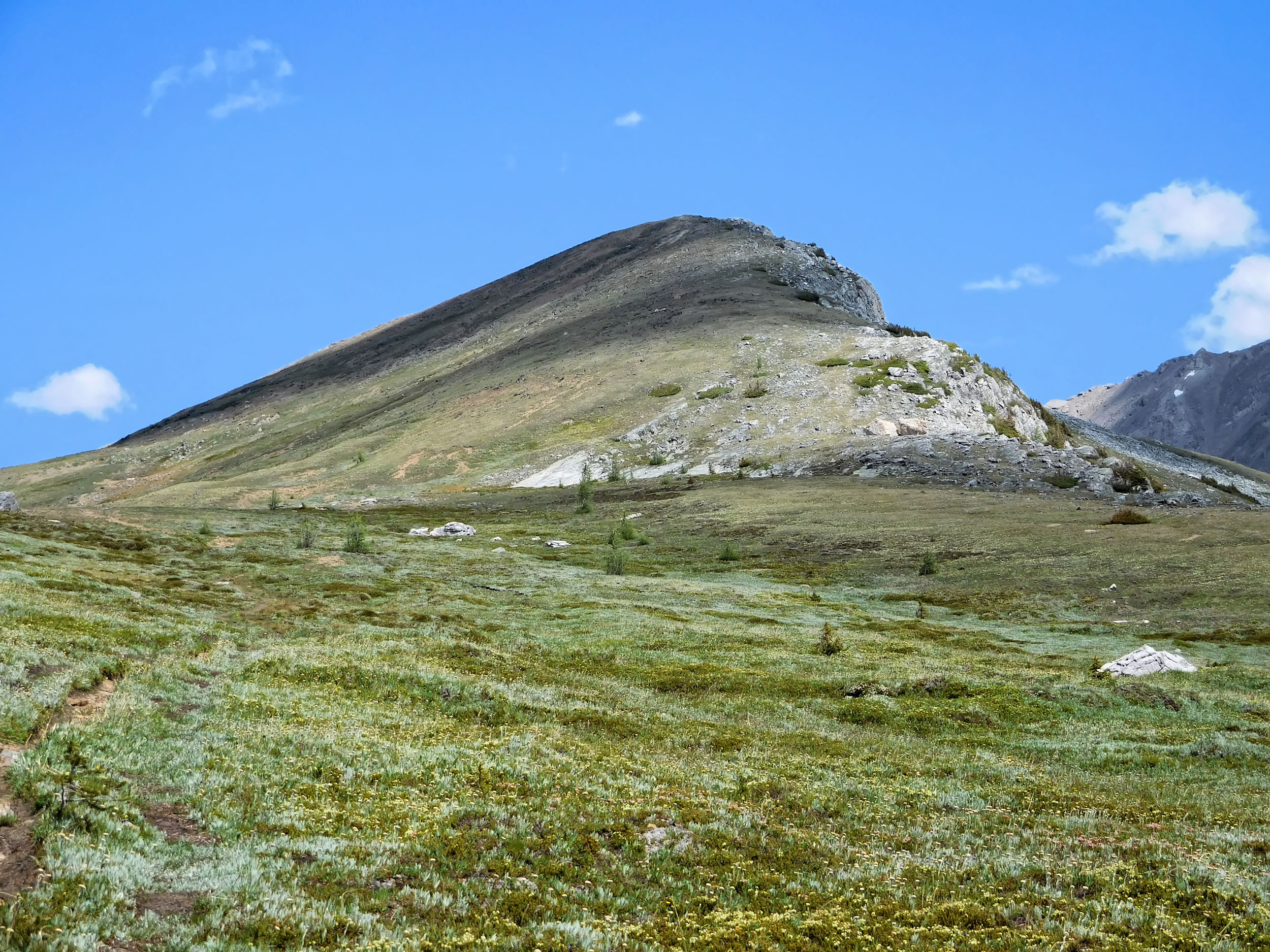
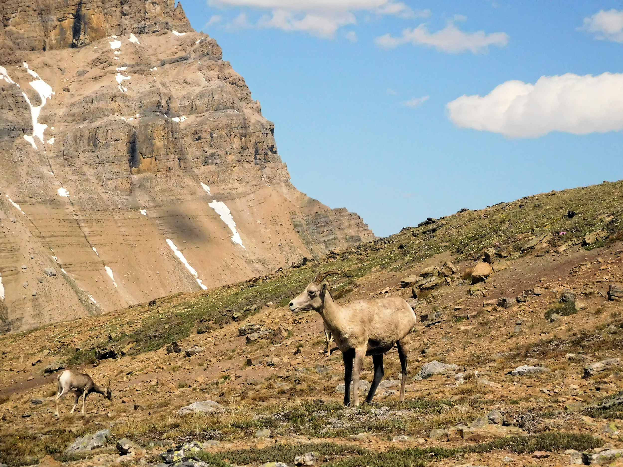
Packers Pass Peak 2595 m
I still have enough energy to climb up Packers Pass Peak. This peak is easy and at about 130 meters above the pass another opportunity for a 360 degree view. I want to leave my backpack behind, but a group of Bighorn Sheep is approaching. They like to lick salt and I am worried about my luggage. I wrap everything into the groundsheet of my tent and hope for the best.
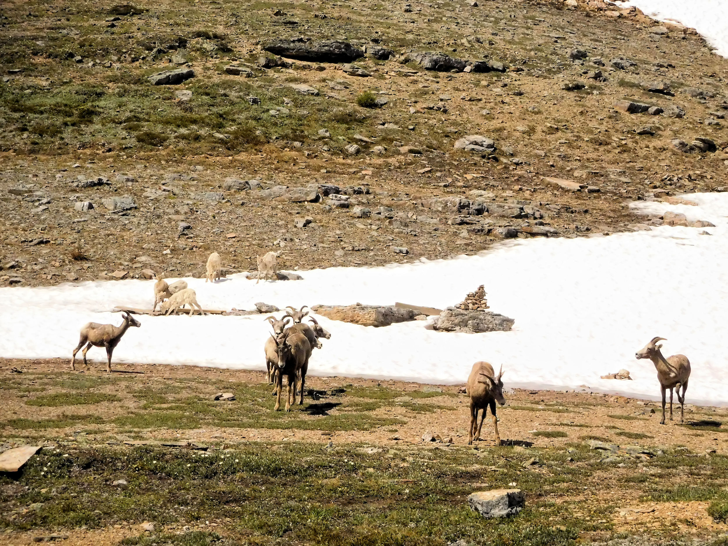
While I hike up the mountain, I keep an eye on the sheep. They get closer to my bundle but then cross the pass without even acknowledging it. That’s fine with me.
It takes only half an hour to reach the peak. The views are again phenomenal. I look at the alternate route to Skoki over Deception Pass and decide that I have to come back another time and enter the valley via this way.
Deception Pass
Baker Lake is in the distance. That’s where I spent my second night.
Baker Lake
Ptarmigan Lake and Redoubt Mountain look even more imposing from this elevation.
Ptarmigan Lake and Redoubt Mountain
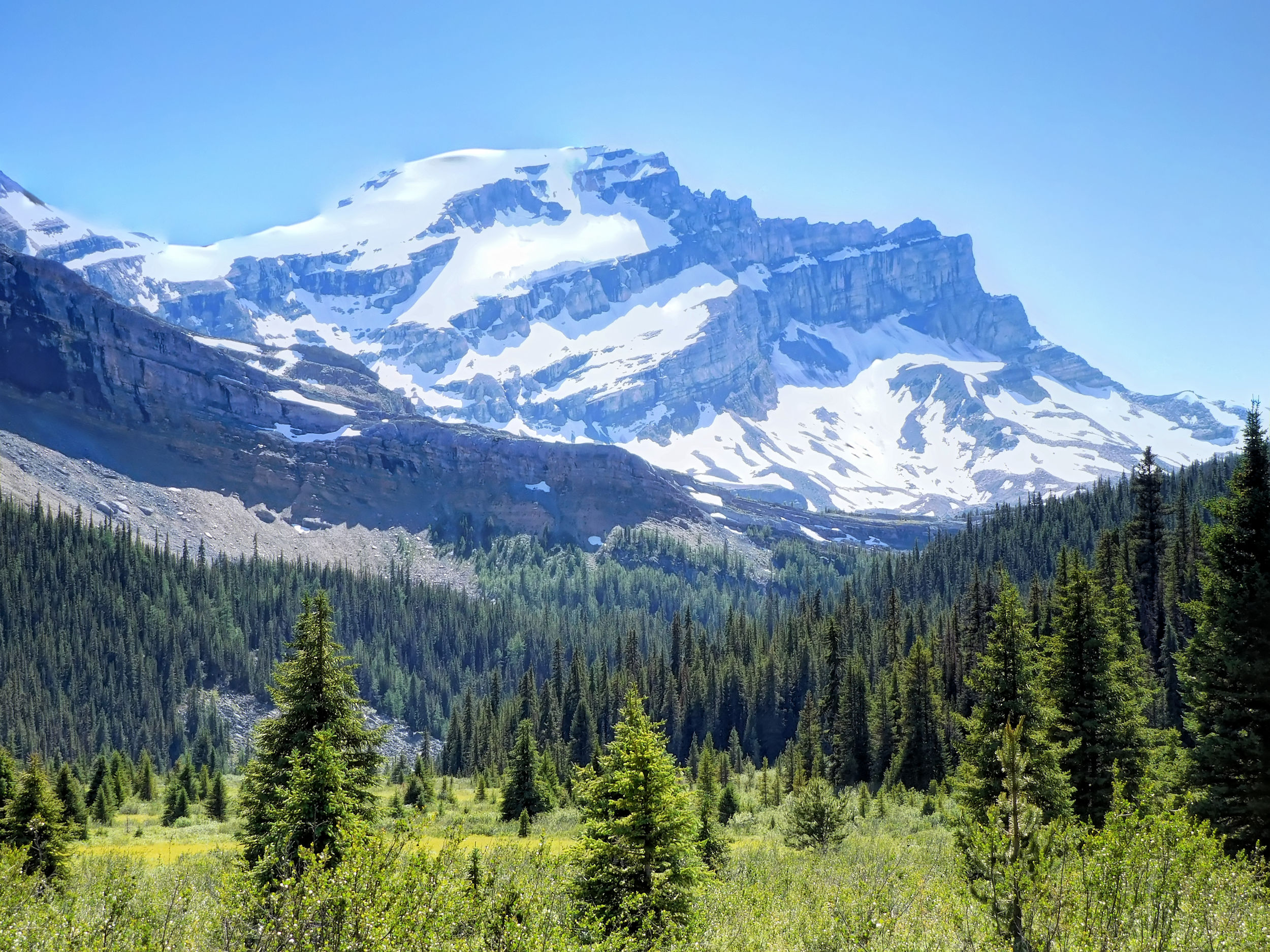
With 3544 meters Mt. Temple is the highest mountain in the Lake Louise area.
Redoubt Mountain with Mt. Temple in the background
I walk over to the other edge of Packers Pass Peak. From here you can see both Skoki Lakes.
Skoki Lakes
A helicopter approaches again. Some equipment is hanging on a long rope below it. From my perch I can observe how it hovers over Skoki Lodge and is unloaded and reloaded with supplies. It flies in and out several times while I am on my descent.
Packers Pass Peak
My luggage stayed safe. The herd of Bighorns still grazes on the other side of the pass. I pack up and hike down the mountain. Soon I join the Skoki Lakes loop trail that I came in on a few days ago. I take a last look back to Packers Pass Peak and set a waypoint on my GPS. The turnoff is inconspicuous and not marked.
I leave the valley on the trail along Ptarmigan Lake. Boulder Pass provides me a beautiful view of Mt. Temple.
Mt. Temple seen from Boulder Pass
This time I check out Halfway Hut near the turnoff to Hidden Lake. Not much to be seen and it is locked, too. In the sunshine the last stage on the gravel road is much nicer than it was in the rain on my way in. Still I am getting tired. At least there are some colourful wildflowers by the wayside to cheer me up.
The last kilometers
After a phone call home I drive to Golden. I have booked a night at Dreamcatcher Hostel. Again there are only a few guests because of the pandemic. I get some groceries from the nearby supermarket and have a nice meal. The best, of course, is a long hot shower. Another adventure in the mountains has come to an end.