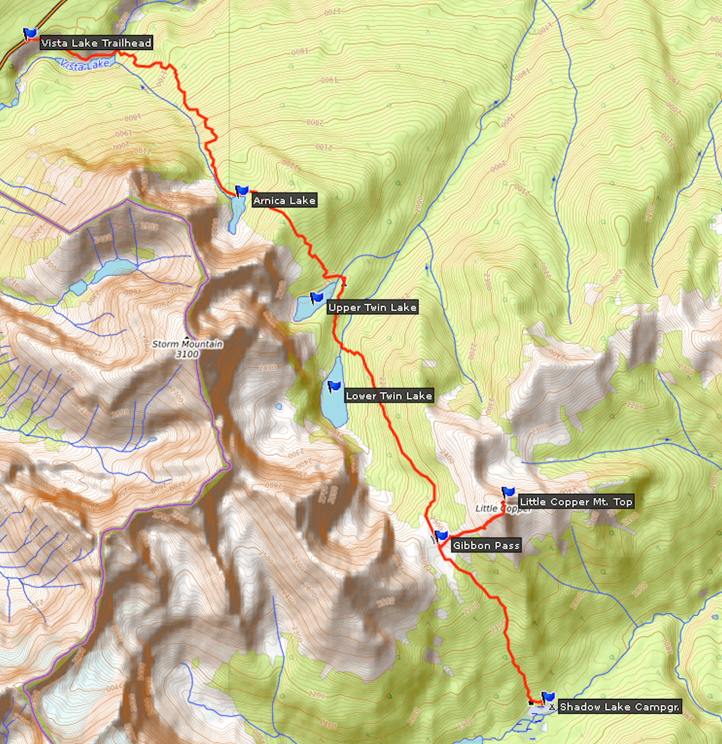
 To Castle JunctionJuly 21

Summer 2019 is off to a late start, extremely cool and sees a lot of precipitation. Again and again I look at the trail reports that are issued for the national parks. Only shortly before my planned start date does the description finally change from "not recommended" to "poor" or "fair". There is still snow on the passes. I don’t let the conditions deter me, because I have no choice. Since January, all the campgrounds are fully booked and I can praise myself lucky that I have reservations.
My destination for the first night is Castle Mountain Wilderness Hostel. It is located at Castle Junction between Lake Louise and Banff. From there, Highway 93S leads into Kootenay National Park to the Vista Lake trailhead, where my hike will begin tomorrow.
The 600 kilometer drive takes about seven hours, including breaks for food and refueling. The weather is good. Officially, the hostel opens at five o’clock. When I arrive in the afternoon, it is still closed, but the caretaker lets me in, so I can put down my luggage. He recommends a visit of the wildflower bloom at Sunshine Meadows near Banff, which is supposed to be at its peak right now. This late in the afternoon there is not enough time left for the trip, so I just go for a stroll and buy a cold beer for dinner from the little store at Castle Mountain Chalets across the street.
The hostel is a simple but cozy accommodation. It has two dormitories for 14 people each and offers all necessary amenities including showers, which are a luxury for Wilderness Hostels.
At dinner I meet some of the other guests. The French-Canadian, Patrice, who is traveling by motorcycle, has some entertaining stories to tell. This petite and highly energetic person rides extreme distances across the whole country. Next to her the motorcycle looks oversized. Later I make a last phone call home and say good-bye for the next week. There won’t be any cell reception where I am going. I read in my hiking guide and retire for a quiet night.

| Distance | 19.6 km |
| Time | 7 ½ hrs |
| Incl. Breaks | 9 ½ hrs |
| Min. Elevation | 1569 m |
| Max. Elevation | 2308 m |
| Ascent | 739 m |
| Cum. Ascent | 1515 m |
| Cum. Descent | 1268 m |
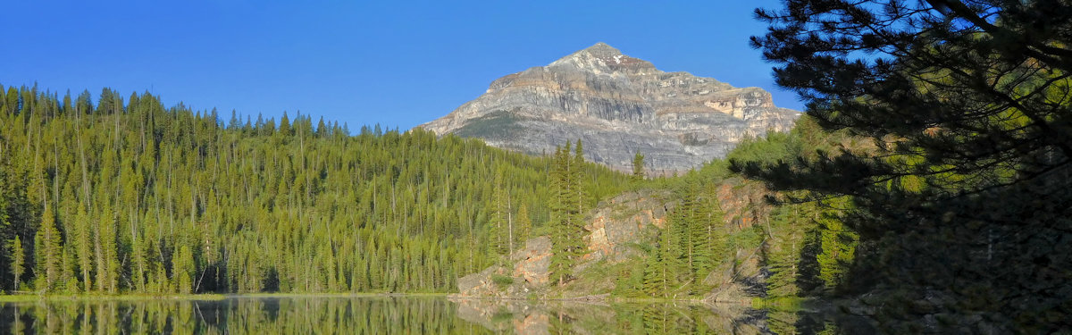
I have a long distance ahead of me. Since the trailhead is so close to the hostel, I'm already on the trail at seven o’clock. The 15.5 kilometers to Shadow Lake are only the beginning. A steep descent from the highway leads down to Vista Lake. Without wind and under a bright sun, the lake shows a brilliant blue color.
Vista Lake
From Vista Lake at the bottom of the valley, the trail goes uphill. I spot the first larches growing on this slope. Constant traffic noise from the highway on the other side of the valley remains audible, until a denser forest swallows it eventually. After about an hour and a half I reach jade-colored Arnica Lake at an altitude of 2155 meters.
Arnica Lake and Storm Mountain
The trail climbs over a spur of Storm Mountain to 2285 meters just to lose elevation again towards Upper Twin Lake at 2090 meters.
Upper Twin Lake
On a few boulders I cross the outflow of the lake. They are barely above water level, but good enough to avoid getting my boots wet. Twin Lakes campground lies on the other shore, where I stop for lunch.
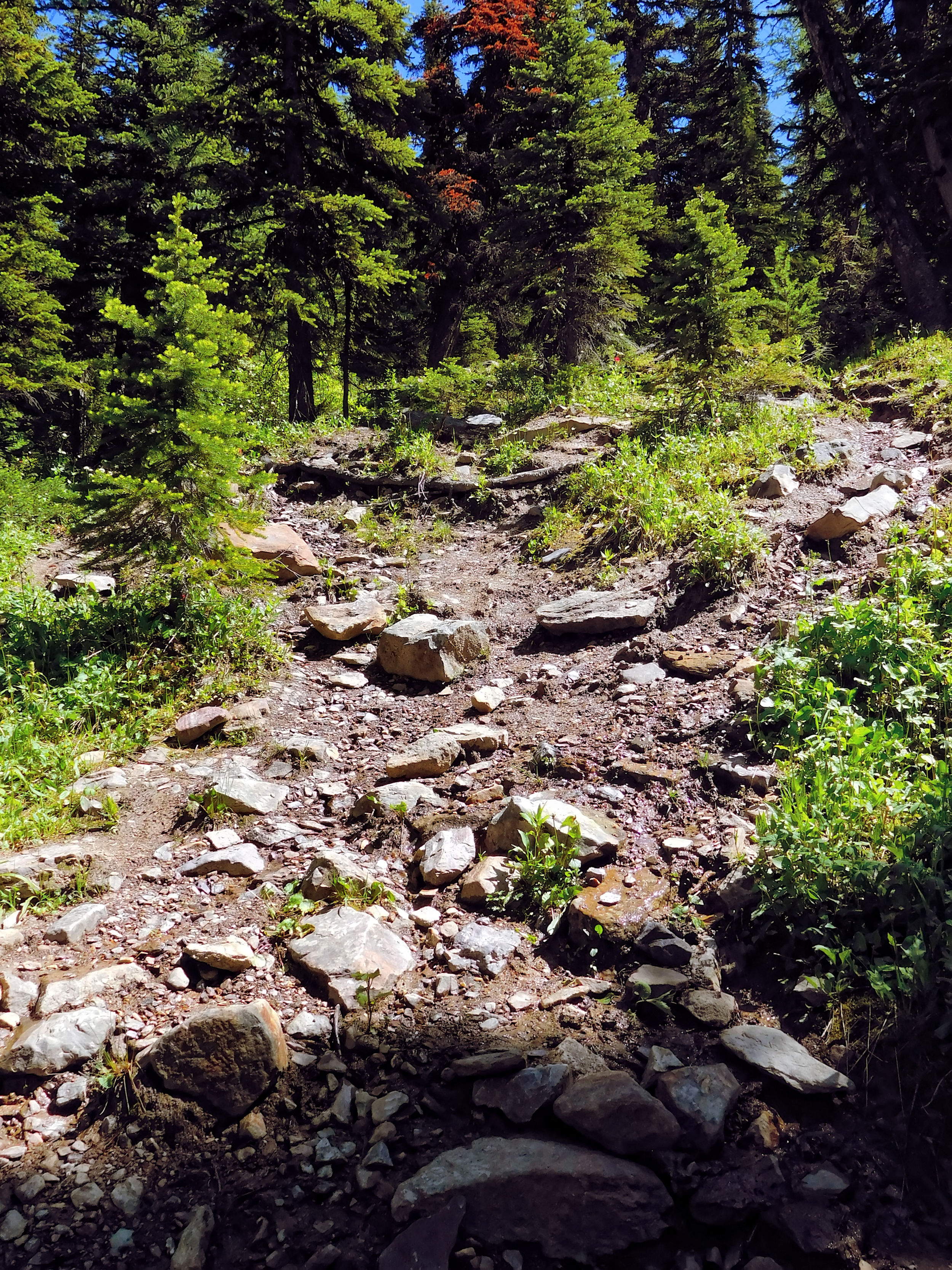
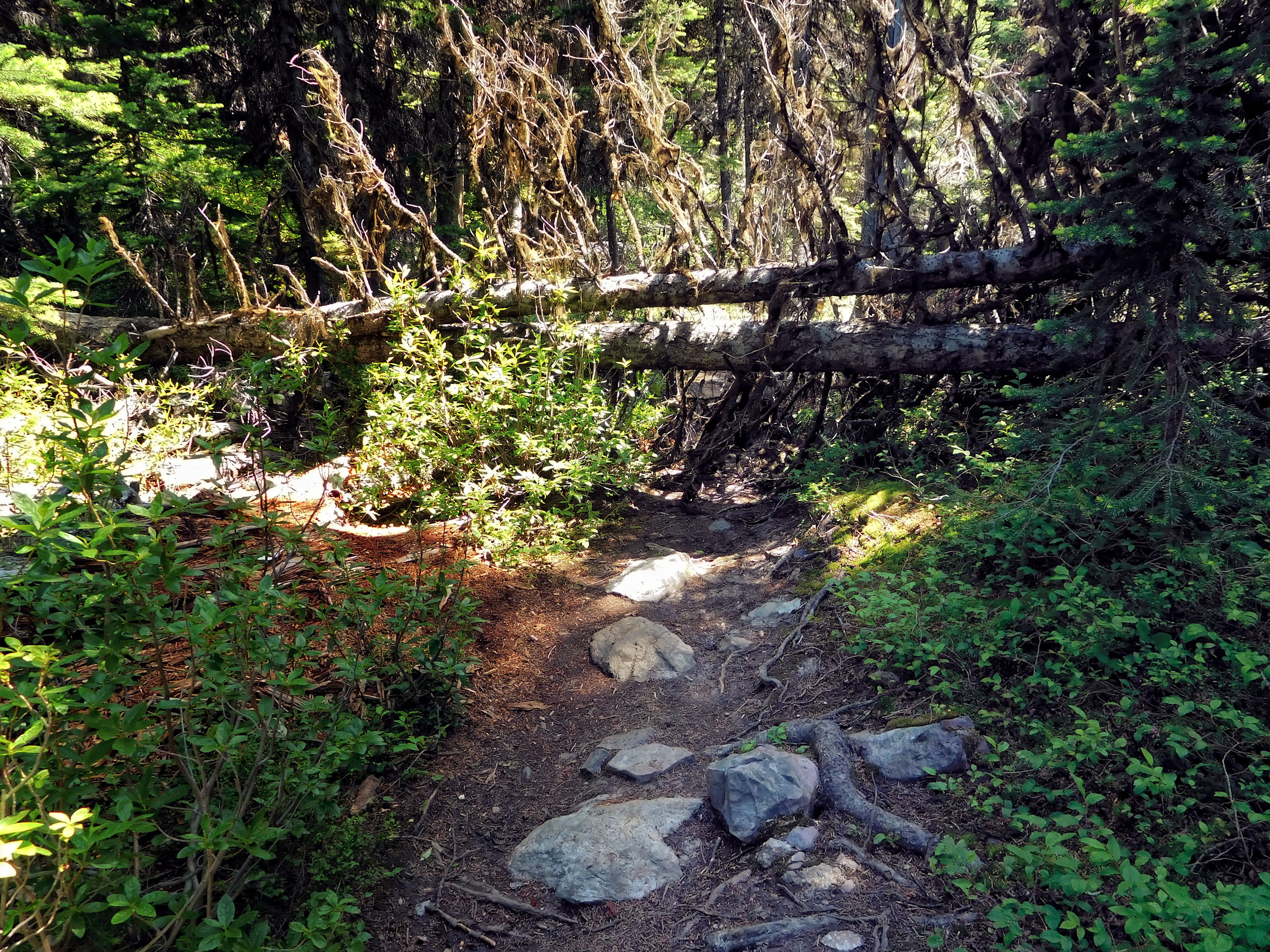
Rough trail
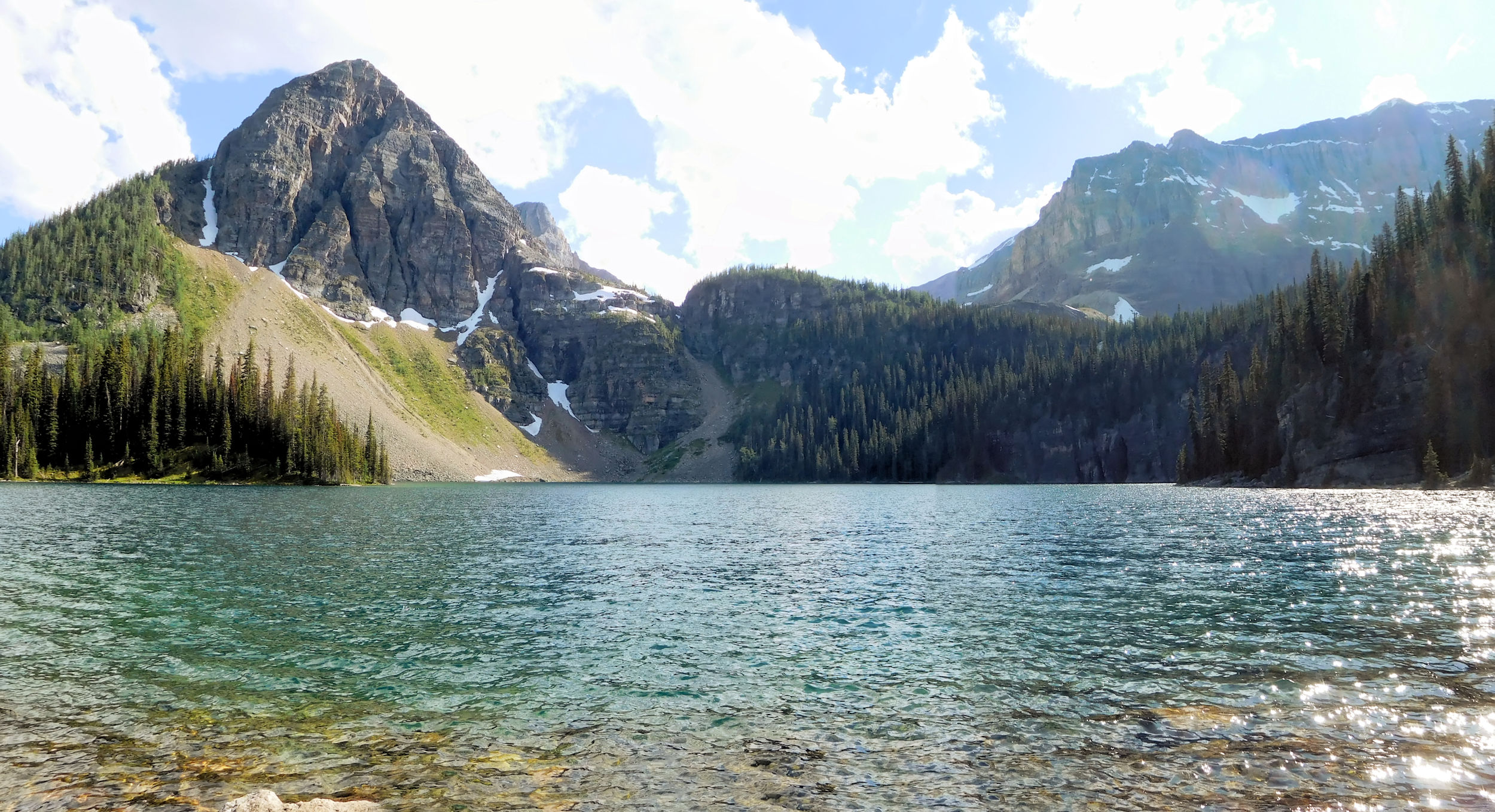
On the way to Lower Twin Lake I intersect another trail that connects to Castle Junction. It is overgrown and muddy and doesn't look like it gets much use. Since Arnica Lake, my trail is very rough, too. It is covered with lots of loose debris and often wet. I have to pay attention in order not to trip or step into muddy puddles. No wonder that in the trail report conditions were categorized as "poor" until a few days ago. Again I cross a bridge and get to the north end of the lake. On the opposite side, a waterfall plunges into Lower Twin Lake. To get a better view of the falls, I follow a partially flooded, indistinct trail along the lake.
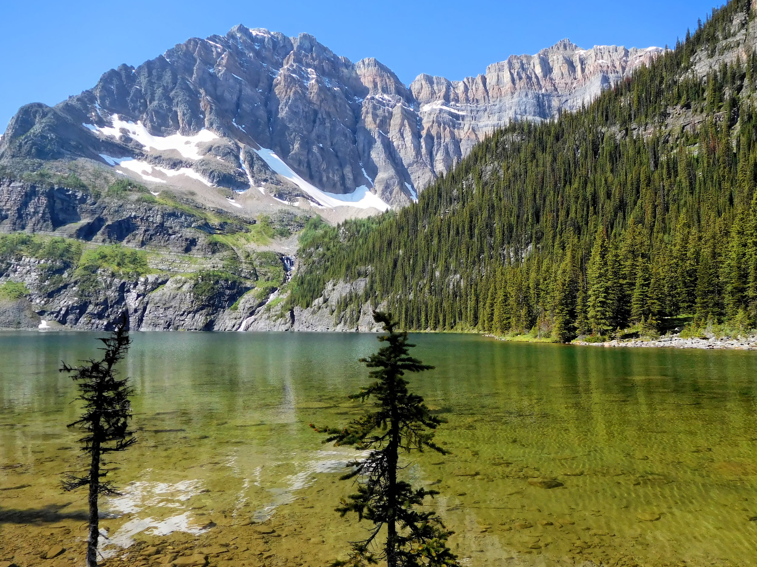
Lower Twin Lake
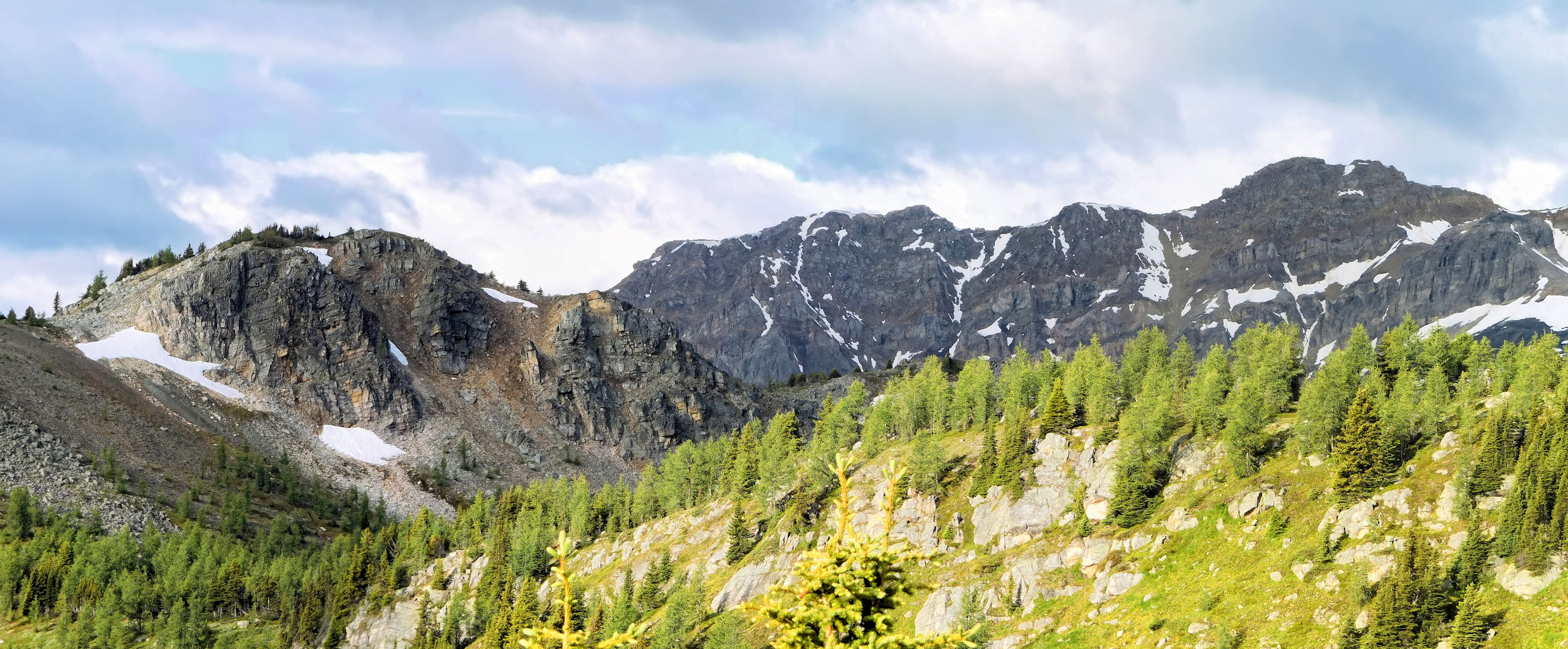
As the path along the lake is increasingly flooded, I return to the main trail and begin the ascent to Gibbon Pass. The forest now consists mostly of larches. Currently, the tender needles of these conifers are still light green. In the fall they will turn into a golden color and must look even more magnificent. Soon I reach Gibbon Pass.
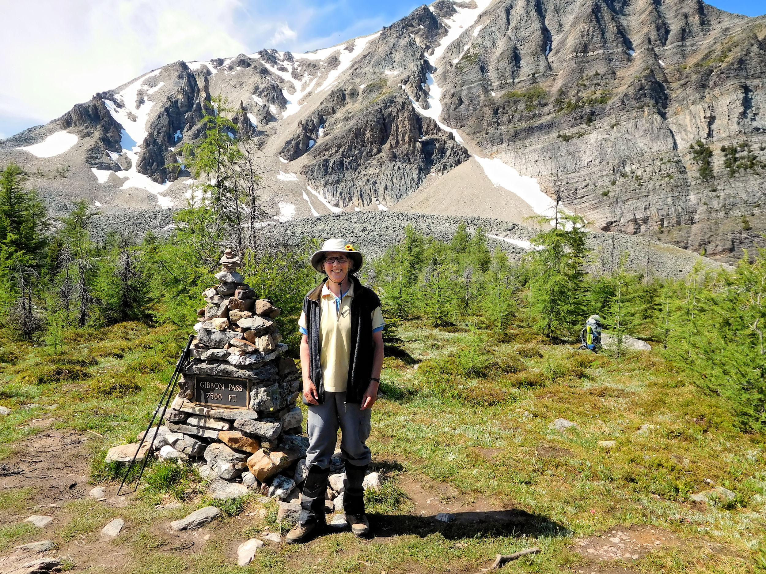
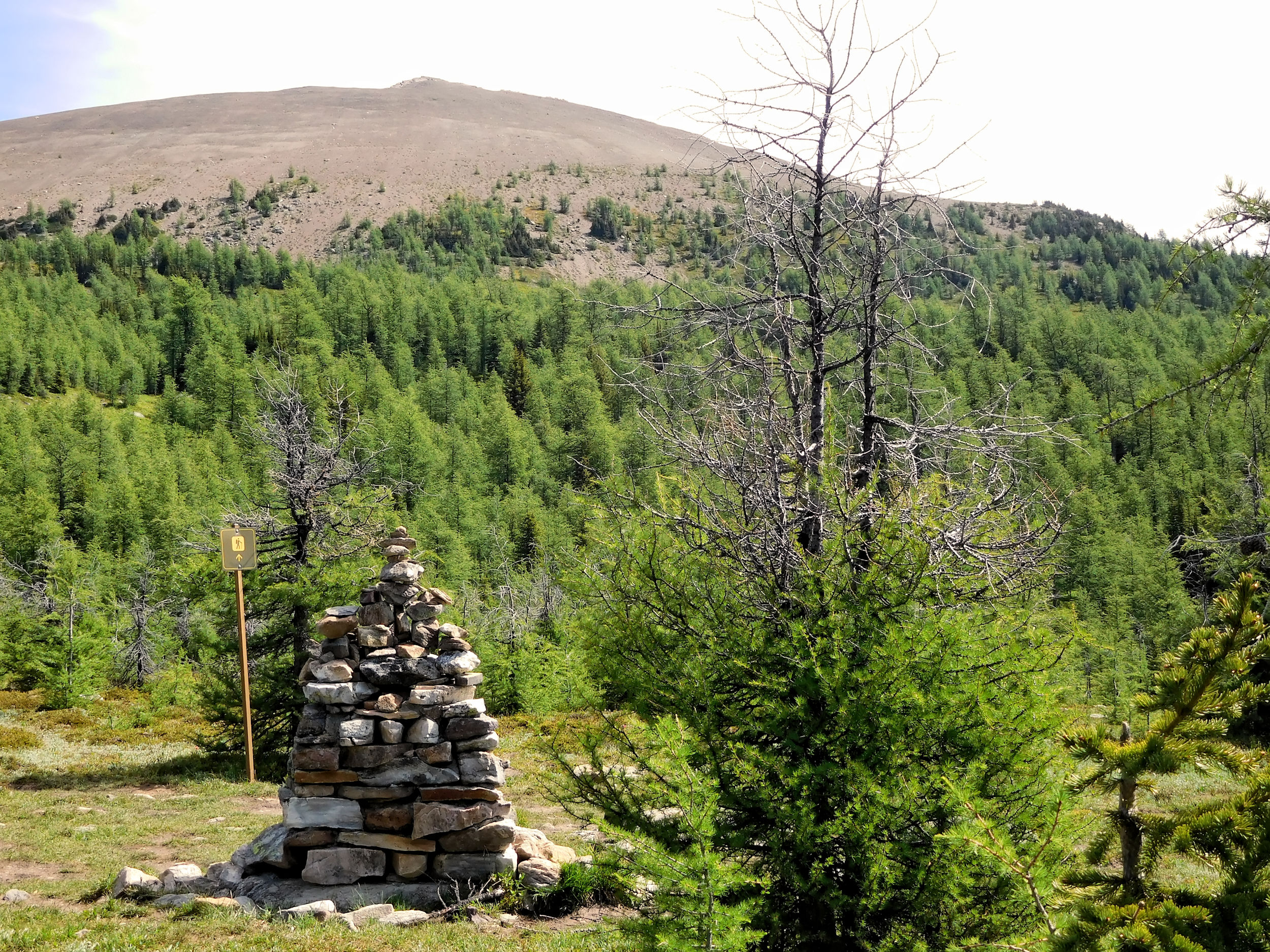
Gibbon Pass 2300 m
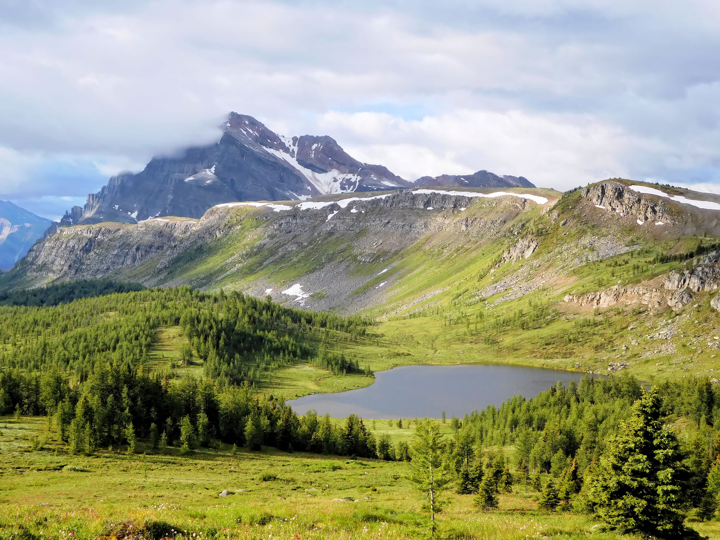
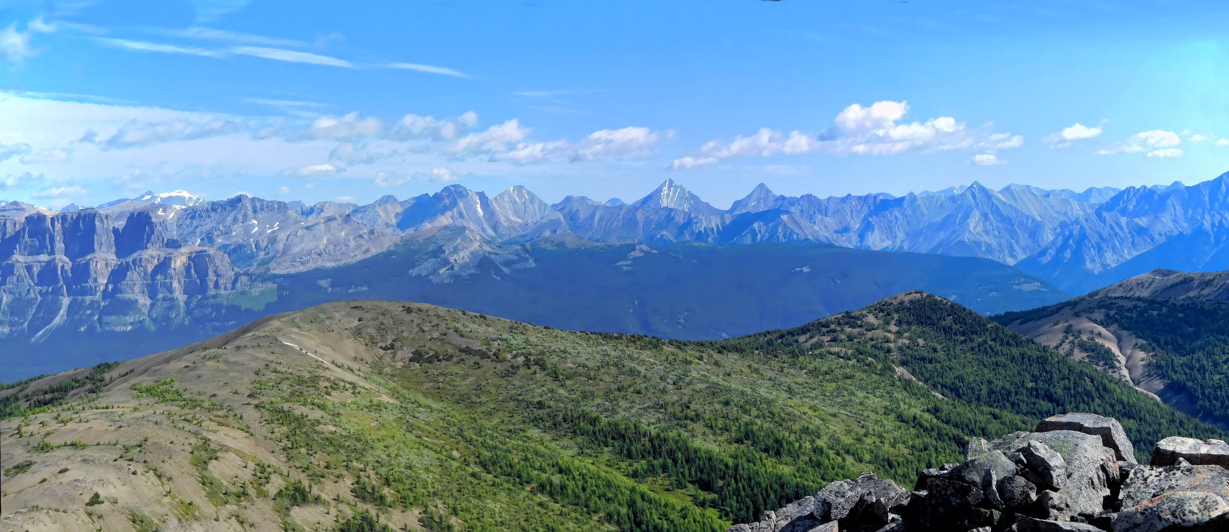
From the pass, I have a first look at Little Copper Mountain, which I want to climb on the way back, weather permitting.
Little Copper Mountain
The pass itself is rather unspectacular, but will show all its glory later in the year when the larches turn to their autumnal color.

Larches near Gibbon Pass
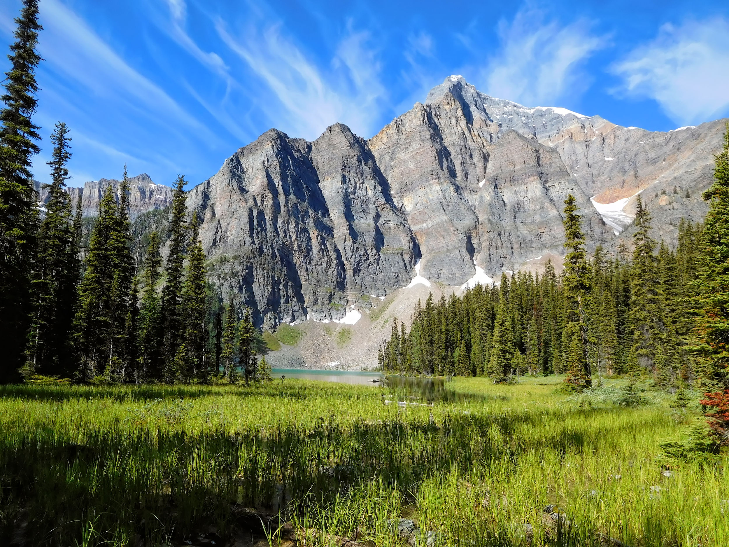
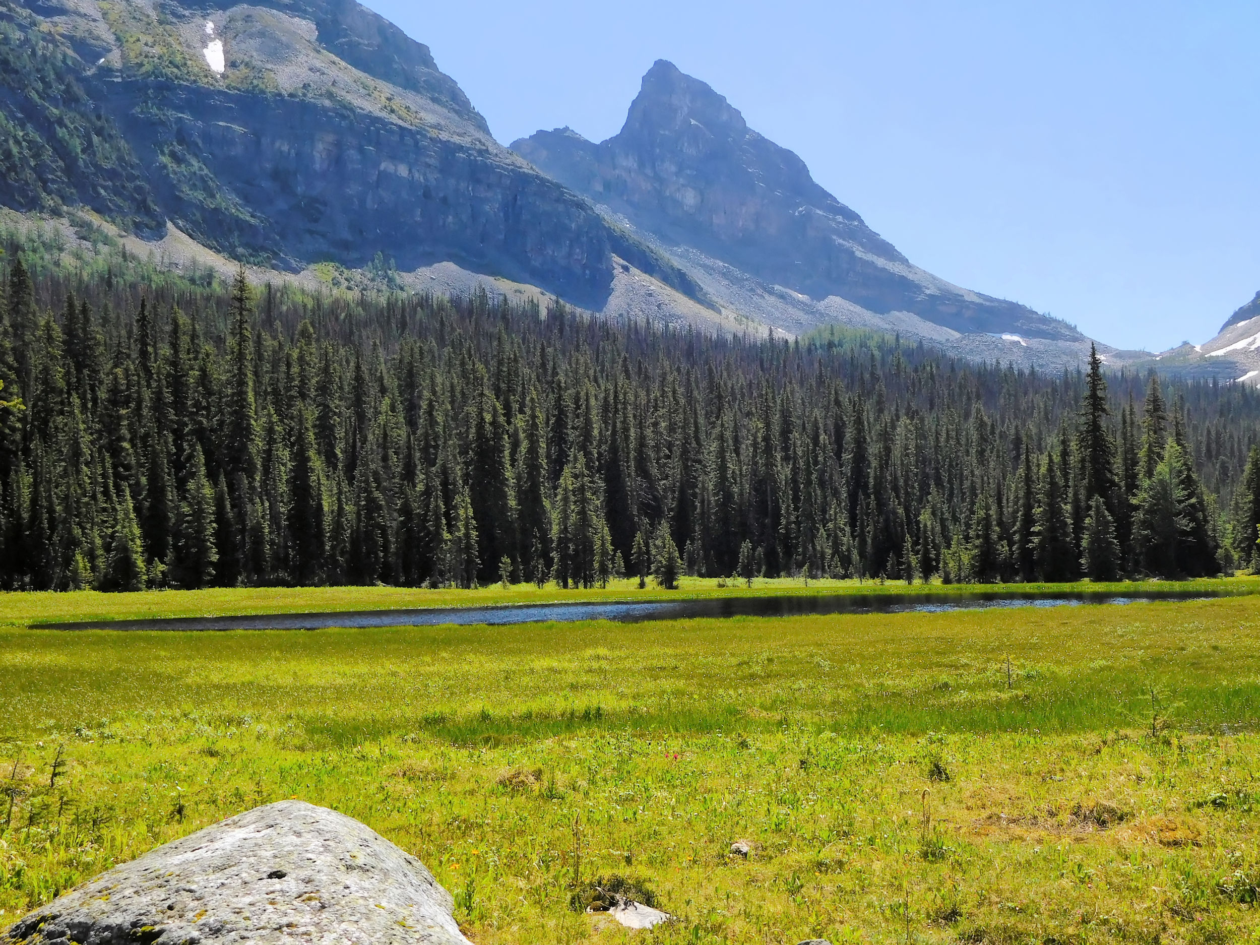
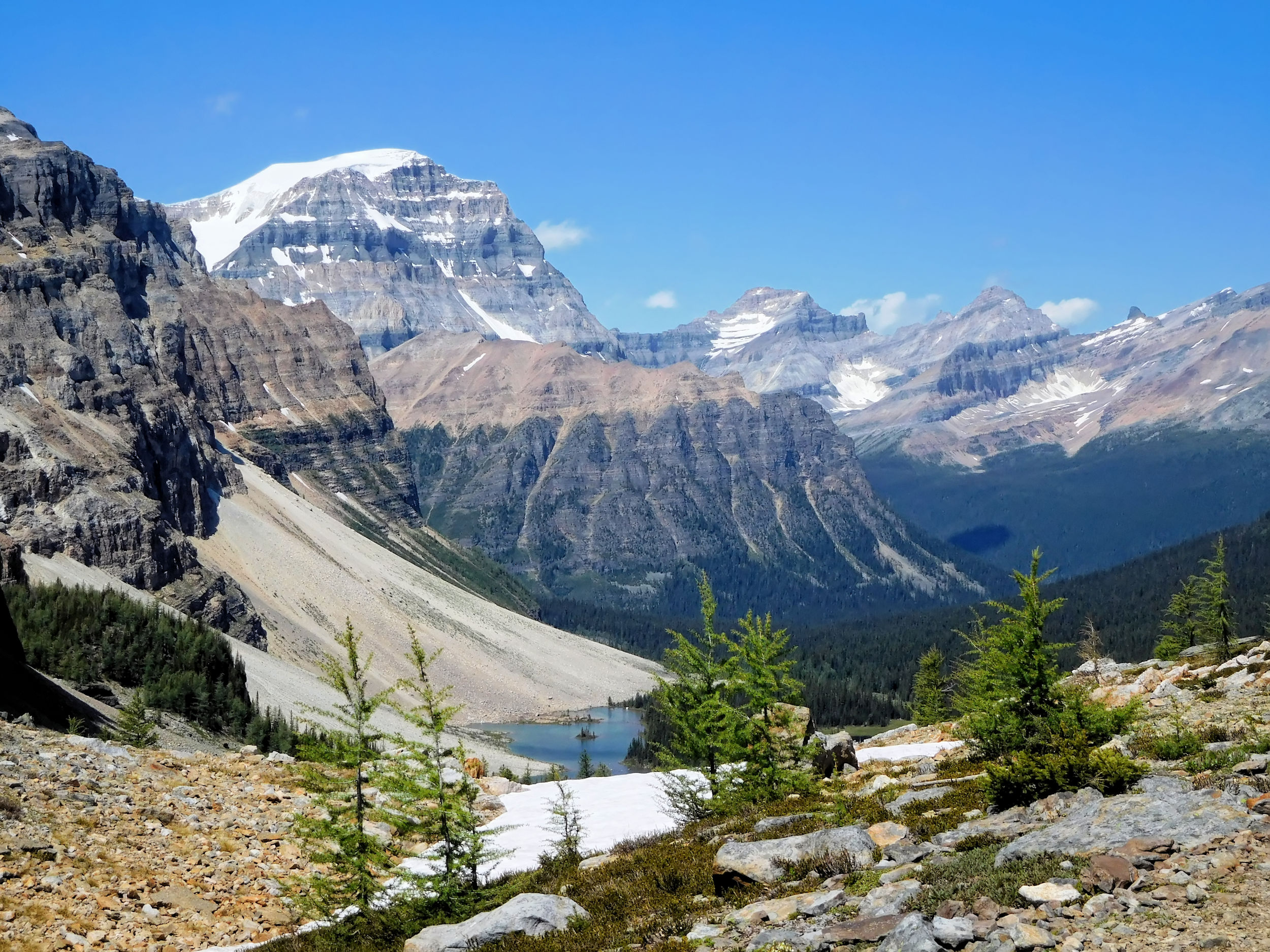
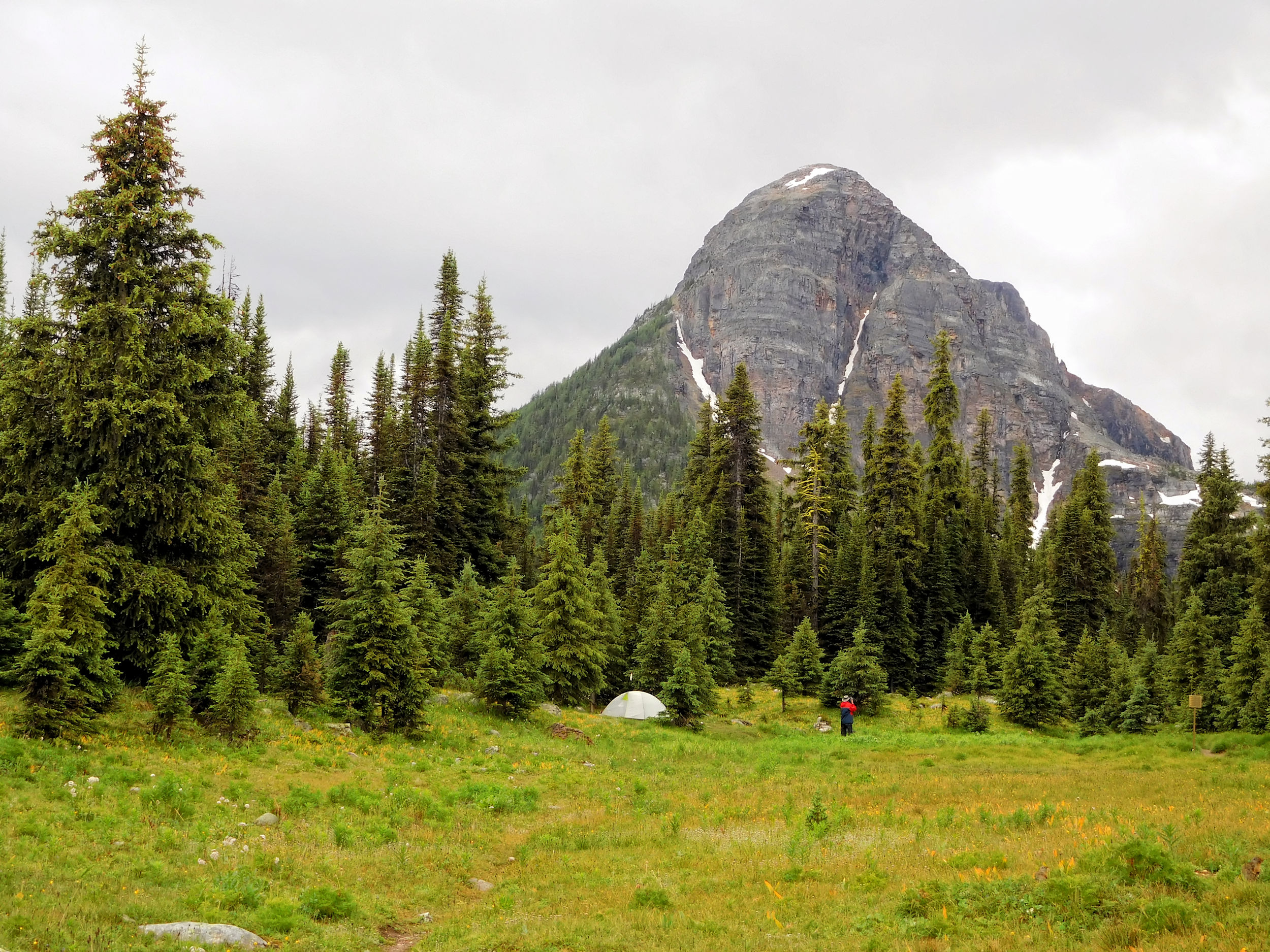
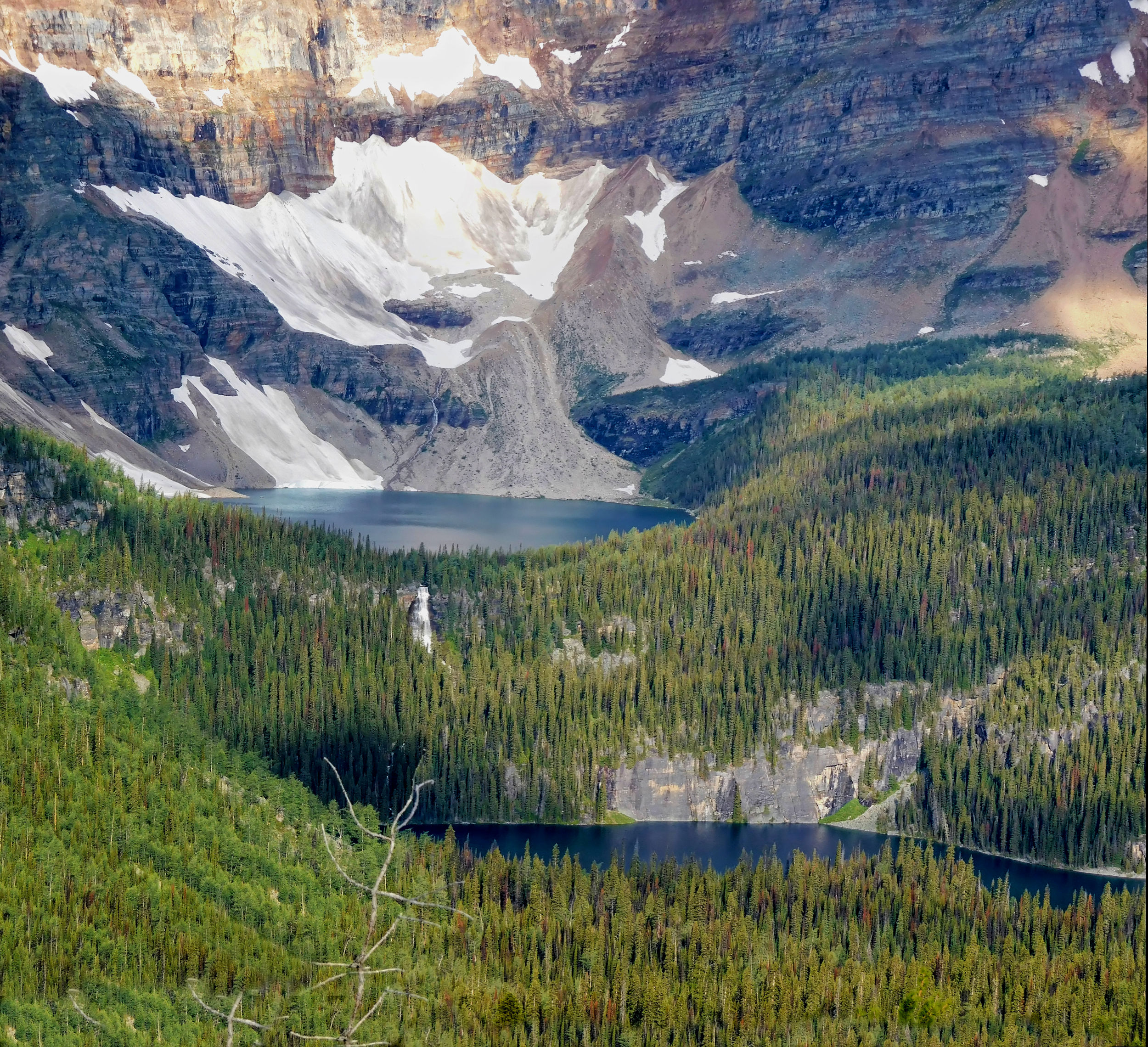
Beyond the pass, Mount Ball becomes visible. My destination for today is the campground at the foot of this mountain. From Gibbon Pass I descend 445 meters and 40 minutes to a trail junction. From there I hike in the direction of Shadow Lake. This large lake is picturesquely situated between Storm Mountain and Mount Ball.

Shadow Lake and Mount Ball
On the long bridge over the lake outlet I meet an Asian couple. They are looking for Shadow Lake Lodge. The lodge and the campground with the same name are nowhere near the lake shore but on the other side of the crossroads that I passed earlier. They have to go on a little further, but they are not lost.
It is still an hour to Ball Pass Junction campground and I am relieved when I finally reach it. This first day has been a tough one with a distance of over 19 kilometers on an extremely rough path and numerous up- and downhills.
The campground has only six tent spots. I pick site number one which lies in the shade and close to the creek. I set up camp and bathe my tired feet in the cold water. Then I prepare dinner, as it is already late in the afternoon. From the picnic table I admire the striking mountain formations surrounding the campground.
View from the campground
At dinner time I meet the other hikers. A few of them are long-distance hikers on the Great Divide Trail (GDT). They are slightly off schedule and therefore have no reservations for tonight, but there is plenty of room at the campground.
GDT hikers are mostly young people who have taken off all summer or quit their jobs to hike the 1200-plus kilometers from Waterton National Park in the south to Mt. Robson Provincial Park in the north. The GDT follows the border between British Columbia and Alberta and takes them over the highest passes in the Rocky Mountains. The official end of the trail is actually even farther north in the hard-to-reach Kakwa Provincial Park in British Columbia.
About every seven days the hikers have to re-supply their food and equipment. For this purpose, they either visit a store or stop at places with a post office to pick up parcels they have sent to themselves in advance. To cover the distance in one summer, on most days they hike between 20 and 30 kilometers. The entire distance between Egypt Lake and Floe Lake is done in a single day, followed by the Rockwall trail in just two. I find this fascinating and note with some pride that, over the years, I have also hiked large portions of the GDT. This summer, my route takes me along the Rocky Mountain watershed again; hence I will run into more through-hikers on my way.
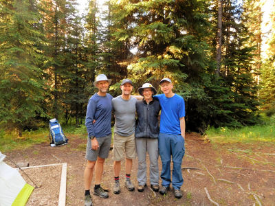
In the evening I meet three guys, who from here on have exactly the same itinerary as I do. We will enjoy each other’s company at every campground on the way. The two older ones are cousins who celebrate their fiftieth birthdays with this hike. The third one, in his twenties, is the son of one of them. We hike separately, because the youngest likes to sleep in, while I am on my way early. Upon reaching camp in the afternoon, it soon feels like reuniting with family. The previous night they stopped at Shadow Lake and therefore had enough time to climb Ball Pass earlier today. This is what I want to do tomorrow, before I leave for Egypt Lake.
| Distance | 5.2 km |
| Time | 1 ¼ hrs |
| Incl. Breaks | 1 ½ hrs |
| Min. Elevation | 1917 m |
| Max. Elevation | 2200 m |
| Ascent | 283 m |
| Cum. Ascent | 461 m |
| Cum. Descent | 461 m |
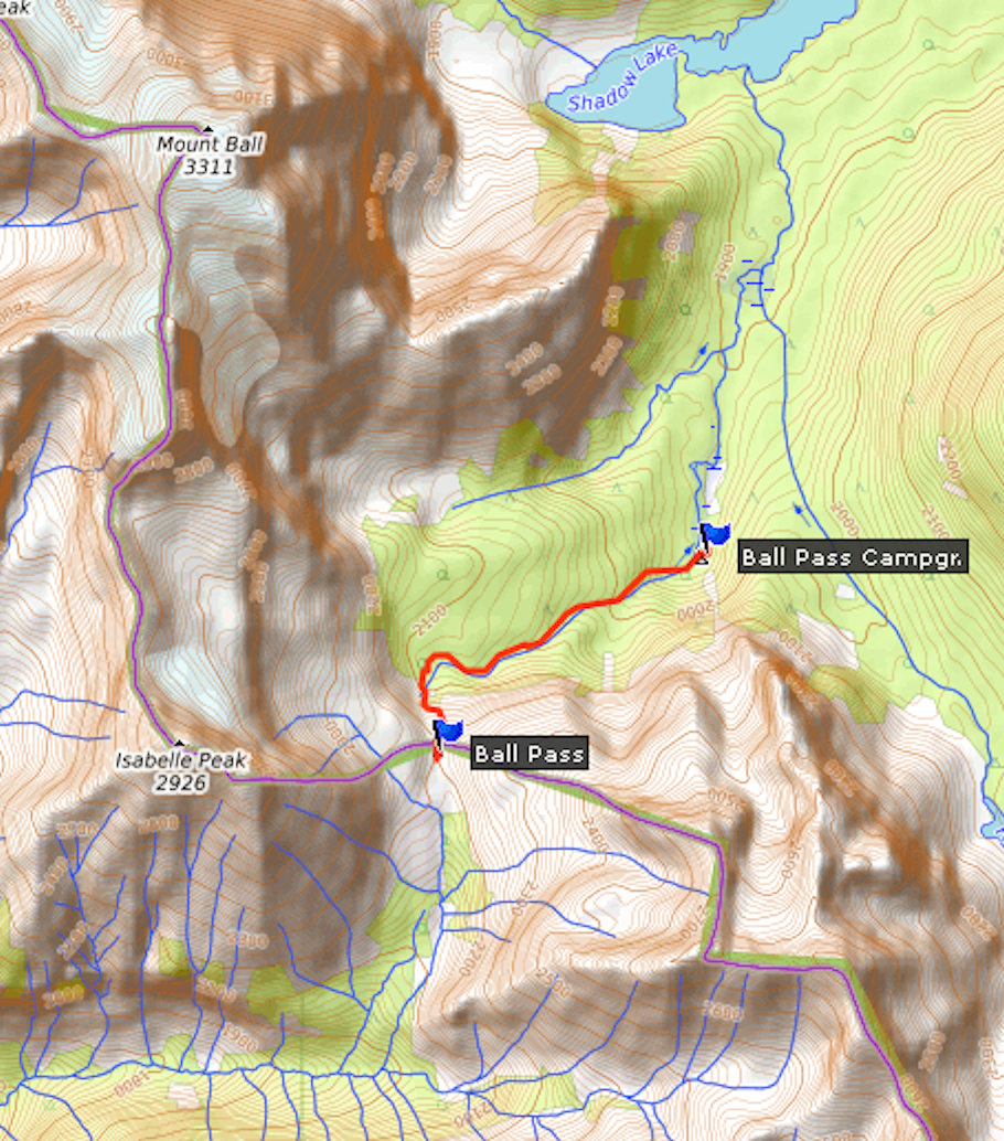
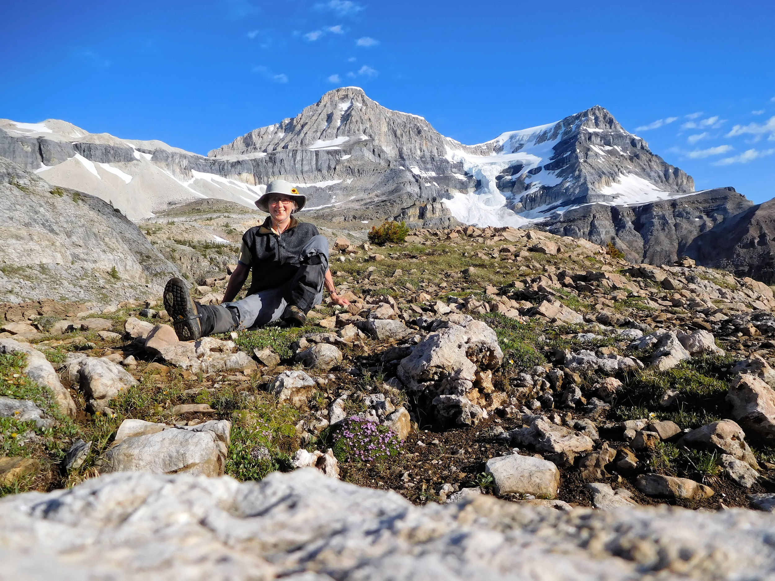
A clear and cold morning welcomes me. After an early breakfast consisting of hot porridge and re-hydrated fruit, I set off for Ball Pass. It is well before seven o’clock. The shaded corner where I have pitched my tent will not see the sun for quite a while. Maybe the tent will be dry by the time I get back.
First I walk along a stream, and the ascent up the valley is gentle. The last portion up to the pass, however, is steep, narrow and pebbly. With my fully packed 16 kilogram backpack this slippery stretch would be quite challenging, but with the light daypack it poses no problem.

Ascent to Ball Pass
Ball Pass
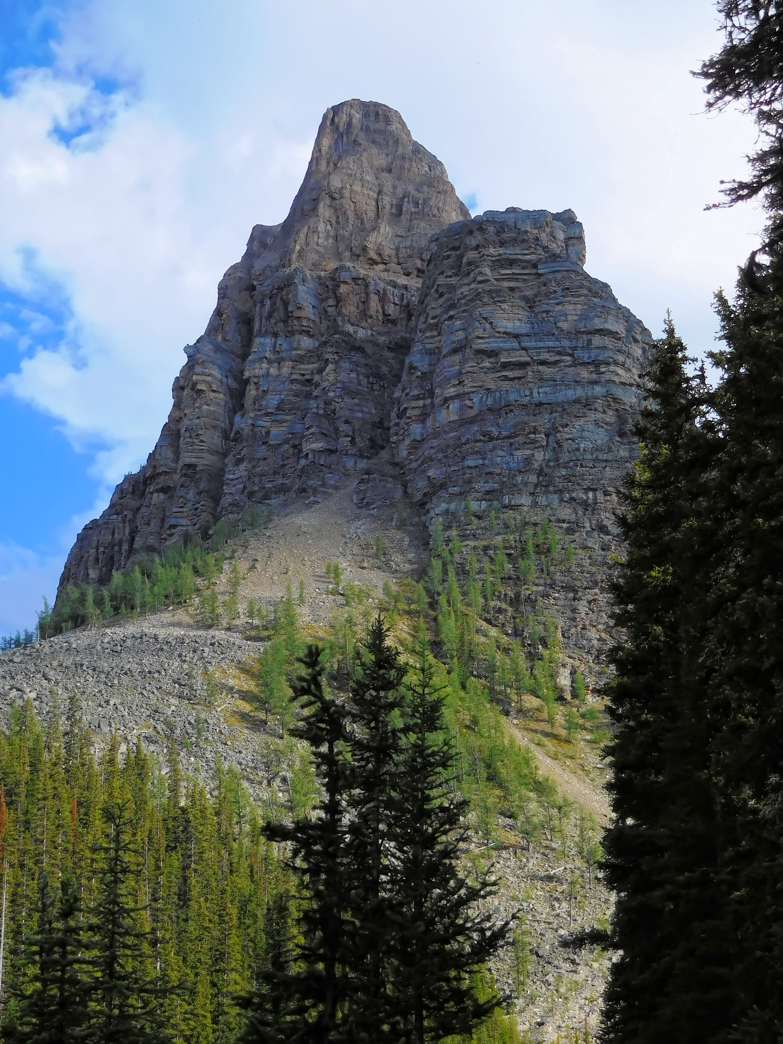
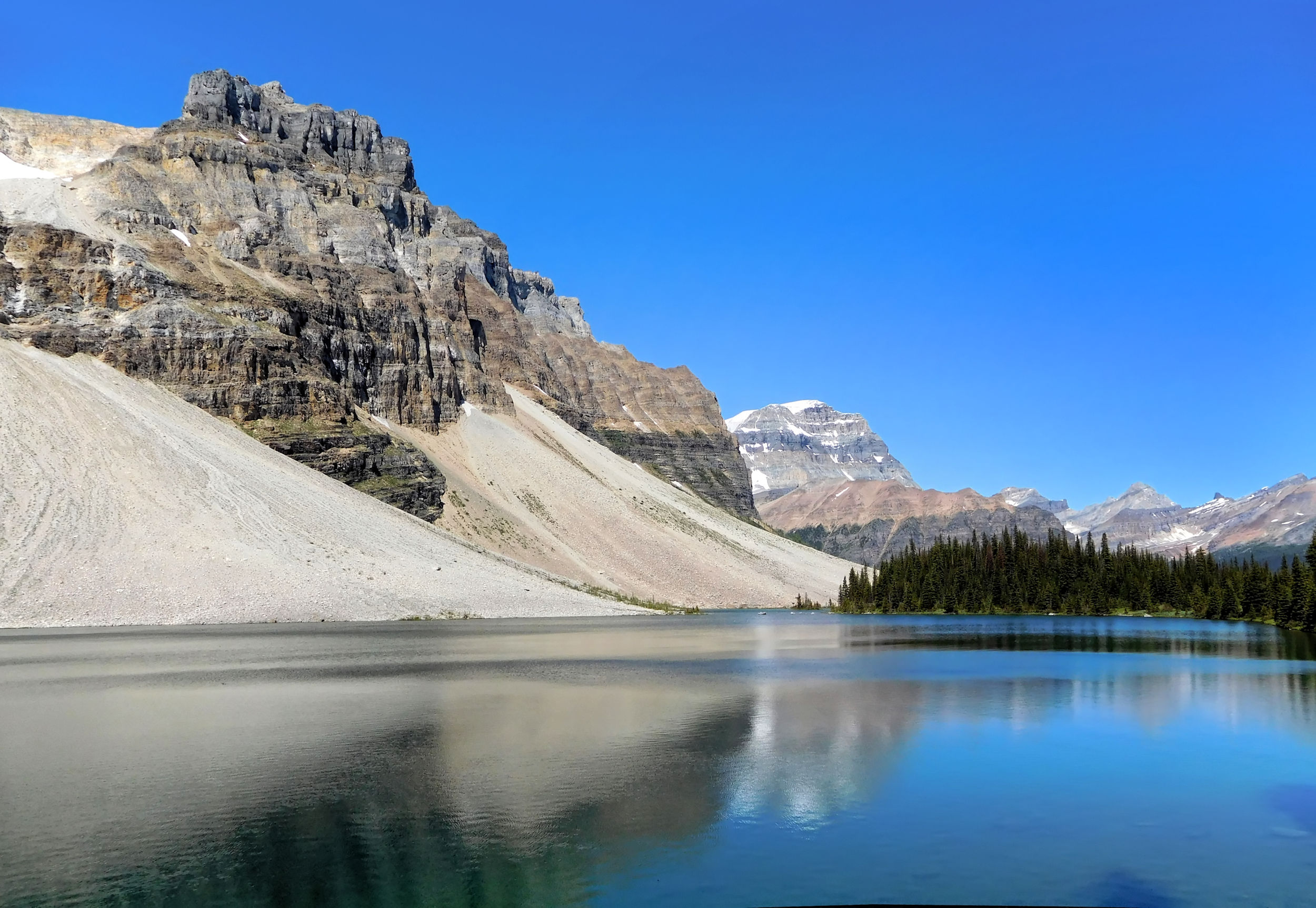
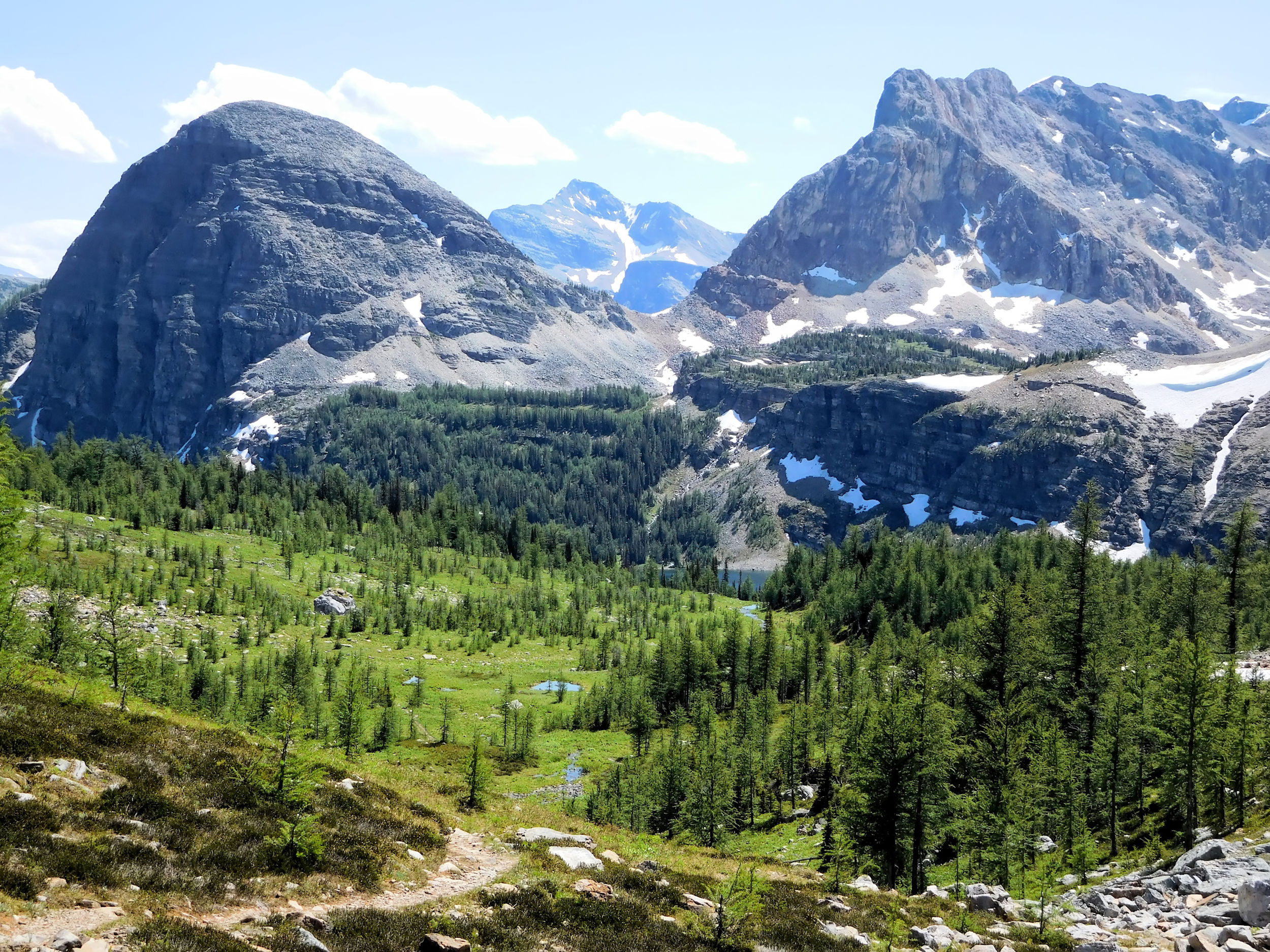
From the pass I look back at impressive Mount Ball with its hanging glacier. Mount Ball and Isabelle Peak on one side and Haiduk Peak on the other surround the pass.
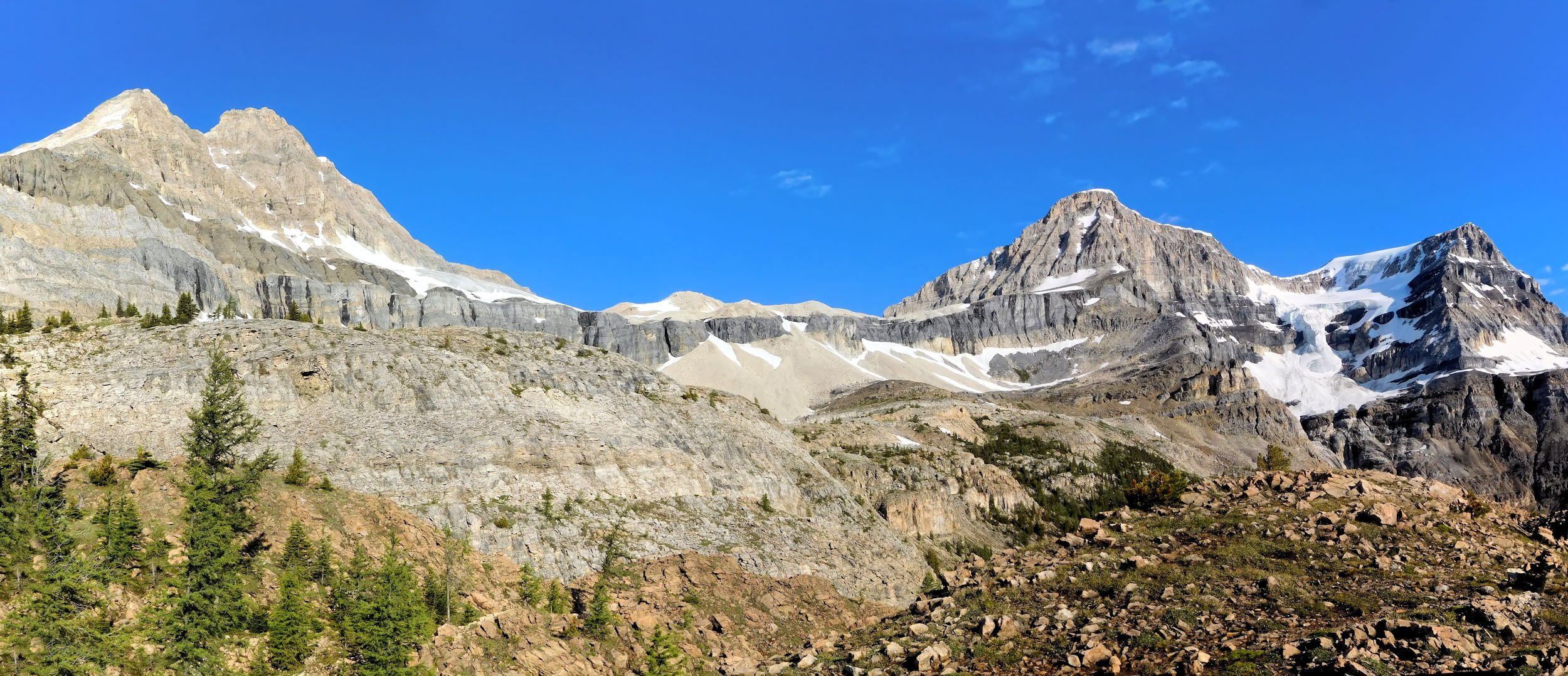
Isabelle Peak 2938 m and Mount Ball 3311 m
I proceed further beyond the pass wondering what the view will be like on the other side and find out that there is none to speak of. The contrast of the two sides of the pass is stark: on this side barren rocks and snow, over there krumholz and meadows.
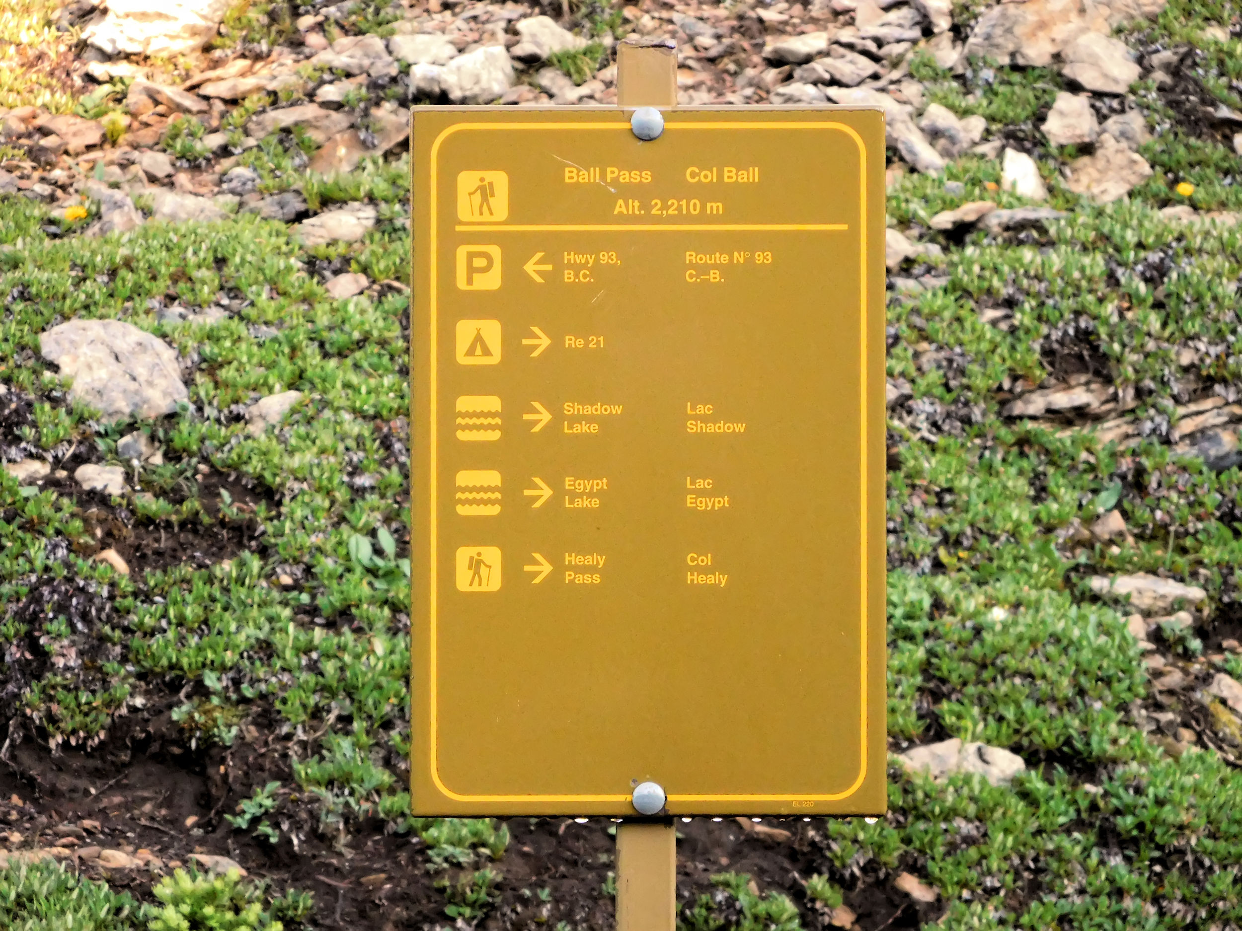
Ball Pass 2210 m
Once I have left the slippery gravel behind me, the return trip is fast. I find the campground deserted, everybody has left. I will see my three companions at the next campground again. Since the sun has not reached my tent yet, I have to pack it still wet and carry the extra weight. Breaking camp takes me about an hour, and I am on my way to Egypt Lake.
| Distance | 11 km |
| Time | 3 hrs |
| Incl. Breaks | 5 hrs |
| Min. Elevation | 1916 m |
| Max. Elevation | 2303 m |
| Ascent | 387 m |
| Cum. Ascent | 708 m |
| Cum. Descent | 861 m |
I leave Ball Pass Junction campground around ten o’clock. After a short climb the trail becomes relatively level while it leads through the Haiduk Creek valley. Haiduk Peak rises to my right.
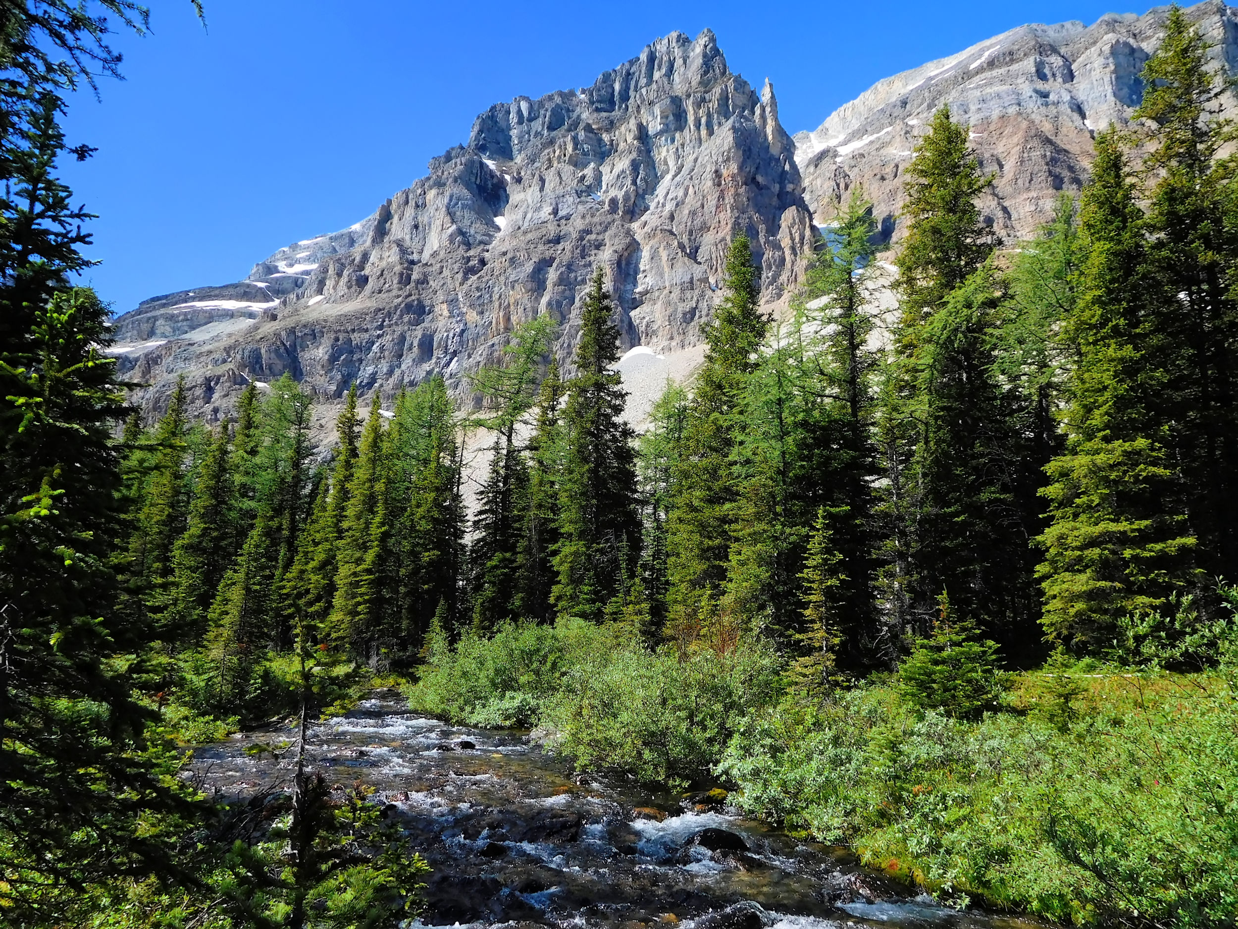
Haiduk Creek valley and Haiduk Peak 2919 m
A little further on I reach a marsh with a pond at its center. Behind it towers one of the Pharaoh peaks.
Pond and Pharaoh Peak
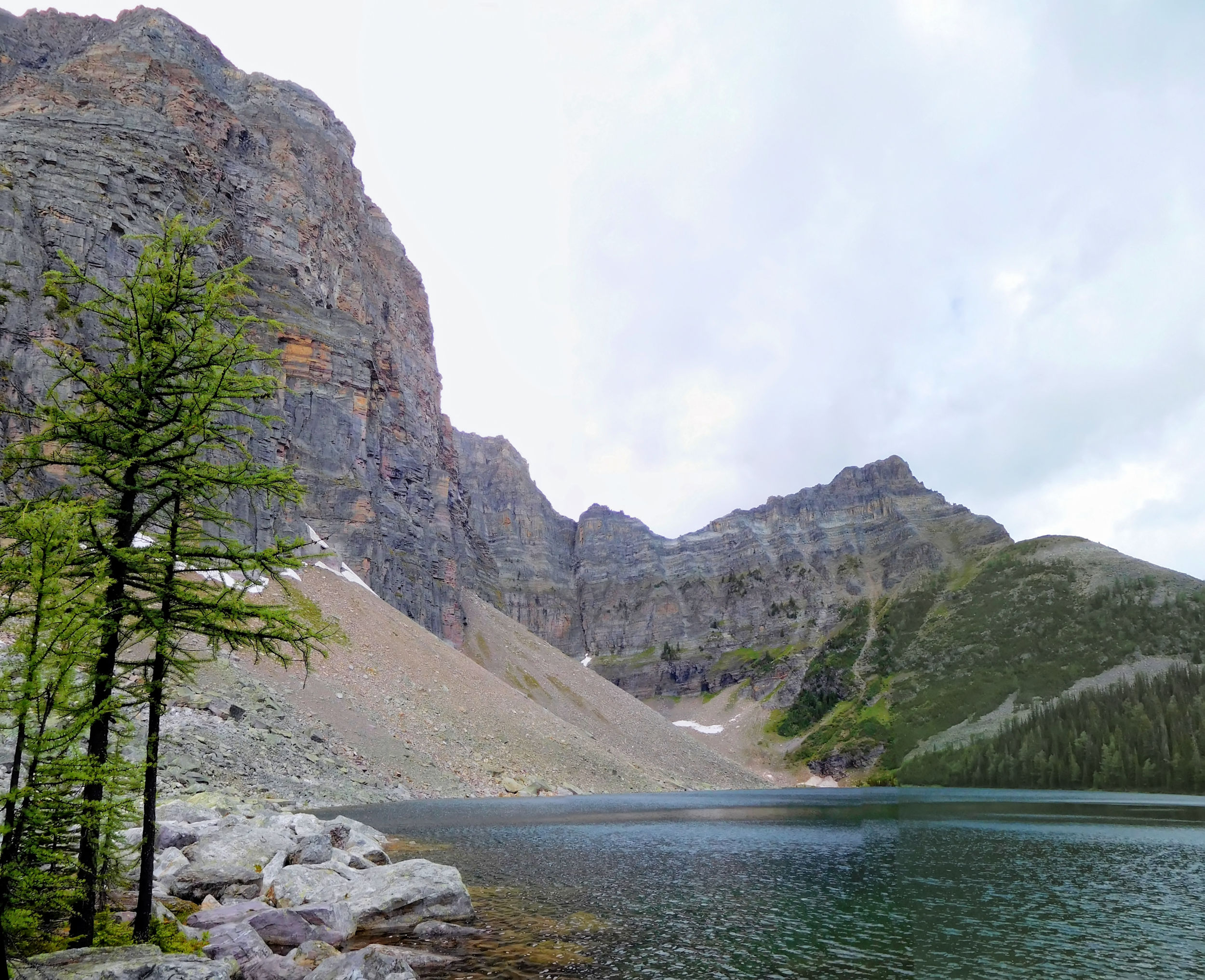
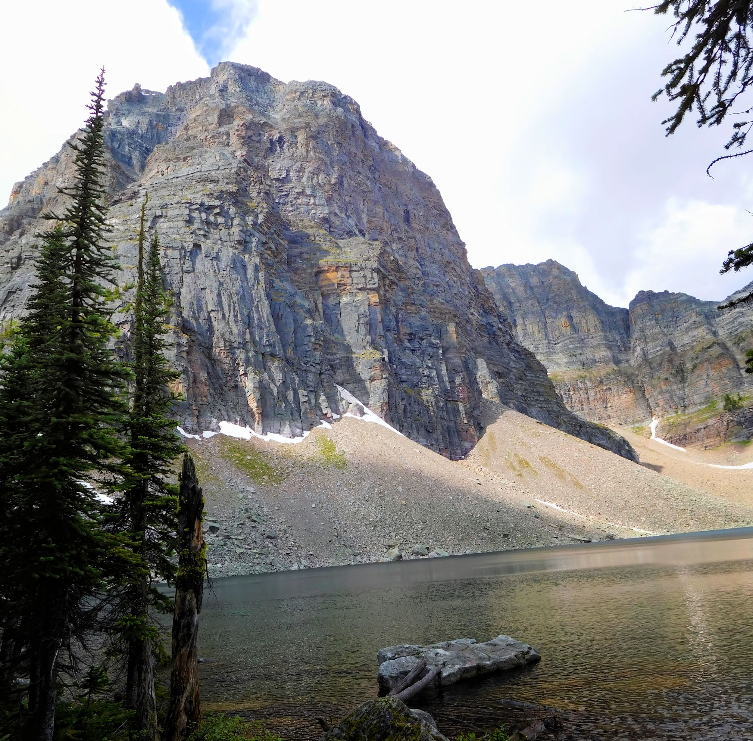
After another ten minutes, a little more than an hour since my departure, I reach Haiduk Lake. The scenery and the time of day both invite for a lunch break.
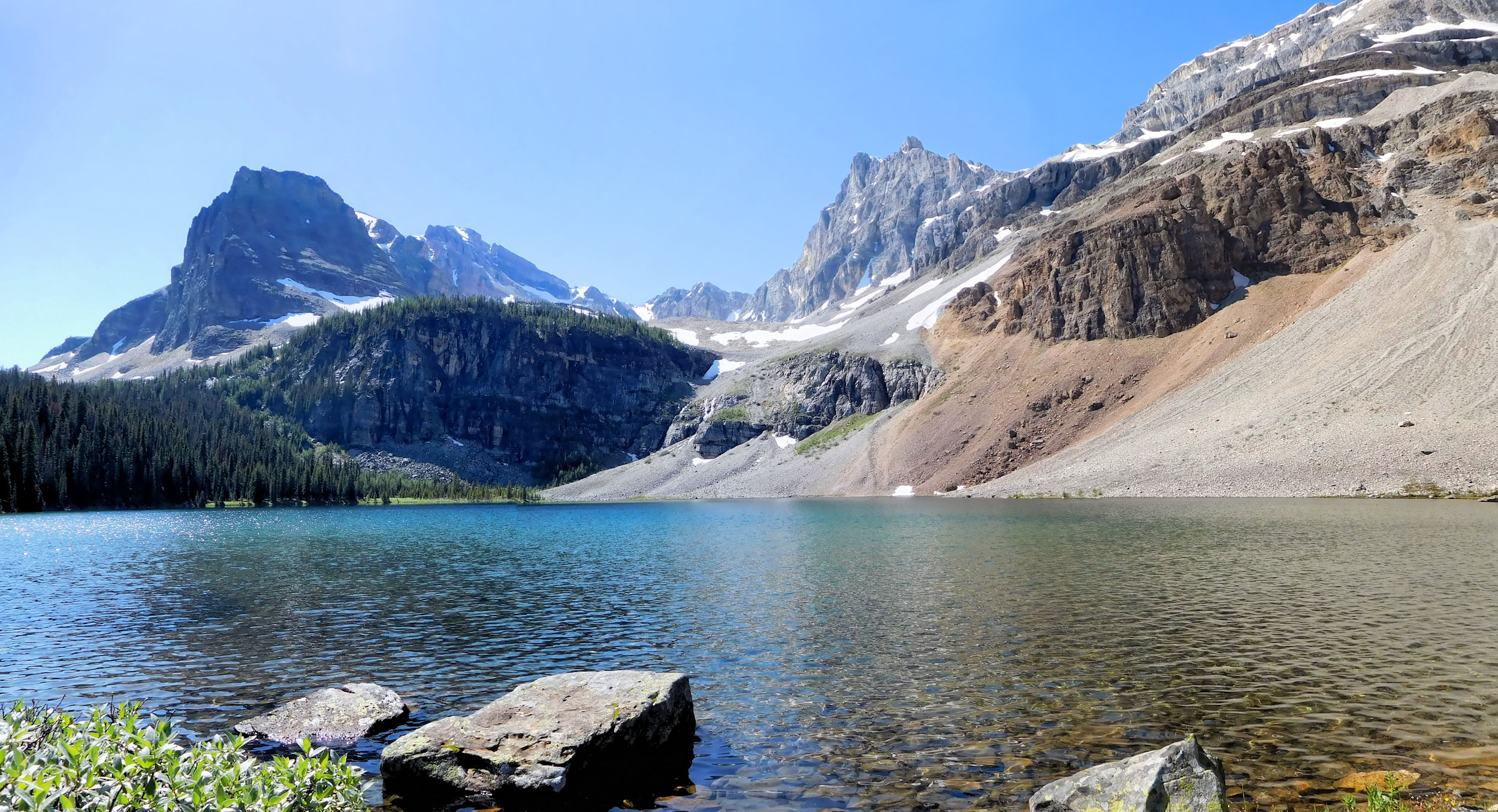
Haiduk Lake 2070 m

Resting at Haiduk Lake
Haiduk Lake and Mount Ball
A little later, the final push up to 2290 m Whistling Pass begins. From this side it looks like you have to mount a wall. The trail is indeed steep but well-trodden, much better to walk than the trail up to Ball Pass.
Up to Whistling Pass
The view from the pass towards Mount Ball and Haiduk Lake is exceptional.
View from Whistling Pass towards Mount Ball
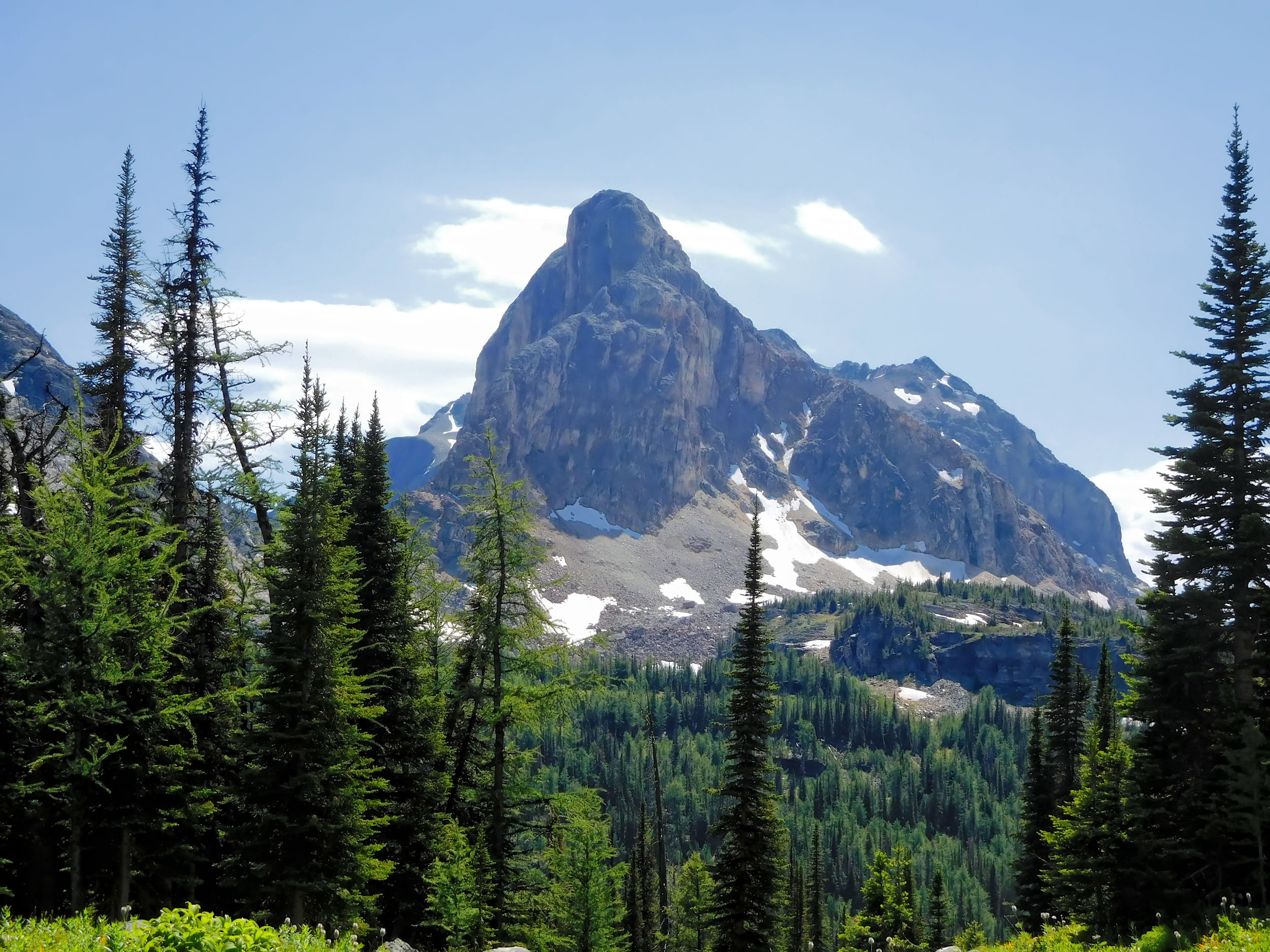
Beyond the pass I talk to some hikers who rest on a rock and enjoy the sights over there. It's hard to decide which of the two sides of the pass is more scenic.
View towards Sphinx and Monarch
The trail now heads down into the Egypt Lake valley. I mistake the prominent mountain in the photo for the Sphinx, but it is just an unnamed peak behind it. In 1922, the surveyors of this area picked an Egyptian theme, but the names don’t reflect the actual shapes of the geographical features that they were applied to.
I come across the turnoff for Scarab Lake and Mummy Lake. I postpone this side trip until some other time, because today I am too tired for this detour. The path down into the valley becomes extremely steep and rocky. With rubble and water everywhere, it’s like walking in a creek bed. I plant each foot with great care in order not to fall. After what seems to be an endless distance, some day hikers come up the trail and encourage me that it's not far now. Finally I reach the bottom of the valley.
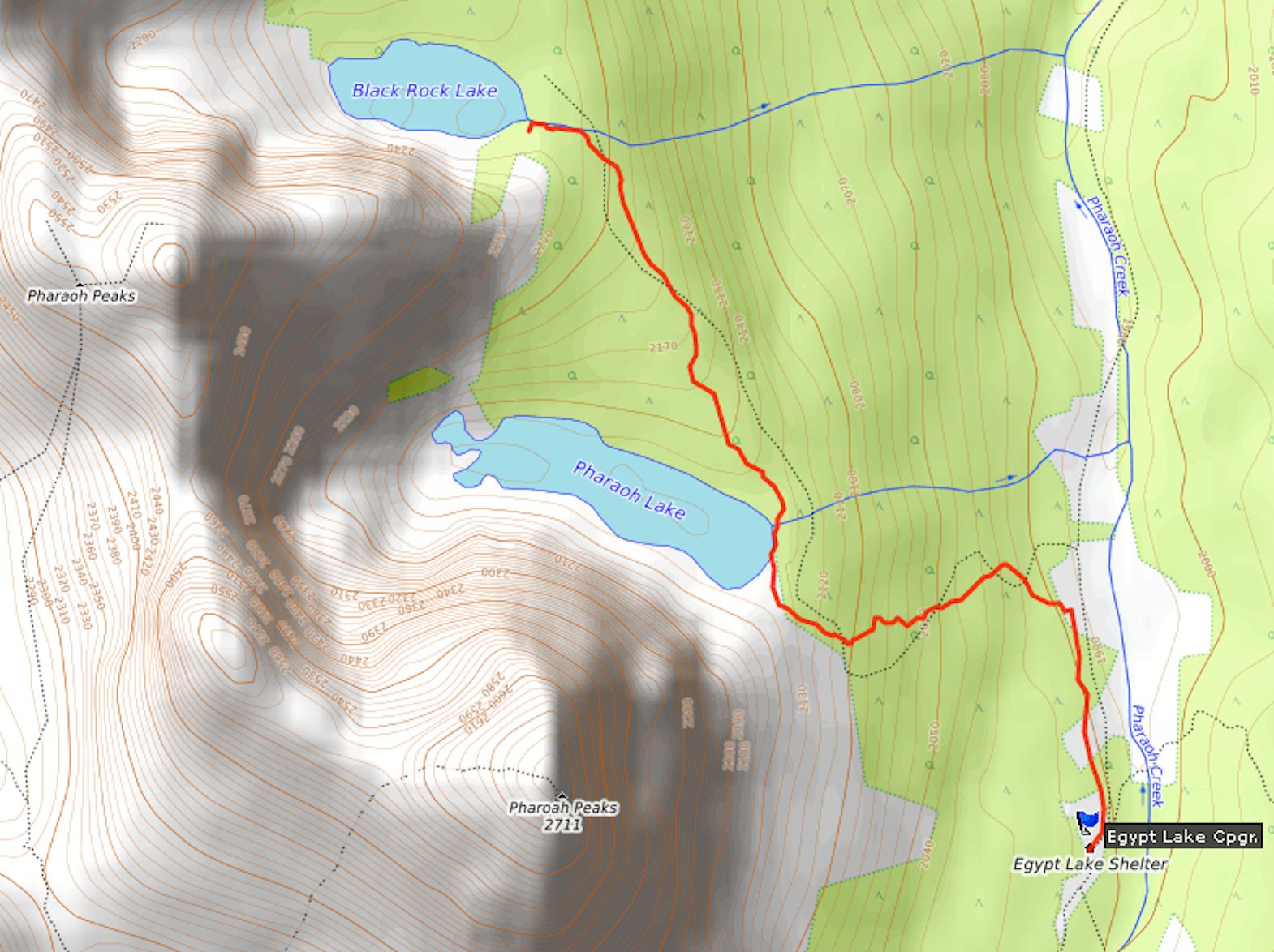
Ignoring the trail to Egypt Lake, I proceed directly to Egypt Lake campground, which despite its name is not on the lake. It has 13 tent sites and a shelter that sleeps another 12 people on platforms. Most of the tent sites sit on a bench above Pharaoh Creek and are already taken. I look for one that is not too far away from the picnic area, the water, and the outhouses. As with most campgrounds in the backcountry, the different areas are kept apart for safety and hygienic reasons and are connected by often steep and muddy trails. Finally, I pick a site across from the shelter and set up camp.
I stow my food in the bear-proof metal boxes provided at the picnic area. The water access is down by the river and reached by a steep trail. After my long hike, I could have done well without the additional climbing.
It's still early and the weather is nice, so I muster the energy to walk the extra kilometer to Egypt Lake, one of the must-sees in the area.
Egypt Lake and Sphinx
Here I meet my three fellow hikers from Ball Pass Junction campground again. They have spent the hot afternoon with a refreshing swim in the lake. In the meantime, wind has come up and brings a chill to the air. We exchange our adventures of the day. The three have decided to cook dinner at the lake shore, but I think it is too windy for that. My cook stove does not work well in the wind, because the burner is not getting hot enough or the flame is extinguished.
I make my way back and cook dinner at the picnic area that is sheltered by trees. In spite of the wind there are many mosquitos. I have been forewarned that this campground is notorious for them. The mosquitos are a popular topic for striking up a conversation with the other hikers. I share my table with a group of three and they have set up a tarp over it, because there’s rain in the forecast.
In fact, that same evening a thunderstorm moves into the valley. A few people brave the rain to take pictures of the lightning. I prefer to watch the spectacle from inside my tent.
| Distance | 4.8 km |
| Time | 1 ½ hrs |
| Incl. Breaks | 2 hrs |
| Min. Elevation | 2004 m |
| Max. Elevation | 2229 m |
| Ascent | 225 m |
| Cum. Ascent | 403 m |
| Cum. Descent | 403 m |
Unfortunately, the evening thunderstorm was not the end of it. I am jolted from my deepest sleep by a strong wind that yanks at the tent and makes the fly flap noisily. Another thunderstorm is approaching. This time it circles directly above us. Torrential rains come down, accompanied by thunder and lightning. The gusty wind tears at my tent so forcibly that I fear for the poles which bend in all directions. Forget about sleeping. The wind roars and thunderbolts crash with multiple echoes through the mountains. Apart from the blinding brightness of sporadic lightning strikes, it is pitch dark.
I switch on my little camp light for some comfort. In the dim light, I have to discover that my tent floor is slowly flooding. Water is running from the outer tarp between the tent footprint and the inner floor, forming a pool there that is steadily expanding. To make things worse, water is also dripping from one of the tent poles where the fly touches the canopy. My air mattress is only three-quarters length, so it does not offer much room to keep me and my stuff off the ground. I put all my things in plastic bags to protect them from the water.
There is no end to the thunderstorm. As soon as the wind and rain abate a bit, new thunder rumbles closer and the lightning becomes more frequent again. Eventually, close to dawn, the storm weakens into mere rain showers and I must have slept for a while.
As it gets light, the sound of rain pattering on my tent stops now and then. I don my rain gear and crawl out of the tent. Fortunately, the outhouse is not far, but the walk to the picnic area is a slippery trek through mud and huge puddles. I am thankful to the fellows who hung their tarp over one of the tables. I manage to have a quick breakfast underneath. One would think that the deluge would have at least scared away the mosquitoes, but no, they are well and numerous as ever. They are attracted to my plate filled with hot porridge, sit down on it and die. This is a kind of extra protein, I could do without.
The skies look dismal. Dark clouds blow in from every direction. The rain never stops for long. In these kinds of conditions, the planned day-hike to Healy Pass has no appeal to me. I haven’t seen my three companions yet, who were going to hike the pass today as well.
I check on my tent. Everything in it is damp and the floor wet; the puddle has spread under the entire tent. I wipe down the floor without being able to accomplish much. I dread spending the next night in this clammy lodging. Again and again I look outside hoping that the weather lets up.
Around 11 o’clock, the rain breaks have lasted long enough that I decide to risk a short day hike to Black Rock Lake. The first stop is Pharaoh Lake. The path is very narrow and overgrown. My hiking boots are exposed to the wet vegetation and can't keep my feet dry for long.
Pharaoh Lake
A sliver of blue sky drifts in. I capture it on my picture.
A sliver of blue sky over Pharaoh Lake
Towards Black Rock Lake the sky looks dark again. In spite of this, I carry on to my intended destination.
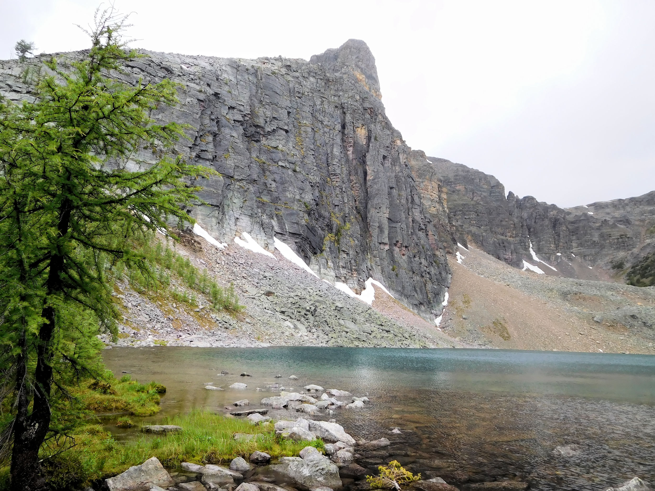
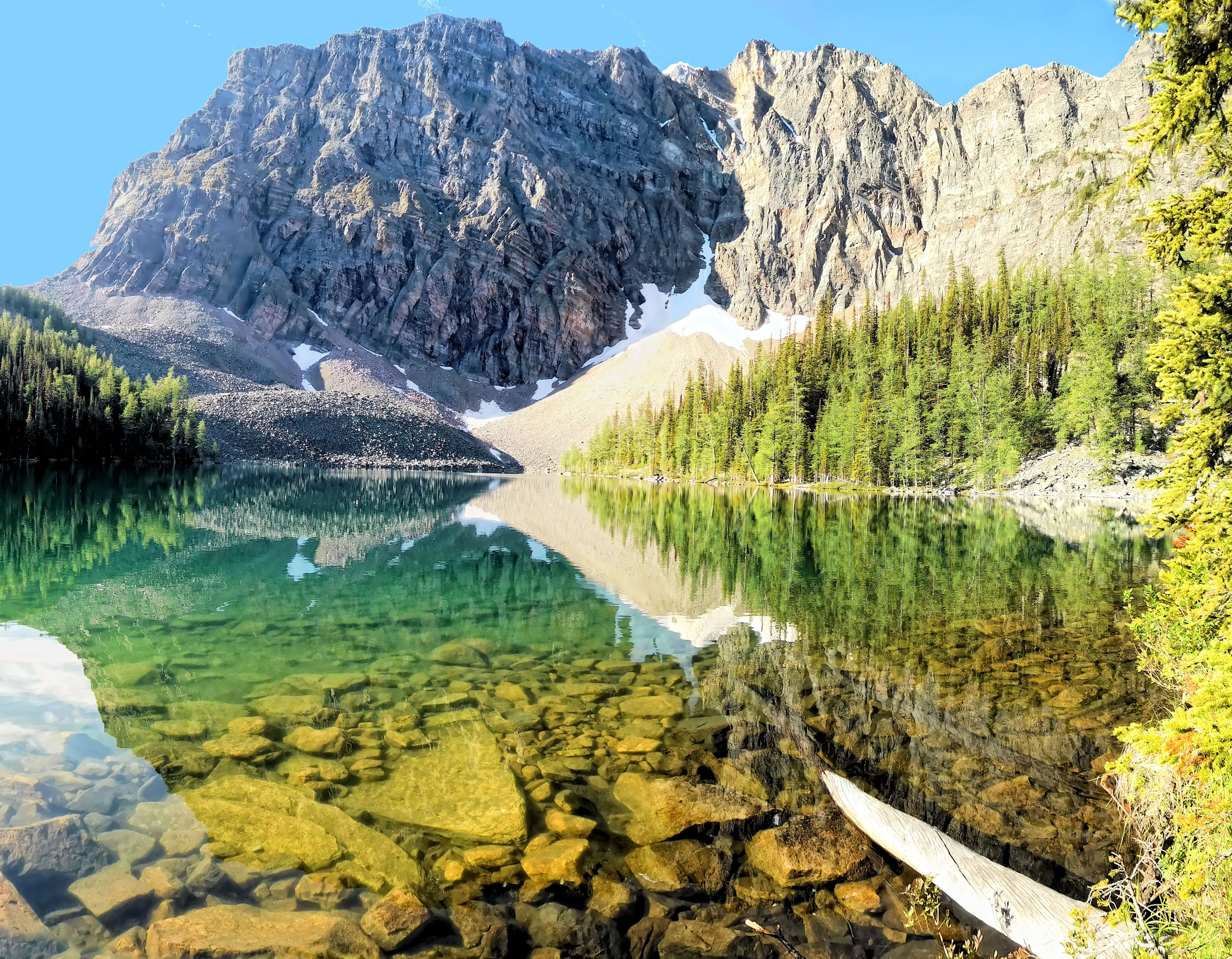
Black Rock Lake
On the way back I hurry, but just before I reach the shelter, another torrent starts coming down. There is thunder, too. I take refuge in the shelter which in the meantime has been taken over by several tent campers. Last night’s renters have gone and the new ones haven’t arrived yet. The stove is going, and things are hung up to dry. A family and their kids sit at the table and pass the time with card games. I find a spot by the stove and take off my hiking boots and socks. They are soaking wet. I remove the insoles, put the boots near the stove and hang my socks on a line.
Some of the campers took the gondola to Upper Sunshine Village and from there hiked down over Healy Pass to Egypt Lake. This is a convenient way to get here and I consider it immediately for next year. There's so much to see around Egypt Lake that even without the rainy day, I couldn't have done it all in one visit.
Two of my three companions come rushing in. They are completely soaked. They made it up to Healy Pass and at the very top they even had a brief view. Then the rain returned and they jogged down the mountain. A while later, the third of the bunch strolls in. He’s had enough of running as he later tells me, because he had to rush back to Egypt Lake in a hurry yesterday to save his iPhone. He had left it there to take a video of the sunset, but all he can show now is the storm moving in.
Inside the shelter, we are having a nice afternoon with lots of interesting conversations. I get to know my three friends a little better, and later Antoine joins the group, another hiker on the Great Divide Trail. Being from Quebec, he prefers to speak French, but mine is too rusty for a decent conversation and we quickly switch back to English.
I am still worried about the wet tent. When the rain diminishes to a drizzle, I venture out and carry my things from the tent into the shelter where I spread them out to dry on one of the sleeping platforms. Then I go out and look for a new tent site. Behind the shelter one has become available that looks pretty good. It has a thick layer of wood shavings and it is level. In a hurry I move my tent to the new site and wipe both floor sheets as dry as I can. Progress!
We manage to cook an early dinner in the shelter before the next group arrives and we have to leave. Antoine is not the only one who is attracted by the delicious smell of my re-hydrated broccoli. It’s heating up together with some beef crumbs. His food, like that of many hikers, comes in store-bought instant bags and is infused with hot water. Since this is neither cheap nor wholesome, I have started to dry my own backpacking food.
I am relieved when I find that my things have dried out reasonably well thanks to the toasty heat inside the shelter. I retire for an early night in the tent and manage to keep nice and warm there after all.
| Distance | 7.6 km |
| Time | 1 ½ hrs |
| Incl. Breaks | 1 ¾ hrs |
| Min. Elevation | 1987 m |
| Max. Elevation | 2364 m |
| Ascent | 377 m |
| Cum. Ascent | 495 m |
| Cum. Descent | 495 m |
During the night the rain stops and I sleep well. In the morning, there are still clouds in the valley, but the sky looks much brighter.
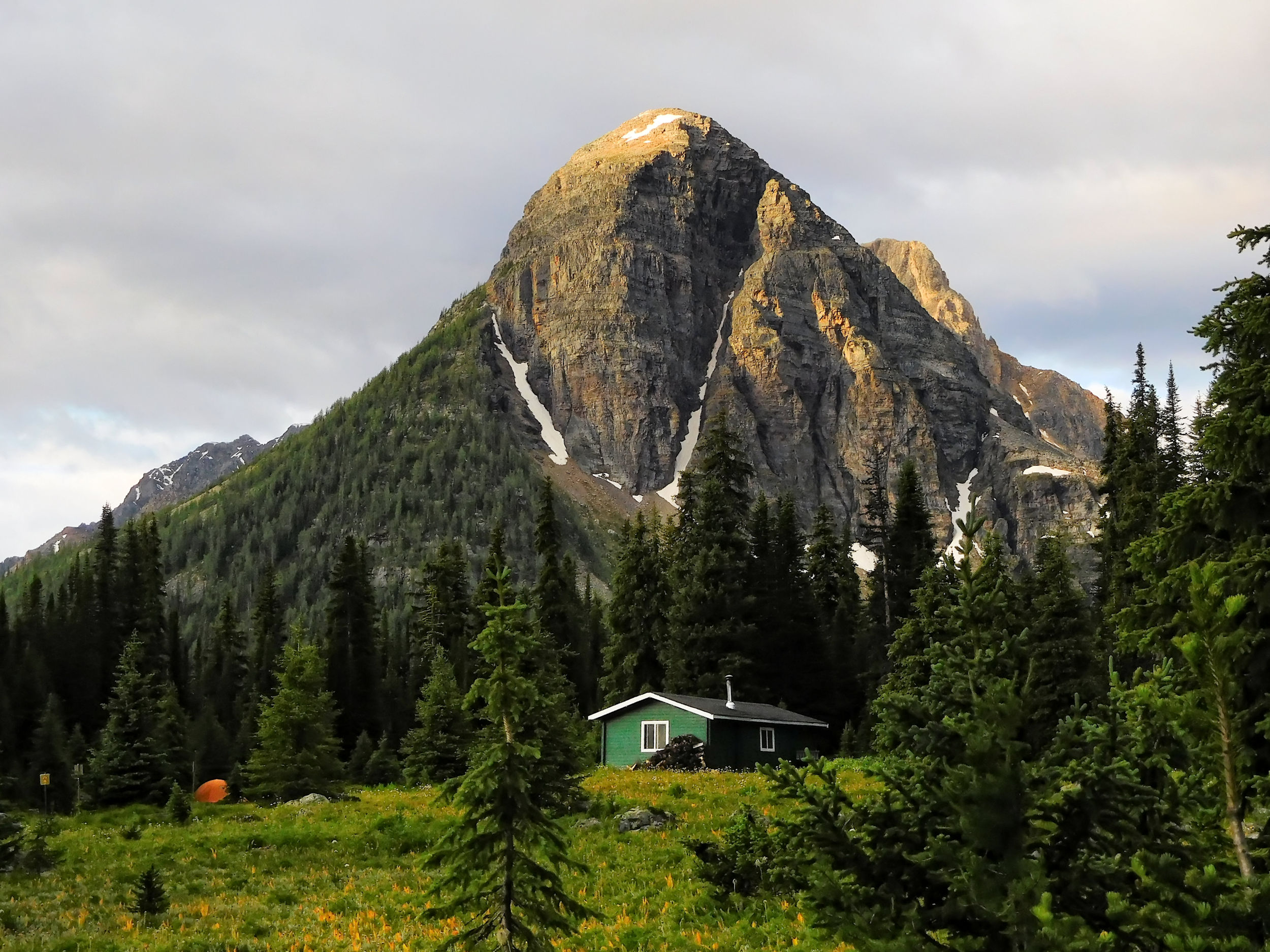
Egypt Lake Shelter and Sphinx
This morning I want to make up for the missed trip to Healy Pass. After that I will set out on my return trip via the somewhat unexciting but easy route along Pharaoh Creek to Shadow Lake. I have dropped the plan to hike back over Whistling Pass, because the climb through the steep headwall has most likely become even trickier after the storm. Luckily I have a choice, unlike a few GDT hikers who have already gone that way to reach Floe Lake today.

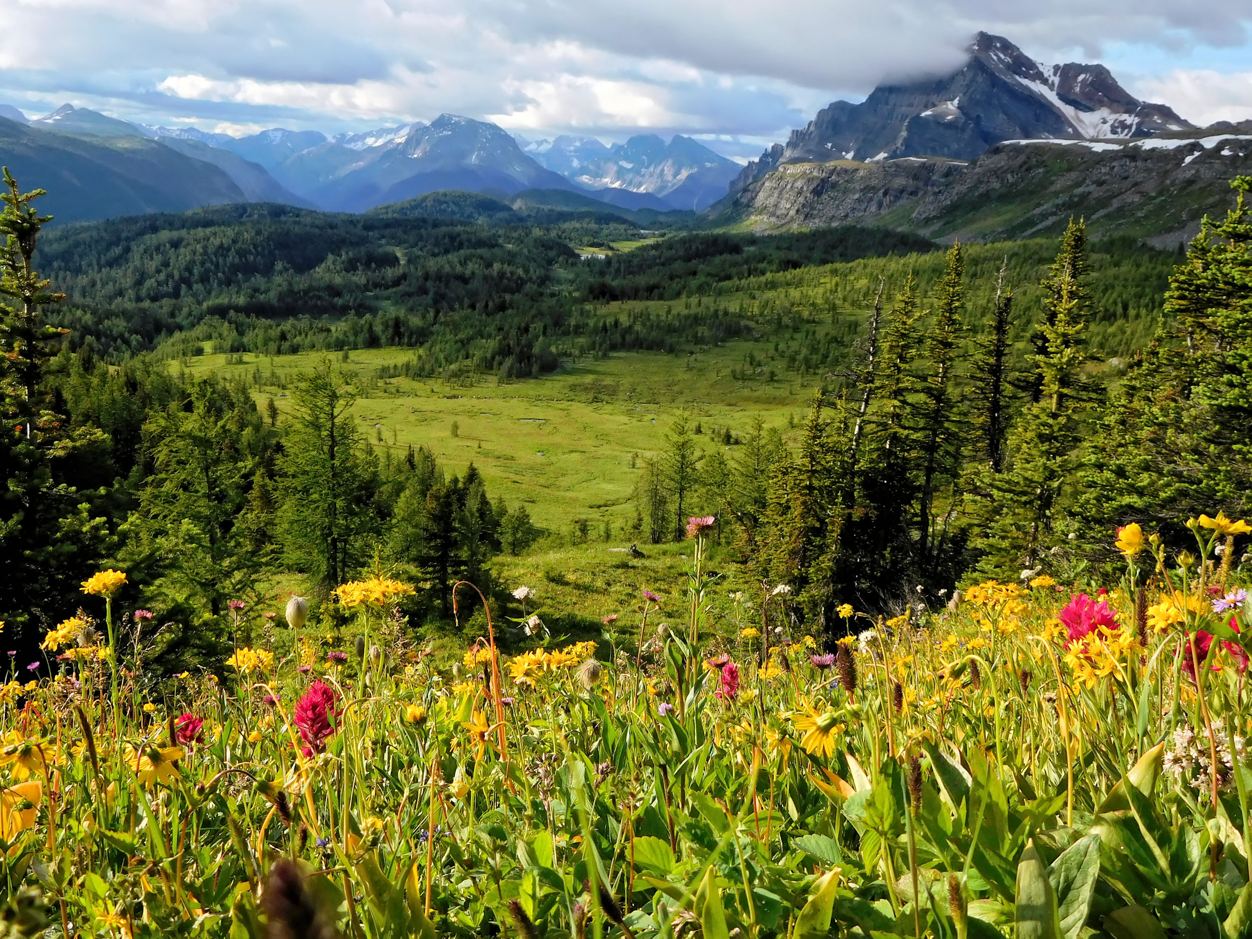
After breakfast, I'm ready to go. It is only 7 o’clock, and it will take me about an hour to reach the pass. Quickly the path climbs out of the forest. The clouds are clearing, revealing a view of the surrounding mountains. The meadows are covered with wildflowers in full bloom.
Just before the pass I turn around for a look back at the best view of Scarab Peak with Scarab Lake and Egypt Lake below. The lakes are connected by a 30 m high waterfall.
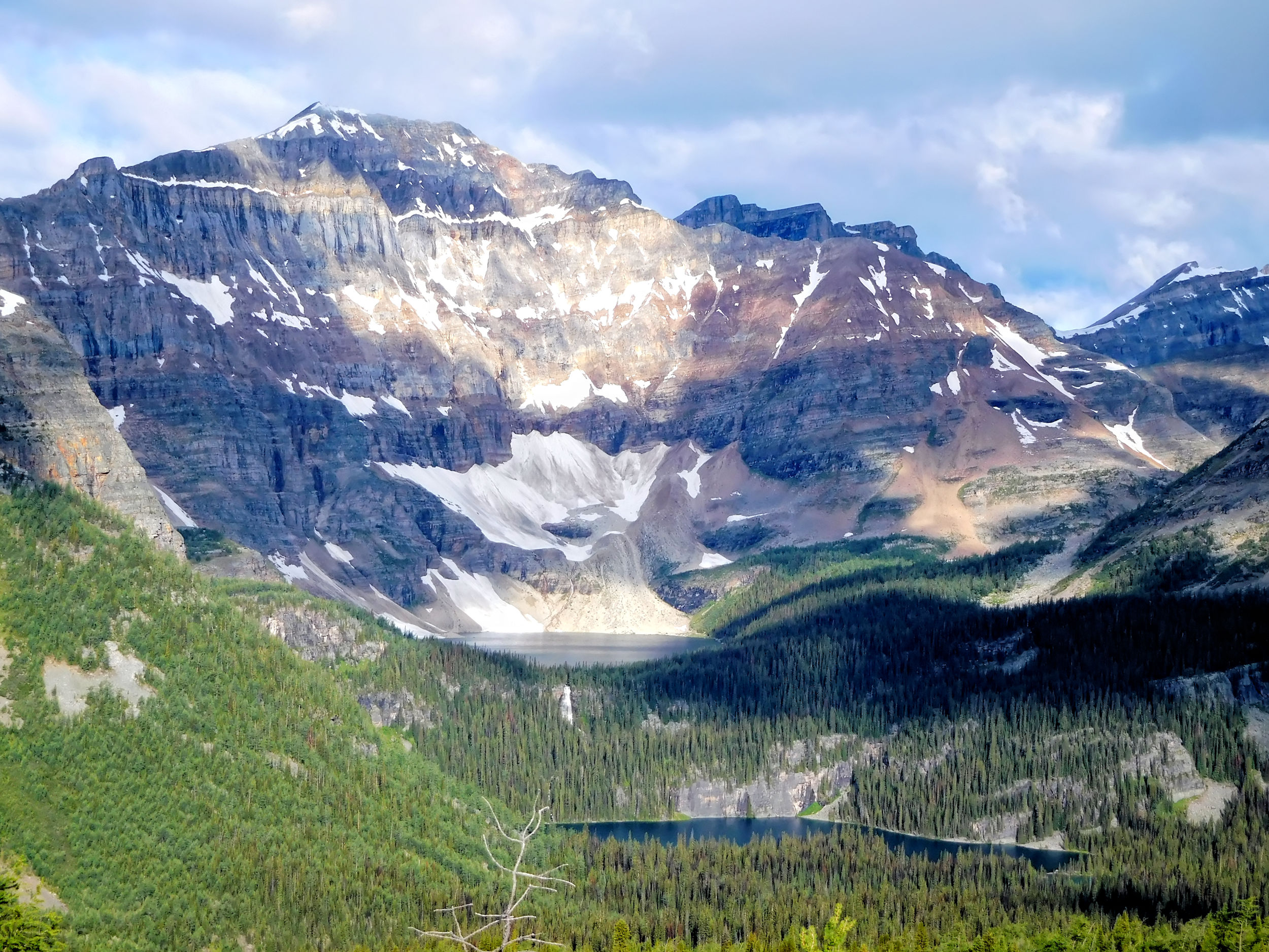
Scarab Peak 2514 m, Scarab Lake and Egypt Lake
There is a trail to the top of the waterfall. For this side-trip, I intend to return to Egypt Lake next summer.
I reach the pass at 2370 meters. Among many other peaks, I look at the majestic Monarch and the Monarch Ramparts. The drifting clouds add to the beauty of the surroundings.
Monarch 2904 m and Ramparts 2393 m
To protect the fragile alpine vegetation, Parks Canada has recently prohibited any cross-country hiking from the pass. It means that the Monarch Ramparts and Healy Pass Peak are off limits. On this particular morning, I wouldn't have had time for that anyway. Instead, I walk down the other side of the pass to admire the wildflowers of Sunshine Meadows.
Wildflowers past Healy Pass


Soon I turn around and jog down the mountain as fast as I can. I pack up my tent, which in the meantime has nicely dried and thus shed unnecessary weight. It is around 11 o’clock when I hit the trail again. My three companions are long gone; I will catch up with them at Shadow Lake campground.
| Distance | 12.1 km |
| Time | 3 ¼ hrs |
| Incl. Breaks | 4 ¼ hrs |
| Min. Elevation | 1724 m |
| Max. Elevation | 2012 m |
| Descent | 288 m |
| Cum. Ascent | 776 m |
| Cum. Descent | 872 m |
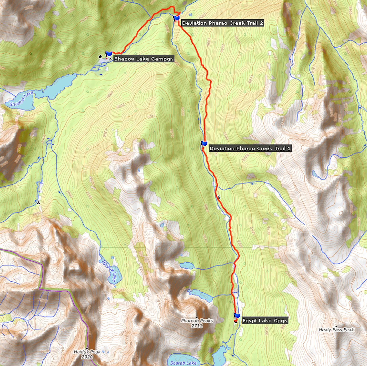
The trail leads through the valley of Pharaoh Creek up to the confluence with Redearth Creek. In the beginning I can still catch a few glimpses of Pharaoh Peak here and there.
Pharaoh Creek valley
Later the trail is densely forested. At Pharaoh Creek campground I fill up my water bottle and have a rest. Continuing on, I cross numerous small bridges over the many tributaries of Pharaoh Creek. During snowmelt these must carry lots of water, for the bridge beams are built extremely high. It is a huge step up each time, made even more laborious by the heavy pack on my shoulders.
All of a sudden, the trail leads away from the creek and up, which contradicts my map and the GPS. Fortunately, I remember the information a hiker gave us at the Egypt Lake shelter. A few years ago Parks Canada relocated the trail because the bridges near Pharaoh Creek were regularly washed out and had to be replaced almost every spring. On the new section of the trail, there are still countless bridges, but the channels they cross are dry right now.
At the end of the detour, the trail winds back down into the Pharaoh Creek valley. Two solid, railed bridges cross Pharaoh and Redearth creeks. Spectacular white-water forms at the confluence. The rocks and the soil of Redearth Creek contain iron and are red in color. This is how the river got its name. I pass the Redearth Creek cabin which serves as a ranger station, but is deserted right now.
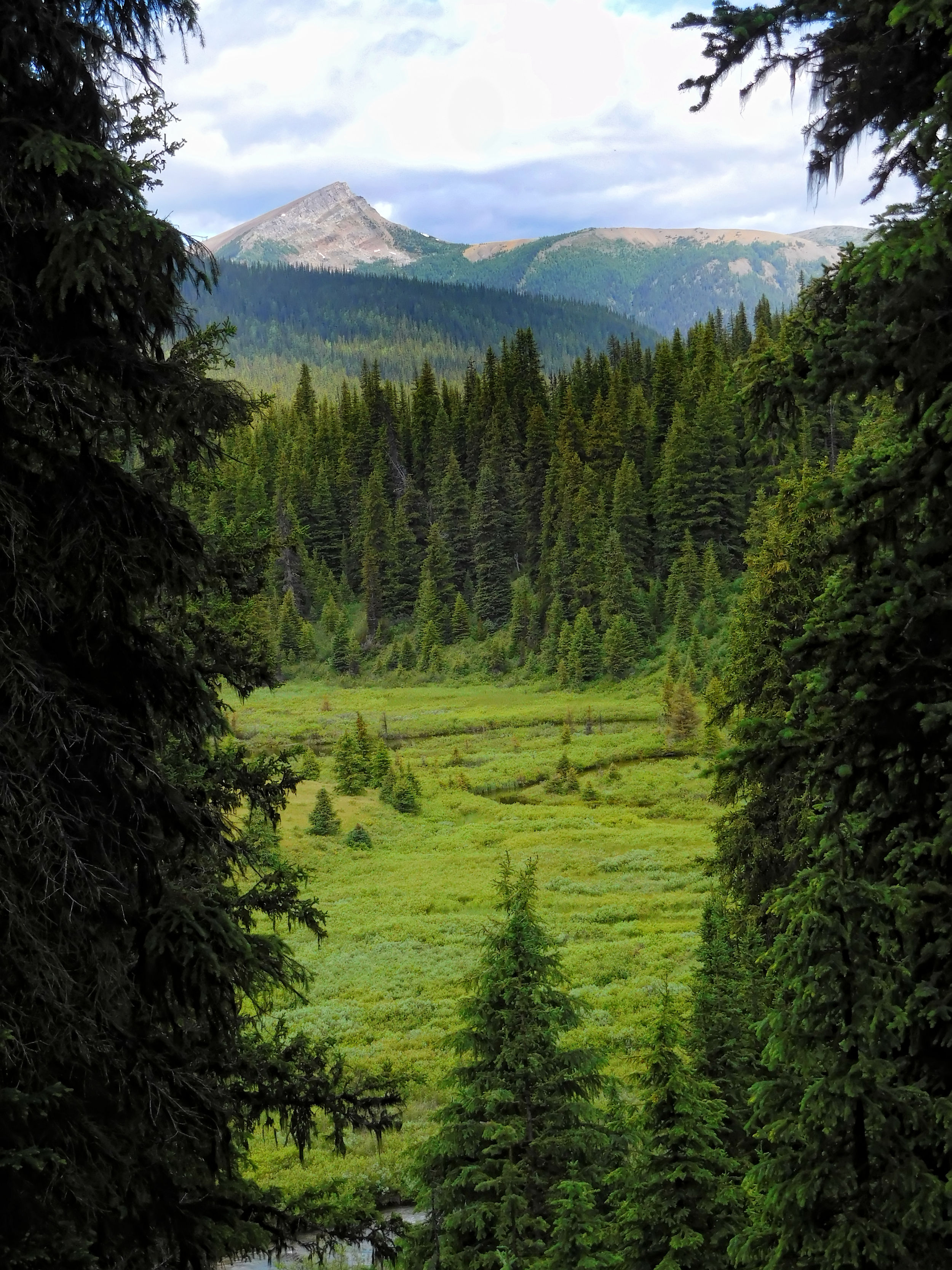
A couple of mountain bikes are parked at the turnoff to Shadow Lake campground and the lodge of the same name. Cyclists coming in via the Redearth Creek trail have to leave their bikes here and continue on foot.

The trail to Shadow Lake campground is quite wide and begins with a steep incline over many roots and rocks. I reach a wetland that is spanned by a long boardwalk. The campground and the lodge are next to each other and only separated by a creek. Despite their names, both are located several kilometers away from Shadow Lake.
I pick a sunny spot to camp, even if it is quite hot right now. I want to make sure I have sun on the tent tomorrow morning, so that I can pack it dry. My three companions have set up camp under some tall trees by the creek, but nobody’s home right now. Suddenly Antoine emerges from the tent next to me and we greet each other happily in French and English. He won’t stay, but is just resting here for a few hours to catch up on sleep. He will hike out the Redearth Creek trail today and then take a few days break from the GDT in Banff.
The watering hole by the creek is equipped with a pipe from which the water spouts within easy reach. This is so convenient that I wash my T-shirt one last time.
In the evening, two young women arrive and take Antoine's site. He left already a while ago. My three friends and I have dinner together. Tomorrow morning we will have to part ways, which makes me sad as they have been such nice company. They have adopted me, the three tell me. Simply because of my age, I think, it must have been the other way around.
| Distance incl. Little Copper Mtn 2.4 km | 17.4 km |
| Time | 6 hrs |
| Incl. Breaks | 8 ½ hrs |
| Min. Elevation | 1584 m |
| Max. Elevation | 2586 m |
| Ascent | 1002 m |
| Cum. Ascent | 1432 m |
| Cum. Descent | 1906 m |
My wish to pack a dry tent is not granted; the night was cold with dew and condensation. I say good-bye to my three friends. For once they hit the trail before me. They want to drive all the way home to the Okanagan today.
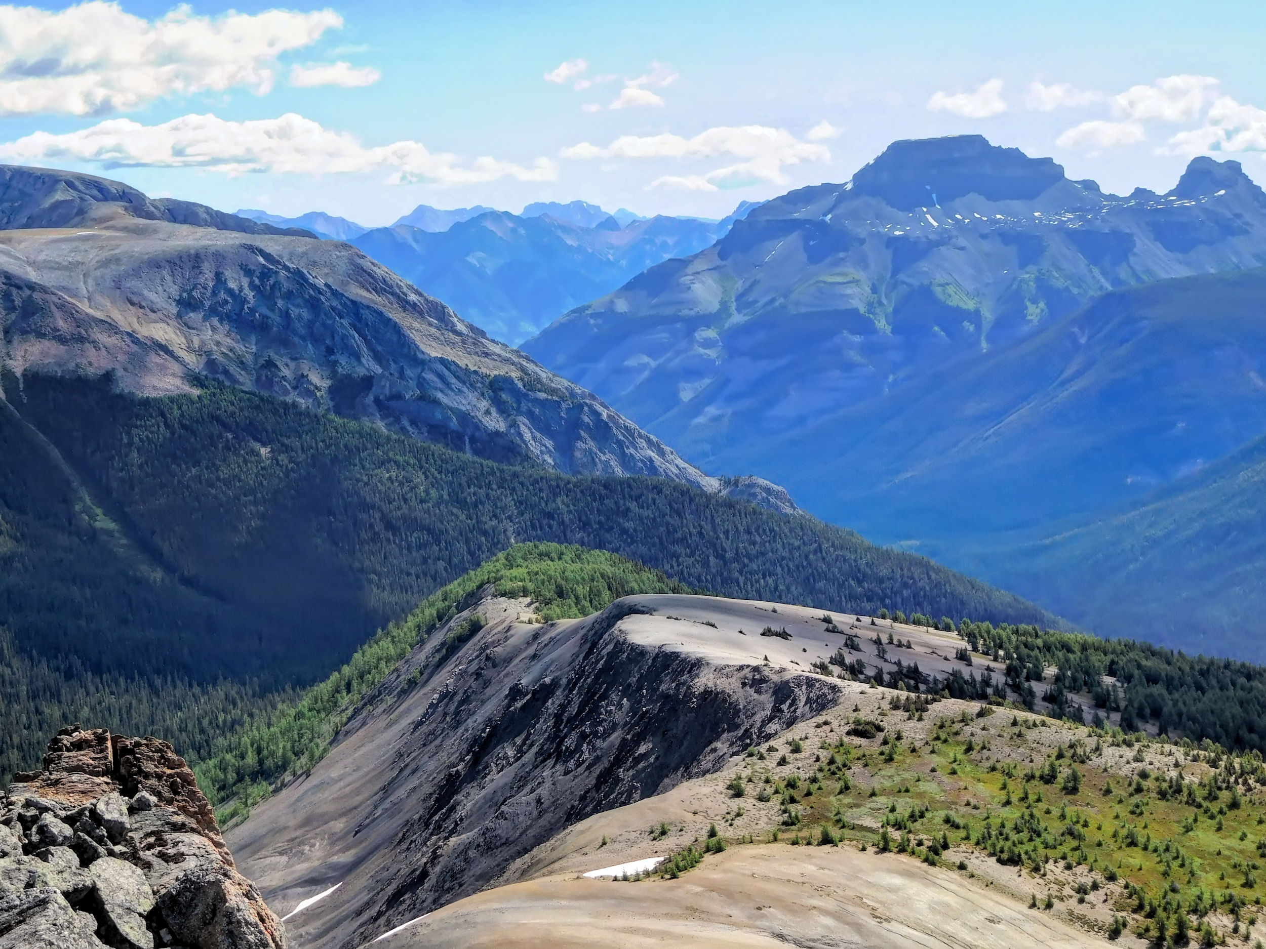
It's only a kilometer to the turnoff to Gibbon Pass, where I finish the loop and reach known territory again. The climb to the pass is steep. But sunny blue skies and the anticipation of scrambling up Little Copper Mountain help me along the way. Soon I reach Gibbon Pass.
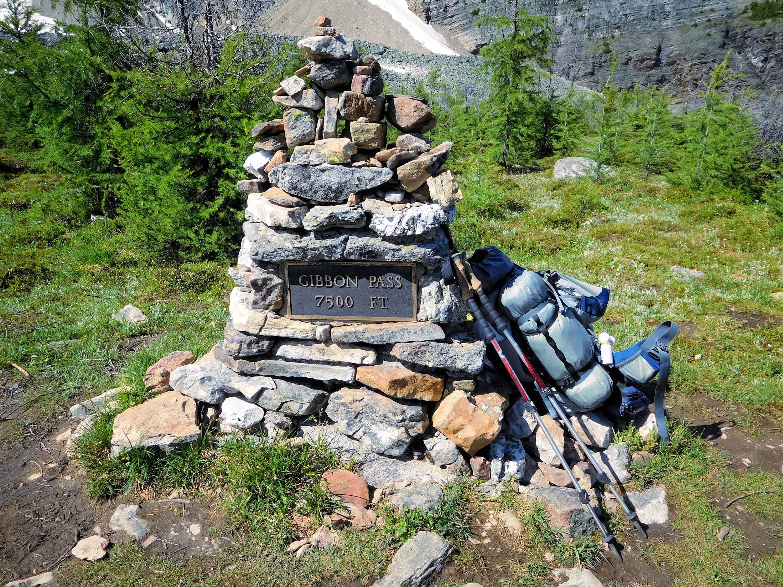
Gibbon Pass
I take a good look at my destination, Little Copper Mountain.
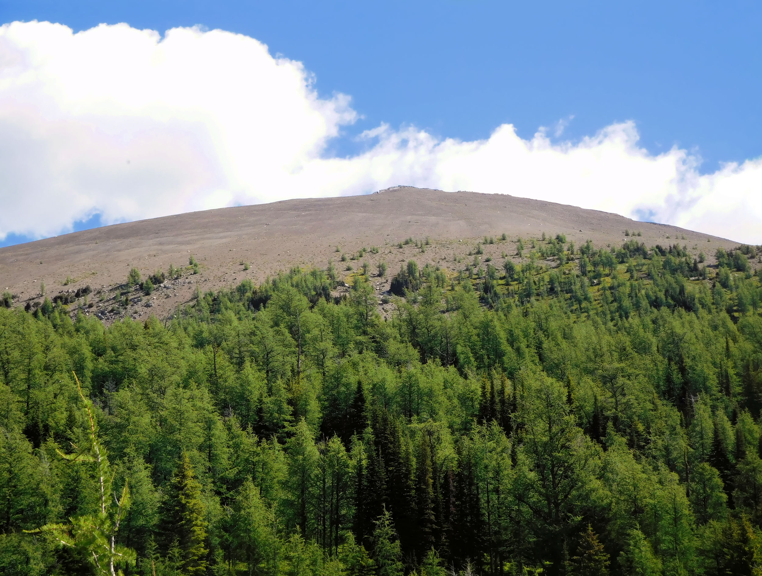
Little Copper Mountain 2590 m
On a clearly visible trail, I climb up through the larches. I want to leave my tent behind to continue walking with a lighter backpack. Since the tent fly should dry during my climb, I stretch a line and hang it in the trees. However, the tarp flaps noisily in the gusting wind. I don’t dare leave it like this, as it might tear loose and blow away. Instead I wait until it has dried, then roll it up again and jam the packed tent bag into a tree fork.

Now my ascent can begin. It is a good 300 meters and first leads through a sparse larch forest and then over scree to the 2590 meter high summit. The re-entry into the forest is marked with a cairn. According to my guidebook, there is also an easier but longer route from the north, while my ascent here seems almost vertical. After a good half hour I reach the summit, puffing heavily and with soft knees.
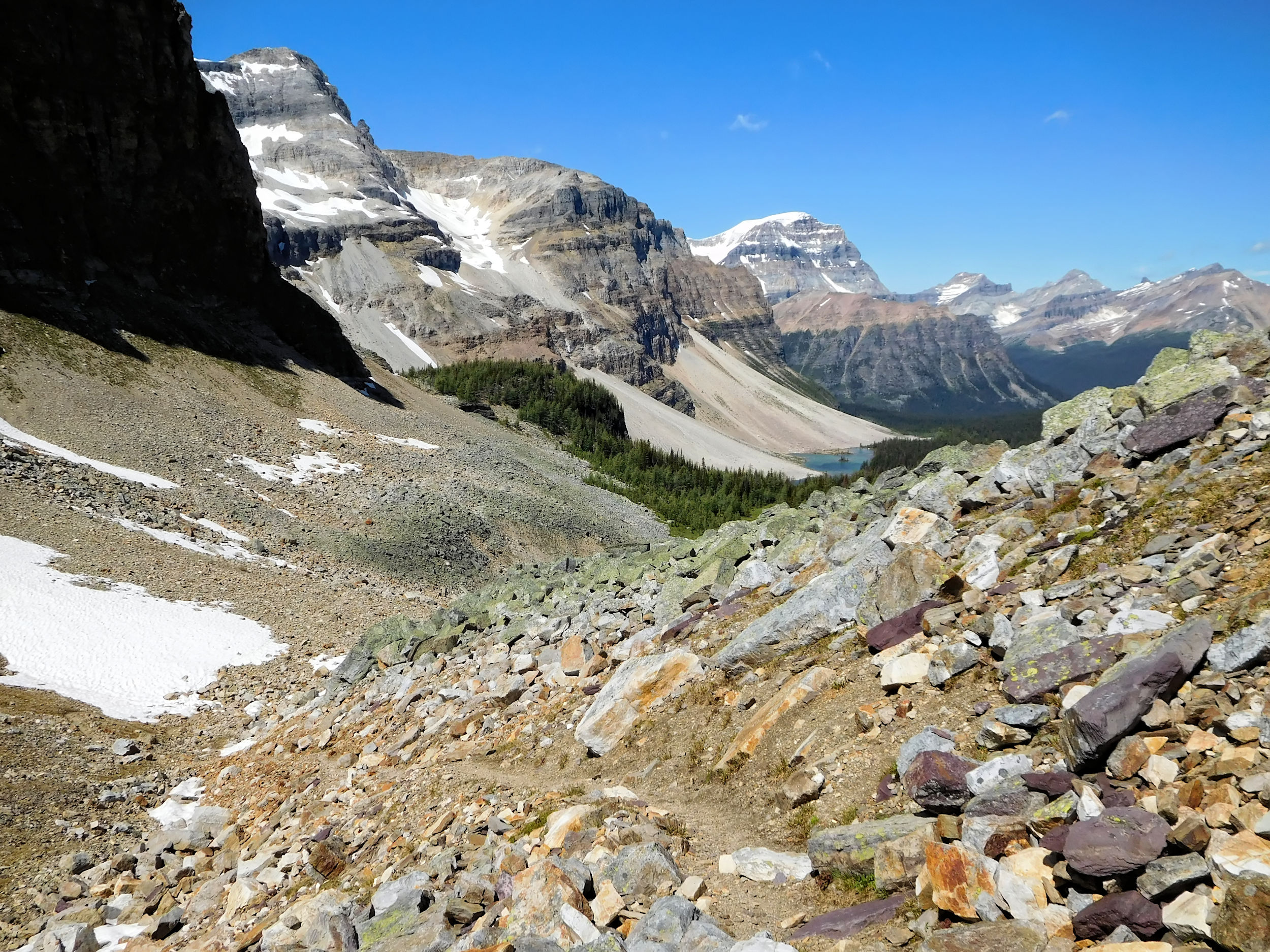
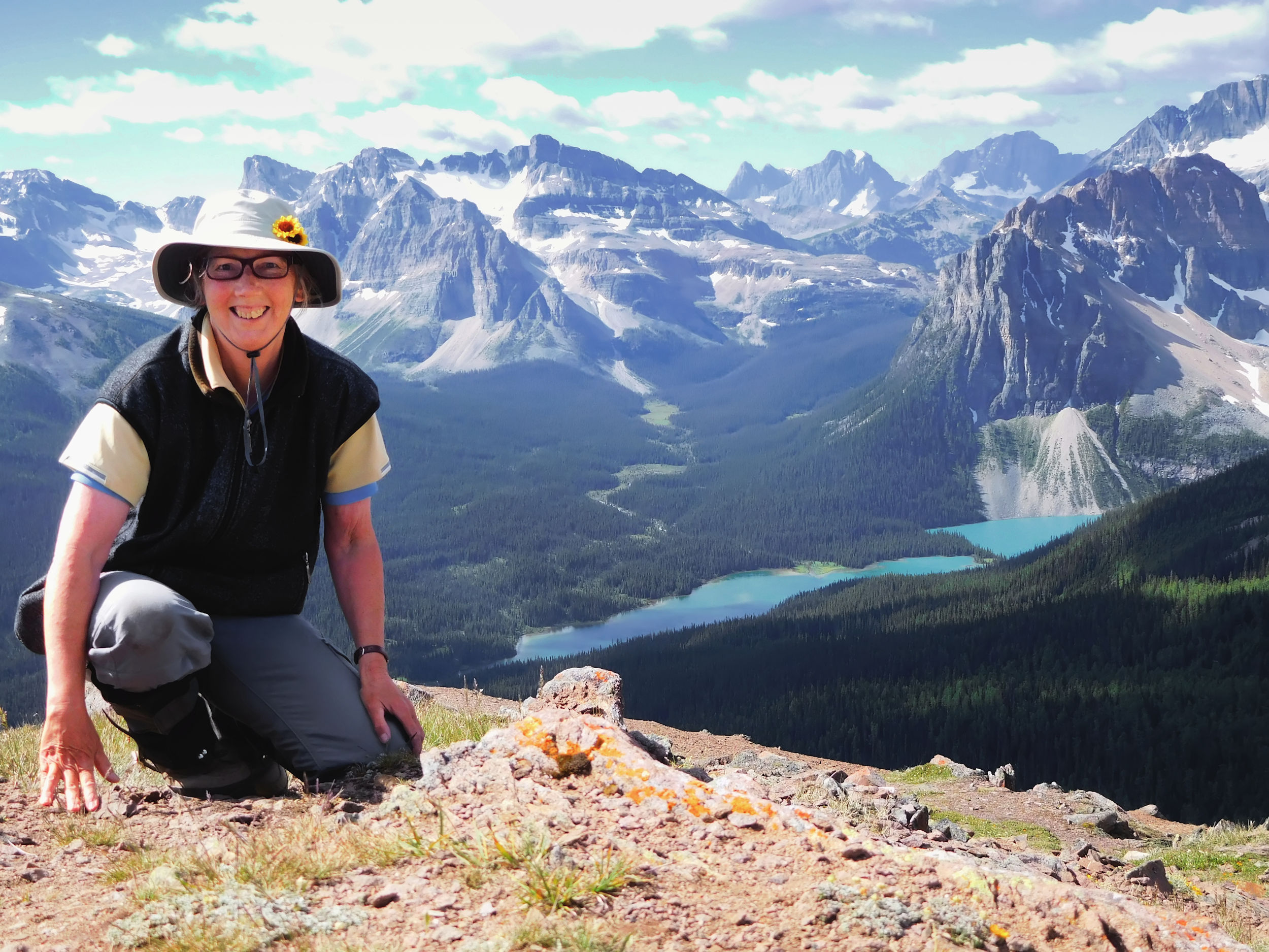
The 360 degree view is worth every effort. It brings on one of these special moments of high-elevation euphoria. I feel elated and one with Nature. That’s exactly why I do it.
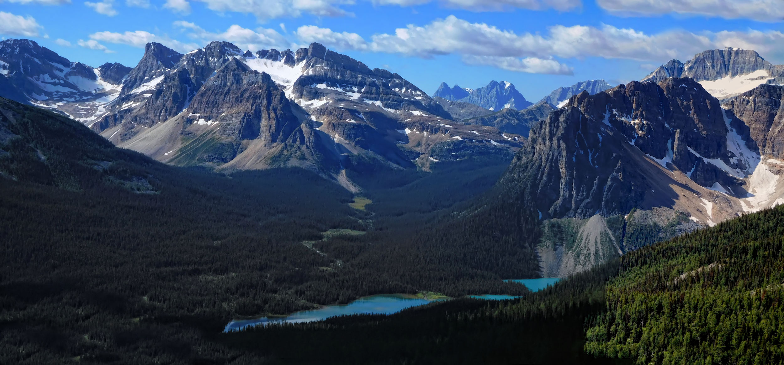
Haiduk Peak, Shadow Lake, Mt. White Tale, Mount Ball
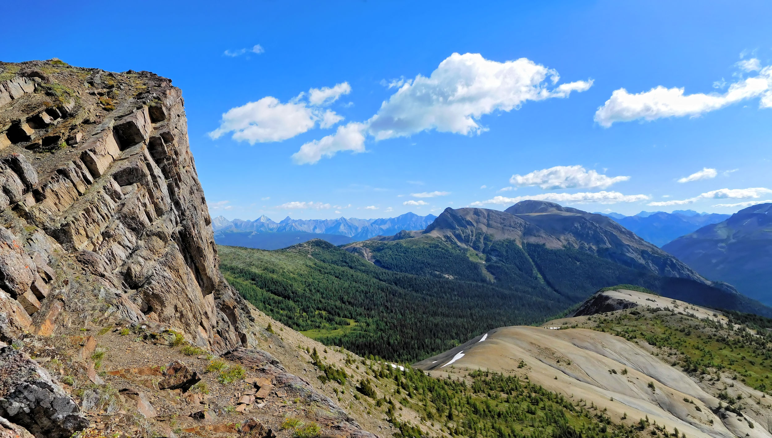
Copper Mountain 2795 m
Copper Mtn., Redearth Creek valley, Pilot Mtn. and the Sawback Range in the background
Castle Mountain 2766 m and Noetic Peaks 3038 m
Mt. Assiniboine 3618 m
Even Mount Assiniboine is visible in the distance. I am glad that I came here. It is a highlight on my tour and makes up for the rainy day at Egypt Lake.
The way back downhill is easy and quick. I collect my tent bag again. The side trip has cost me only one hour, but I know that I’ll feel it in my legs during the many ups and downs still ahead of me on my way to the parking lot.
Back at Gibbon Pass I strengthen myself with a snack. Two hikers come up to me, all excited. Had it been me on the mountain and had I seen the grizzly bear? Apparently, about three quarters of an hour ago, as if stung by a hornet, a bear raced down from Little Copper Mountain and then across the pass up the slope on the other side. On their cellphone they show me a somewhat blurry picture of a huge white-gray grizzly. It all happened so fast that they couldn't take a better picture. I figure that the gunshot-like noises of my tent tarp flapping in the wind must have startled the grizzly, so he fled head over heels from the mountain. Not in my direction, lucky me. The two are day hikers from Shadow Lake Lodge and on their way back there. I can imagine vividly how tonight, at the fireplace, the story of the gray-haired little old lady is told, who scared the grizzly from the mountain.
I embark on the last part of my journey. As a result of the storm, the path has unfortunately not improved since I came in on it. I'm getting tired of the repeated ups and downs across the valleys. Given the poor condition of the path, I have to concentrate very hard, which exhausts me even more.
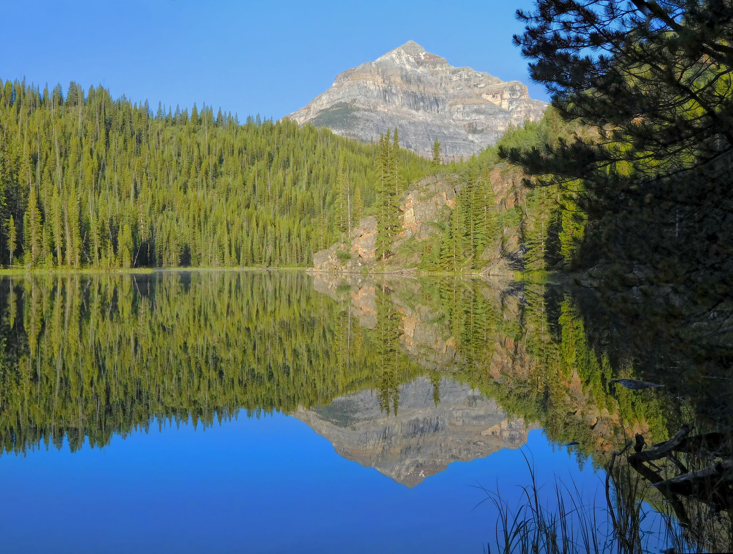
The Twin Lakes invite for a brief rest in the sunshine. On the shores of Arnica Lake an angler tries his luck. During my approach of Vista Lake, I can see the highway and the parking lot with my car on the distant side of the valley. It seems close enough to touch, yet is over an hour away.
Vista Lake and Highway 93S
Finally I'm on my home stretch, a last steep ascent to the parking lot. A few tourists come towards me. One of them holds up a huge foghorn and laughingly points to the miniature version dangling from my backpack. His is for the big bears, mine for the small ones, I laugh back. The parking lot is crowded with weekend visitors; some of their cars are parked on the shoulder along the highway. Everyone wants to know how my hike was. Almost too tired to respond, I'm relieved when I finally drop my backpack and sit down in the car. Done!
There is no cellphone reception here, but at the intersection with Castle Mountain I make a quick call home that all went well. Then I drive to Golden, where I stay at the Dreamcatcher Hostel. I buy some veggies at the nearby supermarket and prepare a simple but delicious dinner in the hostel’s kitchen. I am extremely satisfied with my adventure and confident that I will return to Egypt Lake once again.