 To Castle JunctionJuly 27

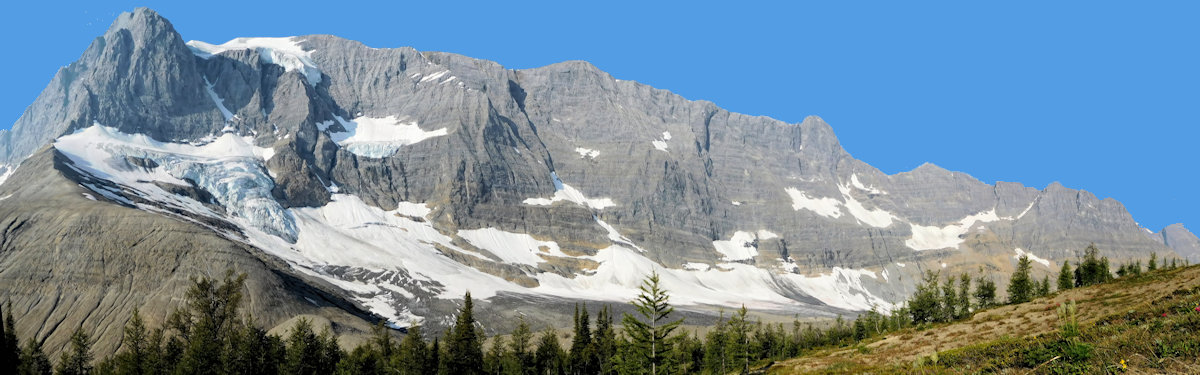
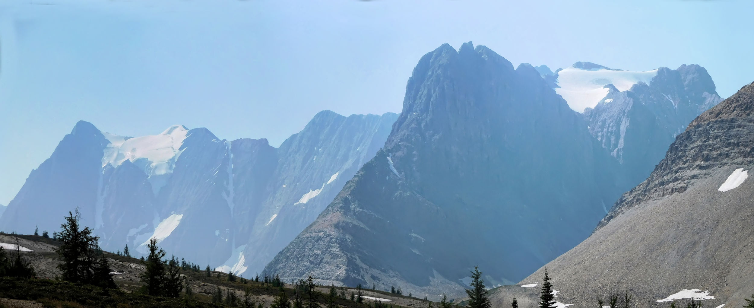
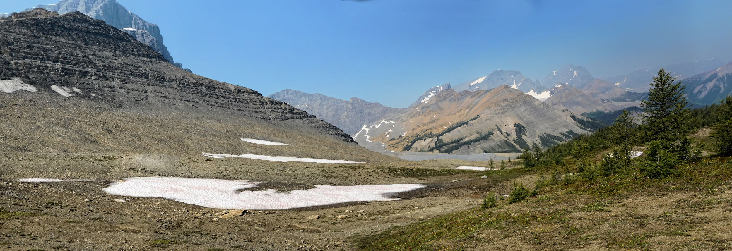
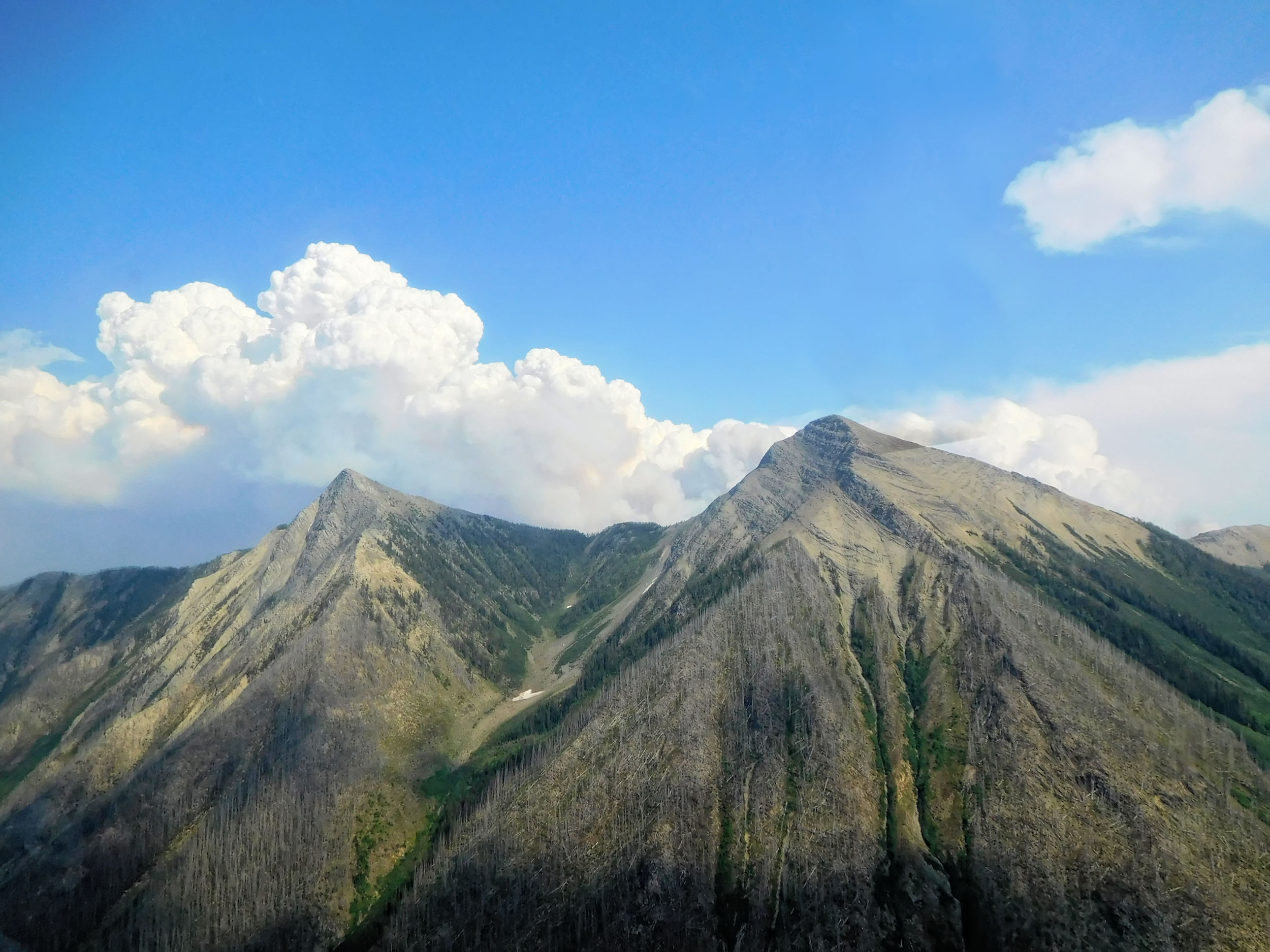
The Rockwall is a 35-kilometer mountain range in Kootenay National Park, broken only by a single pass. It belongs to the Vermillion Range and is part of the North American Continental Divide. The 55 kilometer long Rockwall trail runs along this seemingly endless wall of peaks and is notorious for its many ascents and descents.
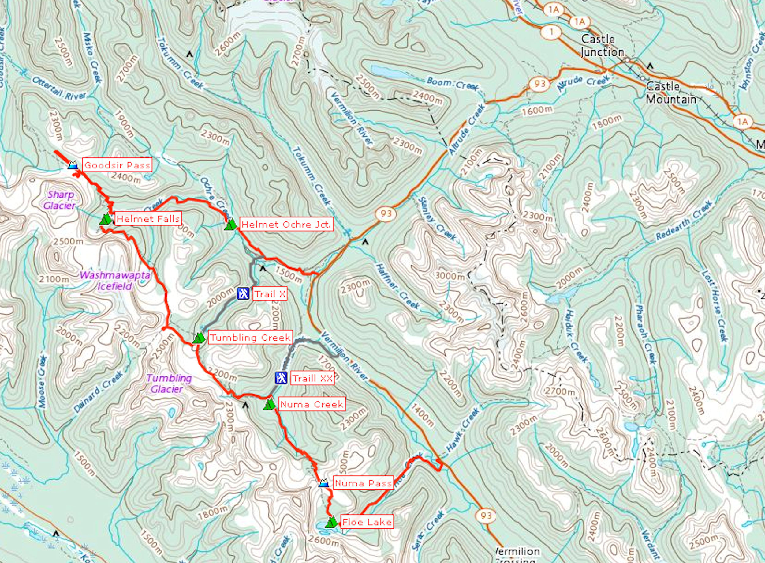
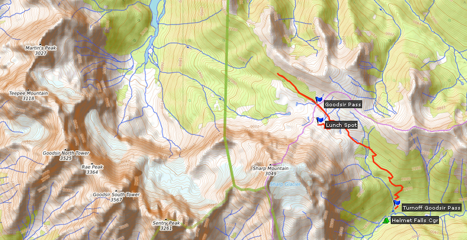
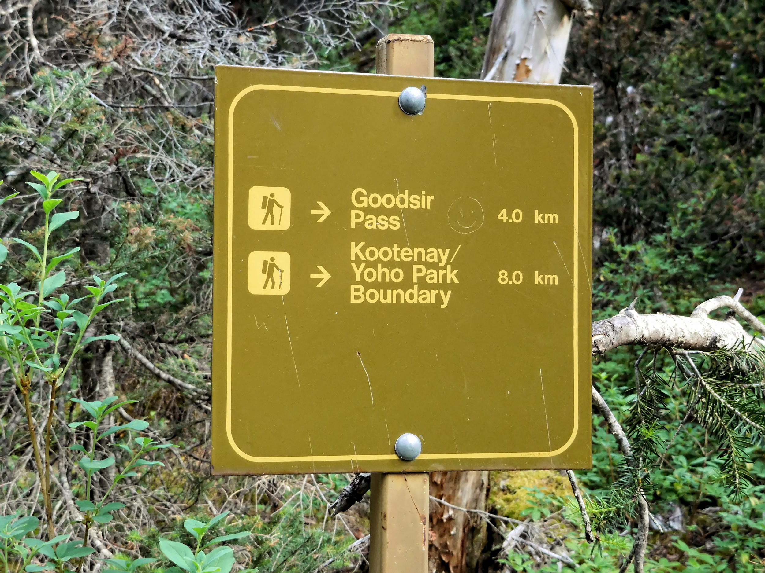
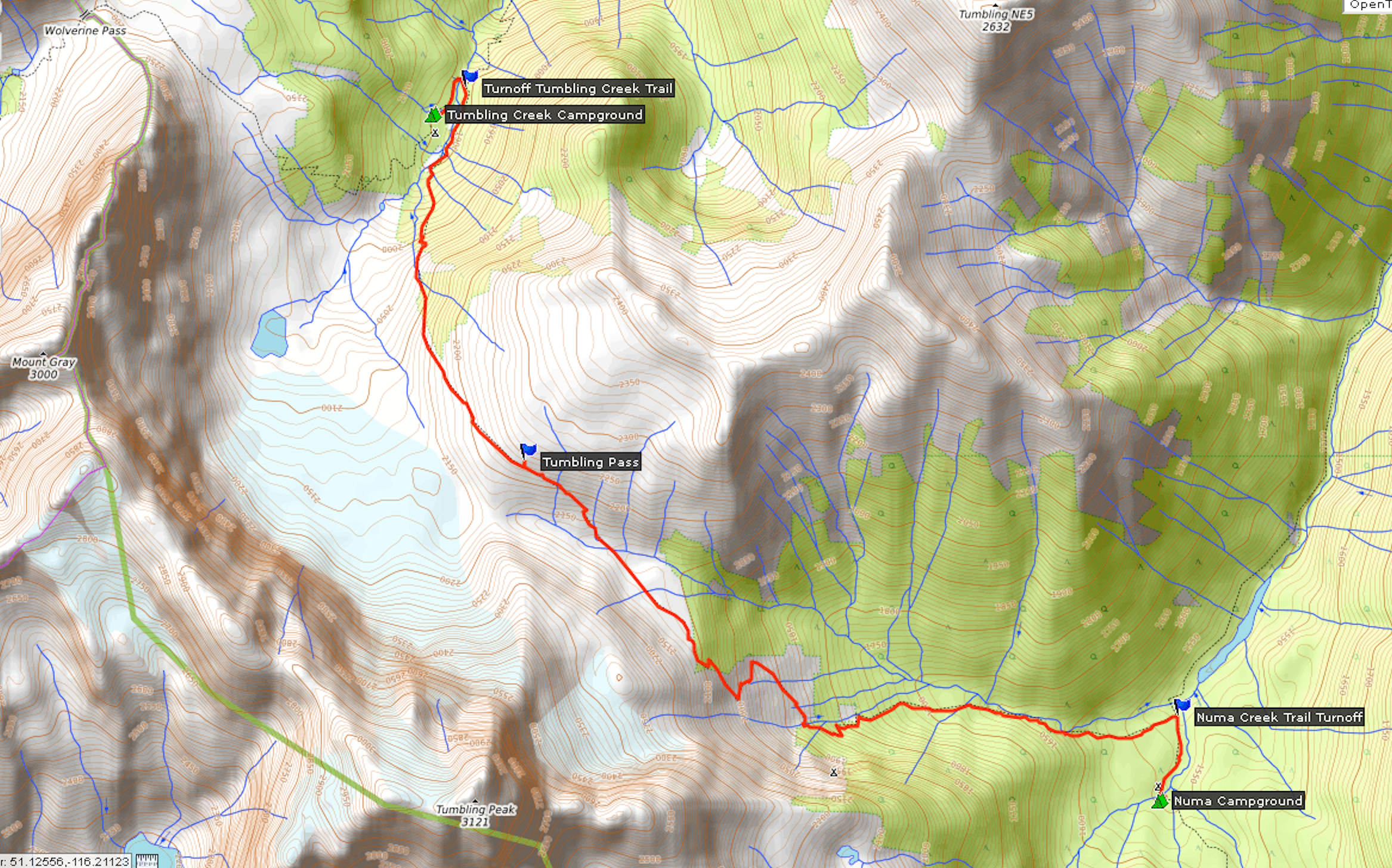
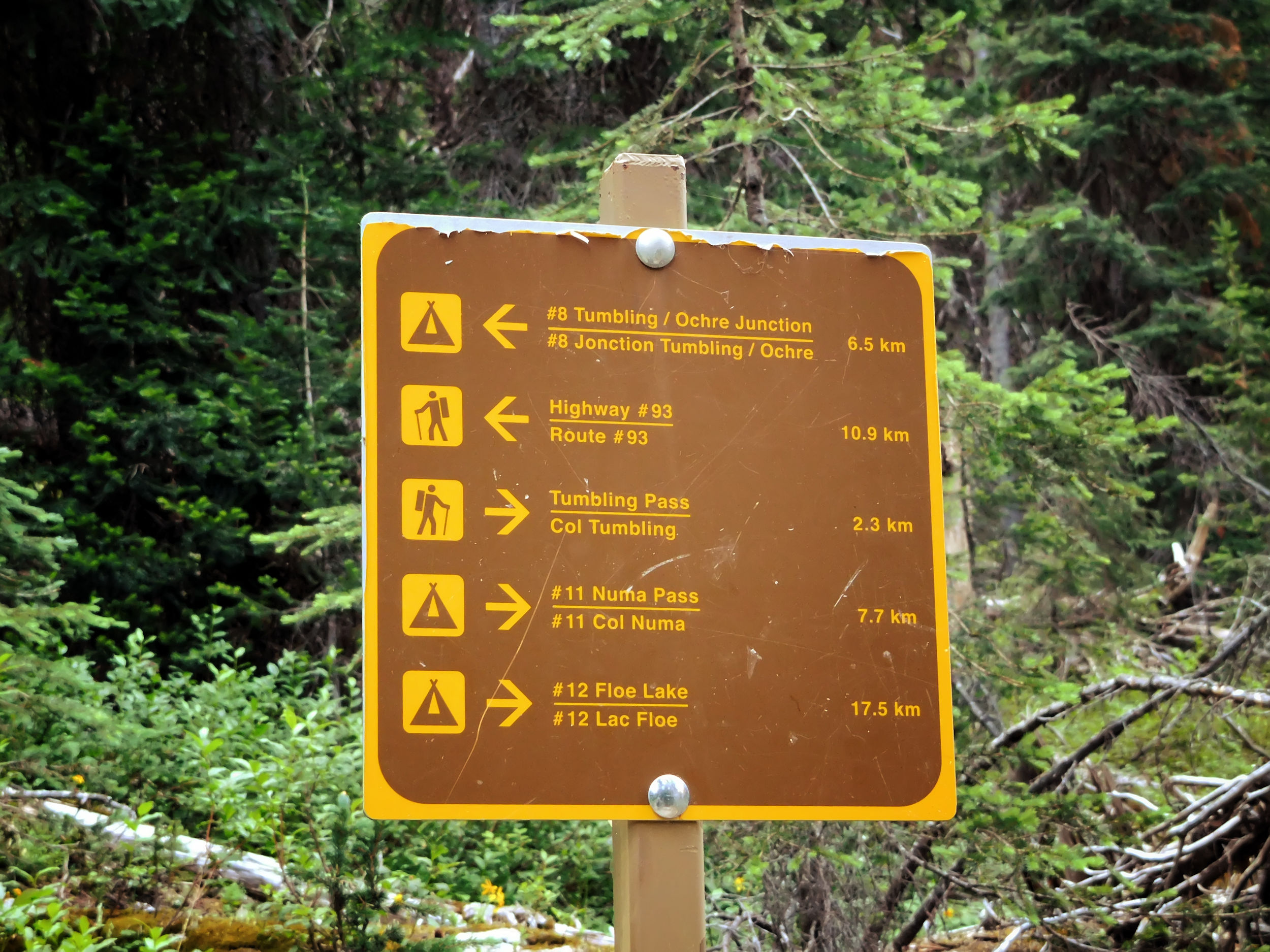
There used to be two routes, the Numa Creek trail and the Tumbling Creek trail, where you could exit the Rockwall trail to shorten the hike if necessary. Both have been closed for a few years now, since essential bridges were washed out and have not been replaced yet. At present (July 2018), you have to walk the entire distance and most hikers spend four to five days on the trail. I will add a sixth day with a side trip to Goodsir Pass.
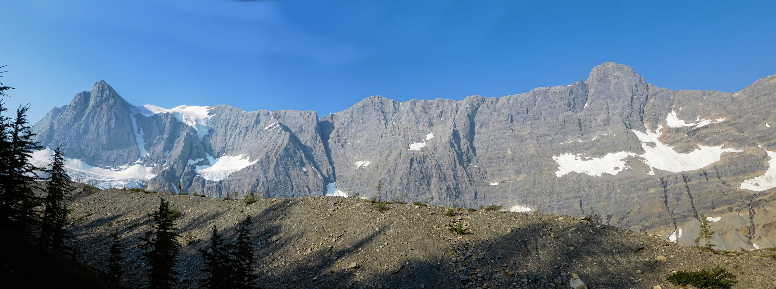
The Rockwall’s profile
After last year’s pleasant experience at Maligne Canyon Wilderness Hostel near Jasper, this time I will stay at Castle Mountain Wilderness Hostel for the first night. The hostel is located at Castle Junction between Lake Louise and Banff. From there, Highway 93S leads to the Paint Pots trailhead in Kootenay National Park, where my hike begins.
The 600-kilometer drive to Castle Junction takes about seven hours, including breaks for food and refueling. The weather is nice.
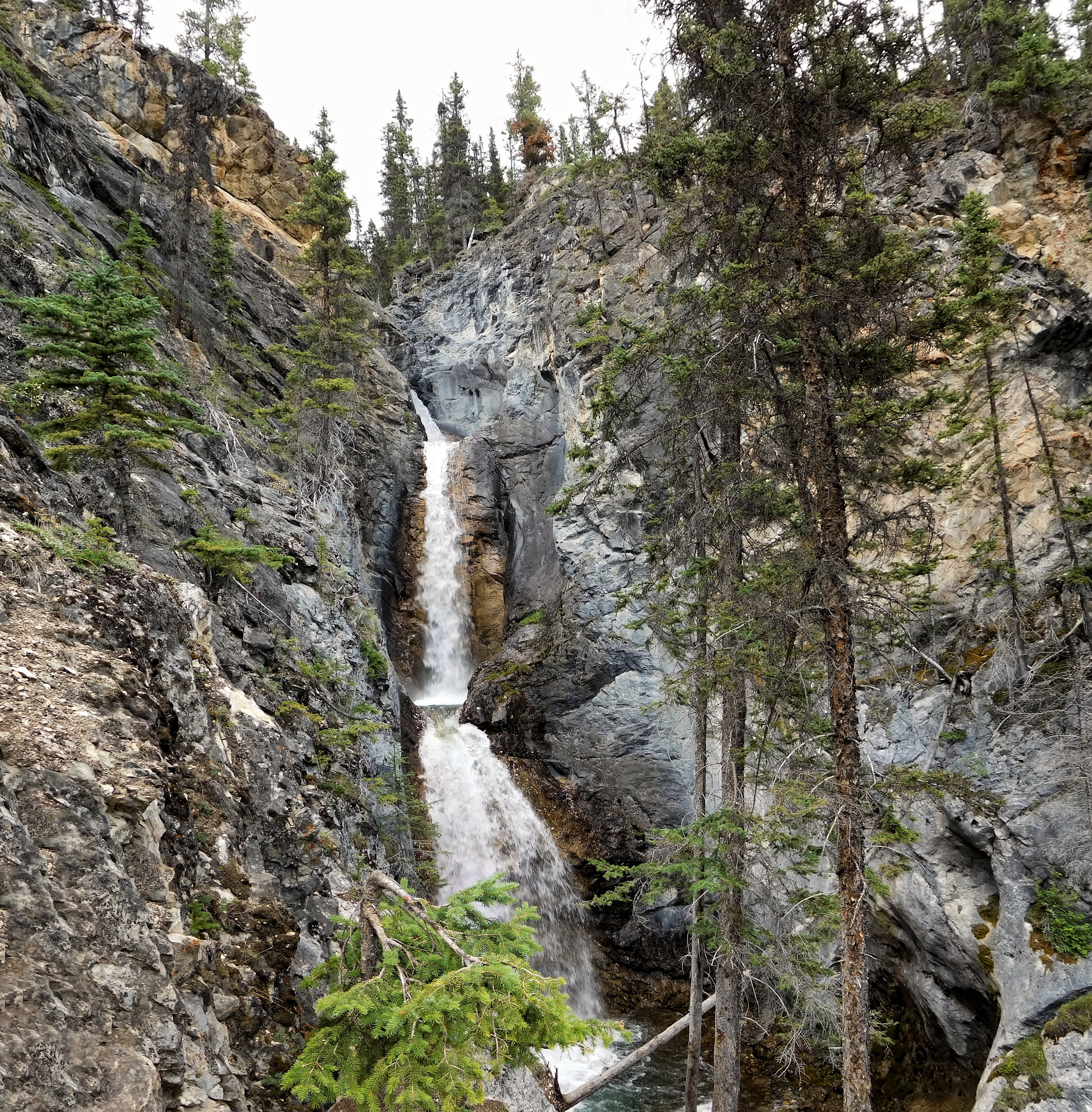
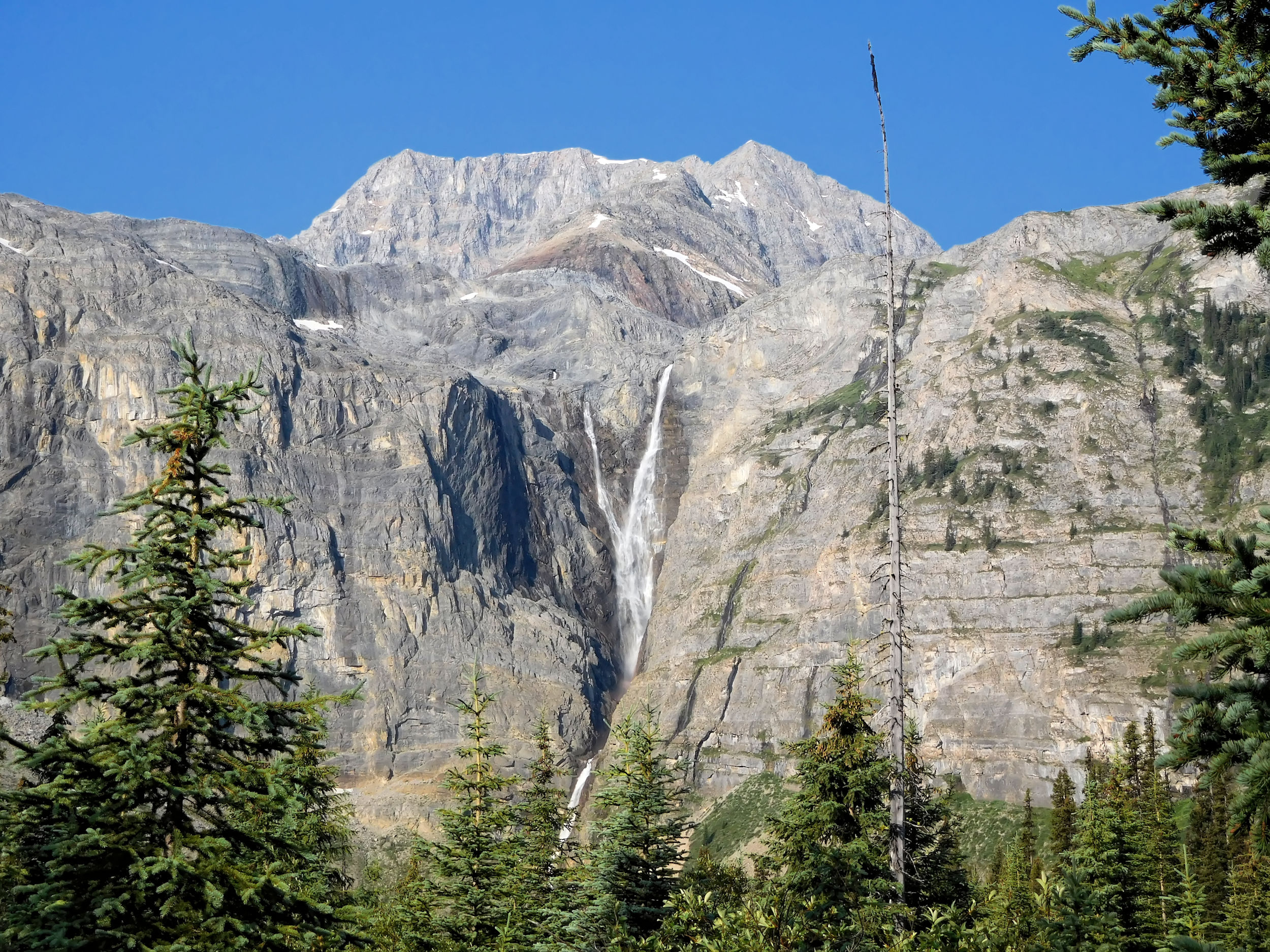
Silverton Falls
When I arrive at the hostel, the caretaker recommends a walk to the Silverton Falls. I am happy to stretch my legs after the long drive, and the waterfall turns out to be quite pretty. On the way back I hurry, because it has clouded over and it starts to drizzle.
The hostel is a simple but cozy accommodation. It has two dormitories for 14 people each and offers all amenities, including showers, which is a luxury for Wilderness Hostels. At dinnertime, I meet an elderly lady who emigrated from Germany a long time ago. She and her friend are passionate hikers. They have a lot of stories to tell, and we spend an entertaining evening in the comfy common room.
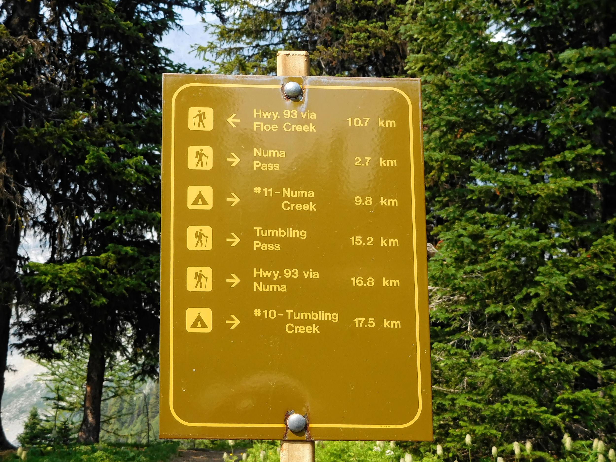
| Distance | 15.2 km |
| Time | 4 ¼ hrs |
| Incl. Breaks | 5 ½ hrs |
| Min. Elevation | 1422 m |
| Max. Elevation | 1777 m |
| Ascent | 355 m |
| Cum. Ascent | 679 m |
| Cum. Descent | 360 m |
Under blue skies and a few clouds, I drive the short distance over Highway 93S to the Paint Pots trailhead. The Paint Pots are a popular destination for day trippers, but no one is out here this early. I have no trouble finding a parking spot. At the end of the hike, I will come out 13 kilometers further down the highway at the Floe Lake trailhead parking lot. I am confident that I will find a ride back to my car.
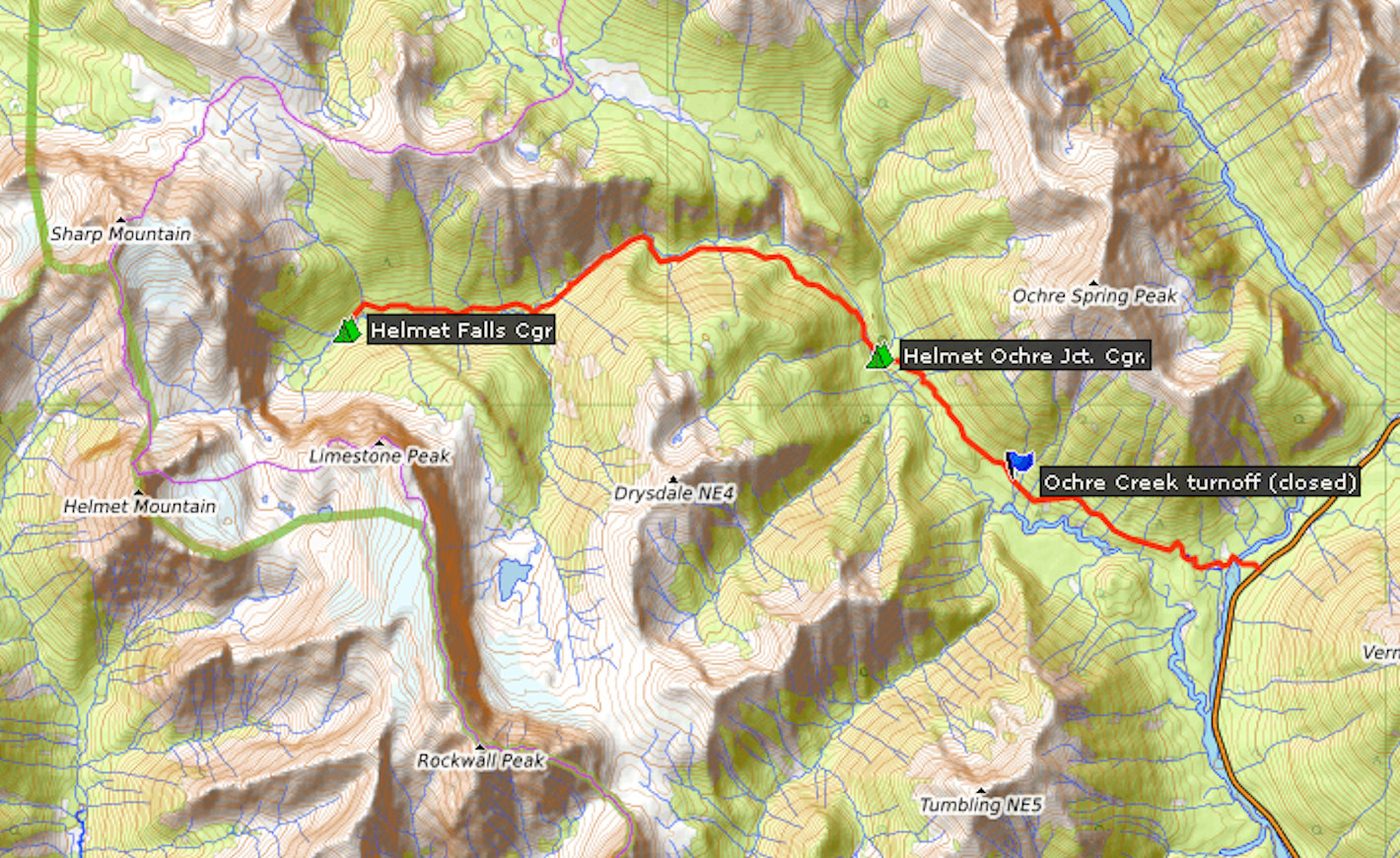
I have visited the Paint Pots before. A short walk takes me to three iron-rich mineral springs that stain the surrounding earth a vibrant orange colour. The water of the springs is very metallic and acidic. The ochre soil contrasts nicely with the green grass. The Paint Pots were once a Ktunaxa First Nations spiritual site. The Natives made paint from the ochre, which they used for ceremonial purposes. In the early twentieth century, the ochre was mined industrially. You still find machine parts from that time hidden in the bushes.
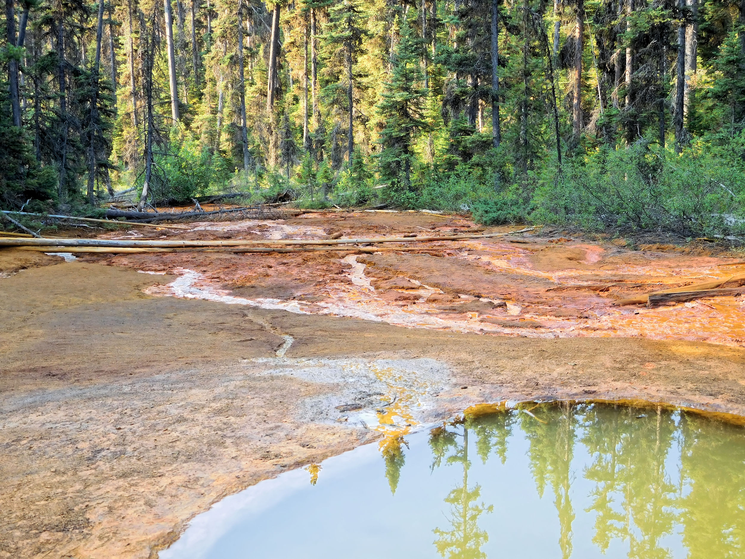
The many well-trodden paths around the springs are confusing. It takes me a while before I find the right one: the Ochre Creek trail.
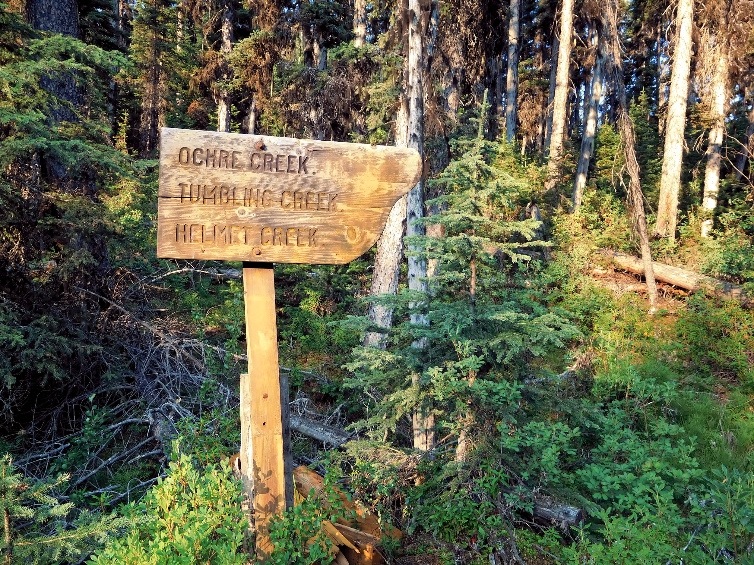
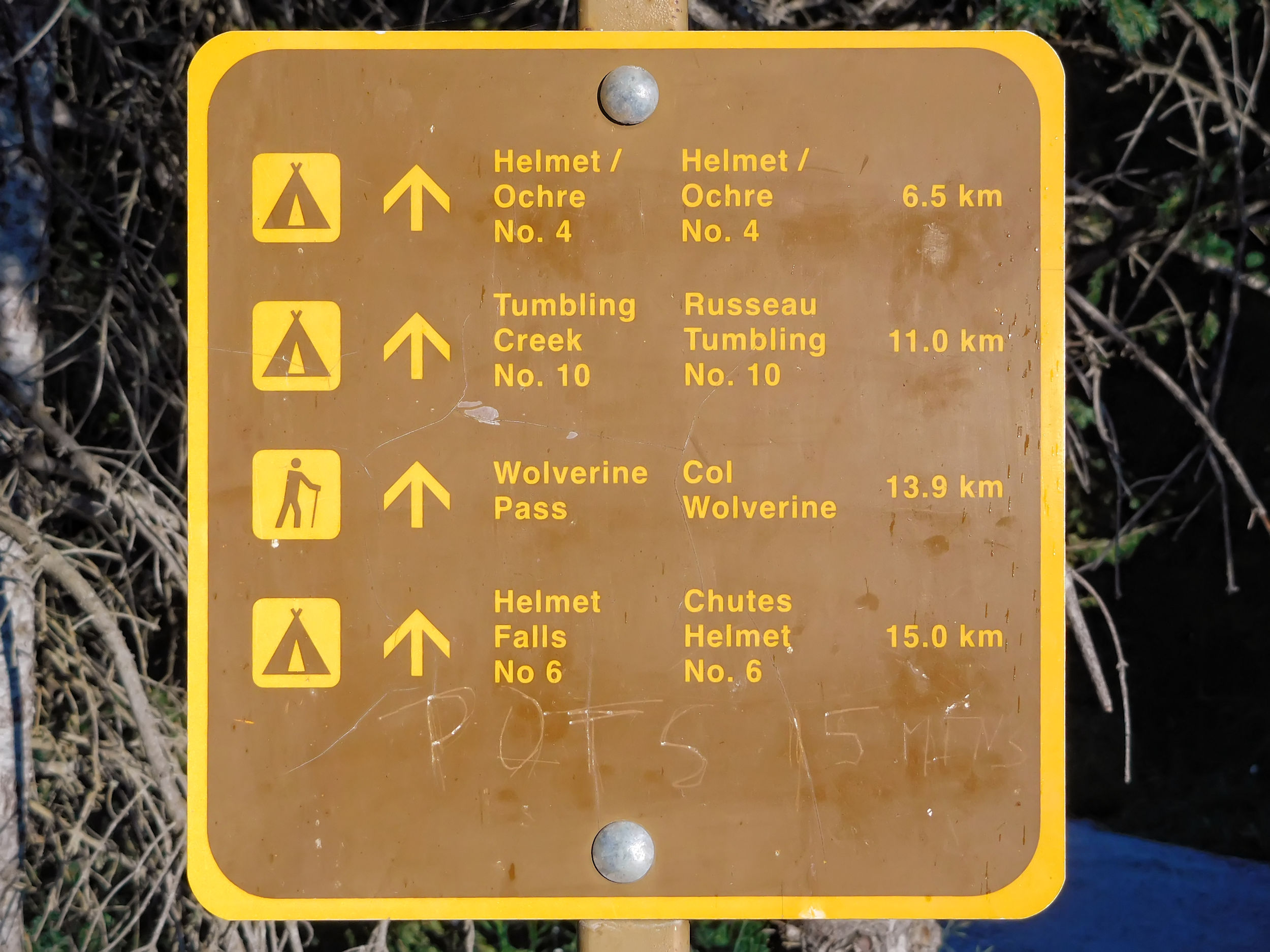
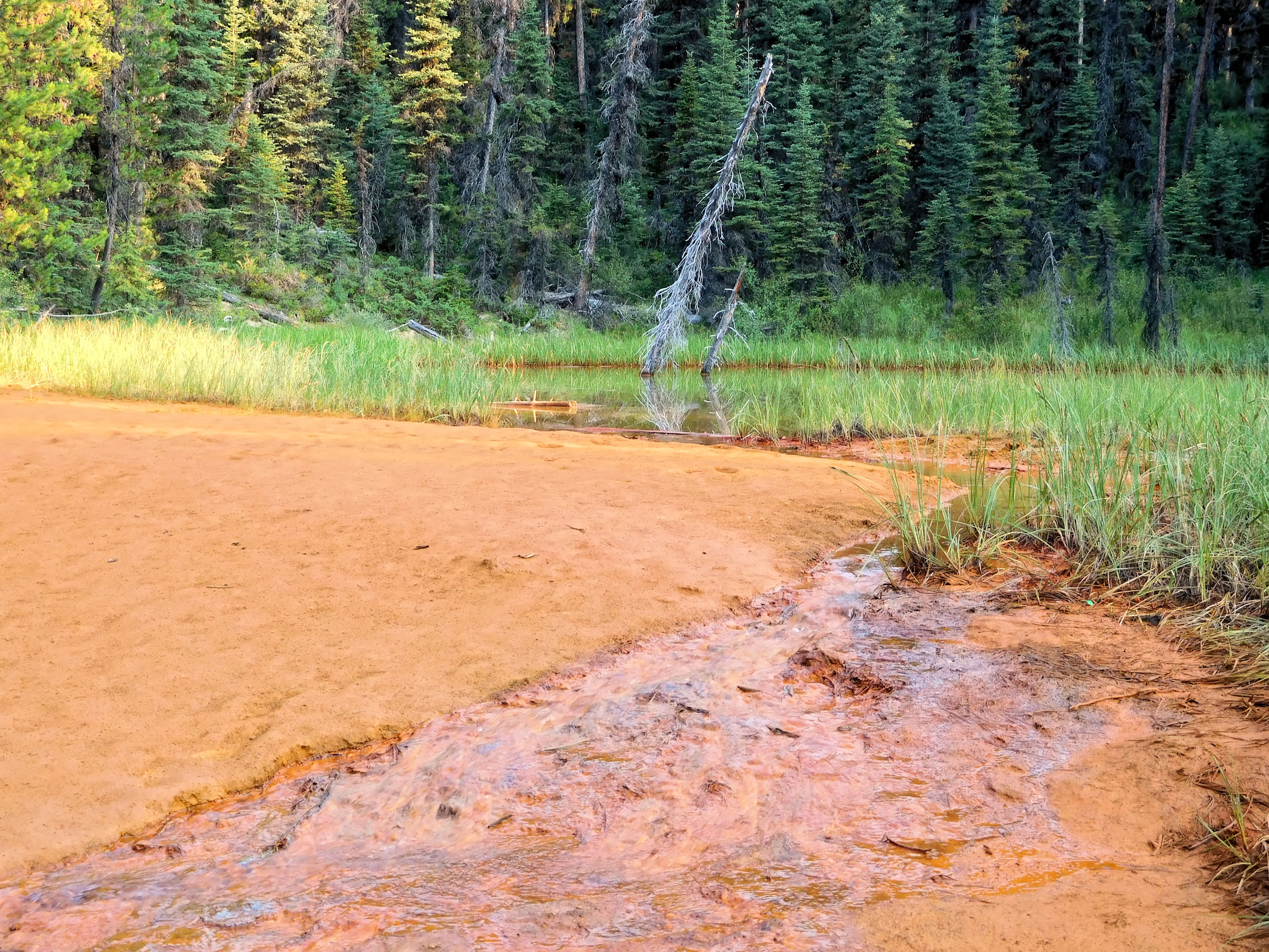
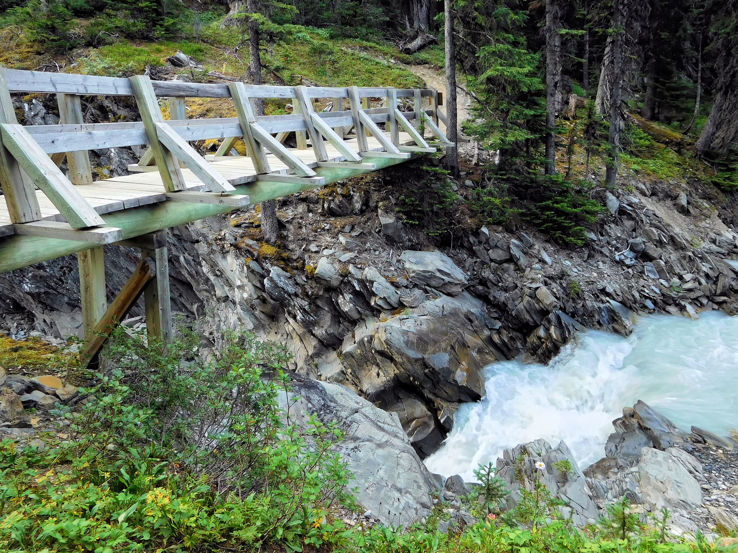
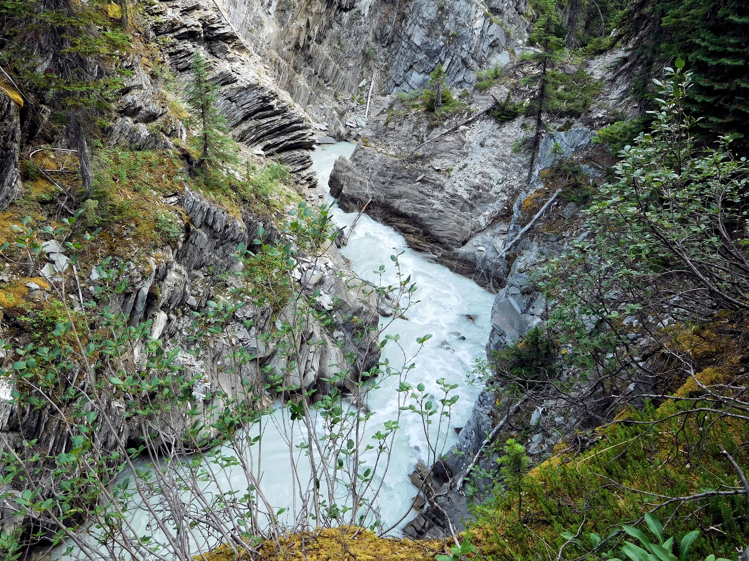
The next trail junctions are well signed. For six kilometers I walk through forest and meadows along Ochre Creek. I cross many tributaries over narrow, hewn logs. Finally, a well-built bridge spans Ochre Creek itself and I arrive at the small Helmet/Ochre Junction campground. It has only six sites and is not used a lot.
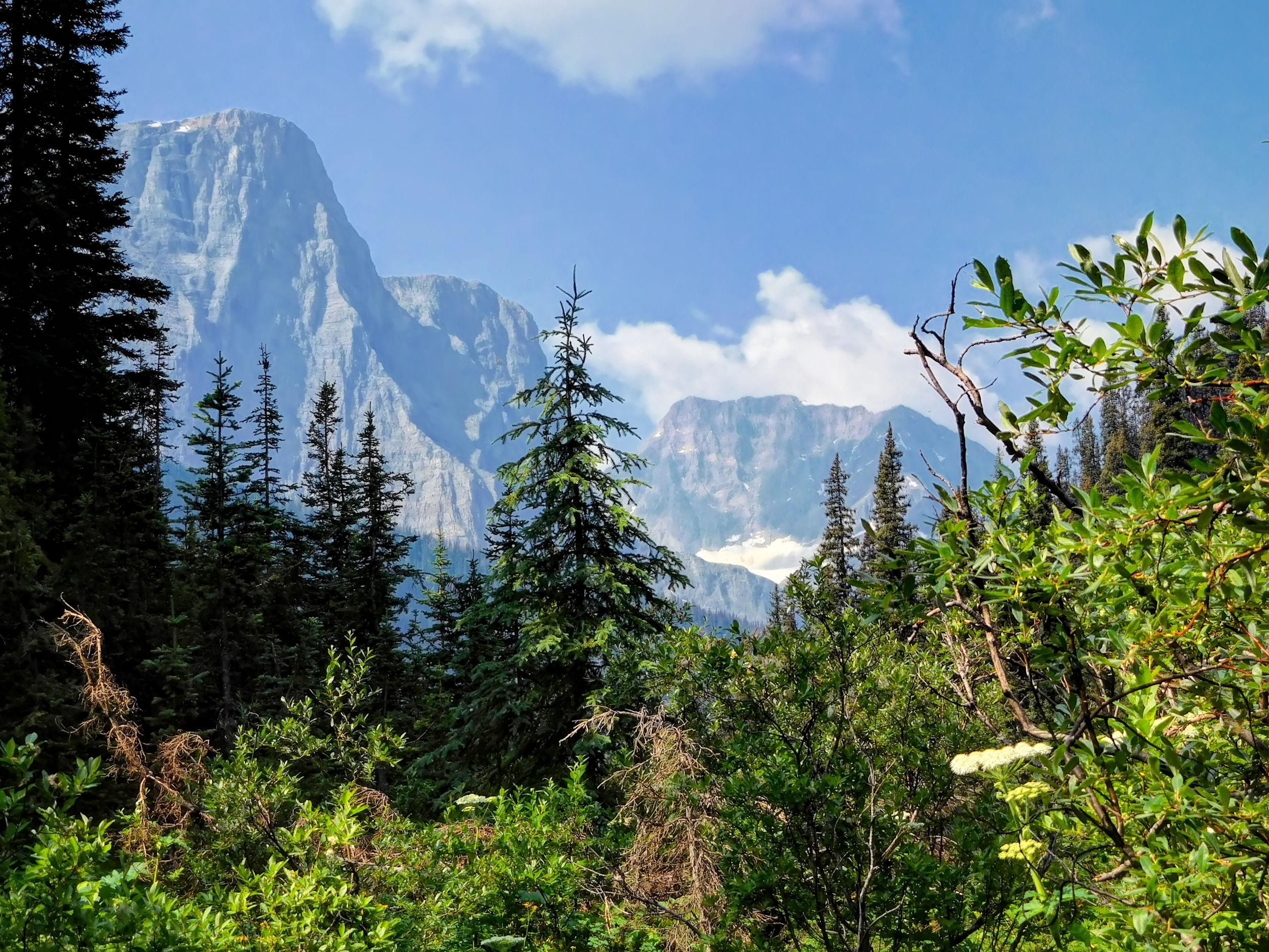
Over some switchbacks I transfer from the valley of Ochre Creek into the valley of Helmet Creek. Accordingly, the trail is called Helmet Creek trail here, and it will finally bring me to the Rockwall trail. I catch a first view of the surrounding mountains.
On the Helmet Creek trail
There are only very few ascents on this first day. Which is a good thing, because my backpack with all the food for the next six days must way at least 17 kg, and today’s 15 km hike is the longest on the trip.
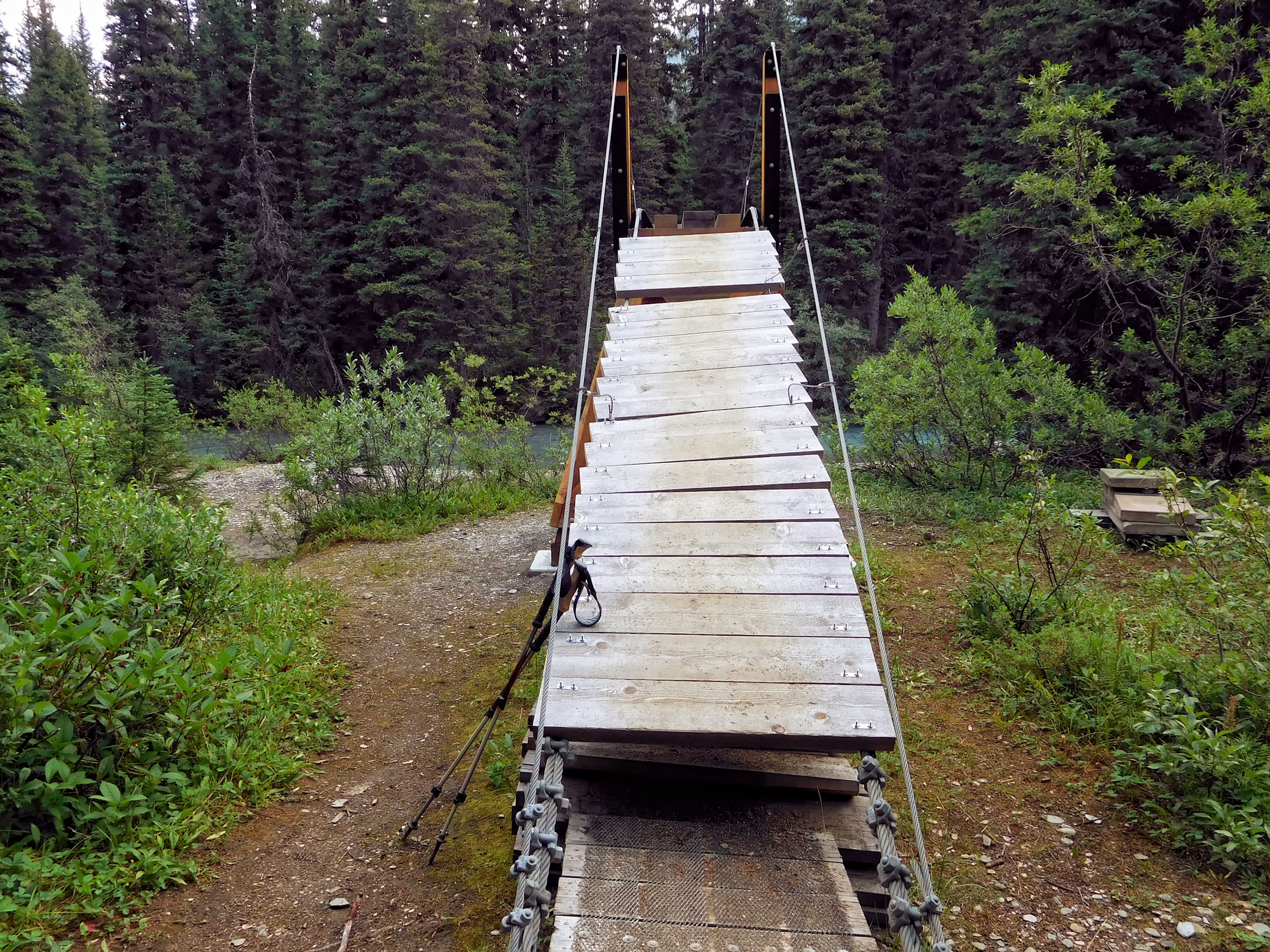
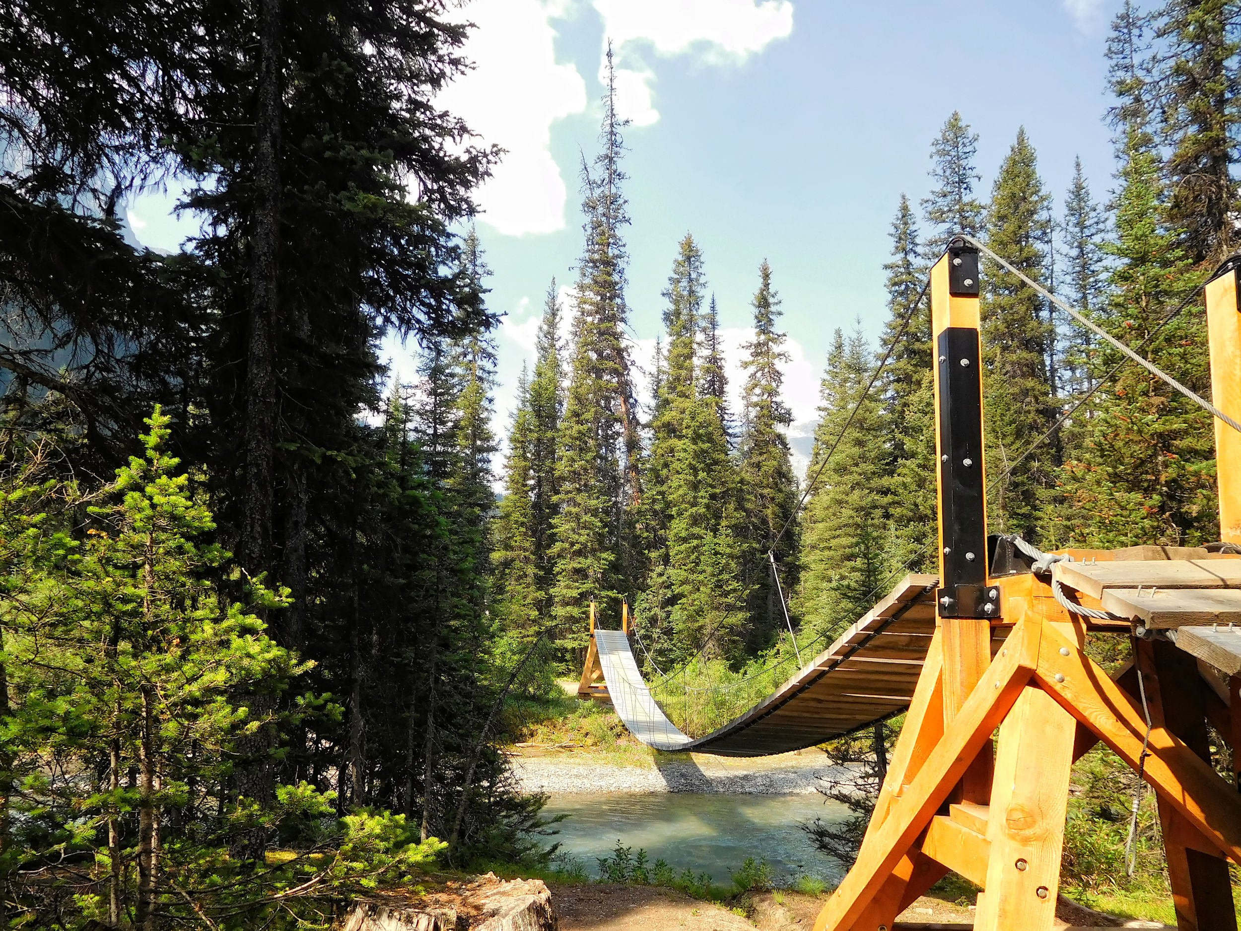
A suspension bridge crosses Helmet Creek. Once you have managed its absurdly steep entrance, you better hold on to the handrail, because due to its considerable length, the bridge swings quite a bit.
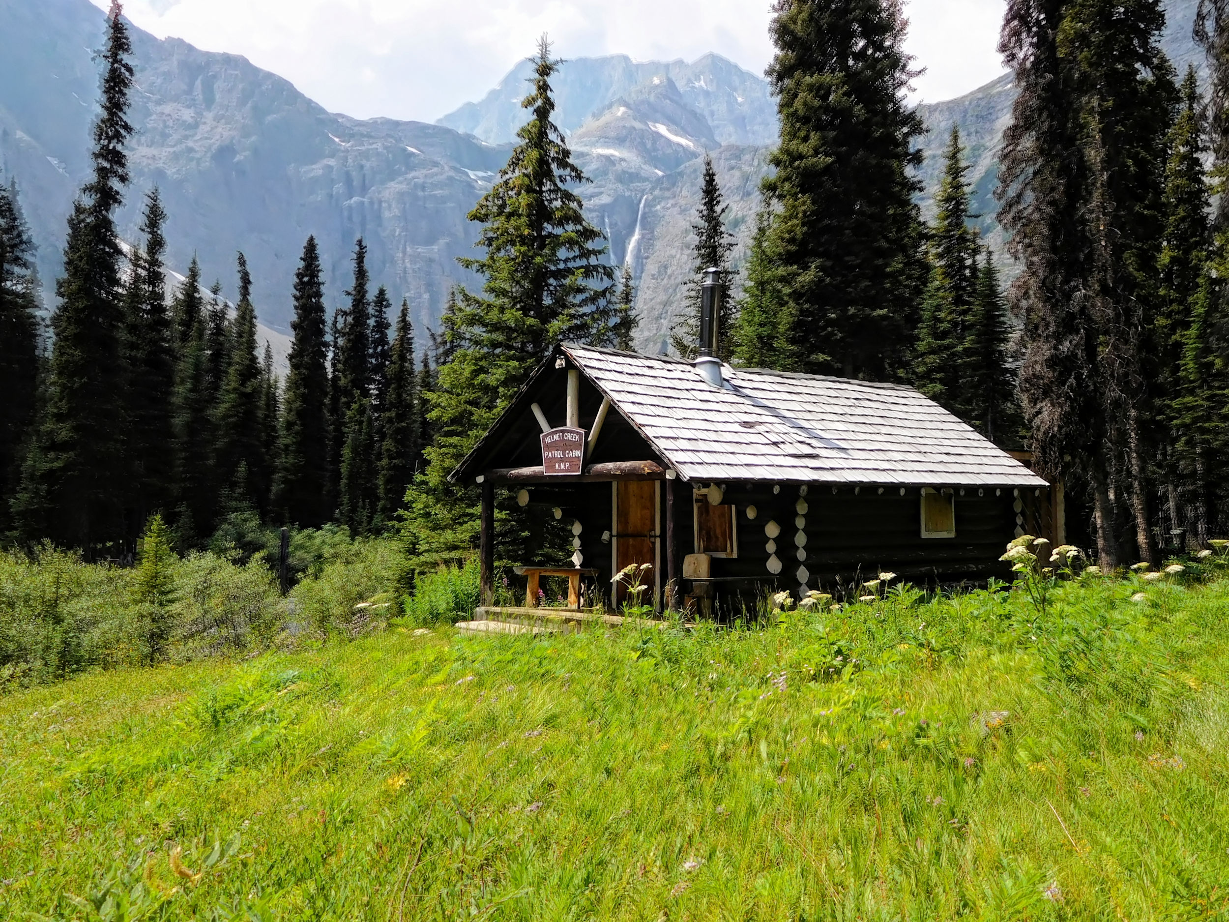
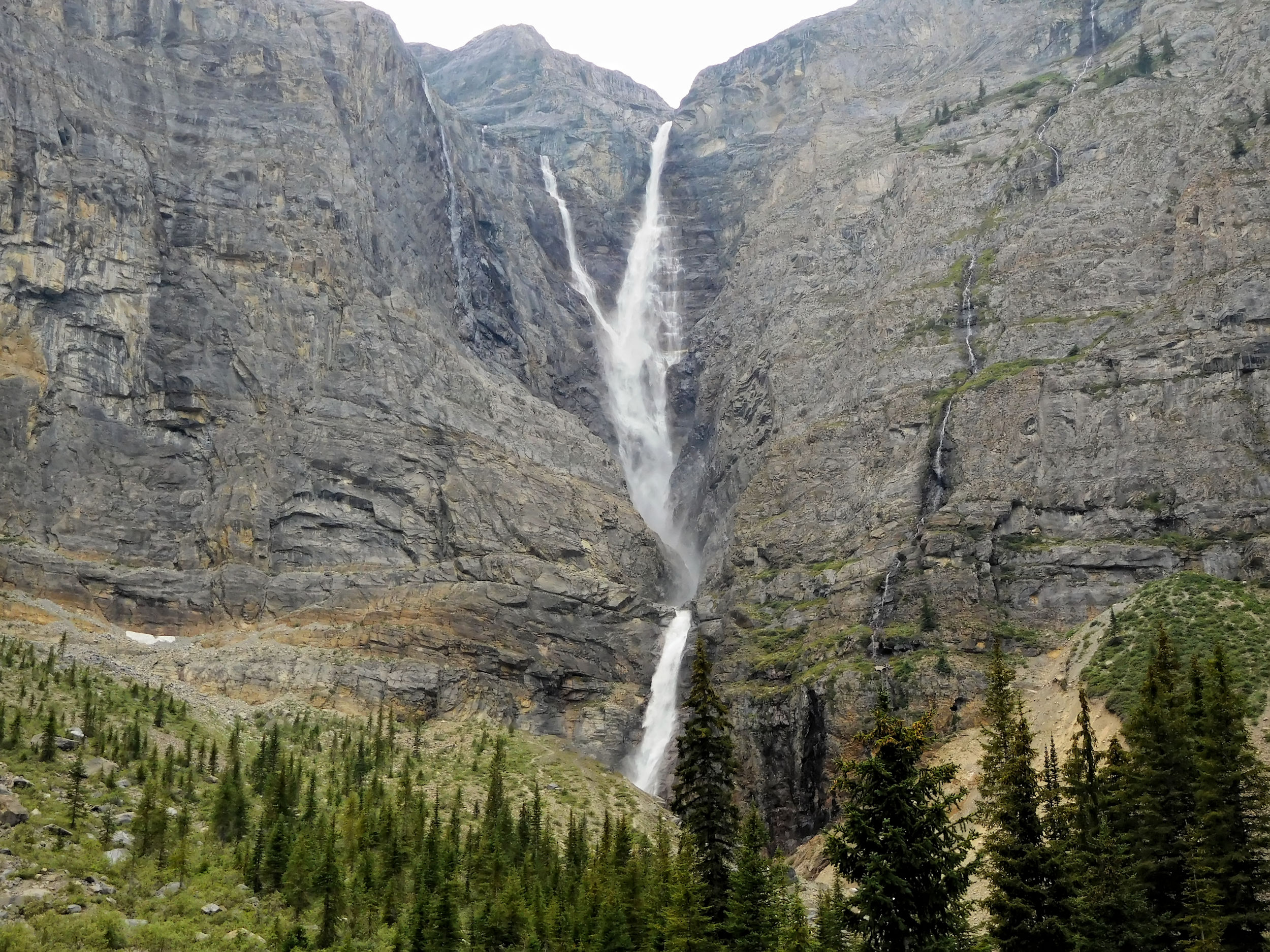
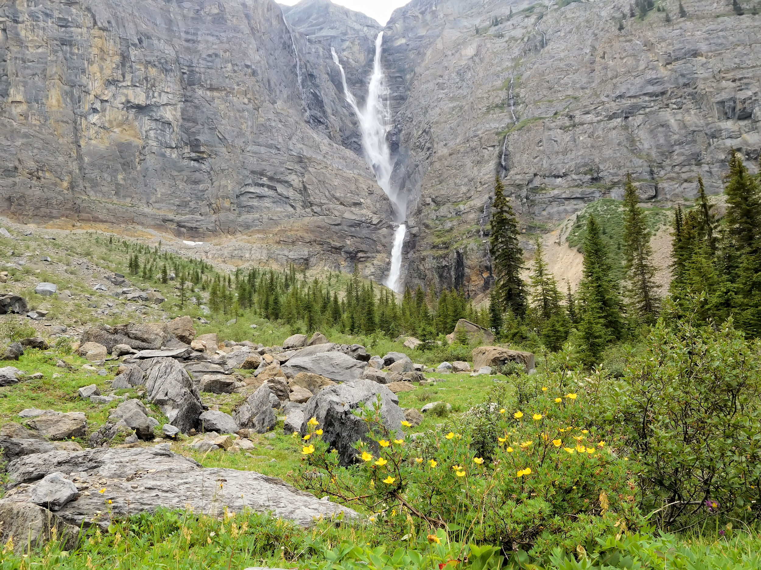
I reach the turnoff to Goodsir Pass where I want to hike on a day trip tomorrow. I keep straight, pass an unmanned ranger cabin and arrive at my destination just beyond, Helmet Falls campground. It is located very dramatically in a deep basin formed by Sharp Mountain, Helmet Mountain, and Limestone Peak. Here, Helmet Creek, which originates in the Washmawapta Icefield, plunges 352 meters to the valley floor. This makes Helmet Falls one of the highest waterfalls in the Canadian Rockies. Its constant roar is everywhere.
Helmet Falls
Helmet Creek
The campground is well laid out and solidly built. The picnic tables offer a wonderful view of Helmet Falls within the semicircle of its surrounding mountains. It’s like sitting in an amphitheater.
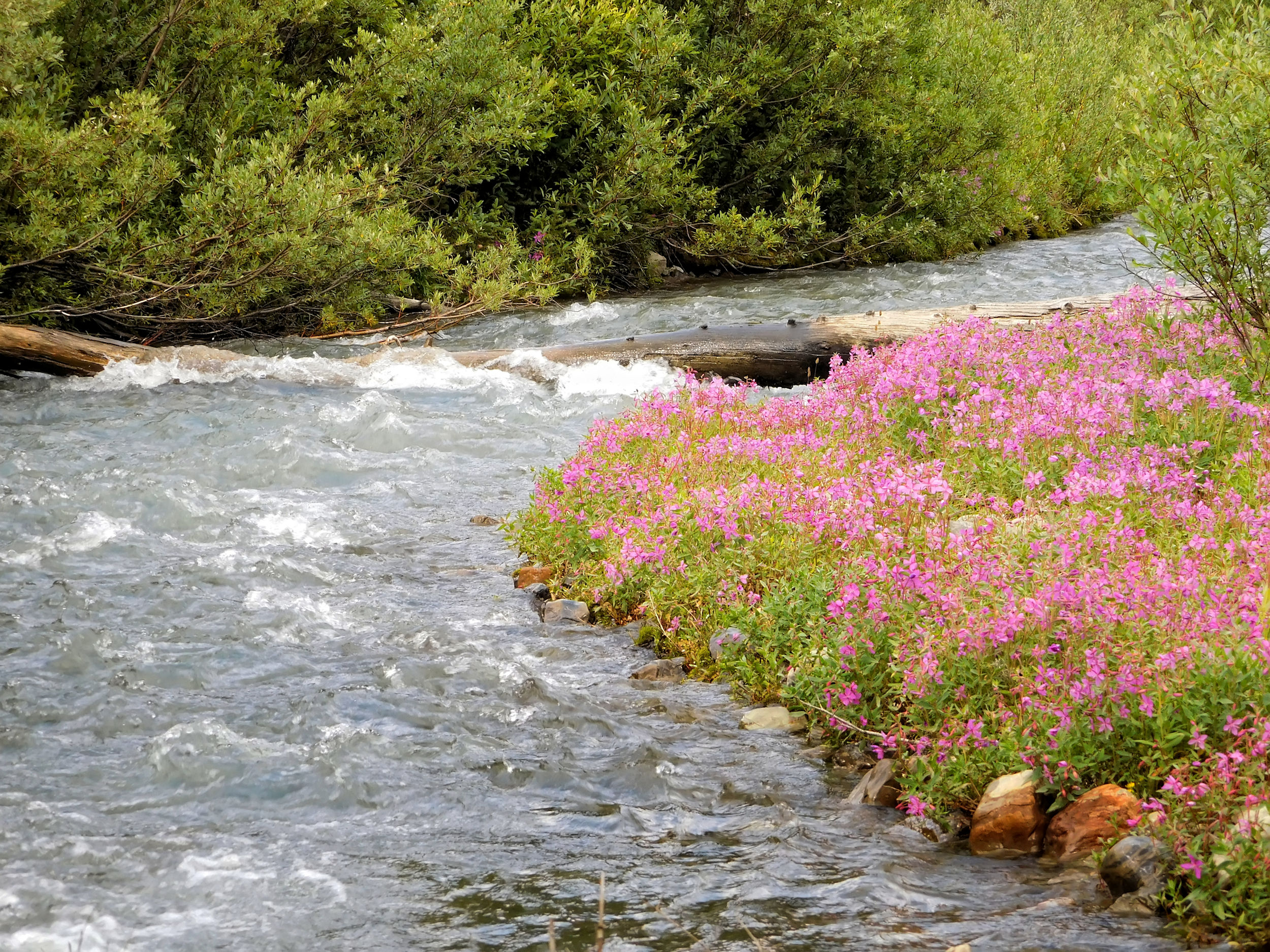
Following another camper’s suggestion, I go for a walk that takes me half a kilometer closer to the base of the falls. From there I have an even better angle for a photo. The skies have clouded over by now, but some wildflowers add color to the picture.
Wildflowers in front of Helmet Falls
Fortunately, the 18 tent sites of this busy campground are spread out and separated by trees and shrubs. So it is not the snoring coming from other tents, but the roar of the waterfall that keeps waking me up during the night.
| Distance | 14 km |
| Time | 4 ½ hrs |
| Min. Elevation | 1765 m |
| Max. Elevation | 2241 m |
| Ascent | 476 m |
The next morning, the clouds have disappeared. Helmet Falls and the mountains present themselves in front of a deep blue sky. What a setting for my breakfast!
Helmet Mountain 3124 m and Helmet Falls
Groundsquirrel
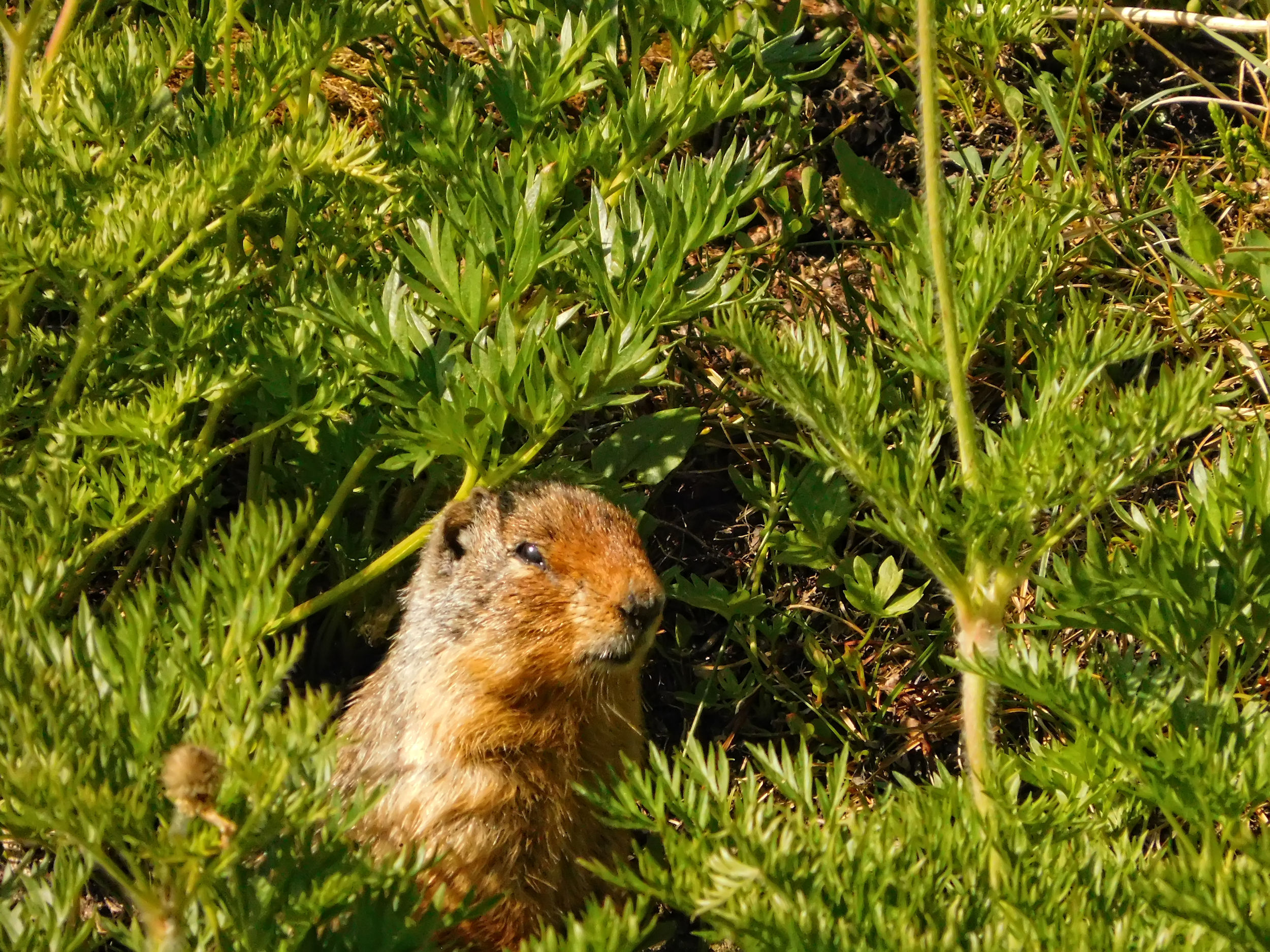
Today I want to visit Goodsir Pass. I hike past the ranger cabin back to the turnoff. From here, the path climbs in switchbacks through the forest. A ground squirrel watches me from its hiding place between the wild flowers. For the first time, I have an unobstructed view of the alpine mountain panorama. With 3567 meters, Mount Goodsir is the highest mountain in neighboring Yoho National Park. It has two prominent peaks.
Mount Goodsir 3567 m
Many larches grow near the pass.
Larches at the pass
I reach the top of the pass at 2210 meters and enjoy the view of the mountain peaks.
Mount Goodsir´s twin peaks
I walk about another kilometer beyond the pass. The trail disappears in the forest and leads steadily downhill. Two women come up behind me. They are on their way into Yoho National Park and, after an overnight stay at McArthur Creek campground, will reach the town of Field via the Ottertail River valley. Since there are no exciting views behind the pass, I turn back to the top. From there, I climb up to some rocks and have lunch.
Lunch break above Goodsir Pass
It is still early in the afternoon when I return to the campsite, lots of time before dinner to enjoy the sights and sounds near Helmet Falls. I meet a father-daughter team from 150 Mile House, close enough to my own home town to be considered neighbors. They are accompanied by a small dog. I wonder how the little guy is going to manage the long distances on his short legs. But his owners assure me that he is used to hiking, they just have to avoid the hottest hours of the day. Consequently, the three are always first on the trail each morning.
| Distance | 13.1 km |
| Time | 4 hrs |
| Incl. Breaks | 7 hrs |
| Min. Elevation | 1754 m |
| Max. Elevation | 2227 m |
| Ascent | 473 m |
| Cum. Ascent | 1053 m |
| Cum. Descent | 926 m |
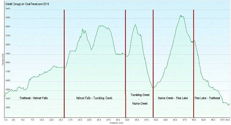
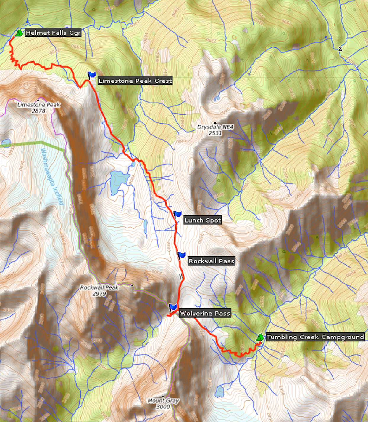
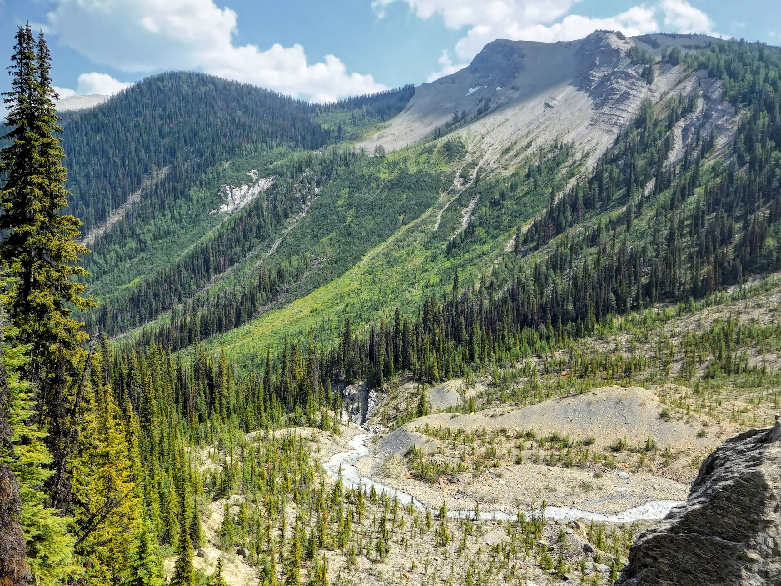
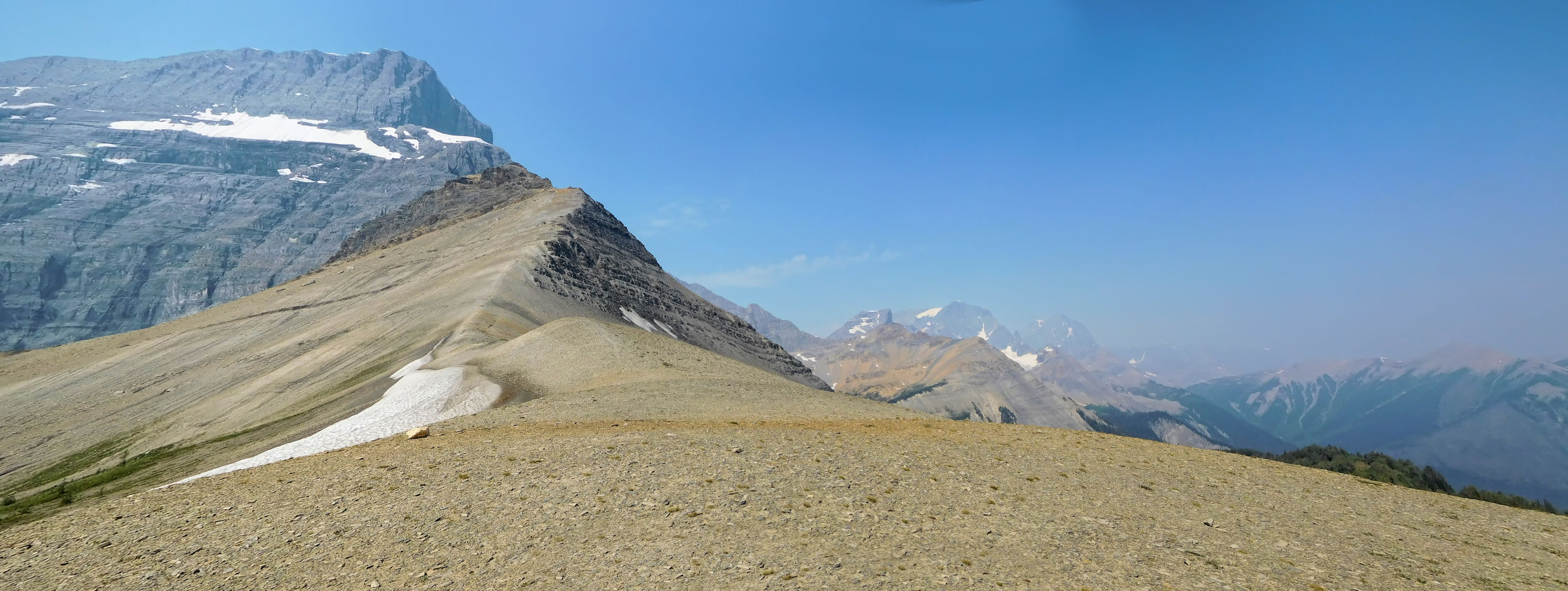
The early morning sky is again cloudless and the sun has yet to find its way into the narrow valley. Today, things are getting serious. Thirteen kilometers are on the agenda, with two substantial climbs followed by big drops: first up the shoulder of Limestone Peak and then up to Rockwall Pass.
On numerous switchbacks, I climb about 400 meters out of the valley and onto the shoulder of Limestone Peak. I have to catch my breath often, because the path is really steep. From here, there is once again a superb view of Helmet Falls.
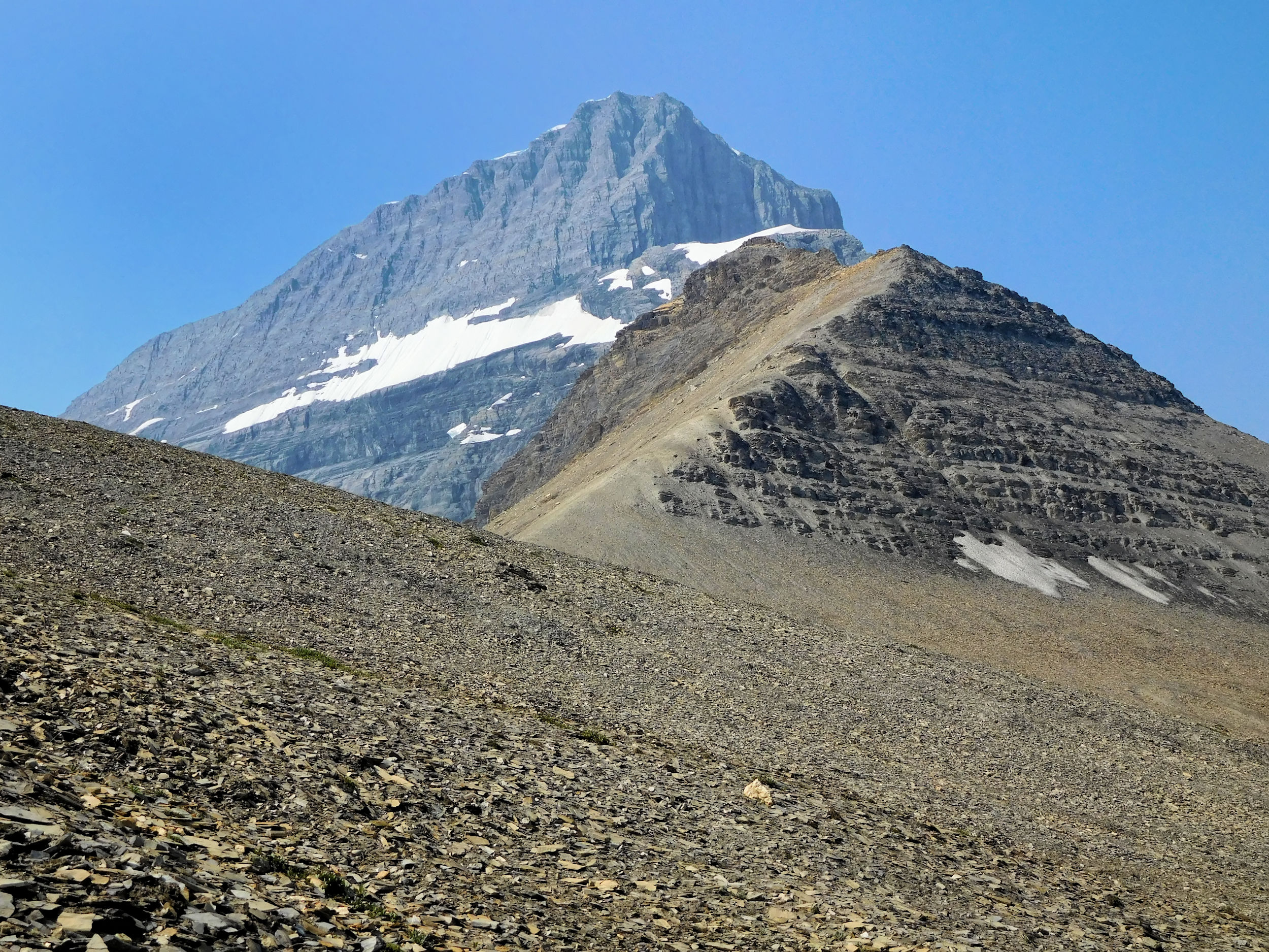
Limestone Peak 2878 m
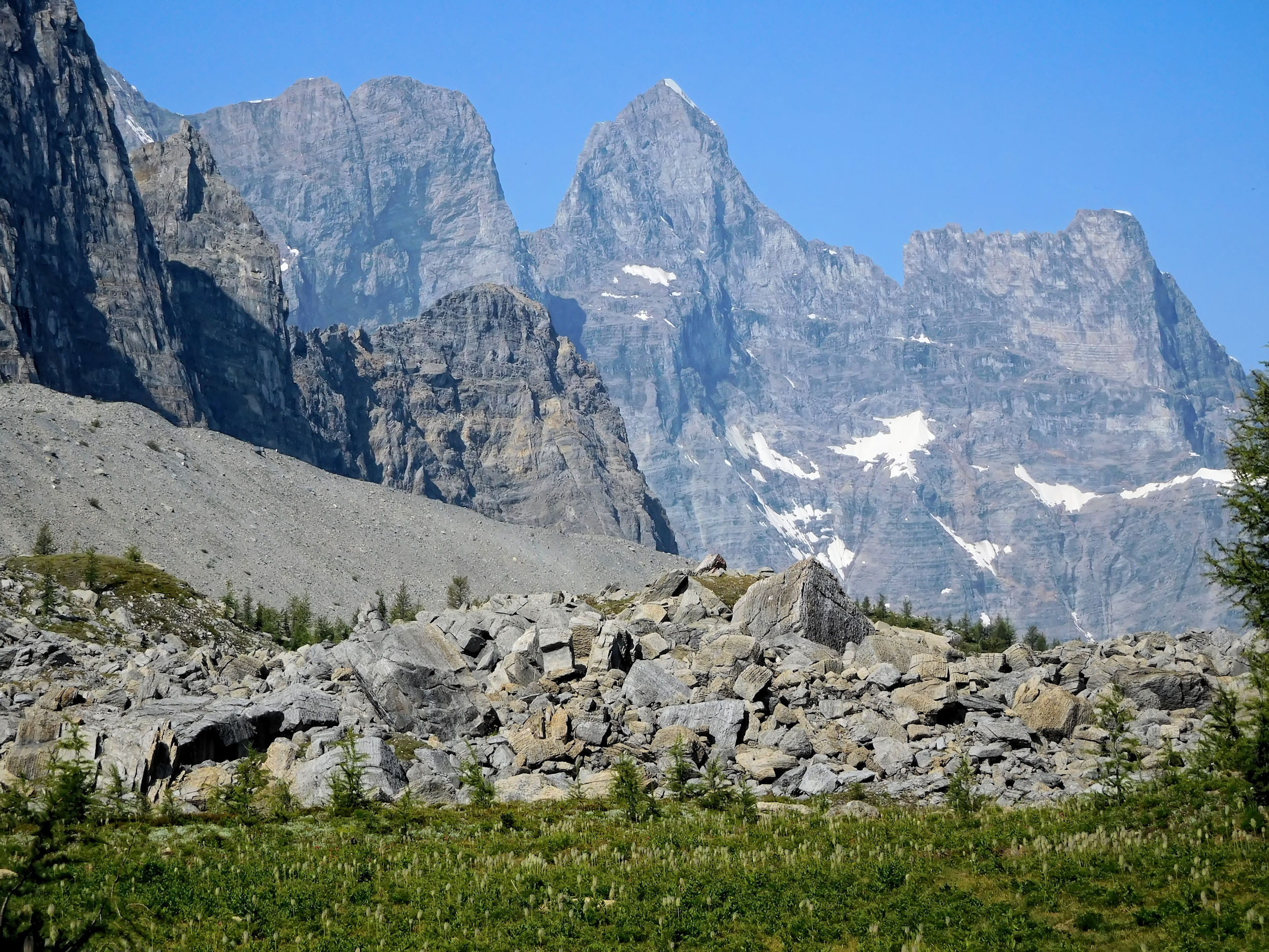
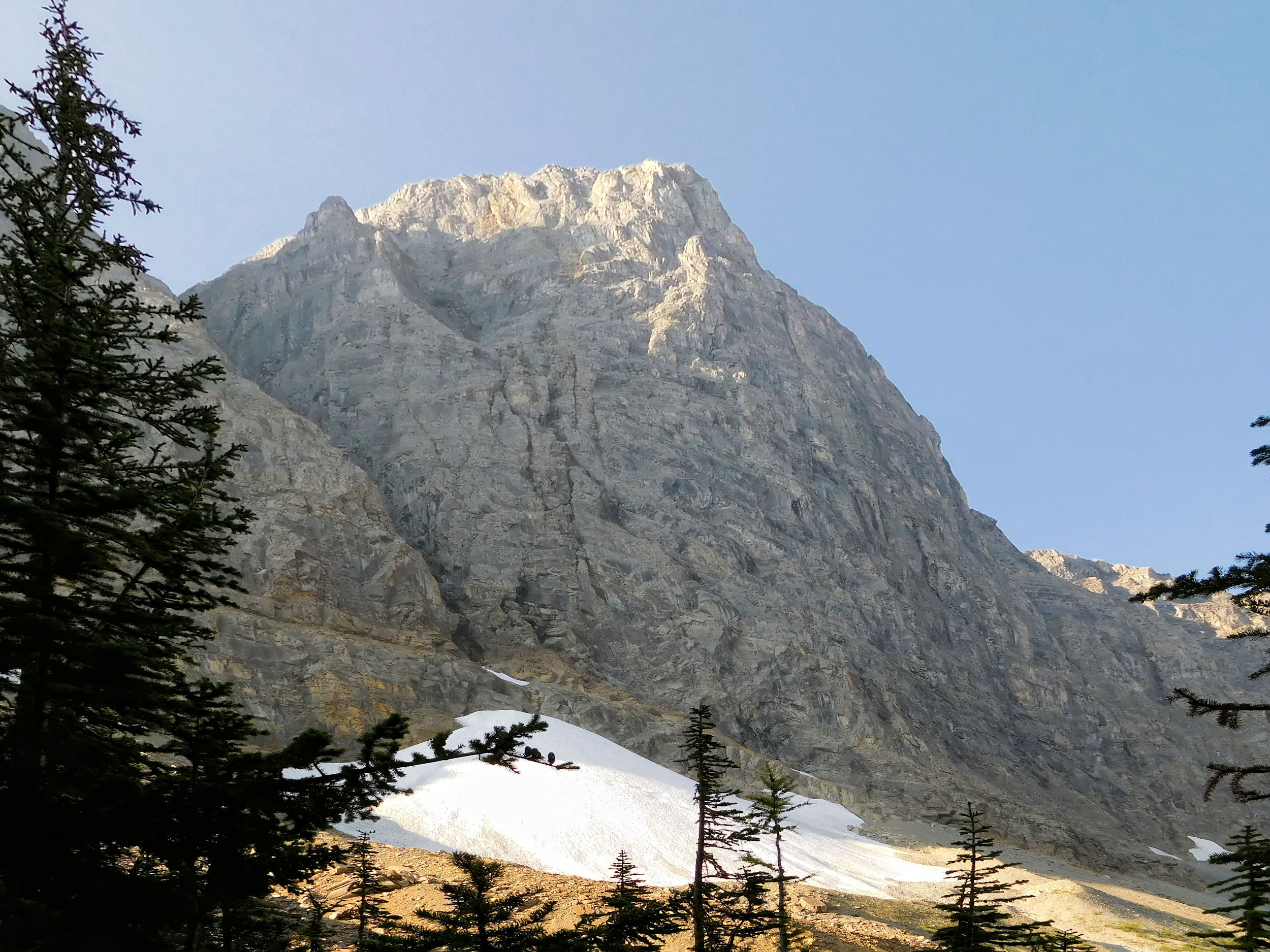
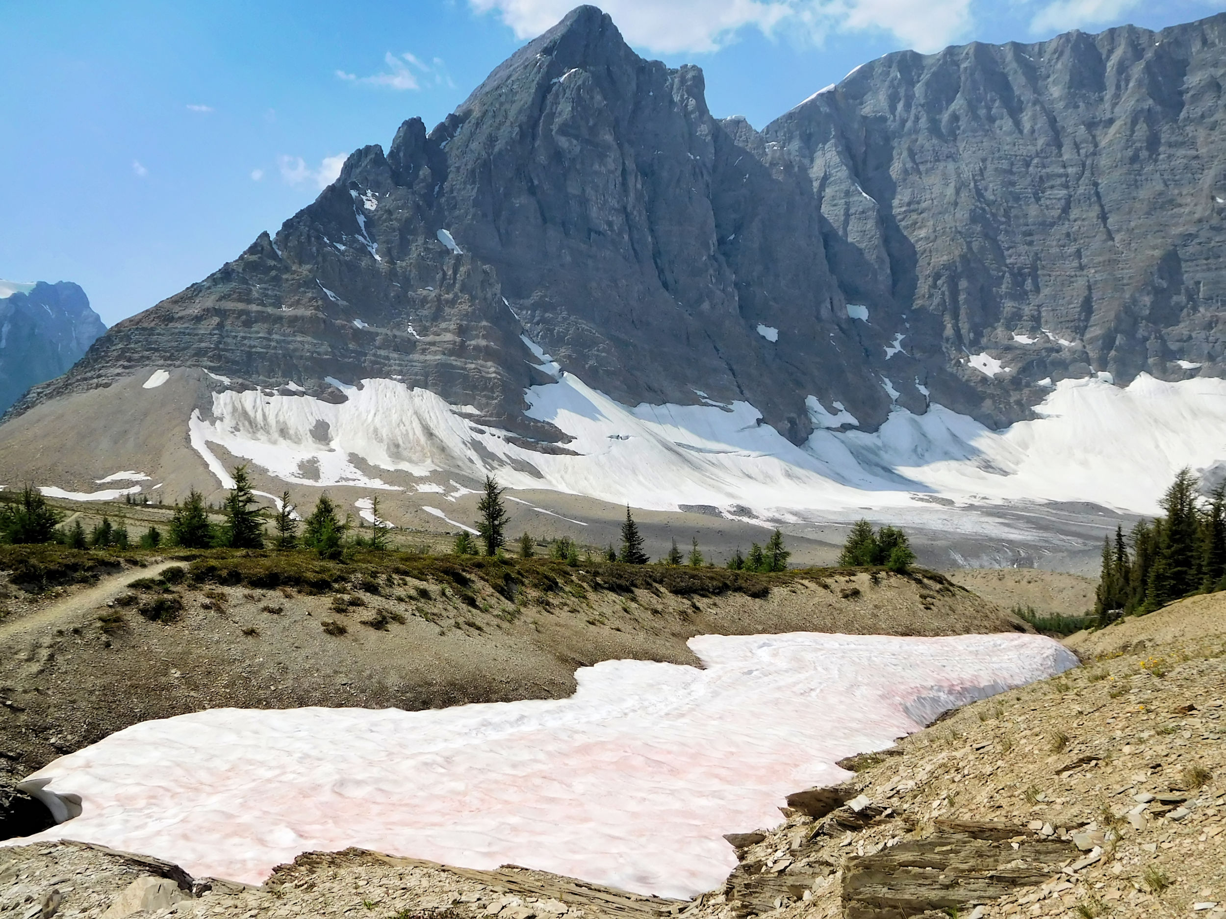
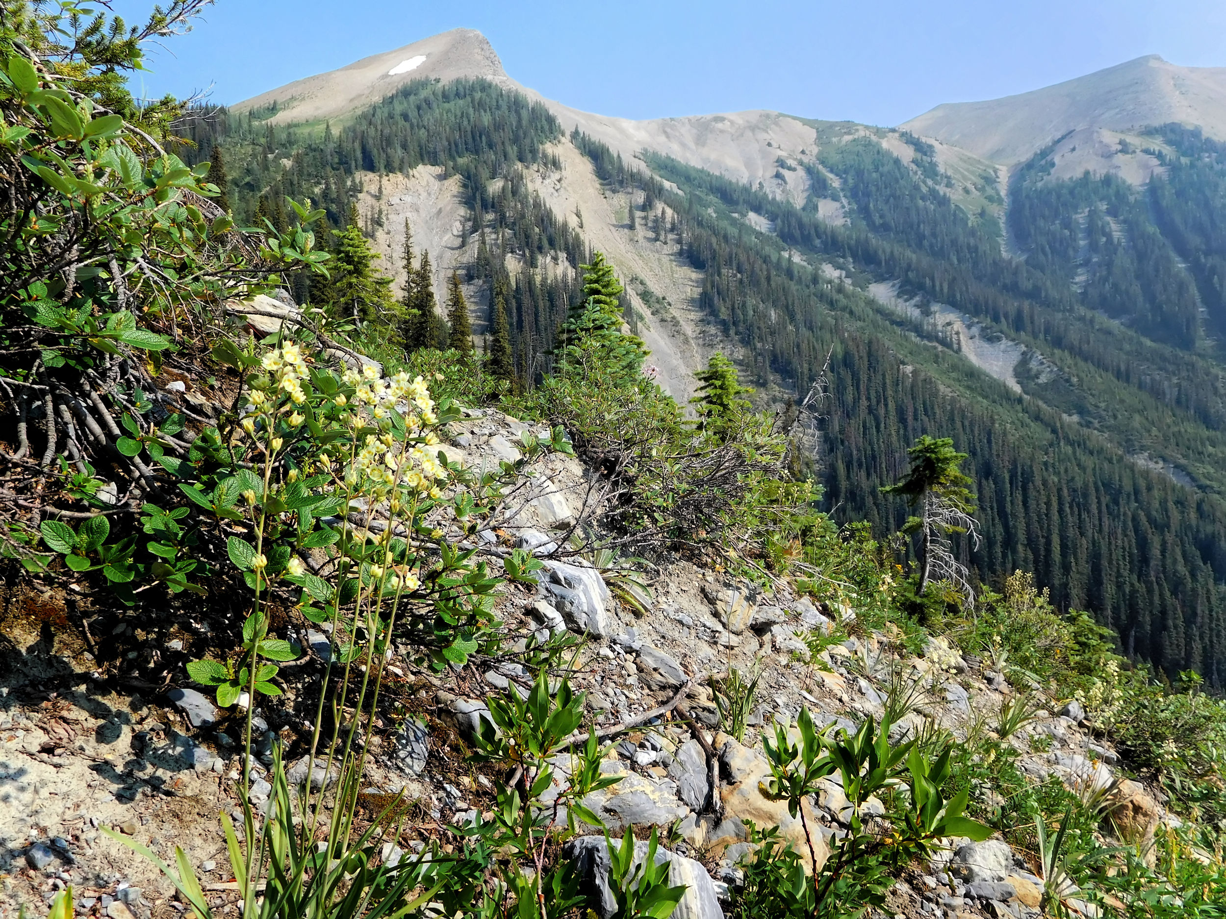
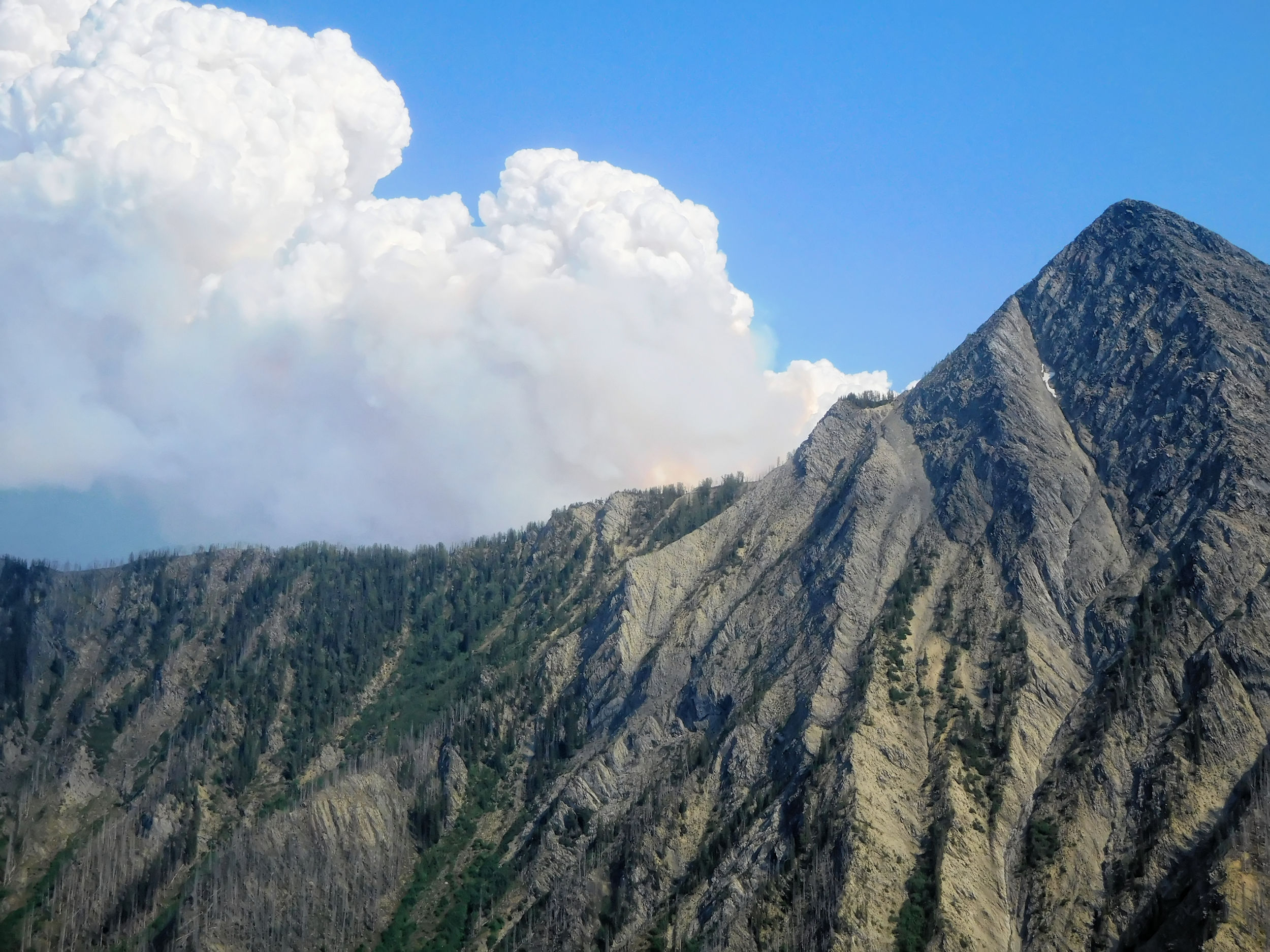
Finally, after the last switchback I am offered the first view of the majestic Rockwall.
The sheer endless cliff lives up to its name and towers over the western side of the trail.
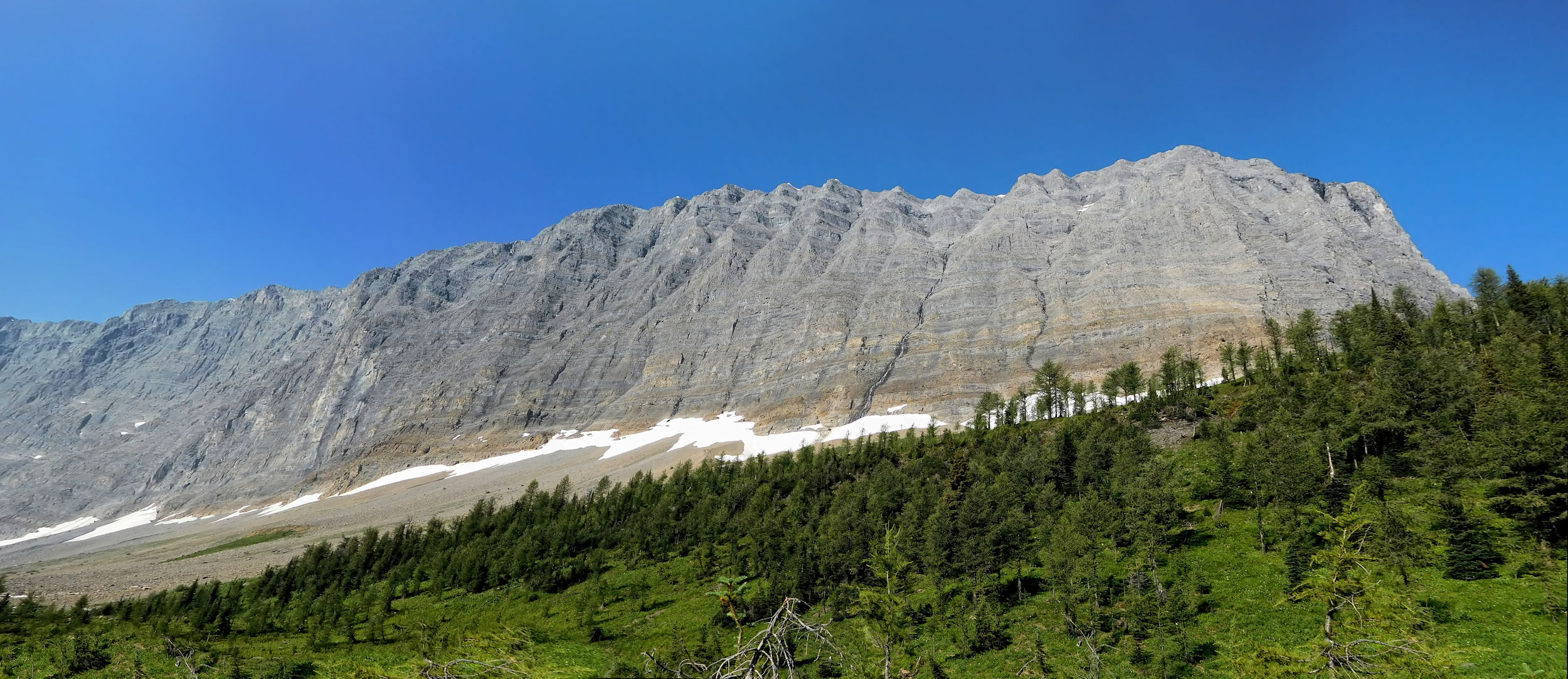
Rockwall
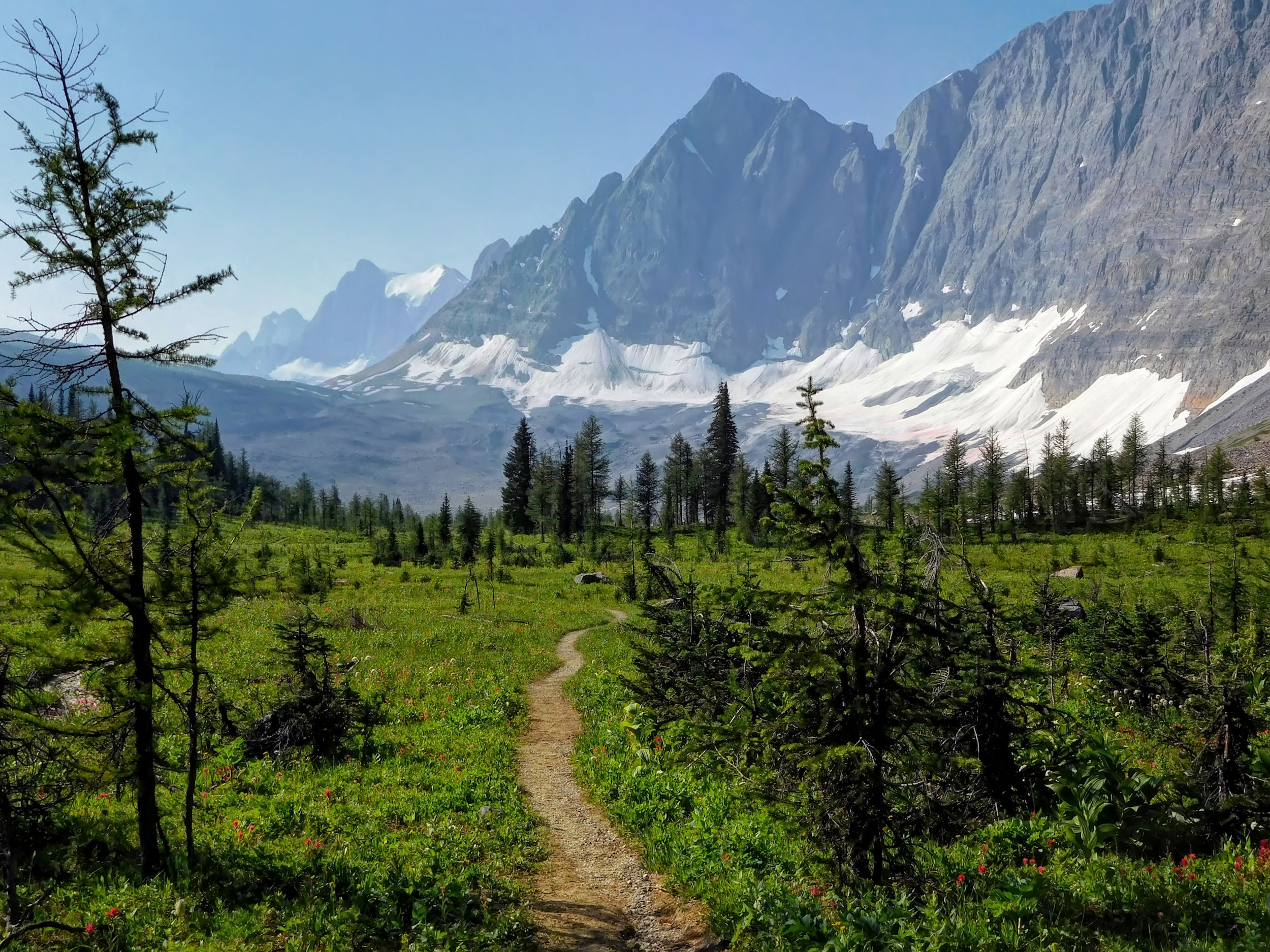
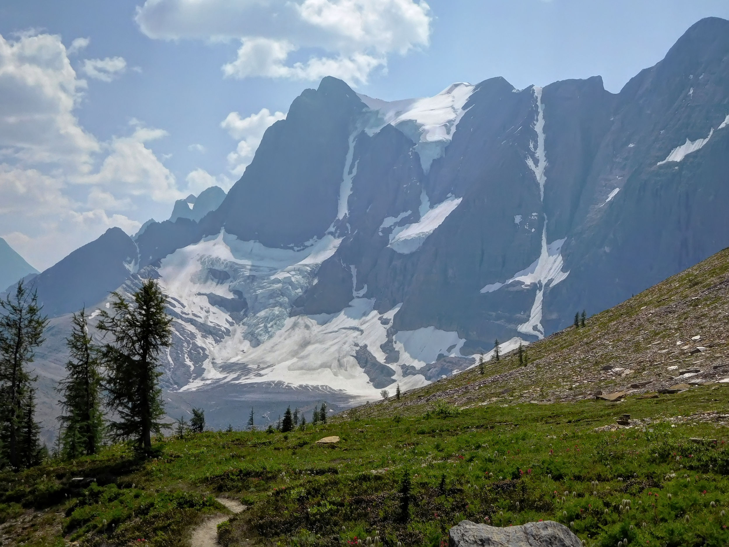
The path now runs downhill through a forest of larches and meadows. It loses about 200 meters of elevation down to a stream, only to climb up again behind it. I climb a scree slope, cross a moraine and arrive at a pretty turquoise tarn.

Tarn
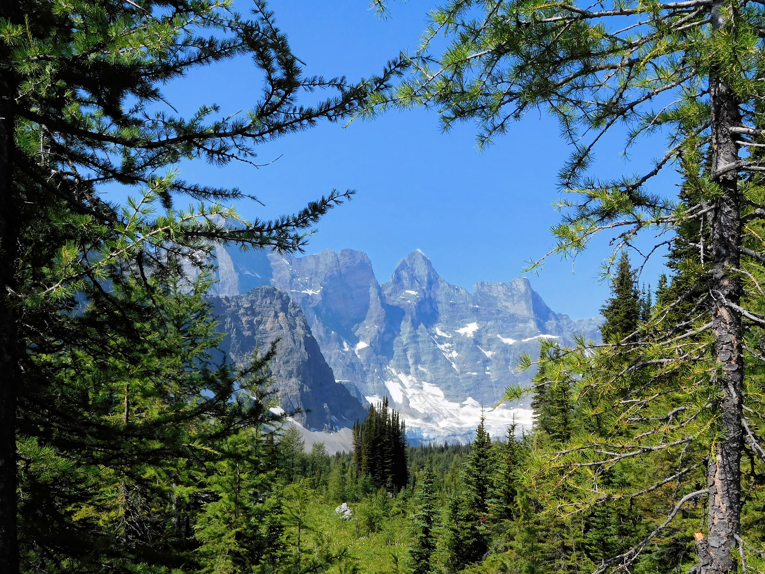
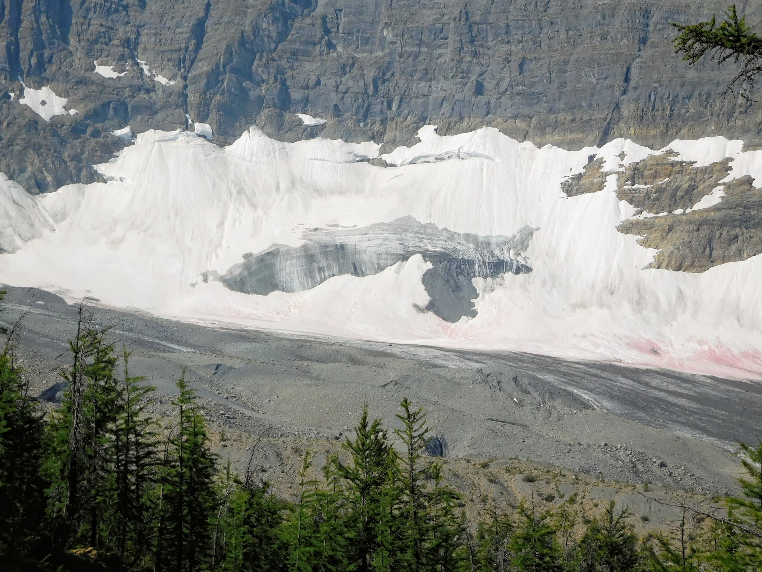
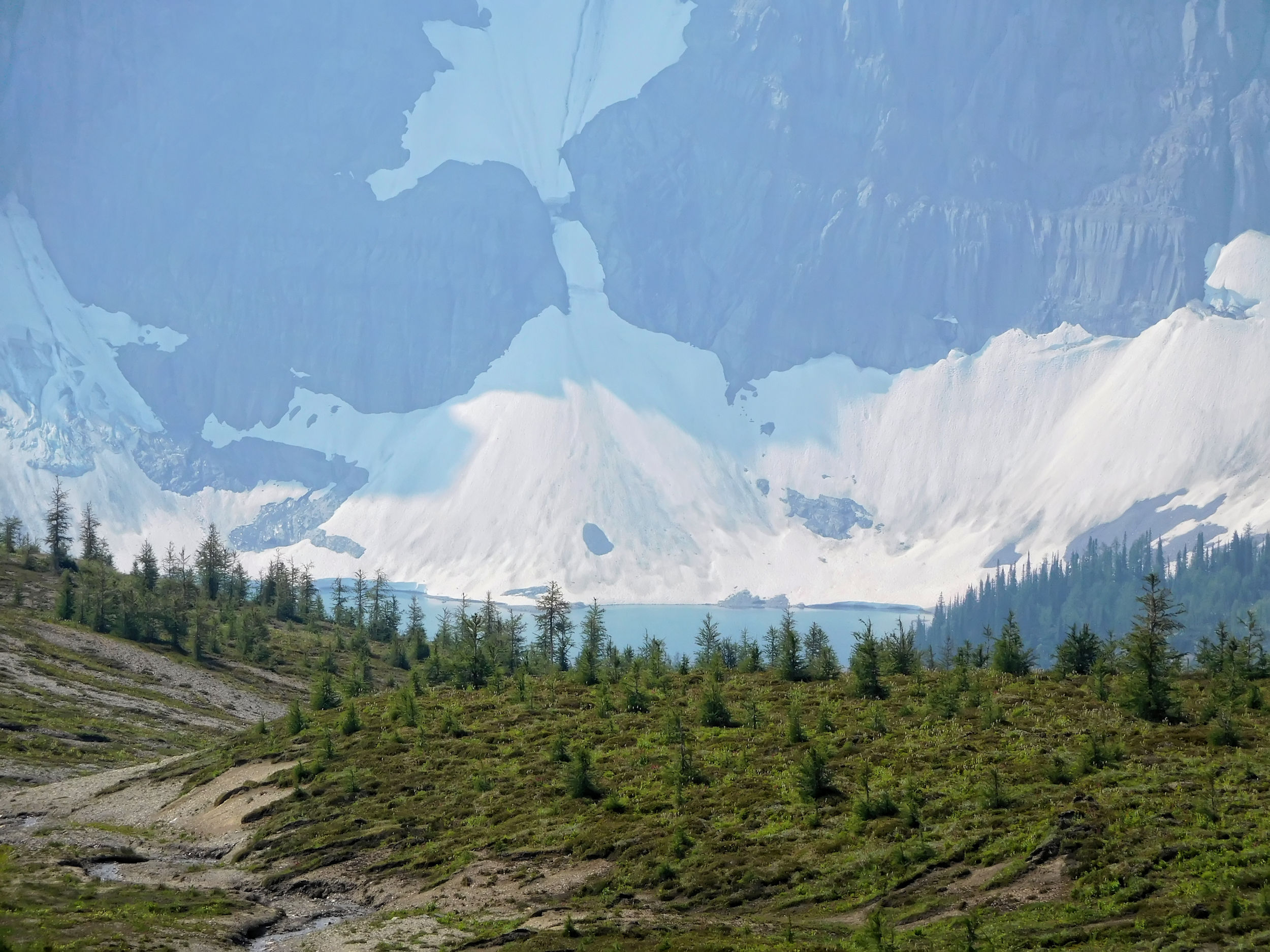
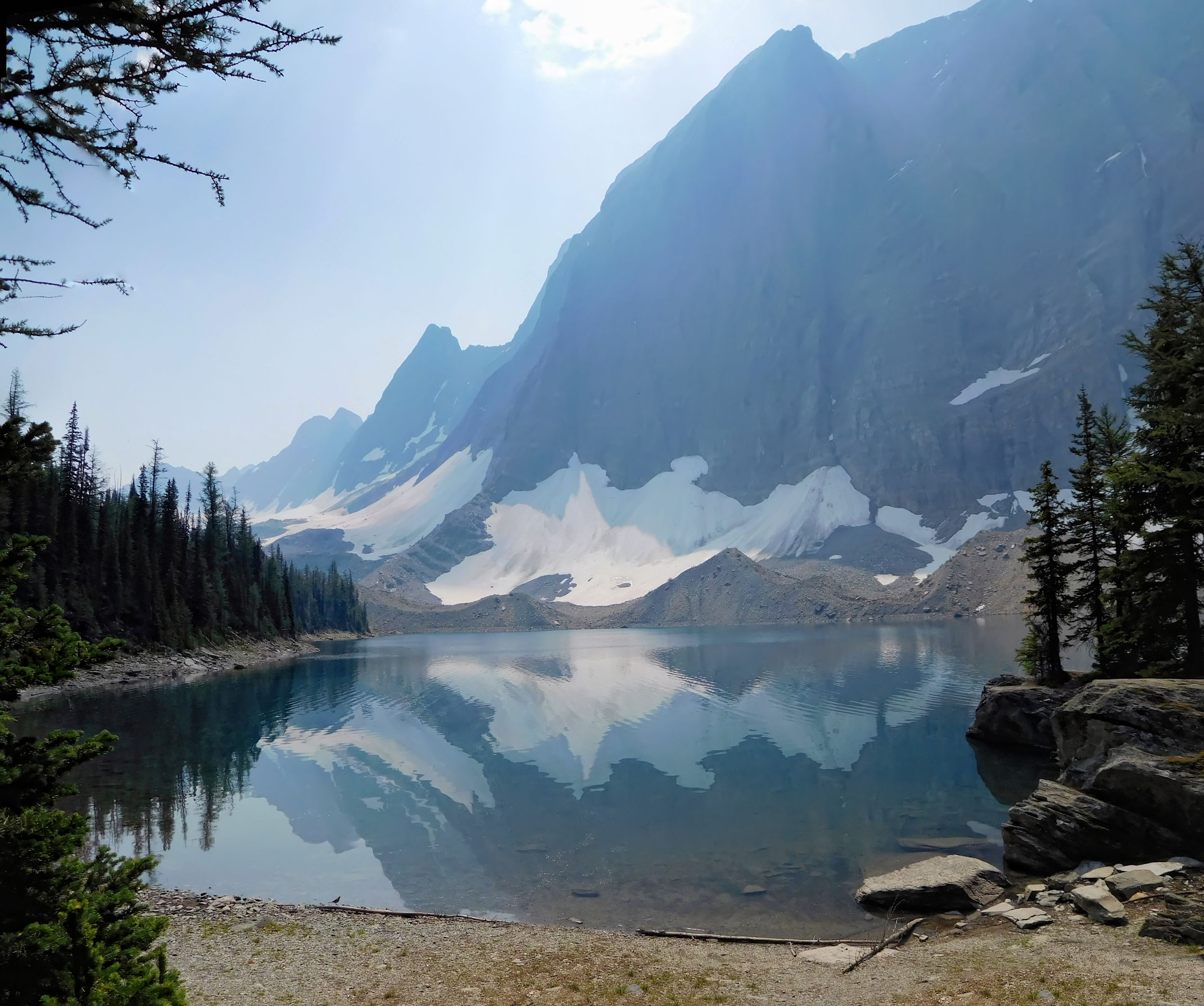
From the next hill a glacial lake at the base of the Rockwall becomes visible.

Glacial lake
There is a good reason why I hike the Rockwall trail from north to south, even if walking into the morning sun is not ideal for taking pictures. This direction has the advantage that the main ascents up the northern slopes are done in the morning when they are shaded. By the early afternoon the southern facing slopes can get very hot, but they are all hiked downhill.
Looking back north
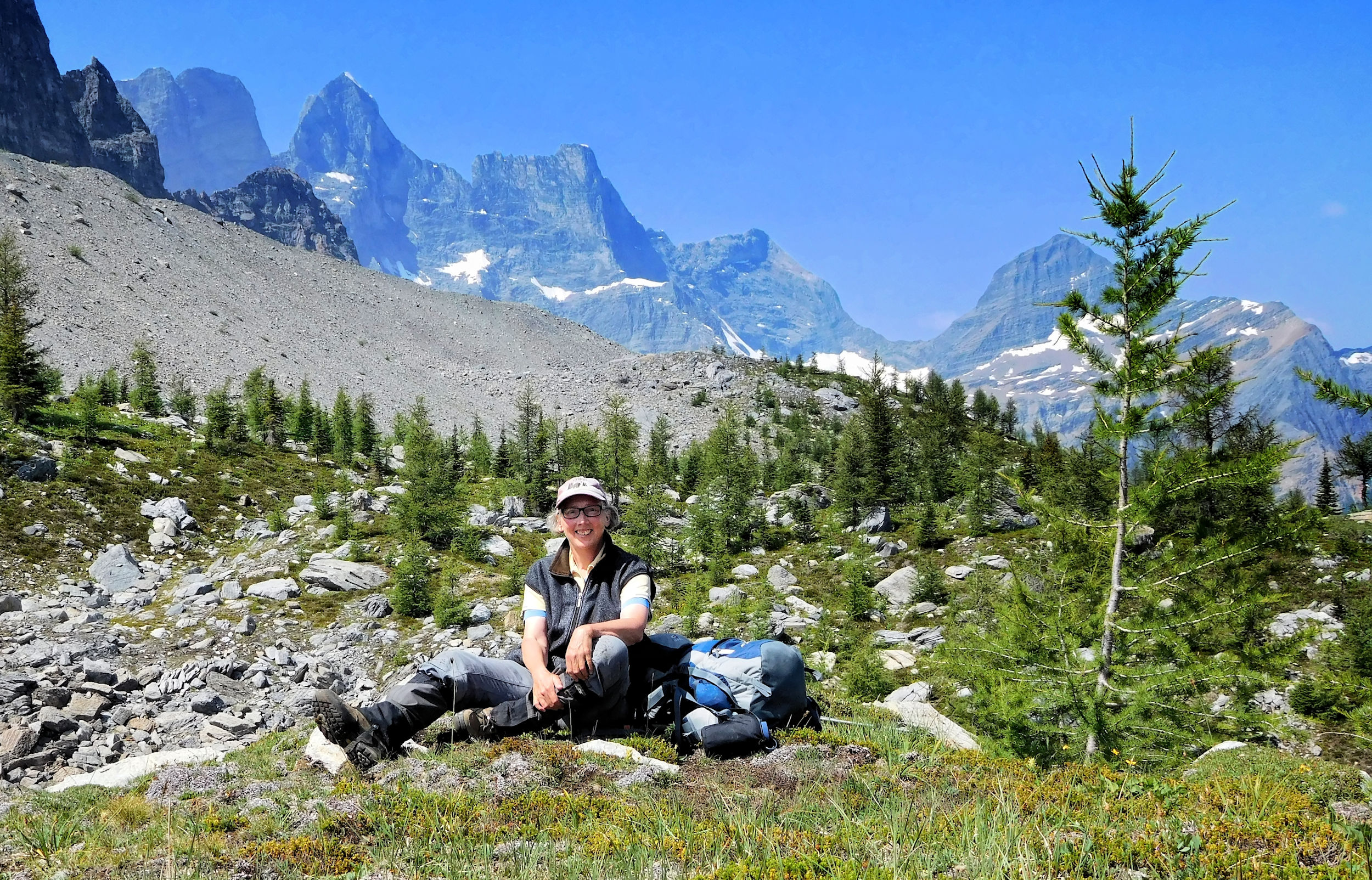
I catch up to a young couple from Victoria. They also hike to Tumbling Creek campground today and we will pass each other a few times on the way. For my lunch break I find some boulders above the trail. I sit down in the midst of beautiful wildflowers and enjoy a magnificent view and a sandwich.
After about 8.5 kilometers of hiking from the campground, I cross Rockwall Pass. The view is one of the most impressive on the entire trek.
Rockwall Pass 2224 m
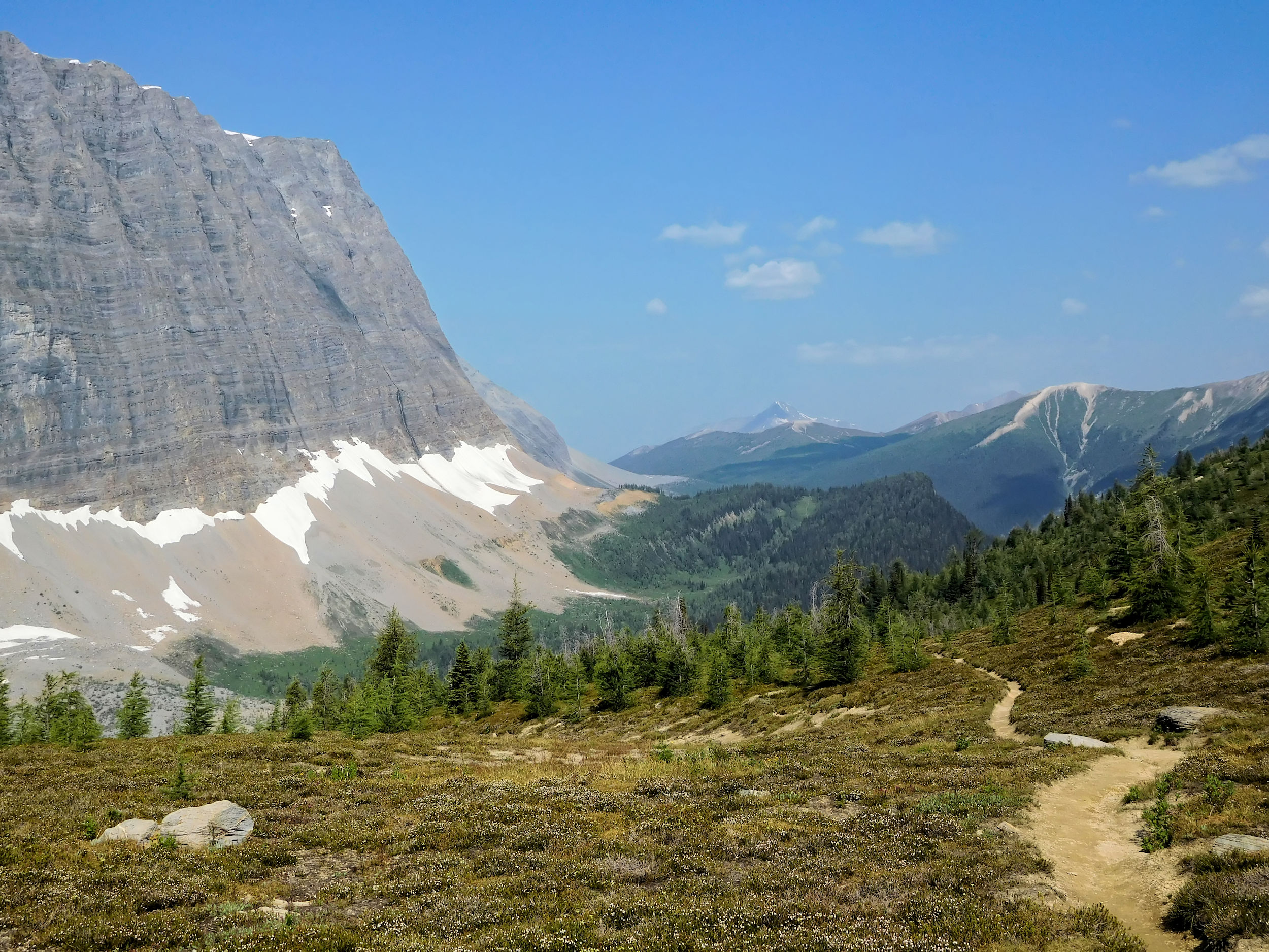
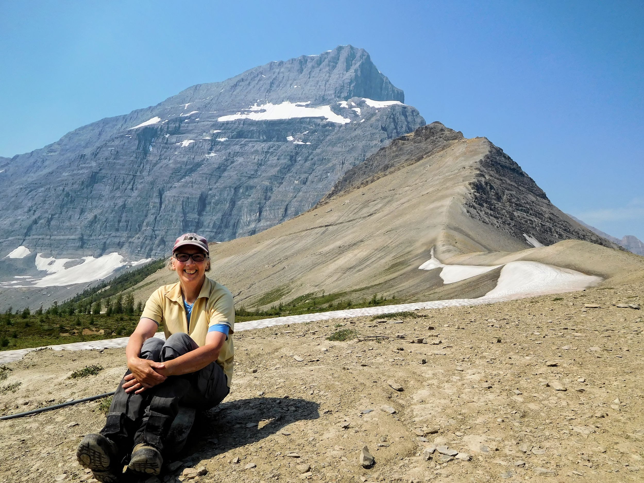
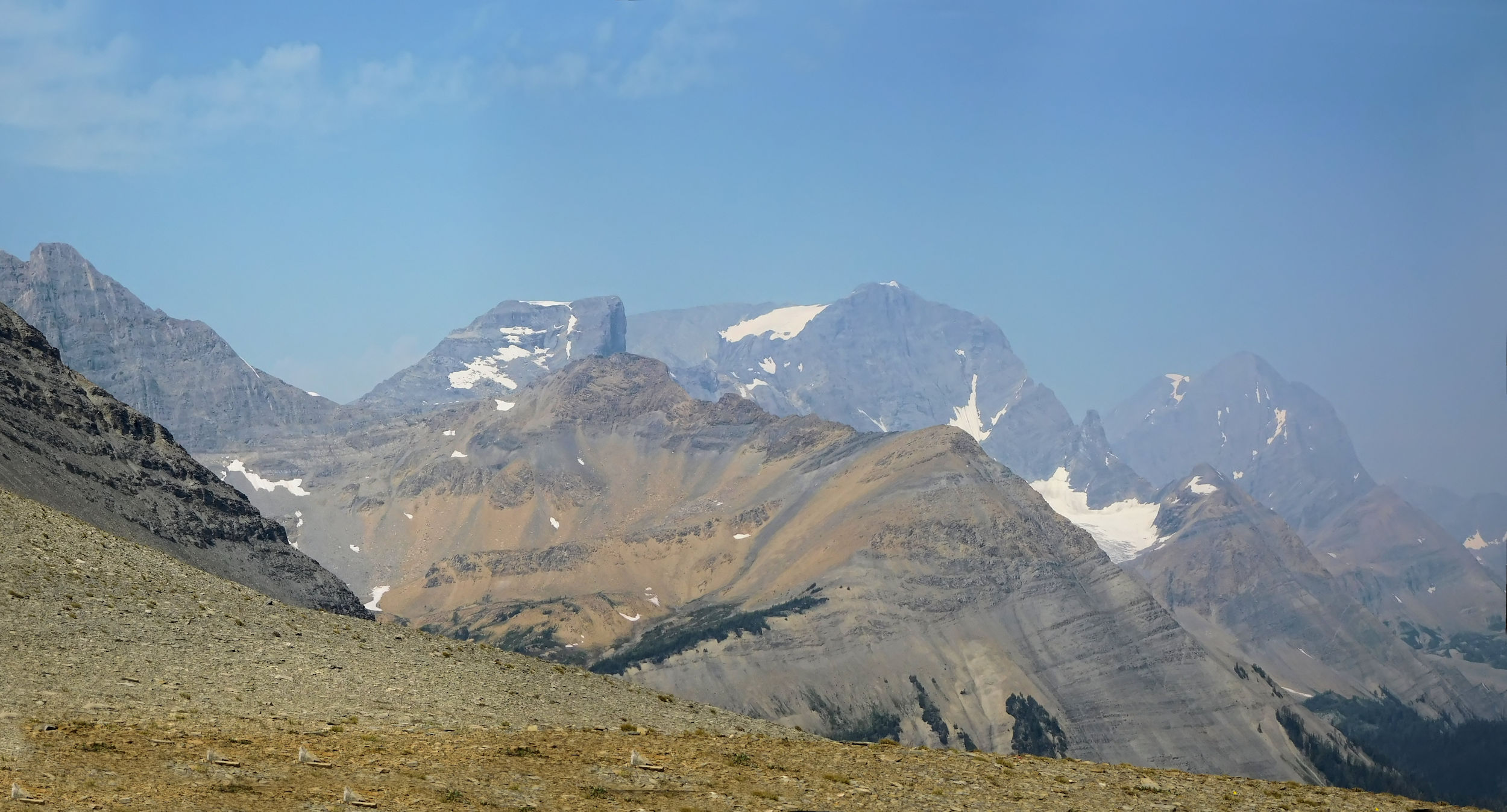
Not far behind Rockwall Pass, I reach the turnoff to Wolverine Pass. Bordered by Mt. Drysdale to the north and by Mt. Gray to the south, this is the only gap in the entire Rockwall. From there the Dainard Creek trail leads down to a backroad outside the park. I walk about 150 meters on it, up to a viewpoint of the Purcell Range. From a small mound I can even see the Bugaboos, which are part of the Purcell Mountains. The view is too distant and hazy for a photo, though.
Mt. Gray at Wolverine Pass
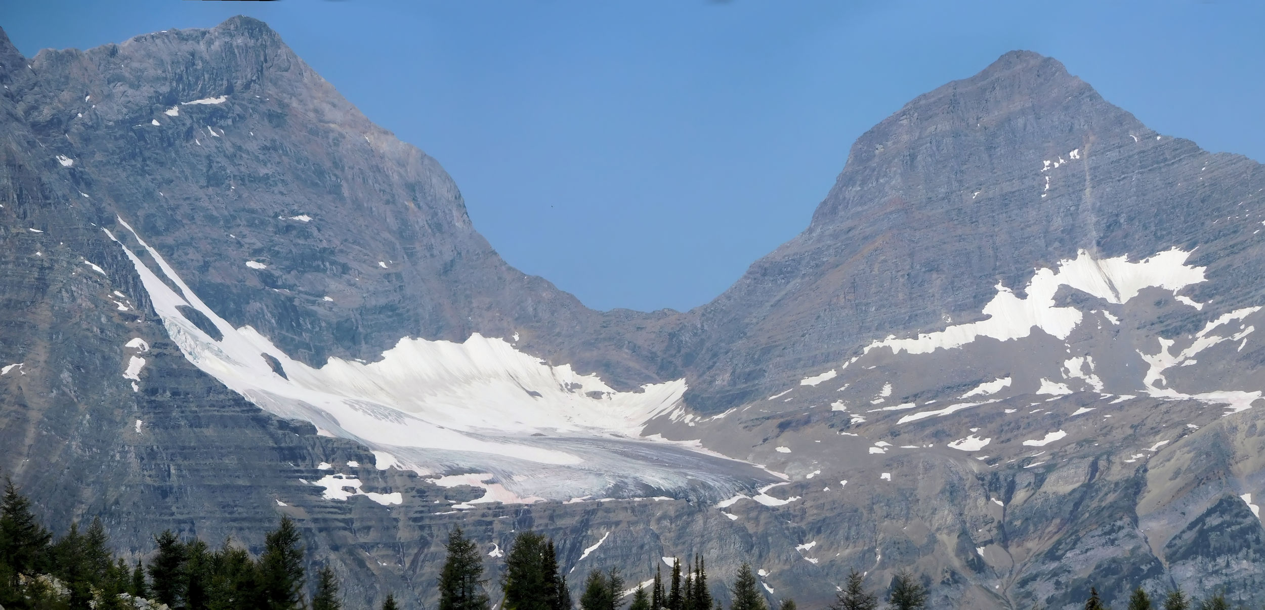
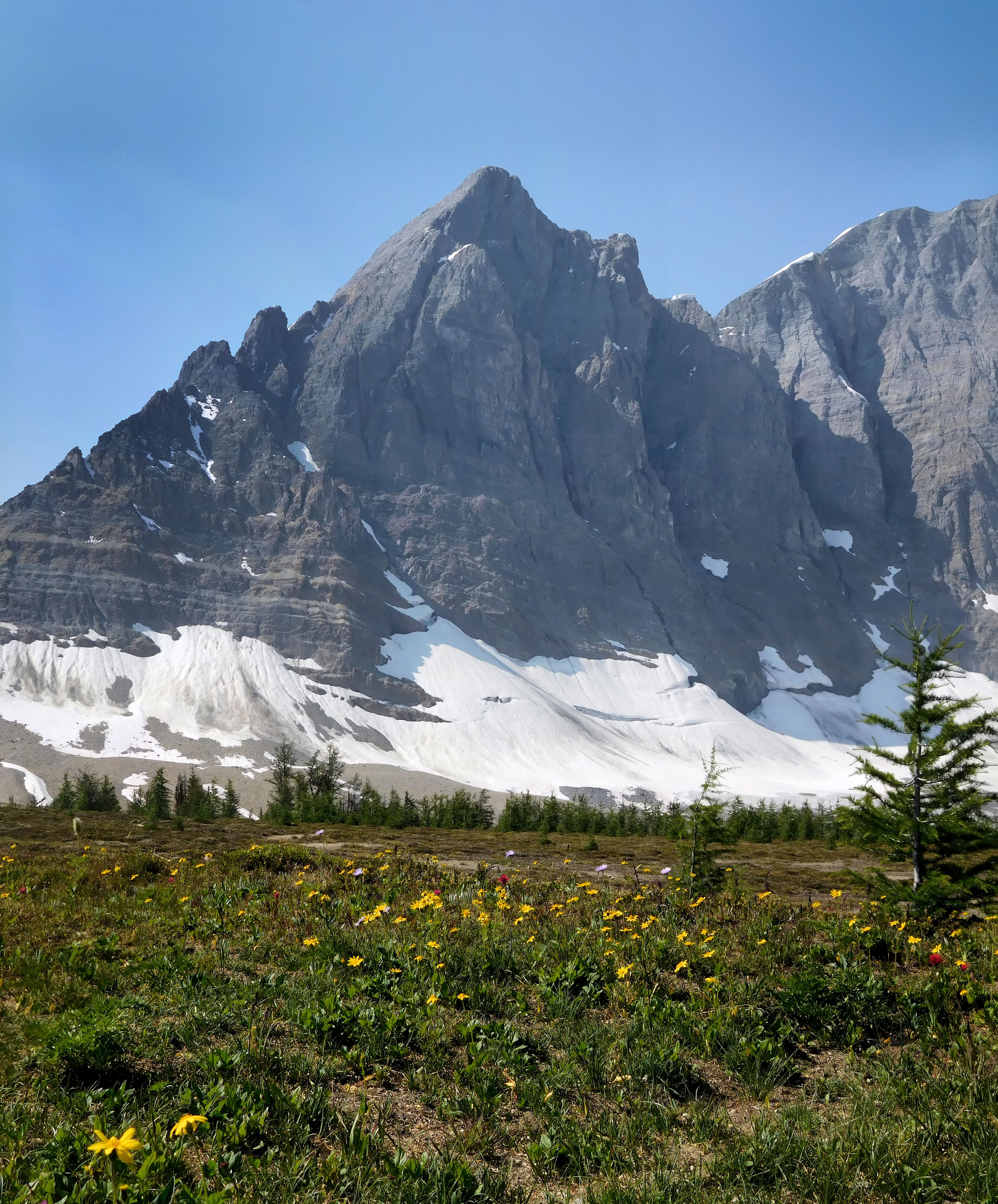
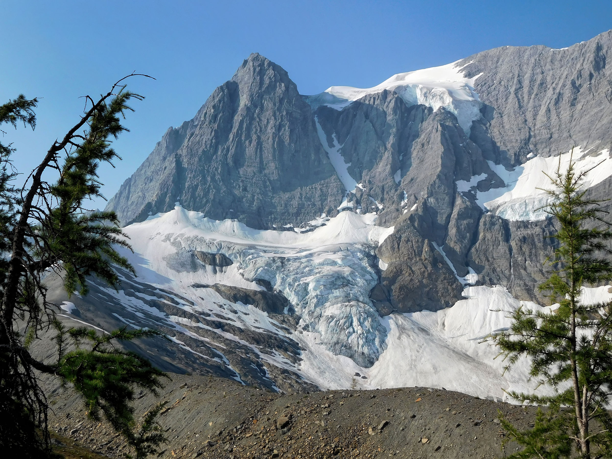
From the pass, I will drop 300 meters to Tumbling Creek campground, my destination for the day. The way down starts with a very gradual incline. 3145 m Tumbling Peak and Tumbling Glacier dominate the landscape.
Tumbling Peak and Glacier
I pass an unsigned turnoff, where I hesitate for a moment before I continue straight. Later on the campground I’ll find out that it leads to a ranger cabin. From here the trail becomes steep and switchbacks into the lightly forested Tumbling Creek valley. The creek’s name is very fitting; it tumbles wildly over many cascades until deep down in the valley it flows into Ochre Creek.
Down towards Tumbling Creek campground
Tumbling Creek campground spreads out on the north shore of the creek and is one of the nicest backcountry campgrounds I've seen so far. It has 18 sites that are scattered throughout a very large area of meadows and trees. There are several dining areas with picnic tables and bear-safe metal boxes for storage. I tour the site extensively to find the best location. Two rangers are in the process of renovating one of the outhouses. I thank them for undertaking this unpleasant and smelly work. They surprise me with the news that they have finished the construction of a new bridge over Tumbling Creek. This means that one of the escape routes is open again to cut the Rockwall trail short. You can hike out to Highway 93S from here or - instead - start on the trail from down there.
Next to a small and quiet branch of raging Tumbling Creek, I find the ideal campsite. It provides access to water, is close to a picnic area and an outhouse and, best of all, it features some "furniture" consisting of tree trunks that can be used as a table and seat. There is even a view of the glacier.
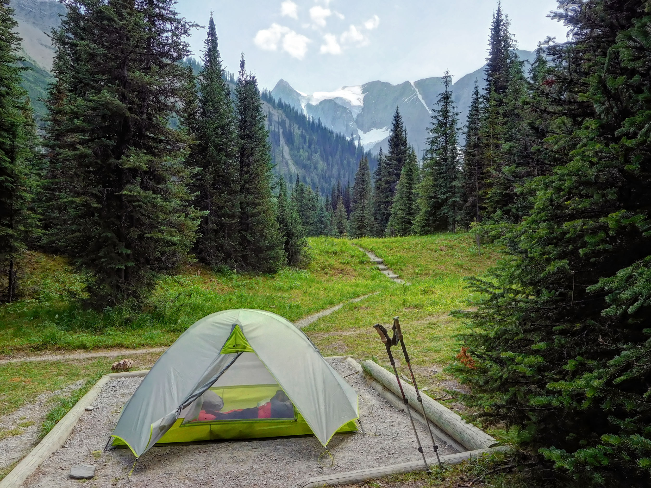
My tent spot
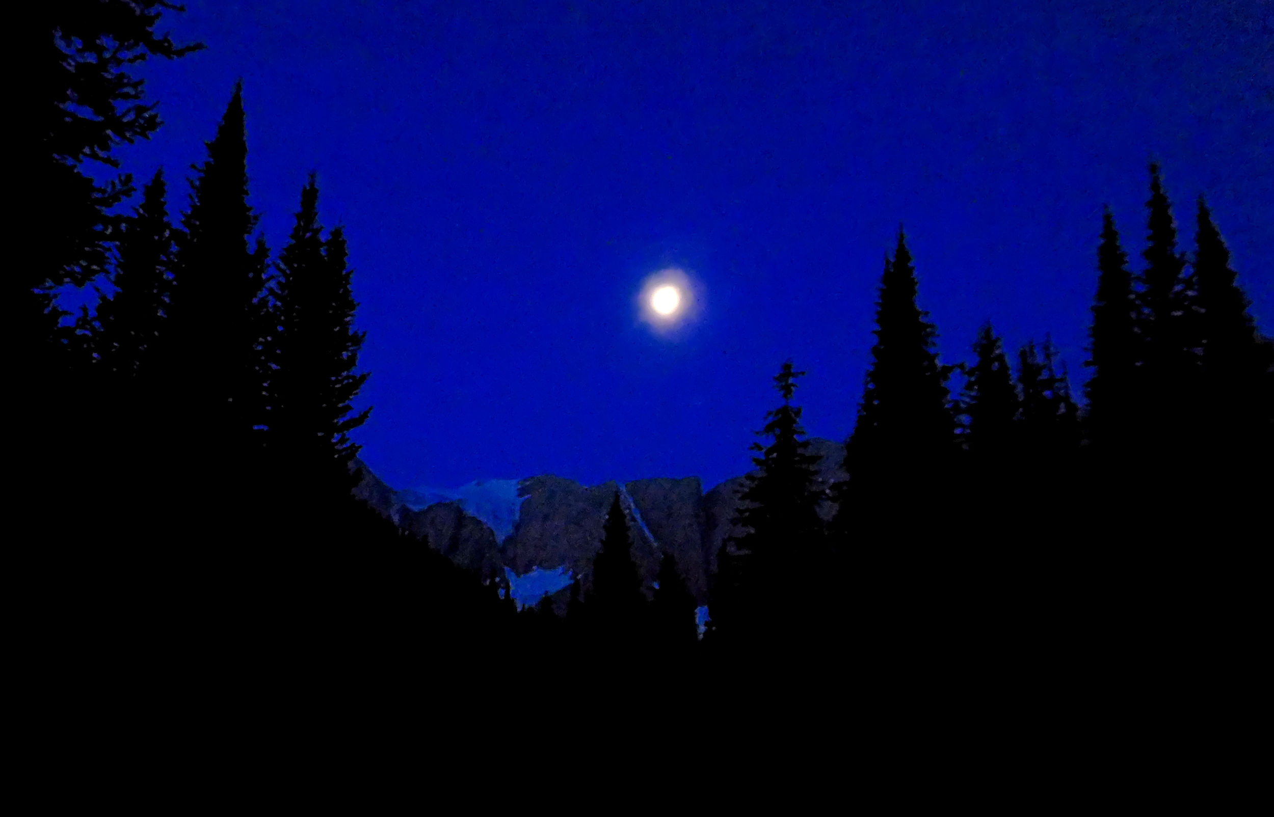
Full moon over Tumbling Glacier
A strenuous but extremely beautiful day has come to an end. With a full moon, my room still has a view in the middle of the night.
| Distance | 8.1 km |
| Time | 3 hrs |
| Incl. Breaks | 4 ¼ hrs |
| Min. Elevation | 1525 m |
| Max. Elevation | 2243 m |
| Descent | 718 m |
| Cum. Ascent | 538 m |
| Cum. Descent | 882 m |
Full moon above the Rockwall
In the morning, the full moon is still visible in the sky. The sun is shining and it promises to be a very hot day. I leave the campground going downstream. I quickly reach the junction between the Rockwall trail and the newly re-opened Tumbling Creek trail. From here it is only 10.5 kilometers to the Paint Pots where I started my tour. I cross the bridge, however, and walk up the other side of the creek to continue on the Rockwall trail.
Over the next three kilometers, the trail climbs out of the valley. Initially, there is only a gradual gain of altitude along Tumbling Creek, but soon it gets steeper. At the exit of the valley towers the majestic Rockwall. Today's hike is only eight kilometers, but with a 340 meter climb followed by a 700 meter descent, it's a tough one.
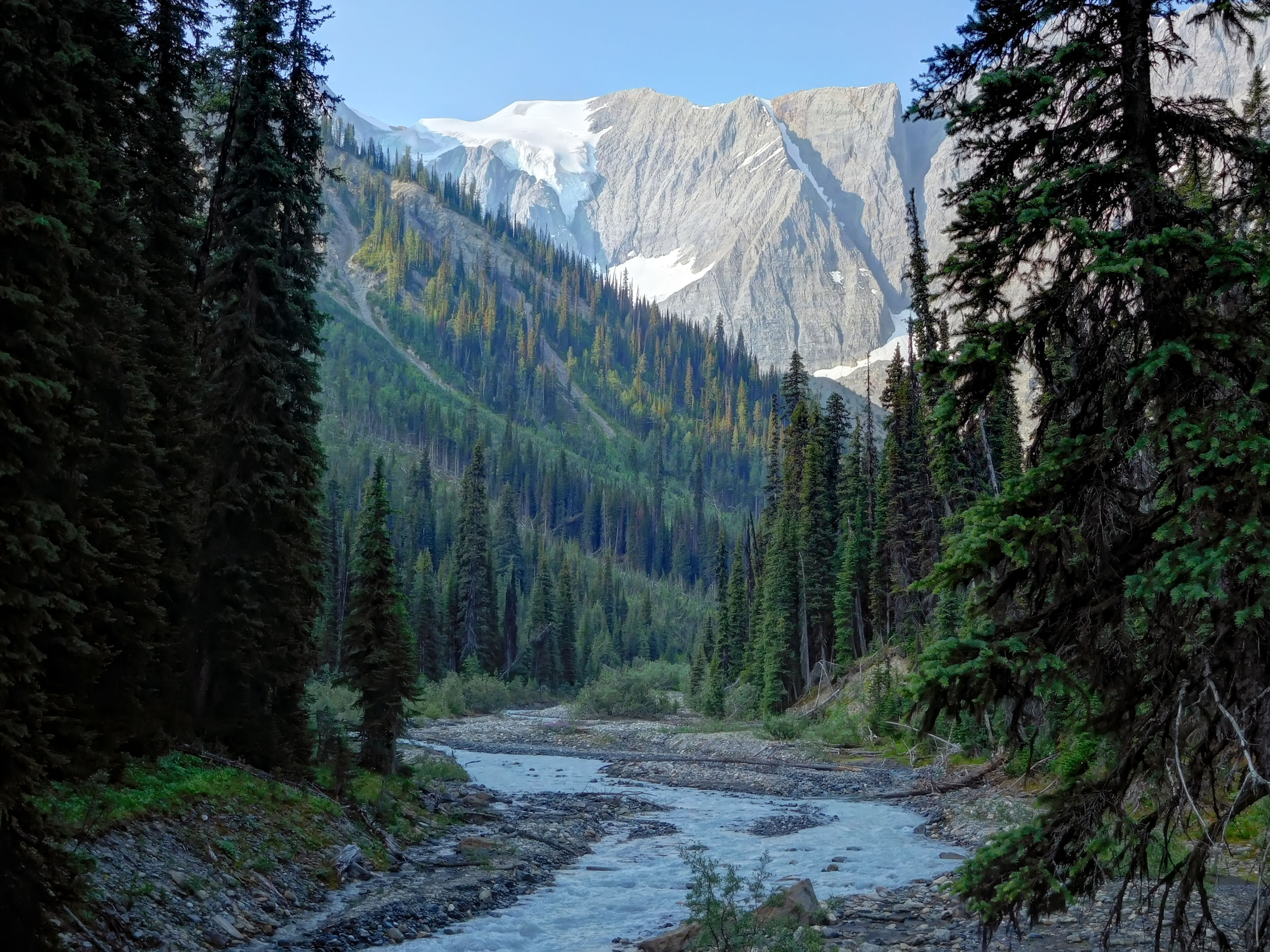
Looking from the Tumbling Creek valley to the Rockwall
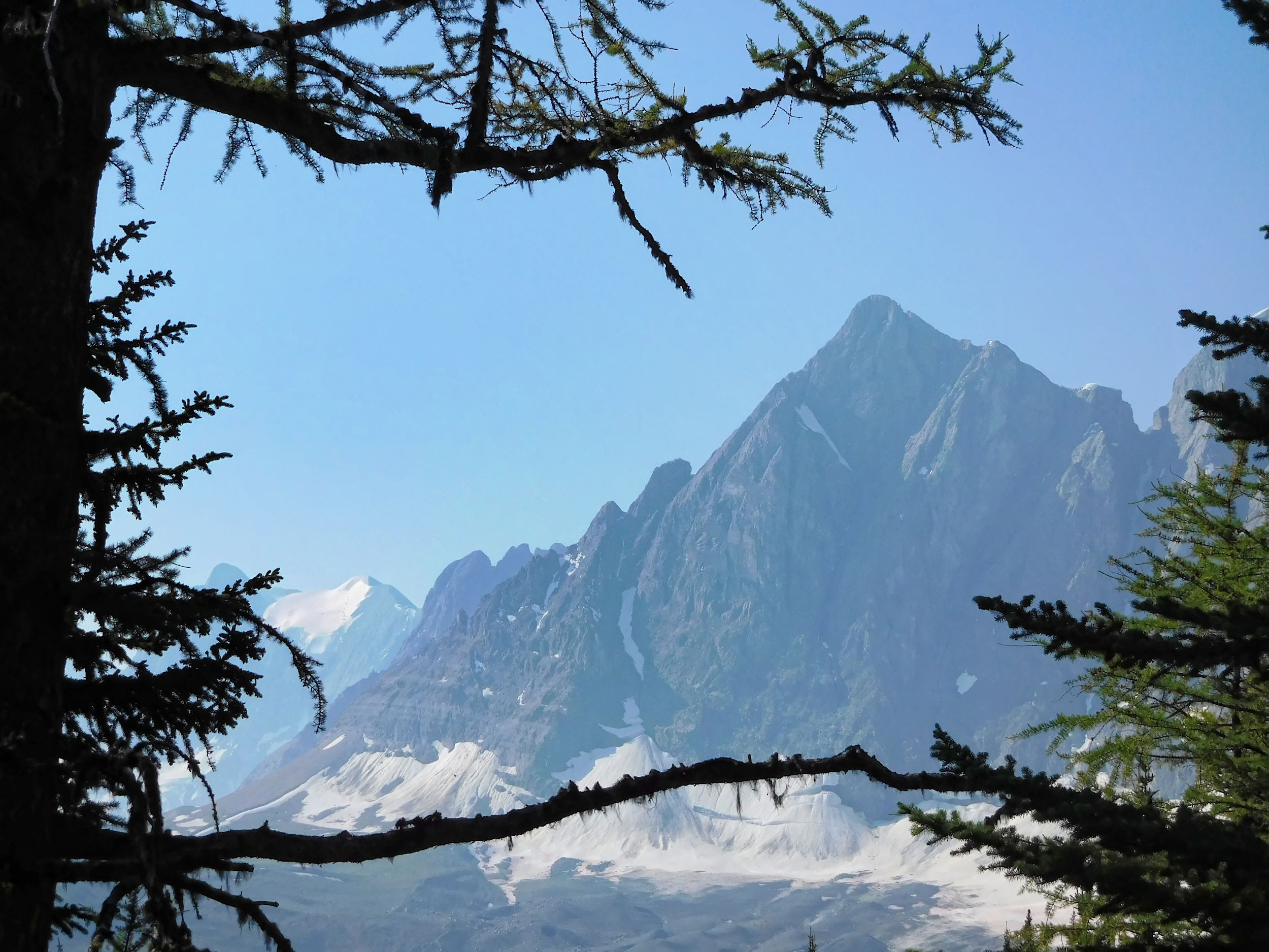
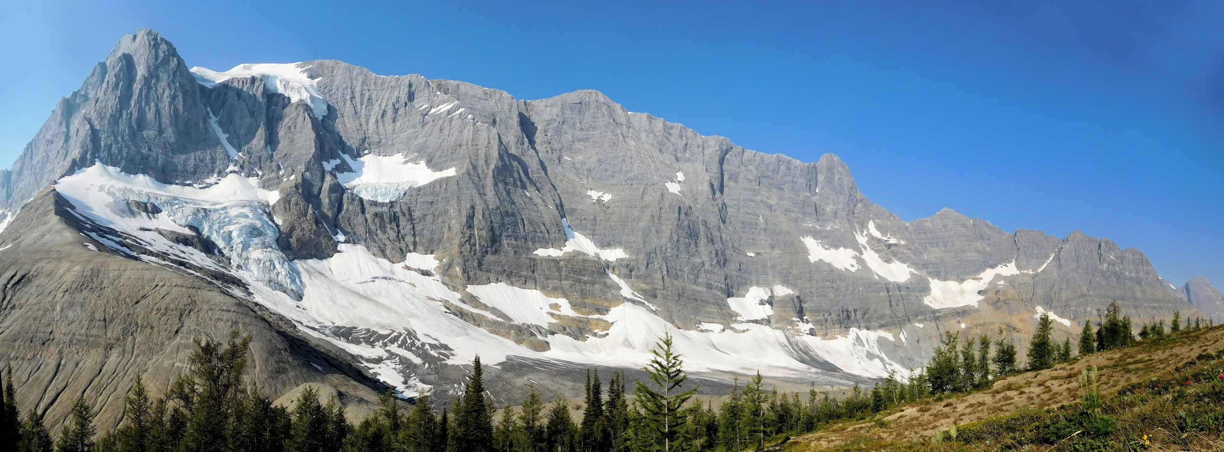
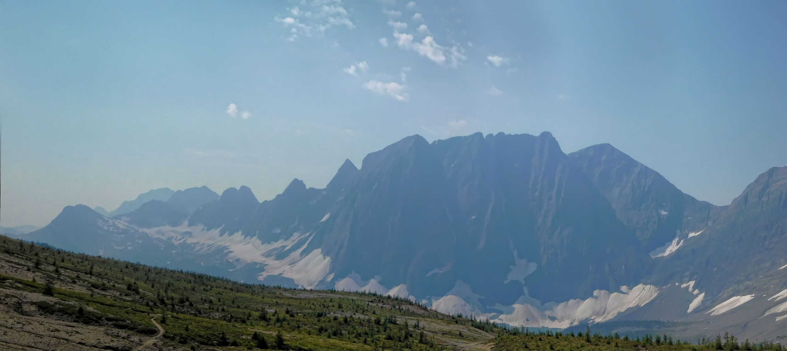
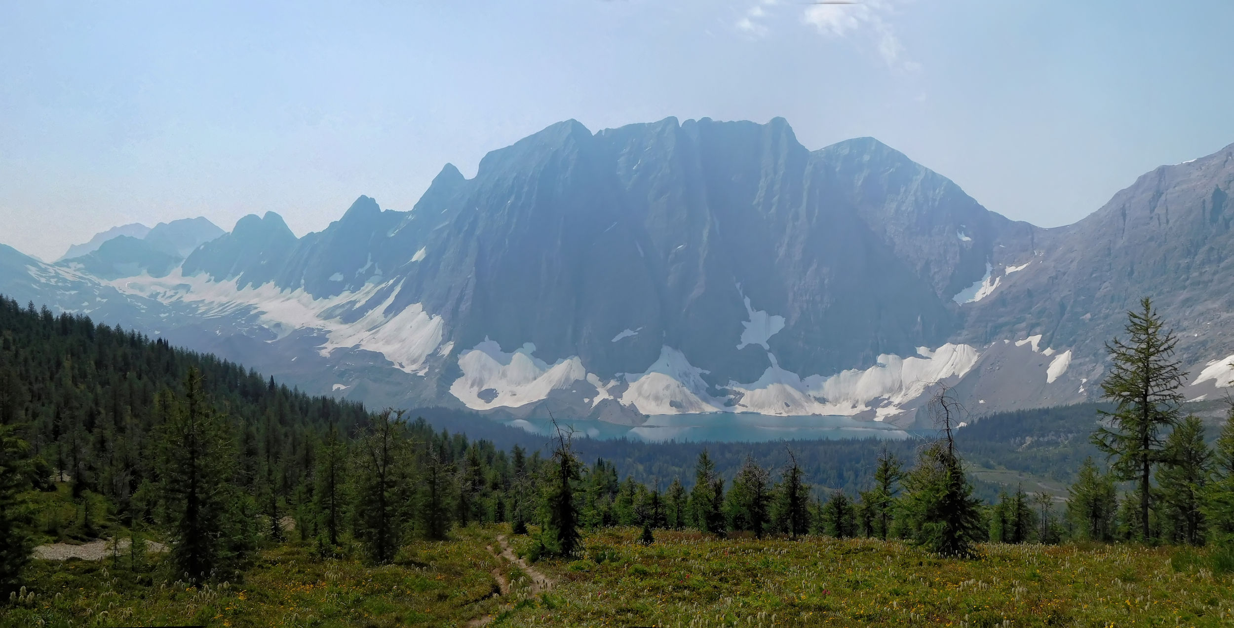
After having left the valley behind, I continue along the southern part of the Rockwall with Tumbling Peak and its prominent glacier being one of the main features. The southern Rockwall is picturesque and contrasts the rugged limestone wall of Limestone Peak in its northern part. Both are beautiful in their own way.
Southern Rockwall
Tumbling Peak 3121 m and Glacier
Looking north
I cross 2250 meter high Tumbling Pass. On the other side I find delighting alpine meadows full of wildflowers. The undemanding red Paintbrush even grows in a rock crevice.
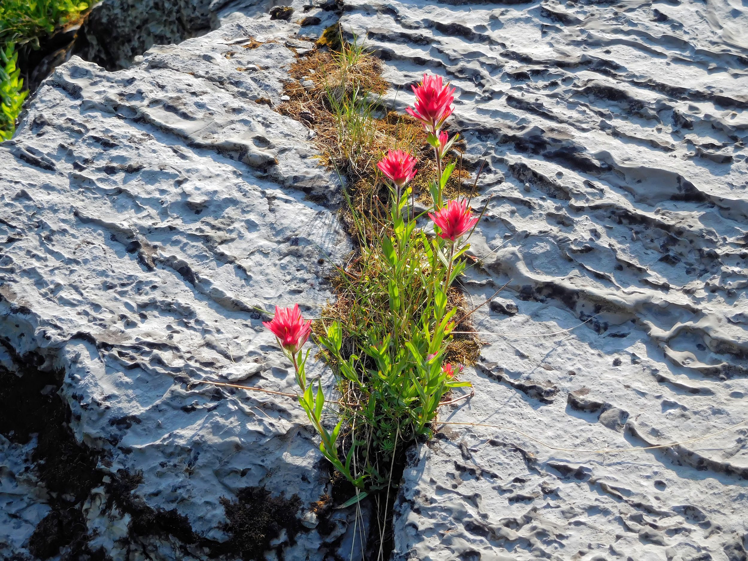
Paintbrush
Behind the pass, I lose a whopping 700 meters over the next five kilometers. At first the grade is easy, but then the path switchbacks down a steep avalanche slope overgrown with low bushes. It is quite hot here.
On the way down into the Numa Creek valley
Near the end of the slope, the path resembles a tunnel through a jungle of willows and alders. I shout and sing a lot in order to warn any bears of my presence. It is not a bear I meet, but another hiker, who is covered in sweat and asks jokingly if they serve beer at the top. The answer is no, of course, and I feel very lucky that I just need to go downhill in this heat.
The trail levels off and continues through a dense forest of tall trees and a lot of underbrush. Within a few kilometers, I have traversed several very different vegetation zones.
The Numa Creek exit to Hwy 93
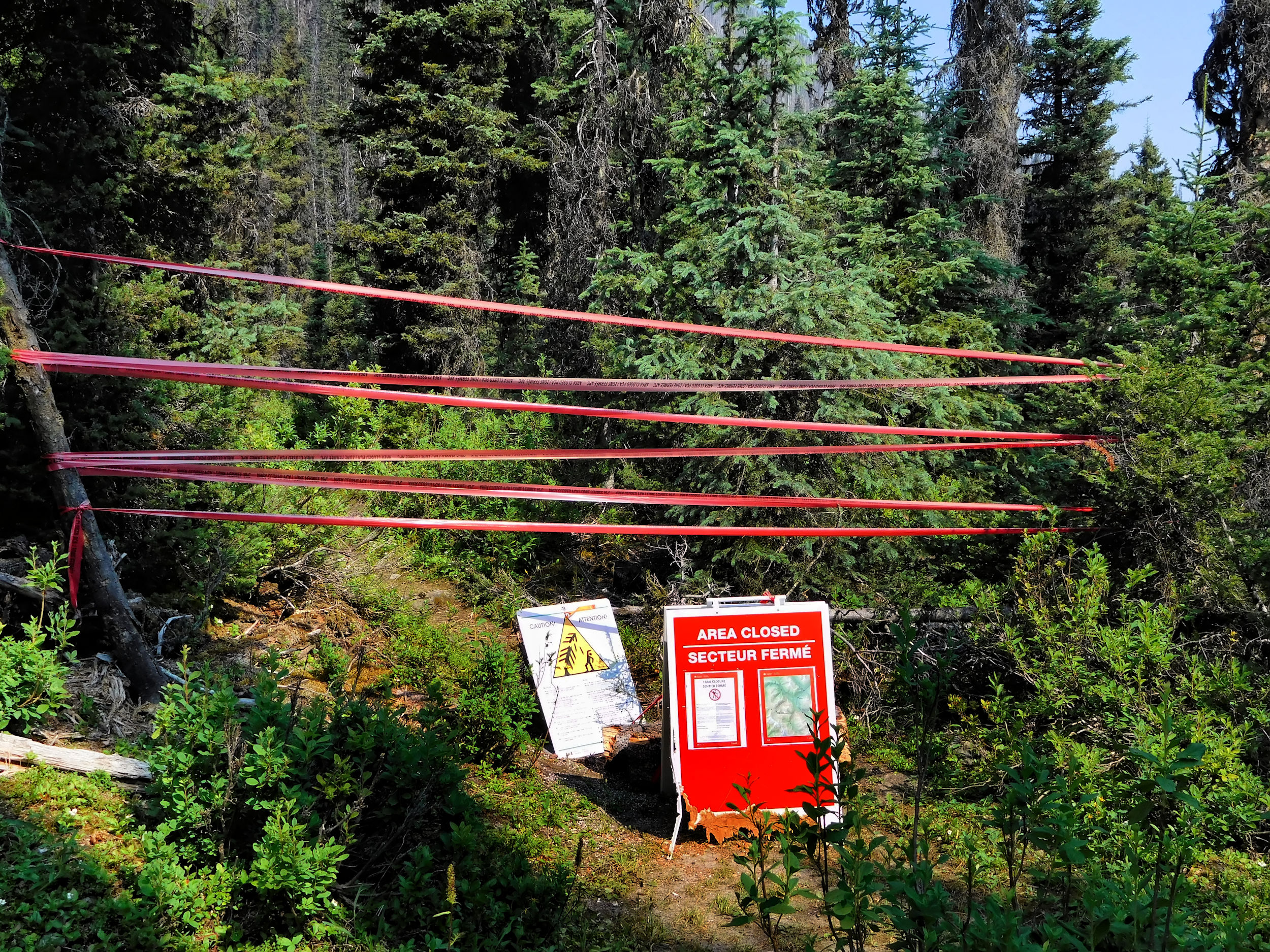
A huge number of broken trees bear witness to the many storms and avalanches that occur in the valley. The turnoff to the Numa Creek trail is cordoned off with red tape. This trail, just 6.5 km away from the highway, continues to be closed.
Only a few minutes later, I reach Numa Creek campground. It is located on the shores of torrential Numa Creek and provides 18 campsites. Compared to the other campgrounds along the Rockwall trail, it looks quite untidy. A lot of trees have blown over and the sawn pieces of their trunks are scattered about. Some of the tent sites further back are overgrown and have become almost indistinct. Hundreds of wasps occupy the only outhouse and make it pretty useless. In this heat, it also releases an awful stench.
The sites near the creek are taken, so I pitch my tent a little further back among the trees. I discover another wasp’s nest under a root in the ground right next to my tent. Fortunately, it seems to be a side entrance and the number of insects flying in and out is low. The many pieces of tree trunks and stumps turn out quite useful, as they provide some rustic furnishing. I sit down at the round "picnic table" near my tent for tea. My hiking colleague from 150 Mile House drops by for a visit. He and his daughter have been at the campground for a while already. Because of their dog and the expected heat, they had an even earlier start on the trail than usual. We talk about last year’s devastating wildfires in the Cariboo. 100 Mile House and 150 Mile House had to be evacuated and some houses were lost. Fortunately, theirs did not burn down.
I find a somewhat calmer spot by the roaring creek to bathe my tired feet and wash a few things. Even in the forest the air is hot and muggy, and the cool water feels very refreshing.
During the night, a strong wind comes up followed by a thunderstorm. With the humid heat of the previous day, this does not come as a surprise. Moreover, in the Cree language "Numa" is the word for thunder and lightning. During the storm and in the darkness of my little tent, I ponder the fact that we are trapped in a deep hole at the campground. In an emergency, we would have to climb at least 700 meters to escape. Fortunately, the storm ends soon and all is quiet again.
| Distance | 9.6 km |
| Time | 3 ¼ hrs |
| Incl. Breaks | 4 ¼ hrs |
| Min. Elevation | 1540 m |
| Max. Elevation | 2355 m |
| Ascent | 815 m |
| Cum. Ascent | 993 m |
| Cum. Descent | 493 m |
The storm has cleared the air and the weather is good again. Today I will reach the highest point on my hike: 2355 meter high Numa Pass. The trail climbs gradually through dense forest along Numa Creek. I cross several side creeks and get a first glimpse of Foster Peak between the trees.
‘Foster Peak
The entire Numa Creek valley seems to be prone to avalanches and landslides. Like on the descent the day before, I have to switchback through an avalanche slope on the ascent as well.

Not for horsemen!
This bridge over a tributary of Numa Creek would certainly not be considered by any horseback riders, even without the sign. With most boards missing, it poses a certain problem for hikers as well.
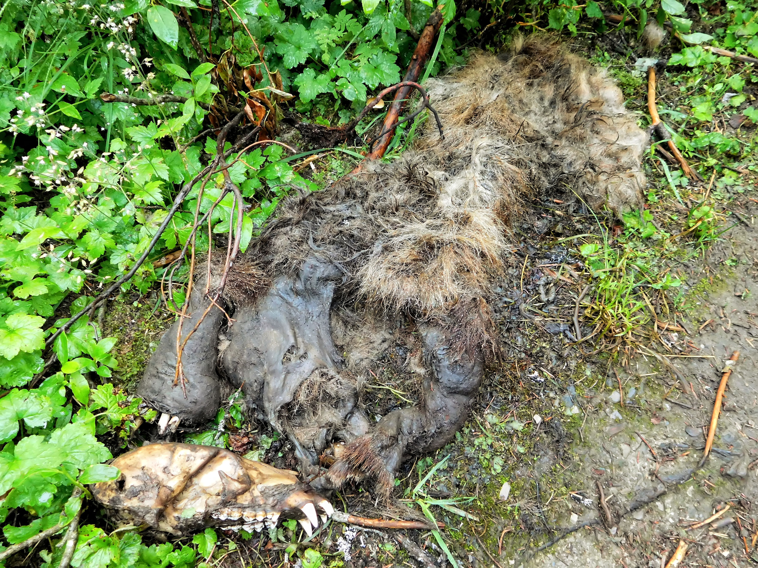
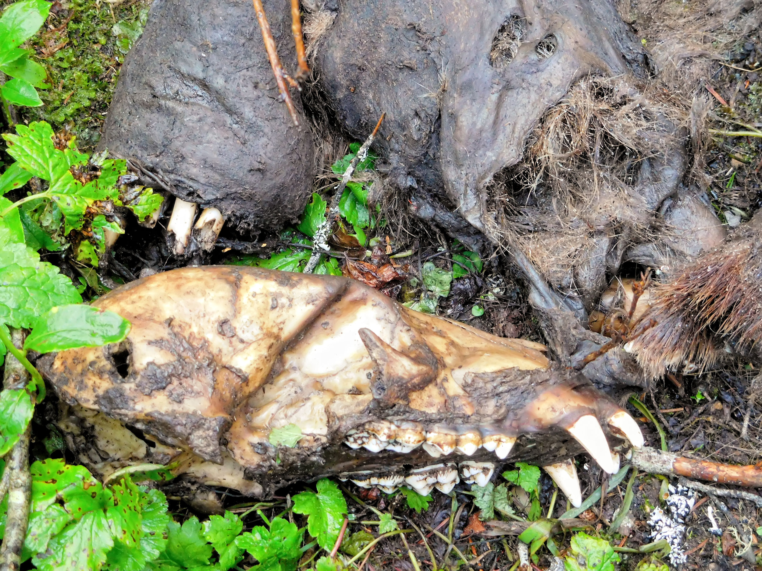
I come upon a decomposing animal cadaver lying by the side of the trail. Later in camp, there are different opinions about what it might have been. I suspect it was a wolverine, because of the large skull. They are very shy creatures, and chances are very low to get one in front of your camera alive.
The trail continues uphill and approaches Foster Peak. I am delighted by the view of a beautiful waterfall.
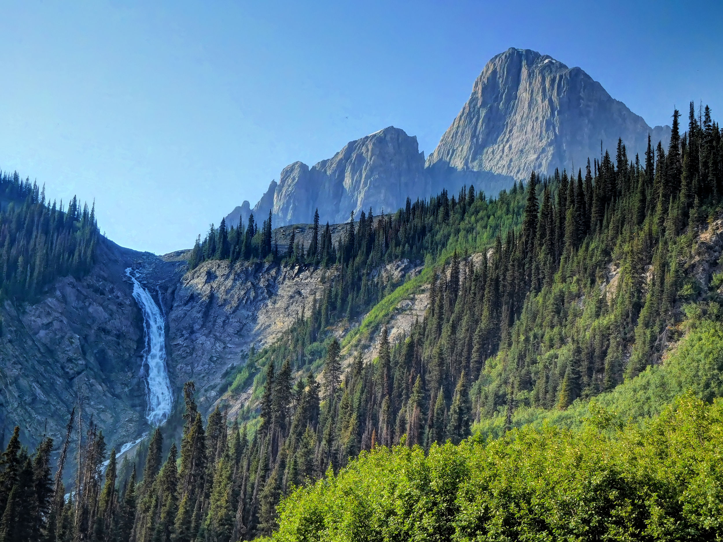
‘Foster Peak and waterfall
I have gone about three kilometers from the campground, when I have to negotiate a particularly long log bridge. Balancing the heavy backpack while “tightroping” over the narrow log, is quite precarious. Very carefully, I put one foot closely in front of the next. I manage to keep my balance, but my heart races. It takes a while until it calms down again on the other side of the raging water.
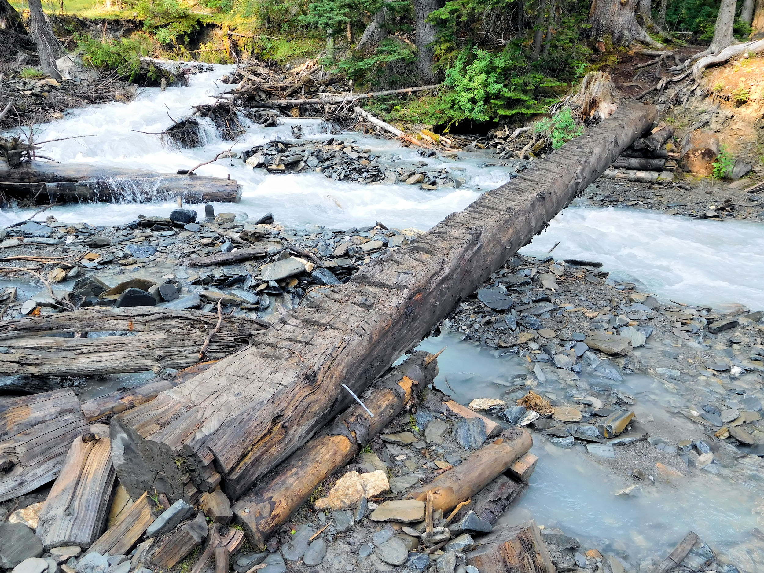
Log over Numa Creek
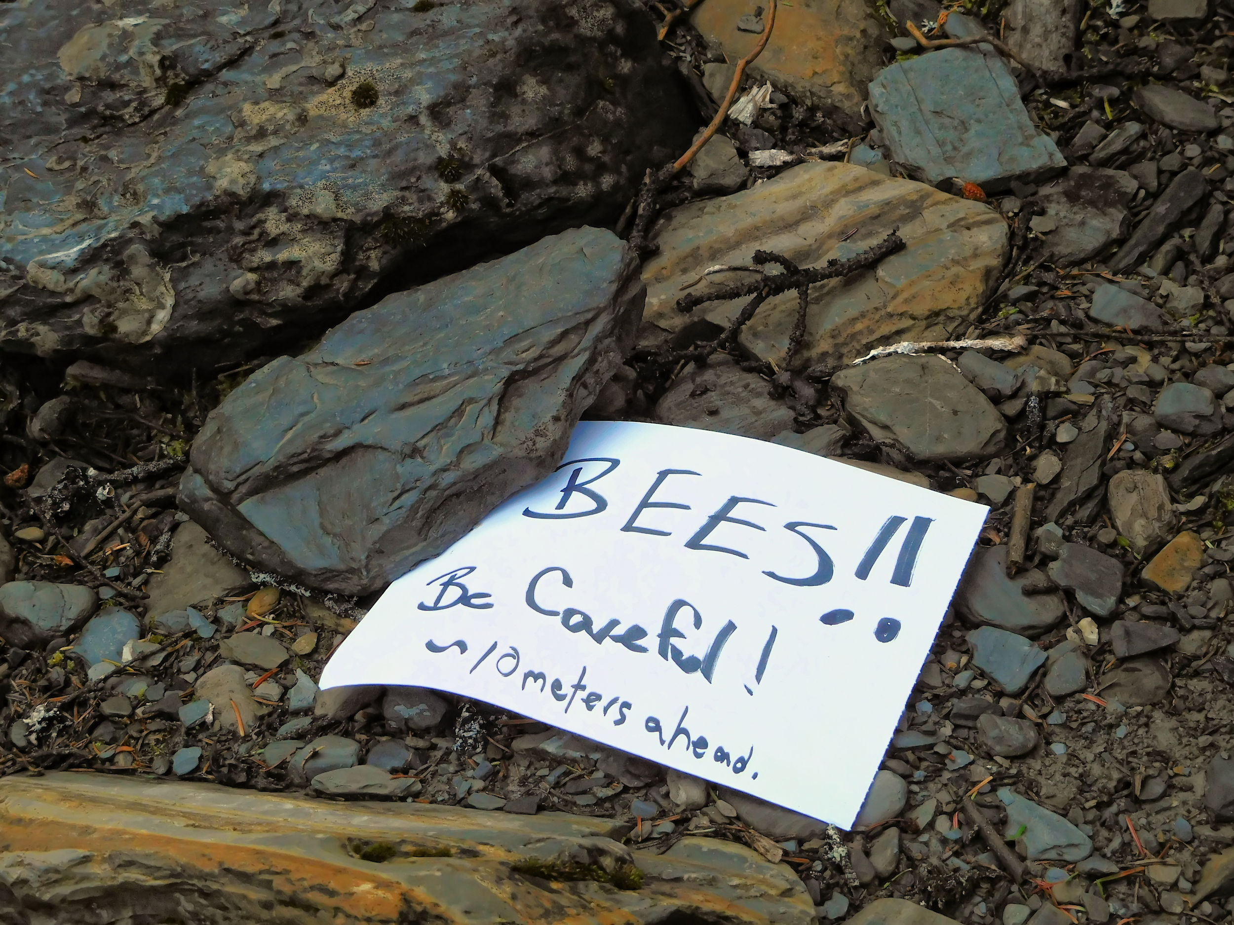
A female hiker comes towards me and warns me about a beehive behind the next bridge. This crossing is easy and I find her note, but no bees. Maybe it is a wasp’s nest, but also no trace of that. Needless to say that I am not keen on either of those stinging insects and prefer to enjoy the beautiful wildflowers around here undisturbed.
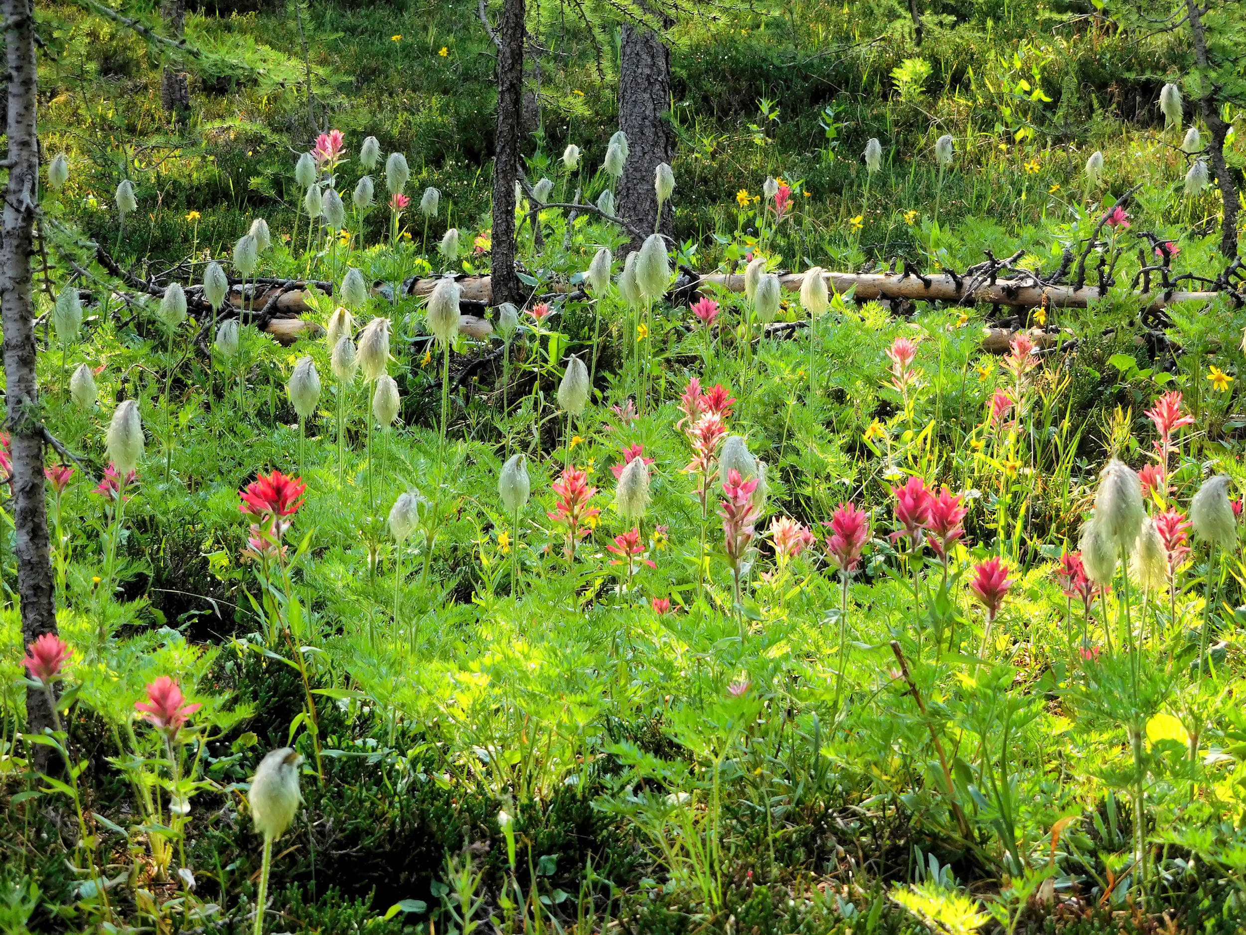
Wildflowers on the way to Numa Pass
The path becomes much steeper. Over switchbacks I climb out of the forest into the alpine zone.
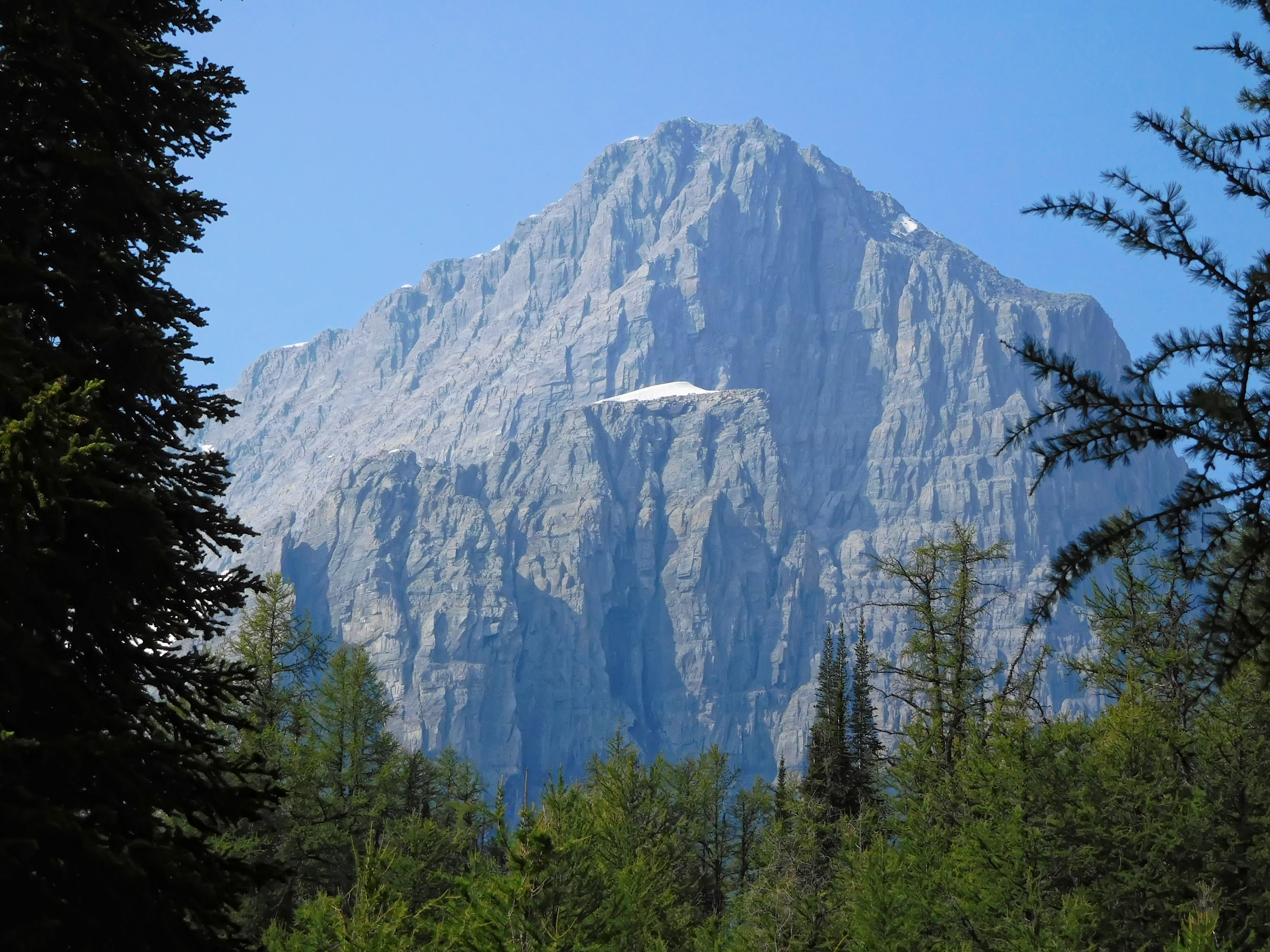
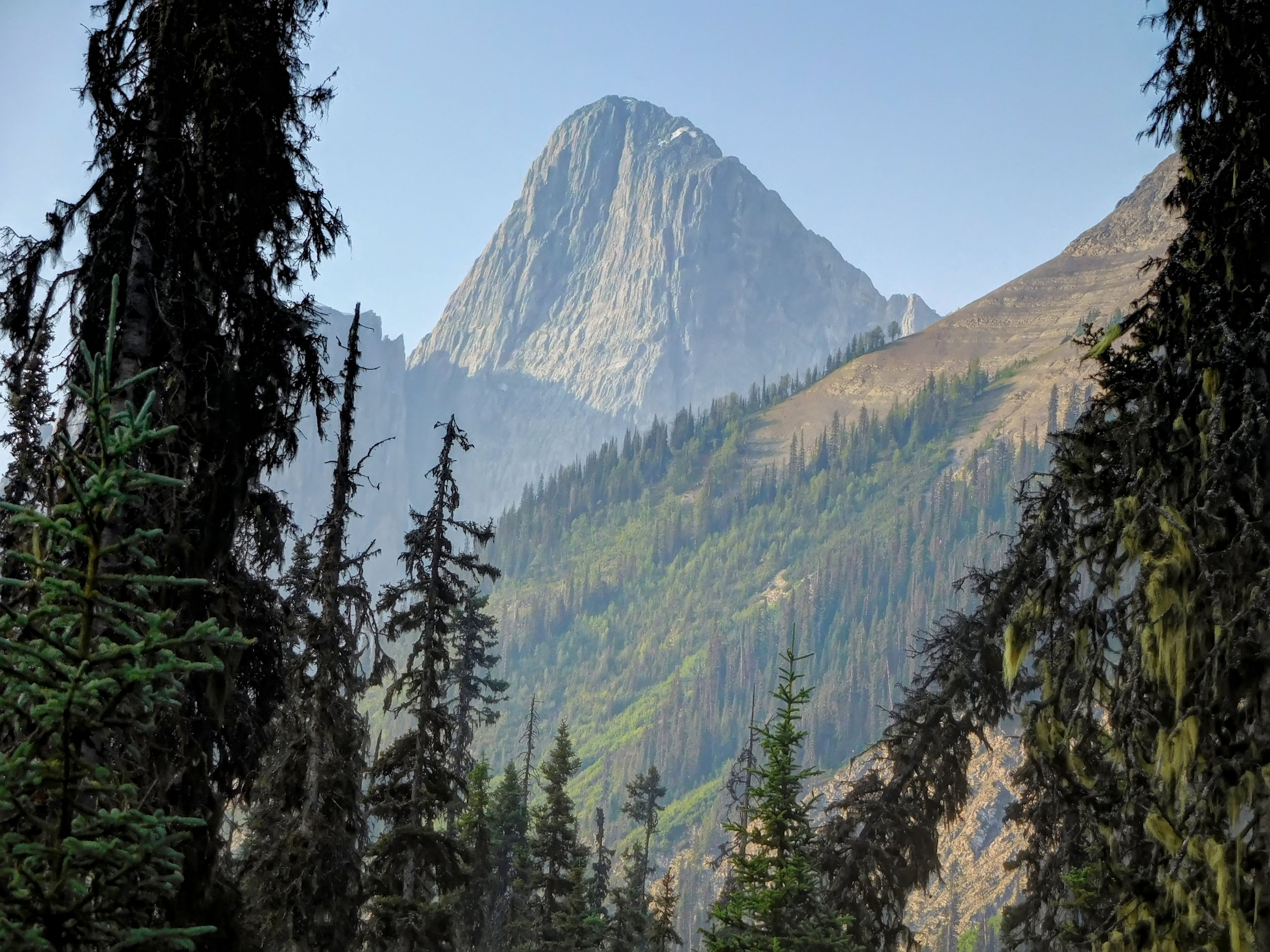
Foster Peak 3204 m
The abundance of larches means that the top of the pass is near.
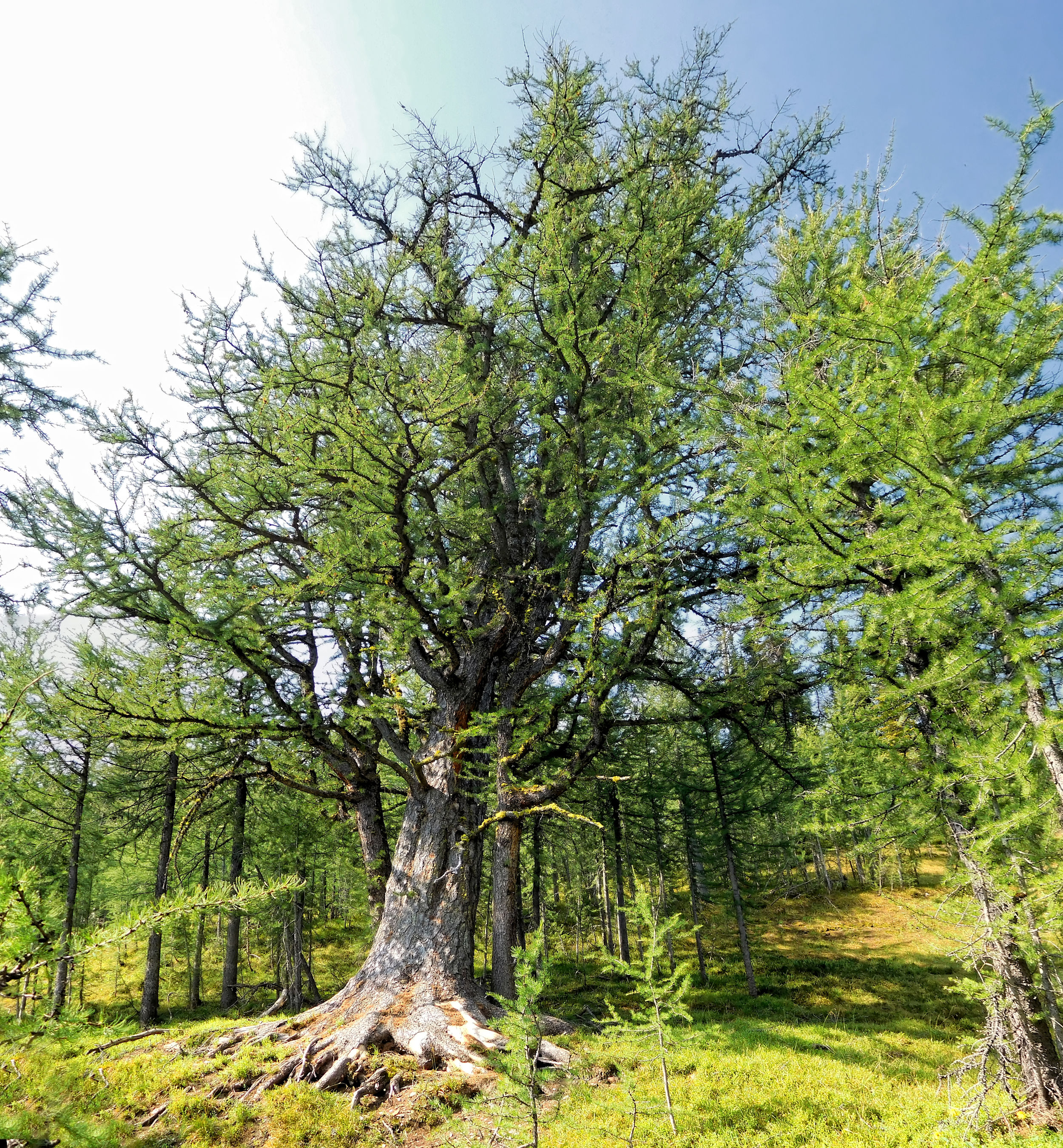
Larches near Numa Pass
Looking back over the valley, I am elated and all efforts to get here are forgotten.
Climbing Numa Pass
The final climb leads over a scree covered slope to the pass.
Scree path up to Numa Pass
Numa Pass
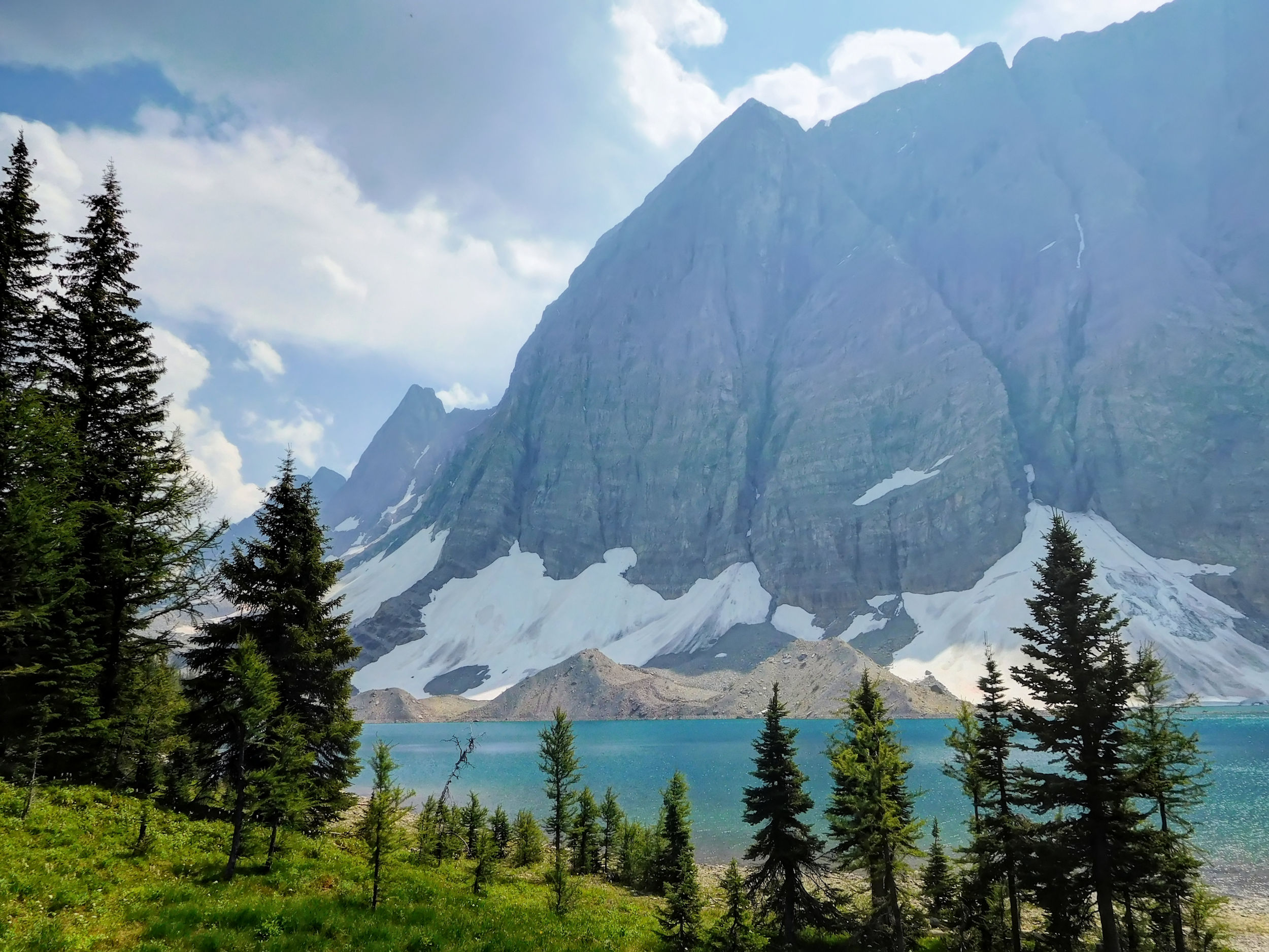
On the other side of the pass, Floe Peak and Floe Lake create a dramatic composition of mountains, ice and water.
Looking south to Floe Peak 3006 m
Floe Lake is named for the small icebergs (floes) that, before the glaciers receded, used to float in the water often. Unfortunately, the sighting of floes has become extremely rare.
Floe Lake
Short rest at Numa Pass
Looking back to Hewitt Peak 3066 m
The pass is marked with a cairn. Leaning against the pile of rocks is a large sign that reads "Area Closed". At first I think it's a joke; who would turn back after a climb of over 800 meters and where to? However, last night's thunderstorm comes to mind and I realize that the air has been hazy for a while. Is it just haze, or smoke from a forest fire? I can’t smell any smoke, so I continue on my way south descending to the campsite at Floe Lake. Since none of my hiking companions who have started out from Numa Creek campground before me are returning, I assume that they have all taken the same decision to head on.
Descent to Floe Lake
Sign at Floe Lake campground
I reach Floe Lake campground, which is located on the lake, directly opposite of the glaciers. The two tent sites with the best views are already taken. All other tent sites are on a slope hidden behind trees. I find an unmarked decommissioned site above the picnic area. I pitch my tent there and head to the lake to join the other campers who sit at the picnic tables enjoying the sun. The heat dares some of them to take a swim in the glacial water. They dive from a rock and come up snorting and well refreshed.
We exchange the latest news, talk about the carcass, the bees, the crazy bridges and the strange closure sign on the pass. The sign is contradicted by the fact that two hikers came up on the trail early this morning, and it remains a mystery for now.
Before the sky clouds over too much, I go for a stroll along the shoreline and take some pictures of this wonderful place.
I wash my socks in the lake, because I have no more fresh ones for tomorrow. I put them on the ground next to my tent to let them dry in the sun. They are quickly found by hundreds of flies. What a pest! At least they don’t bite.
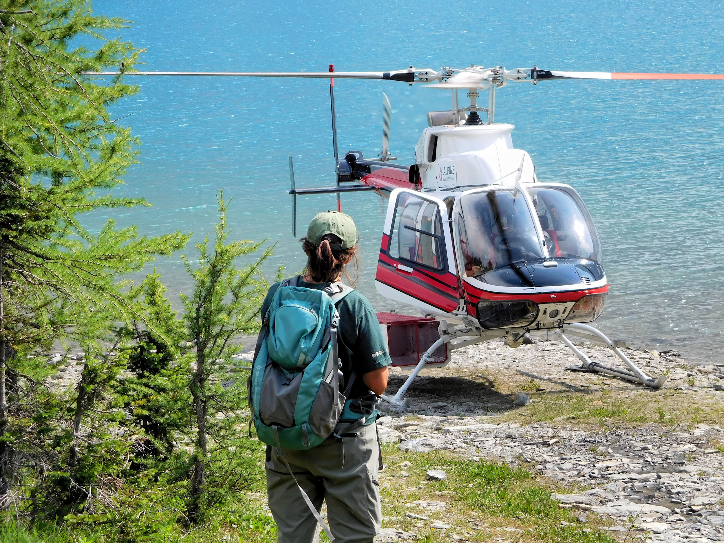
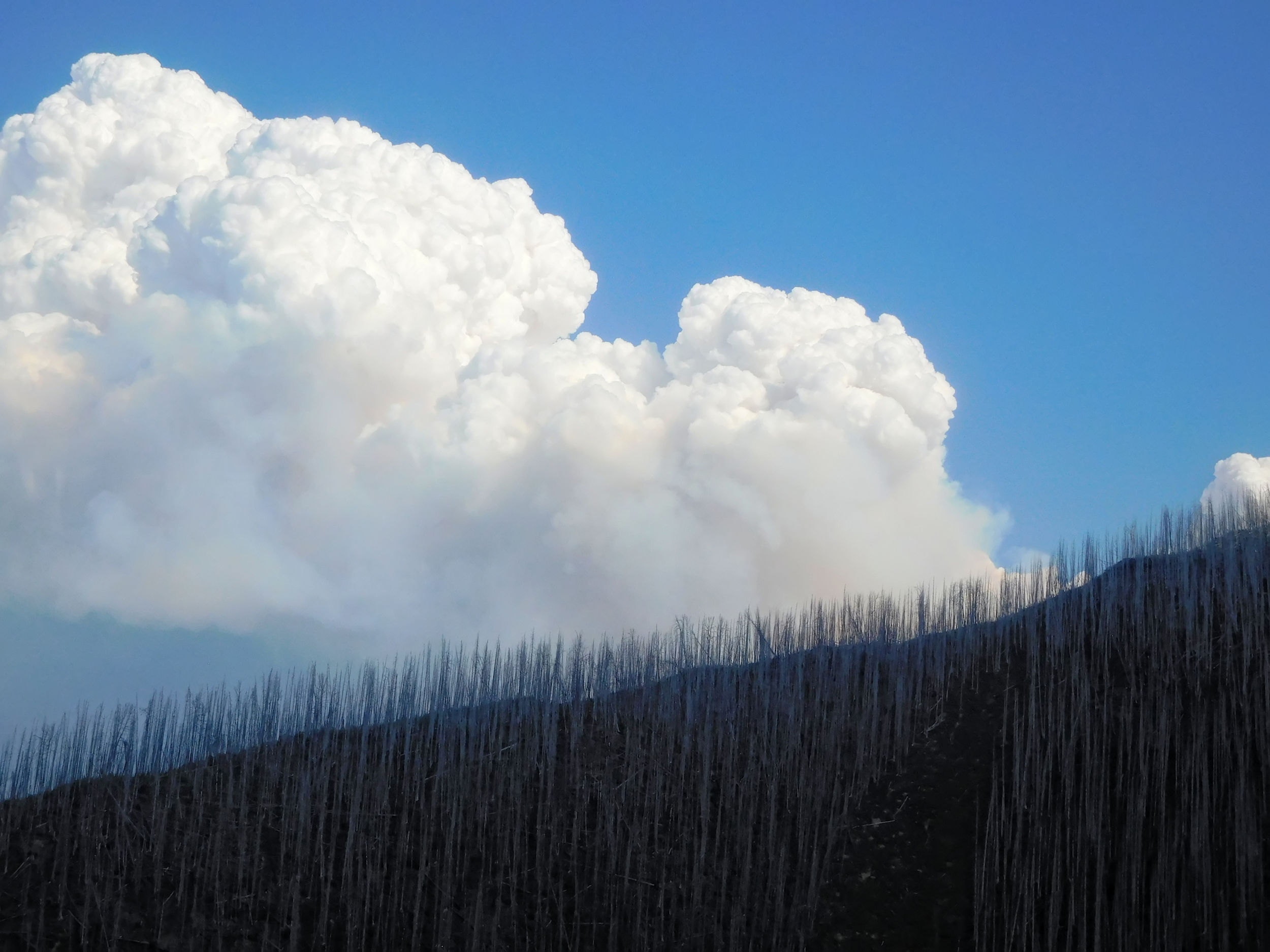
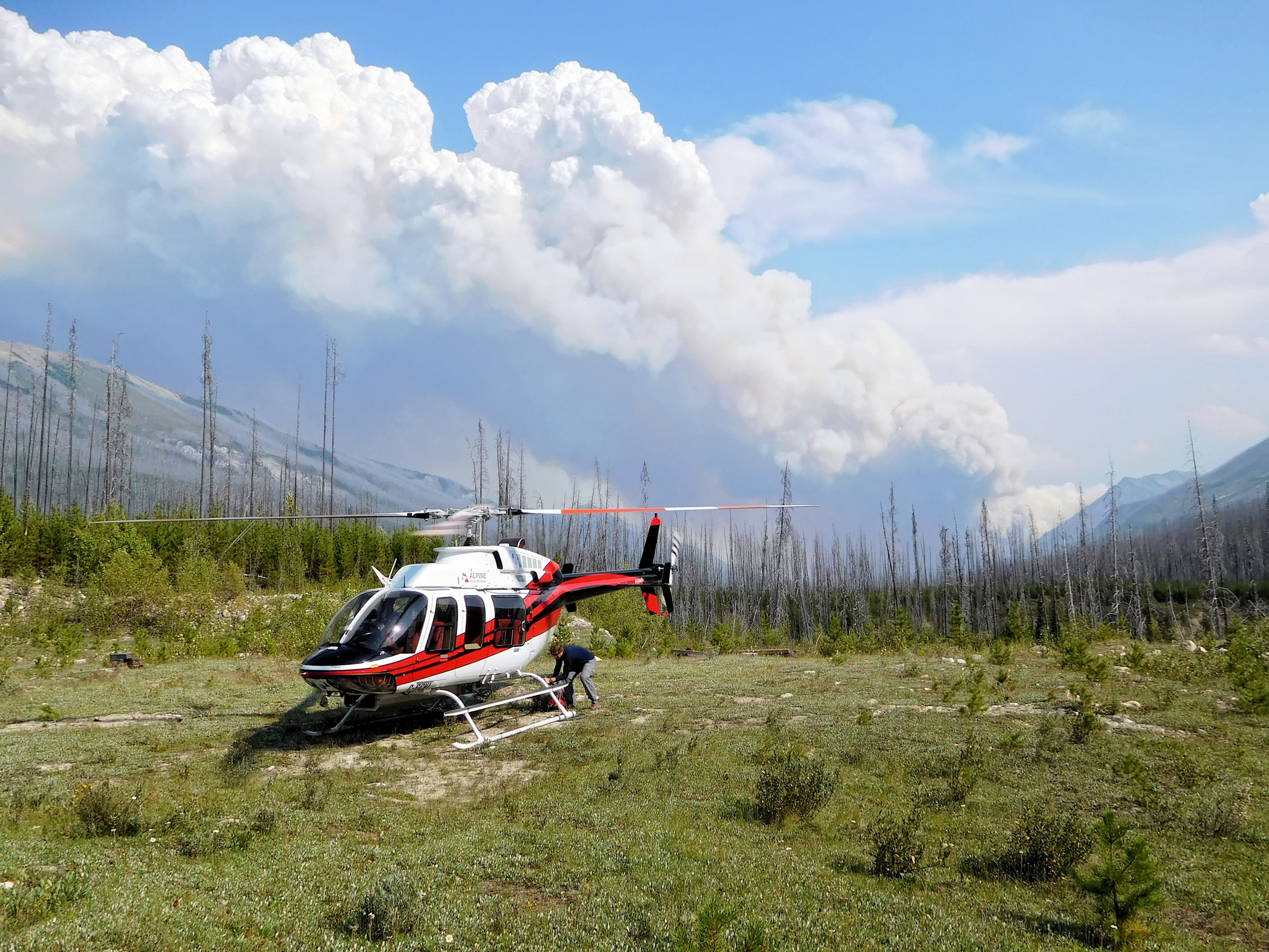
In the afternoon, a helicopter circles overhead. This is not a good sign. Also, some fellow campers have spotted a plume of smoke to the southwest of us. Moments later, the helicopter lands at the nearby ranger cabin. A female ranger makes the rounds and informs us that we are being evacuated. Last night's thunderstorm has started several forest fires. Highway 93S is completely closed, so is the Floe Lake trail. The two day hikers we talked to in the morning were the last ones to come up. The ranger tells us to pack up our belongings as quickly as possible and report to the cabin.
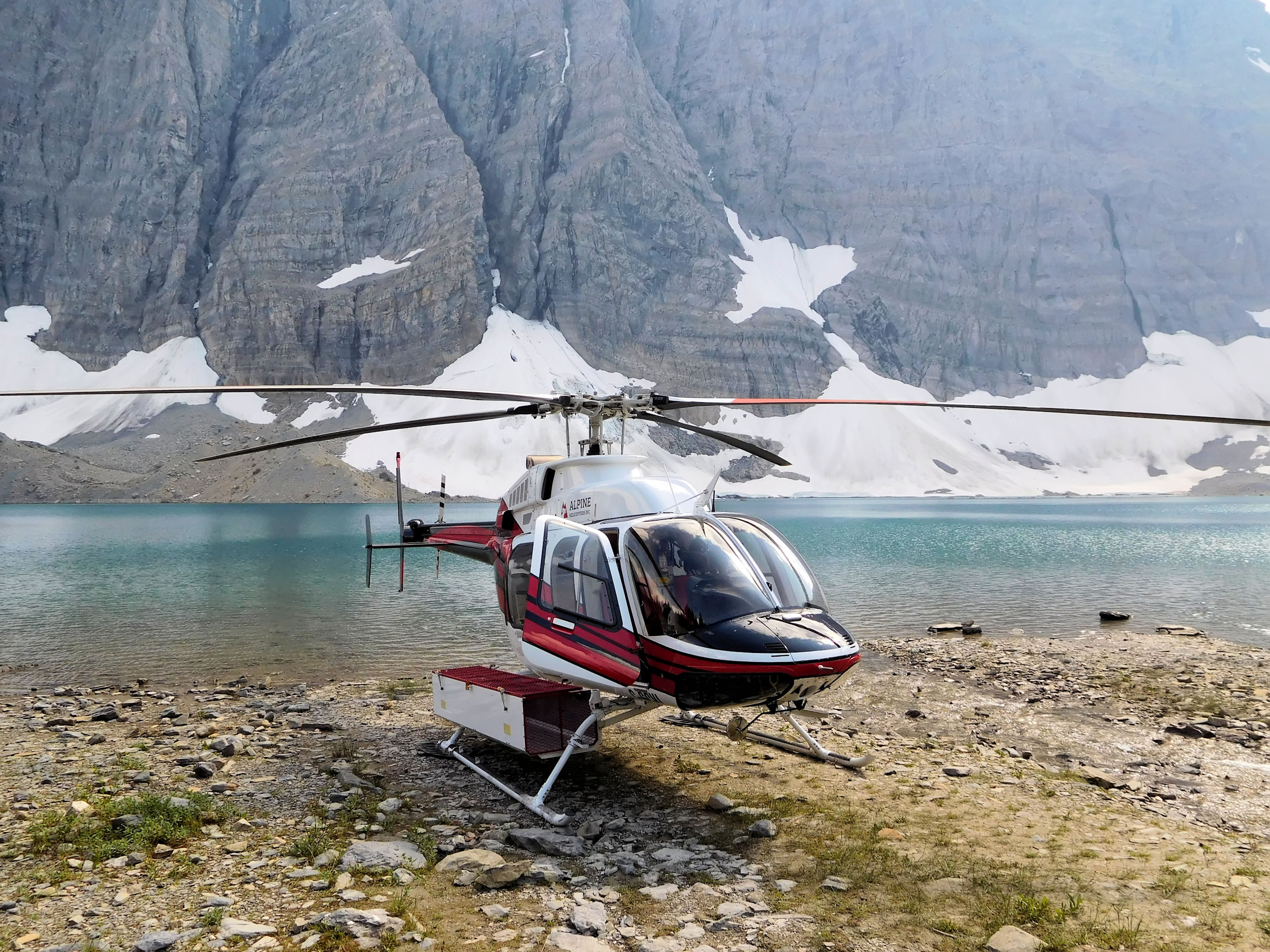
Helicopter at Floe Lake
What a commotion! Normally it takes me at least an hour to properly pack up my equipment. Now, however, I stuff my things indiscriminately and as fast as I can into the backpack and a few large plastic bags. Then I quickly take down my tent that I really don't want to leave behind. Hiking solo, I don’t have help and therefore I am last to arrive at the ranger cabin. I should not have worried; in order to evacuate 15 people, the helicopter has to fly several times. While waiting for the first flight, everybody calms down again. According to the ranger, there is no immediate danger at the moment, the fire being far enough away.
My friends from 150 Mile House are on the first flight, their dog traveling on the lap. We say goodbye and - with the past fires in mind - wish each other well. I'm on the second flight along with a family from Canmore and their two boys. The two were anxious at first, but when the pilot hands them helmets with walkie-talkies, they start enjoying the adventure. While the mother takes care of her two sons, the father, a helicopter pilot himself, is recruited by the rangers to help. He is responsible for the safe disembarkation of the passengers at the landing site.
Unfortunately my stay at Floe Lake now ends a day early. On the short flight, I take as many photos of the surrounding area as possible.
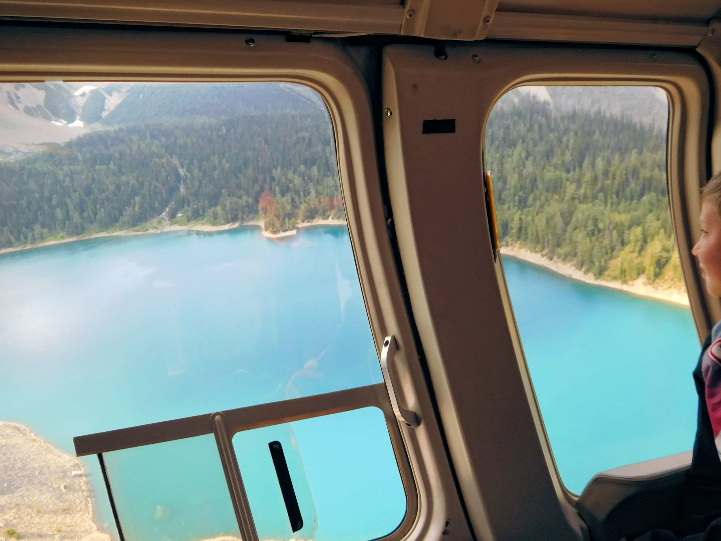
Soon the full extent of the wildfire becomes visible. Columns of smoke color the sky over the southern Kootenay valley.
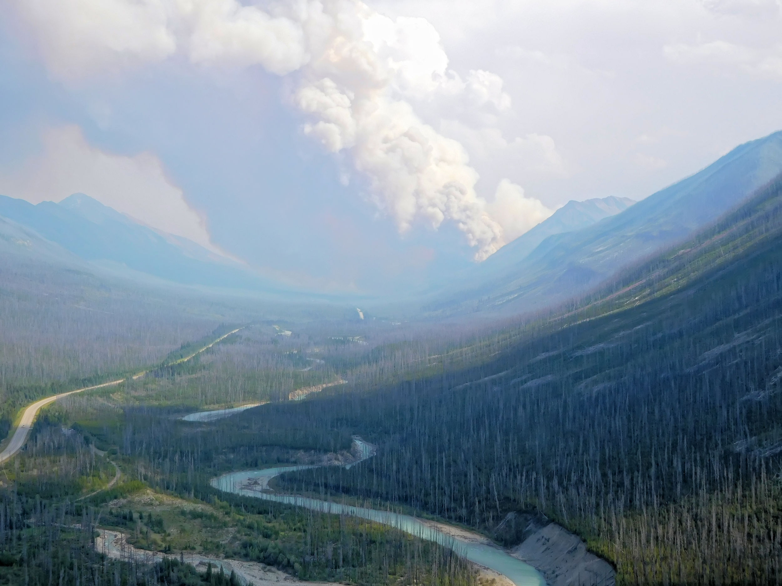
The helicopter drops us off at a landing site south of the Floe Lake trailhead. We are instructed to wait by the roadside until a ranger vehicle takes us back to our cars. Since the family with the kids had parked their car at the Painted Pots trailhead, too, we wait together until the last transport lands and the family is complete again.
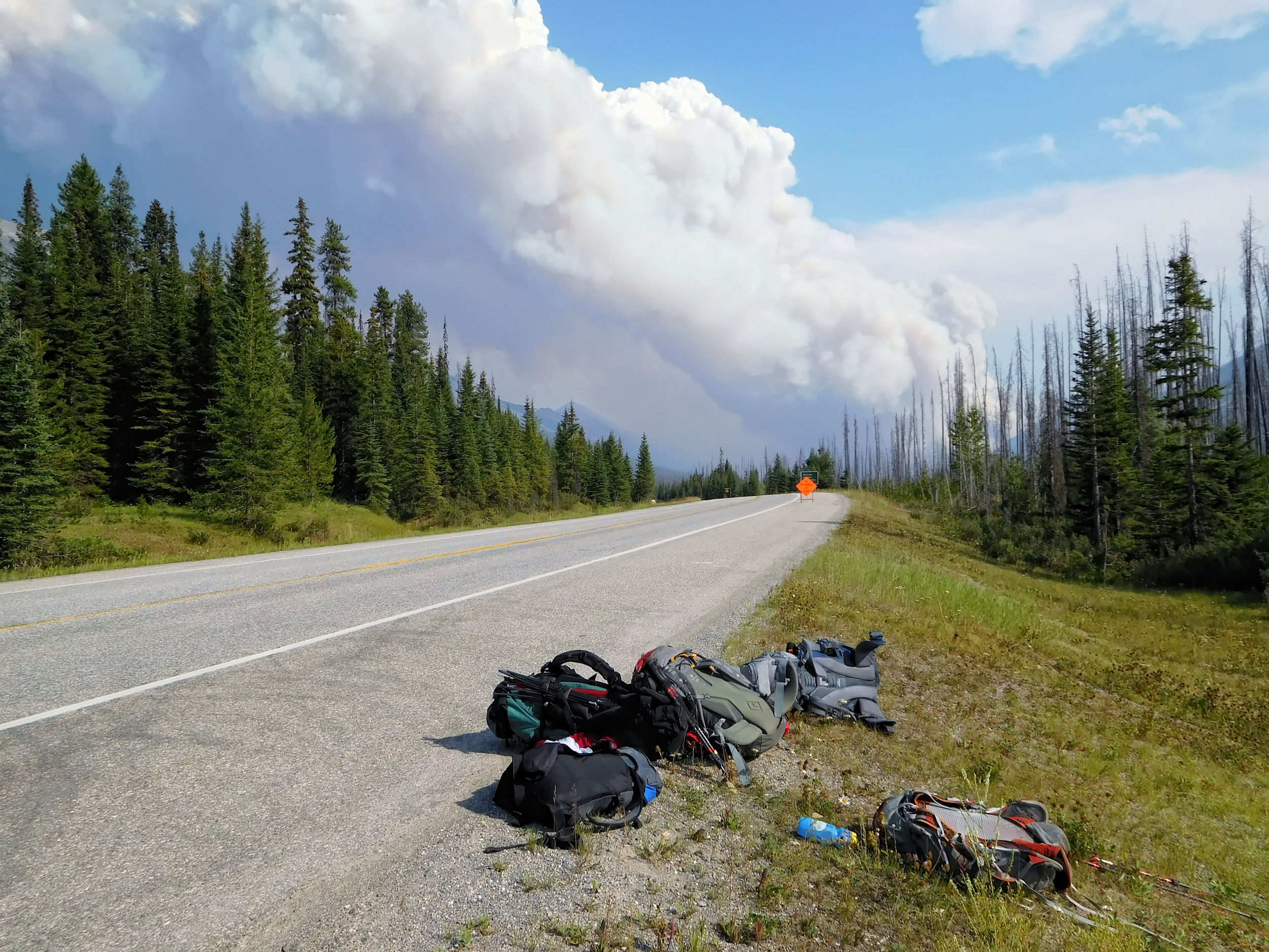
A ranger shuttles us to our vehicles. We learn that the entire Rockwall trail is being evacuated. Floe Lake and Numa Creek campgrounds are vacated by helicopter, while hikers who have spent the night at Tumbling Creek or Helmet Falls campgrounds have to walk out. This is not how I wanted my hike to end. But I must confess that I feel almost lucky: My trip is only shortened by one day; instead of a long slog downhill through an old burn, I am given a free helicopter ride out; last but not least, I don’t even have to hitchhike back to my car.
On a deserted highway I drive to Castle Junction, where I have cell phone reception and finally call home. They haven't heard anything yet about the recent events and did not worry about me. I manage to change my booking at the Dreamcatcher Hostel in Golden to tonight. Golden is surrounded by fires and very smoky. I spend a hot, stuffy night in the hostel room.
Early in the morning of the next day, I set off on my journey home. Fortunately, there are no highway closures anywhere on my way. Just like 2017, the year of 2018 will go down in British Columbian history as a year of severe wildfires. Floe Lake is a magical place that I would have liked to explore more extensively. I will return there some time in the near future.