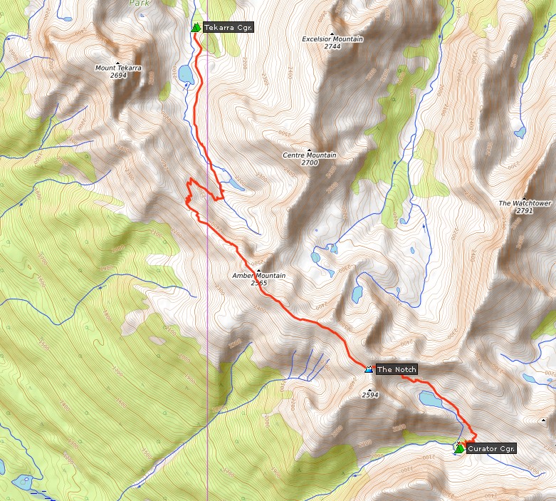
 Via Jasper and Maligne Lake to Evelyn Creek CampgroundJuly 30

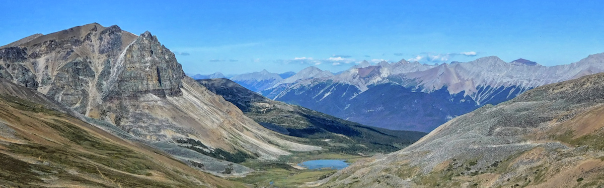
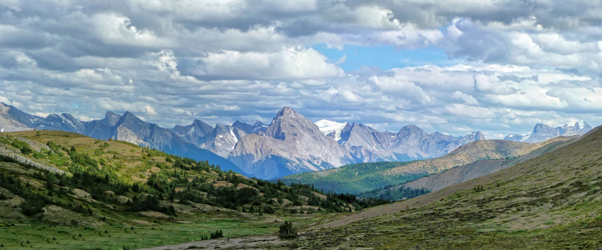
The Skyline trail in Jasper National Park is one of the most beautiful backpacking trips in the Canadian Rockies. More than half of the trail is above the tree line and its highlight, the Skyline, is a 4.5 kilometer long, almost 2500 meter high ridge that offers fantastic 360-degree views of the surrounding mountains. In July 2014, my first attempt to hike it with some friends from my hiking club had to be abandoned due to heavy snowfall at Curator campground, well below this most spectacular section. Now, three years later I have rebooked the popular campsites along the trail and give it another try.
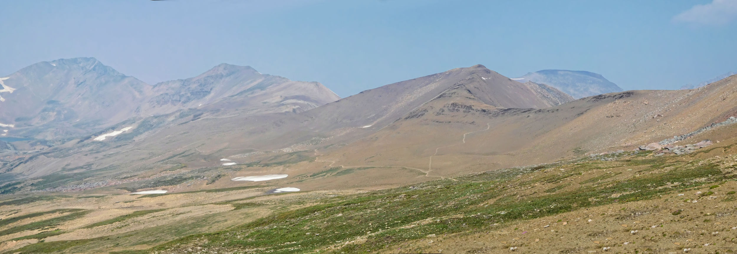
There are a lot of forest fires in Western Canada right now, and the air is often thick with smoke. On my way to Jasper it is not too bad and I reach the town around noon. At the turnoff to 40-kilometer-long Maligne Lake Road I make a quick call home before losing reception for the rest of the trip. The further I get into Maligne Valley, the more smoke fills the air. At the lake itself it is so thick that you can hardly picture the famous view. However, as always, there are many visitors.
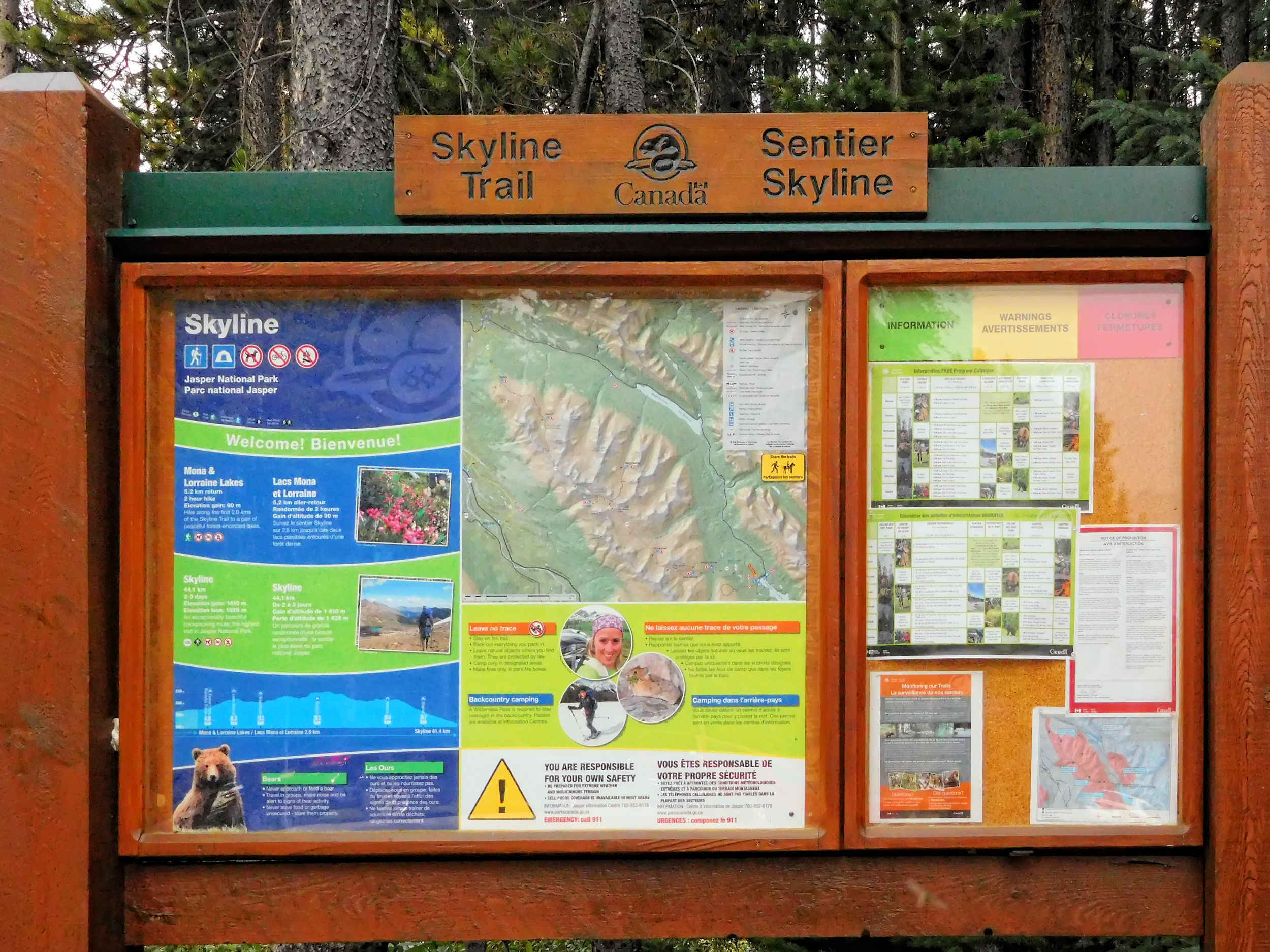
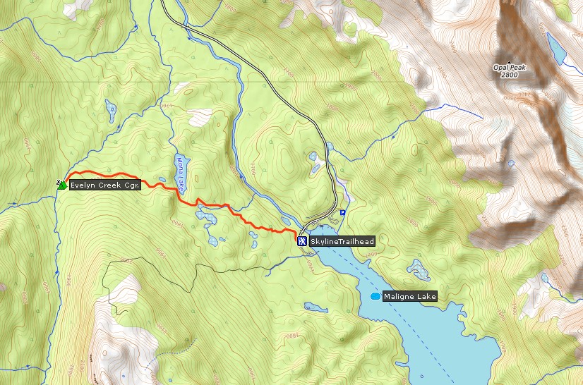
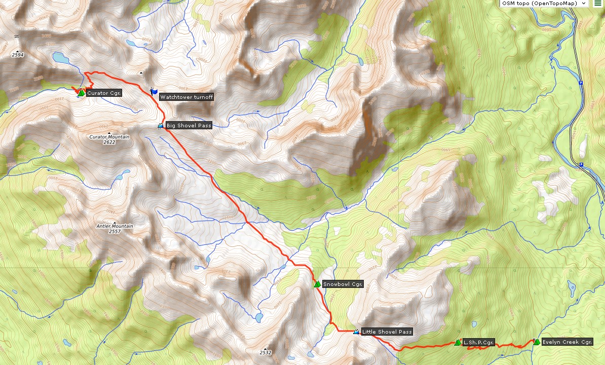
At the far end of the large Maligne Lake parking lot, an area is reserved for Skyline trail hikers. Normally, the Skyline trail is done as a 45-kilometer one-way hike that starts here and ends at the Signal Mountain trailhead, 40 kilometers further back on Maligne Lake Road. However, I both start and finish here at Maligne Lake, while hiking about 70 kilometers. This way I don't need a shuttle and also avoid nearly 8.5 kilometers of boring fire road at the other end.
| Distance | 5 km |
| Time | 1 ½ hrs |
| Min. Elevation | 1681 m |
| Max. Elevation | 1804 m |
| Ascent | 123 m |
I put a few last things into my backpack and start walking. My destination for today is Evelyn Creek campground, a good five kilometers away.
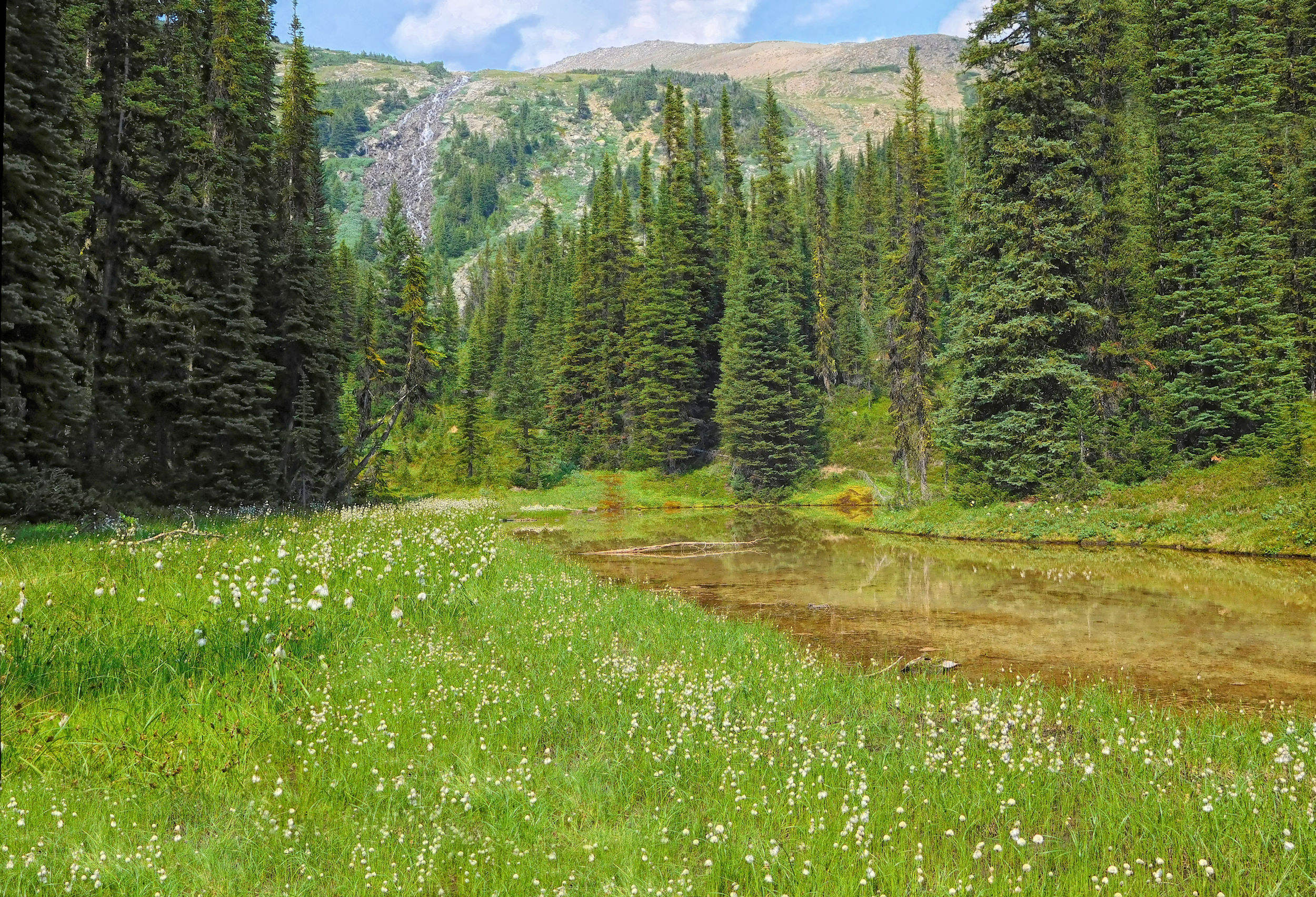
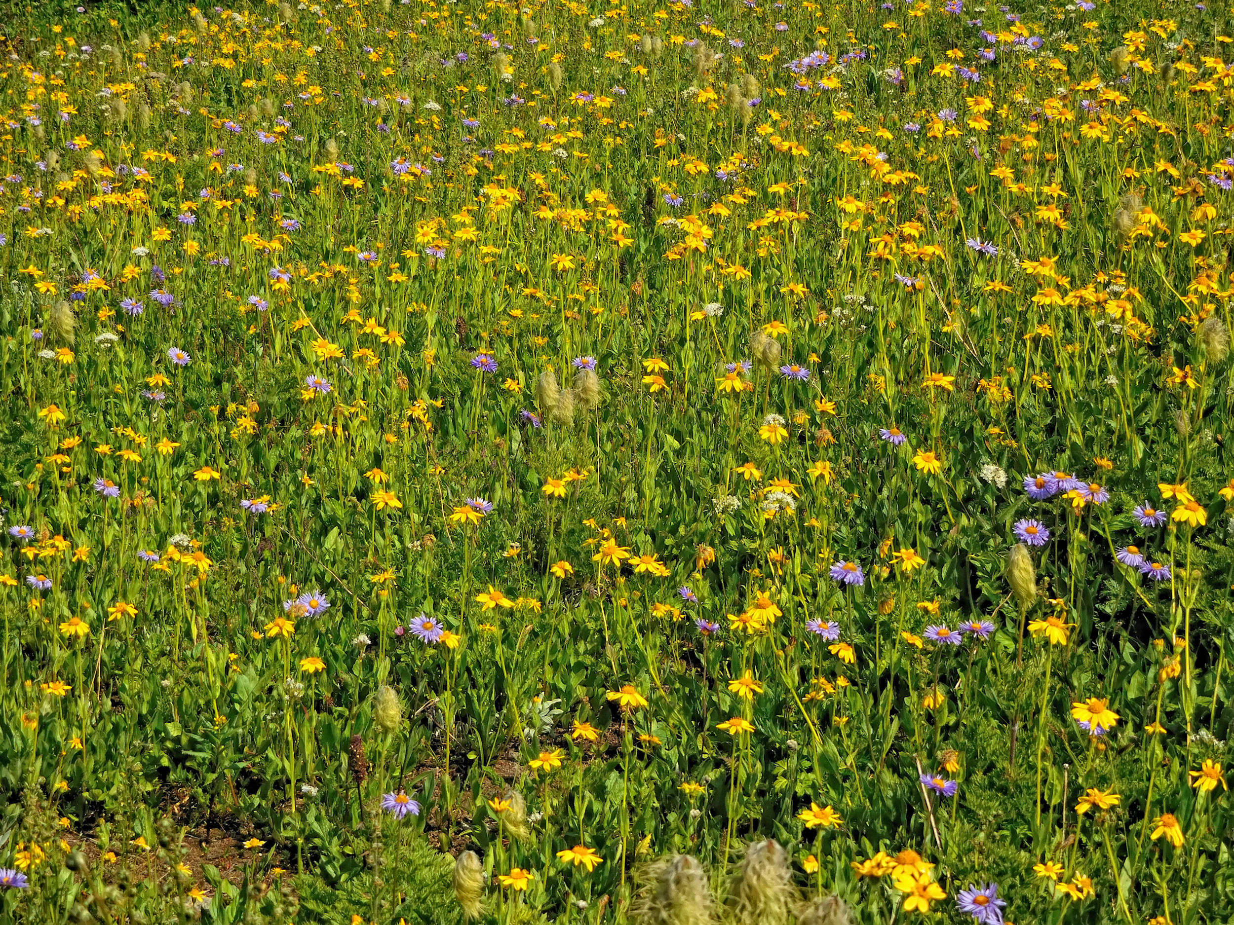
The well-maintained trail leads gently but steadily uphill through a pine forest. I keep meeting other hikers returning from their day trips. After about half an hour I pass Lorraine Lake and reach Mona Lake a little later. Having skirted the southwestern shore of the small lake, the trail disappears between the trees. Here in the forest and at a higher altitude, I hardly notice the smoke.
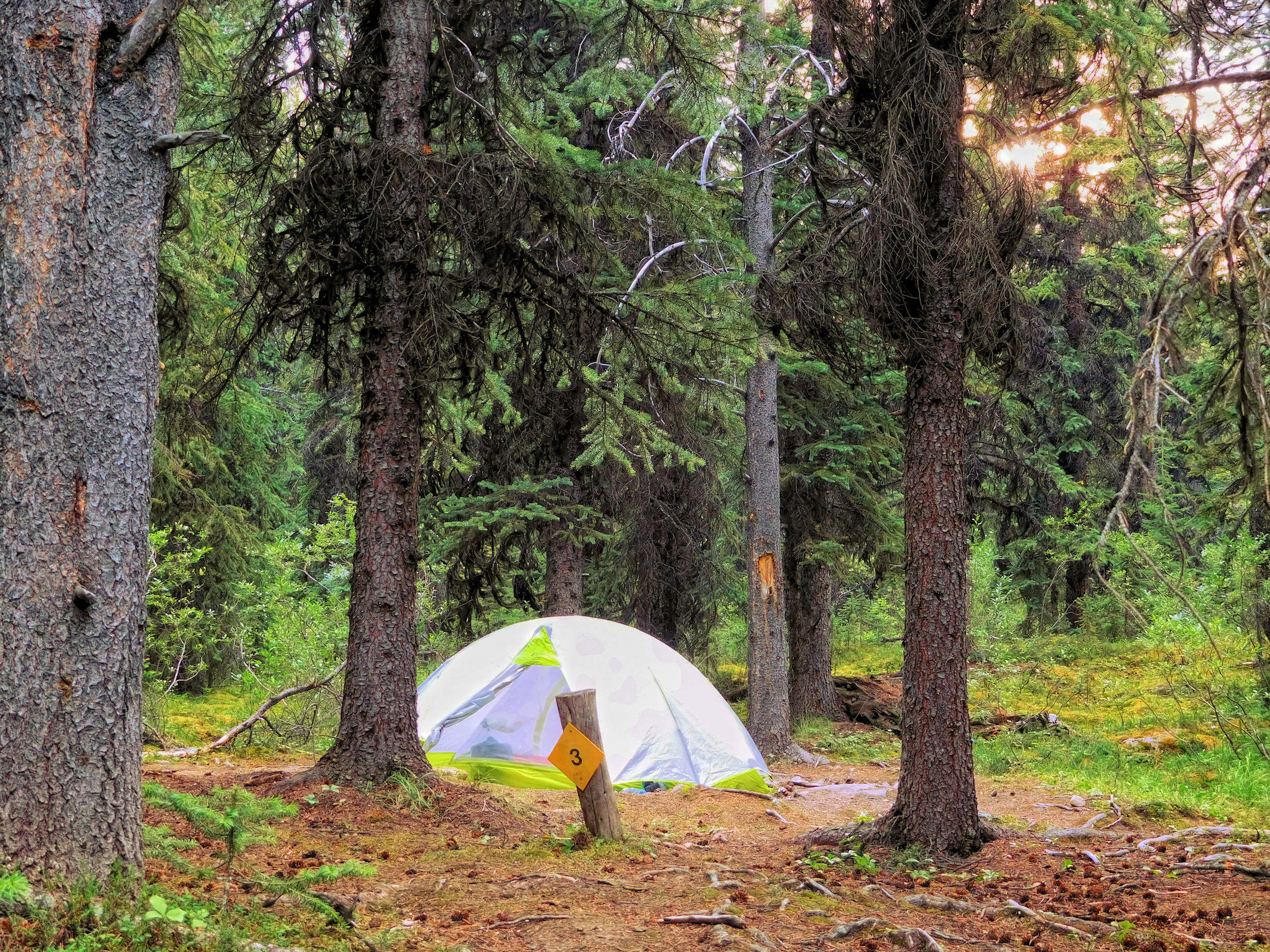
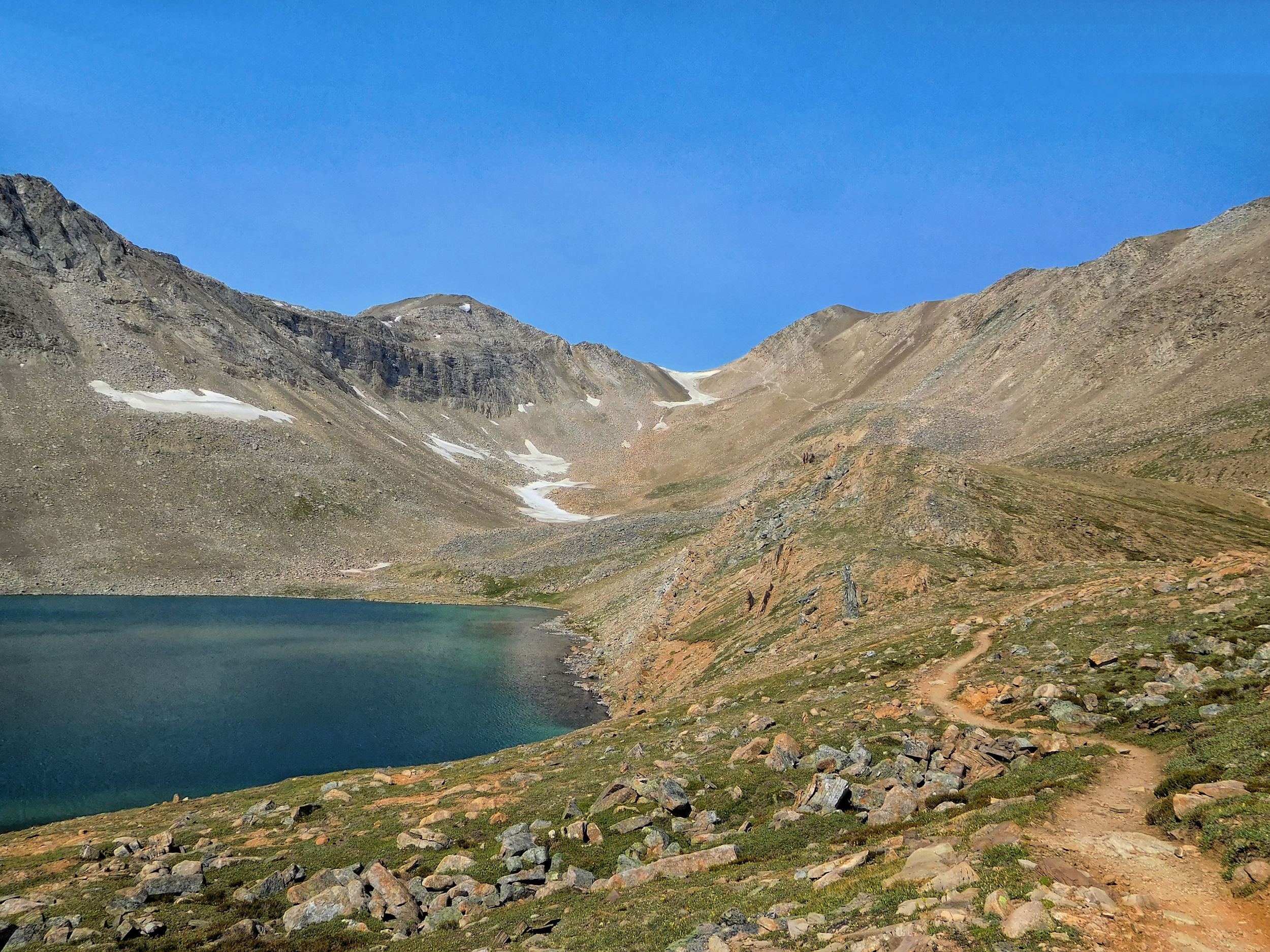
Evelyn Creek campground
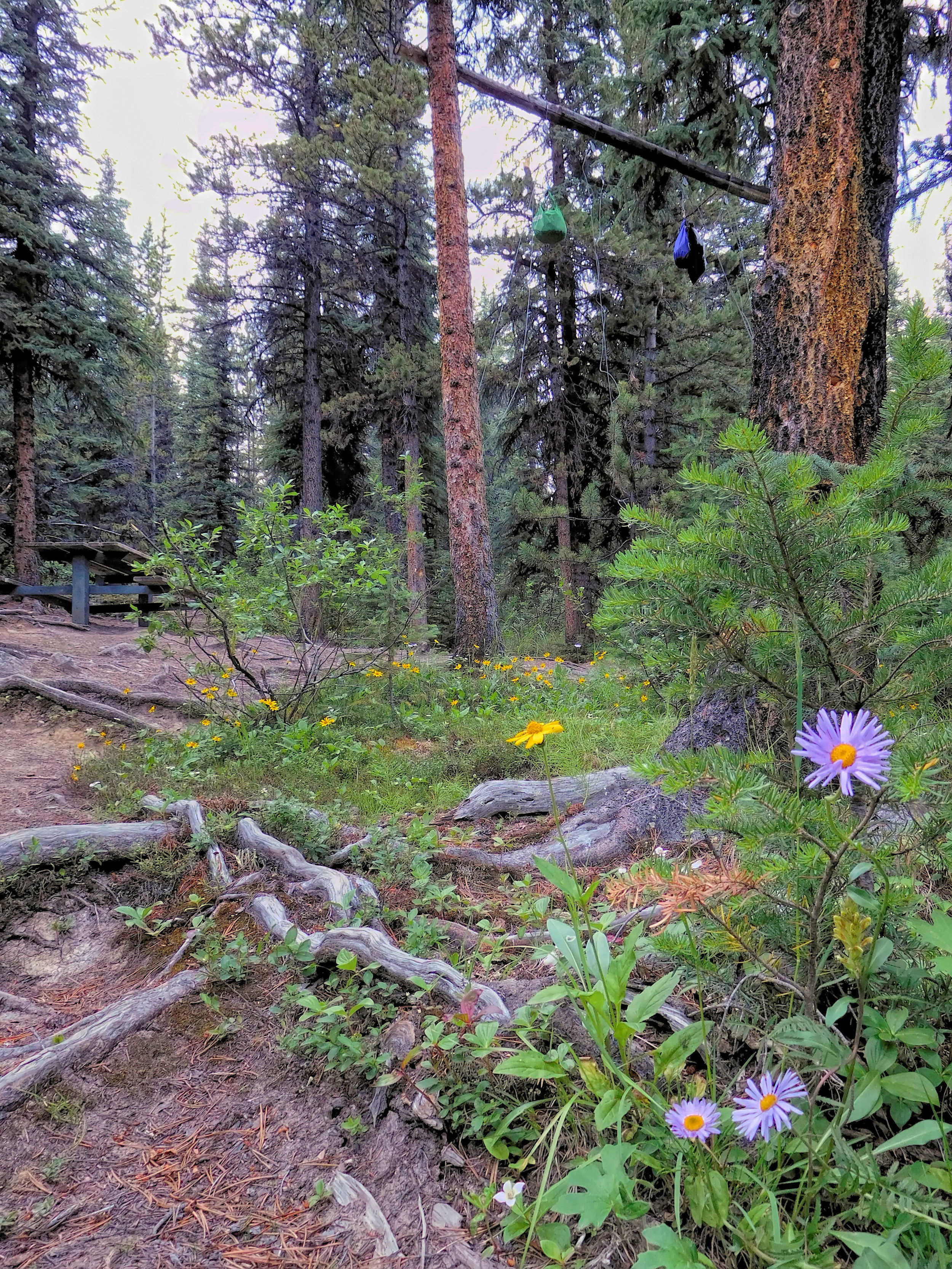
At the junction with the Bald Hills trail I turn right and immediately reach the bridge over Evelyn Creek with the campground on the other side. Evelyn Creek campground lies on a densely wooded hillside and has four tent sites, two picnic tables, and a beam for bear-proof food storage.
I put on my mosquito shirt, set up the tent and prepare dinner. Only one other campsite is taken by a family with two children. They have chosen Evelyn Creek as a base for day hikes suitable for children.
I spend a quiet night with no smoke.
| Distance | 17.2 km |
| Time | 6 hrs |
| Min. Elevation | 1818 m |
| Max. Elevation | 2337 m |
| Ascent | 519 m |
The sky seems friendly, when I look out of the tent in the morning. I have breakfast and pack quickly. Today's stage is more than 17 kilometers long and includes two pass crossings.
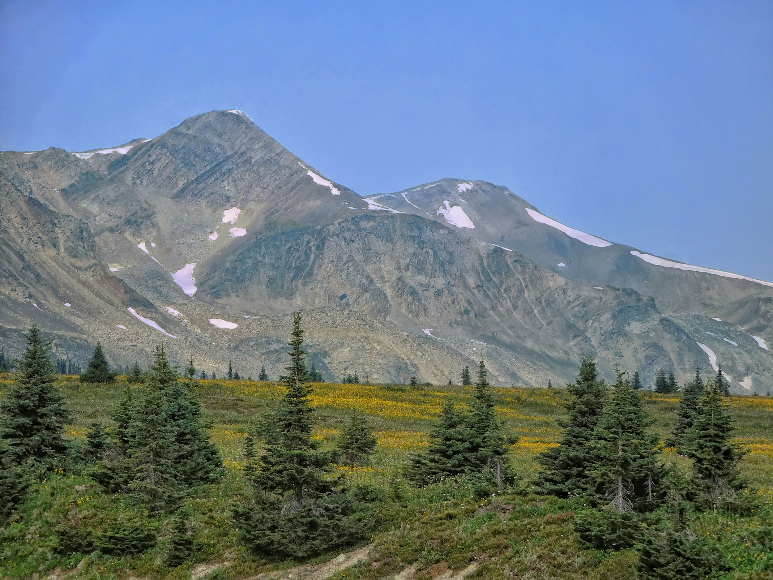
From Evelyn Creek the trail climbs steeply in switchbacks into the outliers of the Maligne Range. There is no view yet, but soon the forest thins out. At an elevation of about 2000 meters, the first vistas of the surrounding mountains appear.

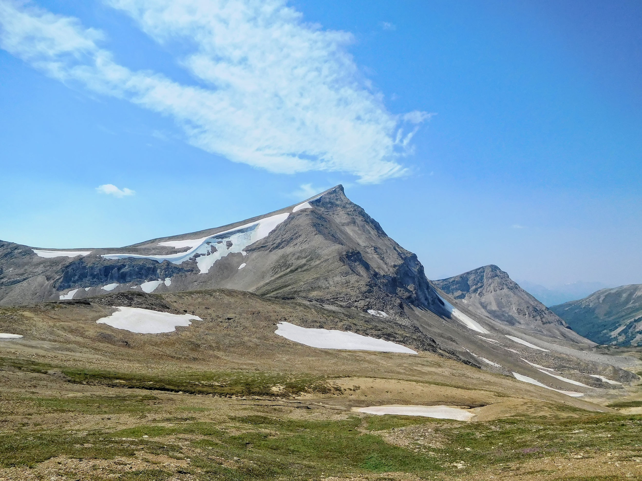
Maligne Range: Trowel Peak 2640 m
I hear a creek rushing through the wooded valley below and soon arrive at Little Shovel campground, where we made our first overnight stop in 2014. Like Evelyn Creek, this site is amidst the trees.
Just beyond the campground, the forest gives way to more open terrain. I am now at an elevation of about 2140 meters.
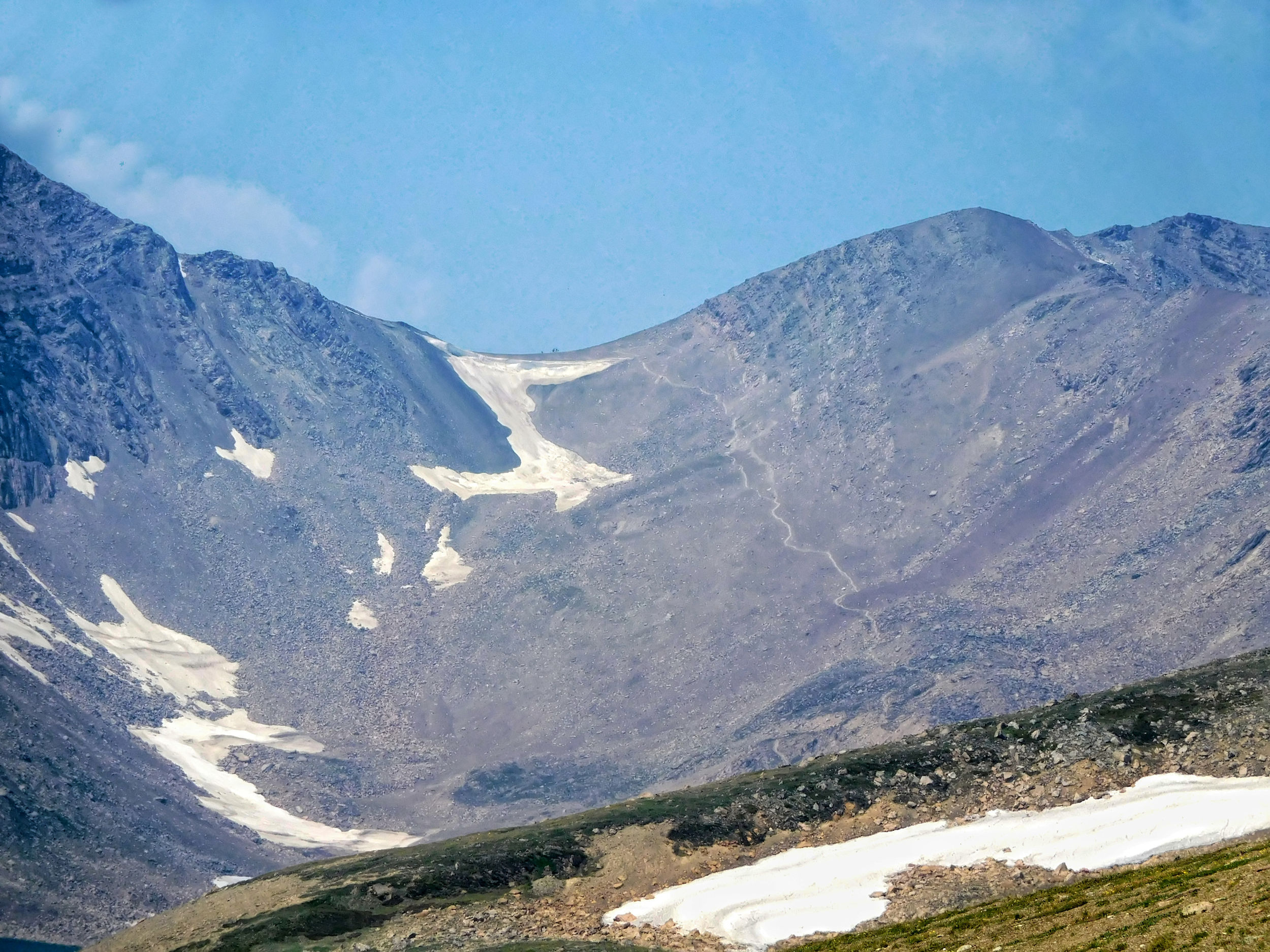
Half an hour later I reach 2240-meter-high Little Shovel Pass. It is framed by Trowel Peak and Sunset Peak. I leave the tree line behind me. To the right there is heather and krummholz, to the left only scree. Numerous marmot families have built their dens here. These creatures are obviously used to being around people and are not shy at all.
As far as views go, Little Shovel Pass is not particularly spectacular. In 2014, we climbed the scree slope of Trowel Peak from the pass and had a wonderful view of the surrounding mountains and the Snowbowl, a wide alpine basin with meadows full of wildflowers.
2014: Little Shovel Pass
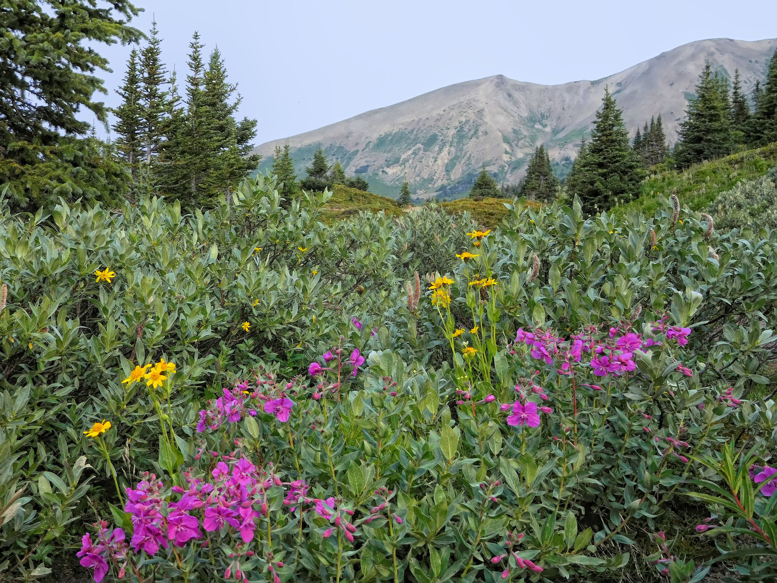
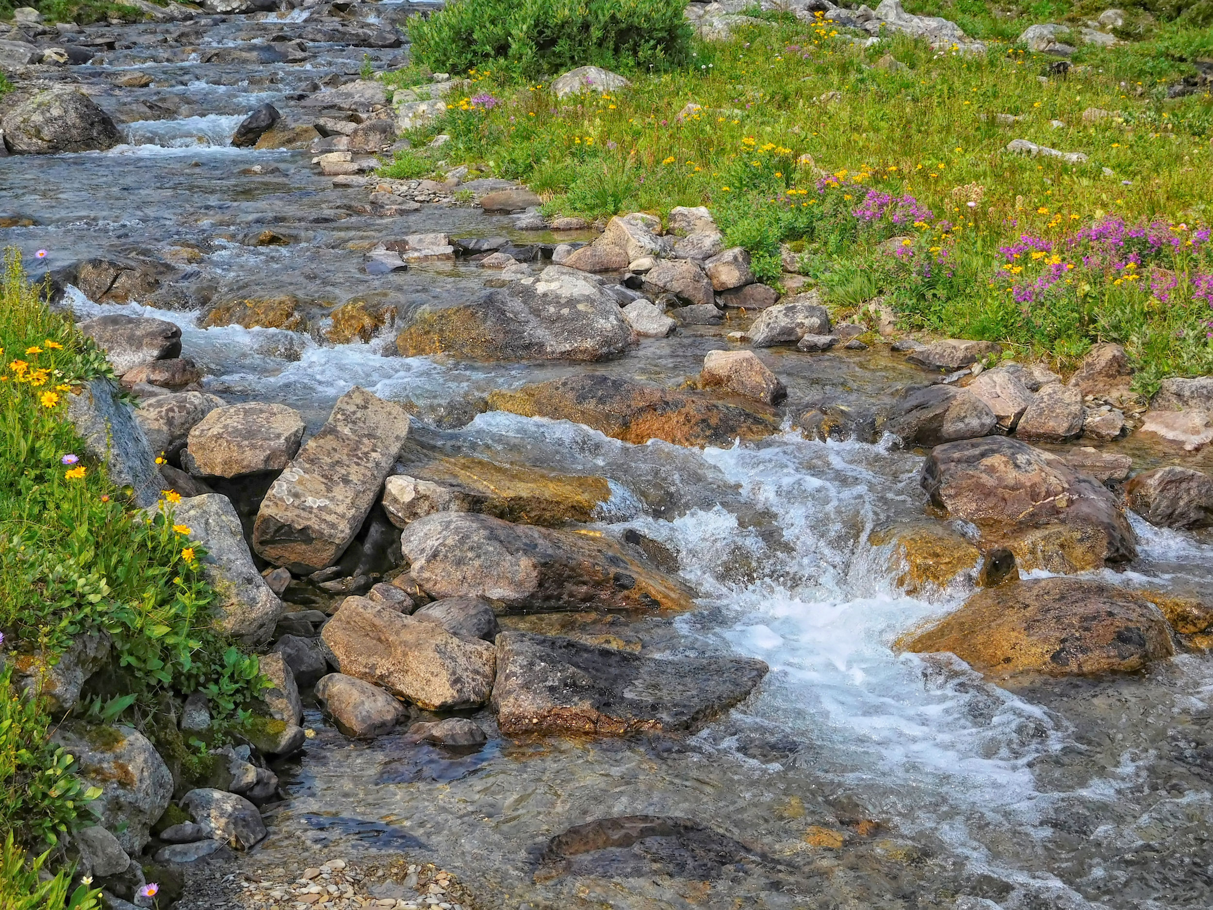
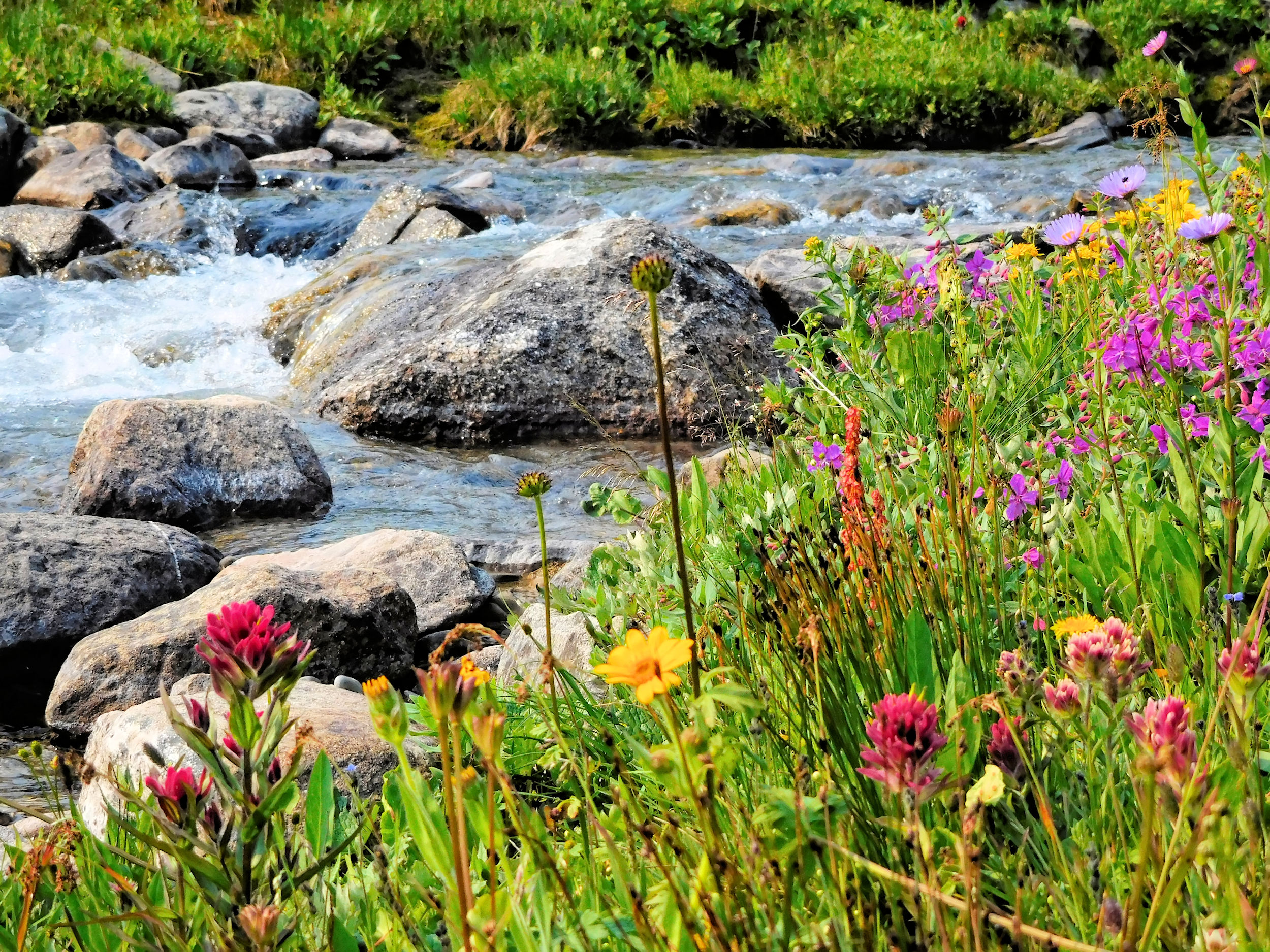
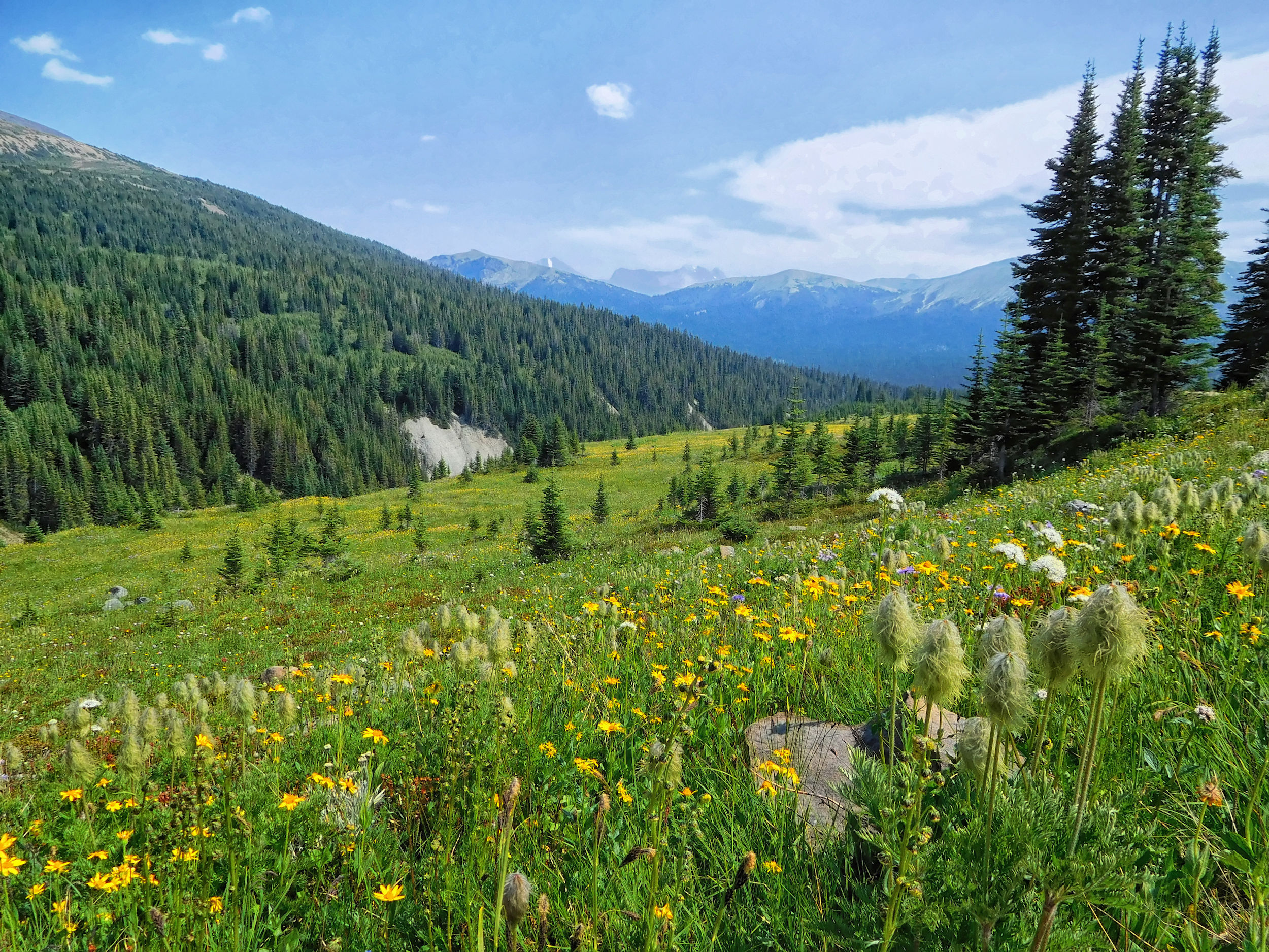
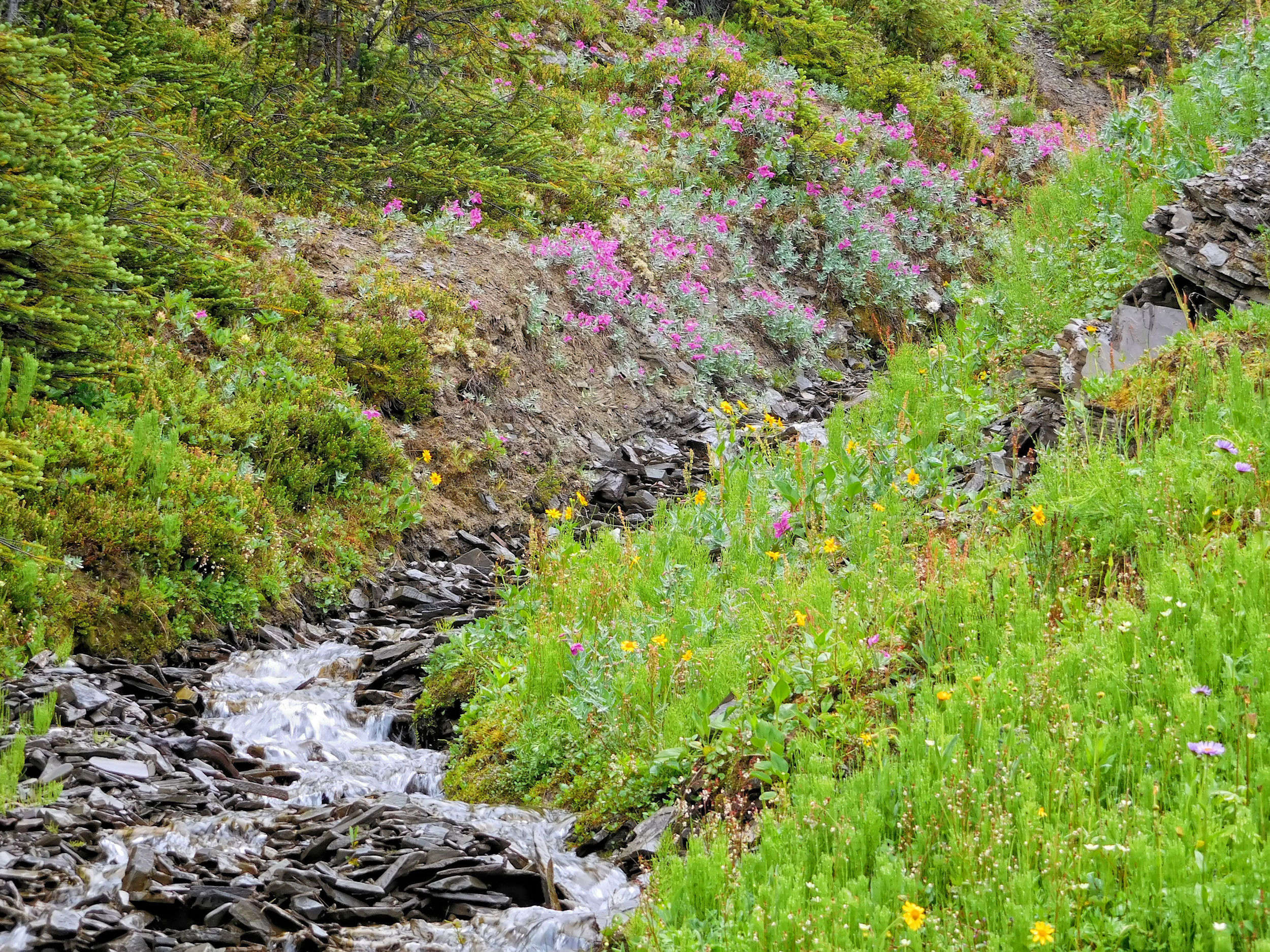
From the pass, the trail descends into the Snowbowl with its lush display of wildflowers.
The trail turns rocky and drops into a gorge carved by the swift Snowbowl Creek. Its rugged slopes and side streams lined with wildflowers are a fascinating sight. I cross the main creek on some boulders.
Gorge of Snowbowl Creek
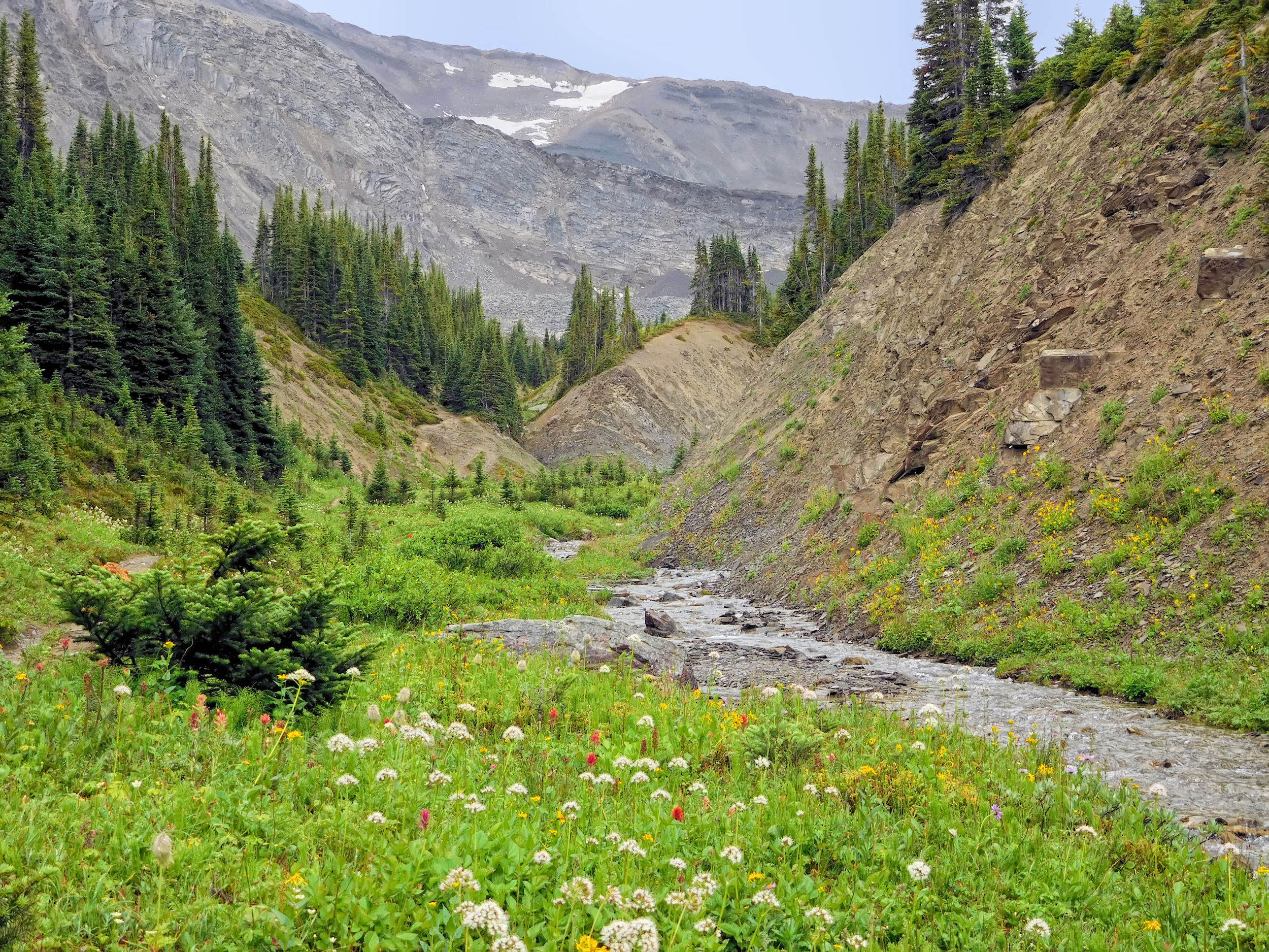
Five minutes ahead is Snowbowl campground at 2050 meters. I will spend the night here on my way back.
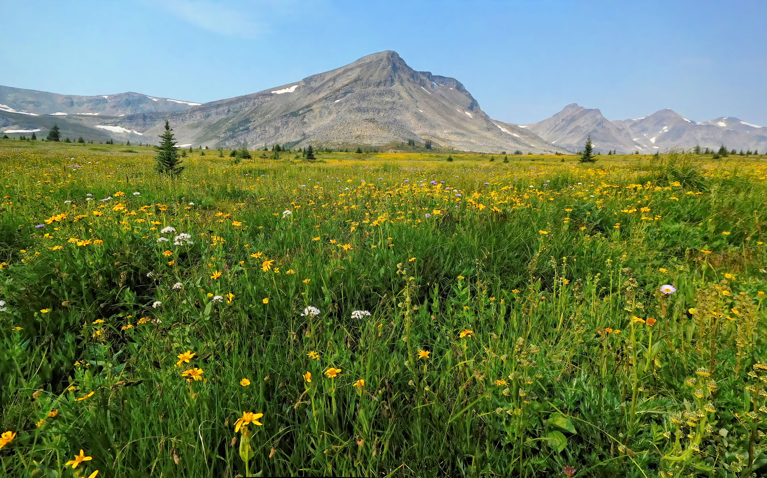
Snowbowl meadows
The wildflowers are particularly abundant on the banks of a small, lively stream.
The trail continues northwest along the slopes of the Maligne Range. Two bridges cross the forks of Jefferey Creek.
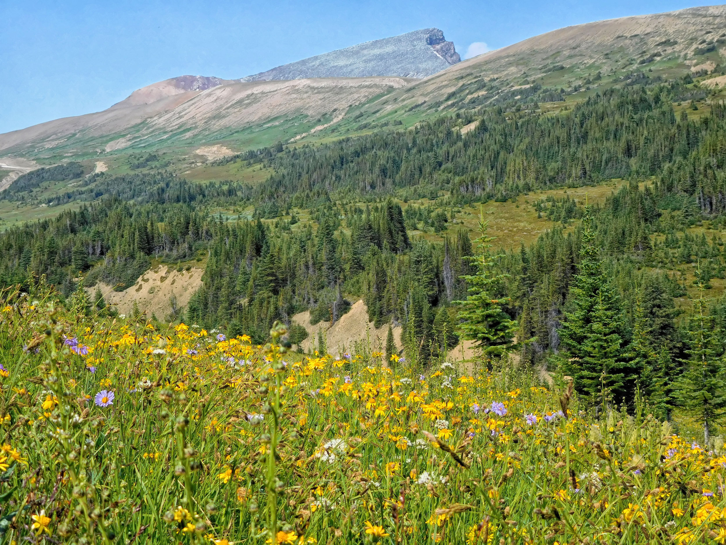
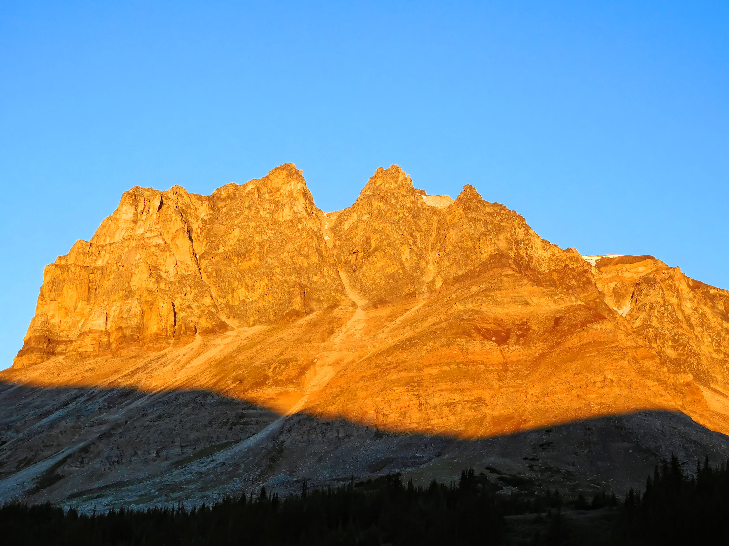
The climb to Big Shovel Pass is gentle. Curator Mountain dominates the view.
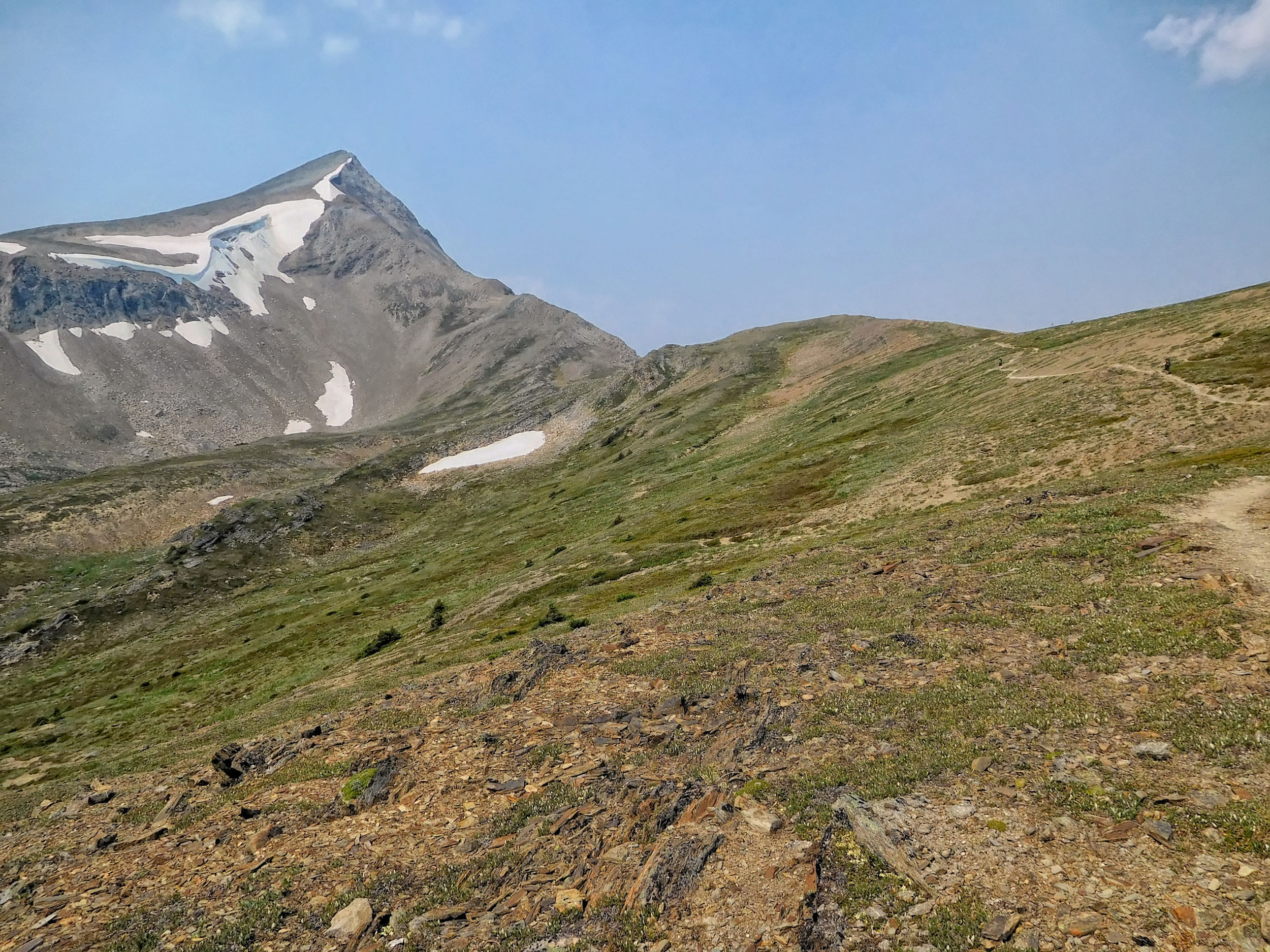
Towards Big Shovel Pass
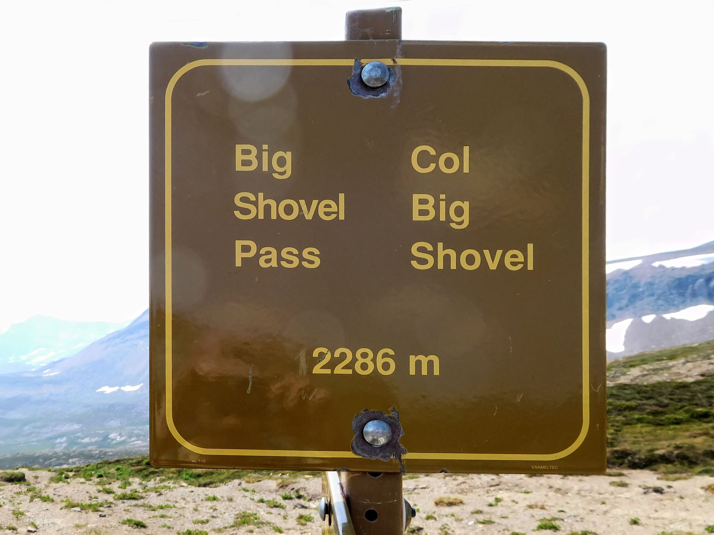
Big Shovel Pass
When it comes to elevation, the guidebook and the GPS usually don't agree with the signs. My GPS shows the pass at 2314 meters, the guide claims 2320 meters. Take your pick.
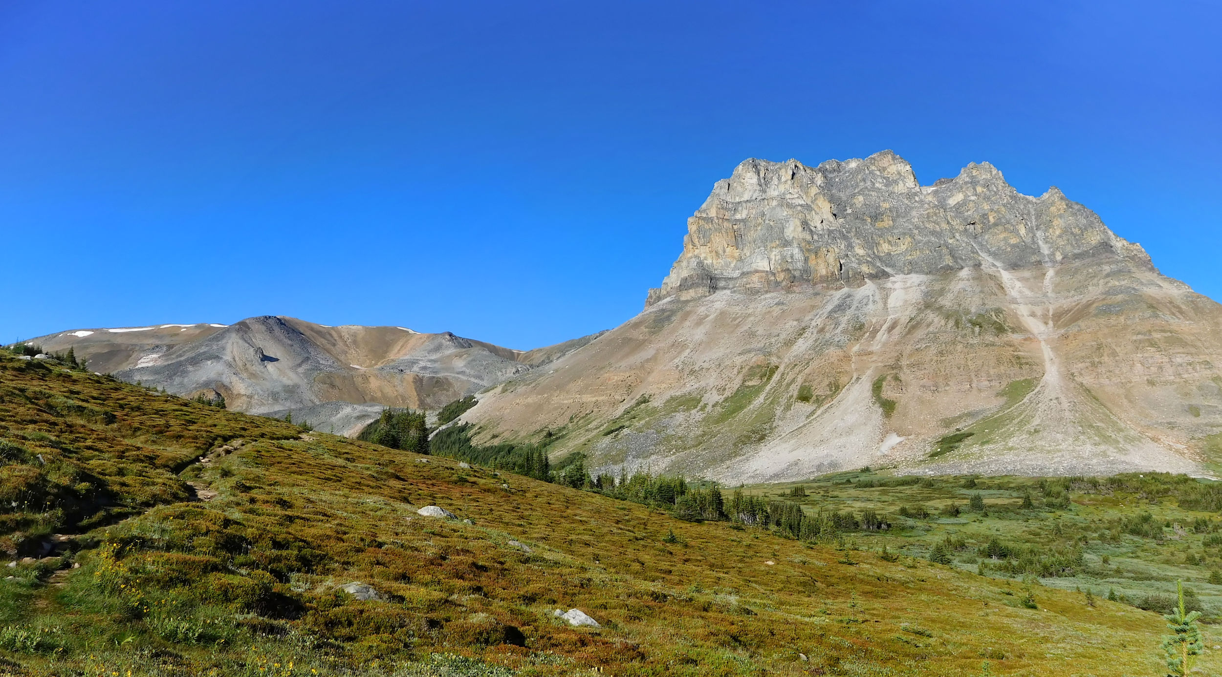
The other side of the pass is not very steep either. But unlike Little Shovel Pass, this one definitely feels like a pass. The view is expansive and the area resembles a lunar landscape. A clearly visible side trail leads over the saddle to Watchtower Basin and the prominent mountain it is named after.
View from Big Shovel Pass
Watchtower junction
I reach the turnoff to Watchtower Basin. Behind the saddle and more than three hundred meters lower lies Watchtower campground. In the past, this trail was used as an emergency exit from the Skyline trail in case of bad weather. It emerged on Maligne Lake Road near Medicine Lake. For several years now, the trail has not been maintained past Watchtower campground, so it is probably no longer passable.
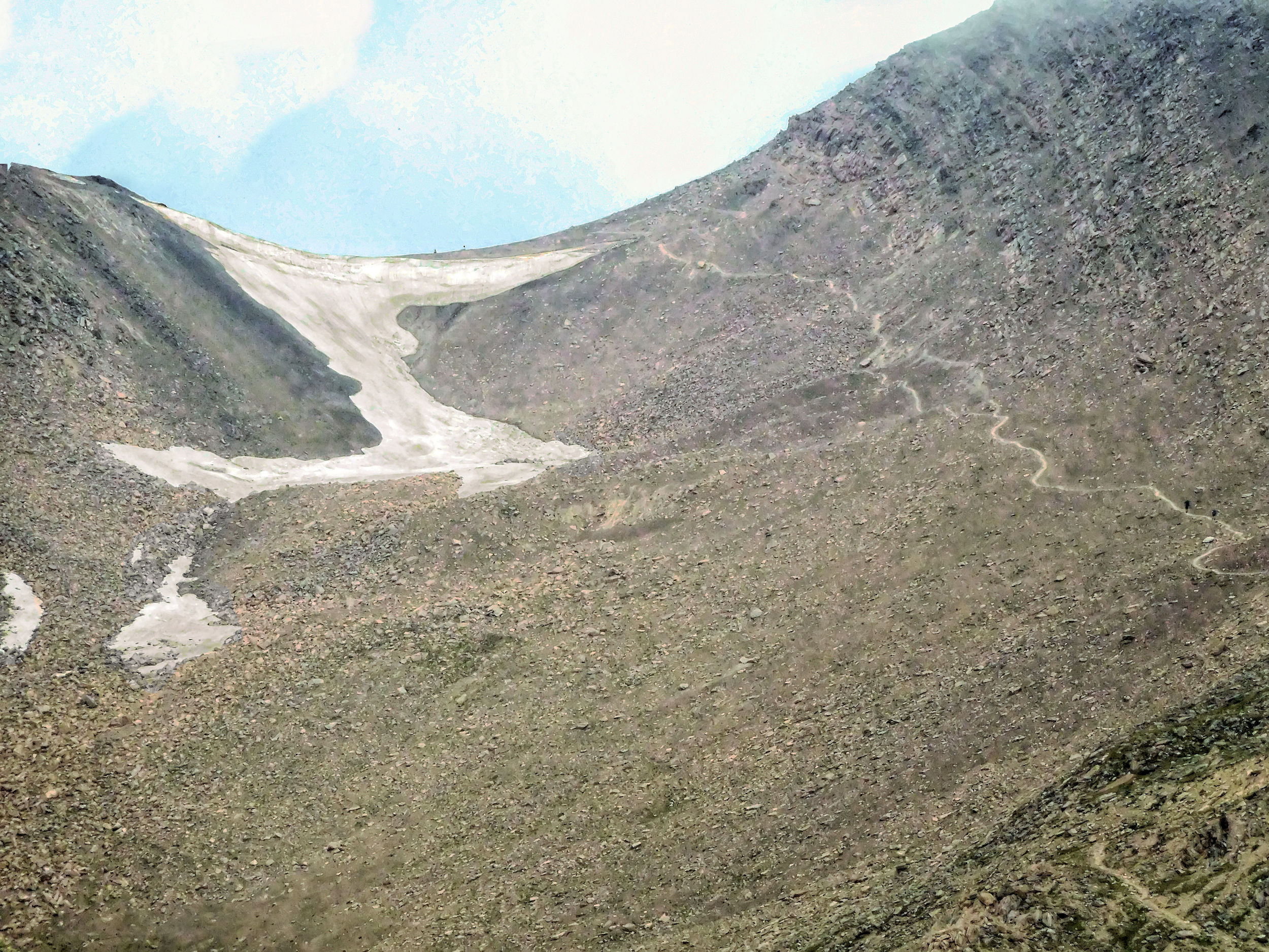
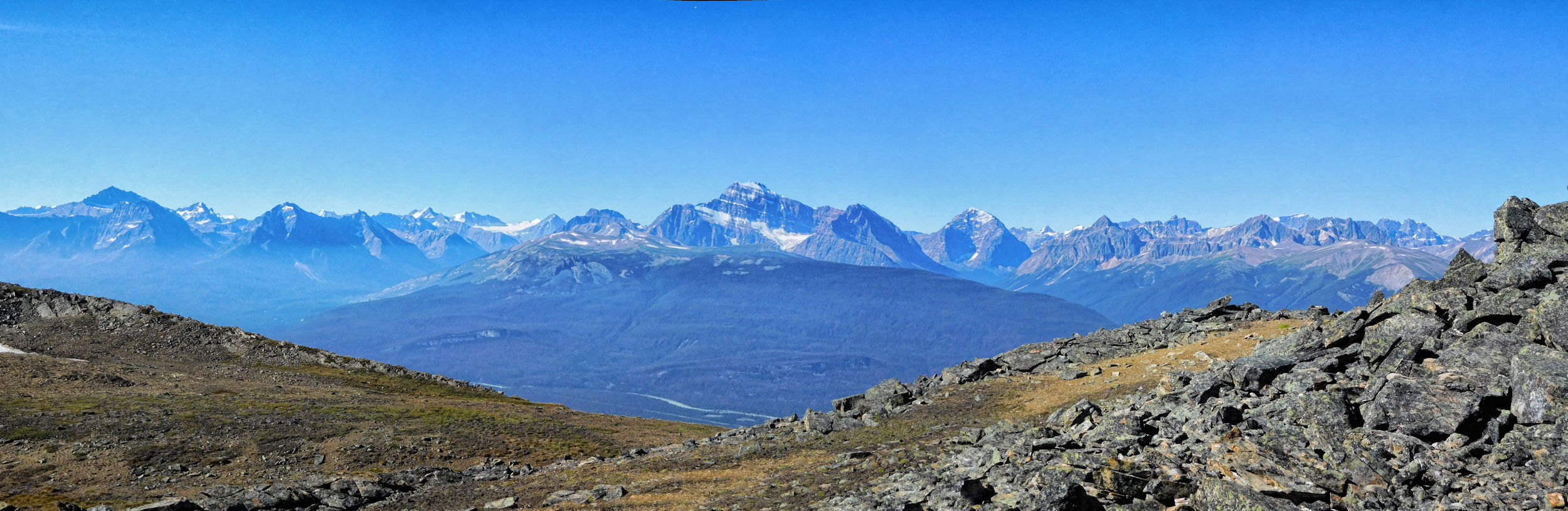
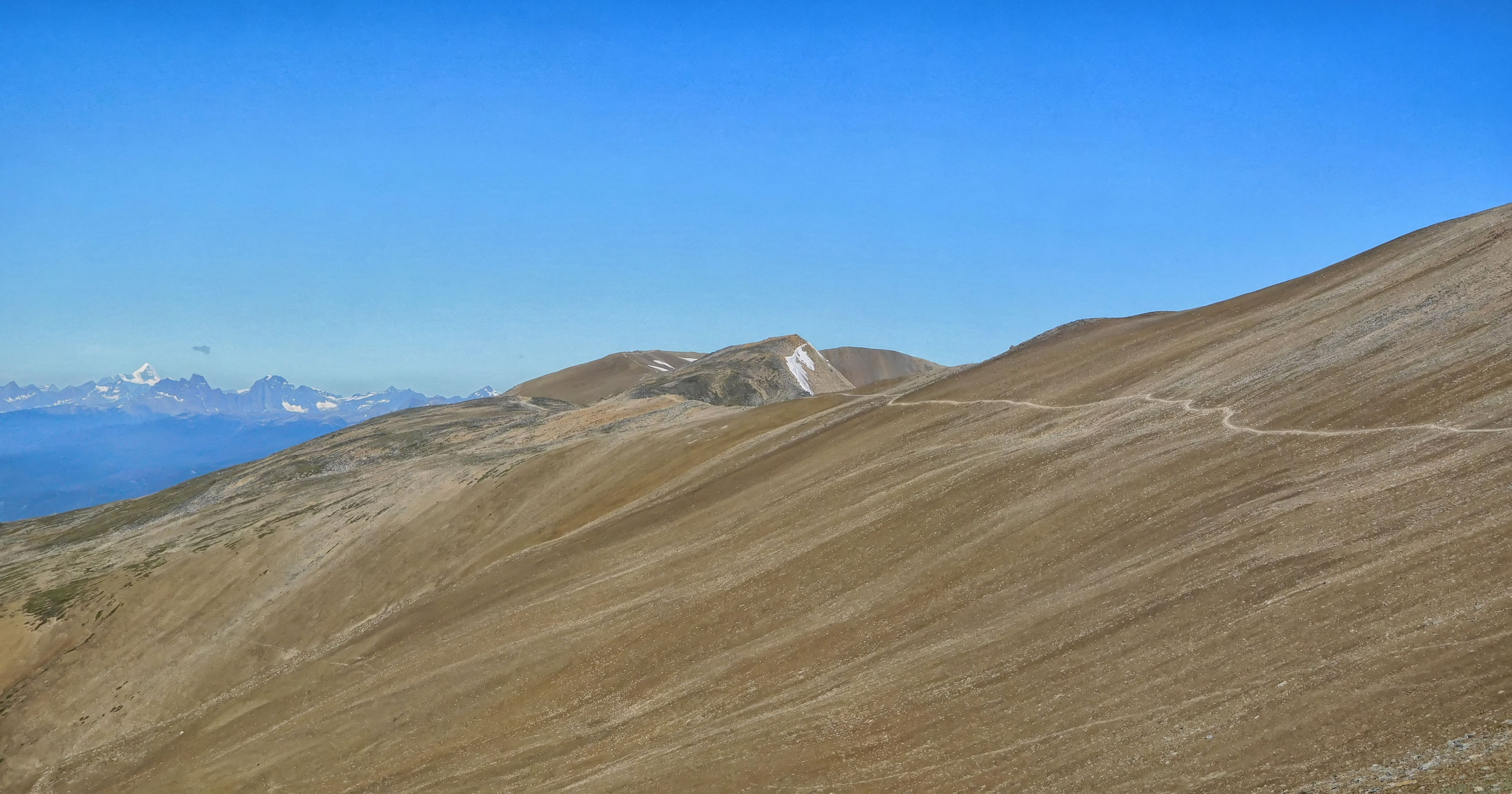
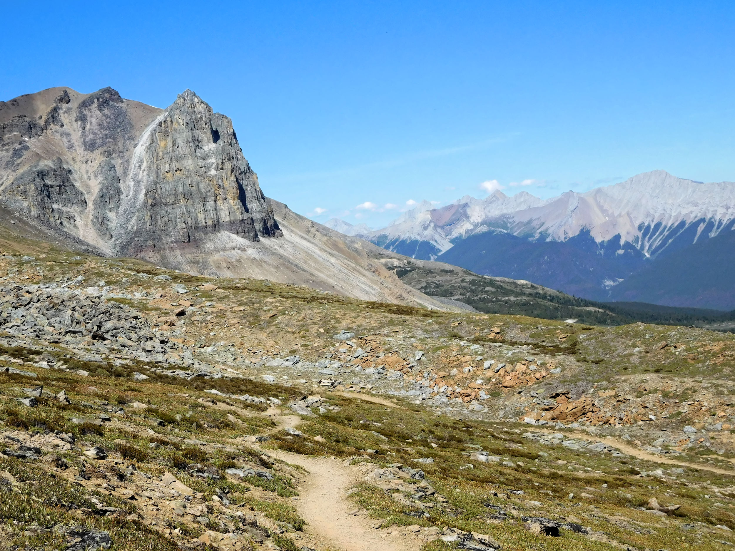
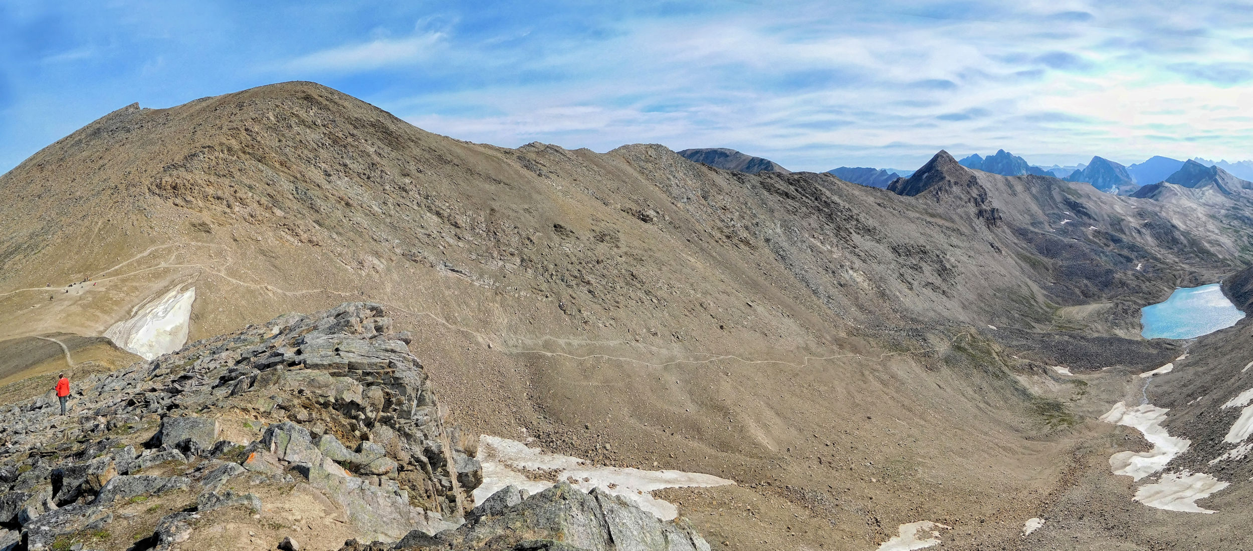
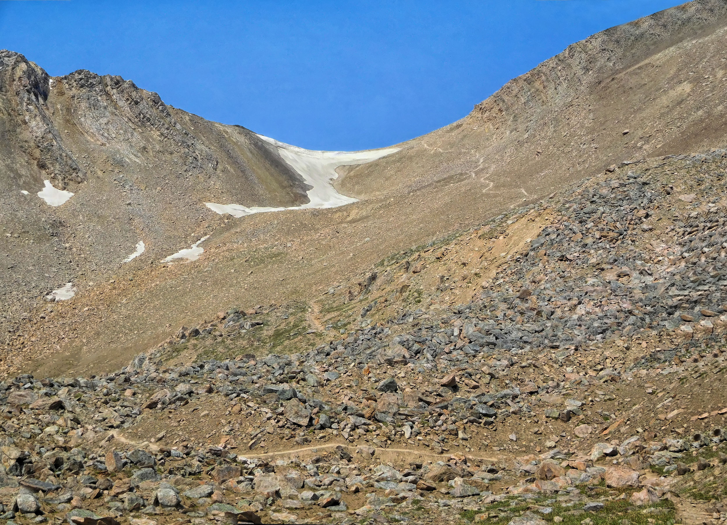
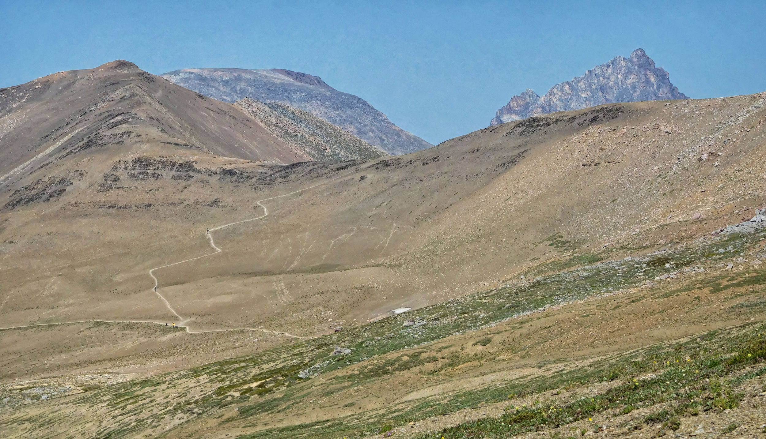
The main trail runs through the barren slopes beyond Big Shovel Pass. From here I have a good view of the so-called Notch, a narrow passage at an elevation of 2510 meters. It is the entrance to a 4.5 km long ridge walk that the trail is named for: The Skyline.
First glimpse of the Notch
However, today I turn left, down to Curator campground. It's a steep 120 meter descent that I'll have to climb up the next day to continue my hike. You can also get to Shovel Pass Lodge this way, a mountain lodge for hikers who prefer a little more comfort. Besides, this trail is the only escape route in case you have to abandon the hike due to inclement weather conditions. After 16 kilometers it ends at the Wabasso Lake trailhead on the Icefield Parkway.
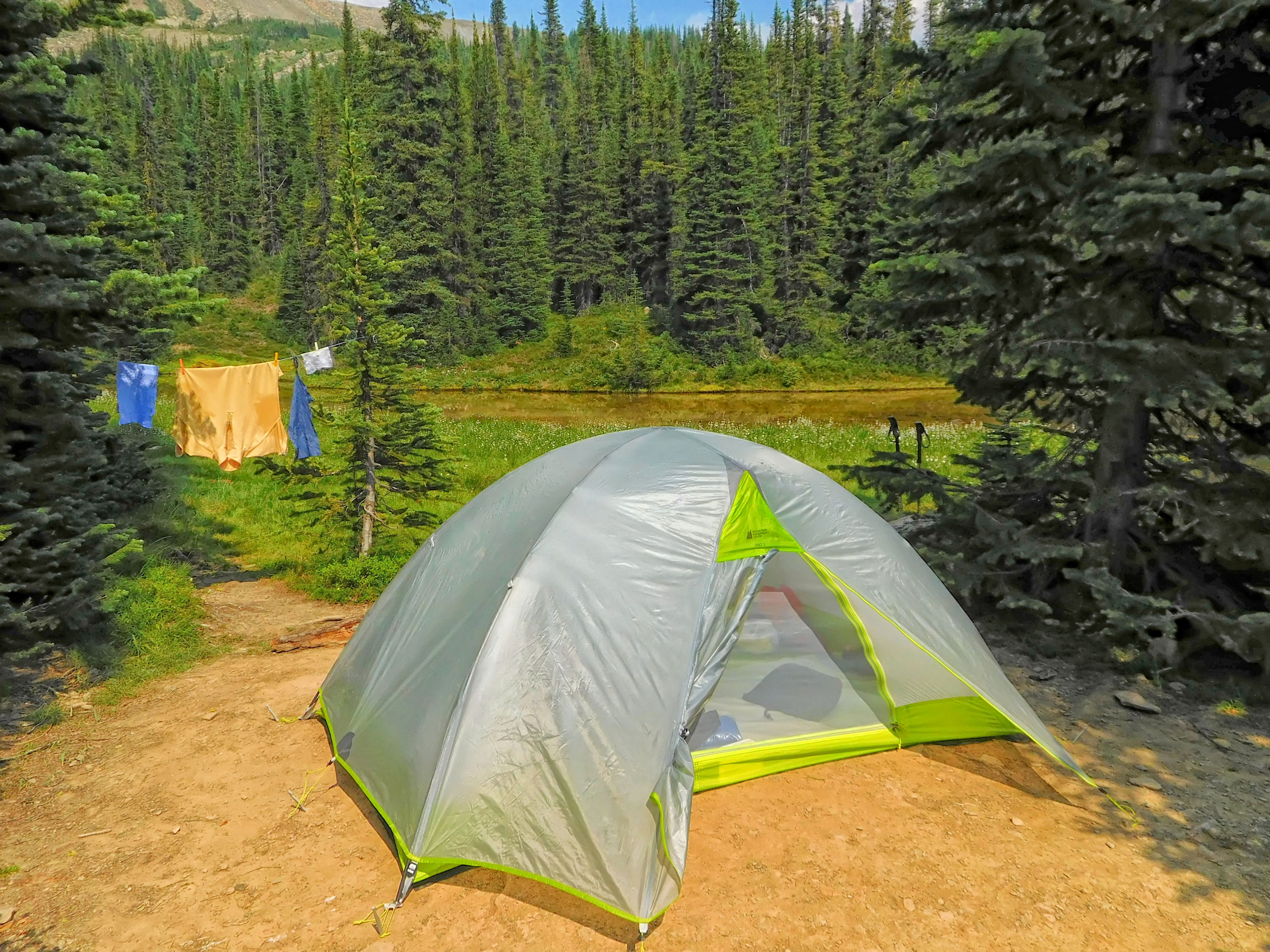
Curator campground borders a picturesque little pond. I find a particularly charming camp spot on the edge of a cottongrass meadow overlooking the pond and a waterfall. It is still early and the sun is shining: a good opportunity to rinse my T-shirts and dry them on the line.
The campground is full, and later hikers arrive to pitch their tent in the sticks. I enjoy a warm afternoon and evening in the sun.
| Distance | 12.5 km |
| Time | 4 ½ hrs |
| Min. Elevation | 2062 m |
| Max. Elevation | 2537 m |
| Ascent | 475 m |
The sky is promising a decent day. Maybe I'll be lucky enough to cross the Notch this time. In 2014 we couldn't even see it in the snowy weather.
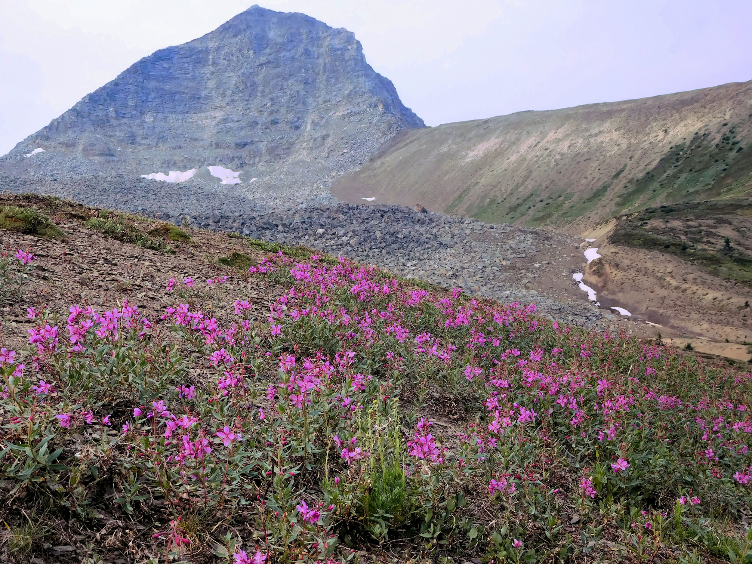
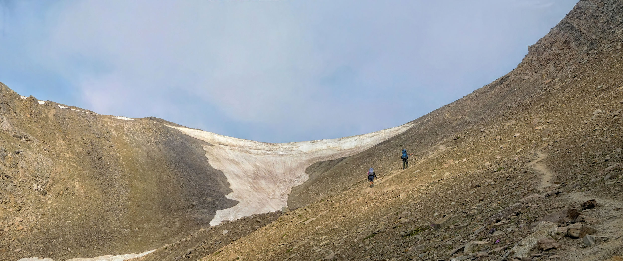
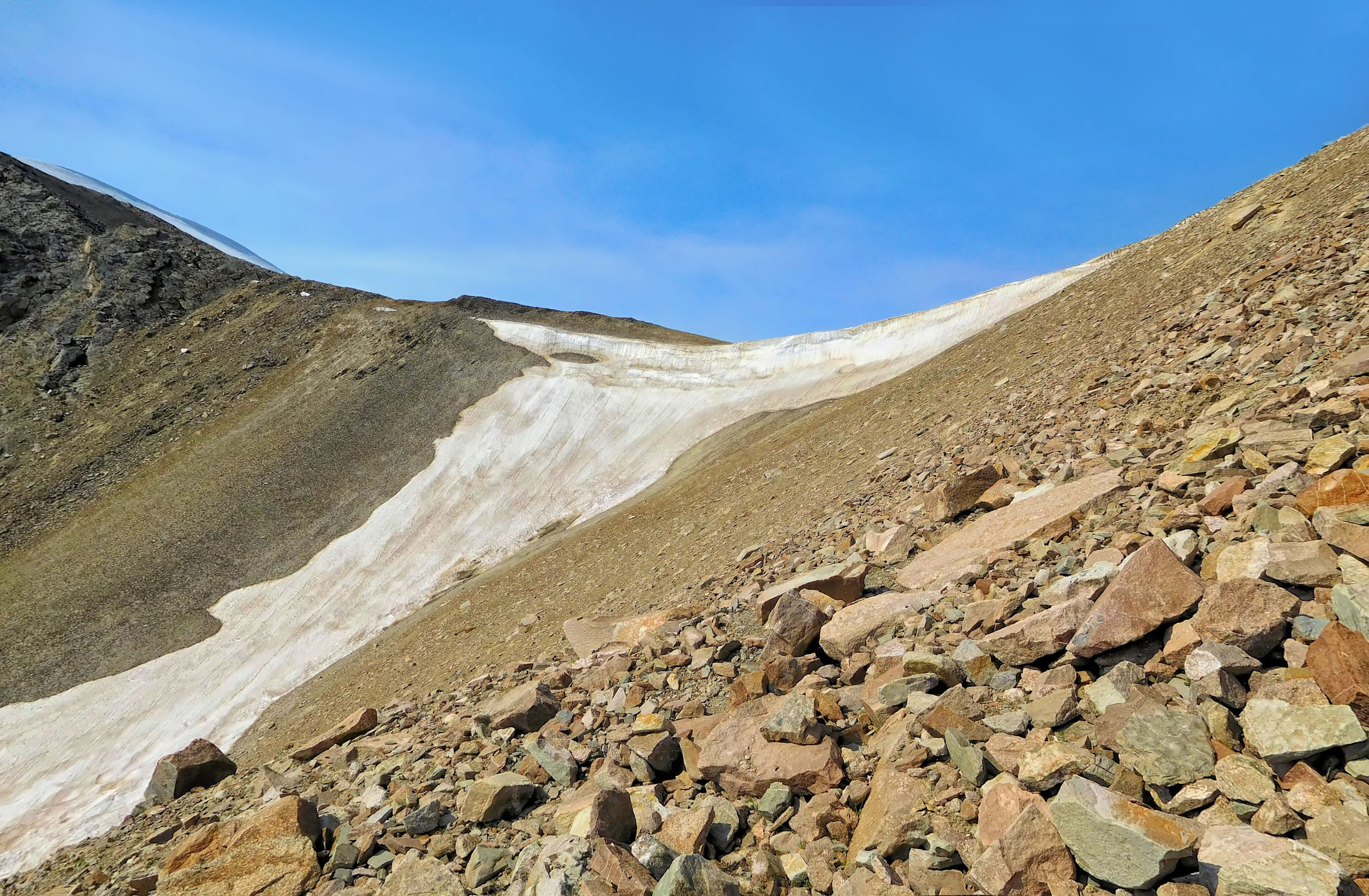
I ascend the kilometer from the campsite to the main trail. There are some clouds near the Notch, but the cornice is clearly visible. The pass is framed by Notch Peak (left) and South Amber Mountain (right). A narrow trail leads past Curator Lake through the scree and looks incredibly steep from down here.
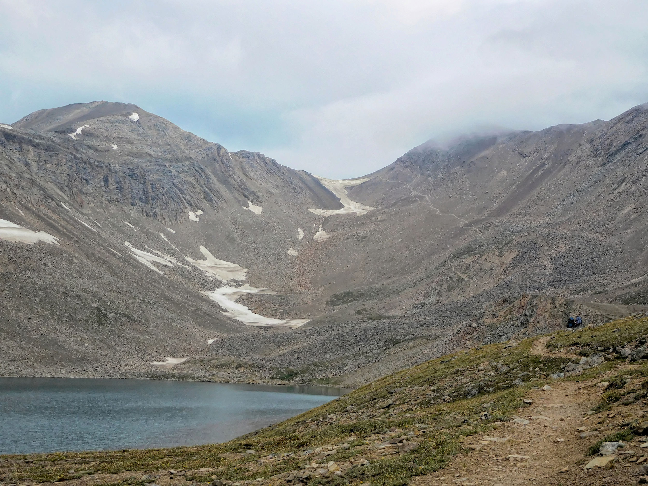
Two other hikers started much earlier and have already made it to the top of the ridge.
Halfway up, you have a nice view of Curator Lake and the whole valley.
Looking back at Curator Lake
My tent neighbors from Curator campground, a couple from Calgary, left shortly before me and are climbing through the rocks a bit ahead of me. The trail is really steep and the scree slippery. Coming down on my way back in two days is going to be even more difficult.
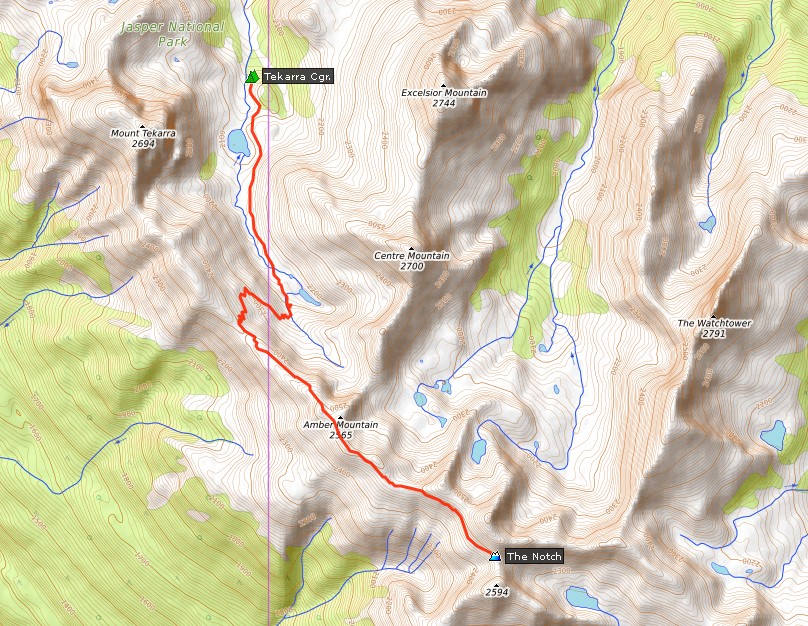
Climbing the Notch
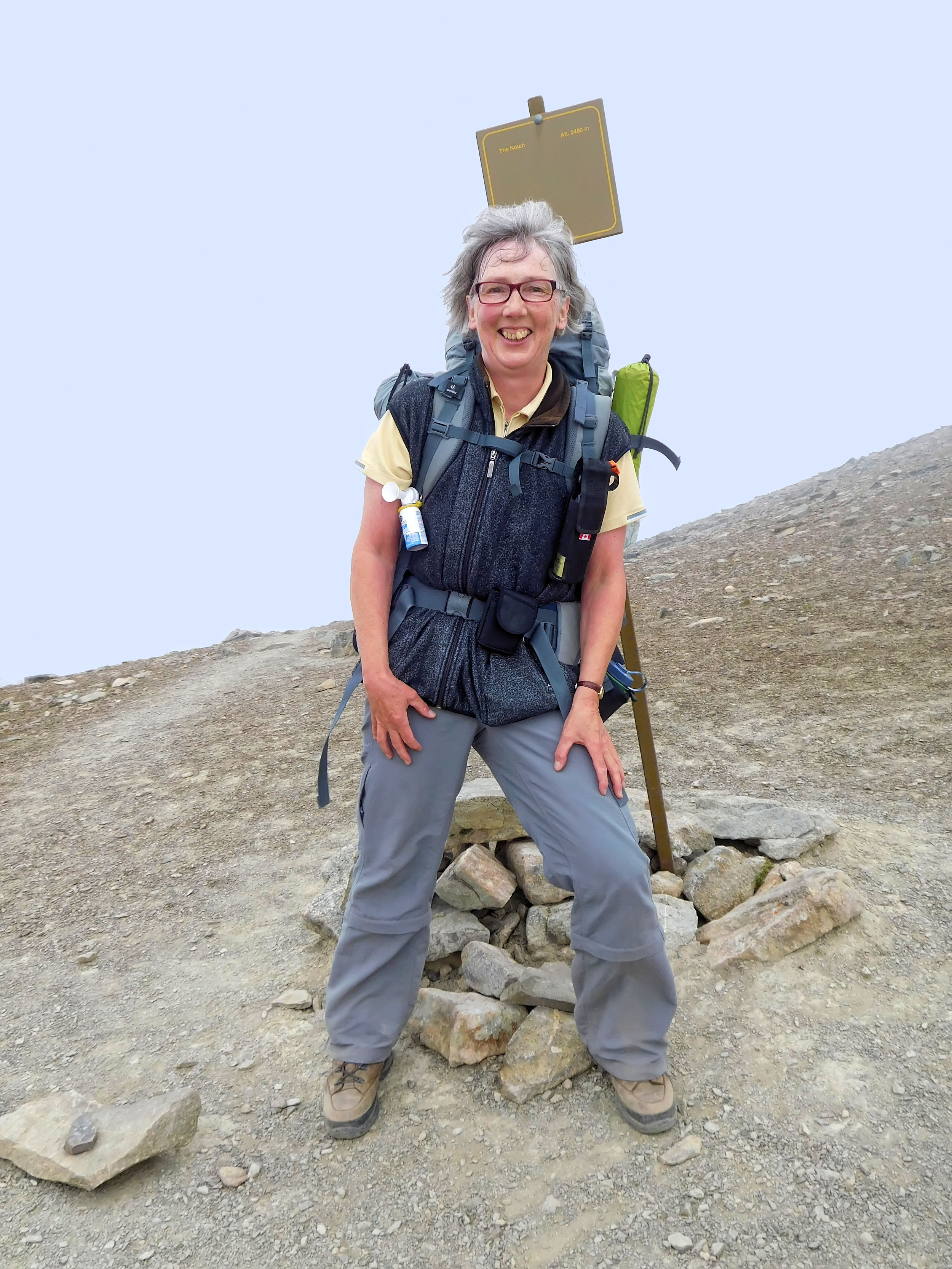
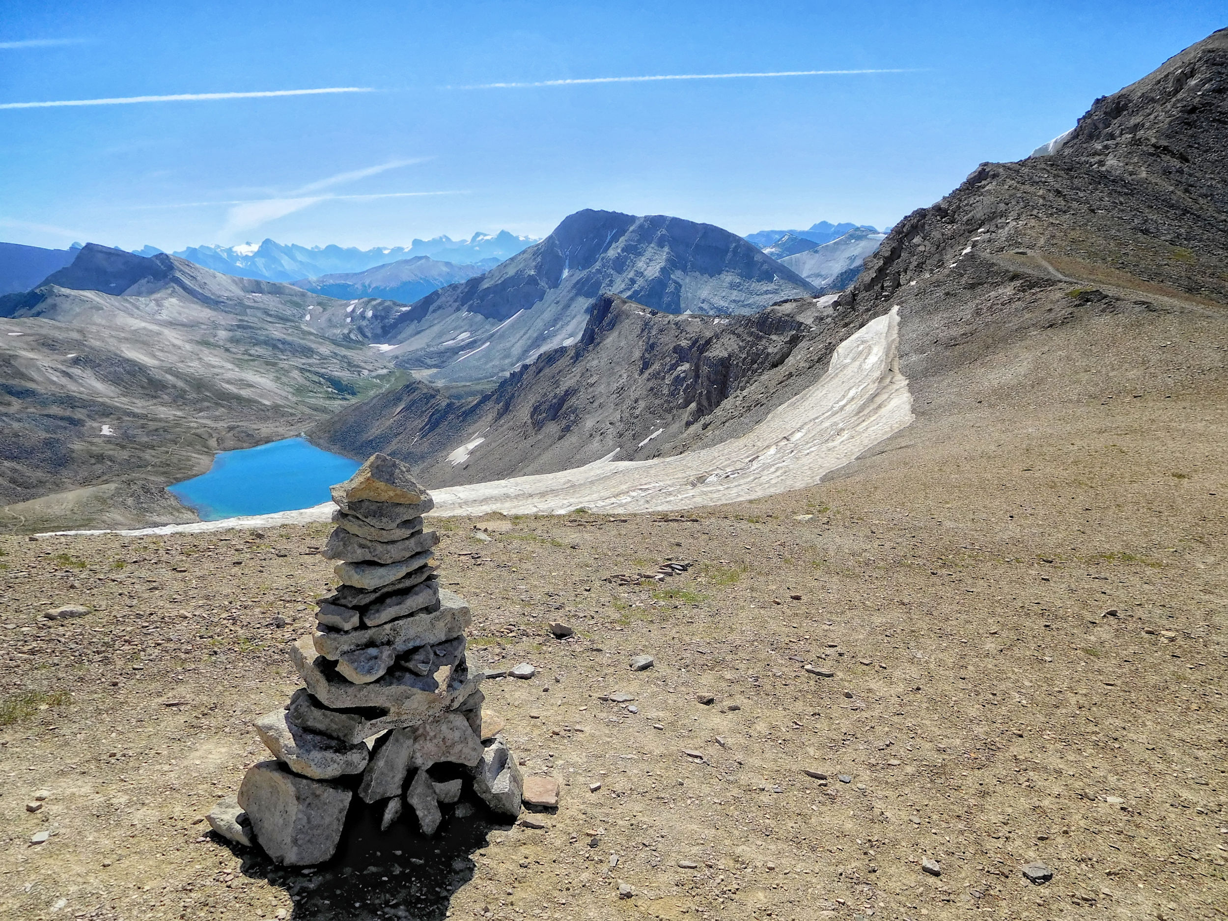
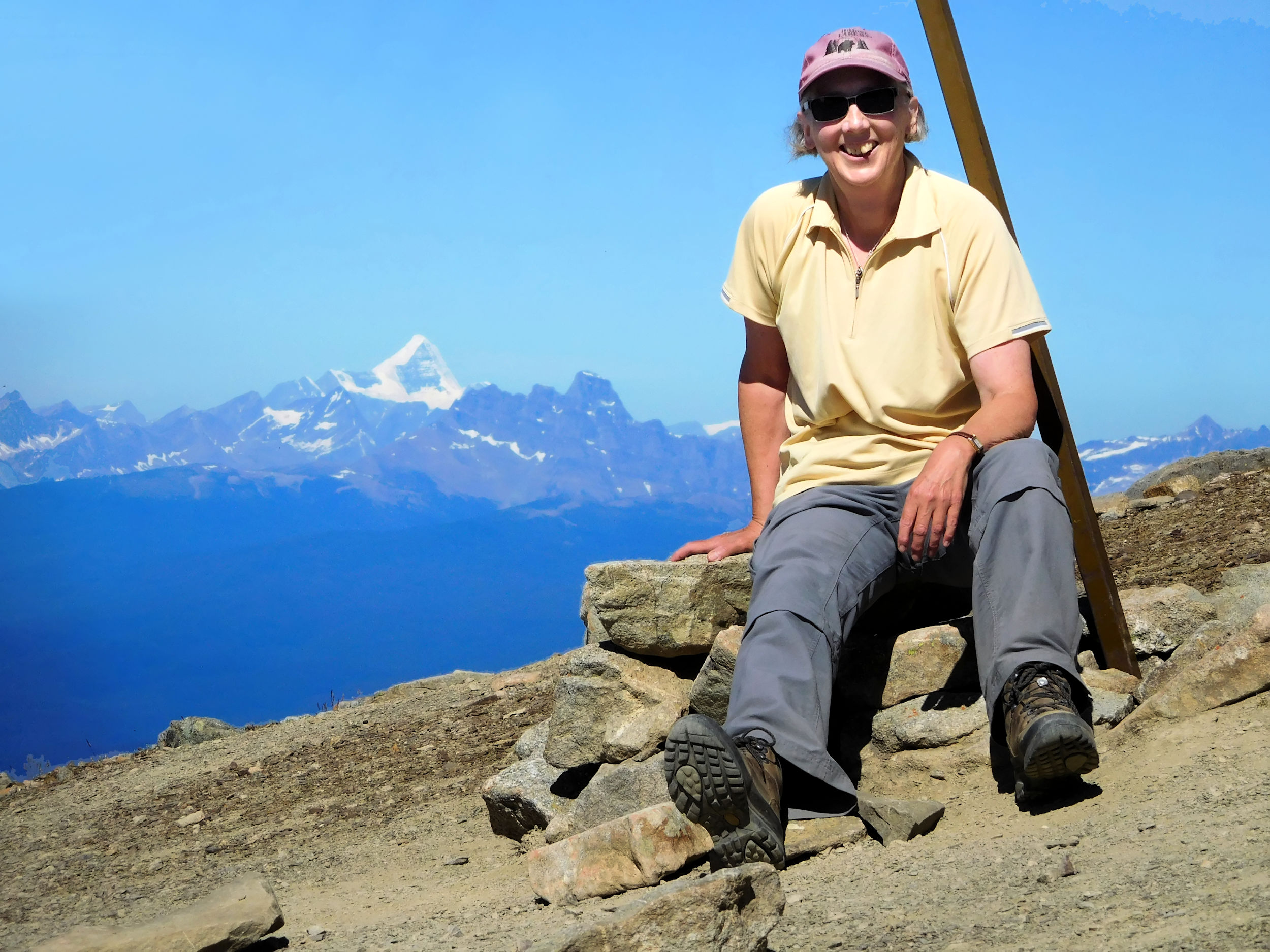
I have arrived! The Notch is marked by a cairn and a sign, its post bent by the masses of winter snow. I have caught up with my tent neighbors, and we take pictures of each other. At this moment we are the only hikers on the summit.
On top of the Notch
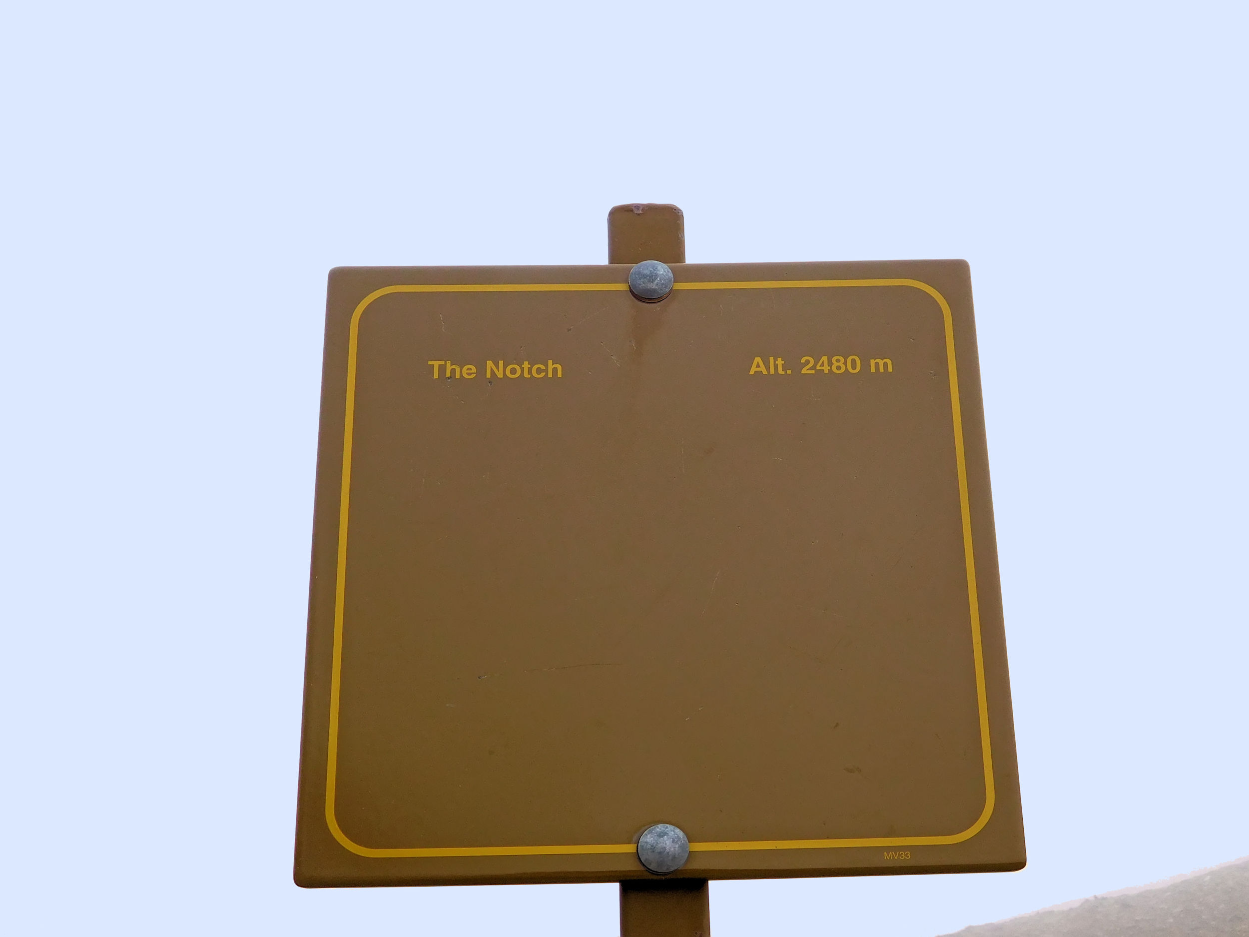
Again, the sources differ: while the sign shows the Notch at 2480 m, my GPS reads 2493 m and the guidebook even says 2510 m.
Unexpectedly, the neighbor's cell phone buzzes with an incoming text message. Apparently we are high enough and close enough to the town of Jasper to have cell reception here. While the other two are leaving, I turn on my own phone and call home. All of a sudden, fog rolls in. Within minutes all visibility is gone. I can barely see the trail in this whiteout. I quickly end the call and hurry to catch up with the other two hikers. It feels eerie to walk alone in the fog.
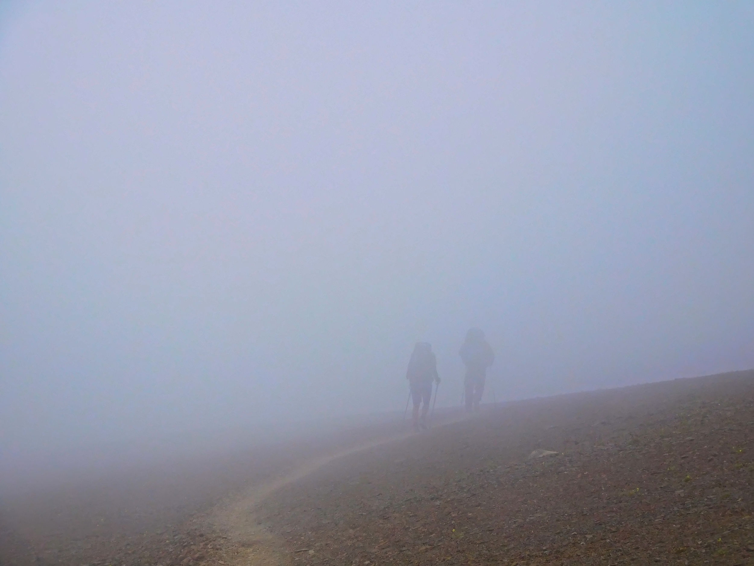
Skyline in the fog
The three of us hike along the most beautiful stretch of the Skyline trail - without any view. While my fellow hikers resign themselves to the fact that they won't see any of the famous vistas of this hike, I console myself with the thought that I'll have another chance on the way back - in hopefully better weather.
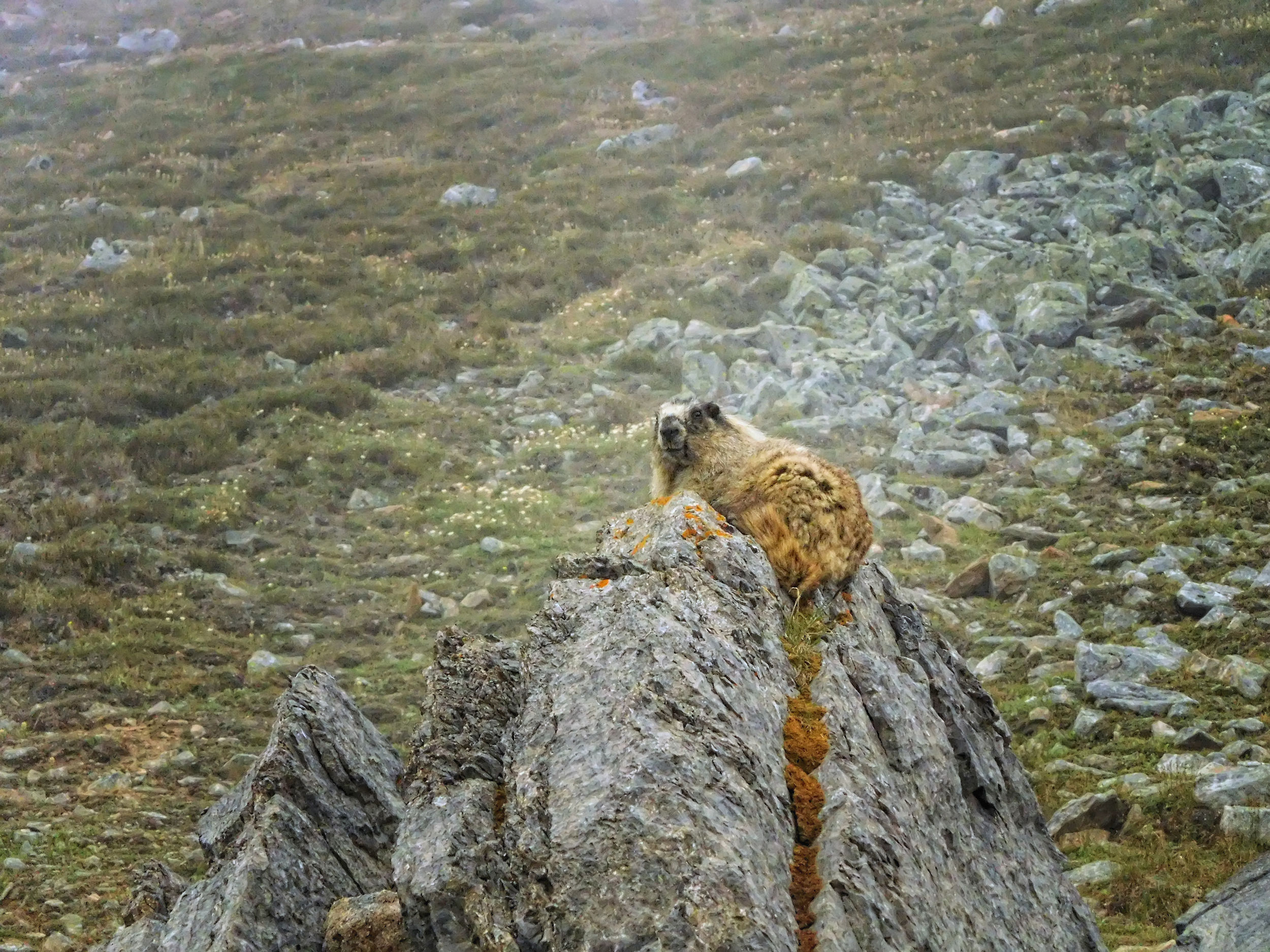
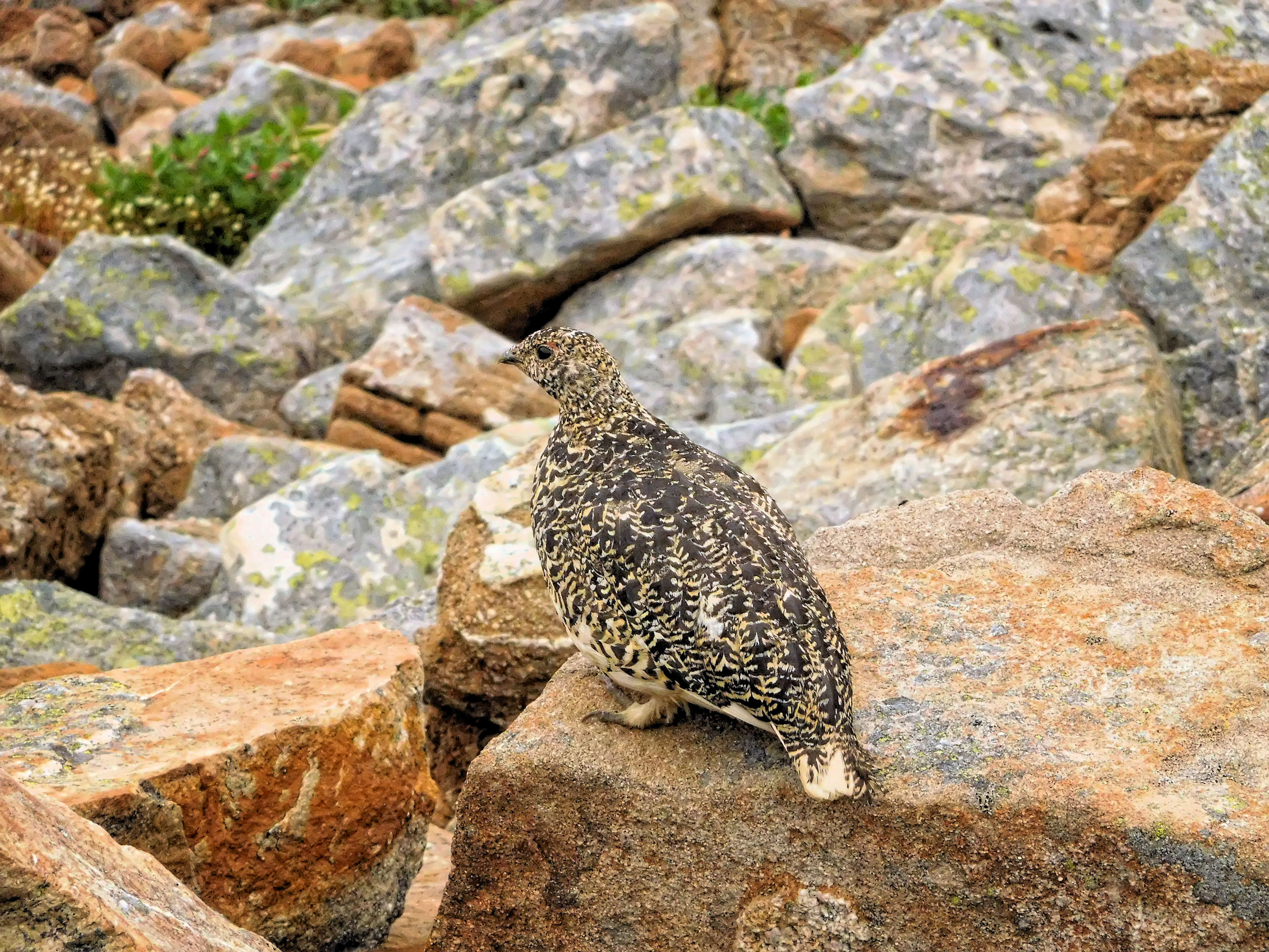
As we descend from the ridge into the valley, the mists begin to lift, but there is still no visibility in the distance. Close by, a marmot and a grouse invite me to take pictures.
The couple from Calgary is now walking at a fast pace because they have to reach the other end of the trail today. Now that we have some visibility again, I don't mind walking alone, so I take my time and stay behind. The three of us will probably have been the last to climb the Notch early this morning. The other hikers would do well to wait for better conditions.
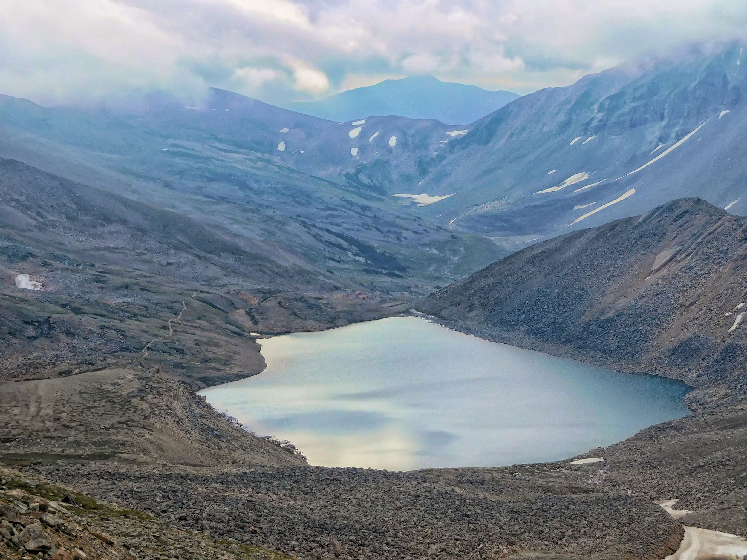
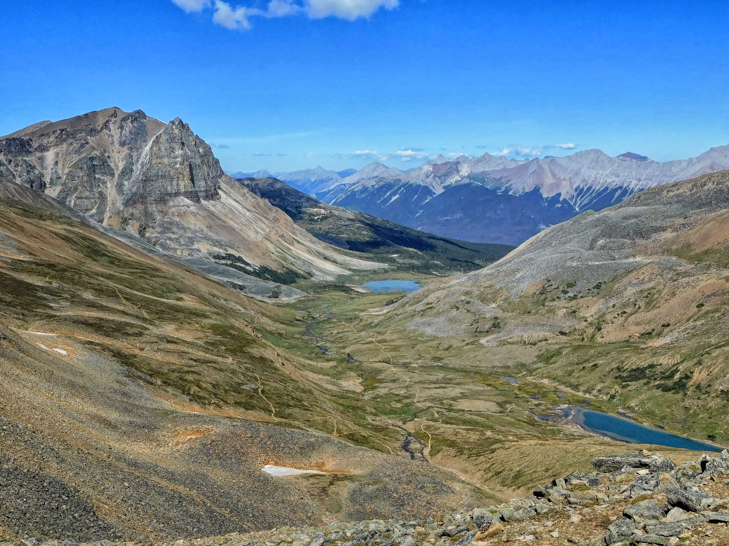
Many switchbacks lead down to Centre Lake. Balancing on some boulders, I cross the creek that flows out of the lake. I meet a group of three women heading in the opposite direction. I wish them luck that the weather clears up quickly.
Soon I reach Tekarra campground, my destination for today. It is located across from Mount Tekarra. I will spend two nights here, so that the next day I can leave the tent up and go for a hike while carrying only a small load.
I learn from the other hikers who arrive long after me, that the conditions on top of the Skyline have worsened during the day and that it has even rained. We spend the rest of the afternoon and into the evening watching the fog and clouds slowly rise and reveal some of the beautiful mountain scenery around us.
| Distance | 18.6 km |
| Time | 6 hrs |
| Min. Elevation | 2062 m |
| Max. Elevation | 2537 m |
| Ascent | 475 m |
| Descent | 475 m |
During the night it gets very cold, because - this is the good news - it has cleared up. In the morning there is no trace of fog, nor clouds, not even smoke.
A clear morning
Originally, I had planned a daytrip to the next stop on the Skyline trail, Signal Mountain. But with the fantastic weather conditions I change my mind: I'll hike the core of the trail to the Notch and back a second time. This route is also my return route for the next day, but who knows what conditions I will find there tomorrow.
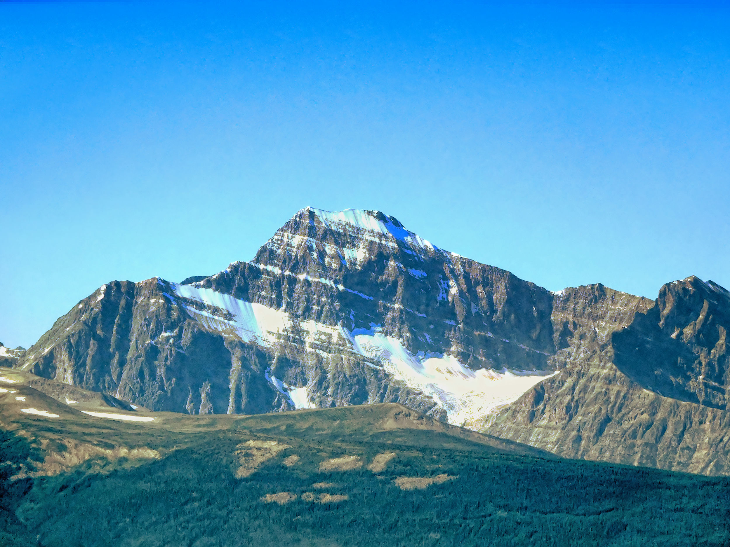
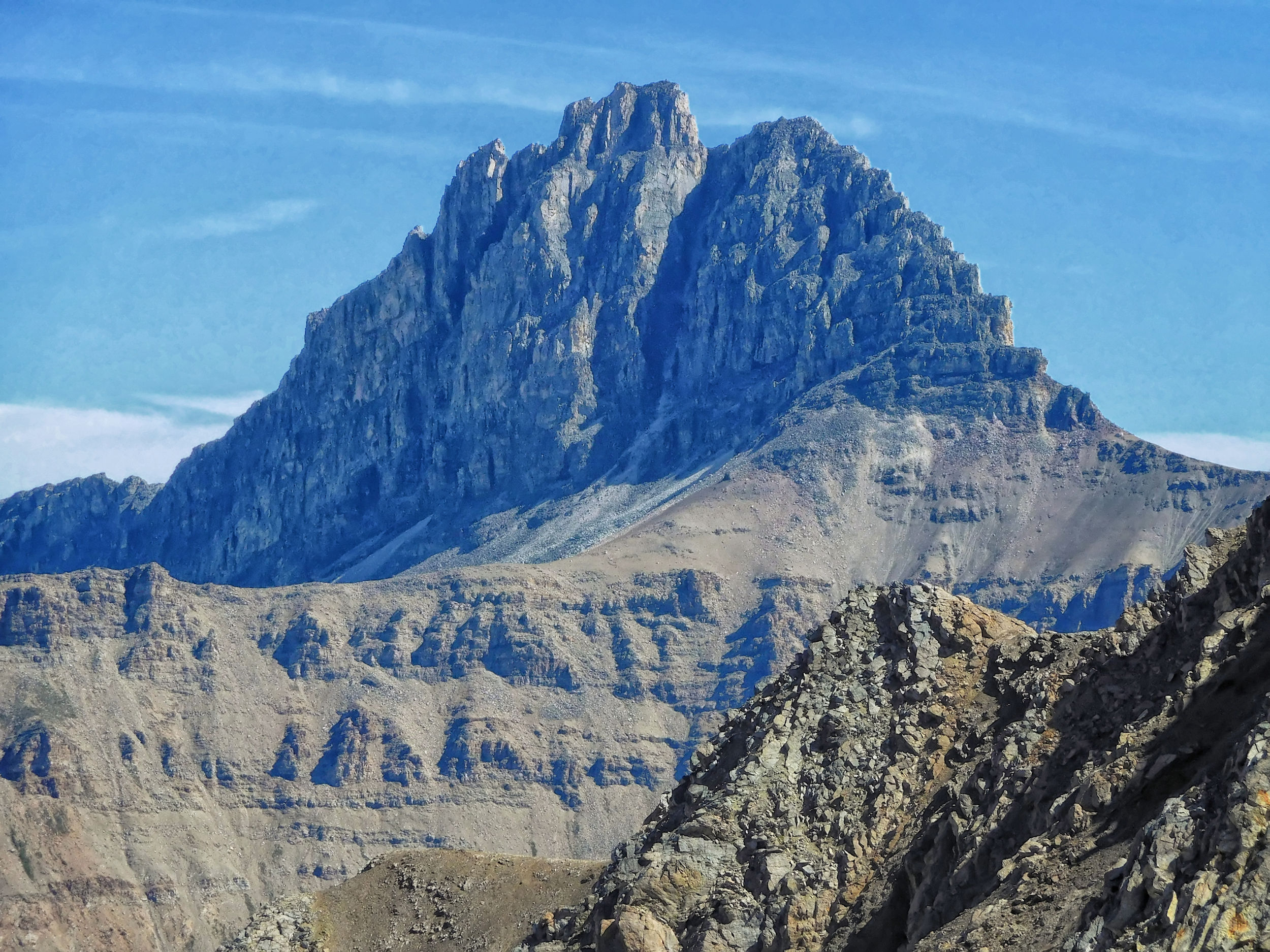
With just a day pack, I hike up the valley of Mount Tekarra. It is the most prominent mountain in the area and can be seen from afar on the drive to the town of Jasper.
Mount Tekarra
Surprisingly, the lake at the base of Mount Tekarra has no name. It is not, as one might assume, Tekarra Lake, which is located on the other, western flank of the mountain.
Mount Tekarra and unnamed lake
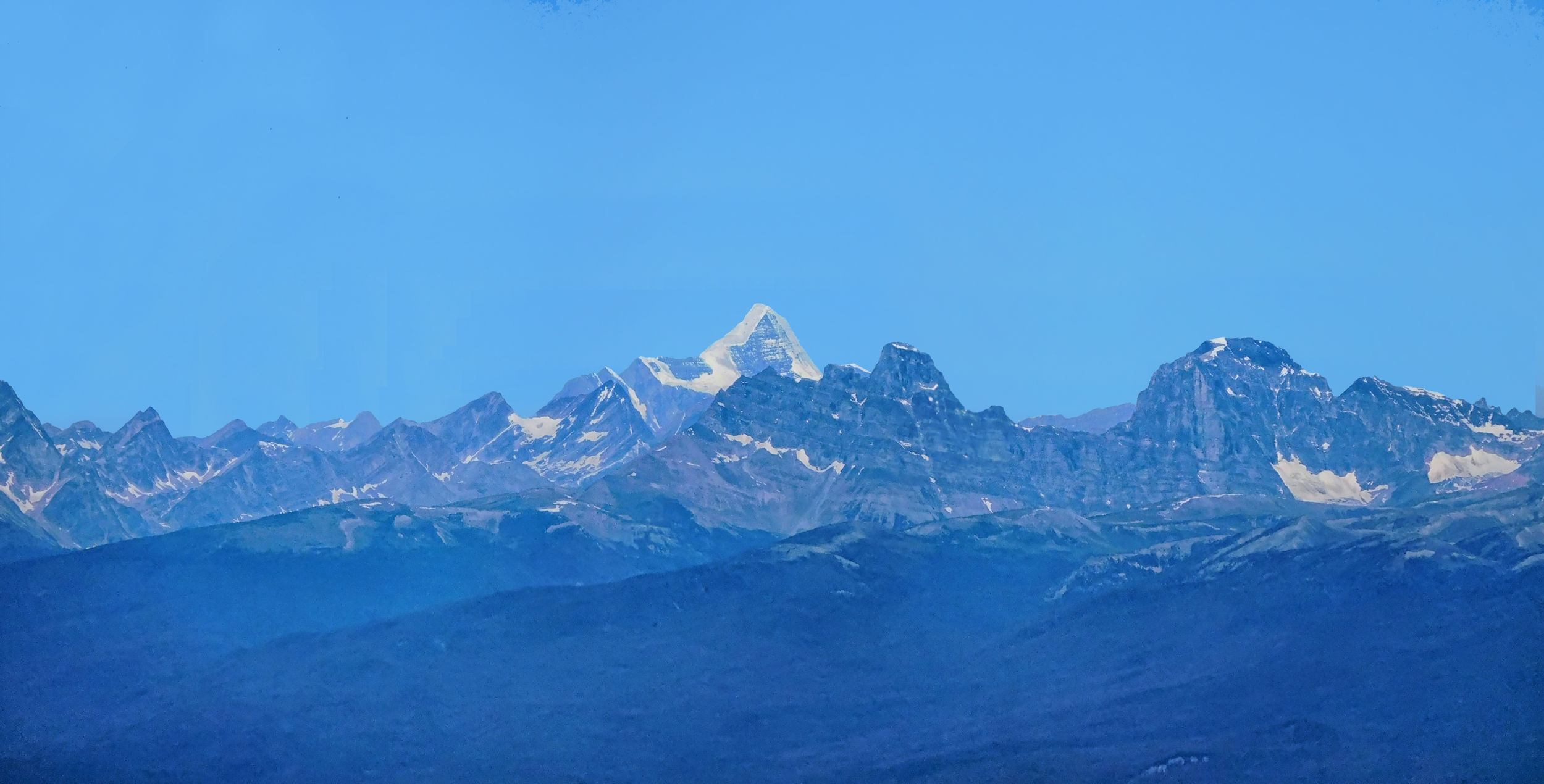
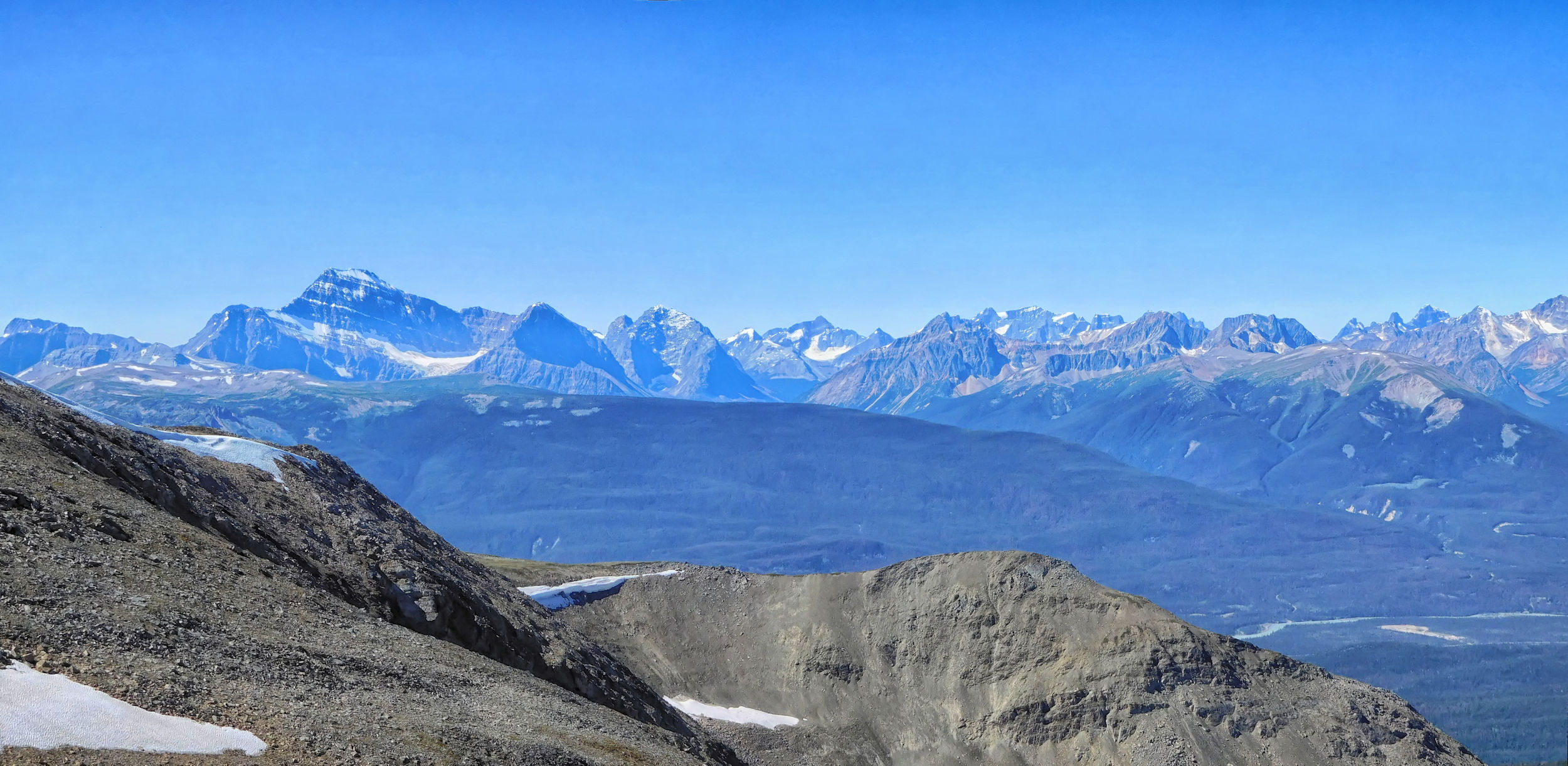
The trail runs between the outliers of Mount Tekarra and Centre Mountain and then makes its way back to Amber Mountain up at the crest of the Skyline. I am out of breath when I reach the top, but today I am rewarded with the phenomenal views I had hoped for.
Panorama with Mt. Edith Cavell
Mount Edith Cavell
The view is so clear that you can even see Mount Robson to the northwest. This is where I did my very first solo hike last year, on the Berg Lake trail.
Mt. Robson
Amber Mountain 2565 m
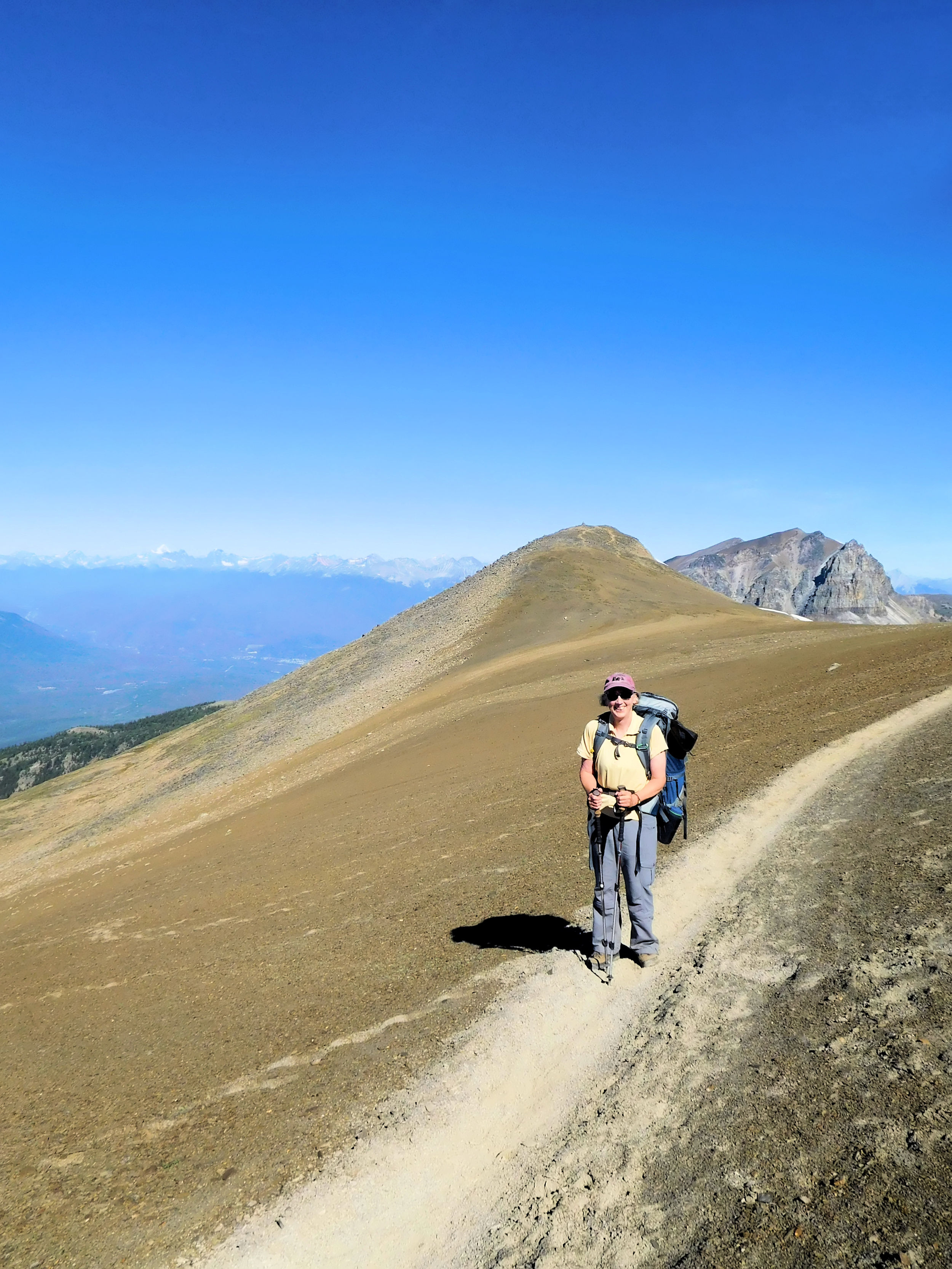
Today I meet a lot of other hikers. Some of them are trail runners, jogging the 45 kilometers in one go and - since they are not staying overnight - carrying tiny hip bags. My backpack is the usual big one, because I don't bring an extra one for day hikes. But it is almost empty and therefore light.
Near Amber Mountain, the Skyline trail reaches its highest point at 2530 meters. Boot-trodden tracks lead to the summit, which is easily accessible from the trail.
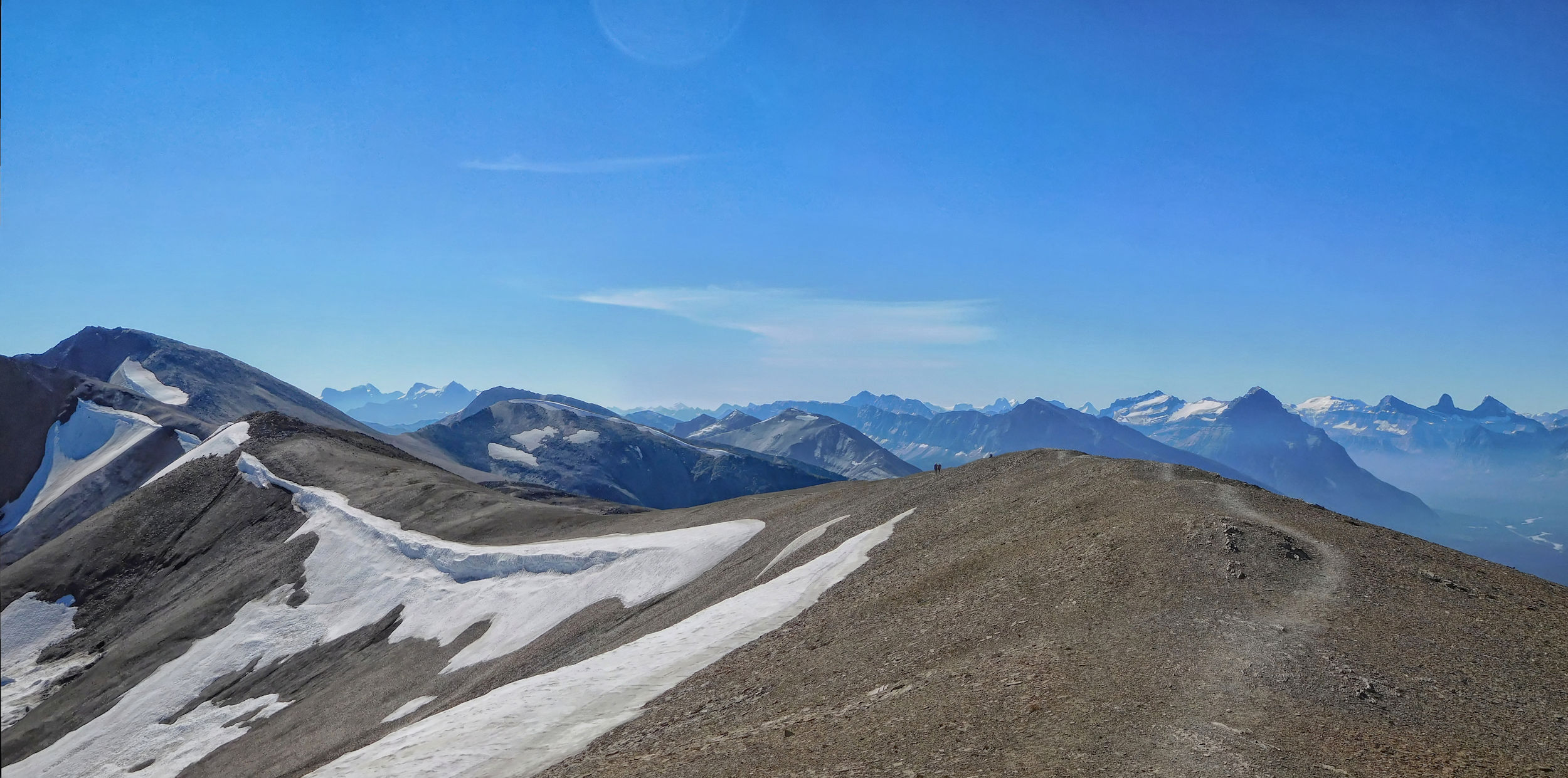
Skyline trail facing southeast
Watchtower 2791 m

The Watchtower Basin in the east
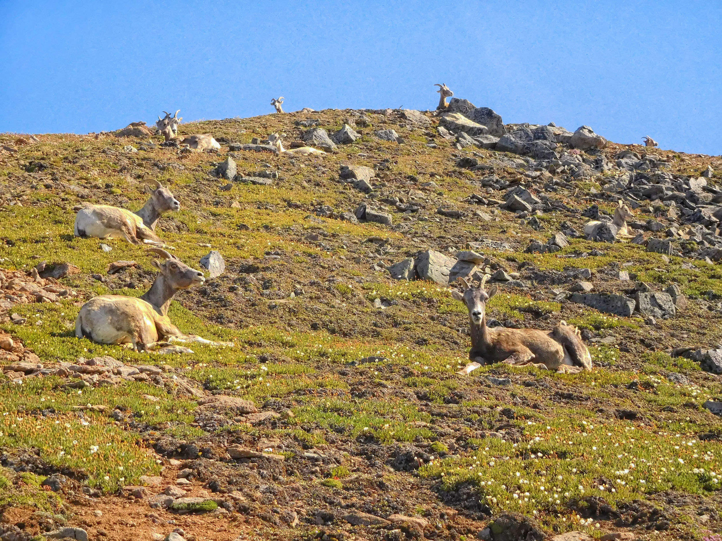
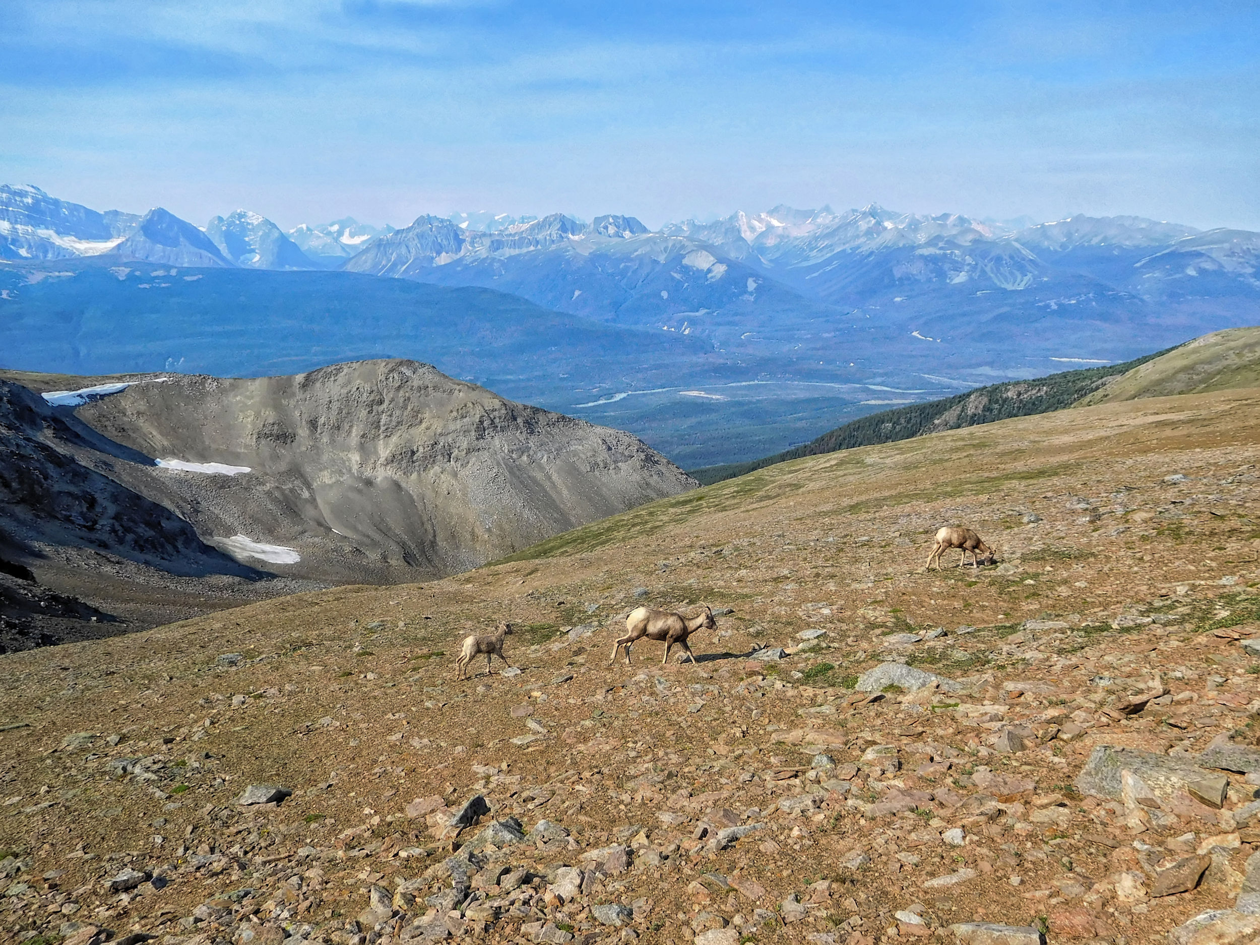
Not far from the Notch, a herd of bighorn sheep is resting.
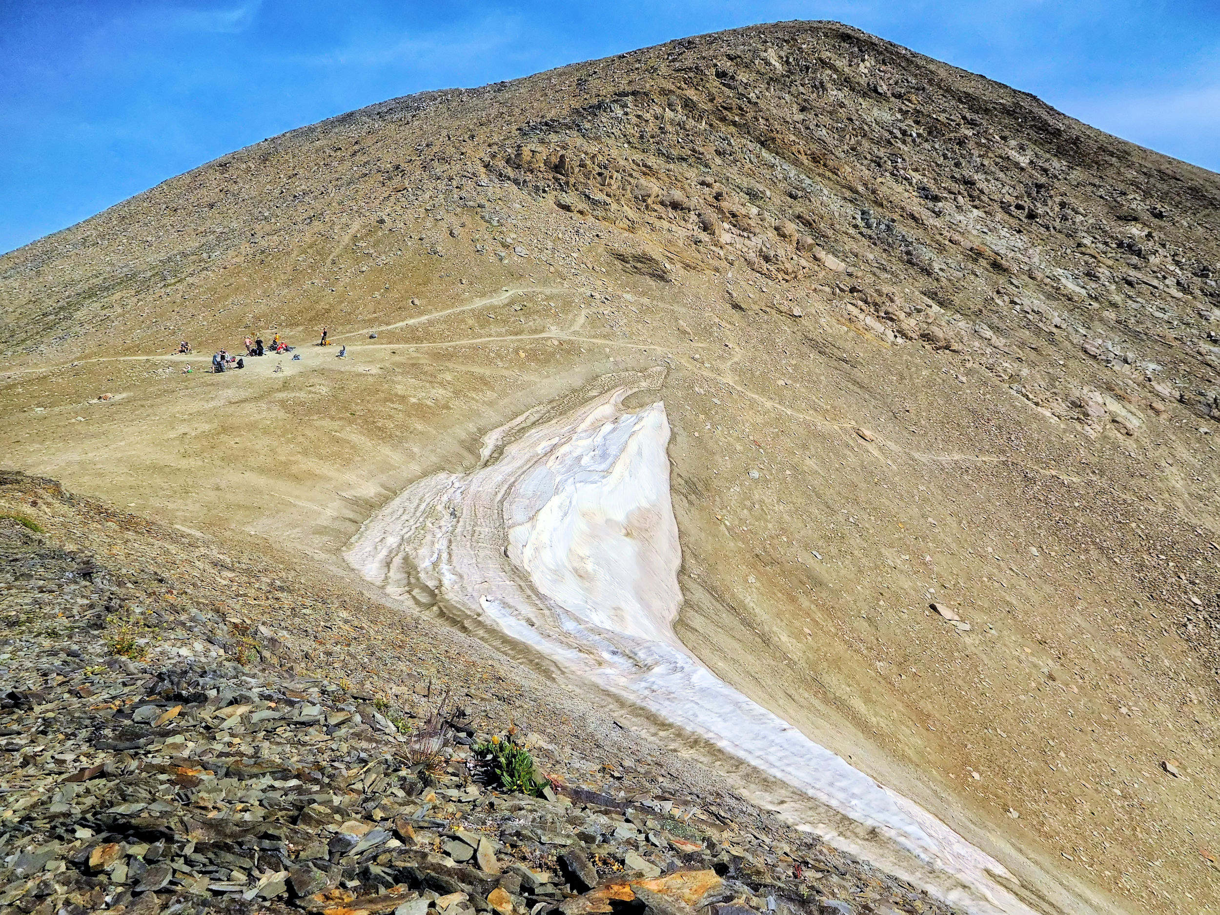
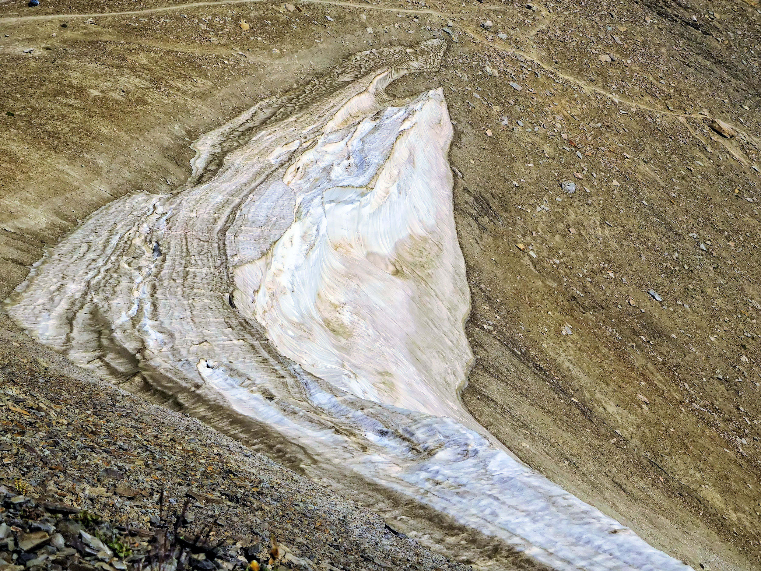
Only a stubborn remnant of snow separates me from the Notch.
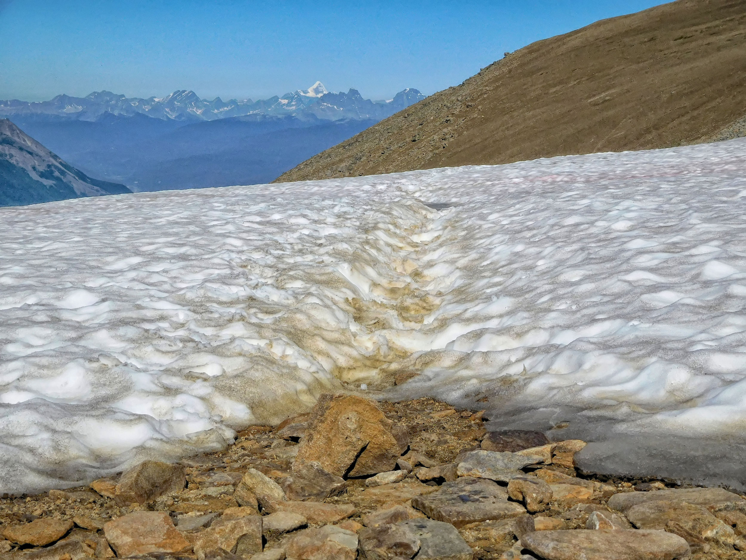
Remnants of snow on the trail
Then I arrive at today's destination.
Cairn at the Notch
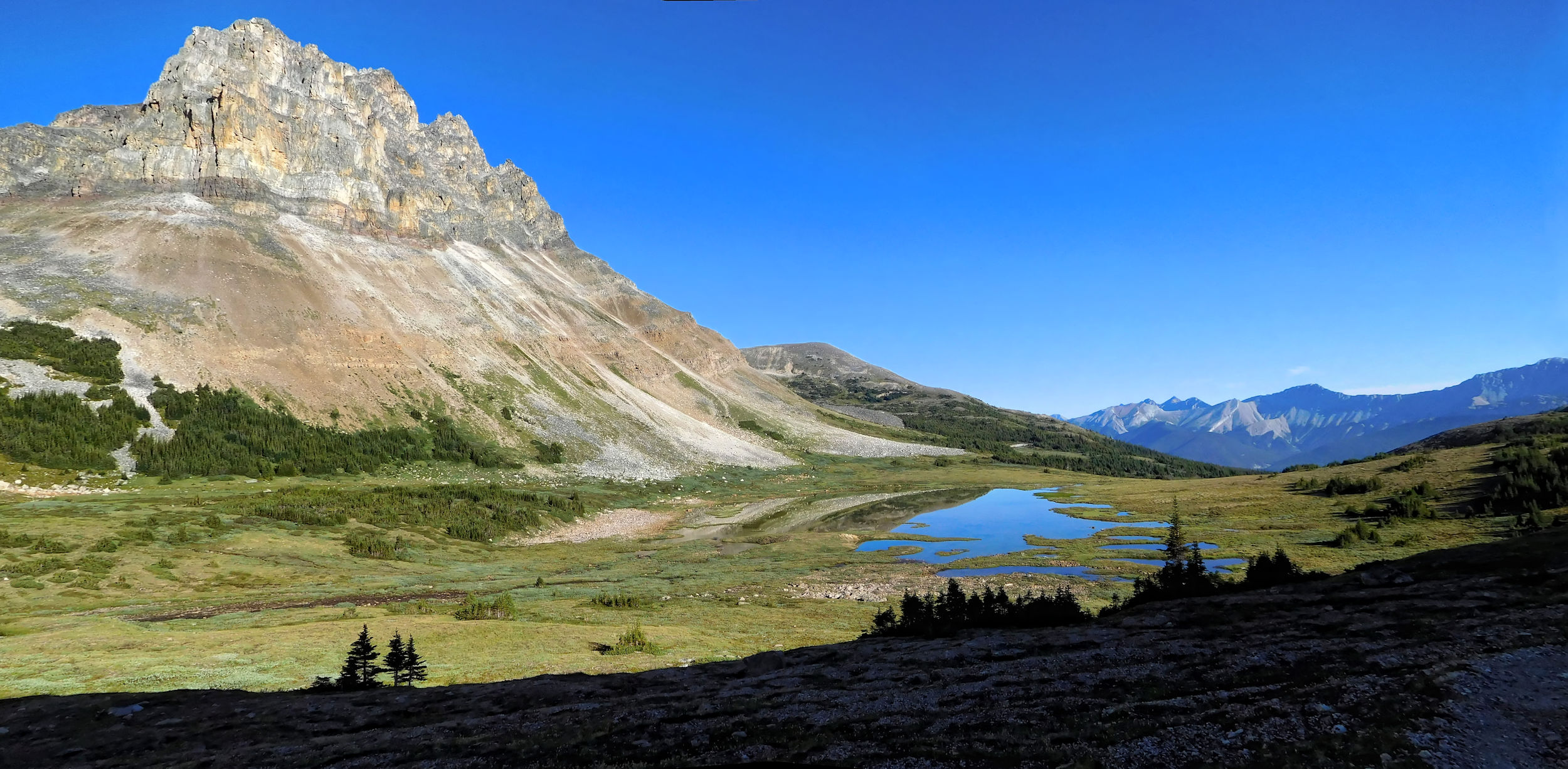
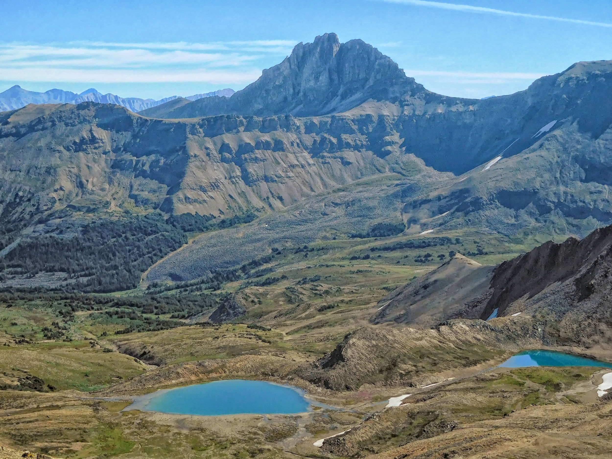
The view of Curator Lake is much nicer in the sunshine than yesterday when the sky was gray and cloudy.
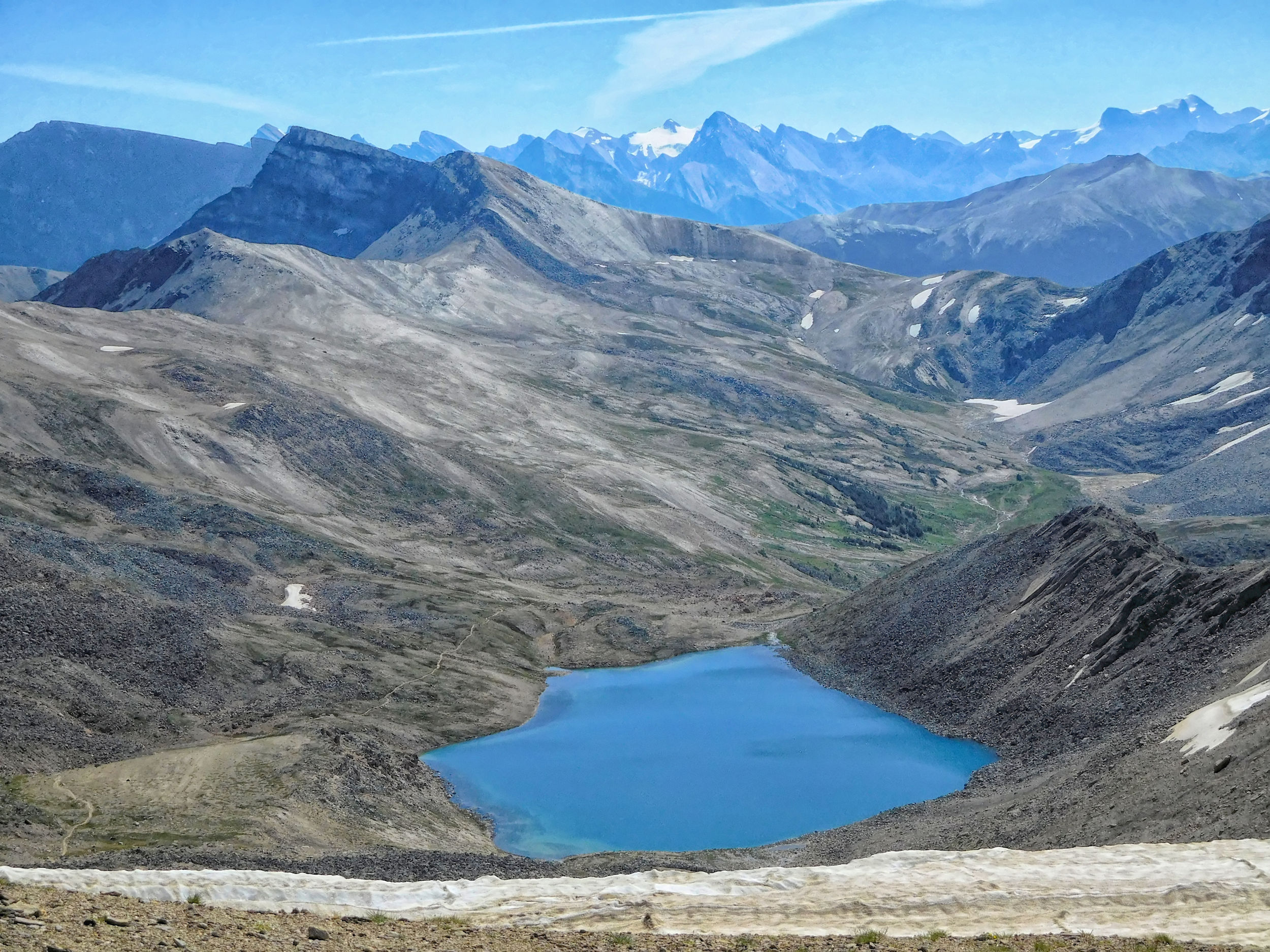
Curator Lake and Maligne Valley to the south
I can't get enough of the panorama, it is simply breathtaking.
Athabasca River Valley and Mount Edith Cavell to the west
Using the phone signal on the Notch again, I share my excitement with the folks at home. Finally, I tear myself away from this magical place and hike back over the ridge towards Tekarra campground. The new perspective on the return presents me with different but equally beautiful views.
Back on the Skyline trail heading northwest

South Amber Mountain and Watchtower
Watchtower Close-Up
Mount Tekarra
The marmots are also enjoying the bright sunshine.
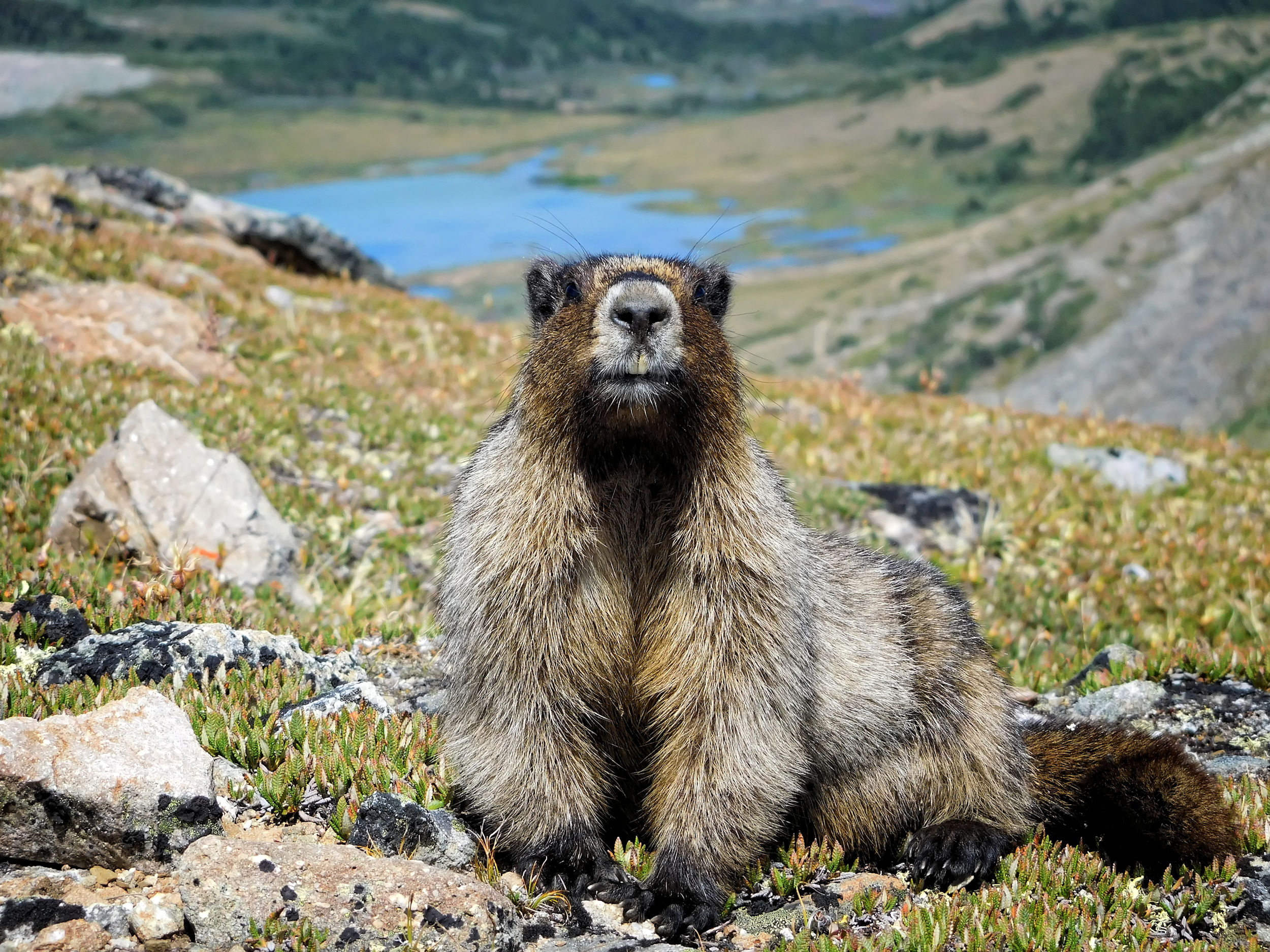
Hoary Marmot
It is not far from here to the campground further down among the trees.
Down to Tekarra campground
A very special day comes to an end. On my third attempt, I finally got to fully enjoy the Skyline trail in perfect conditions.
| Distance | 19.4 km |
| Time | 7 hrs |
| Min. Elevation | 2058 m |
| Max. Elevation | 2537 m |
| Differenz | 479 m |
The next morning the weather is still fine. However, since it is notoriously unpredictable up here, I don't regret that I am hiking the core of the Skyline trail a third time today.
I return to the ridge on a now familiar path. The sky is not as clear as yesterday; there is a haze of clouds or fine smoke on the horizon. But the views are still great.
Just before the Notch, the bighorn sheep are still present. The herd is moving and I see some young ones running around.
Bighorns above the Athabasca River Valley
The Notch is quite busy today. Many hikers are resting on the ridge. The youngest one up here is a little girl, no more than two years old, who can't even walk properly yet. Kudos to the young mom who carried the girl up in a sling (and to dad with all the gear in his oversized backpack).
I put down my backpack, which today is also fully loaded, and climb part of the way up Notch Peak. From there I have a nice view of the Notch, its cornice and the steep scree trail.
Cornice below the Notch
The Notch has become like a phone booth to me, as this is the third time I call home from here. Typically, there is no cell service anywhere in the backcountry of the Rocky Mountains, even on the park road it is limited to a few areas. Because of its proximity to the town of Jasper, the Skyline trail is the exception, supposedly with a second signal at Big Shovel Pass.
Descending the Notch is less tricky than expected. I walk slowly and use my hiking poles deliberately to avoid slipping. The path is so narrow that I often have to step off it to let other hikers pass.
Descent from the Notch
I have taken so many pictures that - just here of all places - the camera battery dies on me. In a switchback I step off the path to change it. I am lucky that neither the batteries nor the camera slip out of my hand and fall into the abyss.
Descent almost complete!
The Notch and Curator Lake
From Curator Lake, I return through the basin toward Big Shovel Pass.
Curator Mountain
The turnoff to Watchtower Basin is busy today as well.
Turnoff to Watchtower Basin
I cross Big Shovel Pass and reach the alpine meadows of the Snowbowl. To the south the sky is very hazy. I suspect that smoke has returned to Maligne Valley.
Wildflowers of the Snowbowl meadows
Soon I reach Snowbowl campground. There is exactly one spot left, so for once I do not have to choose. There were mosquitoes everywhere, but here at Snowbowl campground their number reaches a whole new dimension. Besides the mosquitoes, it is mainly the gazillions of biting flies that give us a hard time. Good thing I brought my mosquito shirt. Tired of the insects and from the long hike, I retire to my tent early. While comfortably resting, I check today’s photos and am very pleased with them.
| Distance | 12.5 km |
| Time | 4 hrs |
| Min. Elevation | 1681 m |
| Max. Elevation | 2228 m |
| Descent | 547 m |
The next morning the sky has clouded over, but it is not raining. I set out on the last leg of my trip. A group of hikers come up to me and warn me of a grizzly bear they have just seen at Little Shovel Pass.
The Snowbowl …
… just before Little Shovel Pass
At the pass, I scan the slopes carefully. There! A movement catches my eyes. But it is only a fat marmot, looking unnaturally big on the barren landscape. Apparently the grizzly has moved on, and for me that is a good thing.
At Little Shovel campground, two campers report that the mosquitos have been "insane" there.
Between Little Shovel campground and Evelyn Creek I see many hikers. The shuttle bus that runs between the trailheads seems to have just arrived. Many Skyline hikers park their vehicles at the Signal Mountain trailhead and take the bus to Maligne Lake in order to start their hike.
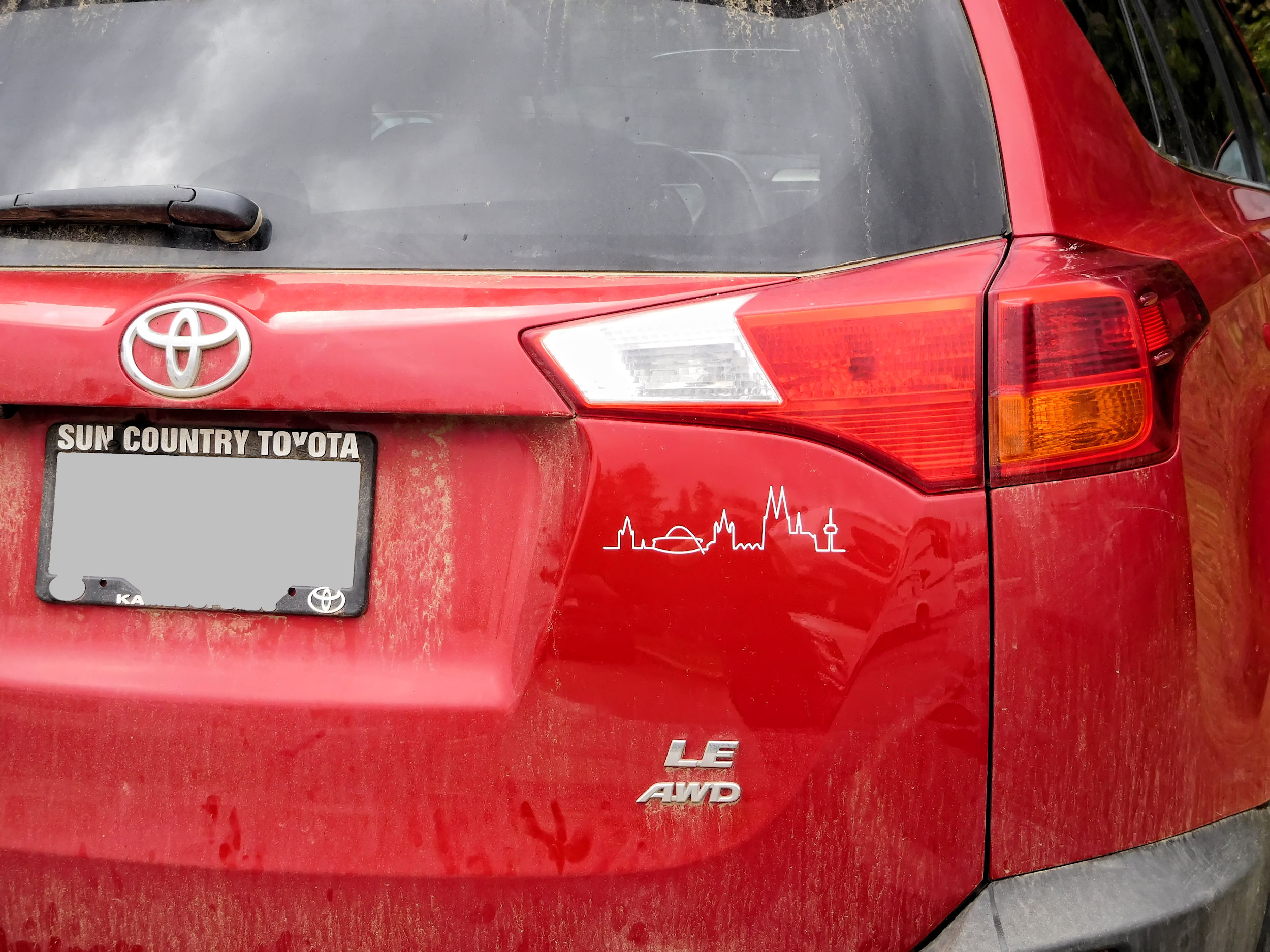
Coming from the spectacular Skyline in Jasper Park, I am now happy to see the familiar red car with the sticker of my old hometown's skyline.
Maligne Lake and the surrounding mountains are shrouded in smoke again. I was really lucky to not have been affected by it at higher elevations.
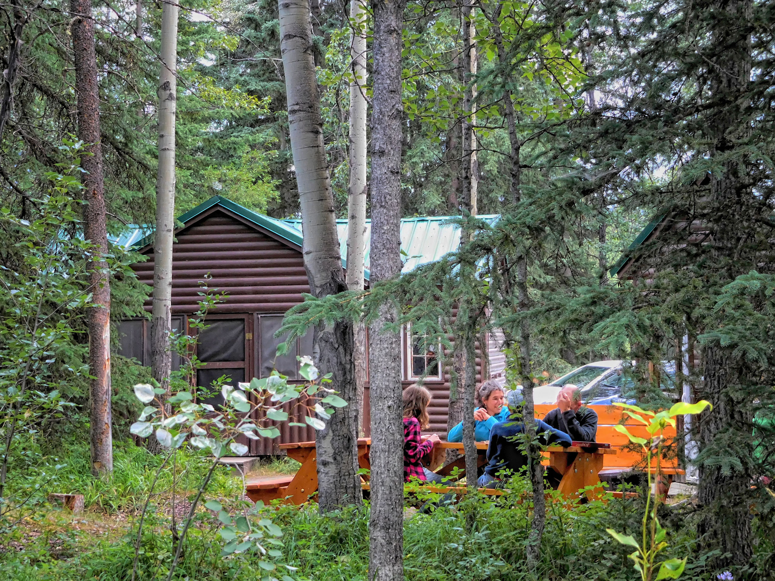
Maligne Canyon Wilderness Hostel
Before I head back home tomorrow, I spend the night at Maligne Canyon Wilderness Hostel. The accommodation is simple, but sufficient for my purposes. In the evening I join the other guests at the tables outside and we chat about our hiking adventures.
The out-and-back hikes and daytrips included, I covered a total of 85 kilometers on the Skyline trail. It was a long-awaited and therefore all the more fulfilling experience.